Categories
News Transportation

Construction Nearing Completion for Latest $546k Phase of Mill Creek Greenway

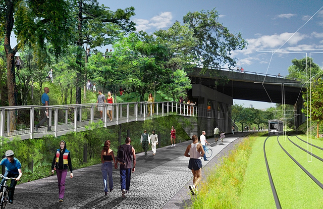
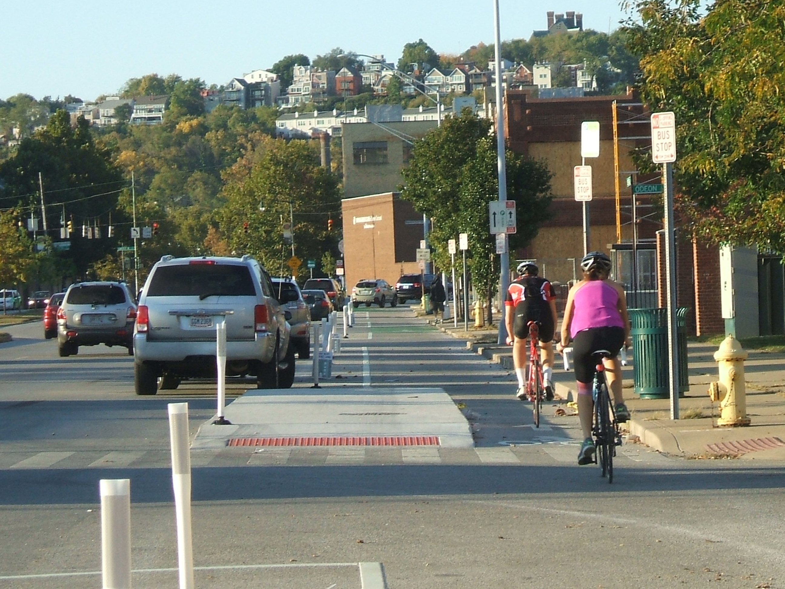
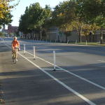
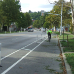
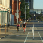
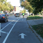
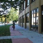
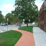
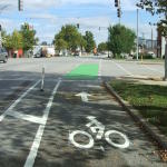
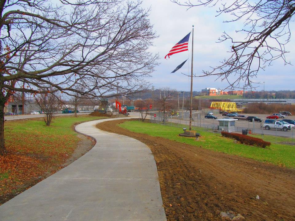
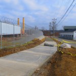
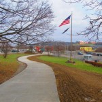
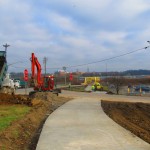
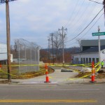
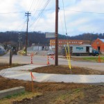
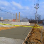
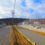
Construction is nearly complete on the fourth phase of work on the Mill Creek Greenway. As part of that work, a new 0.7-mile trail stretches along the border of South Cumminsville and Milvale, from the Millcreek Road Bridge to the intersection of Fricke Road and Beekman Street near Ethel Taylor Academy.

Once this work is complete, project planners say, the stretch will include additional accommodations for the trail to safely cross the creek on the existing roadway bridge, along with traffic calming measures for a safe crossing at Beekman Street near the school.

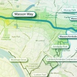
This latest phase of work is part of the much larger Mill Creek Greenway project that is being spearheaded by Groundwork Cincinnati – Mill Creek. The non-profit organization is celebrating its 20th anniversary this year, and is hoping that the planned 15-mile green corridor, which starts at the Hamilton County Fairgrounds in Carthage and will eventually reach the Ohio River Trail in Lower Price Hill, will help clean up one of the region’s most notoriously polluted corridors.

“We have done 33 ecological restoration projects as part of the greenway program,” Robin Corathers, Executive Director of Groundwork Cincinnati – Mill Creek, told UrbanCincy. “That includes bank stabilization, stream bed stabilization, wetland restoration, wildlife habitat restoration.”

In addition to that, Corathers says that edible forest gardens have been planted along the trail, with seven layers of vegetation that mimic a natural forest ecosystem. Improving the health of the ecosystem is a key component of Groundwork’s strategy, and more work is planned to help revitalize and heal damage to the natural resources within the Mill Creek Valley – one of the city’s oldest industrial corridors.

This latest phase of work was funded through a $245,000 grant from the Clean Ohio Trail Fund, $80,000 grant from the Interact for Health Foundation, $30,000 grant from the Greater Cincinnati Foundation, and $191,000 from the City of Cincinnati that was provided through its annual capital budget. Corathers also notes that the C.W. Wood Company donated a strip of land along Fricke Street for the trail.

The project, however, is not just about new trails and habitat restoration. Groundwork leadership also says that they are focused on capacity building, community involvement, and environmental education programming for 4,000 fourth through twelfth grade students each year.

“Phase four is really important to us for several reasons” explained Corathers. “As a ground work trust we are committed to working in economically distressed and historically under-served communities and neighborhoods; and in this case it’s the neighborhoods in the lower Mill Creek watershed.”

To this end, Corathers says that community leaders and neighborhood residents have been excited about the project and the process by which it is being implemented. She says that neighborhood councils become involved in the planning and design work of each phase of the trail, which leads to moments like this past November 12 when they celebrated the groundbreaking for the latest phase of work with about 85 area residents and business owners.

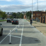
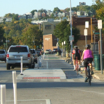
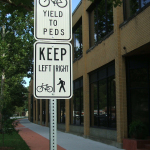
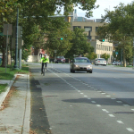
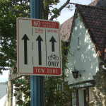
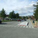
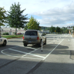
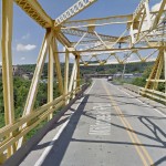
While there has been a good deal of neighborhood support, there are still challenges that exist for project leaders. One of those challenges is the Millcreek Road Bridge, which is envisioned as a crossing for the trail, but is currently only one lane in each direction for automobile traffic.

To tackle this issue, Groundwork Cincinnati has been working closely with Cincinnati’s Department of Transportation & Engineering (DOTE) to address safety issues with the narrow bridge. City officials say that the aging Mill Creek crossing is not considered a priority bridge and is not scheduled for replacement.

As a result, transportation engineers have come up with a solution that will retrofit the lightly used span to have one lane for shared two-way traffic flow, and one lane dedicated to the trail. The DOTE says that new signals will be installed, in February, at either end of the bridge to control alternating movements of vehicles across the Mill Creek Bridge.

“It’s a great investment. The bridge will be so much safer for people, for bikes, and also for vehicles,” Corathers said when emphasizing the importance of the trails connection. “The trail provides opportunities for outdoor exercise and recreation, active living, and active transportation for people in the Mill Creek corridor and nearby.”

Crossing the Mill Creek at this location is critical in the project’s overall goal of eventually reaching the Ohio River to the south. Once getting past this location, project planners say that a former CSX rail corridor can be used to take the trail all the way to its envisioned terminus.

The former freight rail right-of-way is considered to be wide enough to accommodate the Mill Creek Greenway Trail, as well as tracks for a future transit line. The use of this corridor, Corathers says, will also allow the Mill Creek Greenway Trail to tap into the planned $192 million Lick Run project, which will include another corridor of green space and trails.

Ultimately, the ongoing efforts could produce what would become a large network of interconnected trails through the heart of the city, including the Ohio River Trail, Little Miami Scenic Trail, Mill Creek Greenway, Lick Run, and West Fork Mill Creek Trail in Carthage.

The next 2.9-mile phase of work on the Mill Creek Greenway is estimated to cost $860,000, and project officials say they have already secured $500,000 of that from the State of Ohio, $50,000 from Interact for Health, and $10,000 from Duke Energy. The hope is that the remaining funds can come from City Hall. Should the final funding fall into place, Groundwork Cincinnati believes phase five work could be completed next year – creating a continuous eight-mile stretch of trails.

An attempt has been made all along to keep the trail close to the Mill Creek, but in some places, such as along Este Avenue, project planners say that it has not possible. But in locations where restoration and stabilization work has been performed along the creek, recovery of the ecosystems is easily visible.

“We now have great blue heron that fish in Mill Creek. We’ve got turtles, lizards, salamanders, beavers, birds, and all kinds of wildlife” Corathers exclaimed. “What we’re doing is breathing life back into this corridor. The trail allows users and visitors to experience an urban river that is coming back.”

In addition to Groundwork Cincinnati and the DOTE, Queen City Bike, Human Nature, IBI Group, Kolar Design, and Prus Construction have contributed to the development of the Mill Creek Greenway over the past six years.

Categories
News Transportation

New Cincinnati Bike Map Aims to Change the Way New, Old Cyclists View the City

In 2011 Nate Wessel sought out to change the way Cincinnati mapped its transit. In a region with multiple transit operators that all use traditional bus mapping visuals, it was quite the daunting task. But after successfully raising more than $2,000 on Kickstarter, Wessel was able to fund his effort to print tens of thousands of his newly designed maps that ultimately received national praise.

Since that time he has continued his quest to improve the visual nature of map-making in Cincinnati, including serving as UrbanCincy’s official contributing cartographer, but he also embarked on another major endeavor. Instead of a transit map with bus frequencies, Wessel this time focused his energies on creating a new regional bike network map.

“Imagine someone kept taking, and reproducing and sharing, very unflattering photos of you or someone you loved. If you’re like me, you’d probably let the first one slide,” Wessel stated. “Maybe it was an accident, but by the fifth or sixth one, you’d start noticing a pattern and you’d start getting kind of miffed about it.”

This is the feeling the twenty-something urban planner, cartographer and fashion designer felt about the region’s existing bike maps, and he wanted to take control of the situation and improve it.

“This is a subtle visual game and words won’t do,” Wessel explained. “You need to make your own photo that shows the beauty you see in what you love; and then get other people to see what you see.”

One of the ways to accomplish that, he says, is to get the maps into people’s hands – digital maps are not enough. While the physical presence of a printed map gives it a sense of permanency and seriousness, producing a hard copy map also comes with its challenges.

After finishing the design for the Cincinnati Bike Map, Wessel said that he received feedback from the binder recommending a redesign to better accommodate the way the paper would fold, but that it was too late in the process. As a result, he wishes the maps folded a bit better, but that he is otherwise quite pleased with the final product. Perhaps leading to that feeling of satisfaction, however, is the fact that no compromise was needed since the project was entirely self-funded.

“Both times I’ve raised money for these projects it was in advance of having a real demonstrable product,” said Wessel. “In neither project have I ever had to check anything with a sponsor, supervisor or co-designer. The maps were totally my own in both cases, held to my own standards alone and uncompromised. That is very unusual for print maps.”

While quite unusual, it was a situation he preferred. In fact, Wessel says that a local organization very generously offered to fully fund the printing of Cincinnati Bike Map should he work with their graphic designer. A generous offer indeed, but one that came with risks that the final product not turn out as originally envisioned.

The release of the new regional bike map last month comes at a time when Cincinnati is in the national spotlight for its dramatic gains in bike ridership and development of new bike infrastructure.

Now that the project is complete, the goal now shifts to distributing the stack of Cincinnati Bike Maps that now exist. In addition to distributing the maps to local bike shops and organizations, Wessel is also mailing out copies of the map. His hope is that new or unfamiliar riders feel empowered by the maps, and that experienced riders use them to explore new routes throughout the region.

“Regular cyclists have found their favorite routes and will probably stick with what they know,” said Wessel. “Though, I totally discovered Fort Thomas through this map. Every map I’d seen made it look like a pretty crappy, suburban place to ride and I always avoided it; but the streets are beautifully wooded and very slow with 25mph speed limits.

Of course, all of this would not have been possible without access to the treasure trove of data on-hand at Cincinnati City Hall, and with the OKI Regional Council of Governments.

Those who would like to get a free copy of the Cincinnati Bike Map can do so by emailing Nate Wessel at bike756@gmail.com and informing him of your name, how many copies you want, and the address to which he can ship them.

Categories
News Transportation

City Planners Recommend Transportation Overlay District for Wasson Railroad Corridor

Following the guidance of City Council, Cincinnati’s Department of City Planning & Buildings has completed its land use study for the Wasson Railroad Corridor. The study’s findings and recommendations offer the clearest guidance to-date as to how to proceed with redeveloping the abandoned freight rail corridor, following the issuance of preliminary designs in July 2014.

City planners took a comprehensive look at the history of the corridor, its current conditions and the best path forward that respects the desires of the city and the impacted neighborhoods.

In that analysis City staff revealed seven studies and plans that recommend the corridor either be used for rail transit, or a combined multi-modal network that accommodates rail transit, bicycles and pedestrians. Some of the most notable of these include the 2002 MetroMoves regional transit plan, 2010 Bicycle Transportation Plan, 2012 comprehensive Plan Cincinnati, and the 2013 Railroad Safety Improvement Plan – all of which either specifically call for the corridor to be used for rail transit, or a multi-modal corridor.

The history is important as it influenced the study’s recommendation as to how to proceed with acquiring and preserving the corridor. As of now, the 5.7-mile Wasson Railroad Corridor is still owned by Norfolk Southern, but the City of Cincinnati has stated that they are in the process of acquiring the property from them.

“With this corridor being so crucial to the future development of multi-modal transportation in the City, the threat of potential development within the railroad right-of-way would significantly slow down, if not completely hinder, those possible public transportation opportunities from occurring,” city planners wrote in the 32-page land use study released earlier this month.

Of course, this fact has been known by policy makers at City Hall for years. As a result, City Council has, on several occasions, approved interim development controls to protect the corridor from being built upon. These controls, however, are just temporary and city officials must now decide how they would like to move forward.

In the study city planners examined the pros and cons of three potential options for accomplishing this.

The first option examined the idea of rezoning the property to a Parks and Recreation classification. This would offer the corridor significant protections, but it would also severely restrict the City from being able to implement rail transit in the future due to federal regulations that prohibit the use of public parks or wildlife refuges for transit corridors.

A second option studied looked at simply dedicating the land as City right-of-way. This too would offer significant protections, but is not possible until the City acquires the land from Norfolk Southern.

The third option, and the one recommended by city staff, is enacting a Transportation Overlay District over the corridor. While planners admit that crafting the language for such legislation may be complicated, they also stated that it would be most aligned with the preferences of neighborhood residents and publicly adopted planning documents.

In order to address the complexity of the legislation required for such an overlay district, city planners recommended looking at the Atlanta BeltLine Overlay District that was implemented to protect a 22-mile abandoned freight rail corridor. In Atlanta civic leaders are currently in the process of converting the corridor into a similarly envisioned multi-modal network with rail transit, bikeways, parks and pedestrian paths.

“While all options present advantages and disadvantages, the Transportation Overlay District is seen as the best solution for preservation of the Wasson Railroad Corridor,” city planners wrote. “This tool, while it may take a bit longer to craft the ordinance language, will provide more flexibility and also protect the contiguous nature of the corridor.”

City officials say that this solution will allow for the development of the Wasson Way Trail to move forward in the near term, while affirming the City’s intentions to develop the corridor as a multi-modal transportation facility that includes rail transit in the future.

The solution crafted by the Department of City Planning & Buildings appears to be a perfect compromise between the two constituencies looking to use the corridor. Bicycle advocacy groups can see the right-of-way acquired and preserved so that they can move forward with their plans for a bike and pedestrian trail, while transit advocates can rest assure that those immediate efforts are not being done in conflict with ongoing planning and design work for a future light rail line.

With the Wasson Railroad Corridor Land Use Study now complete, it will go before the city’s Planning Commission. Should it be approved by Planning Commission, it will then go back to city staffers so that draft overlay district language can be crafted and recommended to City Council. From there, it would go before City Council for approval.

It is a standard process and one that advocates hope can be completed in the coming months.

Categories
News Transportation

PHOTOS: Ohio’s First Protected Bike Lane Attracting New Riders to Central Parkway

As bicycling continues to grow in popularity in Cincinnati, the city has built out more and more bike infrastructure. These new accommodations, including the new protected bike lanes on Central Parkway, are making it safer for bicyclists and are attracting more riders.

The Central Parkway Cycle Track provides a new protected, on-street route for bike travel between downtown and neighborhoods to the north, including Northside, Camp Washington and Clifton.

City transportation planners say that there has been apprehension for many cyclists to ride in high volumes of speedy traffic. This is particularly true for Central Parkway, which officials say was often avoided by many due to the intimidating nature of the street’s design that favored fast-moving automobiles. Since the opening of the Central Parkway Cycle Track, however, city officials say that there has been a substantial increased in bike traffic there.

Bike advocacy groups consider the project to be the first of its kind in Ohio. It stretches approximately about two miles from Elm Street at the edge of downtown to Marshall Avenue in Camp Washington.

The protected lanes differ from other bike lanes recently built in other locations around the city in that they are separated from moving traffic by a painted median several feet wide. To further delineate the two modes of traffic, the median also includes flexible plastic bollards spaced about 15 to 20 feet apart. This separation then pushes on-street parking out away from the curb.

At one point along the parkway, close to Ravine Street, the southbound lane leaves the street to run on a newly constructed path along the sidewalk for several hundred feet in order to allow 24-hour curbside parking. The off-street path is made of concrete dyed in a color intended to resemble brick.

During the heated debate over this design change, many expressed concern that construction of the new pavement could result in the loss of a large number of trees. Fortunately, due to careful planning and design coordination between city planners and representatives from Cincinnati Parks, who have oversight of the city’s landscaped parkways, they were able to preserve many of the trees in this area. According to city officials, only two trees in total were lost due to the lane.

Transportation officials are now working to link these protected bike lanes along Central Parkway with future bike routes along Martin Luther King Drive and on the reconstructed Western Hills Viaduct.

Furthermore, after work on the Interstate 75 reconstruction project near Hopple Street is complete, planners will consider the extension of the protected lanes north to Ludlow Avenue. But first, Mel McVay, senior planner at Cincinnati’s Department of Transportation & Engineering, told UrbanCincy that the first segment needs to be examined first, and additional community feedback will be necessary.

“We need to see how successful the first section is,” McVay explained. “It [the second phase] will depend on what the community wants.”

EDITORIAL NOTE: All 25 photos were taken by Eric Anspach for UrbanCincy in late September 2014.

Categories
Up To Speed

With Central Parkway cycle track complete, are raised bike lanes next for Cincinnati?

With Central Parkway cycle track complete, are raised bike lanes next for Cincinnati?.

While Cincinnati is the first city in Ohio to build a protected bike lane, it has a ways to go in order to catch up with the amount of bike infrastructure cities all across the nation are building. This, perhaps, says more about how far behind Ohio’s big cities are than how progressive Cincinnati is, but that’s a topic of discussion for another day.

As the U.S. DOT moves forward with new standards for protected bike lanes, some North American cities are now looking at raised bike lanes as the next bit of evolution for the infrastructure. More from Urbanful:

Raised bike lanes, popular in Europe and present in a smattering of streets in several U.S. cities, provide extra protection for cyclists, drivers and pedestrians thanks to a slight change in perspective—or in this case, elevation.

But more U.S. cities are trying out the idea: San Francisco is getting its first raised bike lane–higher than vehicular traffic, but lower than the sidewalk–on one block of Valencia Street as part of the Mission Valencia Green Gateway project, the San Francisco Bicycle Coalition reports. Construction is scheduled to begin in early 2015.