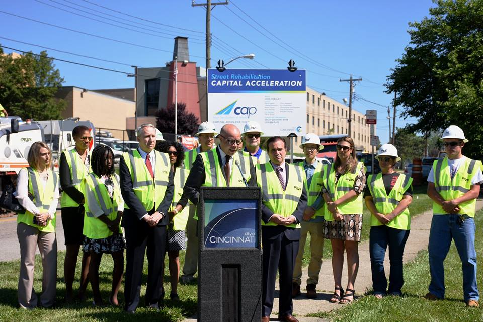
City Manager Harry Black announces CAP kick-off [Provided]
On Thursday, the City of Cincinnati celebrated the start of its bold, new road rehabilitation effort. The six-year program will include the resurfacing and rehabilitation of aging streets, replacement of city vehicles outside of their life cycle, and establish a new focus on preventive road maintenance that city officials will save money in the long-run.
The $109 million Capital Acceleration Plan is a strategic policy shift at City Hall, and represents a large infusion of money into road repair. The new focus on preventive maintenance is particularly noticeable as it represents an eight-fold increase in spending on that front.
“This is much bigger than just spending money to improve the condition of local streets. CAP is about making an investment in the city and people who live here,” City Manager Harry Black said in a prepared release. “This strategic investment in our roadways and infrastructure will serve as the foundation of Cincinnati’s sustained long-term growth.”
City Manager Harry Black announces CAP kick-off [Provided]
City officials say that the investments will improve the condition of 940 center-line miles of streets over the next six years. In its first year, its $10.6 million for street rehabilitation and $4 million for preventive maintenance, officials say, will impact 16 different neighborhoods and improve 120 center-line miles of roads.
With so many streets poised to be improved over the coming years, many people advocating for safer bicycling and walking conditions on the city’s roadways were optimistic that across-the-board improvements could be made. In fact, their cause for optimism is not without cause. The City of Cincinnati’s Bicycle Transportation Plan, which was adopted by City Council in June 2010, calls for incremental improvements to the city’s bike network as road resurfacing projects take place.
“Many of the facilities recommended in this plan can be implemented in conjunction with already scheduled street rehabilitation projects,” the Bicycle Transportation Plan notes. “When this coordination occurs, costs for implementing the bicycle facilities may be reduced by over 75%.”
According to officials at the Department of Transportation & Engineering, such savings can be achieved since the capital costs can be shared for both sets of improvements, and labor costs can be maximized.
The Bicycle Transportation Plan goes on to state that City Hall will be opportunistic and take advantage of every occasion where bicycle facilities can be included with street rehabilitation projects or other capital projects. Taking such an approach, the adopted policy says, “will reduce costs to the lowest levels possible.”
City Hall, however, has fallen woefully behind on the implementation of the recommendations made in the Bicycle Transportation Plan; and the current administration has even made a point of noting that they do not generally support the idea of on-street bike facilities. Rather, Mayor John Cranley (D) and his administration have focused on investing in off-street recreational bike trails.
Such an approach has left many people who use bikes as a means of transportation frustrated; and with $69 million of CAP going toward road improvement projects, it would seem like a great opportunity to maximize the improvements by performing these projects in a manner that also improves safety conditions for the city’s rapidly growing number of people commuting by bike.
Based on statements from City Hall, however, it seems that it will prove more so to be an opportunity lost; and put the city in an impossible position to meet its adopted policy objectives within their target time frames.
In the mid-2000s, ODOT designed a $1 billion reconstruction of I-75 between the Ohio River and I-275 that attracted little attention from the Cincinnati media. Who would win and who would lose as access points were shifted, added, or permanently closed?
Aside from a successful effort in 2006 by OKI to retain access at Galbraith Road over ODOT’s objections, virtually no public objections were made as multi-million dollar contracts were let; and work commenced in 2011 on a mega-project that will shape Cincinnati’s traffic patterns and property values for the next fifty years.
I-74 to Central Parkway Ramp [Jake Mecklenborg]
Closed Ramp at I-75 [Jake Mecklenborg]
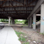
Hopple Street Interchange [Jake Mecklenborg]
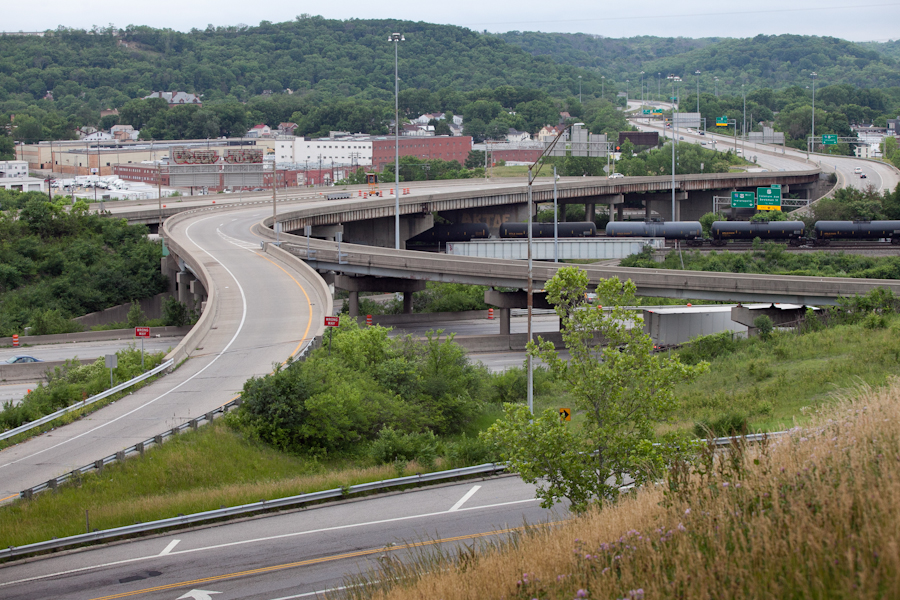
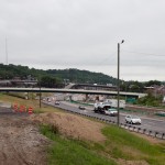
ODOT’s design strategy for the Mill Creek Expressway (Western Hills viaduct to Paddock Rd.) and Thru the Valley (Paddock Rd. to I-275) projects aimed to improve capacity and safety by reducing points of access and mitigating complex merging movements. This means most of I-75’s left-side ramps will be rebuilt as right-side ramps, and odd partial interchanges, such as the Towne Street ramps in Elmwood Place and the famous southbound “canyon” ramps in Lockland, will be permanently removed.
ODOT has already closed a lightly-used ramp providing access to I-75 southbound from Spring Grove Avenue, and another exiting I-74 westbound at Powers Street in Northside.
In 2016, ODOT plans to permanently close two ramps near Cincinnati State Technical and Community College. One provides access to I-75 northbound from Central Parkway, while the other provides access to Central Parkway from I-74. The planned closure of this final ramp – an unremarkable 250-foot deck girder overpass spanning I-75 near the Ludlow Viaduct – has been public knowledge for nearly a decade, but only recently has its closure generated opposition.
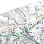
Evidence suggests that replacement of Central Parkway access from I-74 was discussed in the mid-2000s via an aerial structure approximately 10 times longer than the current 250-foot overpass. A drawing from February 2007 illustrates that the flyover ramp would have diverged from I-74 near the Colerain and Beekman Street interchange, bridged Elmore Street, then deposited traffic onto Central Parkway very close to the location of the current ramp.
2007 ODOT Plan [Provided]
Despite an effort led by Cincinnati State and then Vice Mayor Roxanne Qualls (D) several years ago, ODOT has not capitulated to recent pleas by Cincinnati State and the City of Cincinnati to reestablish the access provided by the existing 250-foot exit ramp with a similar ramp forking from the planned I-74 east to I-75 north ramp.
Such a ramp would not comply with current Federal Highway Administration guidelines, which discourage local access ramps built in close proximity to “system” interchanges, and local access ramps that diverge or join system interchange ramps. In fact, construction of a new ramp similar to what currently exists would violate Section 6.2.11 and Section 6.2 of FHWA code.
ODOT’s refusal to permit reconstruction of the I-74 ramp to Central Parkway, however, is inconsistent with its recent activities elsewhere in the state.
As part of the $200+ million reconstruction of the I-71/I-670 interchange in Columbus, an exit ramp to Leonard Avenue, a local residential street, was built in the middle of a “system” interchange. No reciprocal access to I-71 south was built, meaning this new ramp violates two sections of the FHWA’s guidelines and created a new situation identical on paper to the one ODOT seeks to eliminate in Cincinnati.
Access to Cincinnati State Community College from I-74 after 2017
In 2015, the City of Cincinnati, with the endorsement of Mayor John Cranley (D), outlined plans for an entirely new 2,500-foot viaduct connecting Elmore Street in South Cumminsville with Central Parkway at Cincinnati State. Ostensibly the proposed viaduct will restore the easy access from I-74 that Cincinnati State will lose in 2017; and, according to Cincinnati State President O’Dell Owens, help attract and retain students who commute from the city’s western suburbs.
To be sure, the proposed viaduct will improve access to I-74 westbound, as no direct access currently exists. But inbound travel will be significantly slower than what presently exists, and not much faster than what would exist if it weren’t built at all.
Perhaps the Elmore Street Viaduct, or something similar to it, could have been better integrated with the I-74 Beekman Street ramps if access to Central Parkway had been deemed a priority 10 years ago – instead ODOT completed a significant rebuilt of the interchange in 2014 with no provision for a new viaduct to Central Parkway.
Access to Cincinnati State Community College from I-75 after 2017
Missing from the Elmore Street Viaduct conversation, however, is the character of Cincinnati’s access from I-75. Currently, commuters from city’s northern neighborhoods must pass Cincinnati State on southbound I-75, exit at Hopple Street, then backtrack one mile north along Central Parkway. Commuters using I-75 north must exit a mile south of the college, traverse the new jug handle connection between Martin Lurther King Drive and Central Parkway, then drive one mile north.
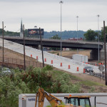
I-75 Reconstruction [Jake Mecklenborg]
If the current circuitous path I-75 commuters use to reach Cincinnati State isn’t discouraging attendance by prospective students from those neighborhoods, why does President Owens contend that use of the very same Hopple Street exit ramp will discourage I-74 commuters?
Why No Ludlow Avenue Interchange?
Missing from I-75’s initial 1950s construction, and its current reconstruction, is a full interchange at Ludlow Avenue. A new diamond interchange on the Ludlow Viaduct would have created ideal access to Cincinnati State, a new alternative route to the University of Cincinnati and the hospitals, and significantly increased property values in Northside.
Construction of a new interchange at Ludlow Avenue does not appear to have entered into ODOT’s conversations a decade ago, nor did construction of an interchange at Vine Street in St. Bernard.
MetroMoves and the Future of the Rapid Transit Right-of-Way
In 2002, Hamilton County voters defeated MetroMoves, a half-cent sales tax that would have funded improved countywide bus service and construction of various modern streetcar and light rail lines. The initiative planned for the convergence of two light rail lines above the I-75/I-74 interchange that would have provided direct access to Cincinnati State via a station located on the west face of its hill above Central Parkway.
The convergence of two lines just north of the property promised frequent train service for the community college, even during off-peak hours; however, no call for improved public transportation has been heard from those currently pushing for the Elmore Street Viaduct.
What’s more, there has been no call to incorporate a provision for rail transit on the proposed Elmore Street Viaduct. When looking at ODOT’s 2007 drawing, it is plain to see how the proposed structure could be integrated into the light rail network, thus eliminating the high expense of a dedicated light rail viaduct over the I-75/74 interchange in the future.
Meanwhile, ODOT’s reconstruction of I-75 will leave the old Rapid Transit Loop right-of-way mostly intact between the subway portals and Cincinnati State – meaning only a 100-foot bridge over Marshall Avenue will be necessary to construct a fully grade-separated surface line between the subway portals and Cincinnati State.
EDITORIAL NOTE: After this article was published, Mayor John Cranley’s office, through spokesperson Kevin Osborne, contacted UrbanCincy and provided additional information regarding the efforts of then Vice Mayor Roxanne Qualls to piece together funding for a smaller, yet similar project years ago. This article has been updated to reflect that reality.
While Cincinnati is the first city in Ohio to build a protected bike lane, it has a ways to go in order to catch up with the amount of bike infrastructure cities all across the nation are building. This, perhaps, says more about how far behind Ohio’s big cities are than how progressive Cincinnati is, but that’s a topic of discussion for another day.
Raised bike lanes, popular in Europe and present in a smattering of streets in several U.S. cities, provide extra protection for cyclists, drivers and pedestrians thanks to a slight change in perspective—or in this case, elevation.
But more U.S. cities are trying out the idea: San Francisco is getting its first raised bike lane–higher than vehicular traffic, but lower than the sidewalk–on one block of Valencia Street as part of the Mission Valencia Green Gateway project, the San Francisco Bicycle Coalition reports. Construction is scheduled to begin in early 2015.
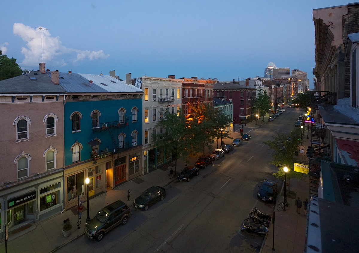
City and community leaders are taking a fresh look at some of Over-the-Rhine’s streets and intersections to see if they might be able to better function if managed differently.
In the 1940’s many downtown streets were converted from two-way to one-way traffic in order to stream automobile traffic through the city center. With the completion of Interstate 75 in the late 1950’s and Interstate 71 in the late 1960’s, some of these streets became important feeders into the highway system.
Additionally, many north-south streets, such as Main, Walnut and Vine, remained one-way to help move traffic throughout the new auto-oriented street system.
It eventually became clear, however, that one-way streets were not adding much benefit beyond moving vehicles slightly faster on their way to and from the interstate highways.
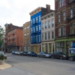
Two-way traffic on Vine meets one-way traffic at Fourteenth [Travis Estell]
Vine Street [Travis Estell]
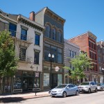
Main Street [Travis Estell]
A sleepy Main Street [Travis Estell]
As a result, the City of Cincinnati spent around $400,000 in 1999 to convert Vine Street back to two-way travel from Central Parkway to McMicken Avenue. A subsequent study in 2004 found that traffic along Vine Street became slightly more congested, but also reduced the speed of motorists traveling through the historic neighborhood.
Since its conversion, Vine Street has also blossomed with dozens of new businesses, which can, in part, be attributed to slower traffic and improved access and visibility. As a result, there have been several other examples of this type of conversion throughout Over-the-Rhine, including sections of Thirteenth and Fourteenth Streets.
Two-way street conversions are typically credited with improving safety for pedestrians and cyclists, while also helping local businesses along the street by making it easier for drivers to navigate city streets. In addition to that, a civil engineer from Penn State University even found that the conversion of one-way streets can even improve traffic flow.
“Two-way networks can serve more trips per unit time than one-way networks when average trip lengths are short,” Dr. Vikash Gayah wrote in his essay. “This study also found that two-way networks in which left-turn movements were banned at intersection could always serve trips at a higher rate than one-way networks could, even long trips.”
Gayah’s conclusion was that the trip-serving capacity of a street network can actually be improved when converted to two-way operations, and when left turns are banned.
“This framework can be used by planners and engineers to determine how much a network’s capacity changes after a conversion, and also to unveil superior conversion options,” Gayah noted.
In Cincinnati, initiating such conversions can come in the form of streetscaping projects or through formal requests made by neighborhood leaders. From there, City engineers will determine the feasibility of suggested conversions. In some cases, like E. Twelfth, E. Thirteenth, Fourteenth Streets, City engineers have said that the streets are too narrow to be converted and remain one-way to allow for on-street parking.
“At most times of the day Main Street has relatively light traffic and motorists speed down the street in order to make every green light,” Seth Maney, head of Main Street OTR, explained to UrbanCincy. “It can seem more like a drag strip than a pedestrian-oriented business district.”
The specific request from Over-the-Rhine activists is to convert both Main Street and Walnut Street. However, transportation officials say that the routing of the first phase of the Cincinnati Streetcar will prohibit such a conversion south of Twelfth Street.
“The streetcar route is something we have to consider if there was a desire to convert the north-south streets to two way traffic.” said Michael Moore, Director of Cincinnati’s Department of Transportation & Engineering (DOTE). “The conversion from Twelfth to Liberty Street, however, would be relatively simple.”
In addition to Twelfth Street, the streetcar’s routing along Elm and Race would also seem to make it improbable that either of those streets could be converted to two-way traffic.
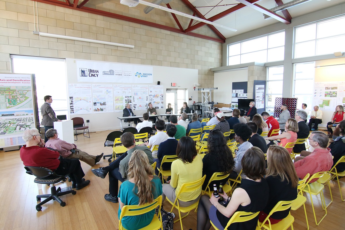
As with previous events we have hosted at the Niehoff Studio, a capacity crowd attended to not only view the student work, but also participate in a panel discussion with regional experts on the topic. At this event, UrbanCincy‘s Jake Mecklenborg moderated the discussion.
The topic of discussion and the proposals put forth by the interdisciplinary students carried even greater weight as the City of Cincinnati allocated $1.9 million for a variety of bike projects, including $200,000 for the Wasson Way Trail. The City has also recently made an offer to purchase the Wasson Corridor for $2 million from Norfolk Southern who abandoned the rail line years ago.
While the Wasson Way Trail envisions a recreational bicycle and pedestrian trail running along the Wasson Corridor, many now view it as a component of a multi-modal transportation corridor that includes a long-planned light rail line.
Mayor John Cranley’s (D) administration appears to be focused on investing in recreational bike/ped trails, which is good, but the development of the Wasson Corridor should include both the proposed recreational trail and room for light rail tracks.
Fortunately, what was once viewed as a project that pitted light rail advocates against biking advocates has changed drastically since UrbanCincy‘s controversial editorial on the matter in 2012. There now appears to be broad consensus from both sides that the corridor should be developed in a comprehensive, multi-modal fashion.