Categories
News Transportation

Everything You Need to Know About the Proposed Elmore Street Viaduct

In the mid-2000s, ODOT designed a $1 billion reconstruction of I-75 between the Ohio River and I-275 that attracted little attention from the Cincinnati media. Who would win and who would lose as access points were shifted, added, or permanently closed?

Aside from a successful effort in 2006 by OKI to retain access at Galbraith Road over ODOT’s objections, virtually no public objections were made as multi-million dollar contracts were let; and work commenced in 2011 on a mega-project that will shape Cincinnati’s traffic patterns and property values for the next fifty years.

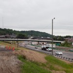
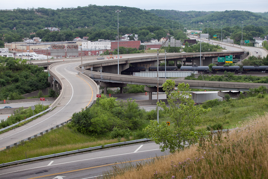
ODOT’s design strategy for the Mill Creek Expressway (Western Hills viaduct to Paddock Rd.) and Thru the Valley (Paddock Rd. to I-275) projects aimed to improve capacity and safety by reducing points of access and mitigating complex merging movements. This means most of I-75’s left-side ramps will be rebuilt as right-side ramps, and odd partial interchanges, such as the Towne Street ramps in Elmwood Place and the famous southbound “canyon” ramps in Lockland, will be permanently removed.

ODOT has already closed a lightly-used ramp providing access to I-75 southbound from Spring Grove Avenue, and another exiting I-74 westbound at Powers Street in Northside.

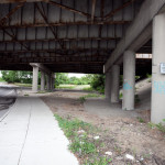
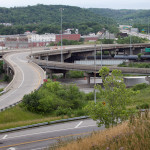
In 2016, ODOT plans to permanently close two ramps near Cincinnati State Technical and Community College. One provides access to I-75 northbound from Central Parkway, while the other provides access to Central Parkway from I-74. The planned closure of this final ramp – an unremarkable 250-foot deck girder overpass spanning I-75 near the Ludlow Viaduct – has been public knowledge for nearly a decade, but only recently has its closure generated opposition.

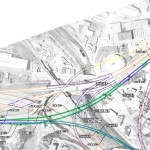
Evidence suggests that replacement of Central Parkway access from I-74 was discussed in the mid-2000s via an aerial structure approximately 10 times longer than the current 250-foot overpass. A drawing from February 2007 illustrates that the flyover ramp would have diverged from I-74 near the Colerain and Beekman Street interchange, bridged Elmore Street, then deposited traffic onto Central Parkway very close to the location of the current ramp.

Despite an effort led by Cincinnati State and then Vice Mayor Roxanne Qualls (D) several years ago, ODOT has not capitulated to recent pleas by Cincinnati State and the City of Cincinnati to reestablish the access provided by the existing 250-foot exit ramp with a similar ramp forking from the planned I-74 east to I-75 north ramp.

Such a ramp would not comply with current Federal Highway Administration guidelines, which discourage local access ramps built in close proximity to “system” interchanges, and local access ramps that diverge or join system interchange ramps. In fact, construction of a new ramp similar to what currently exists would violate Section 6.2.11 and Section 6.2 of FHWA code.

ODOT’s refusal to permit reconstruction of the I-74 ramp to Central Parkway, however, is inconsistent with its recent activities elsewhere in the state.

As part of the $200+ million reconstruction of the I-71/I-670 interchange in Columbus, an exit ramp to Leonard Avenue, a local residential street, was built in the middle of a “system” interchange. No reciprocal access to I-71 south was built, meaning this new ramp violates two sections of the FHWA’s guidelines and created a new situation identical on paper to the one ODOT seeks to eliminate in Cincinnati.

Access to Cincinnati State Community College from I-74 after 2017
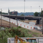
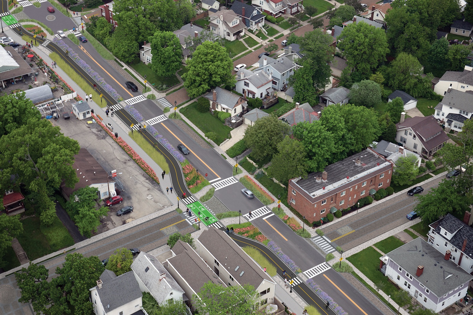
In 2015, the City of Cincinnati, with the endorsement of Mayor John Cranley (D), outlined plans for an entirely new 2,500-foot viaduct connecting Elmore Street in South Cumminsville with Central Parkway at Cincinnati State. Ostensibly the proposed viaduct will restore the easy access from I-74 that Cincinnati State will lose in 2017; and, according to Cincinnati State President O’Dell Owens, help attract and retain students who commute from the city’s western suburbs.

To be sure, the proposed viaduct will improve access to I-74 westbound, as no direct access currently exists. But inbound travel will be significantly slower than what presently exists, and not much faster than what would exist if it weren’t built at all.

Perhaps the Elmore Street Viaduct, or something similar to it, could have been better integrated with the I-74 Beekman Street ramps if access to Central Parkway had been deemed a priority 10 years ago – instead ODOT completed a significant rebuilt of the interchange in 2014 with no provision for a new viaduct to Central Parkway.

Access to Cincinnati State Community College from I-75 after 2017
Missing from the Elmore Street Viaduct conversation, however, is the character of Cincinnati’s access from I-75. Currently, commuters from city’s northern neighborhoods must pass Cincinnati State on southbound I-75, exit at Hopple Street, then backtrack one mile north along Central Parkway. Commuters using I-75 north must exit a mile south of the college, traverse the new jug handle connection between Martin Lurther King Drive and Central Parkway, then drive one mile north.

If the current circuitous path I-75 commuters use to reach Cincinnati State isn’t discouraging attendance by prospective students from those neighborhoods, why does President Owens contend that use of the very same Hopple Street exit ramp will discourage I-74 commuters?

Why No Ludlow Avenue Interchange?
Missing from I-75’s initial 1950s construction, and its current reconstruction, is a full interchange at Ludlow Avenue. A new diamond interchange on the Ludlow Viaduct would have created ideal access to Cincinnati State, a new alternative route to the University of Cincinnati and the hospitals, and significantly increased property values in Northside.

Construction of a new interchange at Ludlow Avenue does not appear to have entered into ODOT’s conversations a decade ago, nor did construction of an interchange at Vine Street in St. Bernard.

MetroMoves and the Future of the Rapid Transit Right-of-Way
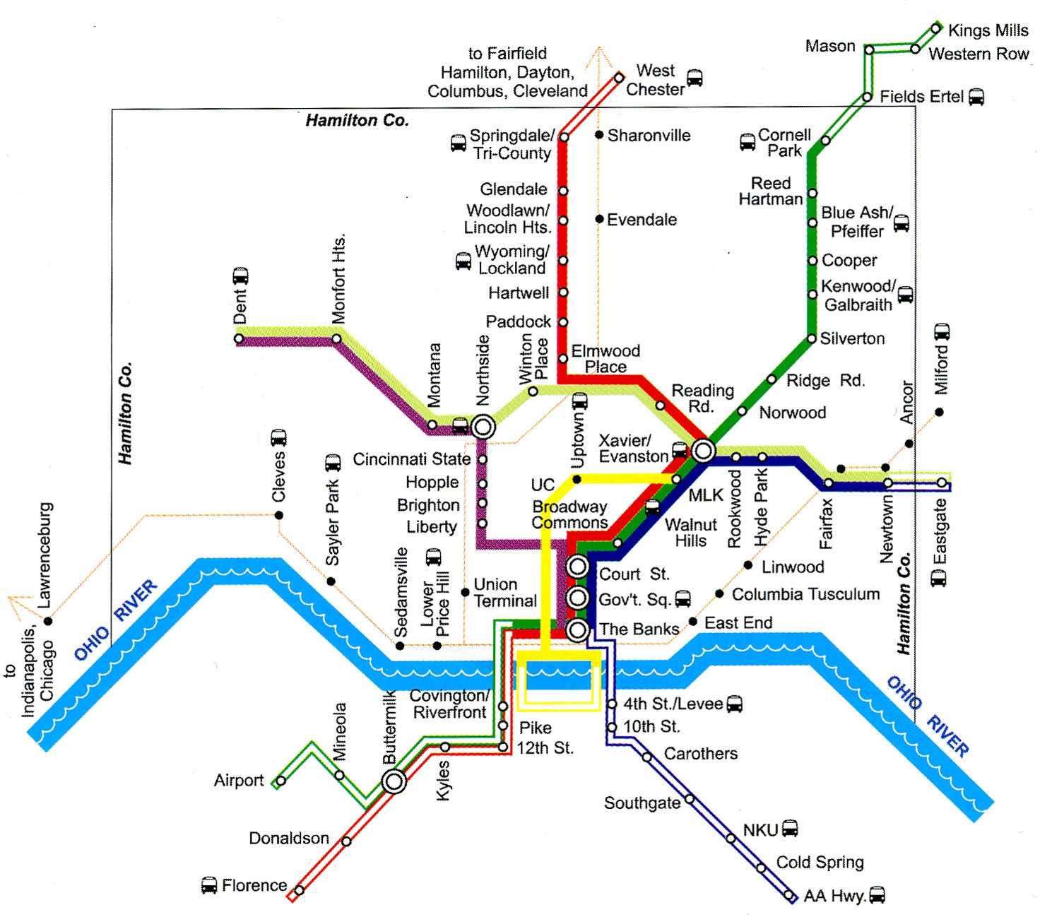
In 2002, Hamilton County voters defeated MetroMoves, a half-cent sales tax that would have funded improved countywide bus service and construction of various modern streetcar and light rail lines. The initiative planned for the convergence of two light rail lines above the I-75/I-74 interchange that would have provided direct access to Cincinnati State via a station located on the west face of its hill above Central Parkway.

The convergence of two lines just north of the property promised frequent train service for the community college, even during off-peak hours; however, no call for improved public transportation has been heard from those currently pushing for the Elmore Street Viaduct.

What’s more, there has been no call to incorporate a provision for rail transit on the proposed Elmore Street Viaduct. When looking at ODOT’s 2007 drawing, it is plain to see how the proposed structure could be integrated into the light rail network, thus eliminating the high expense of a dedicated light rail viaduct over the I-75/74 interchange in the future.

Meanwhile, ODOT’s reconstruction of I-75 will leave the old Rapid Transit Loop right-of-way mostly intact between the subway portals and Cincinnati State – meaning only a 100-foot bridge over Marshall Avenue will be necessary to construct a fully grade-separated surface line between the subway portals and Cincinnati State.

EDITORIAL NOTE: After this article was published, Mayor John Cranley’s office, through spokesperson Kevin Osborne, contacted UrbanCincy and provided additional information regarding the efforts of then Vice Mayor Roxanne Qualls to piece together funding for a smaller, yet similar project years ago. This article has been updated to reflect that reality.
Categories
Development News Transportation

Cincinnati Reaches Agreement With Norfolk Southern on Purchase of Wasson Railroad Corridor

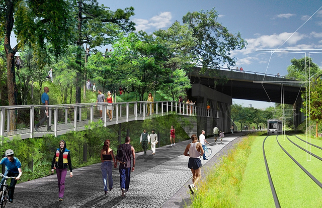
Cincinnati City Council’s Neighborhoods Committee gave a unanimous okay to an ordinance that would solidify an agreement to purchase 4.1 miles of railroad right-of-way from Norfolk Southern for $11.8 million, providing a key piece of the 7.6-mile Wasson Way recreational trail.

The agreement would give the City a two-year purchase option for the property, which extends between the Montgomery-Dana intersection along the Norwood/Evanston line to the intersection of Red Bank and Wooster roads in Columbia Township.

The ordinance was a last minute by-leave item on the committee calendar, made necessary due to a TIGER grant application that is due on Friday. Project backers are seeking $17 million of the $20 million project cost, and City support makes their application much more attractive.

The trail has been in the works since 2011, and a group of nearly 20 volunteers with the Wasson Way nonprofit got a big boost when Mayor John Cranley (D), City Manager Harry Black, and City staff assisted with the negotiations.

“We started looking at the TIGER grant application,” said Mel McVay, senior planner at Cincinnati’s Department of Transportation & Engineering. “They really talk about ‘ladders of opportunity’, increasing mobility and accessibility for folks throughout the region, and so we saw an opportunity between the property we could purchase and some property we already had, and some existing trails.”

Director of Department of Trade and Development Oscar Bedolla spelled out the project’s urgency.

“One of the statutory requirements associated with the scoring for TIGER is related to readiness,” he said. “And so, the more that we can do to show that the project is potentially shovel-ready enhances our ability to acquire or be selected for TIGER funding.”

Bedolla added that under the terms of the agreement, the City would pay nothing in the first year if it does not proceed with the purchase. If the purchase is pursued within the second year, there would be a 5% fee added to the price.

The City’s matching funding of between $3 million and $4 million for construction costs could be made up of a combination of state and federal grants, plus funds raised by Wasson Way, he said.

Still up in the air is approximately two miles or the corridor between the Columbia Township end point and Newtown, where it could connect with the Little Miami Scenic Trail.

“We’re working on it,” McVay said. “Unfortunately, the railroad was not open to selling any additional property east of that point. We’re investigating three or four ways that we can get farther east to the existing Little Miami Trail. We’re very confident we can get there.”

David Dawson, a resident of Mt. Lookout and realtor with Sibcy Cline, expressed concern about how a long-envisioned light rail line could be brought to the corridor once its freight rail designation is abandoned – a legal process that is handled by the U.S. Surface Transportation Board.

“It just can’t be said enough, in my view, that the City will now become the steward of a very valuable asset,” Dawson said. “This is a regional corridor that, in this day and age, cannot really be duplicated. If we lose that ability to eventually have transit, rail transit, or some sort of transit in the future, we won’t be able to put it back.

Dawson and other rail advocates are calling for the corridor to be railbanked, so that the addition of light rail transit remains an option in the future.

“This doesn’t just connect our neighborhoods, but in the future it has the potential to connect the entire region out to Clermont County,” Dawson said.

The use of this corridor has long been eyed for light rail transit, including in the 2002 MetroMoves regional transit plan. A 2014 study by KZF Design recommended a design solution that would preserve the ability to develop both light rail transit and a trail; and estimated that such an approach would bring the cost of developing the trail to approximately $11.2 million.

Andrea Yang, senior assistant City solicitor, said that the purchase agreement would give the City some time to work out those issues.

“The way that the abandonment process is structured, there is a time period which we could utilize to further investigate other options,” Yang said. “Had we chosen to railbank the property and attempt to preserve it, it would actually follow the same process for abandonment, so there’s definitely time to look into that if that is what Council’s interested in seeing.”

In April, Cincinnati’s Planning Commission voted to place an Interim Development Control Overlay District on this corridor in order to give the city more time to allow plans to progress without new development creating new conflicts.

Categories
News Transportation

City Planners Recommend Transportation Overlay District for Wasson Railroad Corridor

Following the guidance of City Council, Cincinnati’s Department of City Planning & Buildings has completed its land use study for the Wasson Railroad Corridor. The study’s findings and recommendations offer the clearest guidance to-date as to how to proceed with redeveloping the abandoned freight rail corridor, following the issuance of preliminary designs in July 2014.

City planners took a comprehensive look at the history of the corridor, its current conditions and the best path forward that respects the desires of the city and the impacted neighborhoods.

In that analysis City staff revealed seven studies and plans that recommend the corridor either be used for rail transit, or a combined multi-modal network that accommodates rail transit, bicycles and pedestrians. Some of the most notable of these include the 2002 MetroMoves regional transit plan, 2010 Bicycle Transportation Plan, 2012 comprehensive Plan Cincinnati, and the 2013 Railroad Safety Improvement Plan – all of which either specifically call for the corridor to be used for rail transit, or a multi-modal corridor.

The history is important as it influenced the study’s recommendation as to how to proceed with acquiring and preserving the corridor. As of now, the 5.7-mile Wasson Railroad Corridor is still owned by Norfolk Southern, but the City of Cincinnati has stated that they are in the process of acquiring the property from them.

“With this corridor being so crucial to the future development of multi-modal transportation in the City, the threat of potential development within the railroad right-of-way would significantly slow down, if not completely hinder, those possible public transportation opportunities from occurring,” city planners wrote in the 32-page land use study released earlier this month.

Of course, this fact has been known by policy makers at City Hall for years. As a result, City Council has, on several occasions, approved interim development controls to protect the corridor from being built upon. These controls, however, are just temporary and city officials must now decide how they would like to move forward.

In the study city planners examined the pros and cons of three potential options for accomplishing this.

The first option examined the idea of rezoning the property to a Parks and Recreation classification. This would offer the corridor significant protections, but it would also severely restrict the City from being able to implement rail transit in the future due to federal regulations that prohibit the use of public parks or wildlife refuges for transit corridors.

A second option studied looked at simply dedicating the land as City right-of-way. This too would offer significant protections, but is not possible until the City acquires the land from Norfolk Southern.

The third option, and the one recommended by city staff, is enacting a Transportation Overlay District over the corridor. While planners admit that crafting the language for such legislation may be complicated, they also stated that it would be most aligned with the preferences of neighborhood residents and publicly adopted planning documents.

In order to address the complexity of the legislation required for such an overlay district, city planners recommended looking at the Atlanta BeltLine Overlay District that was implemented to protect a 22-mile abandoned freight rail corridor. In Atlanta civic leaders are currently in the process of converting the corridor into a similarly envisioned multi-modal network with rail transit, bikeways, parks and pedestrian paths.

“While all options present advantages and disadvantages, the Transportation Overlay District is seen as the best solution for preservation of the Wasson Railroad Corridor,” city planners wrote. “This tool, while it may take a bit longer to craft the ordinance language, will provide more flexibility and also protect the contiguous nature of the corridor.”

City officials say that this solution will allow for the development of the Wasson Way Trail to move forward in the near term, while affirming the City’s intentions to develop the corridor as a multi-modal transportation facility that includes rail transit in the future.

The solution crafted by the Department of City Planning & Buildings appears to be a perfect compromise between the two constituencies looking to use the corridor. Bicycle advocacy groups can see the right-of-way acquired and preserved so that they can move forward with their plans for a bike and pedestrian trail, while transit advocates can rest assure that those immediate efforts are not being done in conflict with ongoing planning and design work for a future light rail line.

With the Wasson Railroad Corridor Land Use Study now complete, it will go before the city’s Planning Commission. Should it be approved by Planning Commission, it will then go back to city staffers so that draft overlay district language can be crafted and recommended to City Council. From there, it would go before City Council for approval.

It is a standard process and one that advocates hope can be completed in the coming months.

Categories
Up To Speed

After 20 years of results, it turns out that transit skeptics in St. Louis were wildly wrong

After 20 years of results, it turns out that transit skeptics in St. Louis were wildly wrong.

Hamilton County residents voted on a half-cent sales tax in 2002 that would have transformed the region’s transportation options. Through that new funding, the region would have completely rebuilt and restructured its bus service, built five light rail lines, and several streetcar lines. Much skepticism, touted by opponents and not unlike what St. Louis voters experienced in their own public vote 20 years ago. The difference is that St. Louis voters approved their measure while Cincinnatians did not. It turns out that the opponents and skeptics in St. Louis were wrong…wildly wrong. More from the St. Louis Post Dispatch:

To say there were doubters that the fledgling MetroLink light-rail service would catch on with riders back in 1993 would be a monumental understatement…Costello also recalled how Washington “bean counters” assured locals that “there is no way that you will meet your ridership numbers.” By contrast, he said, MetroLink exceeded the projected 10-year levels within two years.

Nations recalled how a 1987 report predicted light-rail ridership in St. Louis would be about 3 million by 2000. That year, he said, people boarded trains more than 14 million times…MetroLink now logs more than 17 million boardings a year — many of them commuters and students. Regional leaders also credit light rail with spurring residential and commercial development near stations.

Categories
Business Development News Politics Transportation

MetroMoves: A Decade Later

The election held earlier this month marked the 10-year anniversary of MetroMoves, the Hamilton County ballot issue that would have more than doubled public support for the Southwest Ohio Regional Transit Authority (SORTA). Specifically, a half-cent sales tax would have raised approximately $60 million annually, permitting a dramatic expansion of Metro’s bus service throughout Hamilton County and construction and operation of a 60-mile, $2.7 billion streetcar and light rail network.

MetroMoves was SORTA’s third attempt to fund countywide transit service – sales tax ballot issues also failed in 1979 and 1980.


The 2002 MetroMoves plan called for five light rail lines, modern streetcars, and an overhauled regional bus system. Image provided.

Bus System Expansion
According to John Schneider, who chaired the MetroMoves campaign, SORTA planned to expand bus service immediately after collection of the tax began. In 2003 Metro’s schedule would have been reworked with more frequent service on every existing bus line, including more late night and weekend service. By 2004, with the arrival of newly purchased buses, Metro planned to link a dozen new suburban transit hubs with new cross-town bus routes.

The Glenway Crossing Transit Center, which opened in early 2012, is an example of the sort of suburban bus hubs planned as part of MetroMoves. The 38X bus, which began service when the transit center opened, is an example of the sort of new routes that MetroMoves would have funded.

Modern Streetcars & Light Rail Lines
In 2003 design work would have begun on a modern streetcar line and the first of five light rail lines. The streetcar line was planned to follow a route nearly identical to the line currently under construction in Downtown and Over-the-Rhine. The modern streetcar line was planned to have traveled up the Vine Street hill to the University of Cincinnati, then turn east on Martin Luther King Drive, cross I-71, and meet a light rail line on Gilbert Avenue.

Construction would have begun in 2004 and operation would have begun by 2006 or 2007.

The start date for light rail construction was less certain because the MetroMoves tax revenue was to be used as the local contribution for a large Federal Transit Administration (FTA) match. This process became standard practice in cities throughout the country since federal matching began in the early 1970s.


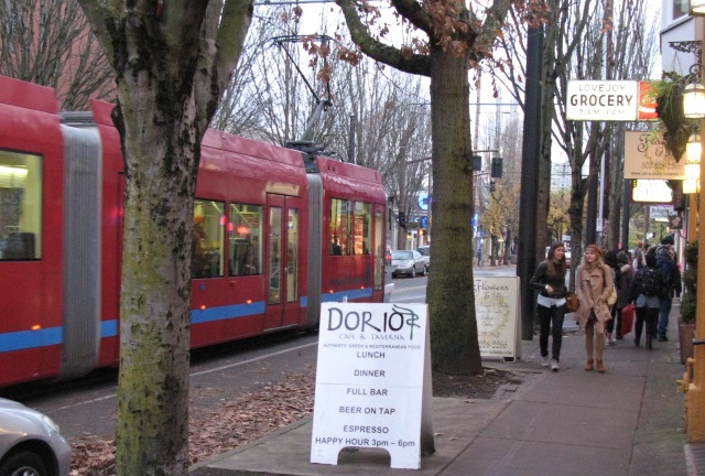
Modern streetcars, similar to those used in Portland, OR, could have been in service as early as 2005 had Hamilton County voters approved MetroMoves in 2002. Photograph provided by John Scheinder.

The first light rail line to be built was the system’s “trunk”, a line connecting Downtown and Xavier University on Gilbert Avenue and Montgomery Road. At Xavier, three suburban light rail lines were planned to converge on a trio of abandoned or lightly used freight railroad right-of-ways.

The first to be built would have been the northeast line through Norwood to Pleasant Ridge and Blue Ash. It was expected that the second line would be one incorporated into a rebuilt I-75; however that highway project has now been pushed back past 2020, meaning the Wasson Road line to Hyde Park likely would have been built soon after the line’s abandonment in 2009.

Renovating the Central Parkway Subway
Lost in the rhetoric employed to defeat MetroMoves was perhaps its most intriguing feature: a plan to renovate and at last put into use the two-mile subway beneath Central Parkway. This tunnel was built between 1920 and 1922 as part of the Rapid Transit Loop, a 16-mile transit line that would have connected Downtown with Brighton, Northside, St. Bernard, Norwood, Oakley, and O’Bryonville. Construction of the Rapid Transit Loop ceased soon after the Charterite ouster of the Boss Cox Machine and never resumed.

Three subway stations at Race Street, Liberty Street, and Brighton were to have been renovated and put into use as part of the 2002 MetroMoves plan. North of the subway’s portals, the line would have traveled on the surface to Northside, then entered I-74’s median near Mt. Airy Forest. Park & Ride stations were planned in the I-74 median at North Bend Road and Harrison Avenue/Rybolt Road in Green Township.

A fifth light rail line, requiring construction of four miles of new track, was planned to connect Northside and the Xavier University junction. Trains on this fifth line would travel from the far West Side to Hyde Park on the I-74 and Wasson Road corridors.

MetroMoves failure at the polls
MetroMoves was placed on the November 2002 ballot by SORTA in anticipation of a new federal transportation bill in 2003. What became known as SAFETEA-LU, a $286.4 billion measure, was not passed until 2005. Although SORTA’s board had the authority to place a transit tax on Hamilton County’s ballot in the years before the federal transportation bill was passed, MetroMove’s 2002 defeat was so lopsided (161,000 to 96,000 votes) that the regional transit authority choose not do so.

When speaking with those affiliated with the 2002 MetroMoves campaign, the failure of the ballot issue is usually attributed to four key factors:

  1. Anti-tax mood caused by the 1996 stadium sales tax and ensuing cost overruns
  2. 2001 Race Riot
  3. The MetroMoves campaign was thrown together quickly during summer 2002. SORTA’s board did not vote to place the issue on the ballot until August 20.
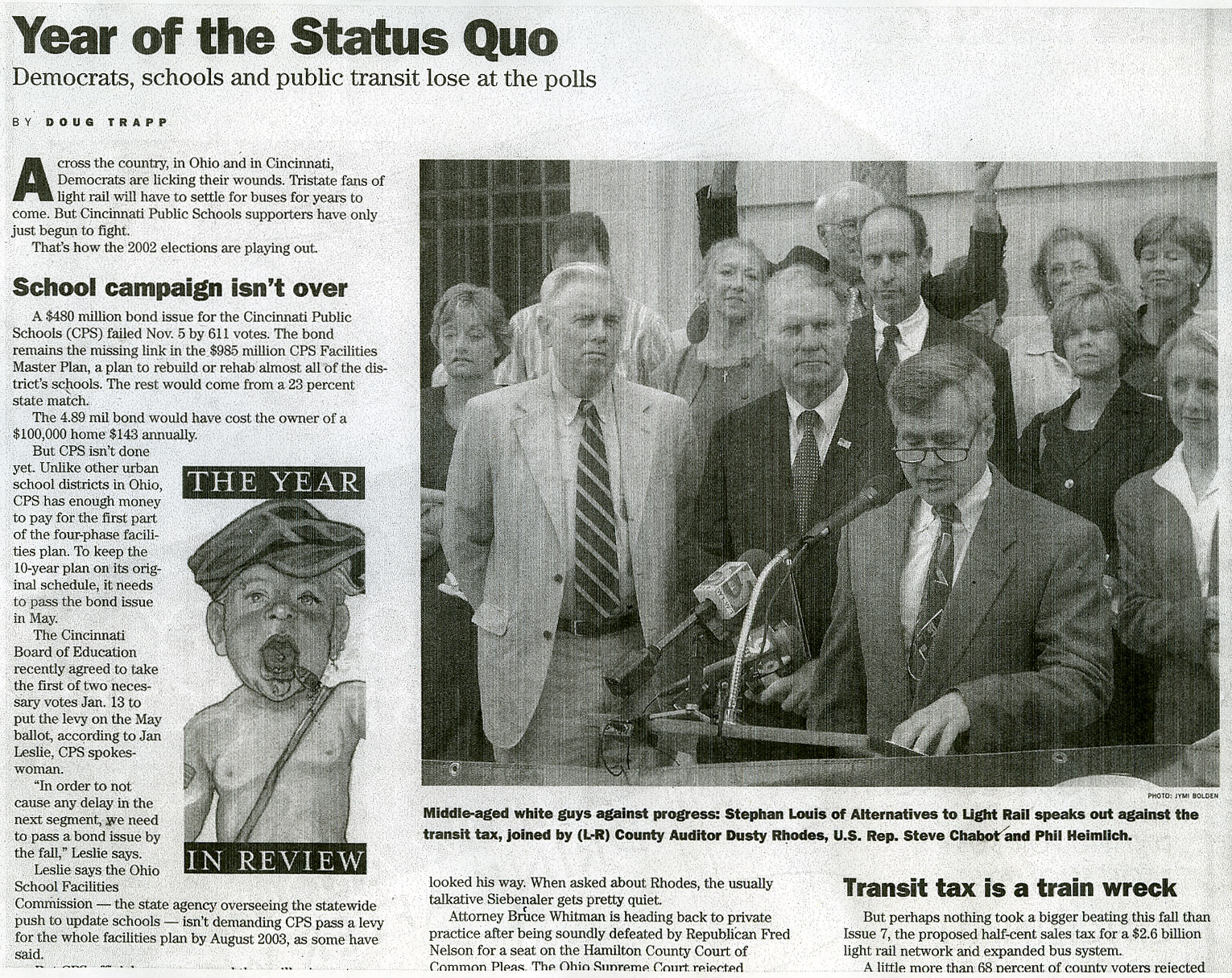
  4. A dirty opposition campaign comprised of Hamilton County Auditor Dusty Rhodes (D), Commissioner John Dowlin (R), Commissioner Phil Heimlich (R), and Congressman Steve Chabot (R).

The opposition campaign was led by Stephan Louis, who in late 2002 was reprimanded for false statements made during the campaign by the Ohio Elections Commission. Nevertheless, as a reward for his work in opposing MetroMoves, he was soon after appointed to SORTA’s board along with fellow public transit opponent Tom Luken in 2003.


Opponents to the 2002 MetroMoves campaign were accused and found guilty of using unethical campaign tactics. Newspaper image taken from a 2002 issue of CityBeat.

In 2006, Louis came under fire for having written racist and anti-public transportation emails and was forced off the board soon after. He reappeared to campaign in support of COAST’s anti-streetcar Issue 9 in 2009 and Issue 48 in 2011.

Another MetroMoves?
In 1972 when Cincinnati voters approved the .3% earnings tax that enabled creation of a public bus company, it was expected that city funding would be temporary and Hamilton County would eventually fund the region’s public transportation. Instead, nearly 40 years later, Cincinnati’s bus company is still funded only by the city and therefore provides only limited service outside city limits.

Ten years after the defeat of MetroMoves, despite a tripling of gasoline prices and the viability of transit systems proven by an increasing number of mid-sized American cities, it seems unlikely that a similar effort stands a chance of passage in Hamilton County in the immediate future. Many of the same public figures who opposed MetroMoves ten years ago have acted repeatedly in the past five to obstruct Cincinnati’s current streetcar project.

Furthermore, since the election of President Barack Obama (D) in 2008, the Tea Party has fomented an irrational suspicion of local government, and local anti-tax groups have authored intentionally misleading ballot issues. Meanwhile our local media, especially talk radio, continues to harass public transportation at every opportunity.

The way forward for the Cincinnati area has, since 2007, been the City of Cincinnati by itself. Despite the efforts of politicians, anti-tax groups, and utility companies to stop Cincinnati’s streetcar project, it broke ground in early 2012 and track installation will begin next year. Along with ongoing demographic shifts within Hamilton County, the success of Cincinnati’s initial streetcar might persuade the county’s electorate to approve county funding of public transportation for the first time.