Categories
News Politics Transportation

Cincinnati’s $109M Capital Acceleration Plan Ignores Adopted Bike Policy

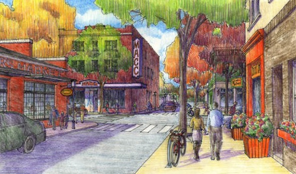
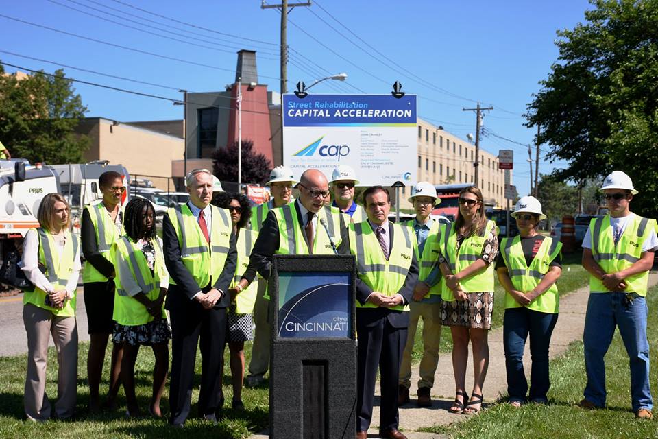
On Thursday, the City of Cincinnati celebrated the start of its bold, new road rehabilitation effort. The six-year program will include the resurfacing and rehabilitation of aging streets, replacement of city vehicles outside of their life cycle, and establish a new focus on preventive road maintenance that city officials will save money in the long-run.

The $109 million Capital Acceleration Plan is a strategic policy shift at City Hall, and represents a large infusion of money into road repair. The new focus on preventive maintenance is particularly noticeable as it represents an eight-fold increase in spending on that front.

“This is much bigger than just spending money to improve the condition of local streets. CAP is about making an investment in the city and people who live here,” City Manager Harry Black said in a prepared release. “This strategic investment in our roadways and infrastructure will serve as the foundation of Cincinnati’s sustained long-term growth.”

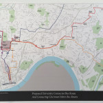
City officials say that the investments will improve the condition of 940 center-line miles of streets over the next six years. In its first year, its $10.6 million for street rehabilitation and $4 million for preventive maintenance, officials say, will impact 16 different neighborhoods and improve 120 center-line miles of roads.

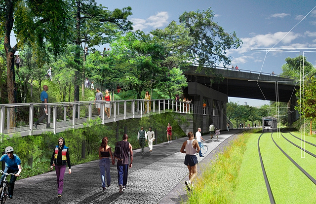
With so many streets poised to be improved over the coming years, many people advocating for safer bicycling and walking conditions on the city’s roadways were optimistic that across-the-board improvements could be made. In fact, their cause for optimism is not without cause. The City of Cincinnati’s Bicycle Transportation Plan, which was adopted by City Council in June 2010, calls for incremental improvements to the city’s bike network as road resurfacing projects take place.

“Many of the facilities recommended in this plan can be implemented in conjunction with already scheduled street rehabilitation projects,” the Bicycle Transportation Plan notes. “When this coordination occurs, costs for implementing the bicycle facilities may be reduced by over 75%.”

According to officials at the Department of Transportation & Engineering, such savings can be achieved since the capital costs can be shared for both sets of improvements, and labor costs can be maximized.

The Bicycle Transportation Plan goes on to state that City Hall will be opportunistic and take advantage of every occasion where bicycle facilities can be included with street rehabilitation projects or other capital projects. Taking such an approach, the adopted policy says, “will reduce costs to the lowest levels possible.”

City Hall, however, has fallen woefully behind on the implementation of the recommendations made in the Bicycle Transportation Plan; and the current administration has even made a point of noting that they do not generally support the idea of on-street bike facilities. Rather, Mayor John Cranley (D) and his administration have focused on investing in off-street recreational bike trails.

Such an approach has left many people who use bikes as a means of transportation frustrated; and with $69 million of CAP going toward road improvement projects, it would seem like a great opportunity to maximize the improvements by performing these projects in a manner that also improves safety conditions for the city’s rapidly growing number of people commuting by bike.

Based on statements from City Hall, however, it seems that it will prove more so to be an opportunity lost; and put the city in an impossible position to meet its adopted policy objectives within their target time frames.

Categories
Business Development News

Madisonville To Celebrate Completion of Historic Bank Building Renovation

Madisonville neighborhood leaders believe that strategic investments over the past few years are finally starting to bear fruit, as is evidenced by the restoration of the historic Fifth Third Bank Building at the corner of Madison Road and Whetsel Avenue.

The $644,000 project was led by the Madisonville Community Urban Redevelopment Corporation (MCURC), and includes a street-level restaurant space with two, two-bedroom apartments on the building’s second floor. The hope is that the project will help stimulate other private reinvestment in the neighborhood.

Built in 1927, the building used to be a bank and still has the vault inside to prove it. Today the 2,800-square-foot street-level “white box” restaurant space is now being marketed to potential tenants. Those interested in the space are asked to contact Matt Strauss, Real Estate and Marketing Manager at MCURC, at 513-271-2495.

Community leaders will gather for a ribbon cutting ceremony next week to celebrate bringing the historic structure back to life.

“MCURC was asked by the community to save this signature building in the heart of the business district,” said Sara Sheets, Executive Director of MCURC. “Our hope is to attract a unique restaurant tenant bringing newcomers to the neighborhood, while offering residents a chance to have a date night in their own neighborhood.”

The Bank Building’s future restaurant tenant will join a growing roster of new dining options nearby.

Lala’s Blissful Bites, a bakery, opened down the street in January; plans for two coffee shops, Mad Llama Coffee by Lookout Joe and CooKoo’s Coffee Shoppe, are in the works; and a commissary retail store from the owner of Mazunte Taqueria is coming soon.

Due to what community leaders attribute to decades of disinvestment and targeted demolition, the Bank Building is one of the few historic buildings still standing in the business district. Many of the surrounding properties are vacant lots, but that too may soon be changing.

Since 2008, the City of Cincinnati has been buying vacant parcels in the area in order to assemble a large site suitable for development. In 2014, the City issued an RFQ to developers on the 7.5 acres of property it had acquired to date, which comprises most of the four blocks that form the intersection of Madison and Whetsel.

City leaders say that the team selected to redevelop these properties will be formally announced in the coming weeks, but early indications point to the Ackermann Group as the leading candidate.

This is all coming at the same time as the $200 million development at Medpace’s campus at Madison Road and Red Bank Expressway, a half-mile west of the neighborhood business district, which includes 250 apartments, 100,000 square feet of commercial space, 250,000 square feet of office space, and a 239-room Dolce Hotel, which is expected to be completed in 2018.

The ribbon cutting ceremony will take place at the Bank Building at 5900 Madison Road at 11am on Thursday, April 28. The Ohio Community Development Finance Fund, Fifth Third Bank, the James A. Schroth Family Charitable Trust, PNC Bank, LISC of Greater Cincinnati & Northern Kentucky, Duke Energy Urban Revitalization Initiative, and the City of Cincinnati provided funding for the project.

Categories
News Transportation

UC Students, Staff Call on Metro to Make Additional Uptown Service Enhancements

University of Cincinnati’s Department of Planning+Design+Construction recently partnered with Metro for an on-campus listening session for input on how to better serve the Uptown community. The two-day outreach event included meetings with students, faculty and staff on both the main campus and medical campus to gather feedback from current bus riders and non-users.

In line with the many other community engagement sessions Metro has hosted throughout the city over the past year, participants were asked how they would like to see Metro improve, while non-riders discussed what was needed to get them to choose taking the bus.

Among the faculty and staff responses, improving east-west crosstown routes and frequency topped the list, followed by adding frequency to the existing 17, 19, 78 (Lincoln Heights) and 43 (Bond Hill) lines, adding express service between Uptown and Liberty Township, improving evening frequency, and adding more ticket vending machines.

Student feedback requested modernizing the fare box; adding evening and weekend frequency on the 19, 51, and 78 lines; improving instructions on how to ride the bus; adding a public display that monitors the number of available bike racks on the bus (currently, each bus has a capacity of two); and integrating the UC Bearcat card as a form of payment for bus fare.

Additionally, staff from the university presented a proposal for a new bus route called the University Connector. Similar to the 51, the route would connect Northside, Clifton, Walnut Hills, Oakley, and Madisonville, with a center circulator around three sides of UC’s main campus.

University staff members believe the route would minimize transfer wait times and improve accessibility to key academic buildings on UC’s main campus, and improve connectivity with the medical campus. But while the proposed circulator service would use established Metro stops, its location in Oakley would not take advantage of the new $1.2 million Oakley Transit Center that will break ground later this year.

As the building boom continues at a rapid pace in Uptown, a growing focus is being placed on improving the area’s transportation access – both UC’s student government and Board of Trustees have recently stated their support for extending the Cincinnati Streetcar up the hill, Metro launched Metro*Plus in 2013 and established the Uptown Transit District in 2014, which features enhanced stations, ticket vending machines, real time arrival signage, and improved wayfinding design.

There is currently no timetable for implementing any of the recommended improvements, but it is widely anticipated that Metro will put a county-wide transit tax on this November’s ballot that would be used to improve the agency’s bus operations.

Categories
Development News

Deadline Given for Community, Developer to Work Out Compromise on $25M Madisonville Project

Developers of The Red, a 246-unit apartment and restaurant development in Madisonville, will have to wait another two weeks to find out if they’ll get the city’s approval.

Cincinnati City Council’s Neighborhoods Committee on Monday tabled a proposal by Hyde Park Circle, LLC developer Ray Schneider to eliminate a planned 120,000 square feet of office space in favor of the residential development on 10 acres just south of its Madison Circle at Babson Place development, which is located on the southwest corner of Madison Road and Red Bank Expressway.

The project, estimated to cost more than $25 million, would include three residential buildings four to five stories in height – including 12 townhomes along Babson Place – and three restaurants of between 2,500 and 6,900 square feet. Garage parking would be spread between all three residential buildings and would provide 427 sheltered spaces, with an additional 51 surface parking spaces.

The City Planning Commission approved the change on March 6, although the commission did not examine how the change meshed with neighborhood plans such as the Red Bank corridor industrial plan and GO Cincinnati, which considered office and industrial uses as the “highest and best uses” of those properties.

That left some on the Neighborhoods Committee wondering what compelled the developer to make the change.

“I’m just curious about creating another residential corridor in an area where I believe, because of the traffic that comes there, because of Medpace, because of some of the other additional retail that’s going down Red Bank Expressway, the highest and best use of that site would be actually supporting office and and/or commercial,” said Councilmember Yvette Simpson.

John Bishop, construction manager for development team, said that recent proposals by Medpace to add additional office, retail, and hotel development in the area caused Schneider to reevaluate the original plans, which were approved by City Council in December 2006.

“We feel like this is the best proposed use of the property that we have currently because of the changes that have taken place in Madisonville and surrounding the property in the nine years from the time we initially submitted the plan,” he said. “That, in conjunction with the success that the [Madison Circle] development has had with the senior housing, has helped guide us in this to be wanting to go down the multi-family path as opposed to competing with the commercial aspect of business development with what Medpace is proposing across the road.”

For several months, the development team has been unable to secure the endorsement of either the Madisonville Community Council or Madisonville Community Urban Redevelopment Corporation (MCURC).

“In my opinion, it’s a shame to utilize 10 developable acres for residential development,” said MCURC Executive Director Sara Sheets. “We would prefer that employees live in the neighborhood – in the heart of the neighborhood – and become involved in the fabric of the neighborhood.”

She added that Madisonville also needs jobs, and that neighborhood plans are right in calling for office and industrial uses.

“At MCURC we consistently receive calls from brokers looking for 15,000 to 30,000 square feet of office space,” Sheets said. “We’ll most likely never have that anywhere else than Red Bank.” Simpson agreed.

“One of the major challenges if you develop residential at this site and then you want to attract jobs, there is no other – you can’t go into the neighborhood and then make that commercial,” she said. “Once we develop this as a residential site, there’s nowhere else to go commercial, industrial, or office within the community of Madisonville.”

The next two weeks will give the development team additional time to work with the neighborhood on a possible compromise. City Council’s Neighborhoods Committee meets next on May 4 at 2pm at City Hall.

Categories
News Transportation

City Planners Recommend Transportation Overlay District for Wasson Railroad Corridor

Following the guidance of City Council, Cincinnati’s Department of City Planning & Buildings has completed its land use study for the Wasson Railroad Corridor. The study’s findings and recommendations offer the clearest guidance to-date as to how to proceed with redeveloping the abandoned freight rail corridor, following the issuance of preliminary designs in July 2014.

City planners took a comprehensive look at the history of the corridor, its current conditions and the best path forward that respects the desires of the city and the impacted neighborhoods.

In that analysis City staff revealed seven studies and plans that recommend the corridor either be used for rail transit, or a combined multi-modal network that accommodates rail transit, bicycles and pedestrians. Some of the most notable of these include the 2002 MetroMoves regional transit plan, 2010 Bicycle Transportation Plan, 2012 comprehensive Plan Cincinnati, and the 2013 Railroad Safety Improvement Plan – all of which either specifically call for the corridor to be used for rail transit, or a multi-modal corridor.

The history is important as it influenced the study’s recommendation as to how to proceed with acquiring and preserving the corridor. As of now, the 5.7-mile Wasson Railroad Corridor is still owned by Norfolk Southern, but the City of Cincinnati has stated that they are in the process of acquiring the property from them.

“With this corridor being so crucial to the future development of multi-modal transportation in the City, the threat of potential development within the railroad right-of-way would significantly slow down, if not completely hinder, those possible public transportation opportunities from occurring,” city planners wrote in the 32-page land use study released earlier this month.

Of course, this fact has been known by policy makers at City Hall for years. As a result, City Council has, on several occasions, approved interim development controls to protect the corridor from being built upon. These controls, however, are just temporary and city officials must now decide how they would like to move forward.

In the study city planners examined the pros and cons of three potential options for accomplishing this.

The first option examined the idea of rezoning the property to a Parks and Recreation classification. This would offer the corridor significant protections, but it would also severely restrict the City from being able to implement rail transit in the future due to federal regulations that prohibit the use of public parks or wildlife refuges for transit corridors.

A second option studied looked at simply dedicating the land as City right-of-way. This too would offer significant protections, but is not possible until the City acquires the land from Norfolk Southern.

The third option, and the one recommended by city staff, is enacting a Transportation Overlay District over the corridor. While planners admit that crafting the language for such legislation may be complicated, they also stated that it would be most aligned with the preferences of neighborhood residents and publicly adopted planning documents.

In order to address the complexity of the legislation required for such an overlay district, city planners recommended looking at the Atlanta BeltLine Overlay District that was implemented to protect a 22-mile abandoned freight rail corridor. In Atlanta civic leaders are currently in the process of converting the corridor into a similarly envisioned multi-modal network with rail transit, bikeways, parks and pedestrian paths.

“While all options present advantages and disadvantages, the Transportation Overlay District is seen as the best solution for preservation of the Wasson Railroad Corridor,” city planners wrote. “This tool, while it may take a bit longer to craft the ordinance language, will provide more flexibility and also protect the contiguous nature of the corridor.”

City officials say that this solution will allow for the development of the Wasson Way Trail to move forward in the near term, while affirming the City’s intentions to develop the corridor as a multi-modal transportation facility that includes rail transit in the future.

The solution crafted by the Department of City Planning & Buildings appears to be a perfect compromise between the two constituencies looking to use the corridor. Bicycle advocacy groups can see the right-of-way acquired and preserved so that they can move forward with their plans for a bike and pedestrian trail, while transit advocates can rest assure that those immediate efforts are not being done in conflict with ongoing planning and design work for a future light rail line.

With the Wasson Railroad Corridor Land Use Study now complete, it will go before the city’s Planning Commission. Should it be approved by Planning Commission, it will then go back to city staffers so that draft overlay district language can be crafted and recommended to City Council. From there, it would go before City Council for approval.

It is a standard process and one that advocates hope can be completed in the coming months.