Categories
Development News

New Western Hills Viaduct Could Arrive in Late 2020’s

City officials recently unveiled plans for a new Western Hills Viaduct to replace the 84-year-old structure.

Built in 1931, the viaduct serves as the West Side’s main connection to the city’s urban core. “It affects everybody,” said Cincinnati City Engineer Richard Szekeresh, the project manager. Over 71,000 vehicles cross the bridge every day. However, a city study back in 2012 highlighted the bridge’s deteriorating structural conditions and the poor pedestrian and bicycle accessibility.

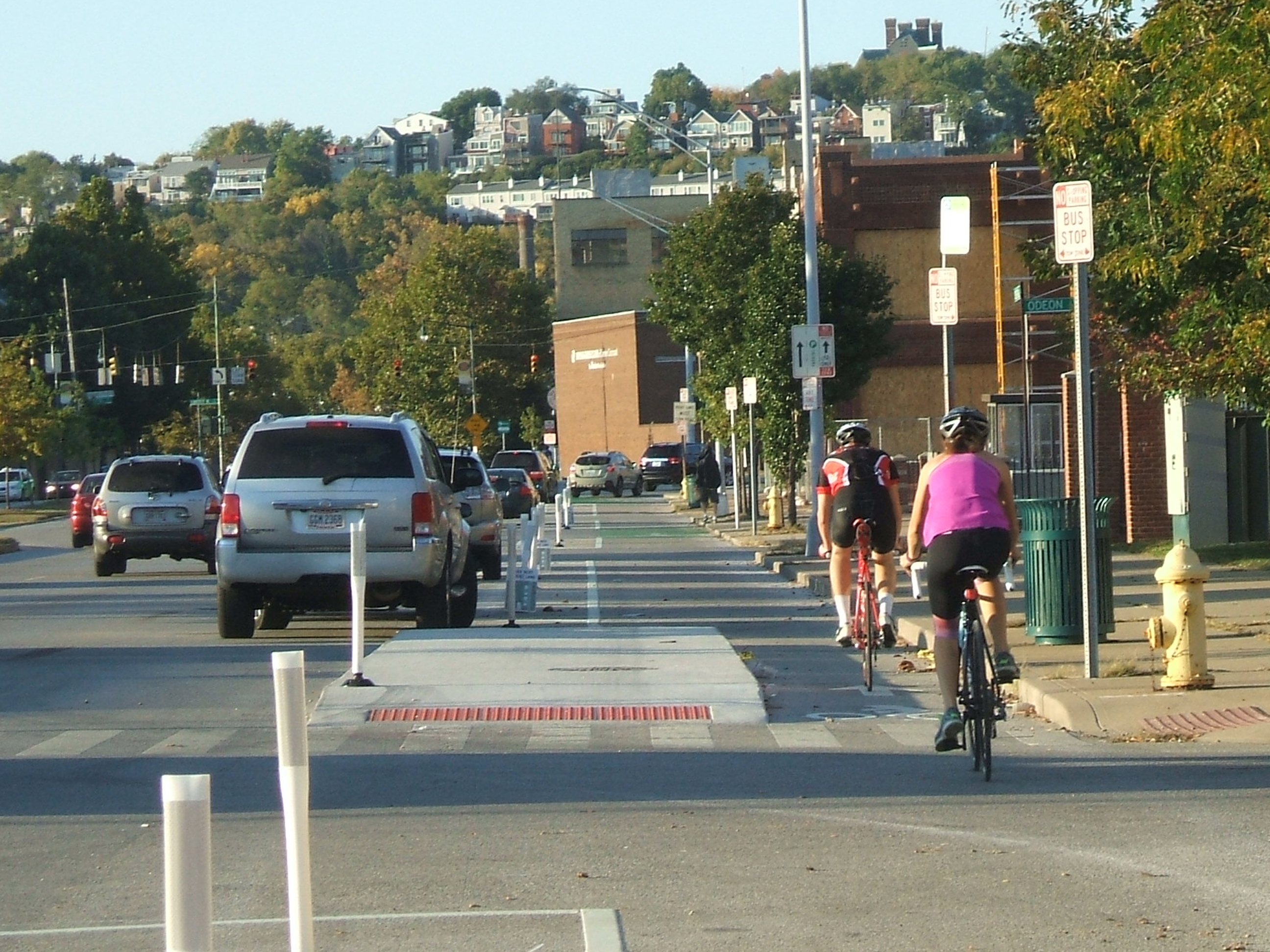
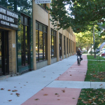
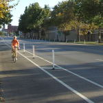
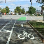
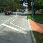
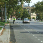
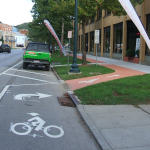
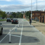
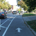
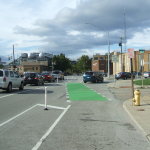
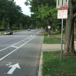
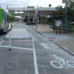
The current viaduct is a car haven. Vehicles zoom by a single, narrow sidewalk along the southern edge and cyclists are rare. According to Department of Transportation and Engineering officials, the new structure will be pedestrian- and bicycle-friendly and built to light rail specifications.

Wester Hills Viaduct NewNew cable-stayed design presented by DOTE

Design

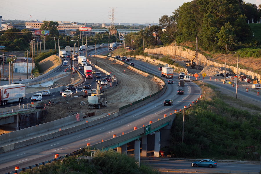
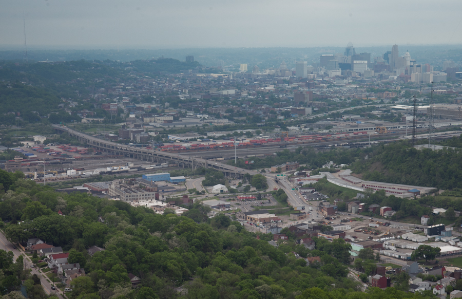
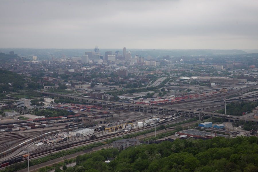
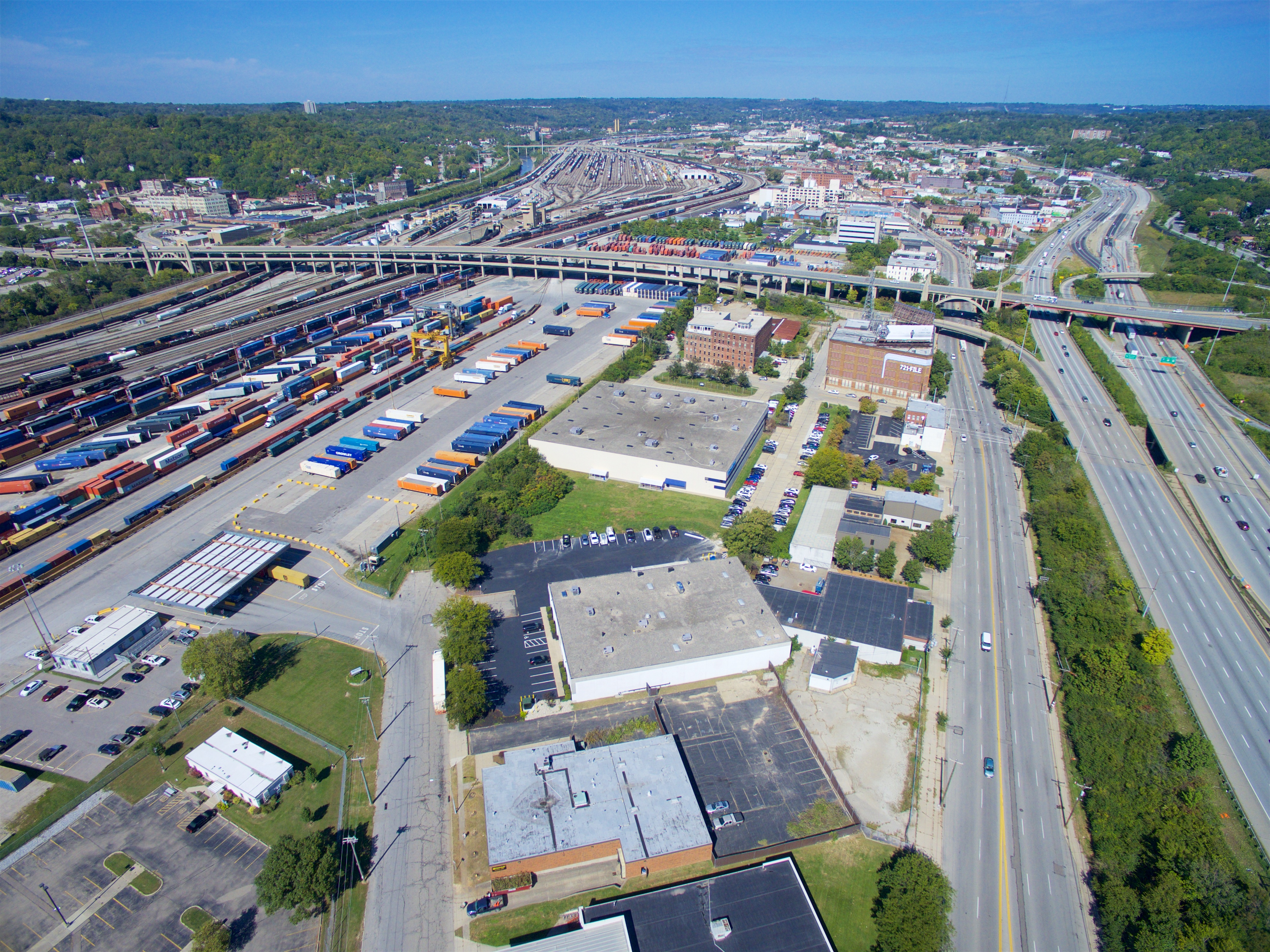
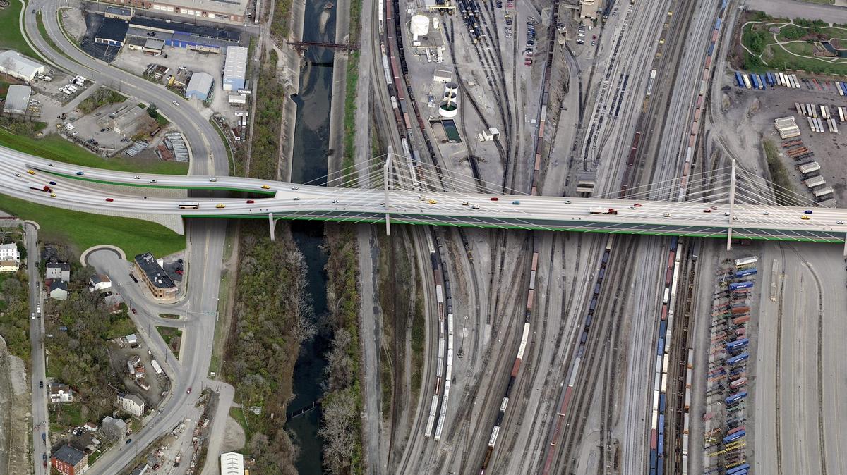
Heading west, the current bridge passes over Interstate 75, the CSX Queensgate rail yard, and then deposits cars onto Queen City Avenue in South Fairmont. Queensgate posed a significant problem for the engineers because they couldn’t shut down a privately-owned and high-trafficked rail yard for several years. “We had to find a way to build only from above,” said Szekeresh.

Two design features overcome this constraint. First, the cable-stayed bridge (shown in the renderings) has large distances between its support towers that (mostly) avoid the yard. Second, the physical structure consists of several interlocking parts, meaning the builders can simply insert the relevant pieces into place without much delay. Some rail lines will still be affected, but never for more than a few hours.

Traffic concerns ensure the old bridge will remain in use until its replacement is erected just to the south. The Ohio Department of Transportation (ODOT) must acquire several land parcels. All of them have been appraised, but ODOT must complete its environmental review before it can purchase the properties.

Funding

Total project cost hovers around $310 million, a substantial hike from the city’s previous estimate of $240 million. Federal funds will cover 80 percent, with the city, county, and state covering the remaining funds. Szekeresh indicated that the project could receive a $20 million Transportation Review Advisory Council grant from the Ohio Department of Transportation.

When federal funding will arrive, however, is unclear. Extensions to the projected 2028 end date may be necessary, especially if President-elect Trump reneges on his promise to improve infrastructure.

After the presentation ended, Szekeresh conducted an informal poll to gauge support for the design. Most community members raised their hands in affirmation.

Categories
News Politics Transportation

EXCLUSIVE: ODOT Expected to Announce Major Shift to ‘Fix-it-First’ Policy

While Ohio’s gas taxes and population have remained flat over the past decade, the Ohio Department of Transportation has continued to add capacity to roadways across the state – in some cases even building entirely new roadways to add to the state’s existing infrastructure. This may all soon be ready to change in what is being called a “major” policy shift in Columbus.

According to employees at ODOT who were briefed at an internal meeting on the matter recently, the nation’s seventh-largest state is poised to announce in the coming months that the days of roadway expansion are over. Instead they say that ODOT will embrace a future focused on maintenance and preservation of its existing network of more than 43,000 miles of roads and 14,000 bridges.

While officials say the move is economically driven, it also comes at a time as activists around the country – including numerous cities throughout Ohio – are increasingly calling for governments to embrace a “fix-it-first” policy.

An increasing number of states have been adopting such policies, with Michigan being one of the first when it enacted its Preserve First program in 2003, and California being the largest when it joined the fray last year.

The forthcoming announcement from ODOT, however, goes a step further than that.

In addition to focusing funds on maintenance and preservation, ODOT officials also say that they will abandon their “worst first” approach to fixing existing roadways. In doing so they say that the new program, called the Transportation Asset Management Plan, can save the state an estimated $300 million over the next six years – money that can then be redirected to other preservation activities like cleaning, sweeping, sealing and micro-surfacing.

The idea here, similar to healthcare or household maintenance, is that it is often much more economical to make steady improvements rather than waiting to make repairs until the asset is too far gone.

“It’s finally sinking in that we cannot continue on this unsustainable pace of highway expansion,” said an ODOT employee who spoke to UrbanCincy on the conditions of anonymity because they were not authorized to speak publicly.

According to ODOT’s own internal estimates, current funds will not be enough to maintain Ohio’s existing system by 2019 – the time when the Ohio Turnpike bonds are gone. Thus, without a major new source of revenue like a gas tax increase, ODOT intends to completely get out of the highway expansion business, and shift all funds to maintenance and rehabilitation.

“Most projects will occur before a road becomes severely compromised, and will be based around maximizing the service life of a particular road,” the ODOT staffer continued. “Long story short, ODOT isn’t going to waste its money on patching up a road as a temporary fix that will simply deteriorate again quickly because of major structural problems.”

There is no clear idea as to whether highway expansion projects currently on the drawing board will be impacted by this, but it appears likely that they will unless they receive capital funding through TRAC prior to 2019.

Such news could be damning for projects like the recently proposed Eastern Bypass or what is left of the Eastern Corridor project. At the same time, it could be the positive jolt needed for projects like the Western Hills Viaduct, which is in desperate need of an estimated $280 million fix.

Categories
Arts & Entertainment News

Cincinnati Dronescape is a Soundtrack of the City and the Sounds That Define It

Cincinnati has a rich history in music production, and recently it has become more of a hotbed for live performances. In addition to that, there are a number of well-known local or locally started musicians out there making the national rounds these days.

A new mashup project, however, is a bit of a change of pace from all of that.

Cincinnati Dronescape is the brainchild of Isaac Hand, and is a bit of an experiment involving art, music, technology and the city.

Hand worked with his friend Nick Denlinger to record what they thought were quintessential sounds from around the city. This included recordings from more than a dozen locations including the sound of the Western Hills Viaduct, Queensgate Railyard, Christian Moerlein Brewerythe hum of the University of Cincinnati Medical Center. From there, they then distributed the audio recordings to local musicians who them composed music to complement those sounds.

One of the interesting components of the project, aside from it recording background city sounds, is the fact that Hand and Denlinger recorded the sounds by using drones.

“The results are simultaneously a representation of the diversity of the Cincinnati music community, but also an aural portrait or sonic map of the city,” explained Hand.

Long-time readers of UrbanCincy may remember Hand from a project he helped champion in 2010 called Aural Grid, which was a “musical-spatial exploration” through Over-the-Rhine. Many of the artists involved with that project, Hand says, were also involved with Cincinnati Dronescape.

“Although I curated it, this really was a community endeavor,” Hand emphasized. “It took a whole bunch of people to make it possible.”

The community description is an apt one with roughly a dozen musicians contributing directly to the effort. In addition to that, Ian Gullett mixed everything into a cohesive recording, Arthur Brum produced the album artwork, and Micah Freeman composed the poem used for linear notes.

Nick Swartsell, who has grown increasingly fascinated by the history of the West End and its Kenyon Barr neighborhood, has even been working on a visual component to complement the track he contributed for the album.

It actuality, there are two albums available for streaming or purchase. The first, entitled Cincinnati Drones, is an album of the recorded sounds, while the second, entitled Cincinnati Dronescape, is the collection of artist remixes of those sounds.

Both albums can either be downloaded online for $7, or purchased in CD form for $10 on the project’s bandcamp webpage, Shake It Records, Everybody’s Records, Rock Paper Scissors and Torn Light.

Categories
News Transportation

PHOTOS: Ohio’s First Protected Bike Lane Attracting New Riders to Central Parkway

As bicycling continues to grow in popularity in Cincinnati, the city has built out more and more bike infrastructure. These new accommodations, including the new protected bike lanes on Central Parkway, are making it safer for bicyclists and are attracting more riders.

The Central Parkway Cycle Track provides a new protected, on-street route for bike travel between downtown and neighborhoods to the north, including Northside, Camp Washington and Clifton.

City transportation planners say that there has been apprehension for many cyclists to ride in high volumes of speedy traffic. This is particularly true for Central Parkway, which officials say was often avoided by many due to the intimidating nature of the street’s design that favored fast-moving automobiles. Since the opening of the Central Parkway Cycle Track, however, city officials say that there has been a substantial increased in bike traffic there.

Bike advocacy groups consider the project to be the first of its kind in Ohio. It stretches approximately about two miles from Elm Street at the edge of downtown to Marshall Avenue in Camp Washington.

The protected lanes differ from other bike lanes recently built in other locations around the city in that they are separated from moving traffic by a painted median several feet wide. To further delineate the two modes of traffic, the median also includes flexible plastic bollards spaced about 15 to 20 feet apart. This separation then pushes on-street parking out away from the curb.

At one point along the parkway, close to Ravine Street, the southbound lane leaves the street to run on a newly constructed path along the sidewalk for several hundred feet in order to allow 24-hour curbside parking. The off-street path is made of concrete dyed in a color intended to resemble brick.

During the heated debate over this design change, many expressed concern that construction of the new pavement could result in the loss of a large number of trees. Fortunately, due to careful planning and design coordination between city planners and representatives from Cincinnati Parks, who have oversight of the city’s landscaped parkways, they were able to preserve many of the trees in this area. According to city officials, only two trees in total were lost due to the lane.

Transportation officials are now working to link these protected bike lanes along Central Parkway with future bike routes along Martin Luther King Drive and on the reconstructed Western Hills Viaduct.

Furthermore, after work on the Interstate 75 reconstruction project near Hopple Street is complete, planners will consider the extension of the protected lanes north to Ludlow Avenue. But first, Mel McVay, senior planner at Cincinnati’s Department of Transportation & Engineering, told UrbanCincy that the first segment needs to be examined first, and additional community feedback will be necessary.

“We need to see how successful the first section is,” McVay explained. “It [the second phase] will depend on what the community wants.”

EDITORIAL NOTE: All 25 photos were taken by Eric Anspach for UrbanCincy in late September 2014.

Categories
Development News Transportation

Public Meetings Set for $200M Western Hills Viaduct Replacement

Over 55,000 vehicles traverse the storied Western Hills Viaduct. The iconic art deco era viaduct, constructed as part of the Cincinnati Union Terminal project in 1932 replaced the older Harrison Avenue Viaduct.

The viaduct last saw renovation in 1977, almost twenty years after the eastern section was demolished to make way for Interstate 75, but over the last few years a team of city, county and consultant engineers have been studying ways to repair or replace the aging bridge.

The city’s Department of Transportation and Engineering (DOTE), Hamilton County Engineer’s Office and URS are working together to determine the future replacement of the aging viaduct. The team will be hosting two public meetings on Thursday to engage adjacent property owners and frequent users of the bridge on the process of replacing the viaduct.

westernhillsviaduct-1-5The Western Hills Viaduct is one of a few crucial road connections to the west side of the city.
Photo by Jake Mecklenborg for UrbanCincy.

Because of the amount of repairs needed to maintain the existing viaduct, the team is not considering continuing the use of the existing viaduct. Instead the team is looking to build a new viaduct just south of the Western Hills Viaduct.

Richard Szekeresh, Principal Structural Engineer with DOTE told UrbanCincy that there are a number of other projects and factors that constrain the teams ability to determine a suitable relocation alignment; such as the rail yard operations below the bridge, the Metropolitan Sewer District’s (MSD’s) Lick Run Valley Conveyance System project, and Ohio Department of Transportation’s (ODOT’s) proposed new connection bridge from I-75 to the viaduct which is part of the Brent Spence Bridge project must be factored into the new location.

Additionally because of hillside grade issues at the McMillan and Central Parkway intersection a new alignment north of the existing viaduct would be extremely challenging and more expensive.

The team is studying whether to pursue another double-decker bridge or a single level span as the replacement alternative. Some private property will be affected along Harrison Avenue and Central Parkway along with the existing rail yard below the viaduct. Additionally, the team is looking for input on bicycle lanes and other transportation alternative improvements.

The design team hopes to have the engineering completed and a preferred alignment selected by 2014. The cost of the viaduct replacement would be an estimated $200 million. No funding has been identified and the project is not part of the Brent Spence Bridge project, even though it is in the northern edge of that section of the I-75 reconstruction project area.

Both of Thursday’s sessions will be at Cincinnati City Hall. One will be from 4pm to 5:30pm and the other from 6pm to 7:30pm. City Hall is accessible by the #1, #6 and #49 Metro buses.

Szekeresh concluded,“Typically, due to the size, complexity, and cost associated with a project of this nature it is not unusual for it to take ten or more years to bring them to construction. We are still at the beginning of a long process.”