Categories
News Transportation

Push for Daily Amtrak Service on Cincinnati Route Intensifies

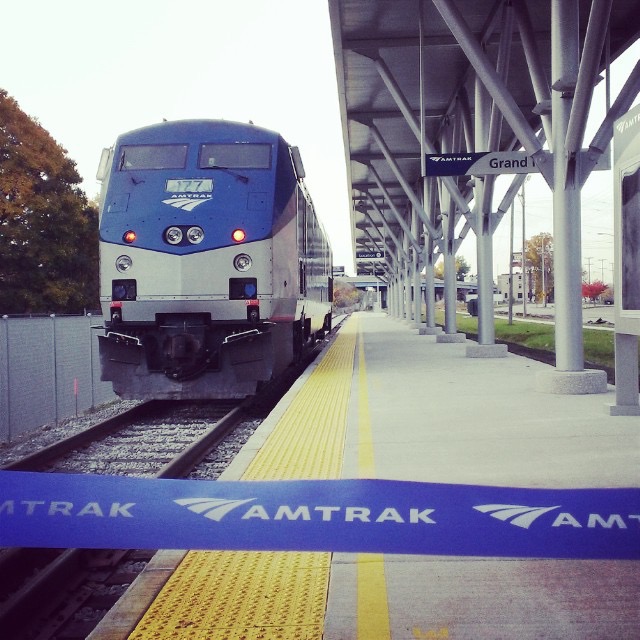
The Chief Scout Executive of the Boy Scouts of America, Michael Surbaugh, appealed to Amtrak CEO Wick Moorman to upgrade Amtrak’s Cardinal from its current tri-weekly service to a daily train. In his December 15 letter, Chief Scout Surbaugh urged a temporary or trial daily Cardinal for the Boy Scouts of America’s National Jamboree, which will take place at the Summit Bechtel Reserve in Mt. Hope, West Virginia. Amtrak’s Cardinal serves stops all along this area, which directly services the 70,000-acre New River Gorge National River. Looking further into the future, the Boy Scouts will be holding their World Scout Jamboree at this same location in 2019.

The Boy Scouts of America have used their Southwest Chief-serviced location near Raton, New Mexico for large events for many years. As an attendee to the joint All Aboard Ohio and Amtrak “Cardinal Conference” hosted by the Cincinnati USA Chamber of Commerce in September – the Boy Scouts were made aware of the issues surrounding less-than-daily Cardinal service.

The Boy Scouts join a myriad of organizations along the line pushing for better service by those communities which are served by it, including the City of Oxford and Miami University, which moved one step closer to a new Cardinal stop in the city. Derek Bauman, All Aboard Ohio’s Vice Chair, stated that, “[w]e are thankful to the BSA for its letter which shows that interest in this enhanced rail service remains strong.”

In his letter to Amtrak CEO Wick Moorman, Chief Scout Surbaugh stated “I know I speak for all when I say that enhanced service would be a welcome addition offering the possibility of increased ridership and visitors to the New River Gorge.” The state of West Virginia seems to agree, as shown by the unanimous motion passed in favor of daily Cardinal service from the West Virginia Governor’s Conference on Tourism. Amtrak itself projected in 2010 that daily service on the Cardinal would result in nearly doubling the current number of passengers utilizing that train.

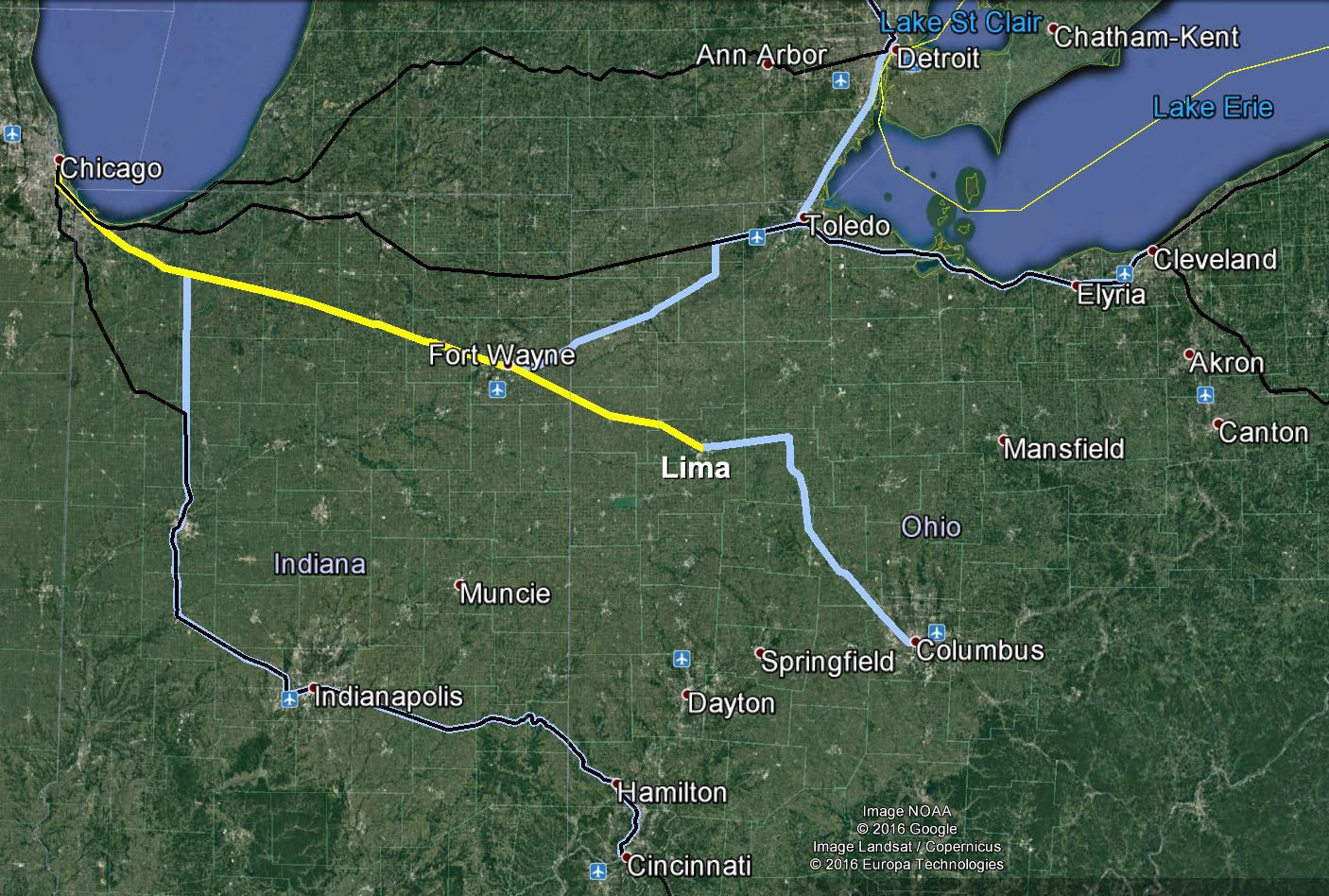
Proposed Amtrak Extensions and Upgrades (map via All Aboard Ohio)

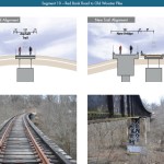
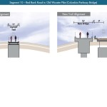
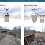
One of the major challenges to running effective train service to Chicago via the Cardinal includes the condition of track on the current route. All Aboard Ohio Chairperson Ken Prendergast told UrbanCincy, “It should be noted that about 50-60 miles of the Chicago-Fort Wayne/Lima nearest to Chicago could be used by Cincinnati to Chicago trains. It would provide a much faster routing into Chicago than the current route of the Cardinal and any other Cincinnati – Chicago trains that may be added in the near future.”

Elsewhere in Ohio, a passenger rail line linking rail-starved cities like Columbus and Lima to Chicago via Ft. Wayne and Gary, IN received a major boost on Tuesday. Federal officials gave permission for communities along the line to begin the Alternative Analysis and Public Input process, which will do preliminary engineering, service planning, and measure environmental impacts. Those officials met at Ft. Wayne’s Baker Street Station, which saw its last passenger service in 1990. This analysis will being in January of 2017 and finish by the Fall of that same year. The $350,000 needed for this initial studying was raised by cities all along the line.

“This is the first step in the Project Development Process, which all major transportation projects must go through. Right now there is enough funding from communities and businesses west of Lima to do the Chicago-Lima portion but not farther east to Columbus” Prendergast stated.

Prendergast sees these lines as a next step in further connecting Ohio via rail between Chicago and the east coast. If a Chicago to Columbus line is created it is not impossible to  imagine future phases that could expand eastward beyond Columbus as well, Prendergast says, “there’s nothing that says the Eastern Terminus of this route has to be Columbus. In fact Amtrak services from Cleveland and Toledo could be routed over this Fort Wayne-Chicago segment. But we still believe Central Ohio will decide it’s in their economic interest to be a part of this project.”

Officials speaking at the news conference highlighted their big dreams and big plans for the new possible rail line. They called for initial service to run between 70-80mph, with eventual upgrades to 110mph. A 2013 study by the Northeast Indiana Passenger Rail Association estimated that 10 trains a day along this line could generate up to 2 million annual passengers by 2020.

While both of these proposals require the cooperation of the freight railroads who own the lines (CSX and Norfolk Southern, respectively), many have hope because of Amtrak’s new CEO, Wick Moorman. Moorman is a veteran of the freight rail industry, having served more than 4 decades with Norfolk Southern and its predecessor, Southern. He has signaled that improved relations with the Class I freight railroads will be a focus of his tenure as CEO.

Categories
Development News Transportation

Construction to Start on $29M South Hamilton Crossing Project This March

Hamilton city officials recently celebrated the announcement that Barclaycard would bring up to 1,500 jobs to Vora Technology Park for a new call center. Now, in almost perfect timing, public officials say they are ready to move forward with a $29 million project that will greatly improve access to the site.

Last week the OKI Regional Council of Governments awarded $3.75 million to the South Hamilton Crossing project. This is in addition to a previous allocation of $2.45 million from OKI, and $10 million from the State of Ohio. The remaining funds are coming from the City of Hamilton and Butler County.

“OKI’s support of the South Hamilton Crossing project is crucial to its success and illustrates how important the overpass is to our regional transit network,” City Manager Joshua Smith stated in a prepared release.

Hamilton has long been defined by its numerous freight railways. While they have been productive for the city, they have also served as barriers between neighborhoods since they typically operate at-grade.

The Jack Kirsch Underpass on High Street is the only grade-separated rail crossing in Hamilton that offers east-west flow. As a result, the South Hamilton Crossing has long been envisioned; with some plans showing it that date all the way back to 1911.

As of now, Grand Boulevard terminates at the CSX and Norfolk Southern tracks in Lindenwald. People walking, biking or driving must then head north along Central Avenue and then cut across the four railroad tracks diagonally.

This new project will extend Grand Boulevard to the west to University Boulevard, serving Vora Technology Park and Miami University Hamilton. Instead of crossing the four railroad tracks, the extended road will bridge them, thus offering fewer conflicts for pedestrians, cyclists and motorists, along with fewer restrictions for freight operators.

“SHX is very important for both safety and economic reasons,” said Smith. “With the recent announcement that Barclaycard is opening a 1,500 person facility at Vora Technology Park, the need for better access to the area is more important now than ever.”

Transportation officials say that 56 trains travel through this crossing on a daily basis, which results in its blockage a total of 15.3% of the time. As a result, the new overpass is expected to greatly improve connectivity, reduce travel times, and increase safety.

Project leaders say that construction should begin in March 2016 and be completed in mid-2018.

Categories
Development News Transportation

Cincinnati Reaches Agreement With Norfolk Southern on Purchase of Wasson Railroad Corridor

Cincinnati City Council’s Neighborhoods Committee gave a unanimous okay to an ordinance that would solidify an agreement to purchase 4.1 miles of railroad right-of-way from Norfolk Southern for $11.8 million, providing a key piece of the 7.6-mile Wasson Way recreational trail.

The agreement would give the City a two-year purchase option for the property, which extends between the Montgomery-Dana intersection along the Norwood/Evanston line to the intersection of Red Bank and Wooster roads in Columbia Township.

The ordinance was a last minute by-leave item on the committee calendar, made necessary due to a TIGER grant application that is due on Friday. Project backers are seeking $17 million of the $20 million project cost, and City support makes their application much more attractive.

The trail has been in the works since 2011, and a group of nearly 20 volunteers with the Wasson Way nonprofit got a big boost when Mayor John Cranley (D), City Manager Harry Black, and City staff assisted with the negotiations.

“We started looking at the TIGER grant application,” said Mel McVay, senior planner at Cincinnati’s Department of Transportation & Engineering. “They really talk about ‘ladders of opportunity’, increasing mobility and accessibility for folks throughout the region, and so we saw an opportunity between the property we could purchase and some property we already had, and some existing trails.”

Director of Department of Trade and Development Oscar Bedolla spelled out the project’s urgency.

“One of the statutory requirements associated with the scoring for TIGER is related to readiness,” he said. “And so, the more that we can do to show that the project is potentially shovel-ready enhances our ability to acquire or be selected for TIGER funding.”

Bedolla added that under the terms of the agreement, the City would pay nothing in the first year if it does not proceed with the purchase. If the purchase is pursued within the second year, there would be a 5% fee added to the price.

The City’s matching funding of between $3 million and $4 million for construction costs could be made up of a combination of state and federal grants, plus funds raised by Wasson Way, he said.

Still up in the air is approximately two miles or the corridor between the Columbia Township end point and Newtown, where it could connect with the Little Miami Scenic Trail.

“We’re working on it,” McVay said. “Unfortunately, the railroad was not open to selling any additional property east of that point. We’re investigating three or four ways that we can get farther east to the existing Little Miami Trail. We’re very confident we can get there.”

David Dawson, a resident of Mt. Lookout and realtor with Sibcy Cline, expressed concern about how a long-envisioned light rail line could be brought to the corridor once its freight rail designation is abandoned – a legal process that is handled by the U.S. Surface Transportation Board.

“It just can’t be said enough, in my view, that the City will now become the steward of a very valuable asset,” Dawson said. “This is a regional corridor that, in this day and age, cannot really be duplicated. If we lose that ability to eventually have transit, rail transit, or some sort of transit in the future, we won’t be able to put it back.

Dawson and other rail advocates are calling for the corridor to be railbanked, so that the addition of light rail transit remains an option in the future.

“This doesn’t just connect our neighborhoods, but in the future it has the potential to connect the entire region out to Clermont County,” Dawson said.

The use of this corridor has long been eyed for light rail transit, including in the 2002 MetroMoves regional transit plan. A 2014 study by KZF Design recommended a design solution that would preserve the ability to develop both light rail transit and a trail; and estimated that such an approach would bring the cost of developing the trail to approximately $11.2 million.

Andrea Yang, senior assistant City solicitor, said that the purchase agreement would give the City some time to work out those issues.

“The way that the abandonment process is structured, there is a time period which we could utilize to further investigate other options,” Yang said. “Had we chosen to railbank the property and attempt to preserve it, it would actually follow the same process for abandonment, so there’s definitely time to look into that if that is what Council’s interested in seeing.”

In April, Cincinnati’s Planning Commission voted to place an Interim Development Control Overlay District on this corridor in order to give the city more time to allow plans to progress without new development creating new conflicts.

Categories
News Transportation

City Planners Recommend Transportation Overlay District for Wasson Railroad Corridor

Following the guidance of City Council, Cincinnati’s Department of City Planning & Buildings has completed its land use study for the Wasson Railroad Corridor. The study’s findings and recommendations offer the clearest guidance to-date as to how to proceed with redeveloping the abandoned freight rail corridor, following the issuance of preliminary designs in July 2014.

City planners took a comprehensive look at the history of the corridor, its current conditions and the best path forward that respects the desires of the city and the impacted neighborhoods.

In that analysis City staff revealed seven studies and plans that recommend the corridor either be used for rail transit, or a combined multi-modal network that accommodates rail transit, bicycles and pedestrians. Some of the most notable of these include the 2002 MetroMoves regional transit plan, 2010 Bicycle Transportation Plan, 2012 comprehensive Plan Cincinnati, and the 2013 Railroad Safety Improvement Plan – all of which either specifically call for the corridor to be used for rail transit, or a multi-modal corridor.

The history is important as it influenced the study’s recommendation as to how to proceed with acquiring and preserving the corridor. As of now, the 5.7-mile Wasson Railroad Corridor is still owned by Norfolk Southern, but the City of Cincinnati has stated that they are in the process of acquiring the property from them.

“With this corridor being so crucial to the future development of multi-modal transportation in the City, the threat of potential development within the railroad right-of-way would significantly slow down, if not completely hinder, those possible public transportation opportunities from occurring,” city planners wrote in the 32-page land use study released earlier this month.

Of course, this fact has been known by policy makers at City Hall for years. As a result, City Council has, on several occasions, approved interim development controls to protect the corridor from being built upon. These controls, however, are just temporary and city officials must now decide how they would like to move forward.

In the study city planners examined the pros and cons of three potential options for accomplishing this.

The first option examined the idea of rezoning the property to a Parks and Recreation classification. This would offer the corridor significant protections, but it would also severely restrict the City from being able to implement rail transit in the future due to federal regulations that prohibit the use of public parks or wildlife refuges for transit corridors.

A second option studied looked at simply dedicating the land as City right-of-way. This too would offer significant protections, but is not possible until the City acquires the land from Norfolk Southern.

The third option, and the one recommended by city staff, is enacting a Transportation Overlay District over the corridor. While planners admit that crafting the language for such legislation may be complicated, they also stated that it would be most aligned with the preferences of neighborhood residents and publicly adopted planning documents.

In order to address the complexity of the legislation required for such an overlay district, city planners recommended looking at the Atlanta BeltLine Overlay District that was implemented to protect a 22-mile abandoned freight rail corridor. In Atlanta civic leaders are currently in the process of converting the corridor into a similarly envisioned multi-modal network with rail transit, bikeways, parks and pedestrian paths.

“While all options present advantages and disadvantages, the Transportation Overlay District is seen as the best solution for preservation of the Wasson Railroad Corridor,” city planners wrote. “This tool, while it may take a bit longer to craft the ordinance language, will provide more flexibility and also protect the contiguous nature of the corridor.”

City officials say that this solution will allow for the development of the Wasson Way Trail to move forward in the near term, while affirming the City’s intentions to develop the corridor as a multi-modal transportation facility that includes rail transit in the future.

The solution crafted by the Department of City Planning & Buildings appears to be a perfect compromise between the two constituencies looking to use the corridor. Bicycle advocacy groups can see the right-of-way acquired and preserved so that they can move forward with their plans for a bike and pedestrian trail, while transit advocates can rest assure that those immediate efforts are not being done in conflict with ongoing planning and design work for a future light rail line.

With the Wasson Railroad Corridor Land Use Study now complete, it will go before the city’s Planning Commission. Should it be approved by Planning Commission, it will then go back to city staffers so that draft overlay district language can be crafted and recommended to City Council. From there, it would go before City Council for approval.

It is a standard process and one that advocates hope can be completed in the coming months.

Categories
Development News Transportation

KZF Releases Preliminary Designs, Cost Estimates for Wasson Way

A newly released feasibility study, produced by KZF Design, finds that construction of the 6.5-mile Wasson Way Trail would cost anywhere from $7.5 million for just a trail to $36 million for both a light rail line and trail totally separated from one another.

The cost estimates vary so much due to the three potential design options studied. The lowest cost alternative looked at placing a 12-foot-wide trail along the entire existing rail alignment. This, however, would make the inclusion of a future light rail line extremely difficult.

The most expensive alternative would construct an entire new trail alignment that does not interfere with any existing rail right-of-way. This would include the construction of several new bridges and completely preserve the ability to easily construct the long-planned light rail line adjacent to the new trail.

Alternative B, which was recommended by KZF and priced at $11.2 million, was a bit of a hybrid. It would include a 12-foot-wide trail offset from the existing rail alignment, but utilize existing rail right-of-way at pinch points along the corridor.

The 45-page study is the first detailed look at the corridor, which has been hotly debated and discussed over recent years. Much of the controversy has surrounded whether or not both light rail and a trail can be accommodated. KZF’s findings appear to show that much of the corridor could in fact accommodate both, but that some segments may prove to be difficult, albeit feasible.

If project supporters are able to advance the trail plan, KZF estimates that it would connect eight city neighborhoods and approximately 100,000 residents with an overall network of more than 100 miles of trail facilities.

“It is hard to build in the urban core, and to find an intact corridor ripe for development is a unique thing,” explained Eric Oberg, Manager at the Midwest Rails to Trails Conservancy. “If this is done right, this can be the best urban trail in the state of Ohio. I have no doubt.”

Some of the most difficult segments of the corridor are the nine existing bridges where the right-of-way is extremely limited. If both light rail and trail facilities are to traverse this corridor together, additional spans will be needed in order to have safe co-operation.

In addition to introducing what may become the region’s best urban trail and light rail corridor, some proponents also see it as an opportunity to fix other problems along the route. Most notably that includes the congested and confusing intersection of Madison, Edwards and Wasson Roads near Rookwood Pavilion.

While the newly released feasibility study offers the most detailed analysis of this corridor to date, the City of Cincinnati has yet to close on its purchase of the former freight rail line from Norfolk Southern.

City officials are reportedly in negotiations with Norfolk Southern now, and have made an initial offer of $2 million. In April, Mayor Cranley’s Administration also allocated $200,000 to the project.