Categories
News Transportation

GUIDE: How to Ride the Bus in Cincinnati

So maybe you’ve been thinking for a while that you should actually take this ‘public transit’ thing that you’re always saying we need more of. Maybe you’ve been meaning to ride the bus to get to bars and shopping but put it off because you can’t figure out how to use the system. Or maybe you work downtown and would ride the bus, but you either get a parking or bus pass from your employer and you drive because it seems easier.

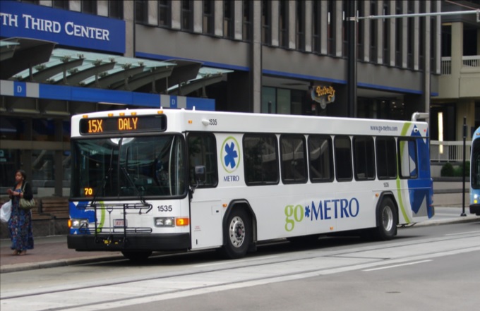
Regardless of the reason, there are many benefits to taking public transit as opposed to driving or taking a rideshare vehicle in Cincinnati. While our city gets a bad rap on the state of our bus system, the reality is that most of the city is easily accessible by bus. The 6 heaviest routes offer good daytime frequencies, serve the densest parts of the city, and are easy to understand when it comes to where they serve. These routes serve the arterial, or main, roads in Cincinnati, including Glenway, Hamilton/ Clifton, Vine, Reading, Montgomery, and Madison/Erie Avenues. Due to the geography and history of development in Cincinnati, most business districts and dense residential areas are on these roads. We are a lot more accessible than you might think!
But how do I use this bus? It may seem challenging to those who are not familiar with the system and how it works, but it’s nearly as easy as calling an Uber. In this article, I will address the three basic questions people have about riding the bus in Cincinnati: how do I know where it goes, how do I pay for my trip, and how do I not miss my stop.

Where Does the Bus Go?

There are several apps and websites that will plot the best route(s) to take as well as alternatives. Google Maps, which is standard on most smartphones, is easy to use and understand. Simply type in your destination and hit the transit icon as your travel mode and Google will do the rest. The app tells you where the nearest bus stop is, walking directions to the stop, and the estimated travel time once you are on the bus.

Another great app which offers much more functionality is the Transit App. This app gives the same directions as Google Maps does, but also includes a live tracker and time countdown of each bus on every route so you don’t have to wonder where the hell your bus is. The user interface is a little friendlier than Google’s as it is centered around transit usage. Additionally, the Transit App works in nearly every city worldwide that has public transportation options. It works especially well with multimodal travel and can estimate your travel time using a combination of travel modes like bike to bus, walk to bus, or bus to bus.

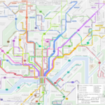
If you are more map-oriented and want to check out the entire route to learn where it goes, the Transit App has the ability to show the actual routing of each bus line and how long it would take to travel to each stop in the entire network by bus. Metro also offers its bus schedules and route maps on its website under Schedules. However, you must already know which line you are taking to take advantage of this.

Finally, you are always welcome to step onto a bus at your stop and ask the driver if this bus is going to X location. The drivers are knowledgeable about their routes as they drive them every day and will give you good advice on whether you should take this bus or another route nearby.

How Do I Pay for My Trip?

There are several ways to pay your bus fare with cash, credit/debit card, smartphone app, or stored value card. First, an explanation of the fare system. The fare in Zone 1, which includes the City of Cincinnati, Norwood, St. Bernard, Elmwood Place, Golf Manor, Delhi Township, and Cheviot, is $1.75 per rider. If you will need to transfer to another line to complete your trip, a transfer slip is an additional $0.50. Hot tip: if you are traveling somewhere and anticipate you will be returning by bus within 2 hours of first paying your fare, ask for a transfer and use that to return home. Transfers are good for up to 2 hours after requesting one and this can save you from spending another $1.75 for your return trip. If you are traveling outside of Zone 1 into Zone 2, the rest of Hamilton County, the one-way fare is $2.65 and transfers are still $0.50.

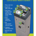
The most basic way to pay your fare is with cash, but keep in mind that the buses’ farebox does not give back change. If you only have singles, you will not be getting a quarter back for buying a Zone 1 ticket. Beyond paying cash you may purchase a stored value card, which you can load up with cash or by credit/debit card at any Ticket Vending Machine and select stores throughout the city. For example, the Clifton Market on Ludlow Ave sells stored value cards. You may put multiples of $10 on a stored value card. Don’t lose your card! Paying for your fare is as simple as swiping your stored value card on the bus, and it will automatically deduct your fare from the card’s balance. This removes the need to carry cash to pay the fare and is much easier and faster to use.

Finally, last year Metro introduced its Metro EZRide app which allows users to pay their fare with their smartphones. Once you have entered your credit/debit card information into the app you may purchase tickets on your phone at any time, to be used at any time. This also includes streetcar tickets. The app is quick enough that you can quickly buy a ticket as your bus approaches the stop if you forgot to beforehand. Simply activate your ticket as you step onto the bus and show the driver your screen. That’s it!

How Do I Not Miss My Stop

Generally speaking, Metro’s buses do not announce the stops they are approaching outside of major stops and transfer points. While some have good spatial minds and generally know where they are at all times, most people need a little help remembering which stop is their destination. I would recommend the Transit app as you can tell it to remind you when you are approaching the stop. Using your GPS location, the app will give you a notification and a ding in your headphones to alert you that you will approach your stop in about a minute. Alternatively, you can ask the driver to tell you when the bus has reached the stop you are going to, although if the bus is full they may be too busy with other passengers to remind you.

When the bus passes the stop prior to your destination stop you must alert the driver to stop the bus by pulling the yellow/grey cord strung up on the walls of the bus, push the vertical yellow tape near the doors, or push the red button on some of the poles coming down from the ceiling. Alternatively, you can yell “THIS STOP PLEASE” to the driver if you would prefer to do it that way. When disembarking the bus, use the back doors to exit so as not to block people entering the bus. This will result in a shorter trip time for everyone aboard.

Useful Links and Pictures

All Route Maps and System Network Maps

Bike & Ride Info

Nate Wessel’s Frequency Map is still up to date, frequencies are generally the same
Categories
News Transportation

New Cincinnati Bike Map Aims to Change the Way New, Old Cyclists View the City

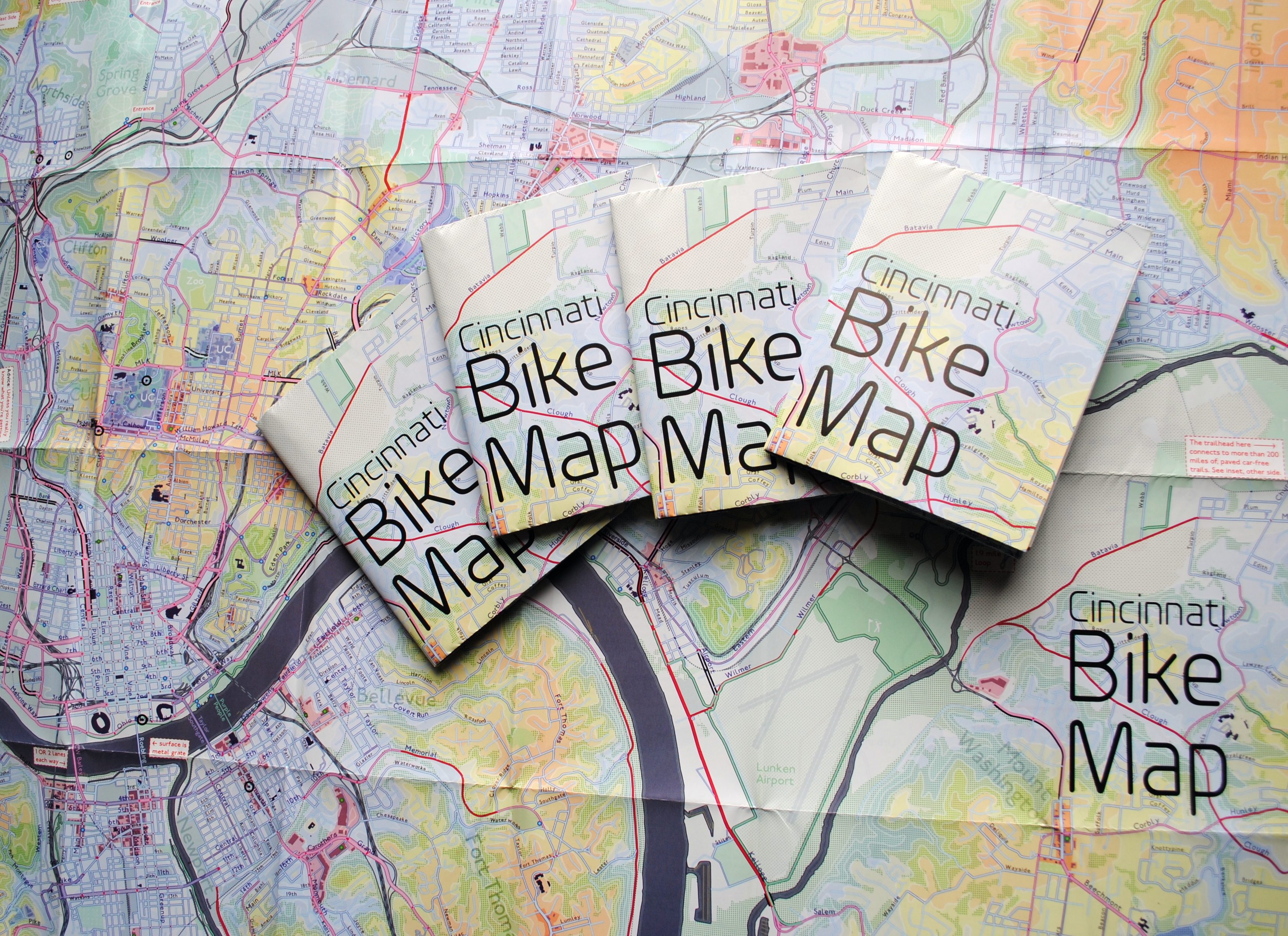
In 2011 Nate Wessel sought out to change the way Cincinnati mapped its transit. In a region with multiple transit operators that all use traditional bus mapping visuals, it was quite the daunting task. But after successfully raising more than $2,000 on Kickstarter, Wessel was able to fund his effort to print tens of thousands of his newly designed maps that ultimately received national praise.

Since that time he has continued his quest to improve the visual nature of map-making in Cincinnati, including serving as UrbanCincy’s official contributing cartographer, but he also embarked on another major endeavor. Instead of a transit map with bus frequencies, Wessel this time focused his energies on creating a new regional bike network map.

“Imagine someone kept taking, and reproducing and sharing, very unflattering photos of you or someone you loved. If you’re like me, you’d probably let the first one slide,” Wessel stated. “Maybe it was an accident, but by the fifth or sixth one, you’d start noticing a pattern and you’d start getting kind of miffed about it.”

This is the feeling the twenty-something urban planner, cartographer and fashion designer felt about the region’s existing bike maps, and he wanted to take control of the situation and improve it.

“This is a subtle visual game and words won’t do,” Wessel explained. “You need to make your own photo that shows the beauty you see in what you love; and then get other people to see what you see.”

One of the ways to accomplish that, he says, is to get the maps into people’s hands – digital maps are not enough. While the physical presence of a printed map gives it a sense of permanency and seriousness, producing a hard copy map also comes with its challenges.

After finishing the design for the Cincinnati Bike Map, Wessel said that he received feedback from the binder recommending a redesign to better accommodate the way the paper would fold, but that it was too late in the process. As a result, he wishes the maps folded a bit better, but that he is otherwise quite pleased with the final product. Perhaps leading to that feeling of satisfaction, however, is the fact that no compromise was needed since the project was entirely self-funded.

“Both times I’ve raised money for these projects it was in advance of having a real demonstrable product,” said Wessel. “In neither project have I ever had to check anything with a sponsor, supervisor or co-designer. The maps were totally my own in both cases, held to my own standards alone and uncompromised. That is very unusual for print maps.”

While quite unusual, it was a situation he preferred. In fact, Wessel says that a local organization very generously offered to fully fund the printing of Cincinnati Bike Map should he work with their graphic designer. A generous offer indeed, but one that came with risks that the final product not turn out as originally envisioned.

The release of the new regional bike map last month comes at a time when Cincinnati is in the national spotlight for its dramatic gains in bike ridership and development of new bike infrastructure.

Now that the project is complete, the goal now shifts to distributing the stack of Cincinnati Bike Maps that now exist. In addition to distributing the maps to local bike shops and organizations, Wessel is also mailing out copies of the map. His hope is that new or unfamiliar riders feel empowered by the maps, and that experienced riders use them to explore new routes throughout the region.

“Regular cyclists have found their favorite routes and will probably stick with what they know,” said Wessel. “Though, I totally discovered Fort Thomas through this map. Every map I’d seen made it look like a pretty crappy, suburban place to ride and I always avoided it; but the streets are beautifully wooded and very slow with 25mph speed limits.

Of course, all of this would not have been possible without access to the treasure trove of data on-hand at Cincinnati City Hall, and with the OKI Regional Council of Governments.

Those who would like to get a free copy of the Cincinnati Bike Map can do so by emailing Nate Wessel at bike756@gmail.com and informing him of your name, how many copies you want, and the address to which he can ship them.

Categories
Business News Politics

What Does Cincinnati’s Nativity Rating Mean for Its Long-Term Migration Prospects?

Cincinnati has a migration problem that is two-fold. First, it lags behind most major metropolitan regions in North America when it comes to attracting international migrants. Second, and perhaps more significantly, is that the region has a stagnant domestic population.

This is not because domestic migrants are any more or less important than international migrants. But rather, it is because stagnancy is a major problem for cities.

As many demographers and social scientists have pointed out, focusing public policy on retaining existing talent is a bad approach. In fact, large movements of people out of one region can be a very positive thing. That is, of course, if it is balanced out by a large influx of people into that same region. This is the case for North America’s largest cities, and is also evidenced at a larger scale in California.

But beyond that, older Midwestern cities with a large cluster of high-quality universities also seem to export more people than they import. That, in and of itself, is not the problem.

“This notion of the university as a “factory” gets very close to the truth,” Aaron Renn, owner of The Urbanophile, wrote in 2010. “A friend of mine noted that if we treated steel mills like universities, Indiana would be obsessing over “steel drain” and spending hundreds of millions of dollars on programs to try to keep steel from leaving the state.”

Renn went on to say that the notion of doing such a thing would be ludicrous, and that it is important to understand the details of what is really going on when it comes to a region’s migration patterns.

“Migration does matter. Any city that thinks it can be blasé about this is fooling themselves,” wrote Renn in a separate piece. “On the other hand, surface numbers only tell us so much. We need to understand the dynamics going on underneath the hood.”

By most comparative measure, Cincinnati actually does very well compared to many places at retaining its population. The problem is that it does very poorly at bringing in new people from outside the region.

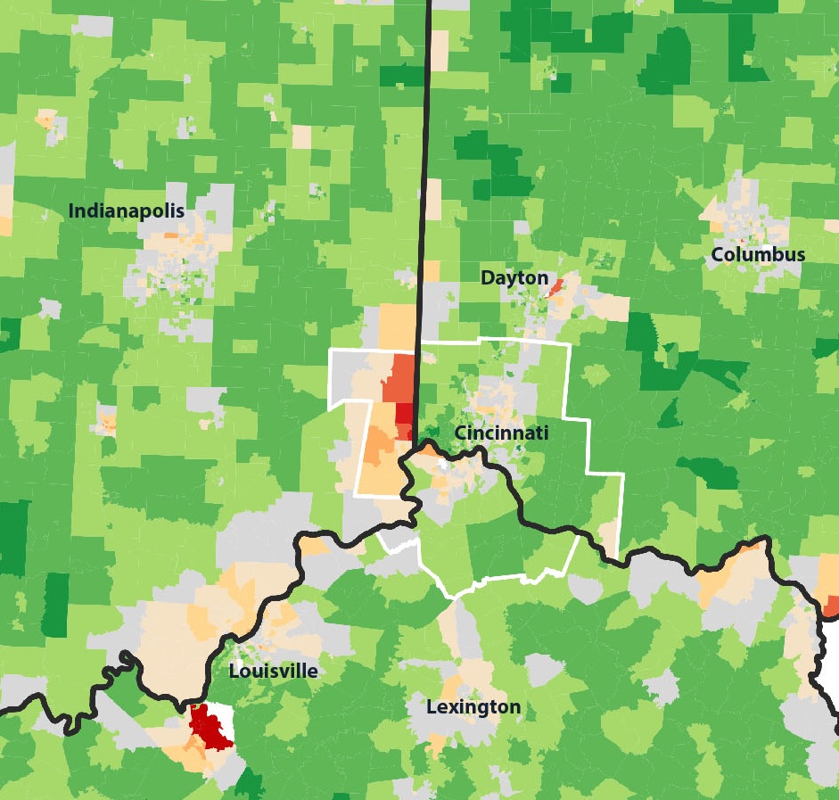
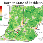
Based on five-year estimates from the American Community Survey, this stagnation can be clearly seen.

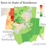
Perhaps not surprisingly, the areas of the Cincinnati Metropolitan Statistical Area (MSA) which have the highest percentage of people living there that were born in another state are near state borders. Since the Cincinnati MSA stretches across three states, you can see that movement of Ohio residents to southeastern Indiana and northern Kentucky has boosted numbers in those locales.

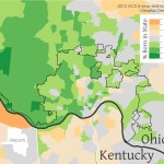
On average, approximately 68% of the 2.2 million person Cincinnati region was born in the state where they currently reside. Meanwhile, Uptown and Cincinnati’s northeast suburbs appear to be the only parts of the region that are actually attracting newcomers to the region.

Another key finding here is the utter lack of movement of people into or out of Cincinnati’s western suburbs, which have a native born population between 80-100%. This number is roughly comparable to most rural areas in Ohio, Kentucky and Indiana.

The Cincinnati region, however, is not alone when it comes to a stagnant population.

While Columbus was seen as a leader amongst big cities in terms of its domestic migration rate, it appears that Columbus is merely attracting new residents to its region from elsewhere in Ohio. Almost the entire Columbus MSA has a native born population between 60-80%.

The numbers are even worse for the Cleveland MSA, which, on average, has a percentage of native born population higher than the average for Ohio, Kentucky and Indiana. This is in spite of the Cleveland MSA attracting more international migrants than any other in the three-state region.

Even though Cincinnati continues to post modest annual population growth, it continues to be on the outside looking in when it comes to North America’s most economically successful cities. If Cincinnati wants to just focus on attracting existing Americans to the region, then it should look to Houston, Dallas or Atlanta, which are all hubs for domestic migration.

This scenario, however, seems unlikely since each of those regions is positioned uniquely in terms of their economy or their geographic location. So, if Cincinnati is to really ramp up its population growth, it better look at what other metropolitan regions are doing to make themselves more attractive to international migrants.

Perhaps Mayor John Cranley’s new, yet-to-be-unveiled initiative can help with this. But does he or his administration actually know what is going on underneath the hood?

Categories
Business News Opinion

Celebrating a Great 2013 While Looking Ahead to Our Eighth Year

Another year has come and gone, and I wanted to take this opportunity to recap some of the highlights from 2013 while also looking to the future.

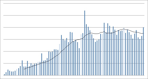
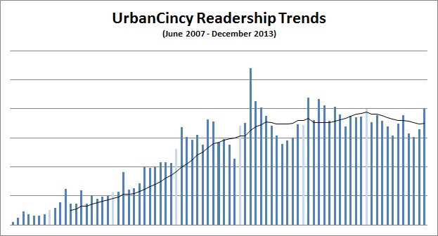
Our readership remained constant in 2013, with accelerated growth in Q4. We expect readership levels to hold at those increased Q4 rates throughout 2014, while recording some additional modest growth. Perhaps not surprisingly, our biggest month was December when the streetcar battle culminated.

More people listened to The UrbanCincy Podcast – now entering its second year – than ever before. The most popular episode last year was our yearly recap at the start of 2013 followed by our interviews with David Ginsburg from DCI and Kevin Wright from the Walnut Hills Redevelopment Foundation. Overall we had more than 109,000 downloads of The UrbanCincy Podcast in 2013 and averaged nearly 7,000 downloads per episode.

UrbanCincy Readership Trends

Staff Changes
Our staff also grew and changed a bit last year. As many of you know, I am temporarily on assignment in Seoul and John Yung has become our local area manager. Travis Estell continues to serve as our technologist and podcast manager, while Jake Mecklenborg continues to perform in-depth reporting on transportation issues and produce much of our photography.

We added two new staff writers in 2013 as well – Caitlin Behle and Paige Mallot. They will be covering a variety of topics, but will help expand UrbanCincy’s coverage of arts and entertainment. A third new staff writer – Jacob Fessler – has contributed some already, but will begin his work covering the region’s urban economics and industry in 2014. We also began working with the talented Nate Wessel and Andrew Stahlke to produce custom maps and videos that complement our stories.

We have an incredible team and none of this would be possible without their dedication and hard work. If you see them out and about, you should treat them to a cup coffee or a glass of beer.

Partnerships
In February we entered into an agreement with the Niehoff Urban Studio to produce events that highlight the interdisciplinary work and research performed by students at the University of Cincinnati. That led to our Metropolis & Mobility event in April and our Urbanist Candidates Forum just prior to November’s election.

We have continued to bolster our exclusive partnership with the Business Courier as well. In addition to our readers getting discounted access to a digital premium subscription, we are also sharing more of our content with them so that our reporting on the city reaches an even larger audience in both print and on the web.

In 2014 we hope to enter into additional partnerships that will help get our content to even more people throughout the region and engage more people with the city.

Events
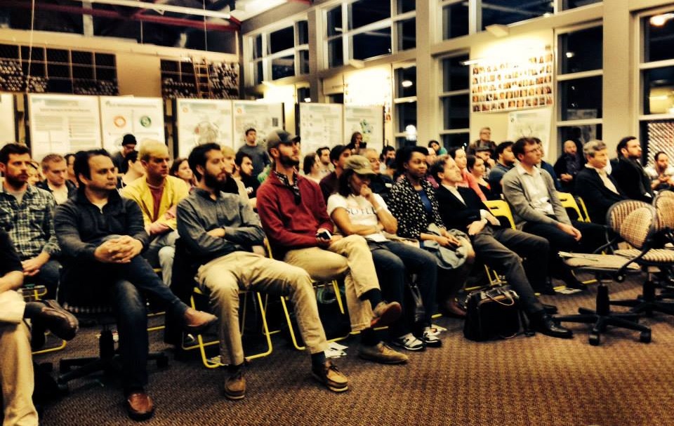
After starting URBANexchange in 2012, we have continued to host the monthly social event at the Moerlein Lager House. Now typically on the first Thursdays of each month, the events consistently draw a diverse collection of 20 to 40 people interested in urbanism. Many of these people are either new to Cincinnati or are looking to get more involved, and I am happy to say that these events are helping grow Cincinnati’s urbanist community.

In 2014 we will continue hosting the events and continue to engage you with area policy makers and influencers, and work to gather your thoughts and ideas about important policy issues. Plus, we hope to keep giving away unique prizes. Hopefully you can join us at our first URBANexchange of the New Year on Thursday, January 9 from 5:30pm to 8:30pm in the Moerlein Lager House’s biergarten.

Urbanist Candidates Forum

Content
One of the things UrbanCincy has always tried to do is connect area residents and visitors with the things happening in the city. This is still true today, but we are now fortunate to have a national audience. So while our focus is still on providing local coverage of public policy, urban design, transportation, arts and culture, we are now also connecting people from around the country with what is taking place here.

In 2013 we published 145 original stories, published 10 perspectives from readers in guest editorials, shared 103 of our insights about what we thought was interesting news from elsewhere in our Up To Speed posts, and produced 16 podcasts. Our ten most read stories in 2013 were:

  1. December 2, 2013: The Day Chaos Ruled City Hall: http://urbn.cc/p3ri
  2. Proposed 210-Unit Apartment Development Would Demolish Historic Christy’s & Lenhardt’s: http://urbn.cc/p2xy
  3. Final Designs Revealed for $125M Dunnhumby Centre Tower: http://urbn.cc/p3i3
  4. Pogue’s Garage to Make Way for 30-Story Residential Tower, Grocery Store: http://urbn.cc/p2yx
  5. EDITORIAL: Localizing Operating Costs for Streetcar Sets Dangerous Precedent: http://urbn.cc/p3sl
  6. GUEST EDITORIAL: Get Over It, Then Get Ready: http://urbn.cc/p3pk
  7. GUEST EDITORIAL: Horseshoe Casino Fails to Deliver on Urban Design: http://urbn.cc/p2zb
  8. IMAGE: Cincinnati to Grow Taller in the Coming Years: http://urbn.cc/p37p
  9. PHOTOS: Historic Glencoe-Auburn Place Row Houses Are Being Demolished: http://urbn.cc/p31l
  10. The Plot Continues to Thicken for Cincinnati’s $133M Streetcar Project: http://urbn.cc/p3s7

We also had two other stories that garnered a significant amount of interest by the way of comments, but didn’t crack the top ten for readership. The story readers commented on the most in 2013 was Paige’s opinion piece about Diner En Blanc held at Washington Park (104), and the second most comments (89) were left on our editorial calling for the consolidation of local governments in Hamilton County.

Our team also traveled to help bring additional perspective from other cities throughout the country and abroad. In 2013 John brought you stories from Europe and Portland; Jake traveled to Nashville; and I filed reports from Kansas City, Los Angeles, Salt Lake City, Seoul and Chicago. We will continue to use our travel to bring even more perspective into the issues we cover in Cincinnati. In 2014 we have already planned reports from Denver, Houston, Dallas, Minneapolis, Bangkok, Seattle, Hong Kong, Seoul, Nashville and Atlanta.

In 2014 you will also see us advocate more for specific projects and policy recommendations, based on our research and collaborations. In the past we have advocated for changing the city’s parking requirements, overhauling the city’s zoning code, and how to use the Riverfront Transit Center. In the coming weeks you will hear even more specific solutions from our team about how to address various problems and opportunities in our city today.

It has been nearly seven years since UrbanCincy started, and we are thrilled it is has become one of the largest independent sources for news in the region, and one of the most well-read websites focused on urbanism in the country.

We have some big plans for the year ahead and we hope that you will stick along for the ride. And while you’re at it, why don’t you bring a few friends. Thanks for all of your support.