The growth of Cincinnati’s bike culture has attracted national and even international attention over recent months. While much of the attention has been paid to the growth in ridership and use of Red Bike, less focus has been on the more intangible growth of the various support industries and groups helping fuel the change.
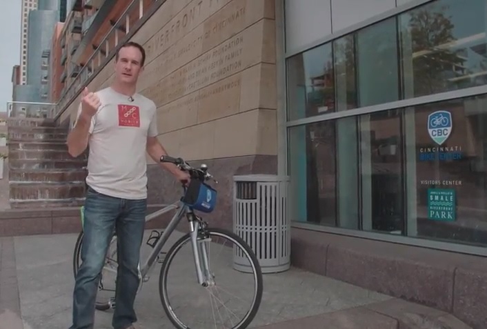
In the third episode of Mobile Cyclist, a web-based TV series focused on bicycling culture across the United States, host Anthony Barr explores the Queen City. In the nearly 13-minute video Barr takes viewers to a collection of bicycle friendly destinations that help shed some light on the region’s bike scene.
He first stops at Velocity Bike & Bean in Florence, where he tries some coffee and talks to the owners. Then he visits the Cincinnati Bike Center at Smale Riverfront Park to discuss how it operates, and how its bike rental services differ from those offered by Red Bike. Following that, Barr stops to speak with the ever-present Frank Henson from Queen City Bike, before making his way to Element Cycles in Hyde Park to check out their art work and bamboo bikes.
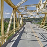
The last stop on his tour takes him to Fifty West Brewing where he learns about the Little Miami Scenic Trail and Oasis Trail, along with their bicycle friendly brew called Radler.
Cincinnati City Council’s Neighborhoods Committee gave a unanimous okay to an ordinance that would solidify an agreement to purchase 4.1 miles of railroad right-of-way from Norfolk Southern for $11.8 million, providing a key piece of the 7.6-mile Wasson Way recreational trail.
The ordinance was a last minute by-leave item on the committee calendar, made necessary due to a TIGER grant application that is due on Friday. Project backers are seeking $17 million of the $20 million project cost, and City support makes their application much more attractive.
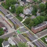
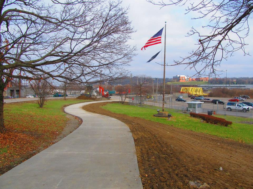
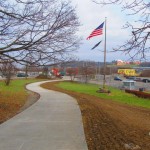
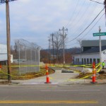
Wasson Way at Shaw Avenue [Chris Wyatt]
Wasson Way at Erie Avenue [Chris Wyatt]
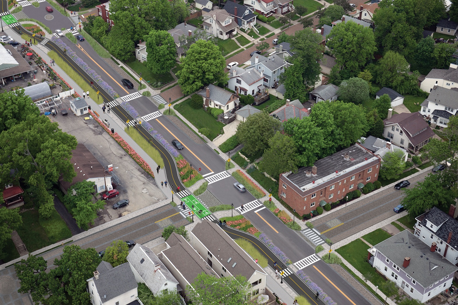
Wasson Way Concept [Chris Wyatt]
The trail has been in the works since 2011, and a group of nearly 20 volunteers with the Wasson Way nonprofit got a big boost when Mayor John Cranley (D), City Manager Harry Black, and City staff assisted with the negotiations.
“We started looking at the TIGER grant application,” said Mel McVay, senior planner at Cincinnati’s Department of Transportation & Engineering. “They really talk about ‘ladders of opportunity’, increasing mobility and accessibility for folks throughout the region, and so we saw an opportunity between the property we could purchase and some property we already had, and some existing trails.”
Director of Department of Trade and Development Oscar Bedolla spelled out the project’s urgency.
“One of the statutory requirements associated with the scoring for TIGER is related to readiness,” he said. “And so, the more that we can do to show that the project is potentially shovel-ready enhances our ability to acquire or be selected for TIGER funding.”
Bedolla added that under the terms of the agreement, the City would pay nothing in the first year if it does not proceed with the purchase. If the purchase is pursued within the second year, there would be a 5% fee added to the price.
The City’s matching funding of between $3 million and $4 million for construction costs could be made up of a combination of state and federal grants, plus funds raised by Wasson Way, he said.
Still up in the air is approximately two miles or the corridor between the Columbia Township end point and Newtown, where it could connect with the Little Miami Scenic Trail.
“We’re working on it,” McVay said. “Unfortunately, the railroad was not open to selling any additional property east of that point. We’re investigating three or four ways that we can get farther east to the existing Little Miami Trail. We’re very confident we can get there.”
Wasson Way Map [Provided]
David Dawson, a resident of Mt. Lookout and realtor with Sibcy Cline, expressed concern about how a long-envisioned light rail line could be brought to the corridor once its freight rail designation is abandoned – a legal process that is handled by the U.S. Surface Transportation Board.
“It just can’t be said enough, in my view, that the City will now become the steward of a very valuable asset,” Dawson said. “This is a regional corridor that, in this day and age, cannot really be duplicated. If we lose that ability to eventually have transit, rail transit, or some sort of transit in the future, we won’t be able to put it back.
Dawson and other rail advocates are calling for the corridor to be railbanked, so that the addition of light rail transit remains an option in the future.
“This doesn’t just connect our neighborhoods, but in the future it has the potential to connect the entire region out to Clermont County,” Dawson said.
The use of this corridor has long been eyed for light rail transit, including in the 2002 MetroMoves regional transit plan. A 2014 study by KZF Design recommended a design solution that would preserve the ability to develop both light rail transit and a trail; and estimated that such an approach would bring the cost of developing the trail to approximately $11.2 million.
Andrea Yang, senior assistant City solicitor, said that the purchase agreement would give the City some time to work out those issues.
“The way that the abandonment process is structured, there is a time period which we could utilize to further investigate other options,” Yang said. “Had we chosen to railbank the property and attempt to preserve it, it would actually follow the same process for abandonment, so there’s definitely time to look into that if that is what Council’s interested in seeing.”
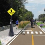
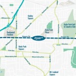
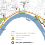
The fate of a long-planned commuter rail line along the eastern riverfront took an abrupt turn over the past month. With the Southwest Ohio Regional Transit Authority (SORTA) Board voting 12-1 in favor of a plan to use it for the Ohio River Trail, it puts a severe damper on one day using it as commuter rail to the city’s eastern suburbs.
The commuter rail, commonly referred to as the Oasis Line, had been pursued by Hamilton County Commissioner Todd Portune (D) for many years. Over time the Oasis Line had become a component of the much larger Eastern Corridor project, which is also now facing a very unclear future of its own.
SORTA purchased the right-of-way in 1994 for $4 million, after which it sold the more southern of the parallel-running tracks and easement to Genesee & Wyoming – the parent company of the Indiana & Ohio Railway Company – which also has the rights to utilize the northern tracks that would be paved over as part of this plan.
Ohio River Trail Plan [Provided]
As a result, SORTA officials still need to work out details with G&W in order to allow the bike trail to move forward.
“After a comprehensive three-month review of all aspects of the issue, the SORTA Board has overwhelmingly endorsed the concept of a temporary bike trail on the Oasis Line,” said Jason Dunn, Chair of the SORTA Board. “We will do all in our power to work collaboratively with our partners to support the development of the trail.”
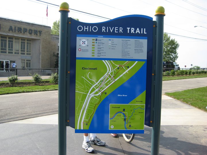
The 4.75-mile section of trail will complete the Ohio River Trail on the city’s east side. This segment is estimated to cost $4 million, of which $1 million has already been raised by Ohio River Way. Other portions of the Ohio River Trail, which connects to the Little Miami Scenic Trail, have been completed in a piecemeal fashion over the years.
Project supporters say that if everything goes smoothly, the multipurpose trail could open as early as 2017.
“The trail is an asset that the community clearly wants and it will be an enhancement to multimodal transportation in the region,” Dunn stated in a prepared media release.
SORTA officials say the next steps call for working out regulatory issues with federal agencies, and coming up with a design for the trail that is both safe and amenable to G&W.
While this move may hamper future efforts of developing commuter rail along this corridor, SORTA officials structured the agreement to allow for future flexibility. This includes the design of what the transit agency is calling a “temporary trail” that does not preclude from future passenger rail service along the Oasis Line.
To some passenger rail advocates, however, the prospect of the Oasis Line going away is a good one.
“The riverfront is a perfect place for a recreational trail, while light rail transit would be better-suited serving our neighborhoods,” Derek Bauman, Chair of Cincinnatians for Progress and SW Ohio Director for All Aboard Ohio, told UrbanCincy. “We should move forward with this plan to complete the Ohio River Trail, and then shift our attention to developing a recreational trail and light rail line along the Wasson Corridor.”
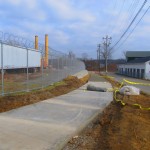
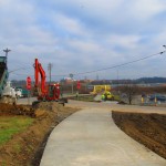
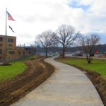
Construction is nearly complete on the fourth phase of work on the Mill Creek Greenway. As part of that work, a new 0.7-mile trail stretches along the border of South Cumminsville and Milvale, from the Millcreek Road Bridge to the intersection of Fricke Road and Beekman Street near Ethel Taylor Academy.
Once this work is complete, project planners say, the stretch will include additional accommodations for the trail to safely cross the creek on the existing roadway bridge, along with traffic calming measures for a safe crossing at Beekman Street near the school.
This latest phase of work is part of the much larger Mill Creek Greenway project that is being spearheaded by Groundwork Cincinnati – Mill Creek. The non-profit organization is celebrating its 20th anniversary this year, and is hoping that the planned 15-mile green corridor, which starts at the Hamilton County Fairgrounds in Carthage and will eventually reach the Ohio River Trail in Lower Price Hill, will help clean up one of the region’s most notoriously polluted corridors.
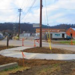
Phase 4 Construction [Provided]
Phase 4 Construction [Provided]
Phase 4 Construction [Provided]
Phase 4 Construction [Provided]
“We have done 33 ecological restoration projects as part of the greenway program,” Robin Corathers, Executive Director of Groundwork Cincinnati – Mill Creek, told UrbanCincy. “That includes bank stabilization, stream bed stabilization, wetland restoration, wildlife habitat restoration.”
In addition to that, Corathers says that edible forest gardens have been planted along the trail, with seven layers of vegetation that mimic a natural forest ecosystem. Improving the health of the ecosystem is a key component of Groundwork’s strategy, and more work is planned to help revitalize and heal damage to the natural resources within the Mill Creek Valley – one of the city’s oldest industrial corridors.
This latest phase of work was funded through a $245,000 grant from the Clean Ohio Trail Fund, $80,000 grant from the Interact for Health Foundation, $30,000 grant from the Greater Cincinnati Foundation, and $191,000 from the City of Cincinnati that was provided through its annual capital budget. Corathers also notes that the C.W. Wood Company donated a strip of land along Fricke Street for the trail.
The project, however, is not just about new trails and habitat restoration. Groundwork leadership also says that they are focused on capacity building, community involvement, and environmental education programming for 4,000 fourth through twelfth grade students each year.
“Phase four is really important to us for several reasons” explained Corathers. “As a ground work trust we are committed to working in economically distressed and historically under-served communities and neighborhoods; and in this case it’s the neighborhoods in the lower Mill Creek watershed.”
Millcreek Road Bridge [Google]
To this end, Corathers says that community leaders and neighborhood residents have been excited about the project and the process by which it is being implemented. She says that neighborhood councils become involved in the planning and design work of each phase of the trail, which leads to moments like this past November 12 when they celebrated the groundbreaking for the latest phase of work with about 85 area residents and business owners.
While there has been a good deal of neighborhood support, there are still challenges that exist for project leaders. One of those challenges is the Millcreek Road Bridge, which is envisioned as a crossing for the trail, but is currently only one lane in each direction for automobile traffic.
To tackle this issue, Groundwork Cincinnati has been working closely with Cincinnati’s Department of Transportation & Engineering (DOTE) to address safety issues with the narrow bridge. City officials say that the aging Mill Creek crossing is not considered a priority bridge and is not scheduled for replacement.
As a result, transportation engineers have come up with a solution that will retrofit the lightly used span to have one lane for shared two-way traffic flow, and one lane dedicated to the trail. The DOTE says that new signals will be installed, in February, at either end of the bridge to control alternating movements of vehicles across the Mill Creek Bridge.
“It’s a great investment. The bridge will be so much safer for people, for bikes, and also for vehicles,” Corathers said when emphasizing the importance of the trails connection. “The trail provides opportunities for outdoor exercise and recreation, active living, and active transportation for people in the Mill Creek corridor and nearby.”
Phase 4 Construction [Provided]
Phase 4 Construction [Provided]
Phase 4 Construction [Provided]
Phase 4 Construction [Provided]
Crossing the Mill Creek at this location is critical in the project’s overall goal of eventually reaching the Ohio River to the south. Once getting past this location, project planners say that a former CSX rail corridor can be used to take the trail all the way to its envisioned terminus.
The former freight rail right-of-way is considered to be wide enough to accommodate the Mill Creek Greenway Trail, as well as tracks for a future transit line. The use of this corridor, Corathers says, will also allow the Mill Creek Greenway Trail to tap into the planned $192 million Lick Run project, which will include another corridor of green space and trails.
Ultimately, the ongoing efforts could produce what would become a large network of interconnected trails through the heart of the city, including the Ohio River Trail, Little Miami Scenic Trail, Mill Creek Greenway, Lick Run, and West Fork Mill Creek Trail in Carthage.
The next 2.9-mile phase of work on the Mill Creek Greenway is estimated to cost $860,000, and project officials say they have already secured $500,000 of that from the State of Ohio, $50,000 from Interact for Health, and $10,000 from Duke Energy. The hope is that the remaining funds can come from City Hall. Should the final funding fall into place, Groundwork Cincinnati believes phase five work could be completed next year – creating a continuous eight-mile stretch of trails.
An attempt has been made all along to keep the trail close to the Mill Creek, but in some places, such as along Este Avenue, project planners say that it has not possible. But in locations where restoration and stabilization work has been performed along the creek, recovery of the ecosystems is easily visible.
“We now have great blue heron that fish in Mill Creek. We’ve got turtles, lizards, salamanders, beavers, birds, and all kinds of wildlife” Corathers exclaimed. “What we’re doing is breathing life back into this corridor. The trail allows users and visitors to experience an urban river that is coming back.”
In addition to Groundwork Cincinnati and the DOTE, Queen City Bike, Human Nature, IBI Group, Kolar Design, and Prus Construction have contributed to the development of the Mill Creek Greenway over the past six years.
Not only will it be one of the most impressive bike facilities installed in the region to-date, but it will also link neighborhoods together that have large percentages of bicyclists. Furthermore, it will link other bike facilities with one another, and come close to linking even more.
Some of the existing facilities include numerous bike lanes and the Mill Creek Greenway, but the Central Parkway bike lanes will come about 12 blocks shy of connecting with the Ohio River Trail, which then links to the Little Miami Scenic Trail.
A two-way cycle track should be built in order to connect the new Central Parkway bike lanes with the Ohio River Trail and beyond.
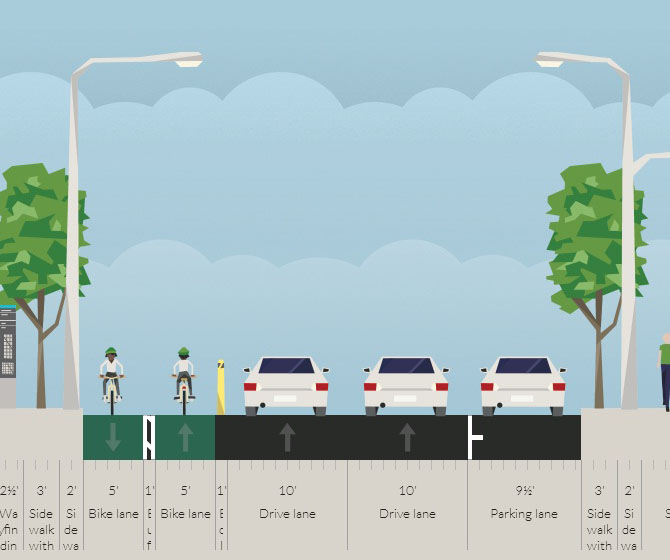
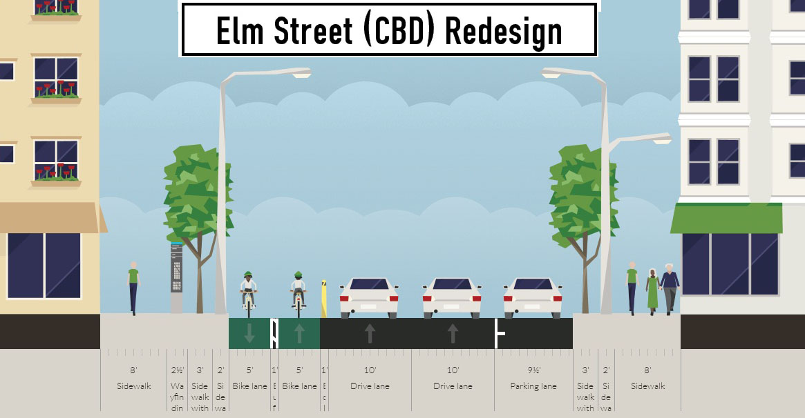
There are two streets that connect from Central Parkway to the Ohio River Trail along Mehring Way without interruption: Main Street and Elm Street. Both of the streets have one-way traffic heading northbound, but Main Street is considerably more congested with cars and buses heading to Government Square.
Elm Street, however, has some of the least congestion of any north/south street in the Central Business District and could easily connect the Central Parkway cycle track with the Ohio River Trail. A reorganization of the street would need to occur however.
Presently Elm Street, from Central Parkway to Mehring Way, lacks consistency in its design with on-street parking located haphazardly along both sides of the street. A reconfiguration of the street could consolidate all on-street parking to the east side of the street, thus eliminating only a nominal number of on-street parking spaces, and maintain 2 to 3 moving traffic lanes (the parking lane could be restricted during rush hours to allow for a third travel lane).
The Elm Street cycle track, meanwhile, would be located along the west side of the street and be buffered from moving traffic by a row of bollards. Such a redesign of Elm Street would be a bit of a road diet, but one that seems reasonable for this stretch of overbuilt roadway.
Planners with the City’s Department of Transportation & Engineering (DOTE) said that the idea of an Elm Street cycle track had not come up before, and has not been presented to any formal committees or community councils to-date. Such coordination, they say, would need to take place prior to the idea moving forward.
Projects like this are low-hanging fruit for the new mayor and council, should they wish to pursue investments that improve the city’s bike infrastructure. They should work with the bike community and come up with a strategy that provides a clear path forward to make this happen.
An Elm Street cycle track like this would provide a critical link in the region’s bike network, make the street safer, more accommodating to more users and more attractive to those who currently find themselves along the now bleak and desolate stretch of roadway. Let’s get to work.