Categories
News Politics Transportation

ODOT Looking For Public Feedback on Reworked Eastern Corridor Program

The Ohio Department of Transportation is looking for additional feedback related to transportation improvements for Cincinnati’s eastern neighborhoods and far reaching suburbs.

The survey comes after ODOT has said that they are backing away from original plans for the hotly debated Eastern Corridor project, which came under public scrutiny for its scope and potentially negative impact to established neighborhoods on the city’s east side.

While the project will most certainly not be moving forward as originally envisioned, public officials are still looking to get a grasp on what kinds of investments could be made to improve traffic congestion and mobility options.

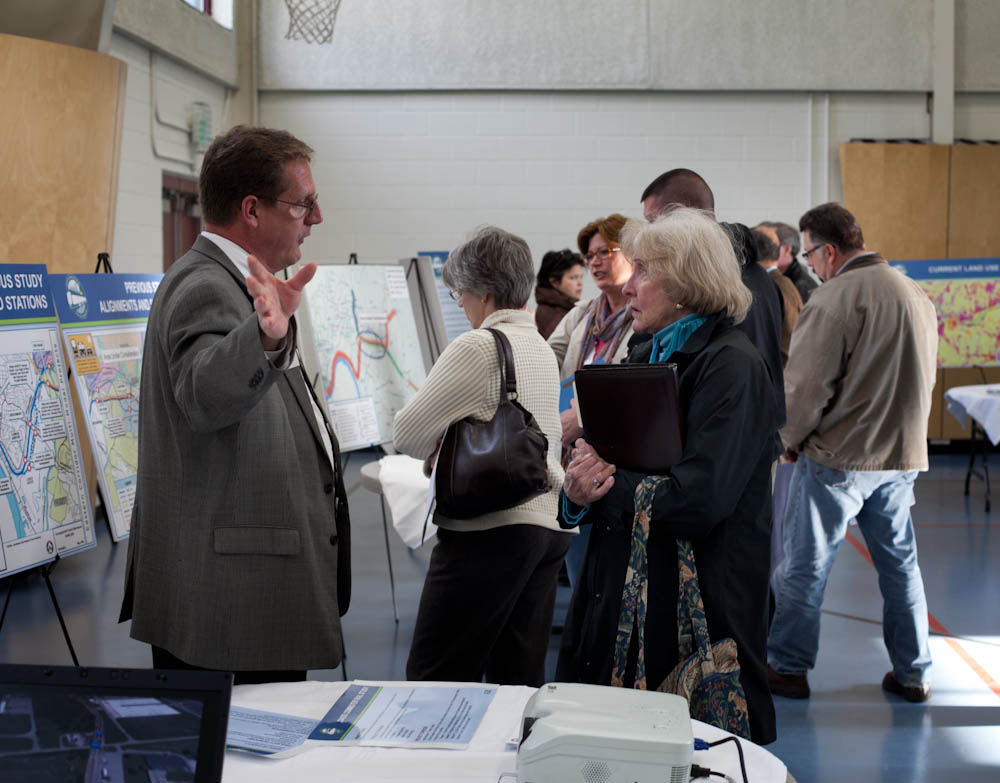
So far, ODOT has held public meetings in Newtown and Mariemont, and will hold meetings in Anderson Township, Mt. Lookout, Fairfax and Mt. Washington in the coming weeks – the next of which will occur this evening, from 6pm to 8pm, in Mt. Lookout at Christ The King Parish Center at 927 Ellison Avenue.

Those unable to attend that or the other upcoming meetings, are being encouraged to complete an interactive web-based survey. Taking approximately five to 10 minutes to complete, the survey asks respondents to rank the importance of the types of transportation improvements needed for the corridor, while also asking for specific location-based improvement suggestions.

The survey and public feedback for this effort is focused on what ODOT calls Segments II and III of the project, and is not limited to those who live or work in the study area, but rather open to anyone who finds themselves passing through the area.

Early results from the survey show that respondents want ODOT to focus investments on improving public transit, biking and walking options, and travel time through the corridor. While the travel time option could mean many different things, it may be connected to the other two top rankings for multi-modal transportation enhancements.

Projects not specifically mentioned in the survey include the Oasis Corridor commuter rail line, which also has been on the ropes lately, and the Wasson Corridor, which is still unclear how it will proceed with respects to a trail only, or a light rail and trail combination.

As UrbanCincy wrote in June 2015, a new local access bridge crossing the Ohio River, from Columbia Tusculum to Dayton, KY, could also greatly help solve access and congestion issues on the east side of the region.

ODOT officials say that the online survey will remain open until Wednesday, June 15. After this evening’s open house in Mt. Lookout, the next meetings to take place in Fairfax and Mt. Washington will occur on May 4 and May 5, respectively.
Categories
News Transportation

VIDEO: ‘Mobile Cyclist’ Explores Cincinnati’s Growing Bike Culture

The growth of Cincinnati’s bike culture has attracted national and even international attention over recent months. While much of the attention has been paid to the growth in ridership and use of Red Bike, less focus has been on the more intangible growth of the various support industries and groups helping fuel the change.

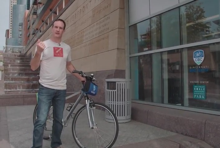
In the third episode of Mobile Cyclist, a web-based TV series focused on bicycling culture across the United States, host Anthony Barr explores the Queen City. In the nearly 13-minute video Barr takes viewers to a collection of bicycle friendly destinations that help shed some light on the region’s bike scene.

He first stops at Velocity Bike & Bean in Florence, where he tries some coffee and talks to the owners. Then he visits the Cincinnati Bike Center at Smale Riverfront Park to discuss how it operates, and how its bike rental services differ from those offered by Red Bike. Following that, Barr stops to speak with the ever-present Frank Henson from Queen City Bike, before making his way to Element Cycles in Hyde Park to check out their art work and bamboo bikes.

The last stop on his tour takes him to Fifty West Brewing where he learns about the Little Miami Scenic Trail and Oasis Trail, along with their bicycle friendly brew called Radler.

Categories
Development News

High Profile $35M Hyde Park Condo Building Officially Topped Out

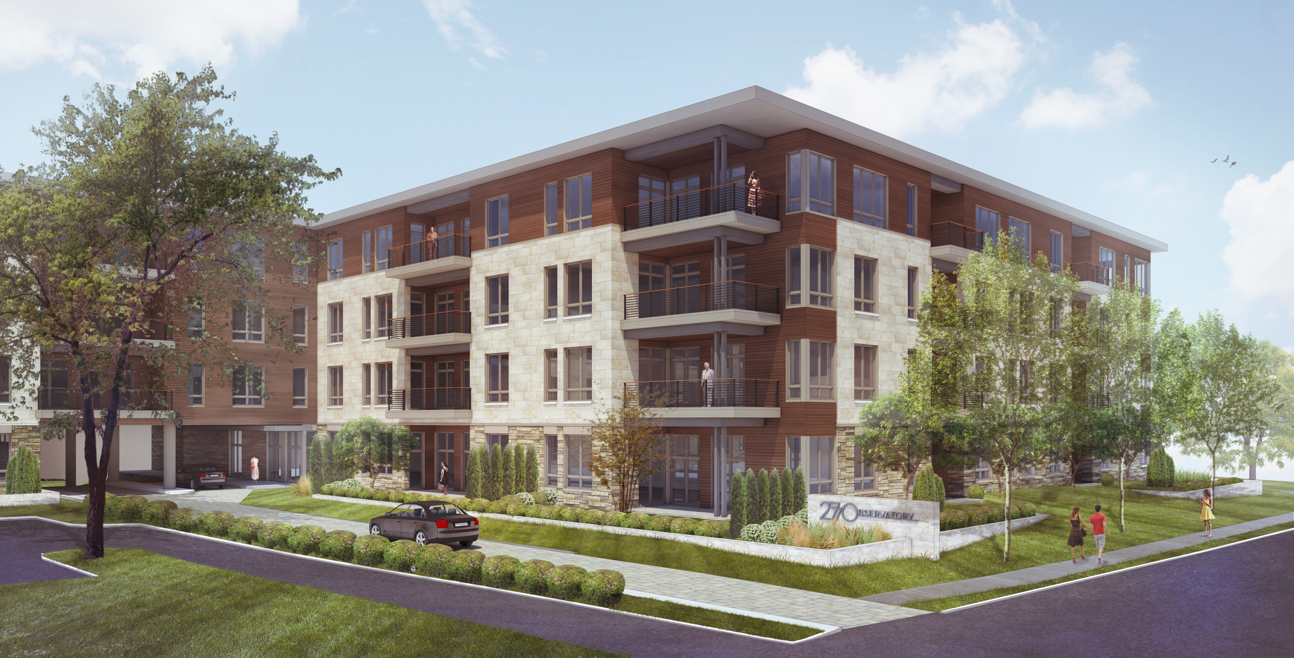
The corner of Observatory and Shaw Avenues now looks much different than it did a year ago. Yesterday, development of 2770 Observatory, a 30-unit luxury condominium project by Greiwe Development officially topped out with a ceremony at the site. The project, which we reported on back in May of 2014, has transformed the corner with the demolition of several apartments that were formerly on the site.

At the ceremony, Mayor John Cranley (D) marked the occasion by proclaiming November 10 “Hyde Park Landmark Day,” recognizing the neighborhood’s historical charm, signature places and 2770 Observatory’s place as its newest landmark. The $35.5 million modern four-floor structure will stand as a gateway to the neighborhood with future residents just steps from Hyde Park Square.

With 16 of the 30 units pre-purchased, the development is expected to sell out before it opens in summer 2016.

Topping Out ceremonies are a Scandinavian custom dating back to 700 A.D. thought to bring good luck to future occupants. After remarks from project developer Rick Greiwe and Mayor Cranley, the event concluded with the traditional raising of an evergreen to the top of the building’s newly completed wooden framework.

2770 Observatory is the fifth Greiwe lifestyle development in the Cincinnati area since the grand opening of Mariemont’s Jordan Park in 2008. In October, Greiwe, with a group of developers known collectively as Gateway Partners LLC, was selected to develop a 12-acre site adjacent to downtown Montgomery, where he will build high-end condominiums as part of an urban in-fill village.

“We choose to build our projects in neighborhoods where dining, shopping and entertaining are within one block of the resident’s front door,” said Rick Greiwe, principal of Greiwe Development in a prepared statement, “Hyde Park Square is the ideal location for one of our developments. It’s in demand and draws people from around the whole city. I’ve been watching it for sometime — waiting for the ideal site to become available, and this is absolutely it.”

2770 Observatory features three bedroom and two bedroom units with large foyers and open entertaining areas. With 10-foot ceilings and 8-foot windows, the units range in size from 1,915 to 4,675 square feet. Each unit has its own balcony or patio. The building has an underground parking garage, and a resident pathway leads from Linshaw Court to Michigan Avenue and Hyde Park Square. Prices range from $700,000 to $2 million.

Categories
News Opinion Transportation

Here’s How to Improve Access Between Ohio and Kentucky’s East/West Neighborhoods

When discussing regional transportation issues, the topic seems to always be about congestion. In reality, outside of a few limited periods, the Cincinnati region has relatively good traffic flow with little actual congestion. So instead of trying to solve a problem that does not exist, we should be instead focusing our resources on maintaining our current system and improving mobility within the overall region.

As is the case in any city, the natural environment often serves as a chokepoint and barrier to regional mobility. This is true for Cincinnati with its hills and rivers.

With the region’s population largely centered along the Ohio River, it is natural that this is where the most choke points exist. Outside of the center city, however, there are very few river crossings. In fact, there are only two Ohio River crossings outside of the center city, and both of those are for I-275.

One such area that makes sense for a new local road bridge is around Cincinnati’s Columbia Tusculum neighborhood and Dayton, KY near where the $400 million Manhattan Harbour project is planned.

An increasing amount of development continues to occur on the northern bank of the river in Columbia Tusculum and East End. Further up the hill sits prosperous neighborhoods like Mt. Lookout, Hyde Park, and Oakley; and just around the bend lies Lunken Airfield.

Conversely, on the south side of the river in Kentucky, large-scale development projects have long been envisioned, but are often derailed due to poor access via existing roadway networks. This remains true for Manhattan Harbour where concerns exist about the traffic burden that would be placed on the narrow KY 8 running through historic Bellevue’s quaint business district.

A local road bridge that is one lane in each direction with space for pedestrian and bicycle paths would be an ideal fit for this area of the region. It would improve mobility and access to two difficult-to-access areas. It would also offer a highway alternative for those looking to cross between the two states.

A second location where a local bridge of this nature would make sense is near where the Anderson Ferry currently operates today on the city’s west side.

While little development has occurred in this area for some time, this may soon change. The Ohio River Trail West will soon make its way toward this area, and several developers have been eyeing the western riverfront for major projects.

The Cincinnati-Northern Kentucky International Airport sits on the southern side of the river where this bridge would land. This area continues to be bolstered by warehouses, distribution facilities and other airport-related services, and could be further bolstered with better access. What’s more, Cincinnati’s western neighborhoods that have long had to deal with excessive airplane noise, yet long treks to the airport, could at least resolve one of those injustices with a new local access bridge.

The Taylor-Southgate Bridge is the most recent span that has been constructed over the Ohio River. It was completed in 1995 and cost $56 million at that time – approximately $85 million when adjusted for inflation. Both of these new bridges would need to span an approximate 1,700-foot-wide width, which is about 300 feet more than the Taylor-Southgate Bridge river width.

One of the main differences, however, is that the Taylor-Southgate Bridge includes two lanes of traffic in each direction, plus sidewalks. The need for only one lane of traffic on these bridges would allow them to have a deck width of around just 30 to 35 feet.

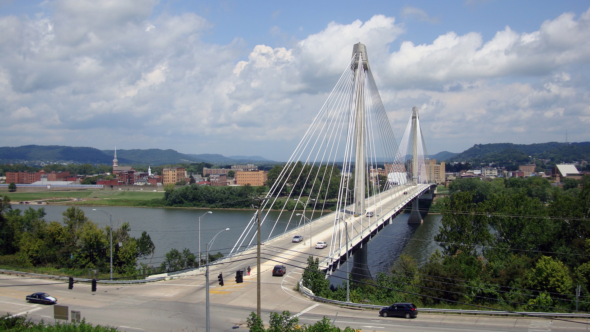
Another good nearby comparison is the U.S. Grant Bridge in Portsmouth, OH. That cable-stayed bridge was completed by the Ohio Department of Transportation in 2006 for approximately $30 million – or about $35 million in today’s dollars.

In addition to access and mobility improvements for motorists, a new bridge in both of these locations would also be a boon for cyclists. Those riding along the Little Miami Scenic Trail and the Ohio River Trail would now also be able to continue on to Northern Kentucky’s Riverfront Commons Trail, which will eventually stretch 11.5 miles from Ludlow to Ft. Thomas.

The Cincinnati region does not need multi-billion dollar solutions for a traffic congestion issues that largely do not exist. Reasonable and affordable projects that aim to increase mobility and access, along with maintaining our existing assets, should be the priority.

New local bridges connecting the region’s east and west side neighborhoods would open up land for new development, improve access between both states, enhance mobility for pedestrians and cyclists, and would do so at a price tag we can afford.

Categories
Development News Transportation

Cincinnati Reaches Agreement With Norfolk Southern on Purchase of Wasson Railroad Corridor

Cincinnati City Council’s Neighborhoods Committee gave a unanimous okay to an ordinance that would solidify an agreement to purchase 4.1 miles of railroad right-of-way from Norfolk Southern for $11.8 million, providing a key piece of the 7.6-mile Wasson Way recreational trail.

The agreement would give the City a two-year purchase option for the property, which extends between the Montgomery-Dana intersection along the Norwood/Evanston line to the intersection of Red Bank and Wooster roads in Columbia Township.

The ordinance was a last minute by-leave item on the committee calendar, made necessary due to a TIGER grant application that is due on Friday. Project backers are seeking $17 million of the $20 million project cost, and City support makes their application much more attractive.

The trail has been in the works since 2011, and a group of nearly 20 volunteers with the Wasson Way nonprofit got a big boost when Mayor John Cranley (D), City Manager Harry Black, and City staff assisted with the negotiations.

“We started looking at the TIGER grant application,” said Mel McVay, senior planner at Cincinnati’s Department of Transportation & Engineering. “They really talk about ‘ladders of opportunity’, increasing mobility and accessibility for folks throughout the region, and so we saw an opportunity between the property we could purchase and some property we already had, and some existing trails.”

Director of Department of Trade and Development Oscar Bedolla spelled out the project’s urgency.

“One of the statutory requirements associated with the scoring for TIGER is related to readiness,” he said. “And so, the more that we can do to show that the project is potentially shovel-ready enhances our ability to acquire or be selected for TIGER funding.”

Bedolla added that under the terms of the agreement, the City would pay nothing in the first year if it does not proceed with the purchase. If the purchase is pursued within the second year, there would be a 5% fee added to the price.

The City’s matching funding of between $3 million and $4 million for construction costs could be made up of a combination of state and federal grants, plus funds raised by Wasson Way, he said.

Still up in the air is approximately two miles or the corridor between the Columbia Township end point and Newtown, where it could connect with the Little Miami Scenic Trail.

“We’re working on it,” McVay said. “Unfortunately, the railroad was not open to selling any additional property east of that point. We’re investigating three or four ways that we can get farther east to the existing Little Miami Trail. We’re very confident we can get there.”

David Dawson, a resident of Mt. Lookout and realtor with Sibcy Cline, expressed concern about how a long-envisioned light rail line could be brought to the corridor once its freight rail designation is abandoned – a legal process that is handled by the U.S. Surface Transportation Board.

“It just can’t be said enough, in my view, that the City will now become the steward of a very valuable asset,” Dawson said. “This is a regional corridor that, in this day and age, cannot really be duplicated. If we lose that ability to eventually have transit, rail transit, or some sort of transit in the future, we won’t be able to put it back.

Dawson and other rail advocates are calling for the corridor to be railbanked, so that the addition of light rail transit remains an option in the future.

“This doesn’t just connect our neighborhoods, but in the future it has the potential to connect the entire region out to Clermont County,” Dawson said.

The use of this corridor has long been eyed for light rail transit, including in the 2002 MetroMoves regional transit plan. A 2014 study by KZF Design recommended a design solution that would preserve the ability to develop both light rail transit and a trail; and estimated that such an approach would bring the cost of developing the trail to approximately $11.2 million.

Andrea Yang, senior assistant City solicitor, said that the purchase agreement would give the City some time to work out those issues.

“The way that the abandonment process is structured, there is a time period which we could utilize to further investigate other options,” Yang said. “Had we chosen to railbank the property and attempt to preserve it, it would actually follow the same process for abandonment, so there’s definitely time to look into that if that is what Council’s interested in seeing.”

In April, Cincinnati’s Planning Commission voted to place an Interim Development Control Overlay District on this corridor in order to give the city more time to allow plans to progress without new development creating new conflicts.