Categories
News Opinion Transportation

Here’s How to Improve Access Between Ohio and Kentucky’s East/West Neighborhoods

When discussing regional transportation issues, the topic seems to always be about congestion. In reality, outside of a few limited periods, the Cincinnati region has relatively good traffic flow with little actual congestion. So instead of trying to solve a problem that does not exist, we should be instead focusing our resources on maintaining our current system and improving mobility within the overall region.

As is the case in any city, the natural environment often serves as a chokepoint and barrier to regional mobility. This is true for Cincinnati with its hills and rivers.

With the region’s population largely centered along the Ohio River, it is natural that this is where the most choke points exist. Outside of the center city, however, there are very few river crossings. In fact, there are only two Ohio River crossings outside of the center city, and both of those are for I-275.

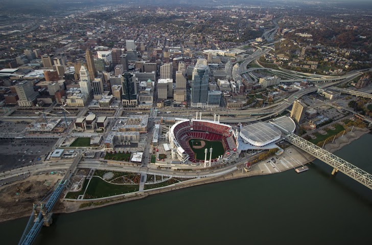
One such area that makes sense for a new local road bridge is around Cincinnati’s Columbia Tusculum neighborhood and Dayton, KY near where the $400 million Manhattan Harbour project is planned.

An increasing amount of development continues to occur on the northern bank of the river in Columbia Tusculum and East End. Further up the hill sits prosperous neighborhoods like Mt. Lookout, Hyde Park, and Oakley; and just around the bend lies Lunken Airfield.

Conversely, on the south side of the river in Kentucky, large-scale development projects have long been envisioned, but are often derailed due to poor access via existing roadway networks. This remains true for Manhattan Harbour where concerns exist about the traffic burden that would be placed on the narrow KY 8 running through historic Bellevue’s quaint business district.

A local road bridge that is one lane in each direction with space for pedestrian and bicycle paths would be an ideal fit for this area of the region. It would improve mobility and access to two difficult-to-access areas. It would also offer a highway alternative for those looking to cross between the two states.

A second location where a local bridge of this nature would make sense is near where the Anderson Ferry currently operates today on the city’s west side.

While little development has occurred in this area for some time, this may soon change. The Ohio River Trail West will soon make its way toward this area, and several developers have been eyeing the western riverfront for major projects.

The Cincinnati-Northern Kentucky International Airport sits on the southern side of the river where this bridge would land. This area continues to be bolstered by warehouses, distribution facilities and other airport-related services, and could be further bolstered with better access. What’s more, Cincinnati’s western neighborhoods that have long had to deal with excessive airplane noise, yet long treks to the airport, could at least resolve one of those injustices with a new local access bridge.

The Taylor-Southgate Bridge is the most recent span that has been constructed over the Ohio River. It was completed in 1995 and cost $56 million at that time – approximately $85 million when adjusted for inflation. Both of these new bridges would need to span an approximate 1,700-foot-wide width, which is about 300 feet more than the Taylor-Southgate Bridge river width.

One of the main differences, however, is that the Taylor-Southgate Bridge includes two lanes of traffic in each direction, plus sidewalks. The need for only one lane of traffic on these bridges would allow them to have a deck width of around just 30 to 35 feet.

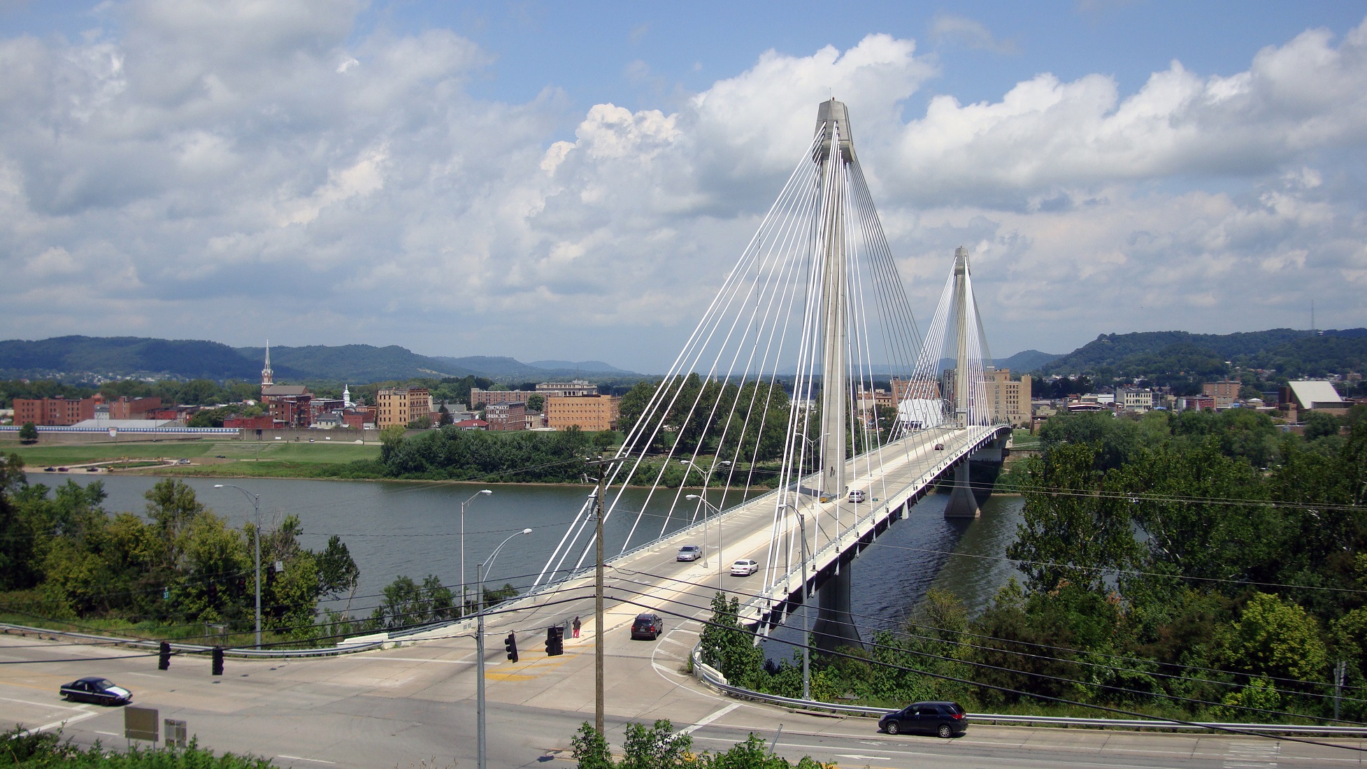
Another good nearby comparison is the U.S. Grant Bridge in Portsmouth, OH. That cable-stayed bridge was completed by the Ohio Department of Transportation in 2006 for approximately $30 million – or about $35 million in today’s dollars.

In addition to access and mobility improvements for motorists, a new bridge in both of these locations would also be a boon for cyclists. Those riding along the Little Miami Scenic Trail and the Ohio River Trail would now also be able to continue on to Northern Kentucky’s Riverfront Commons Trail, which will eventually stretch 11.5 miles from Ludlow to Ft. Thomas.

The Cincinnati region does not need multi-billion dollar solutions for a traffic congestion issues that largely do not exist. Reasonable and affordable projects that aim to increase mobility and access, along with maintaining our existing assets, should be the priority.

New local bridges connecting the region’s east and west side neighborhoods would open up land for new development, improve access between both states, enhance mobility for pedestrians and cyclists, and would do so at a price tag we can afford.
Categories
Business Development News Transportation

A Look Back at the Top Stories on UrbanCincy in 2014

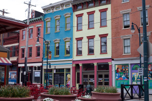
Findlay Market StorefrontsNow that 2014 has come to a close, we at UrbanCincy would like to take a moment to look back on what’s happened in the past year. The following are UrbanCincy‘s top five most popular news stories from 2014:
  1. Eli’s Barbeque, Maverick Chocolate First of Several New Tenants to Open at Findlay Market
    This year marked a turning point for the area known as the Northern Liberties in Over-the-Rhine, with several new developments being announced. The first of these announcements was in April, when craft chocolatier Maverick Chocolate and popular East End restaurant Eli’s Barbeque announced they would open at Findlay Market. Later in the year, Model Group announced a $14 million office development along Race Street and Urban Sites announced their plan to renovate the historic Film Center building.
  2. Uber and Lyft to Soon Enter Cincinnati Market
    In 2014, Cincinnatians gained a brand new transportation option as ridesharing services Uber and Lyft came to town. Our own Jake Mecklenborg began driving for Uber shortly after their launch and told us about his experiences on The UrbanCincy Podcast Episode #41. In November, Cincinnati City Council passed new regulations for carsharing providers, and we discussed this at the beginning of Episode #44.
  3. City Planners Recommend Transportation Overlay District for Wasson Railroad Corridor
    For years, UrbanCincy has been following the Wasson Way project and writing about the corridor’s potential usage as both a bike trail and a rail transportation corridor. The project took a step forward this year, as the Department of City Planning & Buildings announced a plan that would allow for both uses. We’ll be keeping our eye on this project in 2015.
  4. Popular St. Louis-Based Pi Pizzeria to Open Cincinnati Location in AT580 Building
    In collaboration with our partners at nextSTL, UrbanCincy reported on Pi Pizzeria’s entry into the Cincinnati market. The restaurant opened in the AT580 Building, which is currently undergoing a transformation from office space into residential. Pi co-owner Chris Sommers mentioned that the company was “amazed at the resurgence of Downtown and OTR” and chose the location based on its proximity to the Cincinnati Streetcar route.
  5. Findlay Market Ready to Work With Developers Poised to Transform Area Around It
    UrbanCincy talked to Joe Hansbauer, President and CEO of Findlay Market, about how Findlay Market can serve as the hub for new retail, office, and residential development in the Northern Liberties.

Ohio RiverOccasionally, we like to share a photo gallery or video taken by an UrbanCincy team member or a guest contributor. In 2014, our top five most popular visual features were:
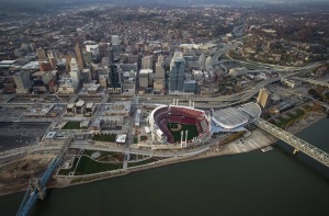
  1. Take a Look at These 20 Breathtaking Photos of Cincinnati’s Center City
    Brian Spitzig shares some of his aerial photography from the Central Business District and Over-the-Rhine.
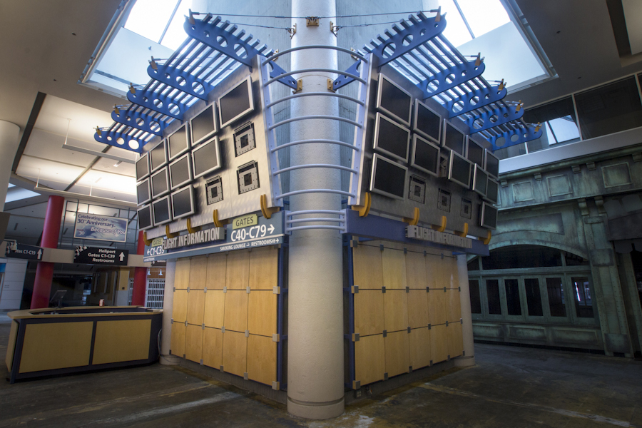
  2. Take a Look at CVG’s Abandoned Concourse C Through Ronny Salerno’s Lens
    Photographer Ronny Salerno documents the abandoned Concourse C at the Cincinnati-Northern Kentucky International Airport, which serves as a symbol of how far the airport has fallen.
  3. Check Out These 14 Amazing Images of Cincinnati’s Inner City Neighborhoods
    Enjoy more of Brian Spitzig’s aerial photography, this time from the West End, Queensgate, Corryville, Mt. Auburn, Mt. Adams, Clifton Heights, Walnut Hills, and University Heights.
  4. Thousands of New Residential Units to Transform Downtown
    Anyone visiting Downtown Cincinnati in 2014 was certainly aware of the huge amount of construction happening in the urban core. Looking back at this photo set shows how much progress has been made on Seven at Broadway, Mercer Commons, AT580, Broadway Square, and other projects in just a year.
  5. 49 Shots from the 2014 Northside Fourth of July Parade
    Jake Mecklenborg captures some interesting sights from Cincinnati’s most eclectic parade.


Categories
Business News

Take a Look at CVG’s Abandoned Concourse C Through Ronny Salerno’s Lens

Ronny Salerno has established himself as one of the region’s best photo journalists. He covers the stories not often given light in the typical news cycle. The stories he publishes on his website, Queen City Discovery, aren’t often current events, but they are always topical.

One of his more recent features that garnered national attention uncovered the history of a ghost ship left stranded downstream from Cincinnati in a small tributary to the Ohio River. Salerno has become well-known for his thoughtful coverage of abandoned buildings and their stories they hold.

The most recent feature of his looks at the now abandoned Concourse C at the Cincinnati/Northern Kentucky International Airport (CVG). While Concourse C was once a symbol of CVG’s prominence and significance, it is now a visual reminder of how far the airline industry in general, and the airport in specific, have fallen over the past decade.

Regional air travel, which is what Concourse C catered to through its Comair service, is becoming more and more a thing of the past. Throughout Europe, China, Japan and Korea, where inter-city high speed rail is prevalent, regional air travel has already fallen by the wayside. In North America, inter-city bus travel has grown in popularity while Amtrak sets ridership records each year.

But still, no sign of comprehensive inter-city high speed rail seems to be anywhere in the near future for Canada and the United States. What will that mean for metropolitan regions with millions of people, like Pittsburgh, St. Louis, Cincinnati, and Cleveland, now being left off the map? Smaller regions, like Birmingham, already lack expansive air service and must rely on larger metropolitan regions nearby for service.

Many cities and regions are being left off the map and have fewer and fewer transportation options to get from one city to the next. Who knows what that will mean for these people and regions in the future, but for now please take a look back at the history and stories of CVG’s Concourse C.

The Concourse: Part 1 – Island in a Stream of Runways
The Concourse: Part 2 – Unaccompanied Minor
The Concourse: Part 3 – The Film (embedded above)

The fall of 1994 was a good time for regional airliner Comair, the company had just opened a second hub in its hometown at the Cincinnati/Northern Kentucky Regional Airport (CVG). Dubbed “Concourse C,” the building was an island in a stream of runways, accessible to passengers only via shuttle busses and the flights they arrived on. The concourse was always a center of human activity amongst the tarmac – featuring shops, eateries and over 50 gates to destinations across the continental United States.

It was a place where people reunited, strangers shared drinks between travels and employees fought the daily grind.

Comair was purchased by Delta Airlines in 2000 and both airlines plunged into bankruptcy protection by 2005. After emerging from bankruptcy in 2007, Delta began to scale back Comair flights and eventually relocated all operations to another section of the airport in 2008. Concourse C was left abandoned. In 2012, Delta completely folded Comair.

Today, Concourse C still remains out in the middle of the runways: no passengers, few visitors and closed off to the general public. It’s eerily quiet state is a stark contrast to the sea of humanity that once flowed through it. On a recent exclusive tour of the facility, I was able to make this short film in addition to several photographs.

Categories
Business Development News Opinion Transportation

Lagging air service at CVG may mean more trouble than just Chiquita’s departure

In 1987, the same year that Chiquita announced its move to Cincinnati from New York City, Delta Airlines began its first non-stop flights to Europe from what was then called the Greater Cincinnati Airport. 18 years later, the airport’s “Hub Era”, as the period is described on the airport’s own website, drew to a close just as a third north-south runway was completed. Since that $250 million runway opened in 2005, total annual passengers at CVG have fallen from 22.8 million to 7.9 million.

In 1998, at the height of the Delta hub’s growth, the Cincinnati Metropolitan Growth Alliance hired Michael Gallis, a Charlotte-based planning consultant, to deliver a report on the state of Cincinnati [Download the Gallis Report] and how it must position itself for the 21st century. Given this week’s news regarding Chiquita, this passage from the report is especially prophetic:

“The Airport cannot be taken for granted. There is strong competition for airline activity and hub status among metro regions. Therefore, it is essential to continue involvement with the Cincinnati/Northern Kentucky International Airport to assure its continuing status as a major global hub.”

Unlike in Europe, where government-owned airlines don’t shift their hub operations, American cities are at the mercy of the finances of those airlines that serve them. Chiquita is moving to Charlotte primarily because of the relative health of US Airways versus Delta — the City of Cincinnati has no say in the affairs of Delta Airlines or even the Cincinnati/Northern Kentucky Airport.


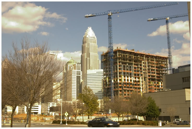
Charlotte will add Chiquita to its corporate roster in late 2012.

So is Cincinnati finished as a viable location for international business because of Delta’s 2006 bankruptcy? Since second-tier cities like Cincinnati and Charlotte are at the mercy of their airport’s hub operator, won’t Chiquita find itself in a similar situation when US Airways inevitably suffers similar financial problems?

The great frustration is that all of this could have been avoided if at the cusp of the jet age a major airport had been built in Butler County so as to draw from the combined 3-plus million population of Cincinnati and Dayton. Such an airport could have attracted all of the development that now occupies Boone County, Kentucky, and the larger combined population would have ensured multiple major carriers.

Is a continued reliance on CVG a strategy that dooms Cincinnati’s potential? There is a temptation, given the billions invested in that facility over the past 60 years, to dismiss any notion of constructing a new airport in Ohio. But with no futuristic transportation mode on the horizon, it appears that jet travel will continue in a form similar to what exists now for decades to come.

A new airport in Butler County, served by I-75 and a new rail transit line linking downtown Cincinnati and downtown Dayton, is the sort of investment that area business leaders and the State of Ohio should be pushing to ensure southwest Ohio’s competitiveness.