Categories
News Politics Transportation

ODOT Looking For Public Feedback on Reworked Eastern Corridor Program

The Ohio Department of Transportation is looking for additional feedback related to transportation improvements for Cincinnati’s eastern neighborhoods and far reaching suburbs.

The survey comes after ODOT has said that they are backing away from original plans for the hotly debated Eastern Corridor project, which came under public scrutiny for its scope and potentially negative impact to established neighborhoods on the city’s east side.

While the project will most certainly not be moving forward as originally envisioned, public officials are still looking to get a grasp on what kinds of investments could be made to improve traffic congestion and mobility options.

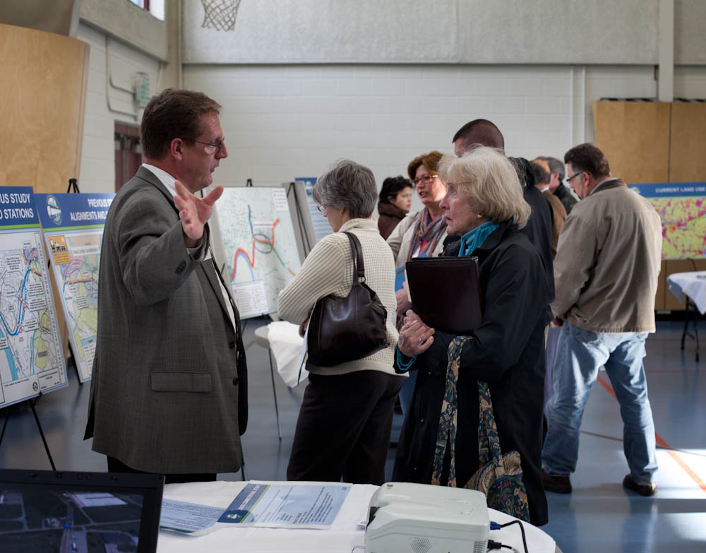
So far, ODOT has held public meetings in Newtown and Mariemont, and will hold meetings in Anderson Township, Mt. Lookout, Fairfax and Mt. Washington in the coming weeks – the next of which will occur this evening, from 6pm to 8pm, in Mt. Lookout at Christ The King Parish Center at 927 Ellison Avenue.

Those unable to attend that or the other upcoming meetings, are being encouraged to complete an interactive web-based survey. Taking approximately five to 10 minutes to complete, the survey asks respondents to rank the importance of the types of transportation improvements needed for the corridor, while also asking for specific location-based improvement suggestions.

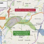
The survey and public feedback for this effort is focused on what ODOT calls Segments II and III of the project, and is not limited to those who live or work in the study area, but rather open to anyone who finds themselves passing through the area.

Early results from the survey show that respondents want ODOT to focus investments on improving public transit, biking and walking options, and travel time through the corridor. While the travel time option could mean many different things, it may be connected to the other two top rankings for multi-modal transportation enhancements.

Projects not specifically mentioned in the survey include the Oasis Corridor commuter rail line, which also has been on the ropes lately, and the Wasson Corridor, which is still unclear how it will proceed with respects to a trail only, or a light rail and trail combination.

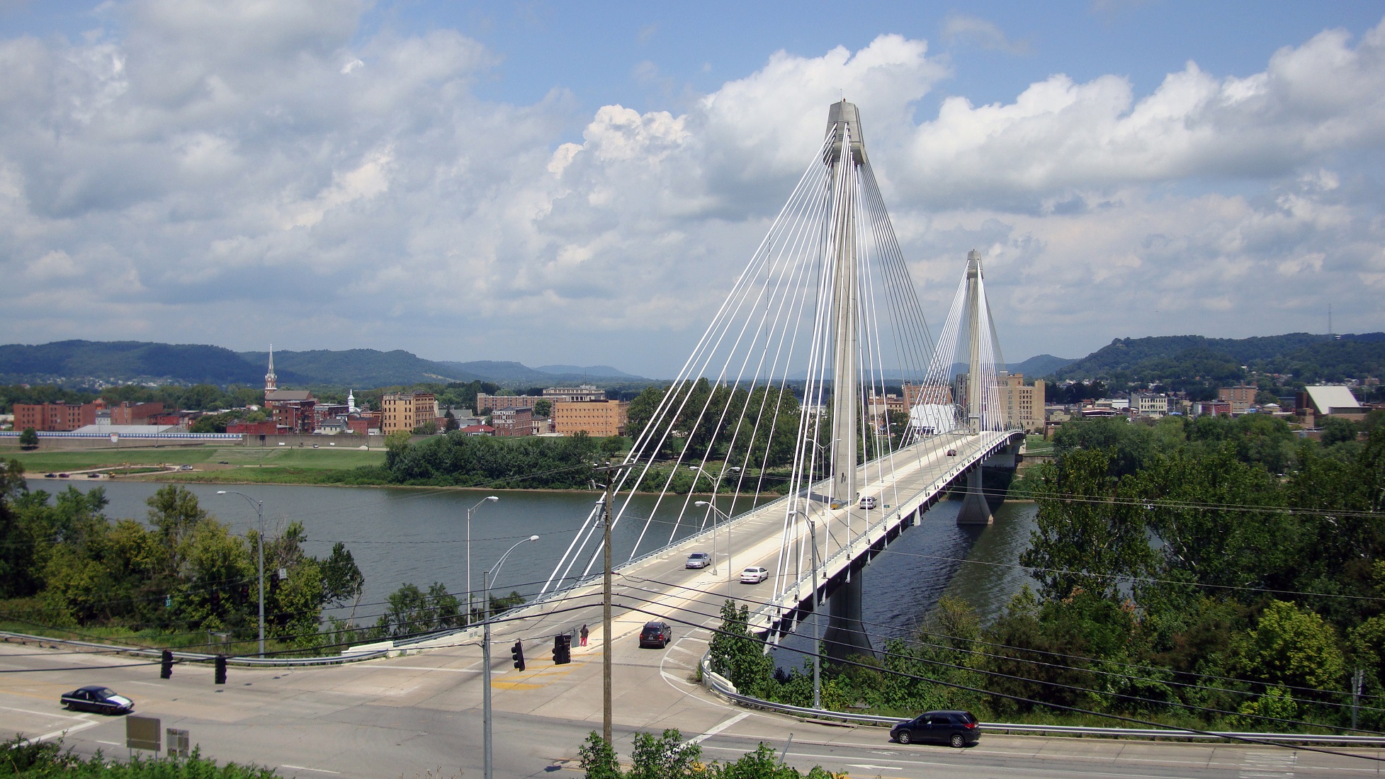
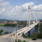
As UrbanCincy wrote in June 2015, a new local access bridge crossing the Ohio River, from Columbia Tusculum to Dayton, KY, could also greatly help solve access and congestion issues on the east side of the region.

ODOT officials say that the online survey will remain open until Wednesday, June 15. After this evening’s open house in Mt. Lookout, the next meetings to take place in Fairfax and Mt. Washington will occur on May 4 and May 5, respectively.

Categories
Arts & Entertainment News

Finding Inspiration From Seoul For Cincinnati’s Public Staircases

ArtWorks has become well-known for its mural program. Over the past eight years, the program has created 90 murals that have added to the vibrancy of 36 city neighborhoods.

This year, however, ArtWorks started to branch out a bit more. In addition to 10 mural projects, they also installed more than 50 public art pieces throughout the city. Some were poetic, while others charming. Regardless of the project, they have always worked to actively engage young people in the city with the artist community.

The program’s impact on the visual appearance of the city cannot be overlooked. Public spaces have been dressed up and walls have been decorated in truly Cincinnati fashion. When considering one of Cincinnati’s most defining features – its hillsides – another opportunity seems to be sitting in waiting for future ArtWorks programs.

Over the years The Hillside Trust has worked to promote and preserve the city’s hillsides and the view sheds that they offer. At the same time, many of the city’s public staircases, which long served as a critical component of the sidewalk network, have fallen into disrepair. In many cases, due to either lack of maintenance or neighborhood distrust, public staircases have been closed off altogether.

This should not be the case.

One potential way to address this would be to focus an ArtWorks program on the city’s public staircases. Artists could be engaged to come up with creative mural designs for the stairs themselves, or perhaps suggest other installations. These could then be complimented by lighting installations that would not on

ly add an artistic touch after dusk, but also make the corridors safer for their users and the neighborhoods around them.

Seoul’s Ihwa neighborhood has done exactly this.

Set on the side of a steep hill leading to Seoul’s historic fortification wall, the neighborhood has seen many of its staircases painted, along with surrounding building walls, to create a truly unique environment. A variety of art installations were also undertaken in order to create an even more dynamic experience.

Today visitors flock to the area to view the murals and experience the other installations some 60 artists created in 2006 as part of Naksan Project. Due to this influx of people, small cafes, galleries and restaurants are now prevalent throughout the neighborhood.

While Cincinnati’s hillsides and surrounding neighborhoods present a different challenge than what exists in Ihwa, there are equal, yet different, opportunities that also exist.

Right now Cincinnati’s hillsides and their public staircases are mostly viewed as barriers and have been constrained to afterthoughts in the city’s public psyche. ArtWorks has changed the way we viewed vacant walls and barren streetscapes. Here’s hoping they can work similar magic on the city’s long-forgotten staircases.

Categories
News Opinion Transportation

Here’s How to Improve Access Between Ohio and Kentucky’s East/West Neighborhoods

When discussing regional transportation issues, the topic seems to always be about congestion. In reality, outside of a few limited periods, the Cincinnati region has relatively good traffic flow with little actual congestion. So instead of trying to solve a problem that does not exist, we should be instead focusing our resources on maintaining our current system and improving mobility within the overall region.

As is the case in any city, the natural environment often serves as a chokepoint and barrier to regional mobility. This is true for Cincinnati with its hills and rivers.

With the region’s population largely centered along the Ohio River, it is natural that this is where the most choke points exist. Outside of the center city, however, there are very few river crossings. In fact, there are only two Ohio River crossings outside of the center city, and both of those are for I-275.

One such area that makes sense for a new local road bridge is around Cincinnati’s Columbia Tusculum neighborhood and Dayton, KY near where the $400 million Manhattan Harbour project is planned.

An increasing amount of development continues to occur on the northern bank of the river in Columbia Tusculum and East End. Further up the hill sits prosperous neighborhoods like Mt. Lookout, Hyde Park, and Oakley; and just around the bend lies Lunken Airfield.

Conversely, on the south side of the river in Kentucky, large-scale development projects have long been envisioned, but are often derailed due to poor access via existing roadway networks. This remains true for Manhattan Harbour where concerns exist about the traffic burden that would be placed on the narrow KY 8 running through historic Bellevue’s quaint business district.

A local road bridge that is one lane in each direction with space for pedestrian and bicycle paths would be an ideal fit for this area of the region. It would improve mobility and access to two difficult-to-access areas. It would also offer a highway alternative for those looking to cross between the two states.

A second location where a local bridge of this nature would make sense is near where the Anderson Ferry currently operates today on the city’s west side.

While little development has occurred in this area for some time, this may soon change. The Ohio River Trail West will soon make its way toward this area, and several developers have been eyeing the western riverfront for major projects.

The Cincinnati-Northern Kentucky International Airport sits on the southern side of the river where this bridge would land. This area continues to be bolstered by warehouses, distribution facilities and other airport-related services, and could be further bolstered with better access. What’s more, Cincinnati’s western neighborhoods that have long had to deal with excessive airplane noise, yet long treks to the airport, could at least resolve one of those injustices with a new local access bridge.

The Taylor-Southgate Bridge is the most recent span that has been constructed over the Ohio River. It was completed in 1995 and cost $56 million at that time – approximately $85 million when adjusted for inflation. Both of these new bridges would need to span an approximate 1,700-foot-wide width, which is about 300 feet more than the Taylor-Southgate Bridge river width.

One of the main differences, however, is that the Taylor-Southgate Bridge includes two lanes of traffic in each direction, plus sidewalks. The need for only one lane of traffic on these bridges would allow them to have a deck width of around just 30 to 35 feet.

Another good nearby comparison is the U.S. Grant Bridge in Portsmouth, OH. That cable-stayed bridge was completed by the Ohio Department of Transportation in 2006 for approximately $30 million – or about $35 million in today’s dollars.

In addition to access and mobility improvements for motorists, a new bridge in both of these locations would also be a boon for cyclists. Those riding along the Little Miami Scenic Trail and the Ohio River Trail would now also be able to continue on to Northern Kentucky’s Riverfront Commons Trail, which will eventually stretch 11.5 miles from Ludlow to Ft. Thomas.

The Cincinnati region does not need multi-billion dollar solutions for a traffic congestion issues that largely do not exist. Reasonable and affordable projects that aim to increase mobility and access, along with maintaining our existing assets, should be the priority.

New local bridges connecting the region’s east and west side neighborhoods would open up land for new development, improve access between both states, enhance mobility for pedestrians and cyclists, and would do so at a price tag we can afford.

Categories
Development News

Developer Seeking Support for Six-Unit Columbia Tusculum Townhome Project

The developer responsible for building “Cottage Hill” along Columbia Tusculum’s Strafer Street is now seeking the community’s approval for a six-unit townhome project.

On Monday, Gary Osterfeld presented to the community council what he called “very preliminary” sketches for the attached buildings at the bottom of Strafer Street – along Columbia Parkway – which would likely be around 1,900 square feet apiece and could be either apartments or for-sale homes.

The site is currently undeveloped and is used as a small community gardening space. If he pursues the project, Osterfeld will be seeking a zoning variance from its current zoning classification of community commercial-mixed to residential mixed, as it would have no commercial component.

“The commercial market in Columbia Tusculum is not real good, despite what people may think,” he said. “The problem is, relative to the number of people, there’s more retail than there is need for it. There’s already more retail than there is people; so in order for businesses to come in there and be enough demand and for the businesses to be profitable, we need more people.”

Osterfeld also told the community council that Al. Neyer’s Columbia Square, which is located directly across Columbia Parkway from his proposed building site, took five years to fill with tenants. He also said that he’s been trying to market his site for about the same amount of time but “hasn’t had a single serious call”.

The site is also challenging because of its steep slope and six-foot retaining wall, which Osterfeld said the City would likely want to keep in place.

“The idea of the zoning in place – what they would like to see – is they would like to see retail on the street level, so that people can walk in the shops like Hyde Park Square or Oakley Square – or like most squares – and the upstairs is residential,” he said. “The problem with that is you don’t see hills in Hyde Park, Mount Lookout, Oakley. The other neighborhoods you don’t see built on a hill like this. So the topography does not lend itself well to what the City’s insisting be there.”

The earliest the project could begin is this fall. Price points are expected to start in the mid-$300,000s, based upon what Osterfeld has seen of the local market.

“My guess is that it’s probably going to be a younger, more transient market,” he said. “There’s going to be a lot of steps, the price point’s not going to be like [the Cottage Hill development on] Strafer. I think that Strafer started out in the upper 3’s [$300,000s] and ended up in the upper 6’s [$600,000s]. I don’t see that happening. But we’re designing it to try to accommodate anybody. We’re going to be as flexible in our design as we can.”

Osterfeld said he plans to keep the neighborhood notified as the proposal navigates the maze of design, variances and permits.

“The City would like to have neighborhood support and neighborhood cooperation, as would I,” he said. “Your interest is what’s good for the community. So, I’m trying to help with that.”

Categories
News Transportation

East Side Commuter Rail Project in Doubt Following Vote to Develop Oasis Line as Trail

The fate of a long-planned commuter rail line along the eastern riverfront took an abrupt turn over the past month. With the Southwest Ohio Regional Transit Authority (SORTA) Board voting 12-1 in favor of a plan to use it for the Ohio River Trail, it puts a severe damper on one day using it as commuter rail to the city’s eastern suburbs.

The commuter rail, commonly referred to as the Oasis Line, had been pursued by Hamilton County Commissioner Todd Portune (D) for many years. Over time the Oasis Line had become a component of the much larger Eastern Corridor project, which is also now facing a very unclear future of its own.

SORTA purchased the right-of-way in 1994 for $4 million, after which it sold the more southern of the parallel-running tracks and easement to Genesee & Wyoming – the parent company of the Indiana & Ohio Railway Company – which also has the rights to utilize the northern tracks that would be paved over as part of this plan.

As a result, SORTA officials still need to work out details with G&W in order to allow the bike trail to move forward.

“After a comprehensive three-month review of all aspects of the issue, the SORTA Board has overwhelmingly endorsed the concept of a temporary bike trail on the Oasis Line,” said Jason Dunn, Chair of the SORTA Board. “We will do all in our power to work collaboratively with our partners to support the development of the trail.”

The 4.75-mile section of trail will complete the Ohio River Trail on the city’s east side. This segment is estimated to cost $4 million, of which $1 million has already been raised by Ohio River Way. Other portions of the Ohio River Trail, which connects to the Little Miami Scenic Trail, have been completed in a piecemeal fashion over the years.

Project supporters say that if everything goes smoothly, the multipurpose trail could open as early as 2017.

“The trail is an asset that the community clearly wants and it will be an enhancement to multimodal transportation in the region,” Dunn stated in a prepared media release.

SORTA officials say the next steps call for working out regulatory issues with federal agencies, and coming up with a design for the trail that is both safe and amenable to G&W.

While this move may hamper future efforts of developing commuter rail along this corridor, SORTA officials structured the agreement to allow for future flexibility. This includes the design of what the transit agency is calling a “temporary trail” that does not preclude from future passenger rail service along the Oasis Line.

To some passenger rail advocates, however, the prospect of the Oasis Line going away is a good one.

“The riverfront is a perfect place for a recreational trail, while light rail transit would be better-suited serving our neighborhoods,” Derek Bauman, Chair of Cincinnatians for Progress and SW Ohio Director for All Aboard Ohio, told UrbanCincy. “We should move forward with this plan to complete the Ohio River Trail, and then shift our attention to developing a recreational trail and light rail line along the Wasson Corridor.”

EDITORIAL NOTE: In August 2010, UrbanCincy provided an in-depth look at the plans for the Oasis Line. Then in February 2012, UrbanCincy published a controversial editorial that called for a new vision with the Oasis Line being utilized as a trail, and the Wasson Line as a combined trail and light rail corridor.