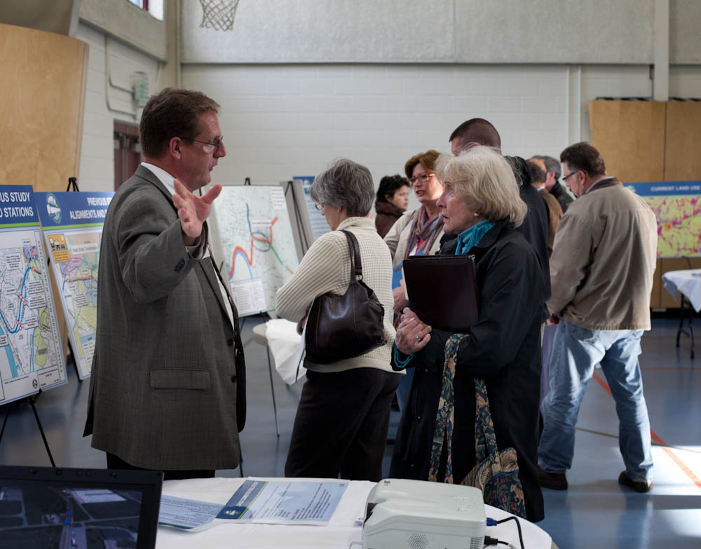
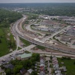
The Ohio Department of Transportation is looking for additional feedback related to transportation improvements for Cincinnati’s eastern neighborhoods and far reaching suburbs.
The survey comes after ODOT has said that they are backing away from original plans for the hotly debated Eastern Corridor project, which came under public scrutiny for its scope and potentially negative impact to established neighborhoods on the city’s east side.
While the project will most certainly not be moving forward as originally envisioned, public officials are still looking to get a grasp on what kinds of investments could be made to improve traffic congestion and mobility options.
Those unable to attend that or the other upcoming meetings, are being encouraged to complete an interactive web-based survey. Taking approximately five to 10 minutes to complete, the survey asks respondents to rank the importance of the types of transportation improvements needed for the corridor, while also asking for specific location-based improvement suggestions.
The survey and public feedback for this effort is focused on what ODOT calls Segments II and III of the project, and is not limited to those who live or work in the study area, but rather open to anyone who finds themselves passing through the area.
Early results from the survey show that respondents want ODOT to focus investments on improving public transit, biking and walking options, and travel time through the corridor. While the travel time option could mean many different things, it may be connected to the other two top rankings for multi-modal transportation enhancements.
Projects not specifically mentioned in the survey include the Oasis Corridor commuter rail line, which also has been on the ropes lately, and the Wasson Corridor, which is still unclear how it will proceed with respects to a trail only, or a light rail and trail combination.
As UrbanCincy wrote in June 2015, a new local access bridge crossing the Ohio River, from Columbia Tusculum to Dayton, KY, could also greatly help solve access and congestion issues on the east side of the region.
A campaign to improve Cincinnati’s parks by raising the City’s property tax by 1 mill will “change the city for the better,” according to Cincinnati Mayor John Cranley (D).
The charter amendment would raise the City’s property tax rate to 13.1 mills and would bring in approximately $5.3 million a year. The move would require City Council to fund the Parks Department’s capital budget at its 2016 budget level, and approve bonds for capital improvements using levy revenue.
Proponents say that 75% of the levy revenue will be available for the City to borrow against in order to fund 13 designated capital projects selected by the mayor and city manager. The remaining 25% will go to system-wide maintenance and operating costs.
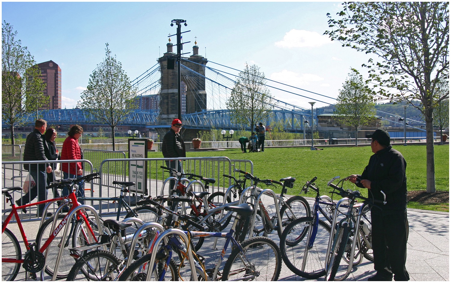
Smale Riverfront Park Boat Dock [Barbara Hauser]
Ziegler Park Preliminary Master Plan [Provided]
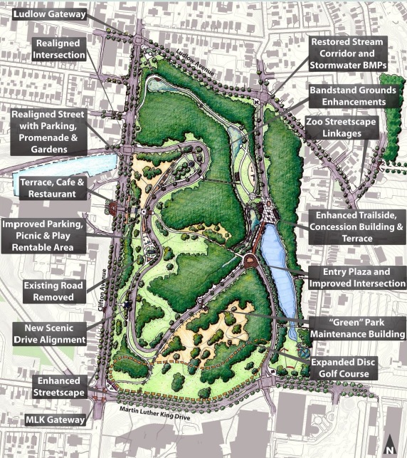
Burnet Woods Master Plan [Provided]
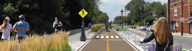
Oasis Bike Trail [Provided]
Wasson Way Concept [Chris Wyatt]
“We’re asking to voters to pass a very small property tax that we believe, for that small amount of money – $35 a year per $100,000 value – will increase property values and increase the quality of life for all Cincinnatians as we take the wonderful park system and we bring it to the neighborhoods,” Cranley said.
The group needs to collect approximately 6,000 signatures by August 15 to make it on to the November 3 ballot. Cincinnati Parks has not placed a levy on the ballot since 1927.
“We have decided that the only fair way to do this, if we’re going to be asking the taxpayers to pay more money, is to ask the citizens first to even let us put it on the ballot,” Cranley said. “At the end of the day, we’re putting this decision in the hands of the voters, and we believe the value proposition is there. We believe that this will build a better city.”
Vision needs funding
Board of Park Commissioners President Otto M. Budig, Jr. said that his organization has been charged with creating the best parks system in the country, but despite generous City funding and donor contributions, it continually finds itself short on money for major initiatives.
“We have had some difficulty in developing major projects that have long been needed,” he said. “I went to the mayor and I said, ‘We need these funds to bring about a new vision. You give us a vision, we’ll take care of the details.’ The mayor has given us the vision.”
While many of the projects are only in the conceptual stage at current time, the Citizens for Cincinnati Parks website says that they were chosen due to being the most shovel-ready, with the ability to be completed quickly.
Multipurpose recreational trails are a major component of the plan, including the Oasis River Trail ($8 million), Wasson Way ($12 million), Mill Creek Greenway Trail ($5 million), and the Ohio River West Trail ($6 million). The City also plans to work with the Cincinnati Off-Road Alliance to develop more than 20 miles of off-road trails in Mount Airy Forest ($11 million).
“The bike system that will be created as a result of this levy, off-road, which is a big thing for me – I think off-road is a much safer, dedicated path that doesn’t have as many accidents – the most extensive, bicycle urban path in America,” Cranley said.
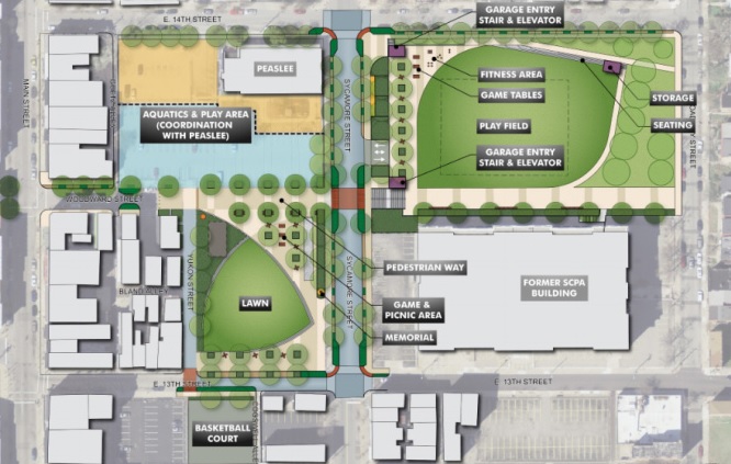
The plan would also raise $10 million for a joint venture between the City, the University of Cincinnati, and Clifton Town Meeting to create a new master plan for Burnet Woods.
“As I often say, Burnet Woods – even more so that Washington Park – could be the Central Park of Cincinnati,” Cranley said. “If you think about Corryville, CUF, Clifton, Avondale…all surround this park. It’s the densest part of the city and it’s right across the street from 30,000 students. We can have the same impact with that park as we did with Washington Park.”
Other projects include:
Developing part of the 20-acre New Prospect Baptist Church grounds into a communal programming center, athletic fields, and an urban camp site that would cost $8 million;
A public-private partnership with Western & Southern Financial Group that would provide $5 million to renovate and reprogram Lytle Park;
$5 million for the redevelopment of a portion of the former Mercy Hospital complex in Westwood into athletic fields and green space for an expanded Oskamp Park;
“Now we have this new vision,” said Parks Director Willie Carden, who already has overseen the amazing transformations at Smale Riverfront Park and Washington Park, among others. “The vision brings ‘parkonomics’, partnerships to the neighborhoods. We can do this. We can make this a safer, healthier community, but we need your help.”
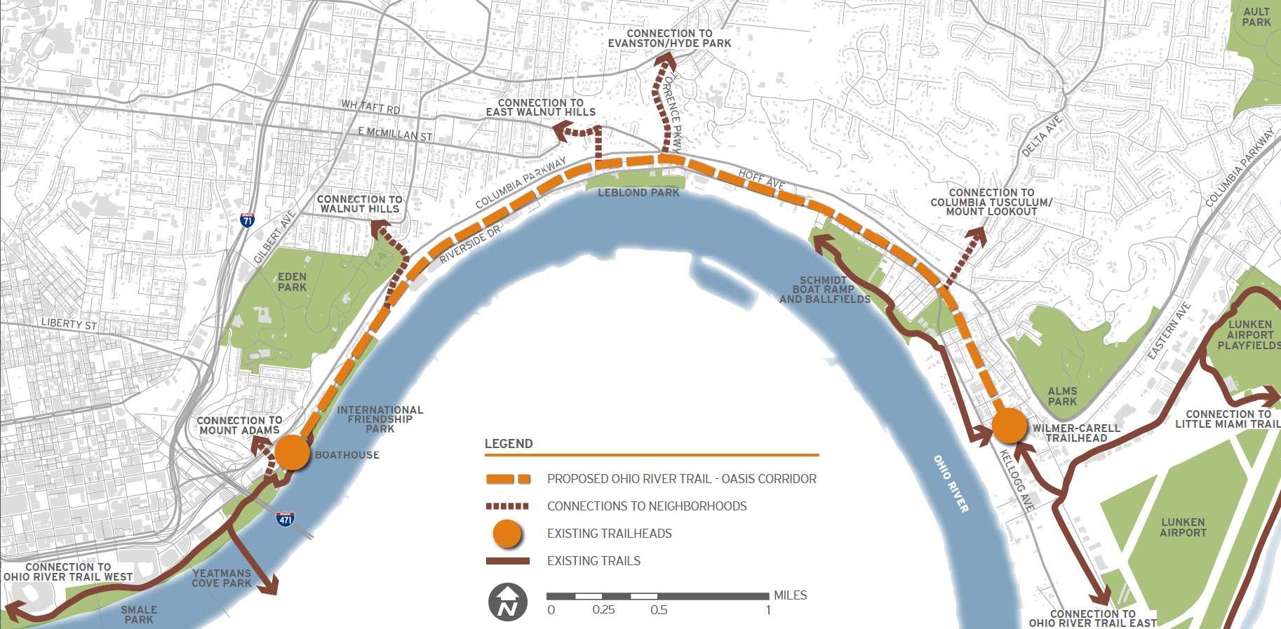
The fate of a long-planned commuter rail line along the eastern riverfront took an abrupt turn over the past month. With the Southwest Ohio Regional Transit Authority (SORTA) Board voting 12-1 in favor of a plan to use it for the Ohio River Trail, it puts a severe damper on one day using it as commuter rail to the city’s eastern suburbs.
The commuter rail, commonly referred to as the Oasis Line, had been pursued by Hamilton County Commissioner Todd Portune (D) for many years. Over time the Oasis Line had become a component of the much larger Eastern Corridor project, which is also now facing a very unclear future of its own.
SORTA purchased the right-of-way in 1994 for $4 million, after which it sold the more southern of the parallel-running tracks and easement to Genesee & Wyoming – the parent company of the Indiana & Ohio Railway Company – which also has the rights to utilize the northern tracks that would be paved over as part of this plan.
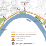
Ohio River Trail Plan [Provided]
As a result, SORTA officials still need to work out details with G&W in order to allow the bike trail to move forward.
“After a comprehensive three-month review of all aspects of the issue, the SORTA Board has overwhelmingly endorsed the concept of a temporary bike trail on the Oasis Line,” said Jason Dunn, Chair of the SORTA Board. “We will do all in our power to work collaboratively with our partners to support the development of the trail.”
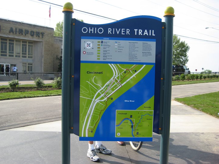
The 4.75-mile section of trail will complete the Ohio River Trail on the city’s east side. This segment is estimated to cost $4 million, of which $1 million has already been raised by Ohio River Way. Other portions of the Ohio River Trail, which connects to the Little Miami Scenic Trail, have been completed in a piecemeal fashion over the years.
Project supporters say that if everything goes smoothly, the multipurpose trail could open as early as 2017.
“The trail is an asset that the community clearly wants and it will be an enhancement to multimodal transportation in the region,” Dunn stated in a prepared media release.
SORTA officials say the next steps call for working out regulatory issues with federal agencies, and coming up with a design for the trail that is both safe and amenable to G&W.
While this move may hamper future efforts of developing commuter rail along this corridor, SORTA officials structured the agreement to allow for future flexibility. This includes the design of what the transit agency is calling a “temporary trail” that does not preclude from future passenger rail service along the Oasis Line.
To some passenger rail advocates, however, the prospect of the Oasis Line going away is a good one.
“The riverfront is a perfect place for a recreational trail, while light rail transit would be better-suited serving our neighborhoods,” Derek Bauman, Chair of Cincinnatians for Progress and SW Ohio Director for All Aboard Ohio, told UrbanCincy. “We should move forward with this plan to complete the Ohio River Trail, and then shift our attention to developing a recreational trail and light rail line along the Wasson Corridor.”
Bicycle Commuter at Moerlein Lager House [Randy Simes]
Research continues to show that Americans are driving less, but are biking, walking and using transit more. This is true in Cincinnati to the extent that transit ridership has increased in recent years.
While originally attributed to the economic downturn at the beginning of the century, these trends have continued while the economy has rebounded – leading many to believe it is an indication of new market forces being driven by aging Baby Boomers and emerging Millennials. Perhaps predictably so, governments have been slow to change with the changing economic forces.
Despite a growing number of trips for biking, walking and transit, funding has not increased correspondingly. In fact, many communities have seen funding for these non-automotive forms of transportation decrease as governments have worked to cut spending at all levels. This, new research finds, is only exacerbating the problem of having underfunded these modes of transportation for many years.
“Conventional statistics tend to under report active travel because most travel surveys under-count shorter trips (those within a traffic analysis zone), off-peak trips, non-work trips, travel by children, and recreational travel,” stated Todd Litman, Executive Director of the Victoria Transport Policy Institute, in a summary of his report entitled Whose Roads? Evaluating Bicyclists’ and Pedestrians’ Right to Use of Public Roadways.
Transportation Mode Share in Cincinnati Region [OKI]
“More comprehensive surveys indicate that active travel is two to four times more common than conventional surveys indicate, so if statistics indicate that only 5% of trips are by active modes, the actual amount is probably 10-20%.”
Litman indicates that funding levels tend to be much lower than even the low 5% trip share estimates, and recommends changing those levels to reflect not only the current trip share levels, but those that could be achieved should investments be made.
Unequal Funding Allocations at Regional Level
At the local level, the same situation of unequal funding allocation exists. In the 2040 Regional Transportation Plan, developed by the OKI Regional Council of Governments, approximately 88% of the nearly $21.5 billion in funding is recommended to go toward roadway projects, just 11% to transit and a mere 0.1% to bicycle and pedestrian improvements.
While the level of investment in transit appears closely aligned with current ridership levels for commute-related trips, it is far below ideal levels for bicycle and pedestrian investments.
“Relatively aggressive pedestrian and cycling improvement programs only cost about 1-4% of the total per capita roadway expenditures, or just 4-10% of general taxes spent on local roadways,” Litman contests. “Since walking and cycling represent about 12% of total trips, and a much larger share of short urban trips, and since most North American communities have under-invested in walking and cycling facilities for the last half-century, much larger investments in walking and cycling facilities can be justified to meet user demands and for fairness sake.”
OKI leadership contends that the organization’s regional planning document does not accurately reflect the level of investment being made in bicycle and pedestrian infrastructure, noting that many of the “roadway projects” in their plan actually include bike and pedestrian elements.
To that end, some recent improvements have been made with regard to bicycle infrastructure. The City of Cincinnati has installed around 40 miles of new on-street bike lanes or paths over the past several years, and has plans to install a total of 290 miles by 2025. The City’s Bicycle Transportation Plan, however, has been plagued by a lack of funding and has been relegated to only moving forward when roadway resurfacing projects emerge.
Not everyone is convinced, however, that enough is being done in terms of the overall investment needed for bike and pedestrian improvements.
Implications for Regional Transit
Of the money being recommended for transit investments, not including operations, approximately 96% is targeted for the contentious Oasis Line – a commuter rail line connecting Cincinnati’s far eastern suburbs with downtown.
Furthermore, the vast majority of OKI’s recommended transit funding is aimed to pay for ongoing operations – not pay for system expansions or improvements.
This grim financial picture for transit gets even worse when considering contributions from state and local governments.
In Kentucky, meanwhile, communities struggle with state law that prohibits any dedicated source of transit funding – thus forcing the Transit Authority of Northern Kentucky (TANK) to go before the state legislature every year seeking money, similar to how Amtrak must annually go before Congress.
Impact on Environmental Justice Populations
These dire funding and political situations have led to Greater Cincinnati taking the title of being the most populated region in North America without any rail transit; while even far less populated regions advance their own regional transit plans.
What makes the figures more troubling is that those most affected by the imbalanced funding appropriations are minority, low-income and disabled populations. While only 6% of the region takes transit, bikes or walks to work each day, that number escalates to 17% for African Americans, 11% for Hispanics and 10% for people with disabilities; while low-income commuters see that number spike to 21%. Quite simply, the lack of funding for non-automotive forms of transportation is most damaging to those who can least afford it.
Bicycle Commuter at Moerlein Lager House [Randy Simes]
The results of this inequality sparked a recent lawsuit by the ACLU of Wisconsin Foundation and Midwest Environmental Advocates filed a complaint against the Wisconsin Department of Transportation over a $2 billion highway interchange project. In MICAH & Black Health Coalition of Wisconsin v. Gottleib, the ACLU states:
“WisDOT explicitly refused to consider transit expansion (or transit in any way) as part of this proposal. This will further widen the already large gap between transit-dependent communities of color and disproportionately white suburban commuters. The ACLU of Wisconsin Foundation was one of the organizations that have complained about the government’s decision-making and reporting process, as well as how the project would exacerbate segregation and disparities in transportation access for low-income people to jobs.”
And while some of these mode shares may seem low, it has been noted by the U.S. National Household Travel Survey that commute trips are the lowest for walking and biking, while personal trips and trips less than one mile are significantly higher for both modes.
“In much of the region where we have large concentrations of EJ populations the sidewalk network is already quite developed, the roadway network is quite developed and available to bicyclists and the transit service is good,” countered Bob Koehler, Deputy Executive Director at OKI. “We do, as a community, need to do a better job at sharing the road and being aware of pedestrians to make these facilities better for all modes.”
Highway Building Frenzy
Even though young people are increasingly either delaying or choosing not to get a driver’s license at all, user fees collected from the gas tax continue to decline, total vehicle miles traveled (VMT) has been decreasing since 2007 and annualized VMT has been decreasing for nearly a decade, the nation and Cincinnati region continue to build new capacity.
Of the roughly $8.3 billion being recommended for roadway projects in OKI’s planning documents, approximately 73% of that is targeted for additional lanes, new facilities or new interchanges, while reconstruction and improvements to existing roadways account for the rest.
I-75 Construction Work at Mitchell Avenue [Jake Mecklenborg]
“Although VMT may be slightly declining in recent years in some parts of the country this may not be a long-term trend. Clearly the region has many needs,” explained Brian Cunningham, Director of Communications at OKI. “This plan addresses the significant existing safety and congestion needs. The plan is updated every four years and will provide an opportunity to revisit the assumptions.”
Litman argues that shifting some of the investment from roadways to bicycle and pedestrian projects due to their proven ability to reduce congestion and improve safety not only for bicyclists and pedestrians, but motorists as well. He also believes that such policy directives empower people by giving them the ability to choose between multiple transportation options for each of their trips.
“It is important to recognize the unique and important roles that active modes [biking and walking] play in an efficient and equitable transportation system, and the various benefits that can result when walking and cycling are improved, including indirect benefits to people who do not currently use those modes,” Litman concluded.
“Just as it would be inefficient to force travelers to walk or bike for trips most efficiently made by motorized modes, it is inefficient and unfair to force travelers to drive for trips most efficiently made by active modes, for example, if children must be chauffeured to local destinations because their communities lack sidewalks, or if people must drive to recreational trails due to inadequate sidewalks and paths near their homes.”
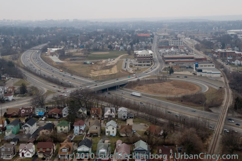
Tomorrow at 12pm, City Council’s Strategic Growth Committee will discuss the proposal that would turn the Wasson Corridor from a railroad right-of-way into a recreational trail. What UrbanCincy is urging City Council to require is a minimum of 28 feet worth of right-of-way preserved for future light rail use.
Standard designs for bi-directional light rail traffic require a minimum of 28 feet of right-of-way. Along some portions of the Wasson Corridor it may very well be possible to accommodate 28 feet for light rail, plus additional right-of-way for the proposed recreational trail, and in those segments it may make sense to get started.
Looking east as the Wasson Line crosses over Interstate 71. Photograph by Jake Mecklenborg for UrbanCincy.
While there is no funding currently in place to build light rail along the Wasson Corridor, it would be short-sighted to remove one of the best rail transit corridors in the city. This was previously done on Cincinnati’s west side when an abandoned railway used by freight and passenger rail traffic was abandoned and then allowed to be built over and occupied by the Glenway Crossings retail center.
Allowing this to take place offered city and county leaders to reap the rewards of a short-term boost, but it has also created a situation that makes building light rail to Cincinnati’s western suburbs almost impossible. This same thing could happen to Cincinnati’s eastern suburbs should the Wasson Corridor be used by a recreational trail.
Proponents of the Wasson Way Trail project made it clear that many of the supporters also want to see light rail eventually happen, but that we should not wait until that day comes to improve the visual appearance of the corridor. Case studies from all over the United States show, however, that once a former rail line is converted into another use, it is almost always an impossible political task to take that land back for rail purposes.
2002 regional light rail plan for Cincinnati.
In the larger scheme of things, UrbanCincy believes that regional leaders need to take a step back and ask themselves why we are still discussing commuter rail along the Ohio River, and a recreational trail through densely populated city neighborhoods. The priorities should be reversed, and the Oasis Line along the Ohio River should be converted into a recreational trail while the Wasson Line is preserved for future light rail use.
It is estimated that the Wasson Light Rail Line would attract three times the number of riders than the Oasis Commuter Rail Line, while also being significantly less expensive to build and operate. Futhermore, when discussions were held about the Oasis Line, residents and property owners along the line voiced their opposition to such activity and have conversely expressed interest in seeing the railway converted into a recreational trail.
City and regional leaders should maintain the natural beauty of the Ohio River and turn the Oasis Line into an attractive recreational trail that can connect into existing trail networks to the east, and the Wasson Line should be preserved for light rail use in the future. It may seem frustrating to leave the Wasson Line in its current state of appearance, but it will be much more frustrating to jeopardize one of the best potential light rail corridors envisioned for the region.