Categories
Development News Transportation

DOTE Hosts Final Open House for Liberty Street Narrowing Alternatives

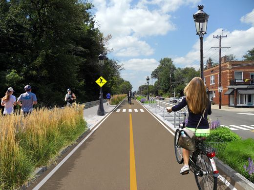
The City’s Department of Transportation and Engineering will present the final two design alternatives for consideration at its third public open house tomorrow night at the Woodward Theater. The study which began in 2013 as a Complete Streets initiative proposed by the OTR Brewery District Master Plan now lives on as a proposal to physically narrow the street by ten to twenty feet on the south side. The new land could potentially unlock development sites along the street.

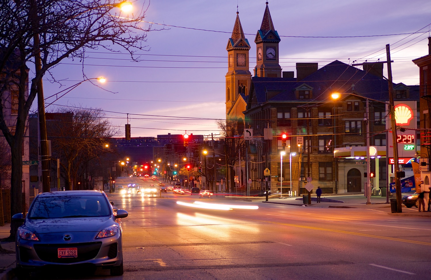
In its original configuration Liberty Street was once the dividing line between unincorporated territory and the city of Cincinnati. It was a narrow street with enough room for parking and less than two full lanes for traffic. In 1959 the City began to demolish properties along the south end of the street to widen the street to seven vehicle lanes and two parking lanes. The once quiet side street became a thru-way for automobile traffic looking to connect to the interstates and Central Parkway.

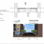
As revitalization progresses in Over-the-Rhine renewed attention is being paid to the street. The narrowing is an attempt to stitch back the fabric of the north and south halves of the neighborhood. Because of its configuration it is difficult for pedestrians to cross the street in the provided amount of time and bicycling is unsafe due to the high volume and speeds of automobile traffic.

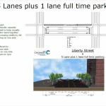
Initial configurations were many ranging from a restoration of the original street width to preserving the current set up. In between proposals called for a reduction to four or five lanes with bicycle lanes or rush hour traffic configurations. After two subsequent meetings the options are down to two: A five-lane and a six-lane configuration. Input taken from this open house will be used to narrow down to the final alternative. Once that alternative is selected it will be presented for adoption at the Over-the-Rhine Community Council in September.

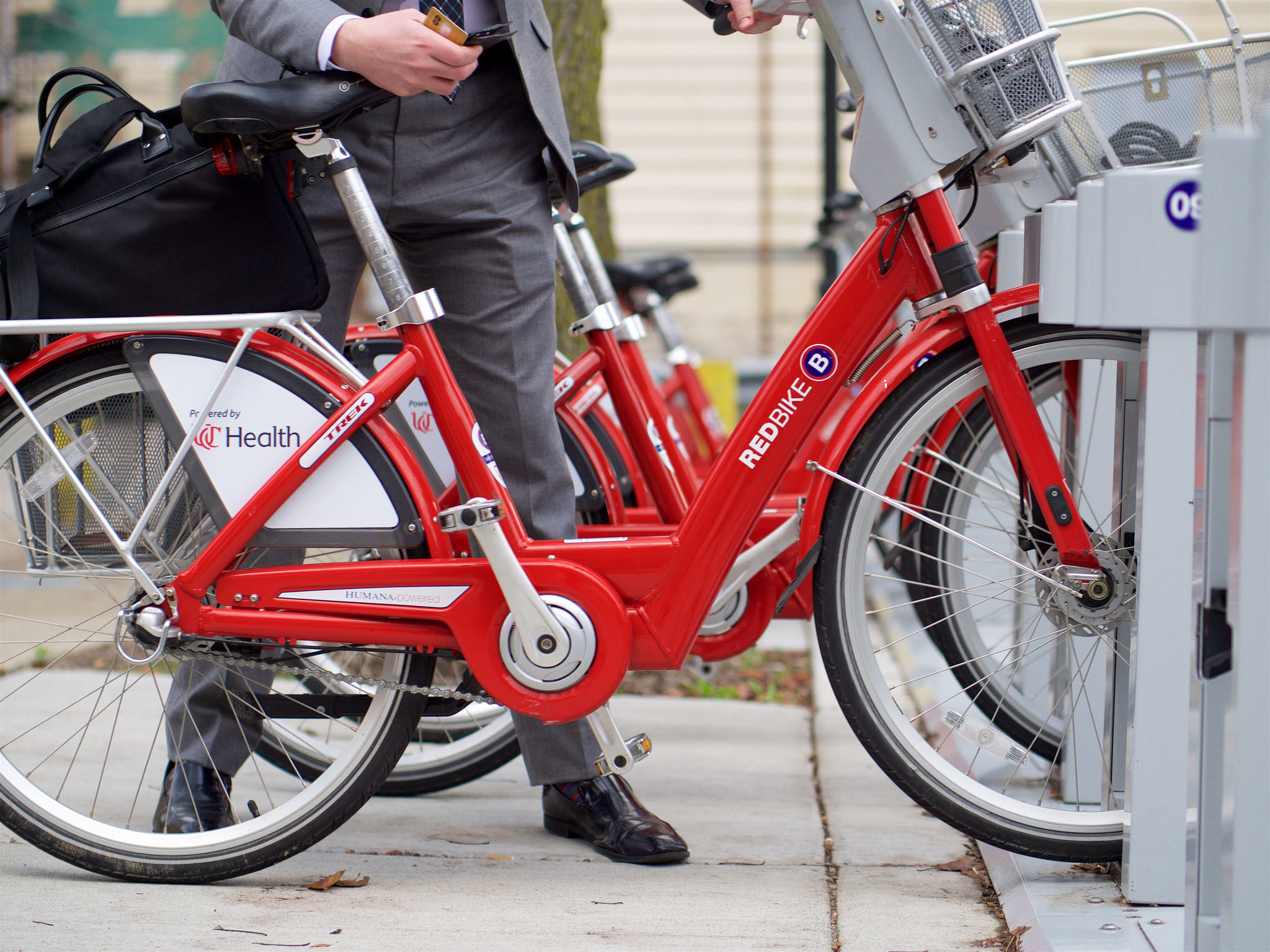
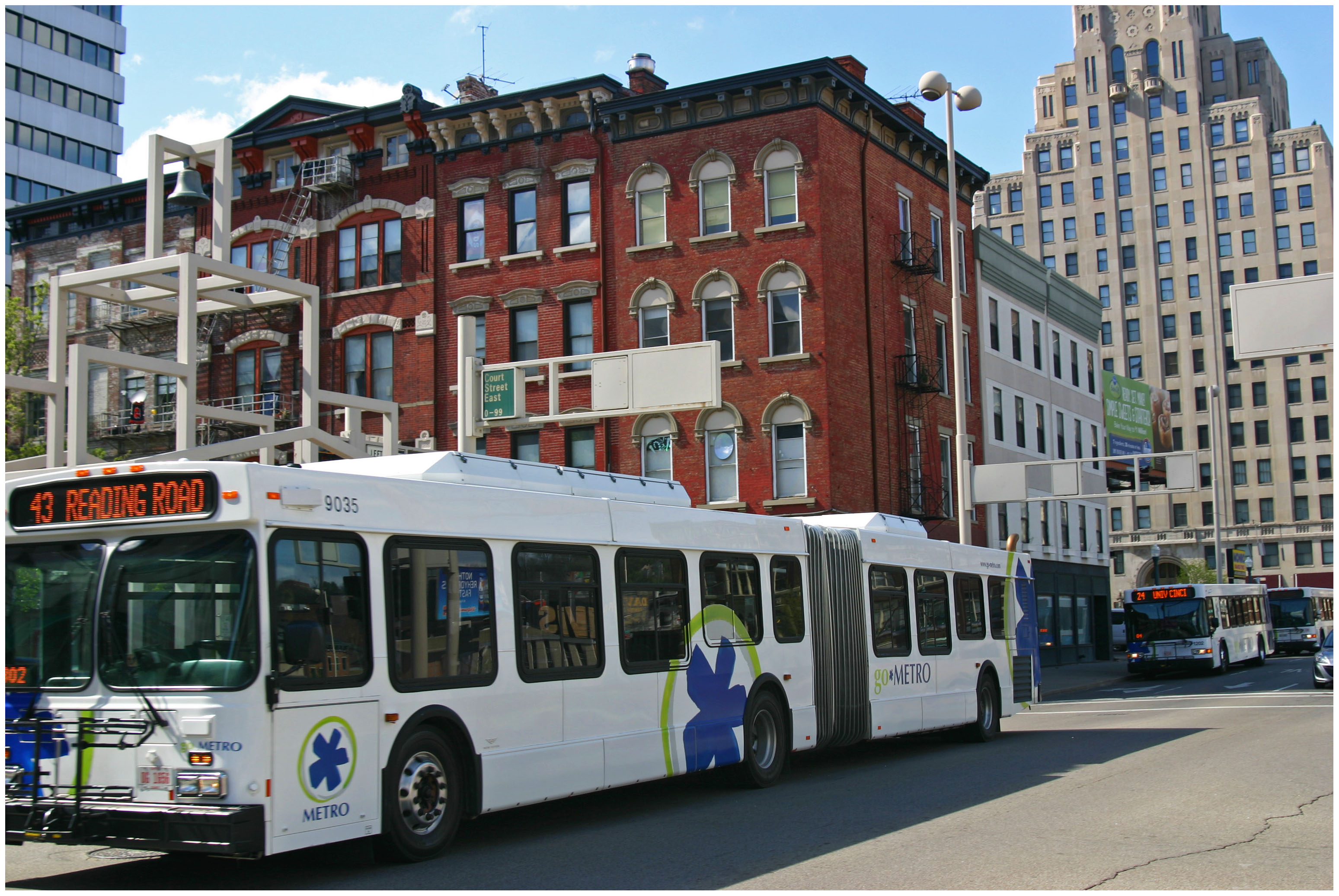
The meeting is this Tuesday evening, 6PM at the Woodward Theater on Main Street in Over-the-Rhine. The Theater is accessible by the #17, #19 and #24 Metro bus routes, and is within 100 feet of a Cincy Red Bike Station located at Main Street and Orchard Street.

Categories
Business News Transportation

Is Cincy RedBike America’s Most Financially Successful Bike-Share System?

RedBike Monthly Ridership Totals

Since launching nearly two years ago, RedBike has been embraced by the region in a way even the bike-share system’s early proponents had not imagined.

When RedBike opened to the public on September 15, 2014 it included 29 stations, but has since swelled to 57 stations spanning two states, four cities and more than a dozen neighborhoods. The ability to expand and integrate the system across state and city lines is particularly notable as it is a feat most other bike-share systems in North America have not yet achieved.

This relatively rapid expansion has been fueled by higher than expected ridership. As of early July, RedBike had hosted 116,739 rides – or about 5,300 per month. Bolstered by more than 1,500 annual members, these ridership totals translate into some 17,683 different people who have ridden a RedBike.

“Red Bike has gotten off to a dream start. Our community has embraced this new form of transportation,” Leslie Maloney, President of the Red Bike Board of Directors and Senior Vice President of the Carol Ann and Ralph V. Haile, Jr./U.S. Bank Foundation, said in a prepared release. “We will work to continue providing the highest quality and most fun transportation option in Cincinnati.”

Following the trends of bike-share systems elsewhere throughout the world, approximately 74% of its riders have either never ridden a bike before or at least not within the month before RedBike opened. This data makes many bike advocates in the region looking for ways to improve road safety for the surge of new cyclists out on the streets.

The biggest news in RedBike’s recently released annual report, however, pertains to its finances.

While many bike-share systems around the country have struggled financially, RedBike has been able to operate in the black since its inception, and has grown its cash reserves year-over-year.

In 2014 RedBike had a total of $234,251 in expenses and $1,144,911 in revenues. That net income grew in 2015 when the bike-share system had $484,389, but $1,740,792 in revenues. This net income, RedBike officials say, is used to purchase capital equipment necessary to keep the system fully functional.

While it is difficult to find bad news in the financial details released by RedBike, one might look at the fact that direct program income (user fees) cover only 65% of program expenses. When factoring in sponsorships, a fairly reliable and steady stream of income, it covers nearly 118% of program expenses.

All of the other income sources help to further stabilize the system, keep it operating at reliable and optimal levels, and are helping build a reserve fund that could be used to offset unexpected capital expenses or lower than anticipated operational performance.

UC Health is thrilled to be the presenting sponsor of the RedBike program,” said Dr. Richard P. Lofgren, President and CEO of UC Health. “As someone who lives downtown, all I have to do is look outside to see how successful this program is, and how bike share has been embraced by the citizens of Cincinnati.”

Categories
Development News Transportation

Hamilton Looking At Possibility of Developing Urban Trail on City’s West Side

The City of Hamilton is looking at the possibility of acquiring approximately 36.5 acres of land from CSX Corporation following its filing for abandonment of the former freight railroad. If city officials ultimately decide to proceed with the purchase, the plan will be to turn it into an urban bike and pedestrian trail on Hamilton’s inner west side.

Running from CSX’s main line in Millville to the former Champion Paper Mill, which is in the process of being redeveloped into a youth sports and entertainment complex, the property also includes a former railyard near the Great Miami River at Two Mile Creek.

Hamilton’s west side neighborhoods currently lack any protected bike lanes or off-street bike paths. As a result, the possibility of adding such an amenity has community leaders excited.

“The proposed Beltline trail will be of great value to our community,” said Hamilton Councilman Rob Wile. “By connecting these neighborhoods to our existing trail infrastructure we open up a number of convenient outdoor recreational opportunities to our residents.”

Earlier in the year city officials hosted public hearings to gather feedback on the concept, and are continuing to gather feedback through an online survey. The results, they say, will help determine whether they should ultimately pursue the project.

“The survey lets the City know what kind of benefits residents see in the trail, how often they may use it, what potential negative aspects or problems may occur with it; and is being used to see what generally the public thinks about the potential trail,” Nicholas Garuckas, City Management Fellow inside Hamilton’s Office of the City Manager, explained to UrbanCincy.

“The [survey] results are carefully being looked at and considered in helping determine whether or not the City should be moving forward with this project or not.

In the meantime, Garuckas says that City Hall is moving forward with an appraisal of the land’s value, along with assessing the possibility of various grants from agencies like the Ohio Public Works Clean Conservation Fund, Rails to Trails Conservancy, Dopplet Family Fund, Ohio Department of Natural Resources Clean Ohio Trail Fund, and Recreational Train Fund.

The project follows a pattern of other more marque urban trail projects around the country that are transforming former industrial rail corridors into park and recreation space for under-served urban communities.

Last June, Chicago celebrated the opening of its 2.7-mile trail called The 606. Atlanta, meanwhile, has been opening segments of its much larger 33-mile BeltLine project in phases over recent years. Nearby, in Cincinnati, city officials are poised to acquire an abandoned 7.6-mile freight rail line in its eastern neighborhoods for what is being called the Wasson Way project.

While smaller in scope, the approximately 2.7-mile Hamilton Beltline has, at least initially, has gained the support of Hamilton City Council, and is rooted in the city’s planning documents. In fact, city officials explain that the idea for the project came out of discussions about what to do with the Champion Paper Mill complex and surrounding areas.

“This project is part of the bike path master plan and it will be an asset to all those who enjoy the outdoors including walkers and joggers,” Wile concluded.

If Hamilton is successful in acquiring the land, it would add significant recreational facilities and new transportation options to the city’s west side. If abandonment proceedings continue without Hamilton moving to purchase the property, it will instead be sold off in piecemeal fashion to private owners.

Categories
News Transportation

Running Time Adjustments Go Into Effect For 9 Express Metro Routes on Monday

Following the re-routing of numerous express bus routes through the central business district earlier this year, Metro is now also making minor running time adjustments to many of these same routes.

The changes will go into effect on Monday, June 20, and will impact Metro’s express routes to Tri-County (23X), Mt. Lookout (25X), Milford (29X), Montana (40X), West Chester (42X), Sharonville (67), Kings Island (71X), Delhi (77X) and Eastgate (82X).

The Southwest Ohio Regional Transit Authority did not offer an explanation for the changes, but it is normal for the transit agency to make adjustments such as this in order to improve efficiencies or avoid service conflicts.

Commuters looking to adjust their schedules to the new timetables can do so by viewing the new schedules on Metro’s website, or by using one of the real-time transit data apps now available to Cincinnati-area bus riders.

Categories
News Politics Transportation

Cincinnati’s $109M Capital Acceleration Plan Ignores Adopted Bike Policy

On Thursday, the City of Cincinnati celebrated the start of its bold, new road rehabilitation effort. The six-year program will include the resurfacing and rehabilitation of aging streets, replacement of city vehicles outside of their life cycle, and establish a new focus on preventive road maintenance that city officials will save money in the long-run.

The $109 million Capital Acceleration Plan is a strategic policy shift at City Hall, and represents a large infusion of money into road repair. The new focus on preventive maintenance is particularly noticeable as it represents an eight-fold increase in spending on that front.

“This is much bigger than just spending money to improve the condition of local streets. CAP is about making an investment in the city and people who live here,” City Manager Harry Black said in a prepared release. “This strategic investment in our roadways and infrastructure will serve as the foundation of Cincinnati’s sustained long-term growth.”

City officials say that the investments will improve the condition of 940 center-line miles of streets over the next six years. In its first year, its $10.6 million for street rehabilitation and $4 million for preventive maintenance, officials say, will impact 16 different neighborhoods and improve 120 center-line miles of roads.

With so many streets poised to be improved over the coming years, many people advocating for safer bicycling and walking conditions on the city’s roadways were optimistic that across-the-board improvements could be made. In fact, their cause for optimism is not without cause. The City of Cincinnati’s Bicycle Transportation Plan, which was adopted by City Council in June 2010, calls for incremental improvements to the city’s bike network as road resurfacing projects take place.

“Many of the facilities recommended in this plan can be implemented in conjunction with already scheduled street rehabilitation projects,” the Bicycle Transportation Plan notes. “When this coordination occurs, costs for implementing the bicycle facilities may be reduced by over 75%.”

According to officials at the Department of Transportation & Engineering, such savings can be achieved since the capital costs can be shared for both sets of improvements, and labor costs can be maximized.

The Bicycle Transportation Plan goes on to state that City Hall will be opportunistic and take advantage of every occasion where bicycle facilities can be included with street rehabilitation projects or other capital projects. Taking such an approach, the adopted policy says, “will reduce costs to the lowest levels possible.”

City Hall, however, has fallen woefully behind on the implementation of the recommendations made in the Bicycle Transportation Plan; and the current administration has even made a point of noting that they do not generally support the idea of on-street bike facilities. Rather, Mayor John Cranley (D) and his administration have focused on investing in off-street recreational bike trails.

Such an approach has left many people who use bikes as a means of transportation frustrated; and with $69 million of CAP going toward road improvement projects, it would seem like a great opportunity to maximize the improvements by performing these projects in a manner that also improves safety conditions for the city’s rapidly growing number of people commuting by bike.

Based on statements from City Hall, however, it seems that it will prove more so to be an opportunity lost; and put the city in an impossible position to meet its adopted policy objectives within their target time frames.