Categories
News Transportation

GUIDE: How to Ride the Bus in Cincinnati

So maybe you’ve been thinking for a while that you should actually take this ‘public transit’ thing that you’re always saying we need more of. Maybe you’ve been meaning to ride the bus to get to bars and shopping but put it off because you can’t figure out how to use the system. Or maybe you work downtown and would ride the bus, but you either get a parking or bus pass from your employer and you drive because it seems easier.

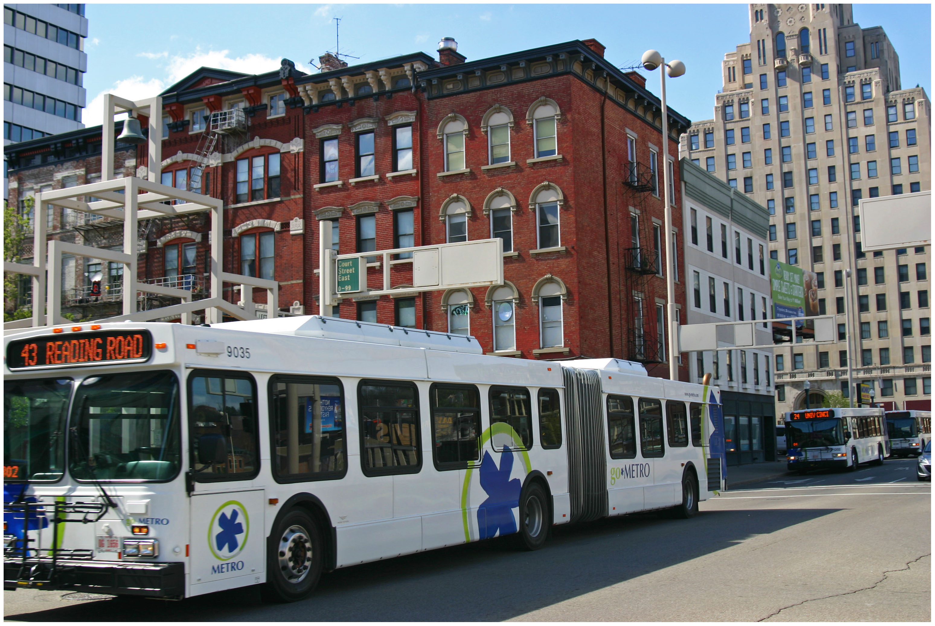
Regardless of the reason, there are many benefits to taking public transit as opposed to driving or taking a rideshare vehicle in Cincinnati. While our city gets a bad rap on the state of our bus system, the reality is that most of the city is easily accessible by bus. The 6 heaviest routes offer good daytime frequencies, serve the densest parts of the city, and are easy to understand when it comes to where they serve. These routes serve the arterial, or main, roads in Cincinnati, including Glenway, Hamilton/ Clifton, Vine, Reading, Montgomery, and Madison/Erie Avenues. Due to the geography and history of development in Cincinnati, most business districts and dense residential areas are on these roads. We are a lot more accessible than you might think!
But how do I use this bus? It may seem challenging to those who are not familiar with the system and how it works, but it’s nearly as easy as calling an Uber. In this article, I will address the three basic questions people have about riding the bus in Cincinnati: how do I know where it goes, how do I pay for my trip, and how do I not miss my stop.

Where Does the Bus Go?

There are several apps and websites that will plot the best route(s) to take as well as alternatives. Google Maps, which is standard on most smartphones, is easy to use and understand. Simply type in your destination and hit the transit icon as your travel mode and Google will do the rest. The app tells you where the nearest bus stop is, walking directions to the stop, and the estimated travel time once you are on the bus.

Another great app which offers much more functionality is the Transit App. This app gives the same directions as Google Maps does, but also includes a live tracker and time countdown of each bus on every route so you don’t have to wonder where the hell your bus is. The user interface is a little friendlier than Google’s as it is centered around transit usage. Additionally, the Transit App works in nearly every city worldwide that has public transportation options. It works especially well with multimodal travel and can estimate your travel time using a combination of travel modes like bike to bus, walk to bus, or bus to bus.

If you are more map-oriented and want to check out the entire route to learn where it goes, the Transit App has the ability to show the actual routing of each bus line and how long it would take to travel to each stop in the entire network by bus. Metro also offers its bus schedules and route maps on its website under Schedules. However, you must already know which line you are taking to take advantage of this.

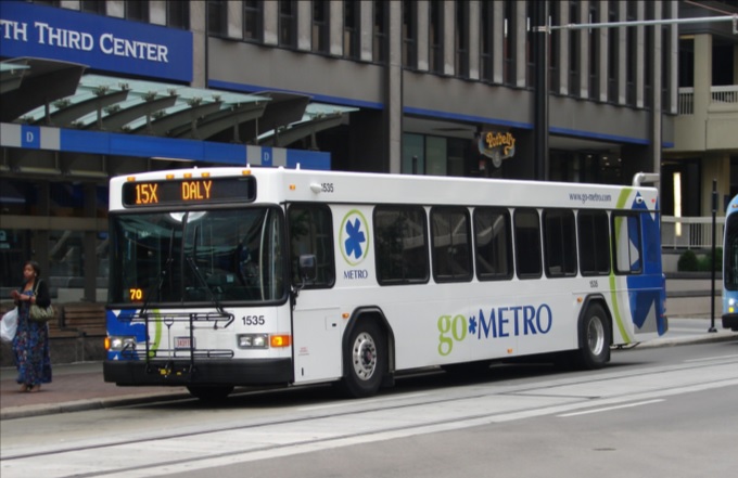
Finally, you are always welcome to step onto a bus at your stop and ask the driver if this bus is going to X location. The drivers are knowledgeable about their routes as they drive them every day and will give you good advice on whether you should take this bus or another route nearby.

How Do I Pay for My Trip?

There are several ways to pay your bus fare with cash, credit/debit card, smartphone app, or stored value card. First, an explanation of the fare system. The fare in Zone 1, which includes the City of Cincinnati, Norwood, St. Bernard, Elmwood Place, Golf Manor, Delhi Township, and Cheviot, is $1.75 per rider. If you will need to transfer to another line to complete your trip, a transfer slip is an additional $0.50. Hot tip: if you are traveling somewhere and anticipate you will be returning by bus within 2 hours of first paying your fare, ask for a transfer and use that to return home. Transfers are good for up to 2 hours after requesting one and this can save you from spending another $1.75 for your return trip. If you are traveling outside of Zone 1 into Zone 2, the rest of Hamilton County, the one-way fare is $2.65 and transfers are still $0.50.

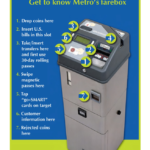
The most basic way to pay your fare is with cash, but keep in mind that the buses’ farebox does not give back change. If you only have singles, you will not be getting a quarter back for buying a Zone 1 ticket. Beyond paying cash you may purchase a stored value card, which you can load up with cash or by credit/debit card at any Ticket Vending Machine and select stores throughout the city. For example, the Clifton Market on Ludlow Ave sells stored value cards. You may put multiples of $10 on a stored value card. Don’t lose your card! Paying for your fare is as simple as swiping your stored value card on the bus, and it will automatically deduct your fare from the card’s balance. This removes the need to carry cash to pay the fare and is much easier and faster to use.

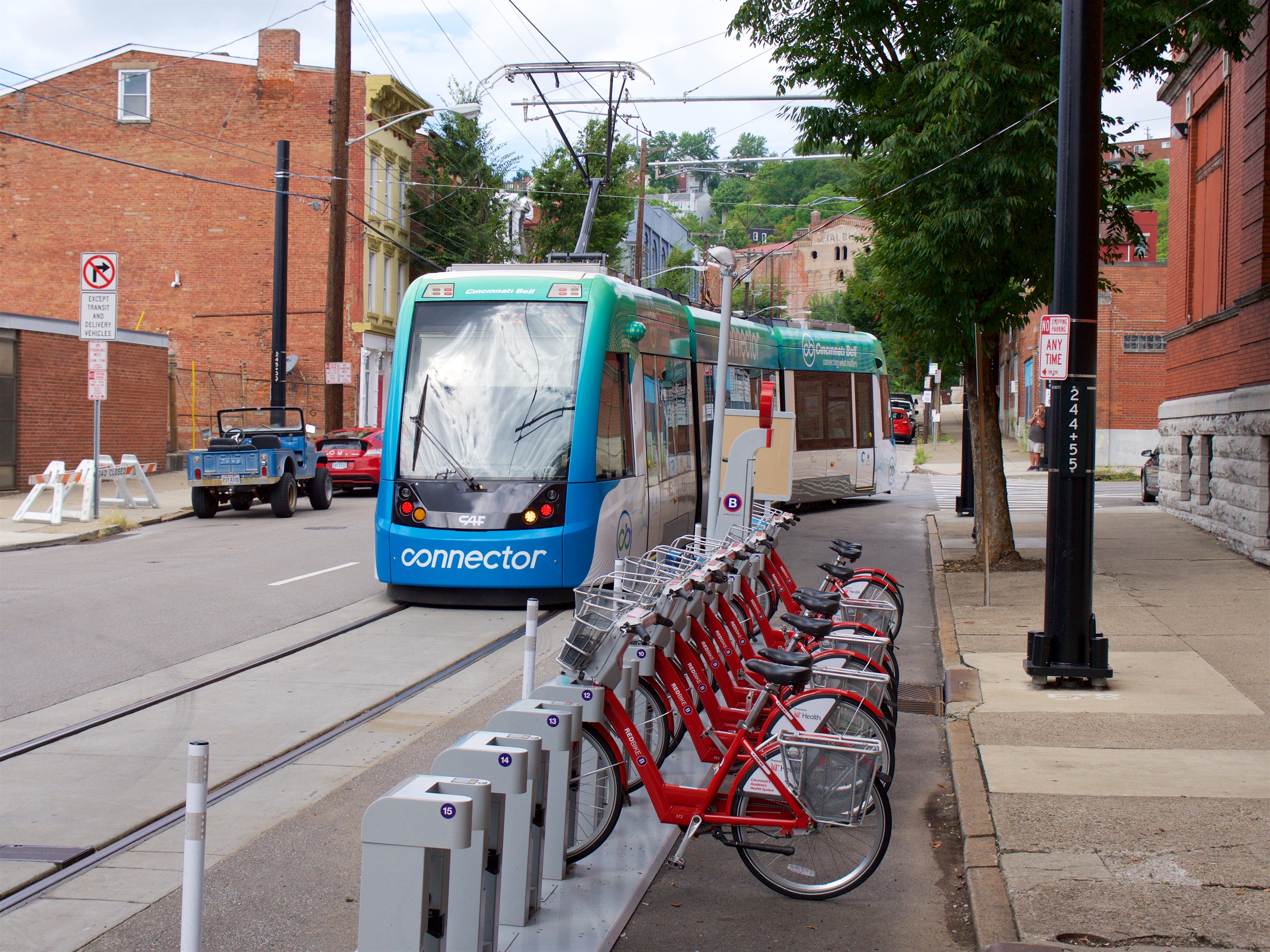
Finally, last year Metro introduced its Metro EZRide app which allows users to pay their fare with their smartphones. Once you have entered your credit/debit card information into the app you may purchase tickets on your phone at any time, to be used at any time. This also includes streetcar tickets. The app is quick enough that you can quickly buy a ticket as your bus approaches the stop if you forgot to beforehand. Simply activate your ticket as you step onto the bus and show the driver your screen. That’s it!

How Do I Not Miss My Stop

Generally speaking, Metro’s buses do not announce the stops they are approaching outside of major stops and transfer points. While some have good spatial minds and generally know where they are at all times, most people need a little help remembering which stop is their destination. I would recommend the Transit app as you can tell it to remind you when you are approaching the stop. Using your GPS location, the app will give you a notification and a ding in your headphones to alert you that you will approach your stop in about a minute. Alternatively, you can ask the driver to tell you when the bus has reached the stop you are going to, although if the bus is full they may be too busy with other passengers to remind you.

When the bus passes the stop prior to your destination stop you must alert the driver to stop the bus by pulling the yellow/grey cord strung up on the walls of the bus, push the vertical yellow tape near the doors, or push the red button on some of the poles coming down from the ceiling. Alternatively, you can yell “THIS STOP PLEASE” to the driver if you would prefer to do it that way. When disembarking the bus, use the back doors to exit so as not to block people entering the bus. This will result in a shorter trip time for everyone aboard.

Useful Links and Pictures

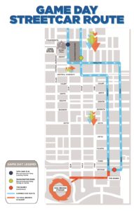
All Route Maps and System Network Maps

Bike & Ride Info

Nate Wessel’s Frequency Map is still up to date, frequencies are generally the same

Categories
News Transportation

Final Designs Revealed for Long-Envisioned Northside Transit Center

One of Cincinnati’s most popular neighborhoods will soon get its very own transit hub.

With more than 13,000 people boarding or exiting buses every day, Northside has long been one of the region’s busiest transit hubs. This is partially due to the neighborhood’s high population and business density, but also because of the numerous transfers from the eight bus routes there (15x, 16, 17, 19, 20, 23x, 27, 51).

This high transit ridership also creates an odd conversion of buses from all over the city. In an effort to clean up the operation of these bus routes, the Southwest Ohio Regional Transit Authority has long been trying to streamline and enhance operations at Knowlton’s Corner.

After years of work, that vision is finally becoming reality with the $320,000 Northside Transit Center.

“Northside has been working to improve bus traffic through the neighborhood for most of two decades, and the pieces are finally falling into place,” said Ollie Kroner, President of the Northside Community Council.

“Metro presented preliminary plans to the community in July. I would say we are a hard group to impress, but their drawings really exceeded expectations,” Kroner continued. “This should be good for commuters, and also good for our business district.”

Its location is further complimented by the nearly location of a large Cincy Red Bike Station at Hoffner Park.

Cincinnati-based MSA Architects has completed its designs for the new transit hub in the heart of the Northside business district immediately south of the recently completed $15 million Gantry Apartments development. The new facility will boast dedicated bus lanes, boarding platforms, passenger shelters, bike racks and lockers, and real-time arrival technology.

The plan also calls for a significant upgrade and expansion of an adjacent parking lot, which SORTA officials envision as also serving as a miniature park-and-ride facility with 18 allocated spaces.

Project officials say that the Northside Transit Center project is expected to be completed by late 2017.

Larger Implications
Northside has become the center point for the city as hit-and-runs with people walking and biking have increased. In September, this even led to the community organizing public demonstrations urging City Hall to reduce the speed limit through the business district, while also committing to other safety improvements city-wide.

The implementation of the Northside Transit Center will significantly help consolidate bus traffic through the popular business district, while also create a safe and hospitable place for people to wait for their transit connections.

“We have the second busiest transit hub in the city after Government Square, in a neighborhood that was built before we had cars,” Kroner told UrbanCincy. “The transit hub should make riding the bus easier, more comfortable, and safer in Northside.”

While the City of Cincinnati has not committed to a Vision Zero campaign, or an official Complete Streets policy, residents continue to call for such measures.

Meanwhile, the move also comes as Metro attempts to reinvent its region-wide bus system in order to better connect people with jobs. Historically, many bus systems relied on what is called a spoke-and-hub system that ran all routes to a central downtown transit center. This train of thought has changed as cities have become increasingly more mixed-use and diverse.

Metro officials plan to unveil a new regional transit plan in early 2017, and may possibly put a transit tax increase before votes next November to help implement the recommendations laid out in that plan.

Categories
News Transportation

Metro’s Bus, Streetcar Services Providing Ample Options For Bengals’ Home Opener

Town Center Garage Streetcar RouteThe Bengals will host their first home game of season this Sunday at Paul Brown Stadium. A capacity crowd is expected to fill the stands, and city leaders are looking to provide a variety of options for fans to easily get to and from the game safely.

One of those options includes the newly opened Cincinnati Bell Connector. Operating from the northern reaches of Over-the-Rhine to The Banks – just two blocks from Paul Brown Stadium – the streetcar vastly expands the reach of those walking to the game from their home or from their car.

As such, City Hall is offering a first-of-its-kind parking special at the Town Center Garage on Central Parkway. Located within two blocks of two different streetcar stations, parking at Town Center Garage will be offered for just $10 on game days; and the first 100 cars will receive four free streetcar passes.

“The Town Center Garage is a natural extension of game day parking options, and its proximity to two streetcar stops makes it a natural fit for fans looking to save money and avoid game day traffic,” said Oscar Bedolla, Director of Cincinnati’s Department of Community and Economic Development.

City officials are encouraging fans to come early on game day to enjoy all the offerings along the Cincinnati Bell Connector route, including the tailgate party at The Banks, watch party on Fountain Square and numerous bars, restaurants and shops throughout Over-the-Rhine.

“What we are looking to do here is take full advantage of the link that the Cincinnati Bell Connector offers from Over-the-Rhine to Downtown, to the benefit of football fans,” Parking Division Manager Daniel Fortinberry said in a prepared statement. “We see this as a fun way for fans to get to and from the game.”

The first weekend the streetcar was open saw more than 50,000 riders take advantage of free service. The second weekend, which coincided with Oktoberfest Zinzinnati, saw more than 29,000 riders pay to ride the Cincinnati Bell Connector. With large crowds expected at the Bengals game and MidPoint Music Festival, another large number of riders is anticipated for this weekend.

In addition to the parking special and streetcar service, Metro has again partnered with Miller Lite to offer free rides on Metro bus service from 7am to midnight this Sunday.

While the special partnership is an effort to cut back on drunk driving, it also offers Cincinnatians a good chance to check out Metro bus service for free – not just going to the game, but anywhere on Metro’s regional system.

“As a transit system, the safety of our customers is always our top priority,” said Dwight Ferrell, Cincinnati Metro CEO & General Manager. “Thanks to Miller Lite, Bengals fans will now be able to enjoy the game even more by letting Metro be their designated driver with free rides to and from the stadium.”

The Bengals (1-1) will take on the defending Super Bowl champion Broncos (2-0) this Sunday at 1pm along the central riverfront at Paul Brown Stadium.

Categories
Business News Transportation

Cincinnati Bell Connector Makes Its Debut With New Branding Scheme

Local transit officials on Tuesday rolled out the first vehicle to bear the colors of the new branding scheme for the Cincinnati Bell Connector. Naming rights for the local rail transit system, formerly known as the Cincinnati Streetcar, have been purchased by Cincinnati Bell.

Under the sponsorship contract, the communications company has agreed to pay $340,000 per year for the next decade. The funding will be used to help cover costs for streetcar operations.

The new graphic scheme for the transit vehicles features the blue and green colors of Cincinnati Bell on the ends of the cars, and above the windows. While some remnants of the original branding scheme remain, the burnt orange color that had become synonymous with the streetcar will entirely go away in time for the system’s opening.

The new branding will be used throughout the system, including on the website, on all printed materials, and on support vehicles. Stations will be rebranded as Cincinnati Bell Connector stations; and several stations already have new signage reflecting the change.

After a photo session for the media, the vehicle departed along Race Street to start regular operations for the day. All five streetcars will display the new branding by the start of regular service on September 9.

Categories
News Transportation

Running Time Adjustments Go Into Effect For 9 Express Metro Routes on Monday

Following the re-routing of numerous express bus routes through the central business district earlier this year, Metro is now also making minor running time adjustments to many of these same routes.

The changes will go into effect on Monday, June 20, and will impact Metro’s express routes to Tri-County (23X), Mt. Lookout (25X), Milford (29X), Montana (40X), West Chester (42X), Sharonville (67), Kings Island (71X), Delhi (77X) and Eastgate (82X).

The Southwest Ohio Regional Transit Authority did not offer an explanation for the changes, but it is normal for the transit agency to make adjustments such as this in order to improve efficiencies or avoid service conflicts.

Commuters looking to adjust their schedules to the new timetables can do so by viewing the new schedules on Metro’s website, or by using one of the real-time transit data apps now available to Cincinnati-area bus riders.