Categories
Opinion Transportation

Redefined Over-the-Rhine Intersection Prioritizes Pedestrians

The following is a guest post by Indianapolis based planner Jeffrey Tomkins with a forward from Micah Paldino, Clifton Heights resident, and founder of creative storytelling agency, Fallon Thatcher. It has been edited lightly.

“With the area in and around Findlay Market expanding with new restaurants, bars, and lifestyle concepts, the neighborhood is primed and ready for a conversation around how we provide a safer and more beautiful experience.

This is timed nicely with ongoing construction of FC’s stadium set to open in March 2021 that will bring even more focus on how pedestrians utilize this space. Visibility for pedestrians at this important, but rather troubling and cumbersome, intersection has always been a pain point when crossing the street and competing with cars.

In this reconfiguration designed by Jeffery Tompkins it lessens the risk for pedestrians by reducing the allowances of turns and creates a calmer environment. This is something we need more than ever as Over-the-Rhine and Clifton Heights become a more singular unit.”

Micah Paldino
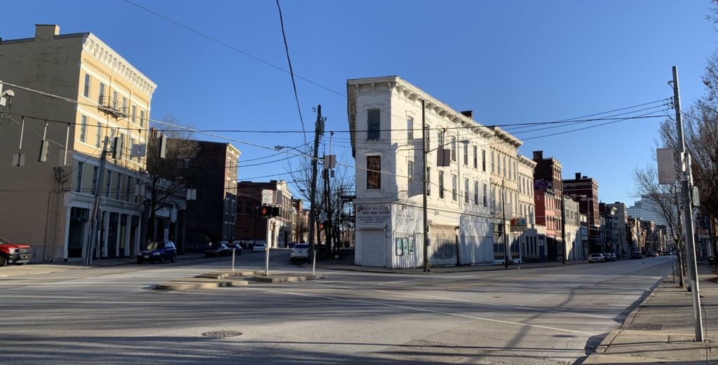
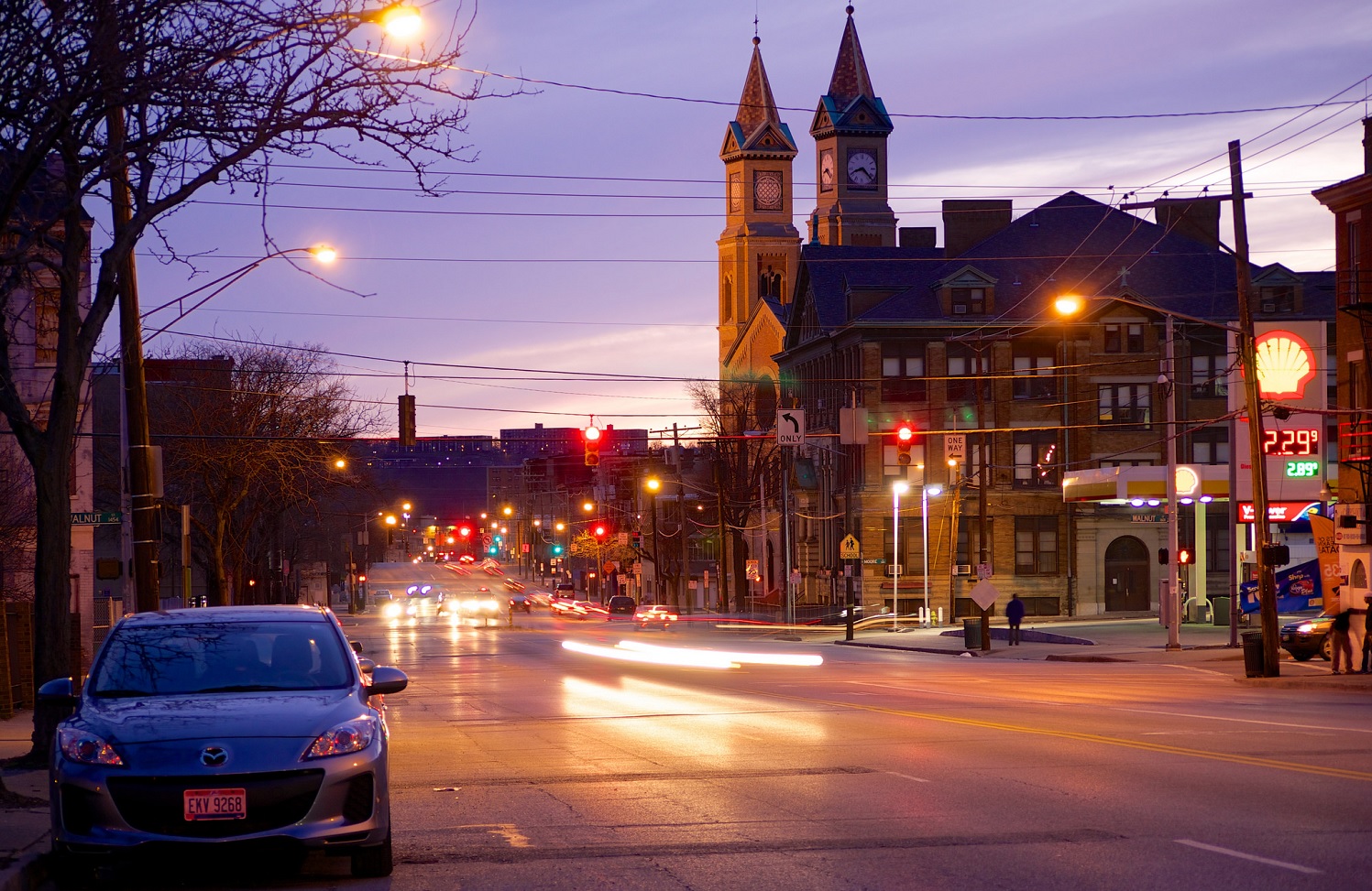
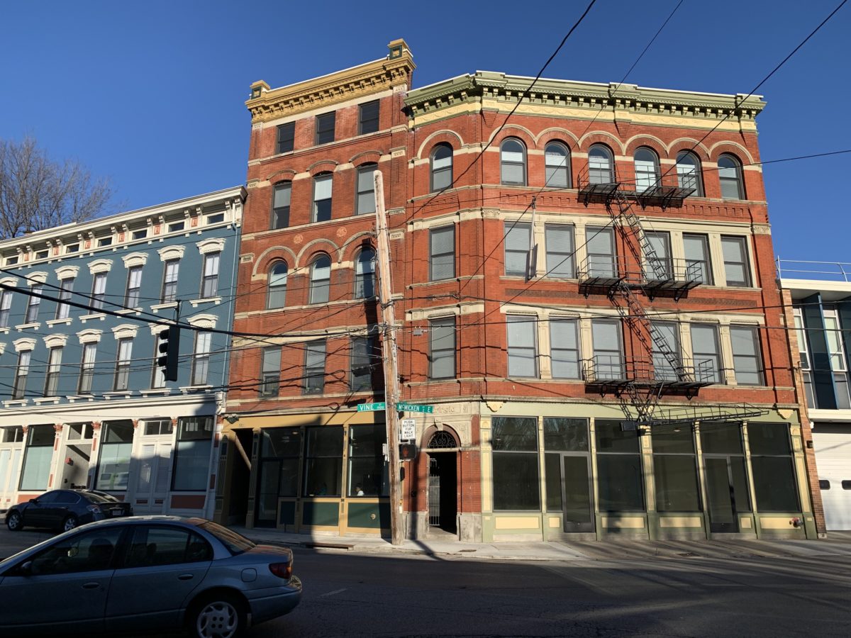
Vine Street and McMicken Avenue today. Photo by John Yung.

The intersection of Vine St. and McMicken St. is one of Cincinnati’s more complicated – and potentially more deadly. While it has been the subject of art, the first search engine result for the five-way intersection lists pedestrian deaths as its biggest story. And this is no surprise: complicated turn radii, low vehicle visibility from a wild angle of incidence, and an antiquated slip lane have created a logistical nightmare for cyclists and pedestrians hoping to cross the intersection.
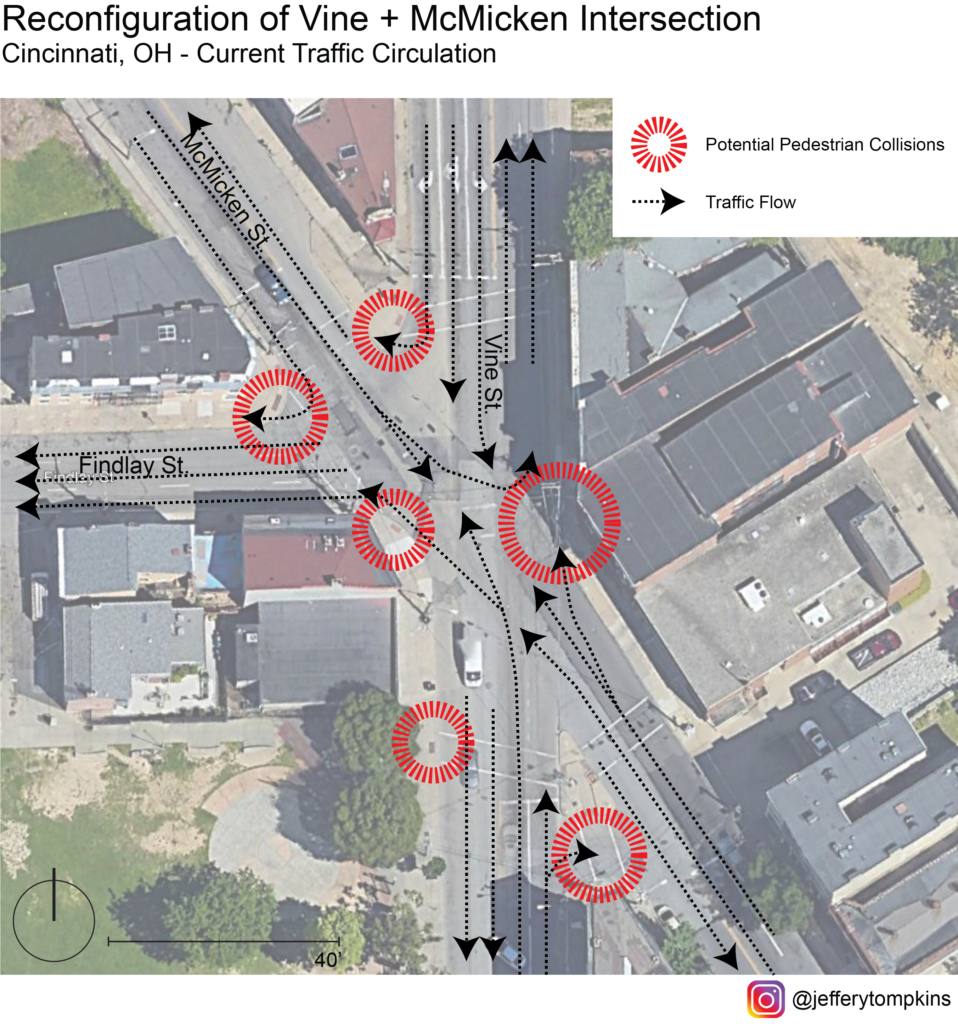
Current Traffic Circulation

Any design intervention hoping to calm traffic and improve mobility at this nexus should account for the district-wide significance of this crossing and, thus, must think in terms of the relevant traffic flow through Vine and McMicken corridors. As it stands, current traffic flow is overly complicated and caters almost entirely to automobiles rather than encouraging pedestrian interaction.

Seen from this map, the wide turn radii and allowance of multitudinous turning options fosters inhospitable conditions for peds, with several critical points ripe for accidents. On top of decreasing pedestrian safety, this wide array of turns also can negatively impact traffic flow and connectivity between adjacent neighborhoods. To fully reconfigure the intersection to allow for smoother traffic flow and safety, traffic flow of the corridor should be reanalyzed and possibly rerouted.

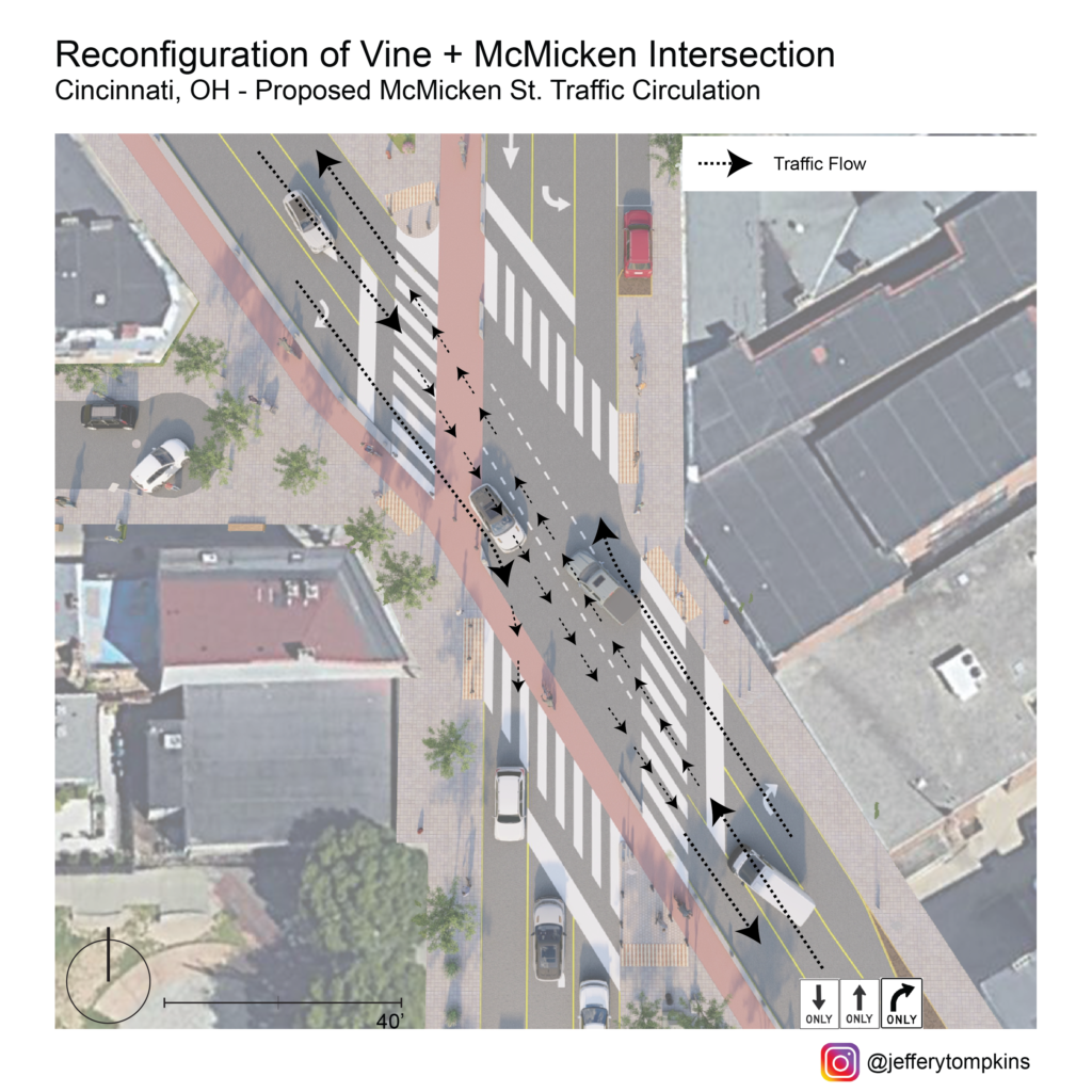
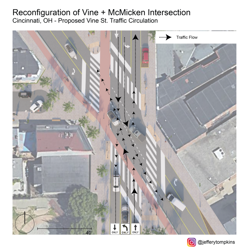
To allow for a complete-streets redesign of Vine/McMicken, my proposal eliminates left turns from McMicken onto Vine and removes right turns from Vine onto McMicken. North-bound traffic on Vine intending to turn right on McMicken would be rerouted to a new two-way Elder St. allowing for southbound travel. South-bound traffic on Vine intending to turn right on McMicken would instead be rerouted south to a two-way Elder and directed north-ward on a reconfigured two-way Race St. north of the Cincinnati streetcar connector, leaving the slip lane redundant. North-bound traffic from McMicken onto Vine would be routed south from Pace to Elder and then north on Vine. South-bound traffic from McMicken to Vine would instead utilize Elder as a conduit between the two streets. While this reconfiguration could create inconveniences for residents in the near-term, it is with a long-term eye toward saving pedestrian lives that makes it worth it. Atop this, the redesign hopes for slower traffic, improvements in overall traffic flow with elimination of one-ways, and a reduction in accidents.
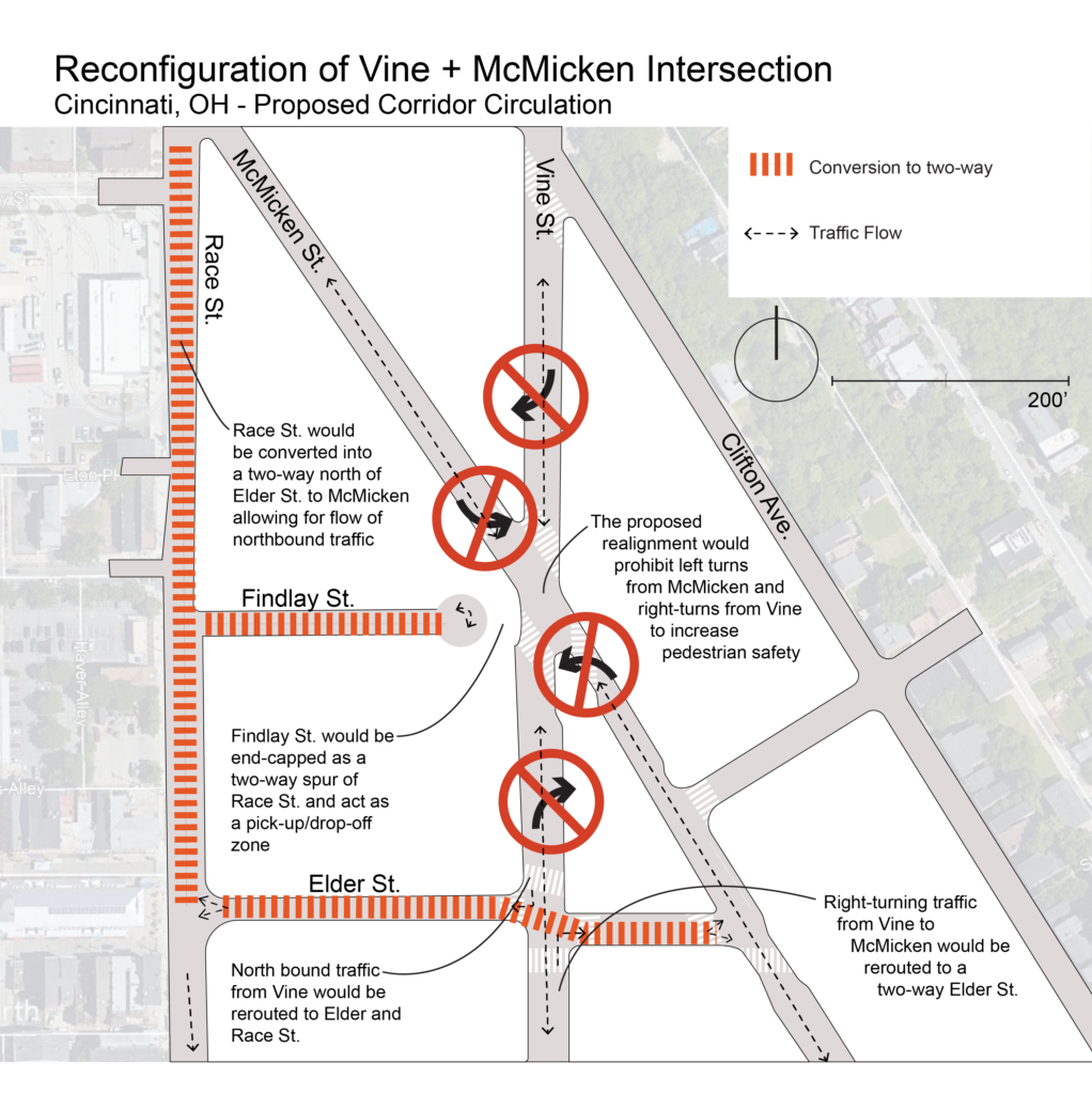
Corridor Flow Map

Aside from turn-regulation at the intersection, my proposal forVine/McMicken involves the capping of Findlay St. to eliminate the five-way and diminish incidence points. With this reclaimed space from the new configuration and removal of slip lanes, public space would be created, and pedestrian sightlines would be vastly improved at the new four-way intersection. 
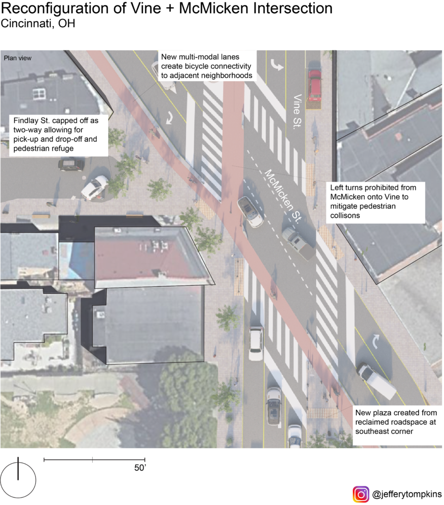
Plan View

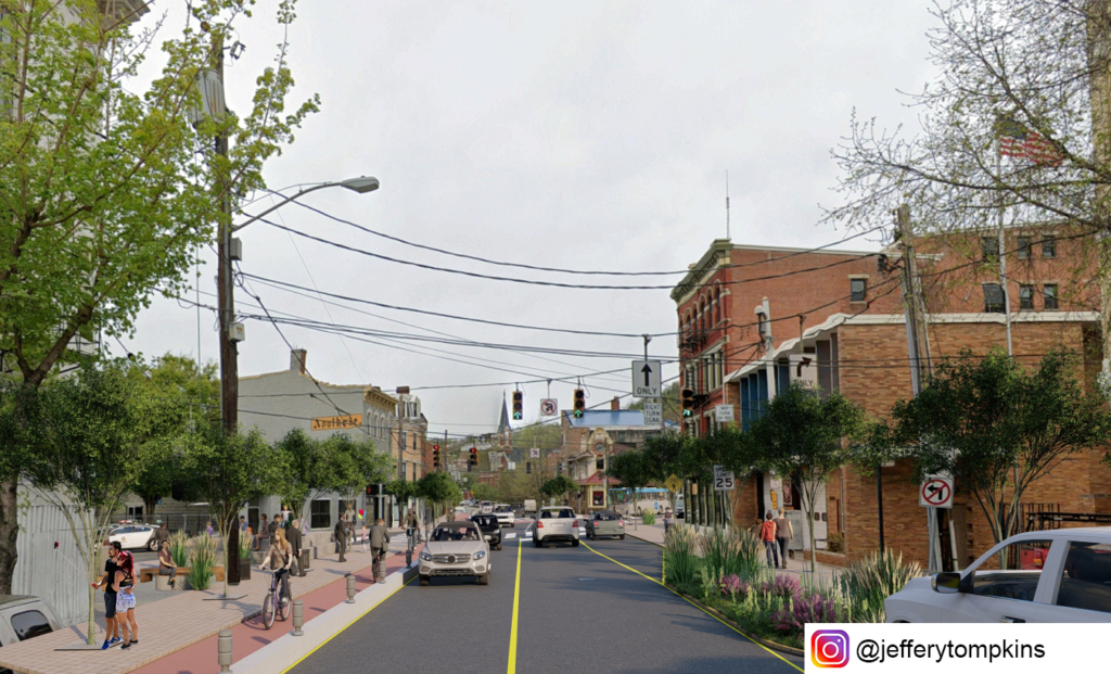
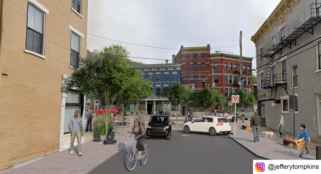
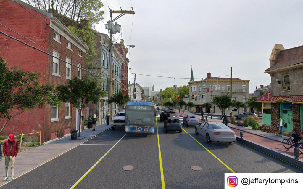
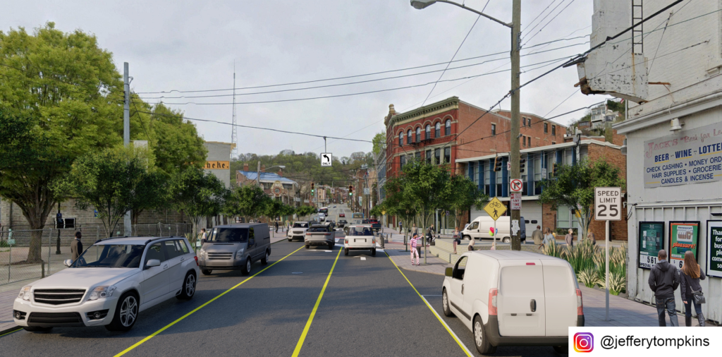
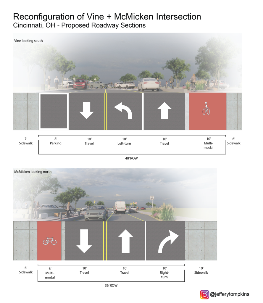
The new configuration calls for a reduction in vehicular space and the inclusion of multi-modal lanes catering to mid-speed travel (bicycle, scooter, powerchair, etc.) along Vine and McMicken. The reclaimed slip lane at the southeast corner would be reallocated as a public plaza and pedestrian sanctuary protected by bollards and activated by food carts or public art. A 6’ multi-modal lane along McMicken would improve connectivity for bicyclists along the corridor and offer a commuting solution for Over-the-Rhine residents. The 10’ multi-modal lane along Vine would take the place of the current right-turn lane and give a north-bound option for bicycle connectivity. One side of street parking would still be retained north and south of the intersection on both streets. The capped-off Findlay St. would become a possible pick-up and drop-off zone for rideshare and Uber/Lyft.
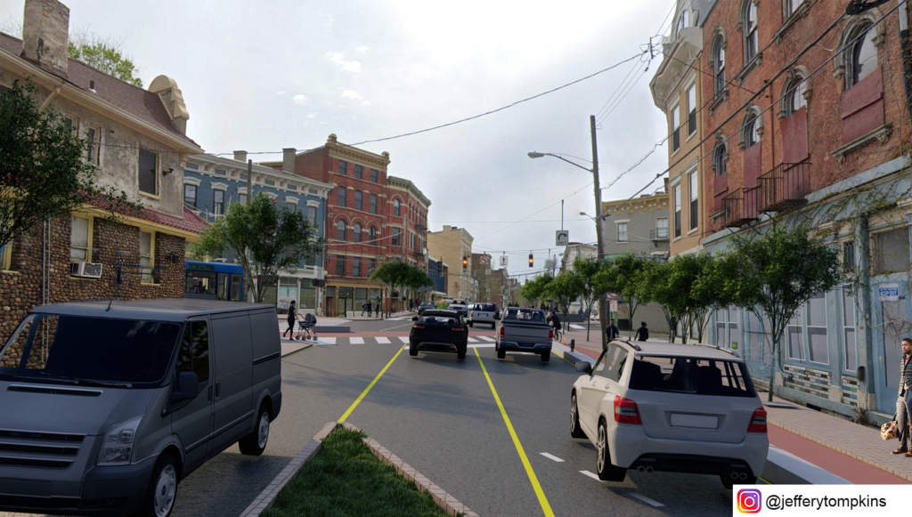
Aside from fostering pedestrian safety and increasing bicycling viability, the redesigned intersection vastly improves overall traffic flow with its reduction in turns. This may offset future rates of accidents. While the reconfiguration would affect bus routes 46 and 78 currently turning from south-bound Vine onto Findlay to get to Race St. SB, the new configuration would allow for bus travel on the newly designated two-way Elder St, with traffic stop bars pushed back to allow for bus travel.
If you would like to have your thoughts and opinions published on UrbanCincy, simply contact us at editors@urbancincy.com.
Categories
News Opinion Transportation

EDITORIAL: City Should Move Forward on Liberty Street

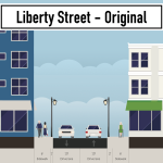
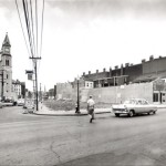
Liberty Street was originally built as a typical 30 foot wide city street, but was widened to 70 feet in 1955 to serve as a connector to Interstate 471 and Reading Road. The widening required a significant number of building demolitions and physically severed the neighborhood into two halves. Over the past fifteen years, as the southern half of OTR has redeveloped, the northern half has seen much less investment–and most of this has been in the area around Findlay Market, not along Liberty Street.

It is uncomfortable as a pedestrian to cross Liberty Street, as the walk light changes almost immediately to a countdown timer, and it takes about a half a minute to cross walking at an average speed. The current design, at 7 lanes wide, is optimized for speeding cars and is wholly inappropriate for a dense urban neighborhood like Over-the-Rhine.

Liberty Street is too wide and the City knows it. At an open house event in 2015, the City of Cincinnati first proposed a “road diet” for the street. Over the next several years, they facilitated several community input sessions regarding what came to be called the Liberty Street Safety Improvement Project. Each of these meetings was held at the Woodward Theater for a packed audience of people who live, work, or spend time in Over-the-Rhine. Members of the community spoke about the need to make Liberty Street safer for all people, including pedestrians, bicyclists, and transit riders–not just drivers.

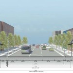
DOTE staff took the community input into consideration and ultimately presented their final plan to OTR Community Council on October 23, 2017. The plan called for removing two lanes from the south side of Liberty Street, reducing the crossing distance for pedestrians and discouraging excessive speeding. Additionally, this will free up land for new development along the south side of the street, providing space for new housing, retail, or office space.

As of June this year, the project was set to go out for bid this fall and begin construction in 2019, according to the city’s website.

Unfortunately, in August, the City Administration decided to “pause” the Liberty Street Safety Improvement Project because of concerns about the traffic that will be generated by the new FC Cincinnati stadium in the West End and a sudden concern about how the installation of a new water main would be funded.

The Liberty Street plan, which has been in the works for years, has now been mothballed because of a stadium plan that didn’t exist until a few months ago–publicly, at least. To make matters worse, City Council previously denied the OTR Community Council’s request to be involved in the stadium’s Community Benefits Agreement, saying that OTR would not be impacted by the stadium; but now seems that Over-the-Rhine may be negatively impacted by the cancellation of the Liberty Street Safety Improvement Project.

The City Administration’s concern about traffic is bizarre, as the narrowed Liberty Street would maintain five lanes of traffic during peak traffic times, the same number of travel lanes that exist today. Typically the outer lanes would be used for parking during off-peak periods, but the city could install “no parking” signs on game days. Therefore, the impact on traffic through the neighborhood would be minimal or non-existent.

As for the water infrastructure, that can be solved through a mix of council and departmental leadership. An example of that is a potential solution presented by Councilmember P.G. Sittenfeld to use the money from the sale of the Whex garage to plug the budget gap.

We urge the City Council to keep the city’s promise to the Over-the-Rhine community and pass legislation requiring the City to follow through with the Liberty Street Safety Improvement Project.

Categories
Business Development News

Christmas Came Early for Southwest Ohio Developers, Historic Preservationists

The Ohio Development Services Agency provided developers and historic preservationists around the state with an early Christmas present when they announced 18 projects that would receive Ohio Historic Preservation Tax Credits.

In total, the tax credits are worth $22.8 million and are expected to spur $225.6 million in private investment.

“A community’s historic buildings make it unique,” said David Goodman, director of the ODSA. “Giving a building new life honors the history of the building, while creating construction jobs in the short-term and opportunity for economic activity in the future.”

In recent years southwest Ohio had fared extremely well in the competitive bid process for the funds, and this round proved to be much of the same. This group of winning applicants includes five from Cincinnati, one from Hamilton, and two from the Dayton area.

One of the Dayton projects was the winner of one of the state’s two prestigious $5 million awards. That money will go toward the $46 million United Brethren Building project in downtown Dayton, which will transform the long-vacant, 112-year-old building into 164 apartments.

While the Cincinnati-region had the most number of awarded projects, most of the tax credits were small in size. Four projects, three located in Over-the-Rhine and one in Hamilton, received amounts ranging from $150,000 to $250,000. While small in scope, the projects will save numerous historic structures from demolition, while also creating dozens of residential units and commercial space.

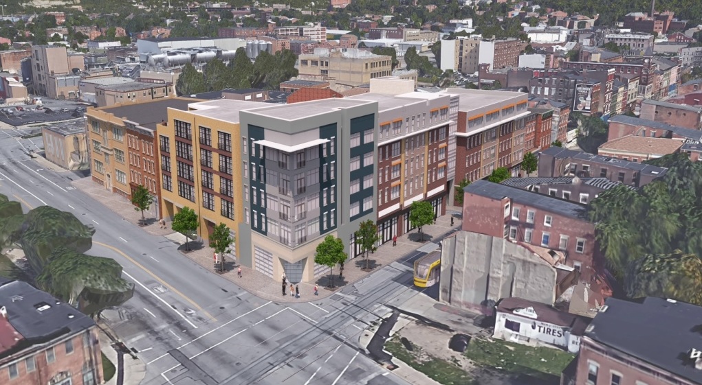
The long-debated Freeport Row project, located at Liberty and Elm Streets, received a sizable $1,358,772 tax credit to help restore five historic structures as part of the overall $25 million development. Once complete, the project is expected to yield 110 apartments, 17,000 square feet of retail, and a total of 100,000 square feet of new construction on the vacant lots surrounding the historic structures.

Just blocks north of Freeport Row, along the Cincinnati Bell Connector, is another project that took home the largest tax credit in Cincinnati. Market Square III was awarded with $1,690,000 in tax credits and push forward the latest phase of Model Group’s massive redevelopment efforts surrounding Findlay Market.

Market Square III will renovate eight historic structures, most of which are currently vacant, to include street-level commercial space with 38 apartments in the upper floors.

Categories
Development News Transportation

DOTE Hosts Final Open House for Liberty Street Narrowing Alternatives

The City’s Department of Transportation and Engineering will present the final two design alternatives for consideration at its third public open house tomorrow night at the Woodward Theater. The study which began in 2013 as a Complete Streets initiative proposed by the OTR Brewery District Master Plan now lives on as a proposal to physically narrow the street by ten to twenty feet on the south side. The new land could potentially unlock development sites along the street.

In its original configuration Liberty Street was once the dividing line between unincorporated territory and the city of Cincinnati. It was a narrow street with enough room for parking and less than two full lanes for traffic. In 1959 the City began to demolish properties along the south end of the street to widen the street to seven vehicle lanes and two parking lanes. The once quiet side street became a thru-way for automobile traffic looking to connect to the interstates and Central Parkway.

As revitalization progresses in Over-the-Rhine renewed attention is being paid to the street. The narrowing is an attempt to stitch back the fabric of the north and south halves of the neighborhood. Because of its configuration it is difficult for pedestrians to cross the street in the provided amount of time and bicycling is unsafe due to the high volume and speeds of automobile traffic.

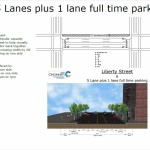
Initial configurations were many ranging from a restoration of the original street width to preserving the current set up. In between proposals called for a reduction to four or five lanes with bicycle lanes or rush hour traffic configurations. After two subsequent meetings the options are down to two: A five-lane and a six-lane configuration. Input taken from this open house will be used to narrow down to the final alternative. Once that alternative is selected it will be presented for adoption at the Over-the-Rhine Community Council in September.

The meeting is this Tuesday evening, 6PM at the Woodward Theater on Main Street in Over-the-Rhine. The Theater is accessible by the #17, #19 and #24 Metro bus routes, and is within 100 feet of a Cincy Red Bike Station located at Main Street and Orchard Street.

Categories
Up To Speed

Cincinnati’s business community supports idea of putting Liberty Street on ‘road diet’

The discussions continue about whether or not to reduce the massive width of Liberty Street through Over-the-Rhine. If it is decided to reduce its size, the question then becomes by how much.

So far, neighborhood residents have been quite consistent in their support for reducing Liberty Street’s width. As of now, residents appear to be supportive of a plan to reduce it by 20 feet, while other neighborhood groups want it to be reduced by even more to allow for dedicated bike facilities and more developable land along the street’s southern side.

In an informal poll, the Business Courier recently asked their readers if they supported the idea of reducing the width of Liberty Street. The response from the city’s business community was overwhelming, with 78% of respondents saying that they support the idea.

More from the Business CourierDo you the support plan to shrink OTR’s Liberty Street?