Categories
Development News Transportation

Hamilton Looking At Possibility of Developing Urban Trail on City’s West Side

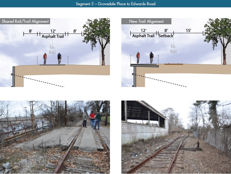
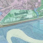
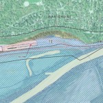
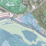
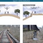
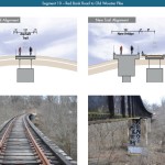
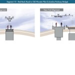
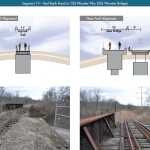
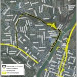
The City of Hamilton is looking at the possibility of acquiring approximately 36.5 acres of land from CSX Corporation following its filing for abandonment of the former freight railroad. If city officials ultimately decide to proceed with the purchase, the plan will be to turn it into an urban bike and pedestrian trail on Hamilton’s inner west side.

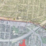
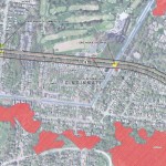
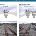
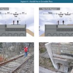
Running from CSX’s main line in Millville to the former Champion Paper Mill, which is in the process of being redeveloped into a youth sports and entertainment complex, the property also includes a former railyard near the Great Miami River at Two Mile Creek.

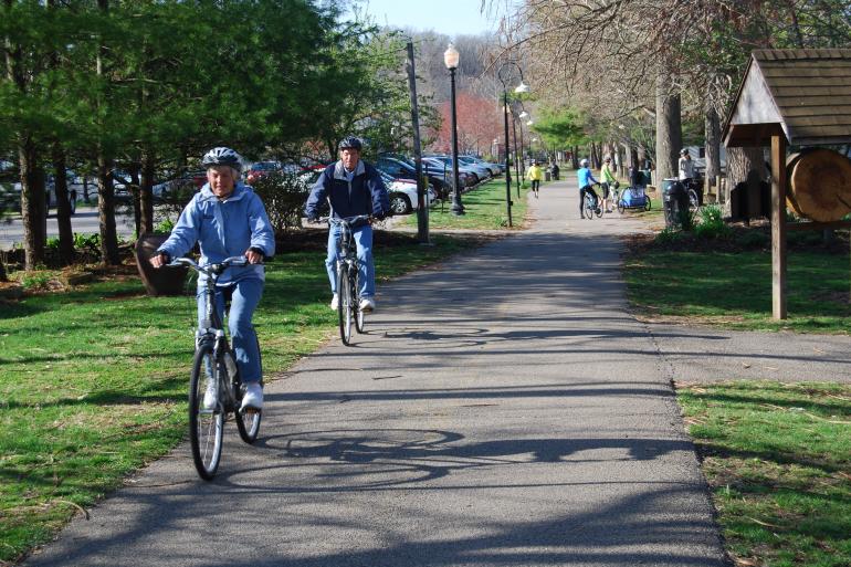
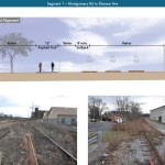
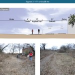
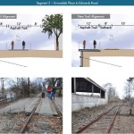
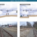
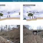
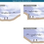
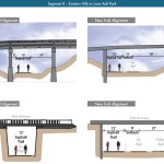
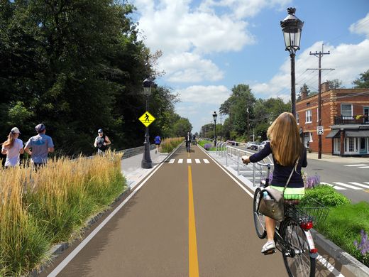
Hamilton’s west side neighborhoods currently lack any protected bike lanes or off-street bike paths. As a result, the possibility of adding such an amenity has community leaders excited.

“The proposed Beltline trail will be of great value to our community,” said Hamilton Councilman Rob Wile. “By connecting these neighborhoods to our existing trail infrastructure we open up a number of convenient outdoor recreational opportunities to our residents.”

Earlier in the year city officials hosted public hearings to gather feedback on the concept, and are continuing to gather feedback through an online survey. The results, they say, will help determine whether they should ultimately pursue the project.

“The survey lets the City know what kind of benefits residents see in the trail, how often they may use it, what potential negative aspects or problems may occur with it; and is being used to see what generally the public thinks about the potential trail,” Nicholas Garuckas, City Management Fellow inside Hamilton’s Office of the City Manager, explained to UrbanCincy.

“The [survey] results are carefully being looked at and considered in helping determine whether or not the City should be moving forward with this project or not.

In the meantime, Garuckas says that City Hall is moving forward with an appraisal of the land’s value, along with assessing the possibility of various grants from agencies like the Ohio Public Works Clean Conservation Fund, Rails to Trails Conservancy, Dopplet Family Fund, Ohio Department of Natural Resources Clean Ohio Trail Fund, and Recreational Train Fund.

The project follows a pattern of other more marque urban trail projects around the country that are transforming former industrial rail corridors into park and recreation space for under-served urban communities.

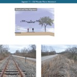
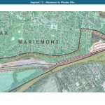
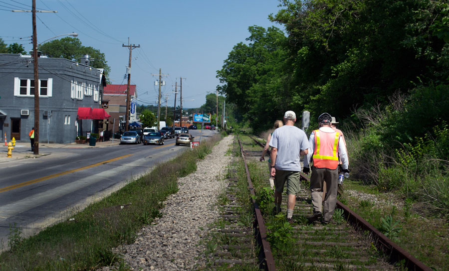
Last June, Chicago celebrated the opening of its 2.7-mile trail called The 606. Atlanta, meanwhile, has been opening segments of its much larger 33-mile BeltLine project in phases over recent years. Nearby, in Cincinnati, city officials are poised to acquire an abandoned 7.6-mile freight rail line in its eastern neighborhoods for what is being called the Wasson Way project.

While smaller in scope, the approximately 2.7-mile Hamilton Beltline has, at least initially, has gained the support of Hamilton City Council, and is rooted in the city’s planning documents. In fact, city officials explain that the idea for the project came out of discussions about what to do with the Champion Paper Mill complex and surrounding areas.

“This project is part of the bike path master plan and it will be an asset to all those who enjoy the outdoors including walkers and joggers,” Wile concluded.

If Hamilton is successful in acquiring the land, it would add significant recreational facilities and new transportation options to the city’s west side. If abandonment proceedings continue without Hamilton moving to purchase the property, it will instead be sold off in piecemeal fashion to private owners.

Categories
Arts & Entertainment News Transportation

Area Organizations Teaming Up to Encourage Active Transportation This Spring Season

Tri-State Trails is aiming to encourage the public to get outdoors with the Opening Day on the Trails Challenge – a seven week series of hikes, group bike rides, and other events on trails and in parks throughout the Cincinnati region.

The challenge starts with an event at Sawyer Point from 12pm to 5pm on Saturday, April 16, which is also Earth Day.

The Opening Day on the Trails Challenge is part of a national kickoff by the Rails-to-Trail Conservancy to promote the spring outdoor season. Running from mid-April to early June, the challenge overlaps with National Bike Month in May.

Information on the challenge can be found online at MeetMeOutdoors.com. Participants can register on the website, and sign up to receive email newsletters and social media alerts. A Trails Challenge Passport is also available for download. To participate, individuals and families attend group events, which are listed on a schedule included with the passport. Attendance at activities is logged on the passport, and those who attend at least one event are eligible to win a prize.

Organizers say that the challenge will conclude with an award ceremony on National Trails Day on June 4 at the Purple People Bridge. Participants who complete the challenge will receive a Nalgene water bottle and other items. A raffle will also be held to award prizes, donated by local businesses and Cincy Red Bike, to registered participants.

Tri-State Trails, a program of Green Umbrella, is the local host of the challenge, and is hoping it will encourage more people to get out and explore the region’s network of bike paths and trails.

Wade Johnston, Regional Trails Coordinator for Tri-State Trails, sees the event as an opportunity to showcase not only the many multimodal trails in the Cincinnati region, but also the hiking and mountain biking trails. Tri-State Trails has been told by the Rails to Trails Conservancy that the Challenge in the Cincinnati region is the largest and longest program of any opening day trail event in the United States.

Johnston told UrbanCincy that public support and usage of the region’s trail system is increasing, citing the Cincinnati Connects plan, and efforts to expand the Mill Creek Greenway, Ohio River Trail, and Wasson Way.

The Opening Day on the Trails event is supported by a $25,000 grant from Interact for Health. While this is the first year for this event in Cincinnati, it is intended to be an annual event in the future.

Green Umbrella’s Outdoor Event Series will continue through the summer with the Kids Outdoor Adventure Expo on July 22 at Winton Woods Harbor, and the Great Outdoor Weekend on September 24 and 25 at a variety of locations around the Cincinnati area.

Categories
Development News Transportation

KZF Releases Preliminary Designs, Cost Estimates for Wasson Way

A newly released feasibility study, produced by KZF Design, finds that construction of the 6.5-mile Wasson Way Trail would cost anywhere from $7.5 million for just a trail to $36 million for both a light rail line and trail totally separated from one another.

The cost estimates vary so much due to the three potential design options studied. The lowest cost alternative looked at placing a 12-foot-wide trail along the entire existing rail alignment. This, however, would make the inclusion of a future light rail line extremely difficult.

The most expensive alternative would construct an entire new trail alignment that does not interfere with any existing rail right-of-way. This would include the construction of several new bridges and completely preserve the ability to easily construct the long-planned light rail line adjacent to the new trail.

Alternative B, which was recommended by KZF and priced at $11.2 million, was a bit of a hybrid. It would include a 12-foot-wide trail offset from the existing rail alignment, but utilize existing rail right-of-way at pinch points along the corridor.

The 45-page study is the first detailed look at the corridor, which has been hotly debated and discussed over recent years. Much of the controversy has surrounded whether or not both light rail and a trail can be accommodated. KZF’s findings appear to show that much of the corridor could in fact accommodate both, but that some segments may prove to be difficult, albeit feasible.

If project supporters are able to advance the trail plan, KZF estimates that it would connect eight city neighborhoods and approximately 100,000 residents with an overall network of more than 100 miles of trail facilities.

“It is hard to build in the urban core, and to find an intact corridor ripe for development is a unique thing,” explained Eric Oberg, Manager at the Midwest Rails to Trails Conservancy. “If this is done right, this can be the best urban trail in the state of Ohio. I have no doubt.”

Some of the most difficult segments of the corridor are the nine existing bridges where the right-of-way is extremely limited. If both light rail and trail facilities are to traverse this corridor together, additional spans will be needed in order to have safe co-operation.

In addition to introducing what may become the region’s best urban trail and light rail corridor, some proponents also see it as an opportunity to fix other problems along the route. Most notably that includes the congested and confusing intersection of Madison, Edwards and Wasson Roads near Rookwood Pavilion.

While the newly released feasibility study offers the most detailed analysis of this corridor to date, the City of Cincinnati has yet to close on its purchase of the former freight rail line from Norfolk Southern.

City officials are reportedly in negotiations with Norfolk Southern now, and have made an initial offer of $2 million. In April, Mayor Cranley’s Administration also allocated $200,000 to the project.

Categories
Development News Transportation

UrbanCincy, Niehoff Studio to Host Regional Discussion on Wasson Corridor

In May 2013, UrbanCincy partnered with the Niehoff Urban Studio to produce an event that highlighted the final work of engineering and urban planning students studying bus rapid transit and bikeways throughout the region. We then showcased their work and engaged the capacity crowd with a panel discussion between some of the region’s foremost experts on the subjects.

One of the hot topics at that event was the Wasson Corridor, which runs through the heart of Cincinnati’s eastern neighborhoods.

The Future of the Wasson Way Bike Trail and Light Rail Corridor

The corridor has long been in regional transit plans as the location for a light rail line, but recent advocacy efforts have been working to convert the abandoned freight rail right-of-way into a recreational trail for bicyclists and pedestrians.

Following UrbanCincy’s controversial editorial opposing the corridor’s conversion into a bike/ped trail, the conversation has shifted to one focused on creating a multi-modal corridor that accommodates the long-planned light rail and the newly envisioned recreational trail.

The next stage of that dialogue will occur this Thursday back at the Niehoff’s Community Design Center in Corryville.

Over the past semester, interdisciplinary students from the University of Cincinnati have been studying the Wasson Corridor and will be presenting their work at this event.

Following the open house where guests can view the final projects, UrbanCincy will then host a panel discussion with Michael Moore, Director of Cincinnati’s Department of Transportation & Engineering (DOTE); Eric Oberg, Manager of the Midwest Rails to Trails Conservancy; Mel McVay, Senior Planner at Cincinnati DOTE; Nern Ostendorf, Executive Director of Queen City Bike. The discussion will be moderated by UrbanCincy’s Jake Mecklenborg.

The event is free and open to the public. The open house portion of the evening will take place from 5pm to 6pm, and the panel discussion will follow immediately at 6pm and go until about 7:30pm.

Light food and refreshments will be provided and a cash bar will be available during the open house. The Niehoff’s Community Design Center can be accessed directly off of Short Vine at the southeast corner of Daniels and Vine Street.