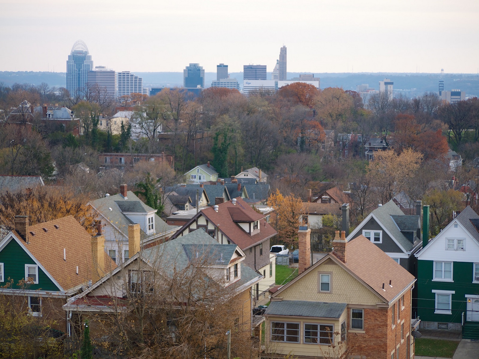
Recent data released by the Brookings Metropolitan Policy Program shows that Cincinnati’s middle class slightly worse off than its Midwestern peers, but is about on pace with the national average.
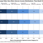
The study, which categorized individual metropolitan areas and gave regional averages, ranked each city’s population based on six household income categories: Bottom 20% ($21,433 and below); Second 20% ($21,433-$41,109); Middle 20% ($41,110-$65,952); Fourth 20% ($65,952-$106,100); Next 15% ($106,100-$200,000); and Top 5% (Above $200,000).
Cincinnati’s percentage of households making less than $21,433, 34.9% of the city’s population, is significantly higher than the Midwestern and national average 25.1% and 20%, respectively. It is also significantly higher than Pittsburgh (27.9%), but lower than Cleveland (43.2%).
The percentage of households in the middle class (I defined this as the Second 20% and Middle 20%), however, is mostly even. Pittsburgh’s middle class population stands at 41.1%, with Cincinnati at 40% and Cleveland at 39.2%. Cincinnati also stands in the middle when it comes to the upper class, with Pittsburgh again leading and Cleveland trailing.
When compared with the rest of Ohio’s cities with more than 100,000 people, Cincinnati is found to have the highest percentage of Top 5% households, while also having the third highest percentage of Bottom 20% households. This, researchers say, follows a national trend where large cities are over-represented in both categories.
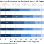
A perhaps startling trend is just how poor so many people are across the Midwest and Ohio.
Of Ohio’s four cities with more than 100,000 people, three of them – Cleveland (#2), Toledo (#4) and Cincinnati (#5) – all rank near the top in terms of the highest percentage of their residents falling within the Bottom 20%. While Columbus comes in at #29, this may be due to the city’s large municipal boundaries that account for areas that would in no way be considered part of any of the other three cities.
While, on average, the study found that Midwestern cities tend to have more low income households, and significantly fewer upper class households than the rest of the nation, it also found that Western and Northeastern cities each have high populations of those making over $200,000, although the Northeast has the highest percentage of households making under $21,433.
Researchers did note, however, that these numbers change somewhat when adjusting for cost of housing across metro areas.
Alan Berube, author of the study and a senior fellow and deputy director at the Brookings Metropolitan Policy Program, also noted that despite media portrayals of some cities being entirely poor, and others being entirely wealthy, virtually all American cities still boast a large middle class.
When discussing regional transportation issues, the topic seems to always be about congestion. In reality, outside of a few limited periods, the Cincinnati region has relatively good traffic flow with little actual congestion. So instead of trying to solve a problem that does not exist, we should be instead focusing our resources on maintaining our current system and improving mobility within the overall region.
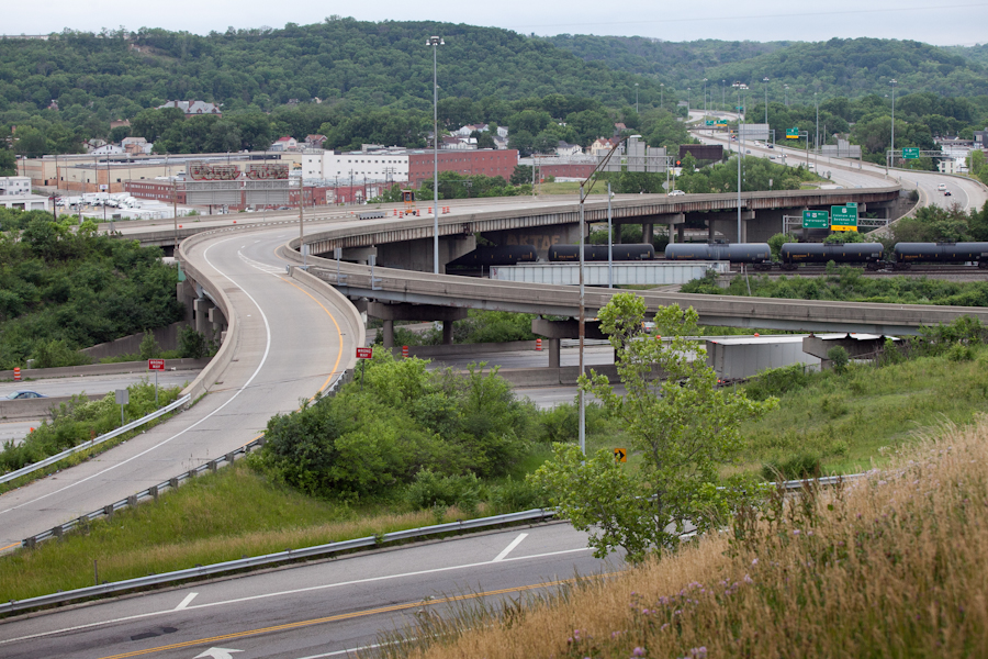
As is the case in any city, the natural environment often serves as a chokepoint and barrier to regional mobility. This is true for Cincinnati with its hills and rivers.
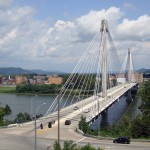
With the region’s population largely centered along the Ohio River, it is natural that this is where the most choke points exist. Outside of the center city, however, there are very few river crossings. In fact, there are only two Ohio River crossings outside of the center city, and both of those are for I-275.
One such area that makes sense for a new local road bridge is around Cincinnati’s Columbia Tusculum neighborhood and Dayton, KY near where the $400 million Manhattan Harbour project is planned.
An increasing amount of development continues to occur on the northern bank of the river in Columbia Tusculum and East End. Further up the hill sits prosperous neighborhoods like Mt. Lookout, Hyde Park, and Oakley; and just around the bend lies Lunken Airfield.
Conversely, on the south side of the river in Kentucky, large-scale development projects have long been envisioned, but are often derailed due to poor access via existing roadway networks. This remains true for Manhattan Harbour where concerns exist about the traffic burden that would be placed on the narrow KY 8 running through historic Bellevue’s quaint business district.
A local road bridge that is one lane in each direction with space for pedestrian and bicycle paths would be an ideal fit for this area of the region. It would improve mobility and access to two difficult-to-access areas. It would also offer a highway alternative for those looking to cross between the two states.
A second location where a local bridge of this nature would make sense is near where the Anderson Ferry currently operates today on the city’s west side.
The Cincinnati-Northern Kentucky International Airport sits on the southern side of the river where this bridge would land. This area continues to be bolstered by warehouses, distribution facilities and other airport-related services, and could be further bolstered with better access. What’s more, Cincinnati’s western neighborhoods that have long had to deal with excessive airplane noise, yet long treks to the airport, could at least resolve one of those injustices with a new local access bridge.
U.S. Grant Bridge [Terry Johnson]
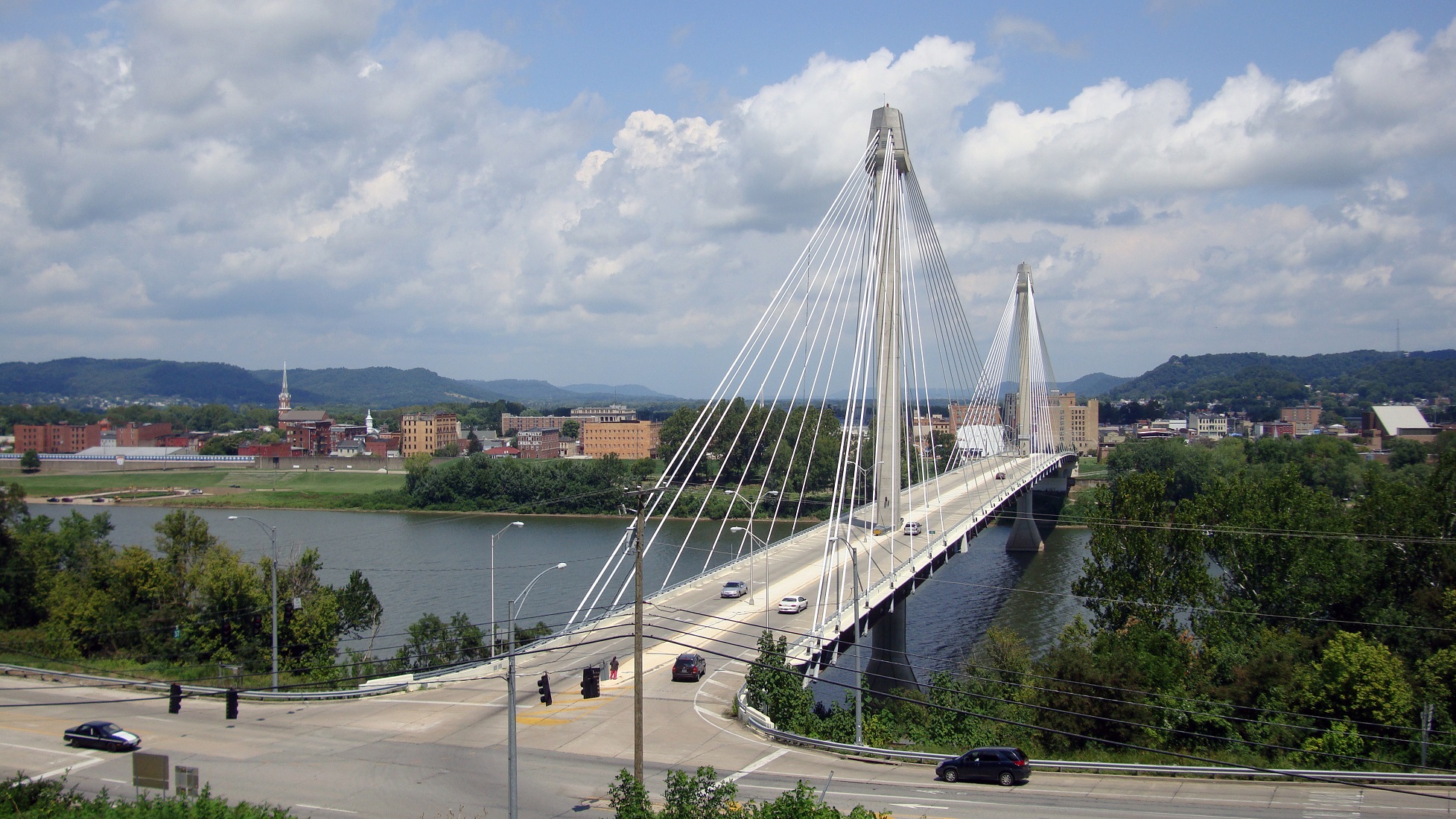
The Taylor-Southgate Bridge is the most recent span that has been constructed over the Ohio River. It was completed in 1995 and cost $56 million at that time – approximately $85 million when adjusted for inflation. Both of these new bridges would need to span an approximate 1,700-foot-wide width, which is about 300 feet more than the Taylor-Southgate Bridge river width.
One of the main differences, however, is that the Taylor-Southgate Bridge includes two lanes of traffic in each direction, plus sidewalks. The need for only one lane of traffic on these bridges would allow them to have a deck width of around just 30 to 35 feet.
Another good nearby comparison is the U.S. Grant Bridge in Portsmouth, OH. That cable-stayed bridge was completed by the Ohio Department of Transportation in 2006 for approximately $30 million – or about $35 million in today’s dollars.
In addition to access and mobility improvements for motorists, a new bridge in both of these locations would also be a boon for cyclists. Those riding along the Little Miami Scenic Trail and the Ohio River Trail would now also be able to continue on to Northern Kentucky’s Riverfront Commons Trail, which will eventually stretch 11.5 miles from Ludlow to Ft. Thomas.
The Cincinnati region does not need multi-billion dollar solutions for a traffic congestion issues that largely do not exist. Reasonable and affordable projects that aim to increase mobility and access, along with maintaining our existing assets, should be the priority.
New local bridges connecting the region’s east and west side neighborhoods would open up land for new development, improve access between both states, enhance mobility for pedestrians and cyclists, and would do so at a price tag we can afford.
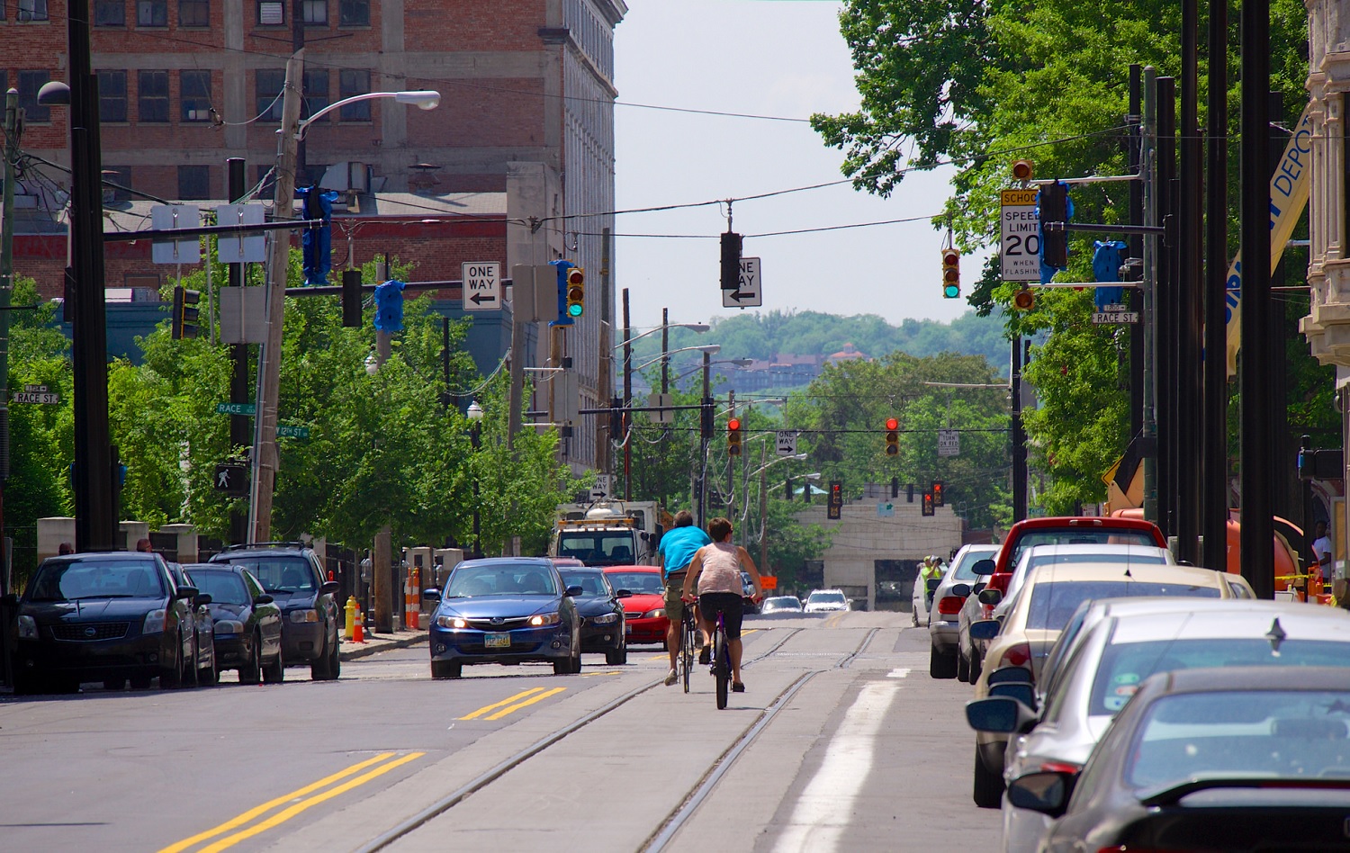
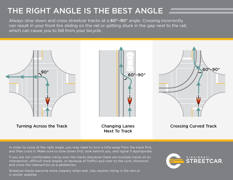
Area cyclists have long been aware of the risks with riding over certain sewer grates due their design that can allow for tires to get caught, thus causing an accident for the person riding the bike. With track work nearly complete, the same is true for cyclists navigating streets with train tracks on them.
While the risks posed by such an arrangement are minimal and easily avoided, local transportation officials are working to make sure that there are no problems. As a result, SORTA and Queen City Bike have put together some recommendations for people riding bikes on streets where the streetcar operates.
They suggest to look and listen for trains, and to never cross in front of a moving train as it is approaching; be aware that rails can be slippery when wet; cross tracks at a 90-degree angle; and to just generally practice safe riding techniques and maintain awareness.
“Cincinnati is becoming increasingly bike-friendly and we want to ensure that riders are aware of these simple safety tips that can help them avoid potential falls or damage to their bikes when riding along the streetcar route,” said Metro’s System Safety Director T.J. Thorn.
Queen City Bike is also working with Cincy Red Bike to offer free streetcar safety clinics every second Saturday of the month at 10am in Washington Park. Organizers say that the free clinics will run through October, which is just after the scheduled arrival of Cincinnati’s first streetcar vehicles. At these clinics bicyclists will learn how to safely ride adjacent to the streetcar tracks, and how to properly cross over the tracks.
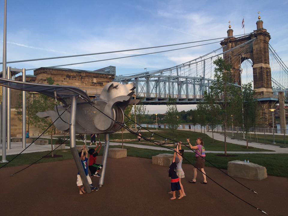
Cincinnati Park officials have celebrated a string of openings at Smale Riverfront Park over the past month. While a few more openings remain, the vast majority of work in the latest major phase of the $120 million park is now essentially complete.
In the latest video update from project manager Dave Prather, he explains what all has taken place and what remains before work slows down considerably. At this point, Prather said, attention will turn to raising funds for the next wave of work, including the boat dock and western reaches of the 45-acre park.
The latest additions to the central riverfront park are more active than what has been developed so far. There are more of the popular family swings overlooking the river, an interactive foot piano, a flying pig playset, water pumps and channels, Carol Ann’s Carousel, and the P&G go Vibrantscape. Where railyards once existed, there are now even movable picnic tables sat atop rail ties.
Two of the larger features of the latest expansion are actually passive spaces. The Great Lawn is now nearly complete and the “beach” is in its early stages of formation. Once complete, visitors will be able to walk all the way down to the water’s edge, although this “beach” will not be made of sand due to the risk of erosion.
Two unique historical features are also part of this latest work. The first is a cornerstone marker in the middle of the Great Lawn that shows where the first addressed building in Cincinnati was situated. The second is a collection of foundation walls that were uncovered during the park’s excavation. These foundations, historians say, remain from 19th century buildings developed along the Ohio River.
This is expected to be the last video update from the Smale Riverfront Park development team for some time. As development at The Banks catches up, the park will soon be able to continue its westward expansion.
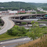
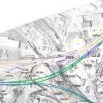
In the mid-2000s, ODOT designed a $1 billion reconstruction of I-75 between the Ohio River and I-275 that attracted little attention from the Cincinnati media. Who would win and who would lose as access points were shifted, added, or permanently closed?
Aside from a successful effort in 2006 by OKI to retain access at Galbraith Road over ODOT’s objections, virtually no public objections were made as multi-million dollar contracts were let; and work commenced in 2011 on a mega-project that will shape Cincinnati’s traffic patterns and property values for the next fifty years.
I-74 to Central Parkway Ramp [Jake Mecklenborg]
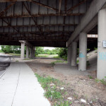
Closed Ramp at I-75 [Jake Mecklenborg]
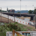
Hopple Street Interchange [Jake Mecklenborg]
ODOT’s design strategy for the Mill Creek Expressway (Western Hills viaduct to Paddock Rd.) and Thru the Valley (Paddock Rd. to I-275) projects aimed to improve capacity and safety by reducing points of access and mitigating complex merging movements. This means most of I-75’s left-side ramps will be rebuilt as right-side ramps, and odd partial interchanges, such as the Towne Street ramps in Elmwood Place and the famous southbound “canyon” ramps in Lockland, will be permanently removed.
ODOT has already closed a lightly-used ramp providing access to I-75 southbound from Spring Grove Avenue, and another exiting I-74 westbound at Powers Street in Northside.
In 2016, ODOT plans to permanently close two ramps near Cincinnati State Technical and Community College. One provides access to I-75 northbound from Central Parkway, while the other provides access to Central Parkway from I-74. The planned closure of this final ramp – an unremarkable 250-foot deck girder overpass spanning I-75 near the Ludlow Viaduct – has been public knowledge for nearly a decade, but only recently has its closure generated opposition.
Evidence suggests that replacement of Central Parkway access from I-74 was discussed in the mid-2000s via an aerial structure approximately 10 times longer than the current 250-foot overpass. A drawing from February 2007 illustrates that the flyover ramp would have diverged from I-74 near the Colerain and Beekman Street interchange, bridged Elmore Street, then deposited traffic onto Central Parkway very close to the location of the current ramp.
2007 ODOT Plan [Provided]
Despite an effort led by Cincinnati State and then Vice Mayor Roxanne Qualls (D) several years ago, ODOT has not capitulated to recent pleas by Cincinnati State and the City of Cincinnati to reestablish the access provided by the existing 250-foot exit ramp with a similar ramp forking from the planned I-74 east to I-75 north ramp.
Such a ramp would not comply with current Federal Highway Administration guidelines, which discourage local access ramps built in close proximity to “system” interchanges, and local access ramps that diverge or join system interchange ramps. In fact, construction of a new ramp similar to what currently exists would violate Section 6.2.11 and Section 6.2 of FHWA code.
ODOT’s refusal to permit reconstruction of the I-74 ramp to Central Parkway, however, is inconsistent with its recent activities elsewhere in the state.
As part of the $200+ million reconstruction of the I-71/I-670 interchange in Columbus, an exit ramp to Leonard Avenue, a local residential street, was built in the middle of a “system” interchange. No reciprocal access to I-71 south was built, meaning this new ramp violates two sections of the FHWA’s guidelines and created a new situation identical on paper to the one ODOT seeks to eliminate in Cincinnati.
Access to Cincinnati State Community College from I-74 after 2017
In 2015, the City of Cincinnati, with the endorsement of Mayor John Cranley (D), outlined plans for an entirely new 2,500-foot viaduct connecting Elmore Street in South Cumminsville with Central Parkway at Cincinnati State. Ostensibly the proposed viaduct will restore the easy access from I-74 that Cincinnati State will lose in 2017; and, according to Cincinnati State President O’Dell Owens, help attract and retain students who commute from the city’s western suburbs.
To be sure, the proposed viaduct will improve access to I-74 westbound, as no direct access currently exists. But inbound travel will be significantly slower than what presently exists, and not much faster than what would exist if it weren’t built at all.
Perhaps the Elmore Street Viaduct, or something similar to it, could have been better integrated with the I-74 Beekman Street ramps if access to Central Parkway had been deemed a priority 10 years ago – instead ODOT completed a significant rebuilt of the interchange in 2014 with no provision for a new viaduct to Central Parkway.
Access to Cincinnati State Community College from I-75 after 2017
Missing from the Elmore Street Viaduct conversation, however, is the character of Cincinnati’s access from I-75. Currently, commuters from city’s northern neighborhoods must pass Cincinnati State on southbound I-75, exit at Hopple Street, then backtrack one mile north along Central Parkway. Commuters using I-75 north must exit a mile south of the college, traverse the new jug handle connection between Martin Lurther King Drive and Central Parkway, then drive one mile north.
I-75 Reconstruction [Jake Mecklenborg]
If the current circuitous path I-75 commuters use to reach Cincinnati State isn’t discouraging attendance by prospective students from those neighborhoods, why does President Owens contend that use of the very same Hopple Street exit ramp will discourage I-74 commuters?
Why No Ludlow Avenue Interchange?
Missing from I-75’s initial 1950s construction, and its current reconstruction, is a full interchange at Ludlow Avenue. A new diamond interchange on the Ludlow Viaduct would have created ideal access to Cincinnati State, a new alternative route to the University of Cincinnati and the hospitals, and significantly increased property values in Northside.
Construction of a new interchange at Ludlow Avenue does not appear to have entered into ODOT’s conversations a decade ago, nor did construction of an interchange at Vine Street in St. Bernard.
MetroMoves and the Future of the Rapid Transit Right-of-Way
In 2002, Hamilton County voters defeated MetroMoves, a half-cent sales tax that would have funded improved countywide bus service and construction of various modern streetcar and light rail lines. The initiative planned for the convergence of two light rail lines above the I-75/I-74 interchange that would have provided direct access to Cincinnati State via a station located on the west face of its hill above Central Parkway.
The convergence of two lines just north of the property promised frequent train service for the community college, even during off-peak hours; however, no call for improved public transportation has been heard from those currently pushing for the Elmore Street Viaduct.
What’s more, there has been no call to incorporate a provision for rail transit on the proposed Elmore Street Viaduct. When looking at ODOT’s 2007 drawing, it is plain to see how the proposed structure could be integrated into the light rail network, thus eliminating the high expense of a dedicated light rail viaduct over the I-75/74 interchange in the future.
Meanwhile, ODOT’s reconstruction of I-75 will leave the old Rapid Transit Loop right-of-way mostly intact between the subway portals and Cincinnati State – meaning only a 100-foot bridge over Marshall Avenue will be necessary to construct a fully grade-separated surface line between the subway portals and Cincinnati State.
EDITORIAL NOTE: After this article was published, Mayor John Cranley’s office, through spokesperson Kevin Osborne, contacted UrbanCincy and provided additional information regarding the efforts of then Vice Mayor Roxanne Qualls to piece together funding for a smaller, yet similar project years ago. This article has been updated to reflect that reality.