Categories
News Politics Transportation

Metro Looking For Feedback On How To Improve Regional Transit System

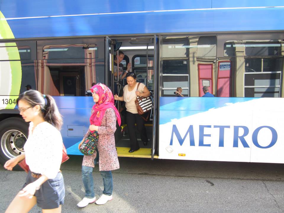
Over the past month, Metro has been hosting public listening sessions in order to get a better idea for what current and would-be transit riders are looking for out of the region’s largest transit provider.

While the five sessions have been completed, Metro is still accepting feedback through an online survey that takes about five minutes to complete. Agency officials have not said when that process will be closed, but they say that the goal is to compile the data by the end of the year.

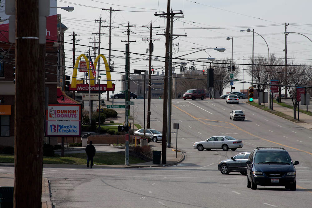
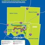
This public feedback process falls in line with growing speculation that Metro will ask Hamilton County voters next fall to approve a sales tax increase that would pay for expanded bus service throughout the county. As it is now, Metro is almost exclusively funded by the City of Cincinnati, and thus primarily provides service within those boundaries. Service outside of those boundaries costs riders extra – a situation that would be removed should voters approve the sales tax increase.

“At the end of the day, the transit system belongs to the people,” explained Jason Dunn, SORTA Board Chair. “It is our job to be good stewards of the transit system and uphold its mission. Ultimately, we’ll use this feedback to help us make decisions that will set the agenda for transit in the future.”

The public is asked to weigh in on a number of key items in the survey, including where bus service should be extended, and what kinds of operating schedules are preferred. The survey also asks about whether real-time arrival display boards, enhanced shelters and ticketing machines would be desired. All of these are items Metro has been adding over recent years, but at a modest pace.

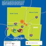
In relation to service operations, Metro officials ask about adding more direct crosstown routes, park-and-ride lots, operating buses earlier or later, increasing weekend frequencies, and adding service to major commercial corridors like Glenway Avenue, Hamilton Avenue, Vine Street, Reading Road and Madison Avenue.

Each of these corridors have been identified for more robust service akin to what has been done along Montgomery Road, which features the first Metro*Plus route in the region. While not full-blown bus rapid transit, Metro officials see it as a step in that direction with its more frequent service, enhanced bus shelters and less frequent stops that allow for faster travel.

Of course, without a dedicated regional transit tax many of these improvements will be difficult to accomplish, or take many years to realize. In the most recent round of TIGER funding, Cincinnati did not apply for any transit-related projects, nor did it even compete for any funds in the recent distribution of the FTA’s Transit-Oriented Development Planning Pilot Program.

While City Hall focused its TIGER grant applications on the Elmore Street Bridge and Wasson Way, both of which were unsuccessful, Metro officials said they did not apply for the FTA funds because they did not believe they had projects ready for successful consideration. But some local transit advocates disagree.

“Our elected officials and administrators are asleep at the wheel,” said Derek Bauman, Southwest Ohio Director of All Aboard Ohio and Chair of Cincinnatians for Progress. “Pools of money exist, particularly at the federal level, for all types of transit planning and construction. We must at accept that times have changed, prepare for the modes of transportation that people are demanding today, and then avail ourselves to resources to make it happen as they become available.”

An additional meeting will be held to gather public feedback from young professionals on Wednesday, November 11 from 6pm to 7:30pm at MORTAR Cincinnati in Over-the-Rhine. Metro CEO and General Manager Dwight Ferrell will be there to take part in the Q/A, and the first 50 people in attendance will receive a free $10 stored value bus pass.

Metro officials say that all of the feedback from the listening sessions and online survey will be considered by the newly created Metro Futures Task Force, which is made up of community leaders who will then present their findings to the SORTA Board in early 2016.

EDITORIAL NOTE: This story has been updated to reflect an additional public meeting that will be held on the evening of Wednesday, November 11.

Categories
News Transportation

Everything You Need to Know About the Proposed Elmore Street Viaduct

In the mid-2000s, ODOT designed a $1 billion reconstruction of I-75 between the Ohio River and I-275 that attracted little attention from the Cincinnati media. Who would win and who would lose as access points were shifted, added, or permanently closed?

Aside from a successful effort in 2006 by OKI to retain access at Galbraith Road over ODOT’s objections, virtually no public objections were made as multi-million dollar contracts were let; and work commenced in 2011 on a mega-project that will shape Cincinnati’s traffic patterns and property values for the next fifty years.

ODOT’s design strategy for the Mill Creek Expressway (Western Hills viaduct to Paddock Rd.) and Thru the Valley (Paddock Rd. to I-275) projects aimed to improve capacity and safety by reducing points of access and mitigating complex merging movements. This means most of I-75’s left-side ramps will be rebuilt as right-side ramps, and odd partial interchanges, such as the Towne Street ramps in Elmwood Place and the famous southbound “canyon” ramps in Lockland, will be permanently removed.

ODOT has already closed a lightly-used ramp providing access to I-75 southbound from Spring Grove Avenue, and another exiting I-74 westbound at Powers Street in Northside.

In 2016, ODOT plans to permanently close two ramps near Cincinnati State Technical and Community College. One provides access to I-75 northbound from Central Parkway, while the other provides access to Central Parkway from I-74. The planned closure of this final ramp – an unremarkable 250-foot deck girder overpass spanning I-75 near the Ludlow Viaduct – has been public knowledge for nearly a decade, but only recently has its closure generated opposition.

Evidence suggests that replacement of Central Parkway access from I-74 was discussed in the mid-2000s via an aerial structure approximately 10 times longer than the current 250-foot overpass. A drawing from February 2007 illustrates that the flyover ramp would have diverged from I-74 near the Colerain and Beekman Street interchange, bridged Elmore Street, then deposited traffic onto Central Parkway very close to the location of the current ramp.

Despite an effort led by Cincinnati State and then Vice Mayor Roxanne Qualls (D) several years ago, ODOT has not capitulated to recent pleas by Cincinnati State and the City of Cincinnati to reestablish the access provided by the existing 250-foot exit ramp with a similar ramp forking from the planned I-74 east to I-75 north ramp.

Such a ramp would not comply with current Federal Highway Administration guidelines, which discourage local access ramps built in close proximity to “system” interchanges, and local access ramps that diverge or join system interchange ramps. In fact, construction of a new ramp similar to what currently exists would violate Section 6.2.11 and Section 6.2 of FHWA code.

ODOT’s refusal to permit reconstruction of the I-74 ramp to Central Parkway, however, is inconsistent with its recent activities elsewhere in the state.

As part of the $200+ million reconstruction of the I-71/I-670 interchange in Columbus, an exit ramp to Leonard Avenue, a local residential street, was built in the middle of a “system” interchange. No reciprocal access to I-71 south was built, meaning this new ramp violates two sections of the FHWA’s guidelines and created a new situation identical on paper to the one ODOT seeks to eliminate in Cincinnati.

Access to Cincinnati State Community College from I-74 after 2017
In 2015, the City of Cincinnati, with the endorsement of Mayor John Cranley (D), outlined plans for an entirely new 2,500-foot viaduct connecting Elmore Street in South Cumminsville with Central Parkway at Cincinnati State. Ostensibly the proposed viaduct will restore the easy access from I-74 that Cincinnati State will lose in 2017; and, according to Cincinnati State President O’Dell Owens, help attract and retain students who commute from the city’s western suburbs.

To be sure, the proposed viaduct will improve access to I-74 westbound, as no direct access currently exists. But inbound travel will be significantly slower than what presently exists, and not much faster than what would exist if it weren’t built at all.

Perhaps the Elmore Street Viaduct, or something similar to it, could have been better integrated with the I-74 Beekman Street ramps if access to Central Parkway had been deemed a priority 10 years ago – instead ODOT completed a significant rebuilt of the interchange in 2014 with no provision for a new viaduct to Central Parkway.

Access to Cincinnati State Community College from I-75 after 2017
Missing from the Elmore Street Viaduct conversation, however, is the character of Cincinnati’s access from I-75. Currently, commuters from city’s northern neighborhoods must pass Cincinnati State on southbound I-75, exit at Hopple Street, then backtrack one mile north along Central Parkway. Commuters using I-75 north must exit a mile south of the college, traverse the new jug handle connection between Martin Lurther King Drive and Central Parkway, then drive one mile north.

If the current circuitous path I-75 commuters use to reach Cincinnati State isn’t discouraging attendance by prospective students from those neighborhoods, why does President Owens contend that use of the very same Hopple Street exit ramp will discourage I-74 commuters?

Why No Ludlow Avenue Interchange?
Missing from I-75’s initial 1950s construction, and its current reconstruction, is a full interchange at Ludlow Avenue. A new diamond interchange on the Ludlow Viaduct would have created ideal access to Cincinnati State, a new alternative route to the University of Cincinnati and the hospitals, and significantly increased property values in Northside.

Construction of a new interchange at Ludlow Avenue does not appear to have entered into ODOT’s conversations a decade ago, nor did construction of an interchange at Vine Street in St. Bernard.

MetroMoves and the Future of the Rapid Transit Right-of-Way
In 2002, Hamilton County voters defeated MetroMoves, a half-cent sales tax that would have funded improved countywide bus service and construction of various modern streetcar and light rail lines. The initiative planned for the convergence of two light rail lines above the I-75/I-74 interchange that would have provided direct access to Cincinnati State via a station located on the west face of its hill above Central Parkway.

The convergence of two lines just north of the property promised frequent train service for the community college, even during off-peak hours; however, no call for improved public transportation has been heard from those currently pushing for the Elmore Street Viaduct.

What’s more, there has been no call to incorporate a provision for rail transit on the proposed Elmore Street Viaduct. When looking at ODOT’s 2007 drawing, it is plain to see how the proposed structure could be integrated into the light rail network, thus eliminating the high expense of a dedicated light rail viaduct over the I-75/74 interchange in the future.

Meanwhile, ODOT’s reconstruction of I-75 will leave the old Rapid Transit Loop right-of-way mostly intact between the subway portals and Cincinnati State – meaning only a 100-foot bridge over Marshall Avenue will be necessary to construct a fully grade-separated surface line between the subway portals and Cincinnati State.

EDITORIAL NOTE: After this article was published, Mayor John Cranley’s office, through spokesperson Kevin Osborne, contacted UrbanCincy and provided additional information regarding the efforts of then Vice Mayor Roxanne Qualls to piece together funding for a smaller, yet similar project years ago. This article has been updated to reflect that reality.

Categories
Up To Speed

Uptown leaders should copy Buffalo and develop a street-calming plan

Uptown leaders should copy Buffalo and develop a street-calming plan.

Cincinnati’s uptown neighborhoods are experiencing a bit of a boom. Hundreds of residential units are being developed, new transportation infrastructure and capacity is coming online, and smaller, historic buildings are controversially making way for new, taller ones. While significant changes are underway, one thing that remains the same, and seems poised to only get worse as new roadway projects are built, is the fact that most major thoroughfares uptown are inhospitable to people who wish to walk or bike to get around. In Buffalo they have developed a plan to address just that in the city’s historic downtown. A similar plan should be considered for Cincinnati’s second largest employment center. More from Buffalo News:

The new Downtown Infrastructure Master Plan lays out a series of enhancements to key streets, districts and public squares to bolster the appearance and feel of the city center for residents, employees and visitors, while making the downtown more vibrant. At the same time, it seeks to make the area more cohesive and pedestrian-friendly, by improving access and connections. And it calls for traffic calming, more accessible green space and public space, and a “softening” of barriers like highway overpasses.

The goal is to provide a framework for future public-sector investments and projects, using shared objectives in making decisions about where to target new initiatives. But it’s also flexible enough, officials said, so that it can be adapted to tie in new projects to downtown and neighborhoods.