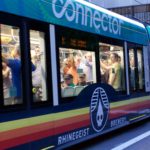
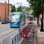
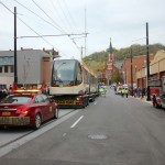
All five streetcars were in service and full of riders all weekend.
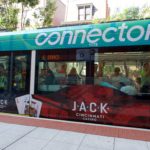
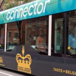
The much-awaited Cincinnati Bell Connector opened to the public on Friday, September 9, and gave over 50,000 rides during its grand opening three-day weekend.
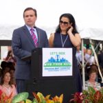
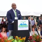
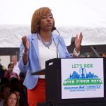
Councilwoman Amy Murray, who serves as Chair of the Major Transportation and Regional Cooperation Committee, hosted the grand opening ceremony at Washington Park. In addition to Murray, there were 12 speakers including current and former politicians, transit officials, and business leaders. Many of the speakers thanked the streetcar supporters who kept the project going over the years as it faced obstacle after obstacle. Several used the opportunity to call for an expansion of the system, with former mayor Mark Mallory saying that it’s not a question of “if,” but “when” and “where” the streetcar goes next.
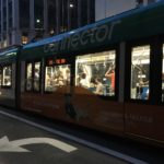
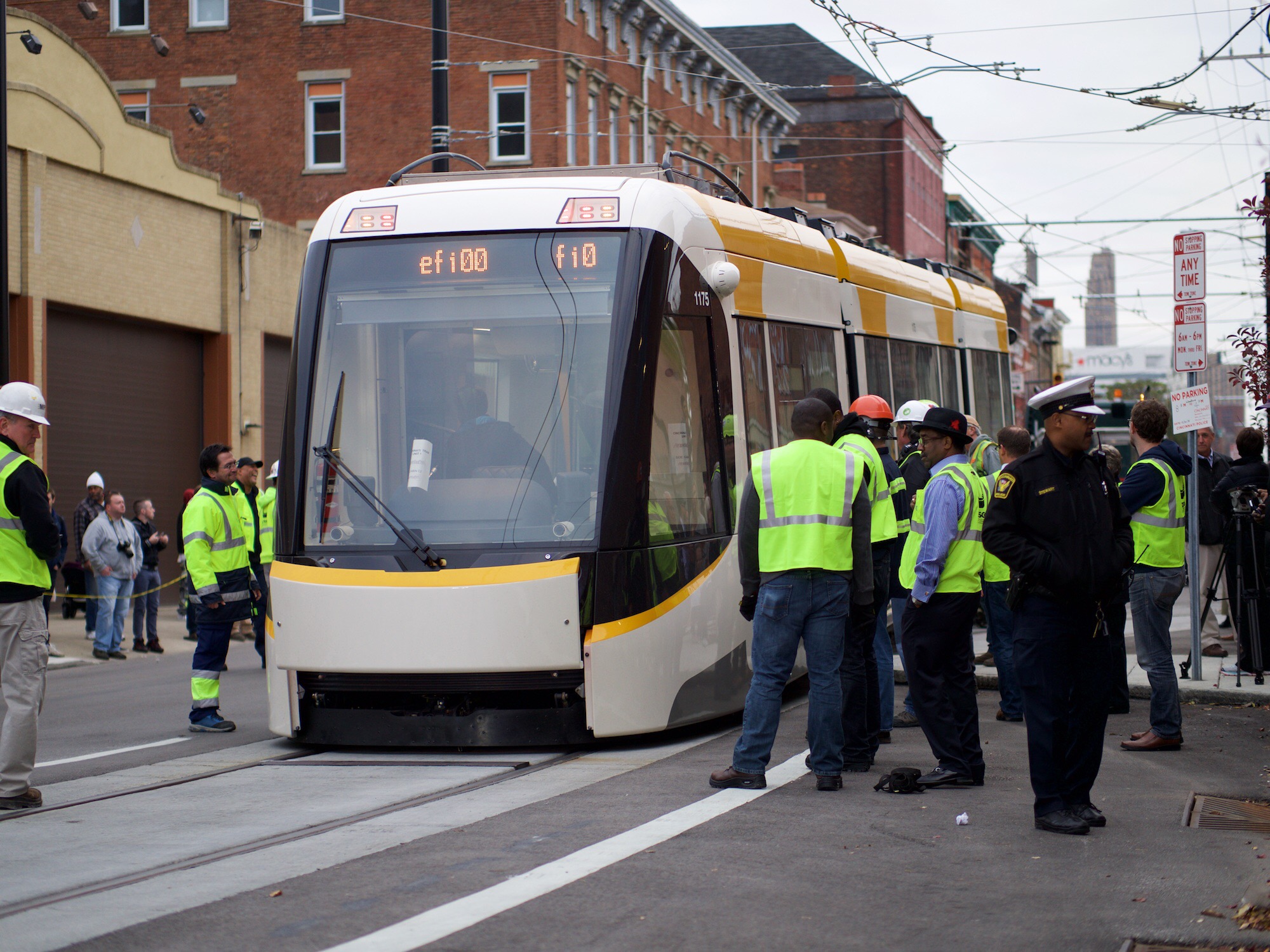
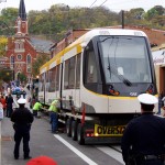
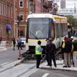
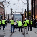
Four streetcars wait on Elm Street to pick up passengers for the start of service.
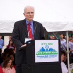
“Mr. Streetcar” John Schneider speaks at the opening of the Cincinnati Bell Connector.
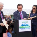
Mayor John Cranley signs the ceremonial shovel that John Schneider used at the groundbreaking of the system.
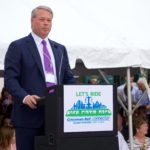
Cincinnati’s Mayor John Cranley, accompanied by First Lady Dena, speaks at the grand opening.
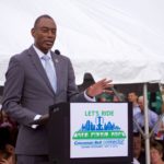
Former Mayor Mark Mallory speaks at the opening of the Cincinnati Bell Connector.
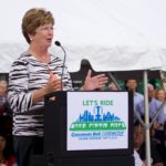
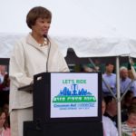
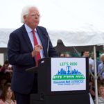
Former Mayor Roxanne Qualls speaks at the opening of the Cincinnati Bell Connector.
Carolyn Flowers, Acting Administrator of the Federal Transit Administration, speaks.
SORTA board chair Jason Dunn speaks at the opening of the Cincinnati Bell Connector.
Ted Torbeck, CEO of Cincinnati Bell, speaks at the opening of the Cincinnati Bell Connector.
Eric Avner, VP of the Haile Foundation, speaks at the opening of the Cincinnati Bell Connector.
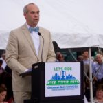
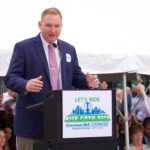
Vice Mayor David Mann speaks at the opening of the Cincinnati Bell Connector.
City Council President Pro Tem Yvette Simpson speaks at the opening of the Cincinnati Bell Connector.
City Council Member Chris Seelbach speaks at the opening of the Cincinnati Bell Connector.
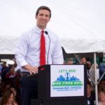
City Council Member PG Sittenfeld speaks at the opening of the Cincinnati Bell Connector.
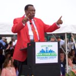
City Council Member Wendell Young speaks at the opening of the Cincinnati Bell Connector.
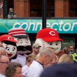
Cincinnati Reds mascots appear at the opening of the Cincinnati Bell Connector.
Randomly selected crowed members “powered on” the streetcar system in lue of a traditional ribbon cutting.
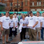
Members of the NKY Streetcar committee wear shirts reading, “Next Stop, Northern Kentucky!”
“Mr. Cincinnati” Jim Tarbell takes one of the inaugural rides on the Cincinnati Bell Connector.
UrbanCincy’s Randy Simes takes one of the inaugural rides on the Cincinnati Bell Connector.
Ken Prendergast, Executive Director of rail advocacy group All Aboard Ohio, rides the streetcar.
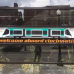
Streetcar riders livestreamed the ride using Facebook Live and other social media networks.
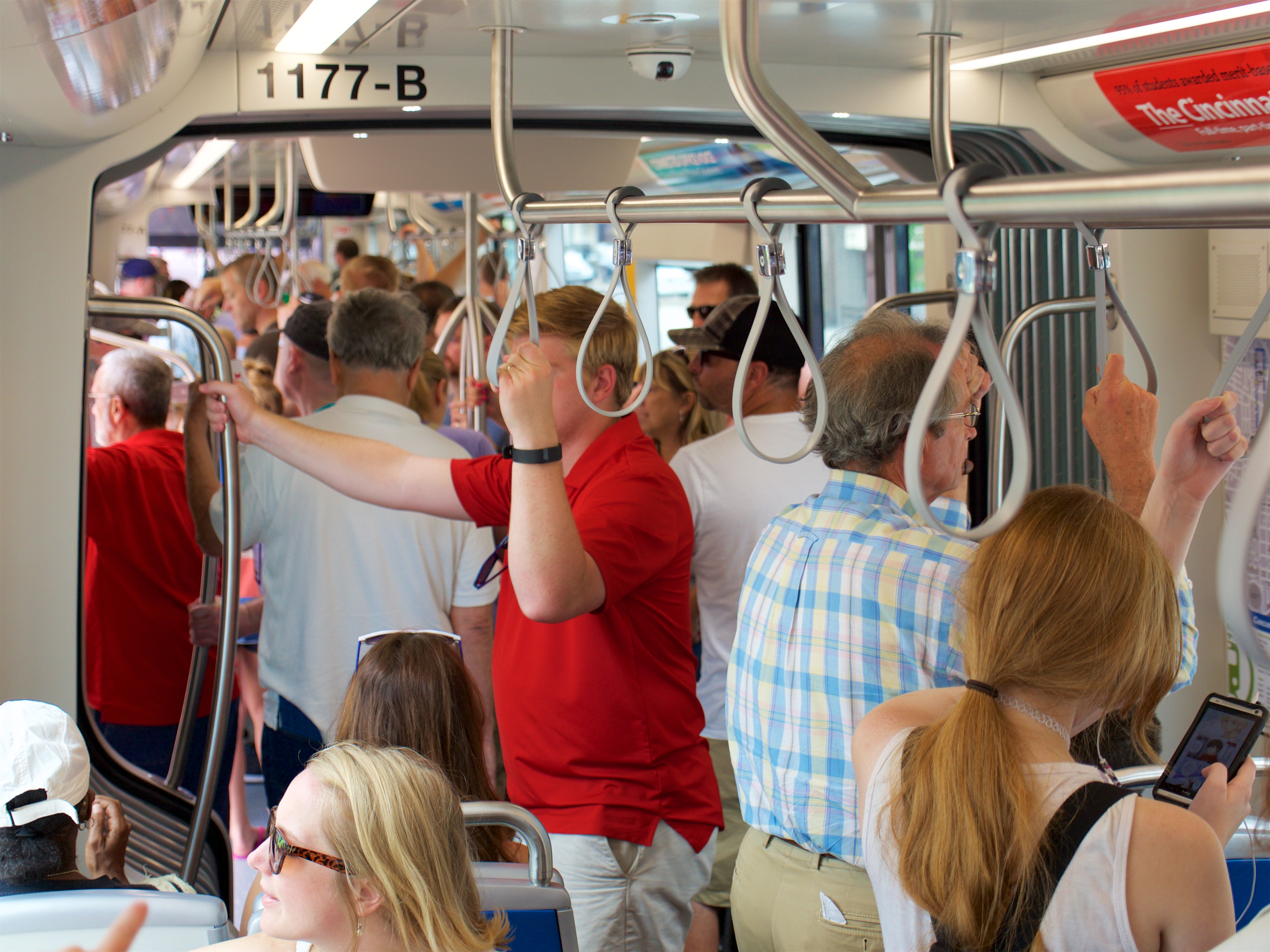
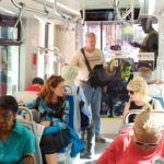
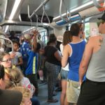
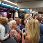
At first, streetcars had enough room to sit, but quickly became standing room only.
All five streetcars were in service and full of riders all weekend.
All five streetcars were in service and full of riders all weekend.
All five streetcars were in service and full of riders all weekend.
All five streetcars were in service and full of riders all weekend.
All five streetcars were in service and full of riders all weekend.
All five streetcars were in service and full of riders all weekend.
All five streetcars were in service and full of riders all weekend.
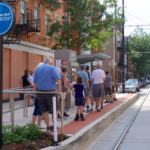
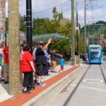
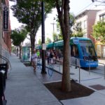
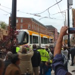
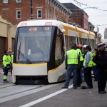
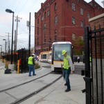
Passengers wait to board the Cincinnati Bell Connector at the Findlay Market Elm Street station.
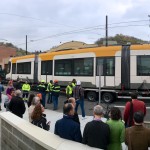
Passengers wait to board the Cincinnati Bell Connector at the Findlay Market Race Street station.
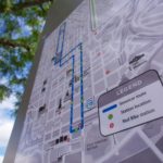
Route maps feature Red Bike stations in addition to the streetcar route.
A new Red Bike station has been added right next to the Brewery District streetcar stop.
Rhinegeist Brewery opened at noon on Friday to welcome riders and give out limited edition streetcar pint glasses.
The Brewery District station in front of Rhinegeist Brewery was very popular all weekend.
Transit advocates from Poznań, Poland came to witness the opening of Cincinnati’s modern streetcar system.
A group of Kansas City Streetcar advocates and leaders visit Cincinnati for the opening of their sister system.
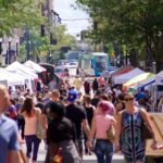
August’s Second Sunday on Main was the first to be served by the Connector.
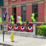
Wash Park Art decorated their storefront with green balloons reminiscent of the Believe in Cincinnati campaign.
Many businesses along the route displayed pro-streetcar messages.
After the first five ceremonial rides, the Connector opened to the public around noon. It was free to ride all weekend thanks to donations from Believe in Cincinnati, streetcar manufacturer CAF, Cincinnati Bell, Fred Craig, the Haile Foundation, and Joseph Automotive Group. Each station was staffed with volunteers who helped inform riders about the how the system works, where it goes, and how to pay your fare after the start of revenue service. Additionally, a number of special events and activities took place place near each of the streetcar stations, ranging from DJs to ballet dancers to sidewalk chalk artists. Many businesses along the route offered special streetcar-themed food, drinks, and merchandise.
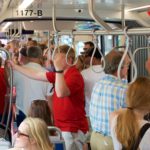
The system initially opened with four out of the five streetcars in service, but the fifth was put into service around 4 p.m. on Friday and all five continued to operate for the remainder of the weekend. The system operated at nearly maximum capacity all weekend, with lines of people waiting to board at each station.
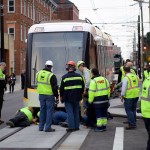
Unfortunately, the system was forced to close on Saturday afternoon due to a bomb threat. The threat, which appears to be connected to similar threats made over the weekend at the Cincinnati Zoo and two local high school football games, was not believed to be credible, but the system was closed down as a precautionary measure. After a bomb-sniffing dog searched all five streetcars and found nothing, they were put back in to service.
Despite this setback, the system transported passengers on 18,141 trips on Friday, 17,160 on Saturday, and 15,345 on Sunday, for a grand total of 50,646 trips during the grand opening.
After the free weekend, revenue service began Monday morning on the Cincinnati Bell Connector. The fare is $1 for a two-hour pass, or $2 for an all-day pass. No streetcar-specific monthly pass is available, but a monthly Metro pass includes rides on the streetcar as well as Metro buses. Tickets can be purchased at kiosks at each station, or using the Cincy EZRide app which is now available in the iOS App Store and Google Play.
On Friday, October 30, Cincinnati’s first modern streetcar vehicle arrived at the Maintenance and Operations Facility in Over-the-Rhine.
A crowd was gathered on Race Street as Cincinnati Streetcar #1175, which continues the numbering system Metro used for its streetcars when they went out of service decades ago, arrived on the back of a flatbed truck and was carefully lowered onto the track and towed into the building.
The most common reaction overheard from the crowd was, “It’s big!” While renderings of the streetcar have been available online, many people will be surprised when they see the streetcars in person. Each vehicle can hold 150 passengers, about three times more than a bus.
The remaining four streetcars are expected to arrive in Cincinnati by February 5, 2016. Each vehicle must be thoroughly tested before allowing passengers on board, so don’t be surprised if you see streetcars throughout Downtown and Over-the-Rhine over the next several months.
The system is still expected to open to passengers in September 2016.
The first streetcar is transported up Race Street to the Maintenance and Operations Facility (MOF).
Cincinnati’s first modern streetcar is lowered onto the completed Race Street tracks.
A large crowd is gathered to watch the arrival of Cincinnati’s Streetcar #1175.
A large crowd is gathered to watch the arrival of Cincinnati’s Streetcar #1175.
A large crowd is gathered to watch the arrival of Cincinnati’s Streetcar #1175.
You can call it a tram, streetcar, or LRV — just not a trolley.
Cincinnati’s first modern streetcar is lowered onto the completed Race Street tracks.
Cincinnati’s first modern streetcar is lowered onto the completed Race Street tracks.
Cincinnati’s first modern streetcar is lowered onto the completed Race Street tracks.
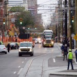
Cincinnati’s first modern streetcar glides along the Henry Street track.
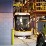
Cincinnati Streetcar project staff guide vehicle #1175 into the Maintenance and Operations Facility (MOF).
Cincinnati Streetcar project staff guide vehicle #1175 into the Maintenance and Operations Facility (MOF).
Cincinnati’s first modern streetcar rests in the Maintenance and Operations Facility (MOF).
Cincinnati’s first modern streetcar rests in the Maintenance and Operations Facility (MOF).
These 14 photos were taken by Travis Estell and John Yung for UrbanCincy.
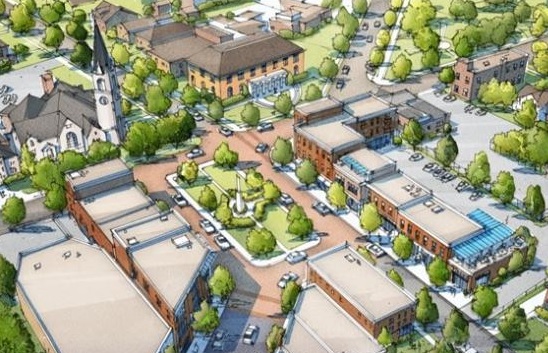
Imagine a picturesque park that is easily known as the center of a neighborhood district. A square with lush landscaping, a stage for plays and space for a farmers market. It’s a square that is easily the envy of Hyde Park or Mt. Lookout or Oakley. That was the vision of Westwood Square.
Westwood Square was born out of the month-long city-wide charrette that helped formulate the city’s four form-based code districts. The vision was further refined in the fall of 2012 by community groups Westwood Works, Westwood Civic Association, Westwood Historical Society, Westwood Community Urban Redevelopment Corporation.
As part of the process, citizens, planners and engineers looked at the problems Harrison Avenue had been causing the neighborhood. Serving mostly as a four-lane connector to Cheviot, ideas were floated to design some traffic calming measures for the corridor.
Westwood Square [Provided]
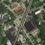
Existing Conditions [Google Earth]
The idea was that Westwood should not be a place for cars to fly through on their way to downtown, but instead a place to be visited and enjoyed.
Through this process, which was championed by then Vice Mayor Roxanne Qualls (D), the team came up with the idea for a central square. By taking a section of Harrison Avenue at the intersections of Epworth and Urweiler Avenues, the square would be constructed to deliberately force vehicles to slow down and turn to navigate around the public gathering space.
City planners found that they could create an opportunity to form a community green space, slow traffic and make the area safer for people walking and biking by implementing such a change.
After MadCap Puppet Theater moved into the old Cincinnati Bell switching station, they cited the plan as one of their main draws to the area. Theater director John Lewandowski spoke about that plan, and the hopes for the neighborhood last year on The UrbanCincy Podcast.
During the 2013 mayoral campaign, Qualls lost to Mayor John Cranley (D), who spoke against the idea of form-based codes during the campaign, and has continued to challenge them ever since.
The recent parks levy announcement from Mayor Cranley and other city leaders included a notable change to the long-held and developed plans for Westwood Square. The adjustments to Harrison Avenue, and creation of the square, are now gone.
Instead, City Hall is now calling for $2 million to renovate the existing green space adjacent to Westwood Town Hall. The new vision will do nothing to slow the traffic at the intersection and appears to make feint aspirations at building the kind of place originally envisioned by the community in 2012.
While specific details for the new plan have yet to be provided, the end result is now expected to be a major departure from the form-based approach that was first laid out.
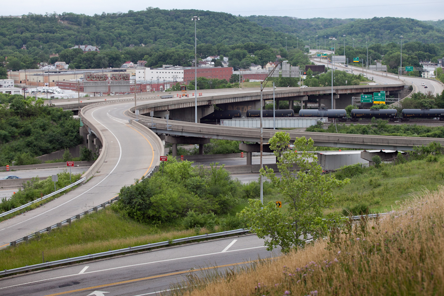
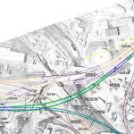
In the mid-2000s, ODOT designed a $1 billion reconstruction of I-75 between the Ohio River and I-275 that attracted little attention from the Cincinnati media. Who would win and who would lose as access points were shifted, added, or permanently closed?
Aside from a successful effort in 2006 by OKI to retain access at Galbraith Road over ODOT’s objections, virtually no public objections were made as multi-million dollar contracts were let; and work commenced in 2011 on a mega-project that will shape Cincinnati’s traffic patterns and property values for the next fifty years.
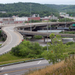
I-74 to Central Parkway Ramp [Jake Mecklenborg]
Closed Ramp at I-75 [Jake Mecklenborg]
Hopple Street Interchange [Jake Mecklenborg]
ODOT’s design strategy for the Mill Creek Expressway (Western Hills viaduct to Paddock Rd.) and Thru the Valley (Paddock Rd. to I-275) projects aimed to improve capacity and safety by reducing points of access and mitigating complex merging movements. This means most of I-75’s left-side ramps will be rebuilt as right-side ramps, and odd partial interchanges, such as the Towne Street ramps in Elmwood Place and the famous southbound “canyon” ramps in Lockland, will be permanently removed.
ODOT has already closed a lightly-used ramp providing access to I-75 southbound from Spring Grove Avenue, and another exiting I-74 westbound at Powers Street in Northside.
In 2016, ODOT plans to permanently close two ramps near Cincinnati State Technical and Community College. One provides access to I-75 northbound from Central Parkway, while the other provides access to Central Parkway from I-74. The planned closure of this final ramp – an unremarkable 250-foot deck girder overpass spanning I-75 near the Ludlow Viaduct – has been public knowledge for nearly a decade, but only recently has its closure generated opposition.
Evidence suggests that replacement of Central Parkway access from I-74 was discussed in the mid-2000s via an aerial structure approximately 10 times longer than the current 250-foot overpass. A drawing from February 2007 illustrates that the flyover ramp would have diverged from I-74 near the Colerain and Beekman Street interchange, bridged Elmore Street, then deposited traffic onto Central Parkway very close to the location of the current ramp.
2007 ODOT Plan [Provided]
Despite an effort led by Cincinnati State and then Vice Mayor Roxanne Qualls (D) several years ago, ODOT has not capitulated to recent pleas by Cincinnati State and the City of Cincinnati to reestablish the access provided by the existing 250-foot exit ramp with a similar ramp forking from the planned I-74 east to I-75 north ramp.
Such a ramp would not comply with current Federal Highway Administration guidelines, which discourage local access ramps built in close proximity to “system” interchanges, and local access ramps that diverge or join system interchange ramps. In fact, construction of a new ramp similar to what currently exists would violate Section 6.2.11 and Section 6.2 of FHWA code.
ODOT’s refusal to permit reconstruction of the I-74 ramp to Central Parkway, however, is inconsistent with its recent activities elsewhere in the state.
As part of the $200+ million reconstruction of the I-71/I-670 interchange in Columbus, an exit ramp to Leonard Avenue, a local residential street, was built in the middle of a “system” interchange. No reciprocal access to I-71 south was built, meaning this new ramp violates two sections of the FHWA’s guidelines and created a new situation identical on paper to the one ODOT seeks to eliminate in Cincinnati.
Access to Cincinnati State Community College from I-74 after 2017
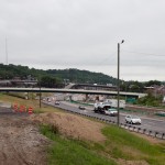
In 2015, the City of Cincinnati, with the endorsement of Mayor John Cranley (D), outlined plans for an entirely new 2,500-foot viaduct connecting Elmore Street in South Cumminsville with Central Parkway at Cincinnati State. Ostensibly the proposed viaduct will restore the easy access from I-74 that Cincinnati State will lose in 2017; and, according to Cincinnati State President O’Dell Owens, help attract and retain students who commute from the city’s western suburbs.
To be sure, the proposed viaduct will improve access to I-74 westbound, as no direct access currently exists. But inbound travel will be significantly slower than what presently exists, and not much faster than what would exist if it weren’t built at all.
Perhaps the Elmore Street Viaduct, or something similar to it, could have been better integrated with the I-74 Beekman Street ramps if access to Central Parkway had been deemed a priority 10 years ago – instead ODOT completed a significant rebuilt of the interchange in 2014 with no provision for a new viaduct to Central Parkway.
Access to Cincinnati State Community College from I-75 after 2017
Missing from the Elmore Street Viaduct conversation, however, is the character of Cincinnati’s access from I-75. Currently, commuters from city’s northern neighborhoods must pass Cincinnati State on southbound I-75, exit at Hopple Street, then backtrack one mile north along Central Parkway. Commuters using I-75 north must exit a mile south of the college, traverse the new jug handle connection between Martin Lurther King Drive and Central Parkway, then drive one mile north.
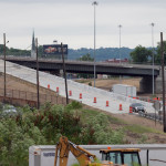
I-75 Reconstruction [Jake Mecklenborg]
If the current circuitous path I-75 commuters use to reach Cincinnati State isn’t discouraging attendance by prospective students from those neighborhoods, why does President Owens contend that use of the very same Hopple Street exit ramp will discourage I-74 commuters?
Why No Ludlow Avenue Interchange?
Missing from I-75’s initial 1950s construction, and its current reconstruction, is a full interchange at Ludlow Avenue. A new diamond interchange on the Ludlow Viaduct would have created ideal access to Cincinnati State, a new alternative route to the University of Cincinnati and the hospitals, and significantly increased property values in Northside.
Construction of a new interchange at Ludlow Avenue does not appear to have entered into ODOT’s conversations a decade ago, nor did construction of an interchange at Vine Street in St. Bernard.
MetroMoves and the Future of the Rapid Transit Right-of-Way
In 2002, Hamilton County voters defeated MetroMoves, a half-cent sales tax that would have funded improved countywide bus service and construction of various modern streetcar and light rail lines. The initiative planned for the convergence of two light rail lines above the I-75/I-74 interchange that would have provided direct access to Cincinnati State via a station located on the west face of its hill above Central Parkway.
The convergence of two lines just north of the property promised frequent train service for the community college, even during off-peak hours; however, no call for improved public transportation has been heard from those currently pushing for the Elmore Street Viaduct.
What’s more, there has been no call to incorporate a provision for rail transit on the proposed Elmore Street Viaduct. When looking at ODOT’s 2007 drawing, it is plain to see how the proposed structure could be integrated into the light rail network, thus eliminating the high expense of a dedicated light rail viaduct over the I-75/74 interchange in the future.
Meanwhile, ODOT’s reconstruction of I-75 will leave the old Rapid Transit Loop right-of-way mostly intact between the subway portals and Cincinnati State – meaning only a 100-foot bridge over Marshall Avenue will be necessary to construct a fully grade-separated surface line between the subway portals and Cincinnati State.
EDITORIAL NOTE: After this article was published, Mayor John Cranley’s office, through spokesperson Kevin Osborne, contacted UrbanCincy and provided additional information regarding the efforts of then Vice Mayor Roxanne Qualls to piece together funding for a smaller, yet similar project years ago. This article has been updated to reflect that reality.
Over the past several years the idea of taking a new approach toward designing our public streets has been gaining traction. For many decades roads were built almost exclusively for people driving cars. But historically speaking, streets have always been much more egalitarian – accommodating all modes of transportation of the time.
While the idea of designing streets for all users has gained attention, it has not always gained supporters. This includes Cincinnati where a Complete Streets policy has yet to be realized. More from Streetsblog USA:
Redesigning streets to make room for people is a no brainer. “Complete streets” projects that calm traffic and provide safe space for walking and biking save money, reduce crashes and injuries, and improve economic outcomes. Need further convincing? Smart Growth America has done some number crunching, looking at the impact of 37 complete streets projects from communities across the country.