Categories
Development News

Proposed Tax Would Provide Dedicated Parks Funding Stream, $85M in Improvements

A campaign to improve Cincinnati’s parks by raising the City’s property tax by 1 mill will “change the city for the better,” according to Cincinnati Mayor John Cranley (D).

Cranley made his remarks during the official launch of the Citizens for Cincinnati Parks levy campaign on Saturday morning at New Prospect Baptist Church in Roselawn.

The charter amendment would raise the City’s property tax rate to 13.1 mills and would bring in approximately $5.3 million a year. The move would require City Council to fund the Parks Department’s capital budget at its 2016 budget level, and approve bonds for capital improvements using levy revenue.

Proponents say that 75% of the levy revenue will be available for the City to borrow against in order to fund 13 designated capital projects selected by the mayor and city manager. The remaining 25% will go to system-wide maintenance and operating costs.

“We’re asking to voters to pass a very small property tax that we believe, for that small amount of money – $35 a year per $100,000 value – will increase property values and increase the quality of life for all Cincinnatians as we take the wonderful park system and we bring it to the neighborhoods,” Cranley said.

The group needs to collect approximately 6,000 signatures by August 15 to make it on to the November 3 ballot. Cincinnati Parks has not placed a levy on the ballot since 1927.

“We have decided that the only fair way to do this, if we’re going to be asking the taxpayers to pay more money, is to ask the citizens first to even let us put it on the ballot,” Cranley said. “At the end of the day, we’re putting this decision in the hands of the voters, and we believe the value proposition is there. We believe that this will build a better city.”

Vision needs funding
Board of Park Commissioners President Otto M. Budig, Jr. said that his organization has been charged with creating the best parks system in the country, but despite generous City funding and donor contributions, it continually finds itself short on money for major initiatives.

“We have had some difficulty in developing major projects that have long been needed,” he said. “I went to the mayor and I said, ‘We need these funds to bring about a new vision. You give us a vision, we’ll take care of the details.’ The mayor has given us the vision.”

While many of the projects are only in the conceptual stage at current time, the Citizens for Cincinnati Parks website says that they were chosen due to being the most shovel-ready, with the ability to be completed quickly.

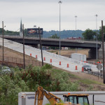
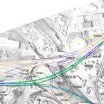
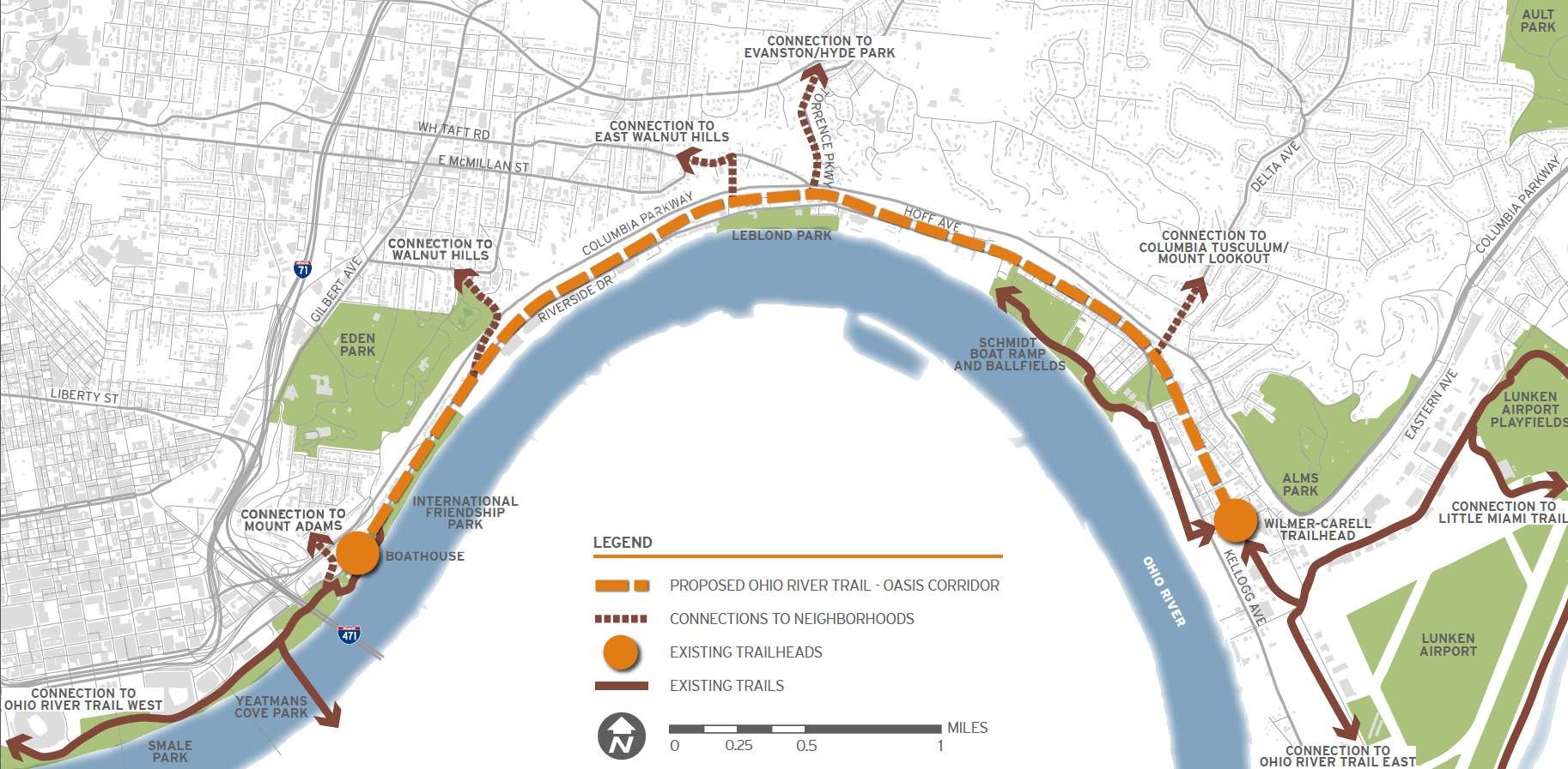
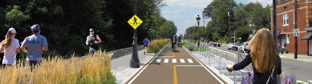
Multipurpose recreational trails are a major component of the plan, including the Oasis River Trail ($8 million), Wasson Way ($12 million), Mill Creek Greenway Trail ($5 million), and the Ohio River West Trail ($6 million). The City also plans to work with the Cincinnati Off-Road Alliance to develop more than 20 miles of off-road trails in Mount Airy Forest ($11 million).

“The bike system that will be created as a result of this levy, off-road, which is a big thing for me – I think off-road is a much safer, dedicated path that doesn’t have as many accidents – the most extensive, bicycle urban path in America,” Cranley said.

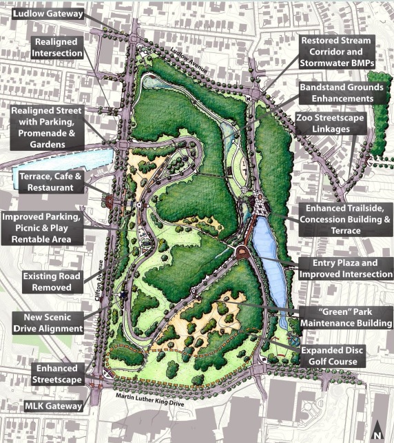
The plan would also raise $10 million for a joint venture between the City, the University of Cincinnati, and Clifton Town Meeting to create a new master plan for Burnet Woods.

“As I often say, Burnet Woods – even more so that Washington Park – could be the Central Park of Cincinnati,” Cranley said. “If you think about Corryville, CUF, Clifton, Avondale…all surround this park. It’s the densest part of the city and it’s right across the street from 30,000 students. We can have the same impact with that park as we did with Washington Park.”

Other projects include:

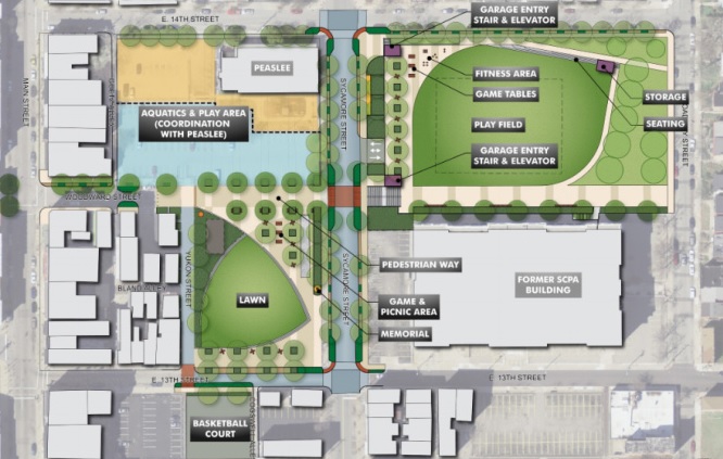
  • Developing part of the 20-acre New Prospect Baptist Church grounds into a communal programming center, athletic fields, and an urban camp site that would cost $8 million;
  • A public-private partnership with Western & Southern Financial Group that would provide $5 million to renovate and reprogram Lytle Park;
  • $5 million for the redevelopment of a portion of the former Mercy Hospital complex in Westwood into athletic fields and green space for an expanded Oskamp Park;
  • A $5 million redesign of Ziegler Park in Over-the-Rhine/Pendleton, in conjunction with the Cincinnati Center City Development Corporation (3CDC);
  • $4 million for streetscape and roadway improvements surrounding Christ Hospital and improvements to Inwood Park in Mount Auburn;
  • $2 million for the preservation of the historic King Studios site and development of a small café/museum in Evanston;
  • $2 million for upgrades around Westwood Town Hall and Epworth Avenue; and
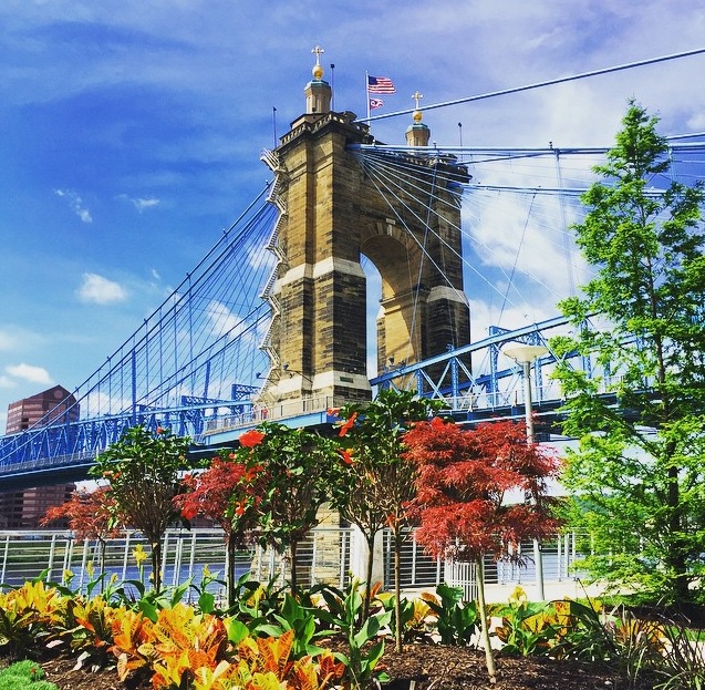
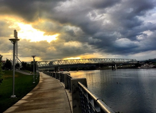
  • $1.8 million for a new boat dock/marina at Smale Riverfront Park.

“Now we have this new vision,” said Parks Director Willie Carden, who already has overseen the amazing transformations at Smale Riverfront Park and Washington Park, among others. “The vision brings ‘parkonomics’, partnerships to the neighborhoods. We can do this. We can make this a safer, healthier community, but we need your help.”

Categories
Development News

VIDEO: $86 Million Renovation of Nippert Stadium Nearing Completion

The $86 million renovation and expansion of the University of Cincinnati’s historic Nippert Stadium is nearly complete.

According to project officials, the work is expected to be complete in time for the Bearcats to host their first game back on campus – after a year away at Paul Brown Stadium – in three months.

The latest project video update reveals that virtually all exterior work is now complete, and that crews are now focused on interior finishings, along with some exterior facade treatments. They also note that the dramatic roll-open windows on the press boxes will soon go in, along with the ribbon scoreboards on both the east and west sides of the 114-year-old stadium.

Designed by New York-based Architecture Research Office and Heery International, the modern architectural style continues a trend on UC’s main campus of blending contemporary with historic designs. The large glass facade on the back side of the western concourse will, perhaps, serve as the best example of this as it looms over the historic, yet modern Tangeman University Center and internationally acclaimed UC Main Street.

The new Nippert Stadium will have an increased seating capacity of 40,000, and boast luxury boxes, press suites, new lounges, and a sorely needed expanded offering of restrooms and concessions stalls.

Originally projected to cost between $80-85 million, University officials say that the $86 million project is being funded through private donations and premium seat revenues.

Categories
News Transportation

Everything You Need to Know About the Proposed Elmore Street Viaduct

In the mid-2000s, ODOT designed a $1 billion reconstruction of I-75 between the Ohio River and I-275 that attracted little attention from the Cincinnati media. Who would win and who would lose as access points were shifted, added, or permanently closed?

Aside from a successful effort in 2006 by OKI to retain access at Galbraith Road over ODOT’s objections, virtually no public objections were made as multi-million dollar contracts were let; and work commenced in 2011 on a mega-project that will shape Cincinnati’s traffic patterns and property values for the next fifty years.

ODOT’s design strategy for the Mill Creek Expressway (Western Hills viaduct to Paddock Rd.) and Thru the Valley (Paddock Rd. to I-275) projects aimed to improve capacity and safety by reducing points of access and mitigating complex merging movements. This means most of I-75’s left-side ramps will be rebuilt as right-side ramps, and odd partial interchanges, such as the Towne Street ramps in Elmwood Place and the famous southbound “canyon” ramps in Lockland, will be permanently removed.

ODOT has already closed a lightly-used ramp providing access to I-75 southbound from Spring Grove Avenue, and another exiting I-74 westbound at Powers Street in Northside.

In 2016, ODOT plans to permanently close two ramps near Cincinnati State Technical and Community College. One provides access to I-75 northbound from Central Parkway, while the other provides access to Central Parkway from I-74. The planned closure of this final ramp – an unremarkable 250-foot deck girder overpass spanning I-75 near the Ludlow Viaduct – has been public knowledge for nearly a decade, but only recently has its closure generated opposition.

Evidence suggests that replacement of Central Parkway access from I-74 was discussed in the mid-2000s via an aerial structure approximately 10 times longer than the current 250-foot overpass. A drawing from February 2007 illustrates that the flyover ramp would have diverged from I-74 near the Colerain and Beekman Street interchange, bridged Elmore Street, then deposited traffic onto Central Parkway very close to the location of the current ramp.

Despite an effort led by Cincinnati State and then Vice Mayor Roxanne Qualls (D) several years ago, ODOT has not capitulated to recent pleas by Cincinnati State and the City of Cincinnati to reestablish the access provided by the existing 250-foot exit ramp with a similar ramp forking from the planned I-74 east to I-75 north ramp.

Such a ramp would not comply with current Federal Highway Administration guidelines, which discourage local access ramps built in close proximity to “system” interchanges, and local access ramps that diverge or join system interchange ramps. In fact, construction of a new ramp similar to what currently exists would violate Section 6.2.11 and Section 6.2 of FHWA code.

ODOT’s refusal to permit reconstruction of the I-74 ramp to Central Parkway, however, is inconsistent with its recent activities elsewhere in the state.

As part of the $200+ million reconstruction of the I-71/I-670 interchange in Columbus, an exit ramp to Leonard Avenue, a local residential street, was built in the middle of a “system” interchange. No reciprocal access to I-71 south was built, meaning this new ramp violates two sections of the FHWA’s guidelines and created a new situation identical on paper to the one ODOT seeks to eliminate in Cincinnati.

Access to Cincinnati State Community College from I-74 after 2017
In 2015, the City of Cincinnati, with the endorsement of Mayor John Cranley (D), outlined plans for an entirely new 2,500-foot viaduct connecting Elmore Street in South Cumminsville with Central Parkway at Cincinnati State. Ostensibly the proposed viaduct will restore the easy access from I-74 that Cincinnati State will lose in 2017; and, according to Cincinnati State President O’Dell Owens, help attract and retain students who commute from the city’s western suburbs.

To be sure, the proposed viaduct will improve access to I-74 westbound, as no direct access currently exists. But inbound travel will be significantly slower than what presently exists, and not much faster than what would exist if it weren’t built at all.

Perhaps the Elmore Street Viaduct, or something similar to it, could have been better integrated with the I-74 Beekman Street ramps if access to Central Parkway had been deemed a priority 10 years ago – instead ODOT completed a significant rebuilt of the interchange in 2014 with no provision for a new viaduct to Central Parkway.

Access to Cincinnati State Community College from I-75 after 2017
Missing from the Elmore Street Viaduct conversation, however, is the character of Cincinnati’s access from I-75. Currently, commuters from city’s northern neighborhoods must pass Cincinnati State on southbound I-75, exit at Hopple Street, then backtrack one mile north along Central Parkway. Commuters using I-75 north must exit a mile south of the college, traverse the new jug handle connection between Martin Lurther King Drive and Central Parkway, then drive one mile north.

If the current circuitous path I-75 commuters use to reach Cincinnati State isn’t discouraging attendance by prospective students from those neighborhoods, why does President Owens contend that use of the very same Hopple Street exit ramp will discourage I-74 commuters?

Why No Ludlow Avenue Interchange?
Missing from I-75’s initial 1950s construction, and its current reconstruction, is a full interchange at Ludlow Avenue. A new diamond interchange on the Ludlow Viaduct would have created ideal access to Cincinnati State, a new alternative route to the University of Cincinnati and the hospitals, and significantly increased property values in Northside.

Construction of a new interchange at Ludlow Avenue does not appear to have entered into ODOT’s conversations a decade ago, nor did construction of an interchange at Vine Street in St. Bernard.

MetroMoves and the Future of the Rapid Transit Right-of-Way
In 2002, Hamilton County voters defeated MetroMoves, a half-cent sales tax that would have funded improved countywide bus service and construction of various modern streetcar and light rail lines. The initiative planned for the convergence of two light rail lines above the I-75/I-74 interchange that would have provided direct access to Cincinnati State via a station located on the west face of its hill above Central Parkway.

The convergence of two lines just north of the property promised frequent train service for the community college, even during off-peak hours; however, no call for improved public transportation has been heard from those currently pushing for the Elmore Street Viaduct.

What’s more, there has been no call to incorporate a provision for rail transit on the proposed Elmore Street Viaduct. When looking at ODOT’s 2007 drawing, it is plain to see how the proposed structure could be integrated into the light rail network, thus eliminating the high expense of a dedicated light rail viaduct over the I-75/74 interchange in the future.

Meanwhile, ODOT’s reconstruction of I-75 will leave the old Rapid Transit Loop right-of-way mostly intact between the subway portals and Cincinnati State – meaning only a 100-foot bridge over Marshall Avenue will be necessary to construct a fully grade-separated surface line between the subway portals and Cincinnati State.

EDITORIAL NOTE: After this article was published, Mayor John Cranley’s office, through spokesperson Kevin Osborne, contacted UrbanCincy and provided additional information regarding the efforts of then Vice Mayor Roxanne Qualls to piece together funding for a smaller, yet similar project years ago. This article has been updated to reflect that reality.

Categories
Arts & Entertainment News

EXCLUSIVE: 43 Photos From the 64th Annual DAAPworks Fashion Show

The University of Cincinnati hosted its 64th annual DAAPworks Fashion Show on Friday, May 1. As in the past, organizers of the fashion show provided UrbanCincy with up-close access in order to photograph one of the biggest events in the city each spring.

As its name suggests, the fashion show corresponds with the larger, week-long DAAPworks exhibition that showcases the final work produced by graduating students from the University of Cincinnati’s top-ranked College of Design, Architecture, Art and Planning. Each year the event draws thousands to view the work, including recruiters and businesses from across the nation.

The DAAP Fashion Show, which is sponsored by Macy’s, is typically the biggest draw and serves as the capstone event for the showcase. The event is regularly a sold-out affair, and is, perhaps fittingly, hosted inside UC’s architecturally acclaimed, Thom Mayne-designed Campus Recreation Center.

The show is a way for the fashion design students, which are required to engage in professional fashion design work prior to graduating, to both showcase their final designs, as well as market themselves to potential buyers and employers in attendance.

EDITORIAL NOTE: All 43 photographs were taken by Jack Mecklenborg on May 1, 2015. Those interested in purchasing or using any of these photos may contact editors@urbancincy.com for more information.

Categories
Up To Speed

Uptown leaders should copy Buffalo and develop a street-calming plan

Uptown leaders should copy Buffalo and develop a street-calming plan.

Cincinnati’s uptown neighborhoods are experiencing a bit of a boom. Hundreds of residential units are being developed, new transportation infrastructure and capacity is coming online, and smaller, historic buildings are controversially making way for new, taller ones. While significant changes are underway, one thing that remains the same, and seems poised to only get worse as new roadway projects are built, is the fact that most major thoroughfares uptown are inhospitable to people who wish to walk or bike to get around. In Buffalo they have developed a plan to address just that in the city’s historic downtown. A similar plan should be considered for Cincinnati’s second largest employment center. More from Buffalo News:

The new Downtown Infrastructure Master Plan lays out a series of enhancements to key streets, districts and public squares to bolster the appearance and feel of the city center for residents, employees and visitors, while making the downtown more vibrant. At the same time, it seeks to make the area more cohesive and pedestrian-friendly, by improving access and connections. And it calls for traffic calming, more accessible green space and public space, and a “softening” of barriers like highway overpasses.

The goal is to provide a framework for future public-sector investments and projects, using shared objectives in making decisions about where to target new initiatives. But it’s also flexible enough, officials said, so that it can be adapted to tie in new projects to downtown and neighborhoods.