Last year over 100 people attended a series of workshops focused on rehabilitating distressed properties in Over-the-Rhine. The 3OTR Owner-Occupied Workshop series was hosted by the Over-the-Rhine Foundation, and each session featured realtors, rehabbers, architects and other experts telling their stories to people who were interested in rehabbing properties of their own.
Organizers say that the series was so impactful that its graduates even earned mention as qualified potential developers by 3CDC for city-owned properties north of Liberty Street.
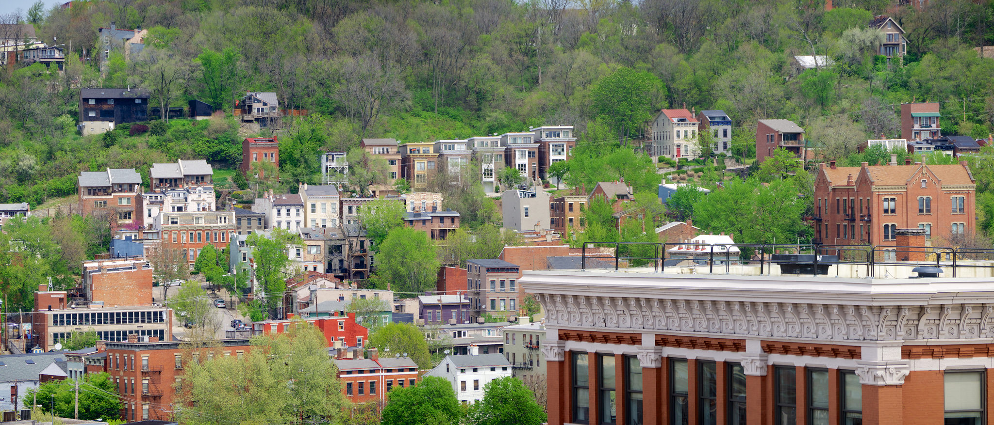
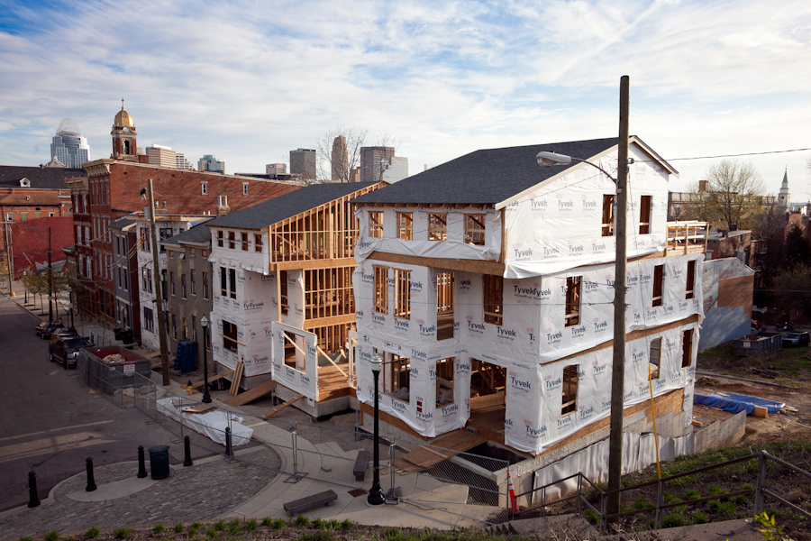
Prospect Hill in Over-the-Rhine [Travis Estell]
“When we conducted our evaluations of the workshops last spring, participants spoke loudly that they benefited most from hearing from individuals who acquired and rehabbed properties,” said Thomas Hadley, an Over-the-Rhine Foundation board member. “This workshop offers hands-on insights into what it takes to do a project in OTR.”
Now, a year later, some of the graduates are returning to share their stories with a new crowd. The event, this time called Lessons Learned, will focus on four rehab projects that resulted from the last year’s series.
Planned discussion topics, organizers says, will include financing, structural changes, LEED projects and combining a multi-family into a single-family building. One of the sessions will even feature a project that involves rehabilitating a three-unit building with retail.
“Lessons Learned is a unique opportunity to find out how alumni from last year’s workshops used what they learned to acquire and rehab property,” Hadley explained.
The workshop will be held on Saturday, June 6 from 9am to 11am at Venue 222 on Fourteenth Street in Over-the-Rhine. Those interested in participating can register online for $10v.
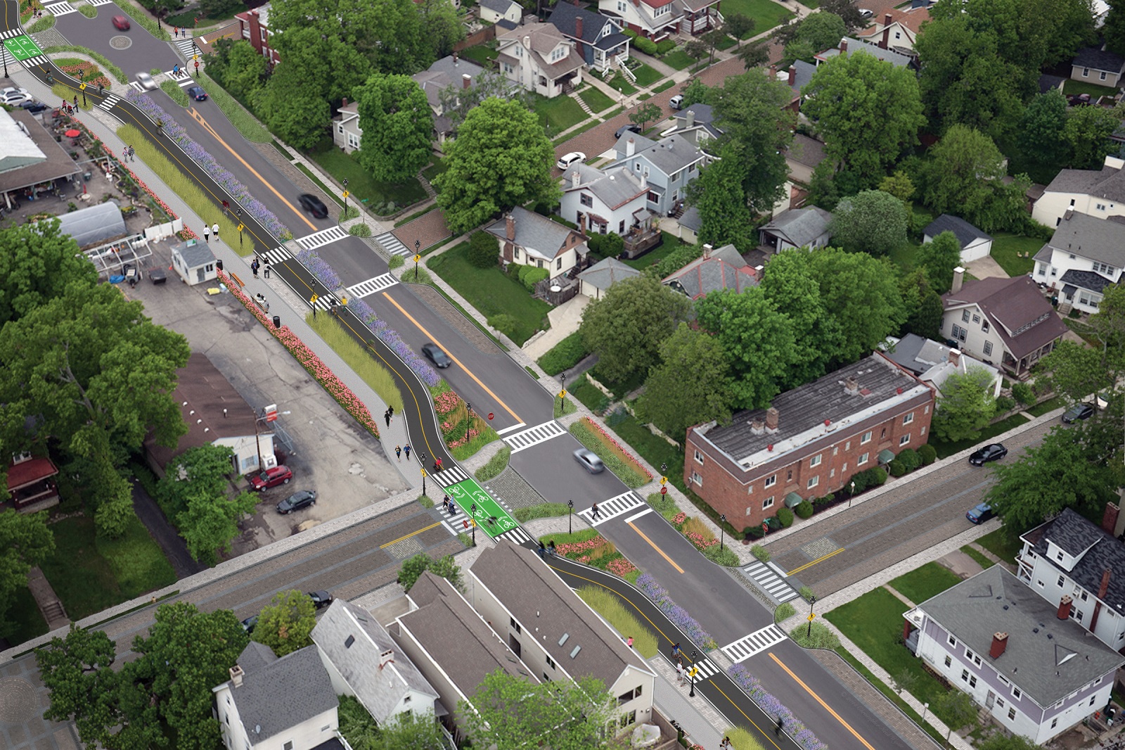
Cincinnati City Council’s Neighborhoods Committee gave a unanimous okay to an ordinance that would solidify an agreement to purchase 4.1 miles of railroad right-of-way from Norfolk Southern for $11.8 million, providing a key piece of the 7.6-mile Wasson Way recreational trail.
The ordinance was a last minute by-leave item on the committee calendar, made necessary due to a TIGER grant application that is due on Friday. Project backers are seeking $17 million of the $20 million project cost, and City support makes their application much more attractive.
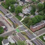
Wasson Way at Shaw Avenue [Chris Wyatt]
Wasson Way at Erie Avenue [Chris Wyatt]
Wasson Way Concept [Chris Wyatt]
The trail has been in the works since 2011, and a group of nearly 20 volunteers with the Wasson Way nonprofit got a big boost when Mayor John Cranley (D), City Manager Harry Black, and City staff assisted with the negotiations.
“We started looking at the TIGER grant application,” said Mel McVay, senior planner at Cincinnati’s Department of Transportation & Engineering. “They really talk about ‘ladders of opportunity’, increasing mobility and accessibility for folks throughout the region, and so we saw an opportunity between the property we could purchase and some property we already had, and some existing trails.”
Director of Department of Trade and Development Oscar Bedolla spelled out the project’s urgency.
“One of the statutory requirements associated with the scoring for TIGER is related to readiness,” he said. “And so, the more that we can do to show that the project is potentially shovel-ready enhances our ability to acquire or be selected for TIGER funding.”
Bedolla added that under the terms of the agreement, the City would pay nothing in the first year if it does not proceed with the purchase. If the purchase is pursued within the second year, there would be a 5% fee added to the price.
The City’s matching funding of between $3 million and $4 million for construction costs could be made up of a combination of state and federal grants, plus funds raised by Wasson Way, he said.
Still up in the air is approximately two miles or the corridor between the Columbia Township end point and Newtown, where it could connect with the Little Miami Scenic Trail.
“We’re working on it,” McVay said. “Unfortunately, the railroad was not open to selling any additional property east of that point. We’re investigating three or four ways that we can get farther east to the existing Little Miami Trail. We’re very confident we can get there.”
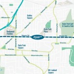
Wasson Way Map [Provided]
David Dawson, a resident of Mt. Lookout and realtor with Sibcy Cline, expressed concern about how a long-envisioned light rail line could be brought to the corridor once its freight rail designation is abandoned – a legal process that is handled by the U.S. Surface Transportation Board.
“It just can’t be said enough, in my view, that the City will now become the steward of a very valuable asset,” Dawson said. “This is a regional corridor that, in this day and age, cannot really be duplicated. If we lose that ability to eventually have transit, rail transit, or some sort of transit in the future, we won’t be able to put it back.
Dawson and other rail advocates are calling for the corridor to be railbanked, so that the addition of light rail transit remains an option in the future.
“This doesn’t just connect our neighborhoods, but in the future it has the potential to connect the entire region out to Clermont County,” Dawson said.
The use of this corridor has long been eyed for light rail transit, including in the 2002 MetroMoves regional transit plan. A 2014 study by KZF Design recommended a design solution that would preserve the ability to develop both light rail transit and a trail; and estimated that such an approach would bring the cost of developing the trail to approximately $11.2 million.
Andrea Yang, senior assistant City solicitor, said that the purchase agreement would give the City some time to work out those issues.
“The way that the abandonment process is structured, there is a time period which we could utilize to further investigate other options,” Yang said. “Had we chosen to railbank the property and attempt to preserve it, it would actually follow the same process for abandonment, so there’s definitely time to look into that if that is what Council’s interested in seeing.”
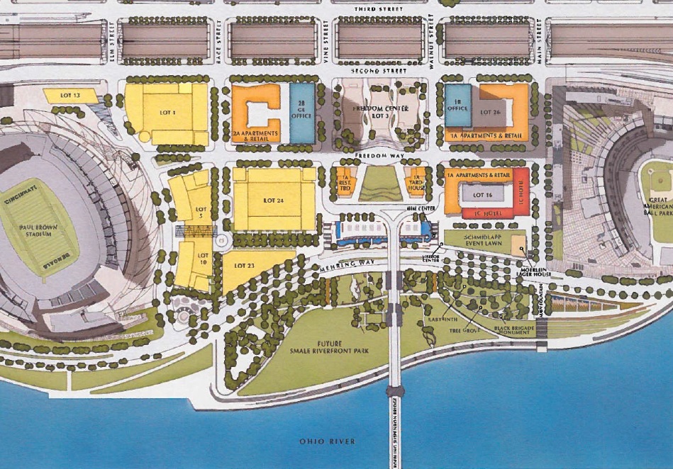
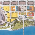
Officials overseeing the development of The Banks have announced that they will soon proceed with the design and construction of the infrastructure needed for the next phase of the massive riverfront project.
Yesterday, at a special meeting of The Banks Steering Committee, the eight-member group unanimously voted in favor of moving forward with what they expect to be $29.3 million worth of work, which would then provide the platform for millions more in private investment in the form of offices, residences and retail on what is referred to as Lot 24.
Vision for The Banks [Provided]
The Banks Development Plan [Provided]
As has been the case with all prior phases of the mixed-use development, the City of Cincinnati and Hamilton County will build out the utilities and roadway network, and construct a 690-space, two-level parking garage that will lift the site out of the Ohio River floodplain. Carter and The Dawson Company – the private development team selected for the project – would consider what elements should be included and then proceed with building and leasing out whatever is built on top of the parking decks.
A guiding principle that has not changed since the beginning of the development process is that the underground parking garage will be reserved for public parking, leaving Carter-Dawson to develop additional above-ground parking to satisfy the City’s mandatory parking requirements.
The Steering Committee said that the public work will be funded through the issuance of $22 million in tax increment finance bonds, and $7 million from the State of Ohio. Project officials say issuance of the bonds is expected to come within the coming months.
While the Carter-Dawson team has not yet decided the exact mix for this third phase of work, it is widely expected to be primarily residential. In total, the zoning and infrastructure for the site will allow for around 320,000 to 400,000 square feet of developable space.
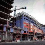
SW View of Phase 2 of The Banks [Jake Mecklenborg]
Phase Two Construction at The Banks [Jake Mecklenborg]
AC Hotel at The Banks [Provided]
The timing of the announcement could not be better, with work rapidly progressing on General Electric’s 338,000-square-foot Global Operations Center, 19,000 square feet of retail space, and the 291 apartments at the phase two site to the immediate north; and with the announcement that AC Hotels will develop the long-sought hotel along Main Street in front of Great American Ball Park.
Phase two work is expected to be completed in phases throughout 2016, while AC Hotel by Marriott is expected to open in spring 2017.
While management with the Cincinnati Bengals expressed some concern over the loss of one of the team’s few remaining tailgating lots, The Banks itself is evolving into more of an entertainment district than many had thought.
Project officials say the phasing of construction at the 18-acre site has been carefully coordinated between the district’s various stakeholders, along with the construction schedule of Smale Riverfront Park. As park work has moved west so has work at The Banks, and with the latest work on the park taking place just south of phase three of The Banks, the timing makes perfect sense.
If all goes according to plan, this next phase of infrastructure work could begin as soon as January or February – just after the conclusion of the Bengals football season.
The U.S. Census Bureau released new population estimates for municipalities across the United States last week. The data showed that while Ohio’s big cities continue to struggle, Cincinnati and Columbus stand as outliers by posting consistent population growth.
According to the estimate, the City of Cincinnati now has 298,165 residents, which represents an increase of 547 over the previous year. While the metropolitan region is Ohio’s largest, Cincinnati is just the state’s third largest city after Cleveland (389,521) and Columbus (835,957), which has nearly three times as much land area as both Cincinnati and Cleveland.
Further reducing Cincinnati’s numbers is the reality that nearly 70,000 people live in the river cities directly across from Downtown in Northern Kentucky. While they are counted toward the regional total, they do not show up in the city’s overall population.
Ohio Population Trends 2010-2014 [UrbanCincy, Data: U.S. Census Bureau]
For Cincinnati it marked the third consecutive year of population gains since the Census Bureau disappointed city officials with their 2010 decennial count, which is a much more robust effort based on actual counts than the annual estimates. This comes after a half-century of population decline that not only defined the Queen City, but most established cities throughout the United States – a fact that while easily noticed also had many root causes that are difficult to ascribe.
Since this newly released data is not the hard count, one is not able to decipher where the population gains and losses are occurring throughout the city, but recent reports have shown strong population growth in Downtown and Uptown – a trend that is expected to continue over the rest of the decade.
For years leading up to the 2010 decennial count, Cincinnati officials had been challenging population estimates that showed declining population numbers. Those declining numbers were held up in that count, but now appear to be on the side of city officials who believe trends are now in their favor.
The growth in both Cincinnati and Columbus follow their regional population growth trends, although the City of Columbus is adding population at a faster rate than its region, while the City of Cincinnati is slightly trailing its regional population growth trends. Quite the opposite is true in Cleveland, where both the city and region are losing people, and the city is doing so at a faster rate.
While Cleveland stands as lone big metropolitan region losing population in Ohio, Toledo looks to be faring even worse. Since 2010, the City of Toledo has been losing more than 1,500 residents each year, while shedding a total of 3,000 residents region-wide since the decennial count.
As UrbanCincy previously reported when updated regional estimates were released, if current trends continue Columbus will surpass Cleveland in 2017 and Cincinnati in 2024 to become the state’s largest metropolitan region.
With both Columbus and Cincinnati also leading the state in terms of their economic performance, it seems likely that their positions as population growth leaders will continue throughout the remainder of the decade.
The developer responsible for building “Cottage Hill” along Columbia Tusculum’s Strafer Street is now seeking the community’s approval for a six-unit townhome project.
On Monday, Gary Osterfeld presented to the community council what he called “very preliminary” sketches for the attached buildings at the bottom of Strafer Street – along Columbia Parkway – which would likely be around 1,900 square feet apiece and could be either apartments or for-sale homes.
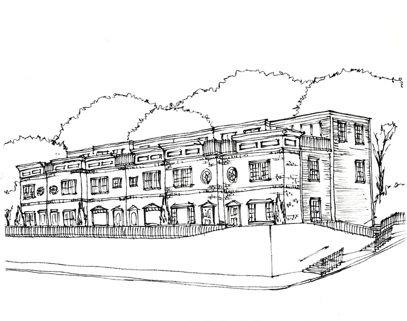
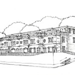
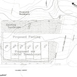
Preliminary Sketch [Provided]
Preliminary Site Plan [Provided]
The site is currently undeveloped and is used as a small community gardening space. If he pursues the project, Osterfeld will be seeking a zoning variance from its current zoning classification of community commercial-mixed to residential mixed, as it would have no commercial component.
“The commercial market in Columbia Tusculum is not real good, despite what people may think,” he said. “The problem is, relative to the number of people, there’s more retail than there is need for it. There’s already more retail than there is people; so in order for businesses to come in there and be enough demand and for the businesses to be profitable, we need more people.”
Osterfeld also told the community council that Al. Neyer’sColumbia Square, which is located directly across Columbia Parkway from his proposed building site, took five years to fill with tenants. He also said that he’s been trying to market his site for about the same amount of time but “hasn’t had a single serious call”.
The site is also challenging because of its steep slope and six-foot retaining wall, which Osterfeld said the City would likely want to keep in place.
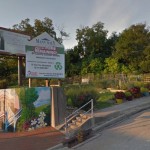
Existing Site Conditions [Google Street View]
“The idea of the zoning in place – what they would like to see – is they would like to see retail on the street level, so that people can walk in the shops like Hyde Park Square or Oakley Square – or like most squares – and the upstairs is residential,” he said. “The problem with that is you don’t see hills in Hyde Park, Mount Lookout, Oakley. The other neighborhoods you don’t see built on a hill like this. So the topography does not lend itself well to what the City’s insisting be there.”
The earliest the project could begin is this fall. Price points are expected to start in the mid-$300,000s, based upon what Osterfeld has seen of the local market.
“My guess is that it’s probably going to be a younger, more transient market,” he said. “There’s going to be a lot of steps, the price point’s not going to be like [the Cottage Hill development on] Strafer. I think that Strafer started out in the upper 3’s [$300,000s] and ended up in the upper 6’s [$600,000s]. I don’t see that happening. But we’re designing it to try to accommodate anybody. We’re going to be as flexible in our design as we can.”
Osterfeld said he plans to keep the neighborhood notified as the proposal navigates the maze of design, variances and permits.
“The City would like to have neighborhood support and neighborhood cooperation, as would I,” he said. “Your interest is what’s good for the community. So, I’m trying to help with that.”