Categories
Opinion Transportation

CNU’s 2018 Transportation Summit: Lessons for Greater Cincinnati

CNU’s 2018 Transportation Summit was September 16-17 in New Orleans. The purpose of the summit was to bring together people focused on the revitalization of urban neighborhoods disrupted by freeways. In attendance were people from Massachusetts, California, Colorado, Texas, Wisconsin, Washington DC, and two members from CNU Midwest, Chris Meyer and Brian Boland. There were many takeaways from the summit but three lessons seem applicable to Greater Cincinnati.

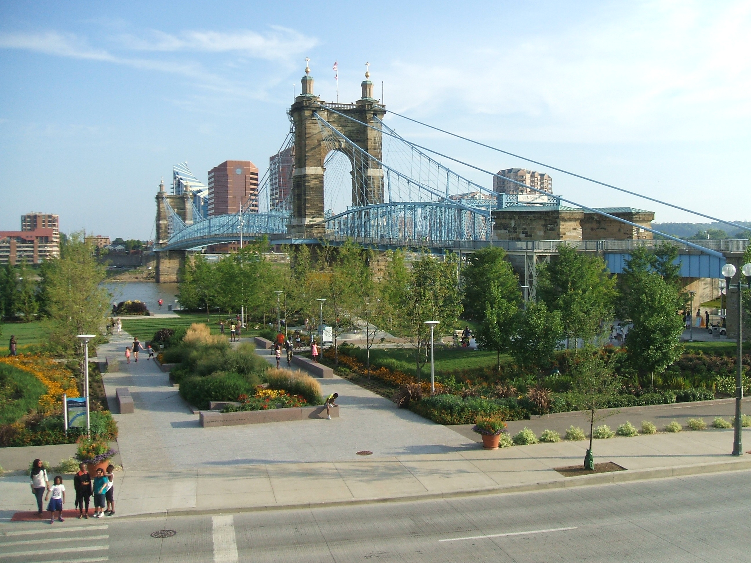
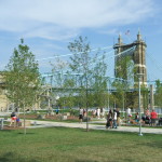
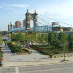
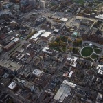
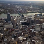
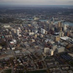
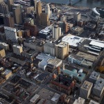
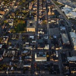
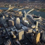
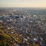
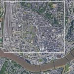
The first is that freeways and urban fabric are incompatible. Urban fabric in Greater Cincinnati typically consists of fine-grained parcels, 2-5 story buildings, and a dense street with grid pedestrian-scale streetscapes. Urban fabric is fundamentally sized for people. The 19th century blessed present-day Greater Cincinnati with an abundance of high-quality urban fabric. A minor takeaway from the transportation summit was that other cities would be jealous if they knew what we have.

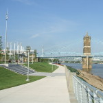
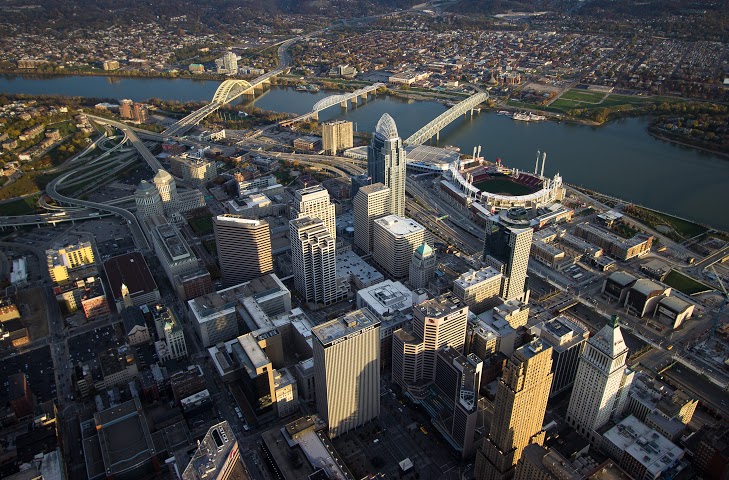
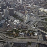
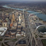
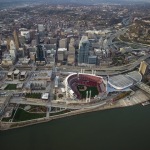
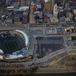
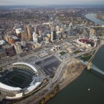
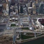
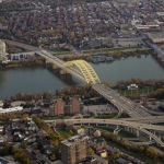
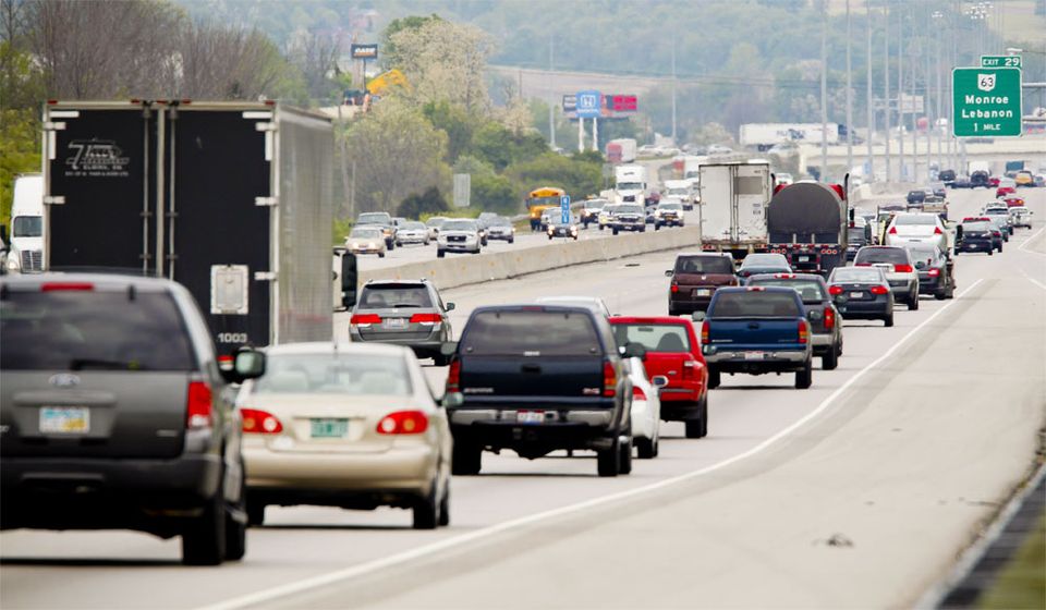
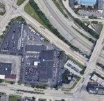
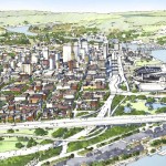
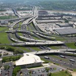
Freeways are scaled for cars and trucks. They are always interruptions in the urban fabric. They break up the street grid wherever they pass through it and form barriers to people passing. The urban fabric for blocks around a freeway is degraded not only by the dirt, noise, smell, and ugliness but also by the profusion of vehicles they concentrate and deliver into the urban fabric. This is true for greater Cincinnati along the I-75, I-71, and I-471 corridors.

Freeways are a necessary part of the urban economy but they are incompatible with the urban fabric. It was a mistake to run them through central cities. Dwight Eisenhower, the father of the interstate system, certainly thought so.

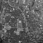
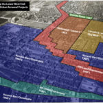
Multiple people at the summit noted that urban freeways are “monuments to racism.” That’s obviously the case in New Orleans. In Cincinnati, the West End neighborhood is physically gone but the Kenyan Barr photo exhibit, currently showing at the University of Cincinnati, illustrates the neighborhood destroyed by I-75. Ninety-seven percent of the residents were black.

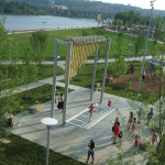
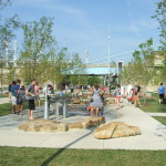
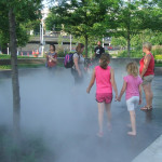
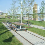
A second lesson from the transportation summit is that urban fabric is valuable. Anyone familiar with CNU understands that. What was new is that urban fabric can be more valuable than the freeways running through it. Implicitly or explicitly, a big part of the argument to remove freeways, be it Denver, Oakland, or Austin, is to free up land for profitable new development.

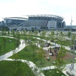
The same principle applies to Cincinnati. The value of land with urban development on it is greater than the same amount of land with auto-centric development on it. The blocks around freeways are almost always taken up with auto-centric development because of how freeway ramps concentrate vehicles in a geographic space. Cincinnati would reap greater economic, tax, and social benefits if the space around Interstate-75 followed urban development patterns rather than auto-centric development patterns.

The third lesson is that the future of urban development doesn’t have to look like the past. When the first Congress for New Urbanism met in 1991, most new development was going to suburbs and central cities were still losing money and population. That has changed. People are moving back to places where they can live, work, and play, without a car. It’s happening in Cincinnati too.

Recognizing the value of urban fabric and the cost of freeways in the urban fabric allows people to recalculate the costs/benefits of future transportation projects. Two high-profile Cincinnati transportation projects include the Cincinnati Bell Connector streetcar and the Brent Spence Bridge expansion.

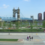
One argument against the streetcar is that it is not “profitable,” so it should be shut down. However, streetcars are compatible with the urban fabric. Most buildings and parcels on the streetcar route have been improved. Streetlife – outdoor dining, social interaction, economic activity – along the streetcar route is as vital as it’s been for decades. The streetcar is a fellow dancer in the sidewalk ballet. It improves the value of adjacent urban fabric, in opposition to freeways that destroy value. A better cost/benefit analysis of the streetcar would include the increased tax value derived from adjacent improved parcels.

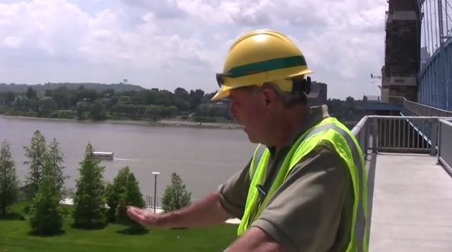
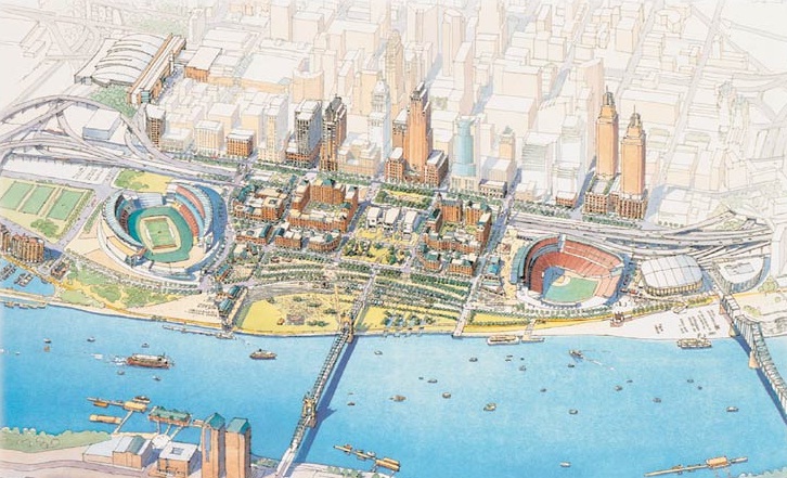
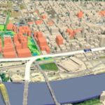
The inverse argument occurs with the Brent Spence Bridge project. The primary cost/benefit evaluation looks at congestion. The potential value of restored urban fabric has never been a part of the bridge’s cost/benefit analysis. When they factored the value of urban fabric into the Fort Washington way redesign, they decided to sink the freeway below grade so it could be capped in the future. It’s easy to envision a redesigned bridge project that includes land for new urban fabric, much as the Fort Washington Way project did.

The 2018 CNU transportation summit brought together thought leaders, local activists, transportation professionals, and city designers. A repeated statement at the 2018 summit was that multi-million dollar infrastructure projects should improve the value of places where they are constructed. In Greater Cincinnati, it seems like the value of place is often not considered in the cost-benefit analysis of large transportation projects.

In the past, it was possible to argue that urban fabric had no value, or that its value was equal to auto-centric development. Those arguments can no longer be made in good faith. If Cincinnati is going to capitalize on the wealth of its urban fabric, the value of that fabric must be included when evaluating future transportation projects. If it’s done so accurately, we should be all the wealthier.

This is a guest article by Chris Meyer reporting on the 2018 CNU Transportation Summit. CNU and CNU Midwest are content partners with UrbanCincy. Chris is an Architect at Hub + Weber, PLC

If you would like to have your thoughts and opinions published on UrbanCincy, simply contact us at editors@urbancincy.com.

Categories
Arts & Entertainment Development News

PHOTOS: The Impressive Impact of Smale Riverfront Park

There are dozens of development projects underway at any given time, but few have the opportunity to make a truly transformative impact. Smale Riverfront Park is one of those rare exceptions.

As UrbanCincy has chronicled in the past, the changes that have taken place along Cincinnati’s central riverfront over the past two decades have been truly remarkable. The consolidation and burial of Fort Washington Way. The construction of two behemoth stadiums, a world class museum and an entire new neighborhood. And now the opening up of the Ohio River through the redesigned riverbank and park.

What was once an asphalt riverfront separated from the rest of the city by an inhospitable highway now the region’s central gathering place for tourists and a destination for everyone in the region looking to the river that gave the city its birth. The changes are breathtakingly wonderful.

Of course, there is nothing better than images to help visual such changes. Instead of posting photos of what the area was once like, as we have in the past, this collection of photos are from that past few weeks at Smale Riverfront Park’s latest addition, and its immediate surroundings.

Projects like this and Washington Park, which is currently hosting thousands of thrilled Cincinnatians as part of this year’s Lumenocity event, are the types of investments and projects that change a city. What’s even better is that they’re accessible to everyone.

EDITORIAL NOTE: All 20 photographs were taken by Eric Anspach in July 2015.

Categories
Arts & Entertainment News

Take a Look at These 20 Breathtaking Photos of Cincinnati’s Center City

Many of you who read UrbanCincy get to see and experience the center city on a regular basis, but others of you cannot. But for those of you that do, rarely do you get to take a bird’s eye view of the city.

Brian Spitzig, an occasional contributor to UrbanCincy, recently took a flight around the inner city to take what turned out to be some incredible aerial photography. He took hundreds of photos, but we went through them and selected some of the best to share with you.

This is the first part of what will be a two-part series. The following 20 photographs are all of Downtown and Over-the-Rhine, while the next part of this series will focus on neighborhoods outside of the greater downtown area.

If you like what you see here, you can follow Brian Spitzig on Instagram.

Categories
The UrbanCincy Podcast

Episode #40: Fort Washington Way

On the 40th episode of The UrbanCincy Podcast, we are joined by John Schneider. Although he is now widely known for his involvement in rail transit projects, Schneider was also one of the fathers of the massive Fort Washington Way rebuild that began in 1998.

Long-time UrbanCincy readers may remember David Ben‘s four-part series on Fort Washington Way, covering the many forward-thinking decisions made by project planners. A few of these include shrinking the highway’s widthbuilding the Riverfront Transit Centerbuilding new water, sewer, and fiber optic infrastructure, and adding support for “caps” which may be added in the future.

We discuss some alternative plans that were considered, such as rerouting I-71; the limitations that were placed on the project, including the need to reuse the existing Lytle Tunnel tubes; and how the stadiums, the Underground Railroad Freedom Center, and The Banks came into the picture. Finally, we speculate on the future usage of the Riverfront Transit Center, the future of USBank Arena, and when/if the highway will ever be capped.

Categories
Business Development News

Construction Pace Picking Up on $120M Smale Riverfront Park Project

As is often the case in construction, warmer weather brings greater progress on the site. This holds true for the $120 million, 45-acre Smale Riverfront Park.

According to project manager Dave Prather, work has picked up in recent months and significant elements of the ongoing phase of work are now becoming visible.

One of the elements that is very quickly nearing completion is the Heekin/PNC Grow Up Great Adventure Playground that sits immediately beside the Roebling Suspension Bridge, and is on schedule to open in spring 2015. Significant progress is also now noticeable on the Vine Street Fountains & Steps, which are almost identical to their existing Walnut Street counterpart, and the Anderson Pavilion.

In the latest video update from Cincinnati Parks, Prather walks viewers through all the progress and mentions that a great deal of additional work will be completed in the near future.

“It’s really starting to come into focus,” Prather said in the 15-minute video update. “The next time we film, which will be in late summer, you’ll see the slides and pick-up sticks in place, all the stone climbing walls will be there, and you’re really be able to get a feel on what we’ll have to offer in this next extension.”

One of the things significantly different about the portion of Smale Riverfront Park west of the Roebling Suspension Bridge is the Anderson Pavilion and Carol Ann’s Carousel. These two features will create the most significant building structure at the central riverfront park to-date, and serve as potential sources of revenue to maintain the sprawling park going forward.

The implementation of the full vision for the park will not come for several years, and is still seeking additional capital funding. Some capital funding help, however, has been found this year in the form of a $4.5 million grant from the U.S. Army Corps of Engineers.

The ongoing work is also being aided by $4 million from the City of Cincinnati that was approved last year following a one-time allocation of resources from a property tax supported bond increase in 2013. The recent budget quickly passed 6-3 by City Council, however, included no additional capital support for Smale Riverfront Park.

Project officials estimate that an additional $30 million will be needed to complete the park.

In April, the American Planning Association presented its National Planning Excellence Award for Implementation to Cincinnati for its execution of the Cincinnati Central Riverfront Plan, which included the reconfiguration of Fort Washington Way, and the development of The Banks and Smale Riverfront Park.