Categories
Business News Transportation

Metro To Break Ground on $1.2 Million Oakley Transit Center Next Summer

At its 2015 State of Metro meeting on Friday, Dwight Ferrell announced that the region’s largest transit agency will be build a new transit center in Oakley, along with a variety of other transit improvements in the immediate area.

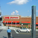
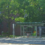
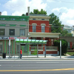
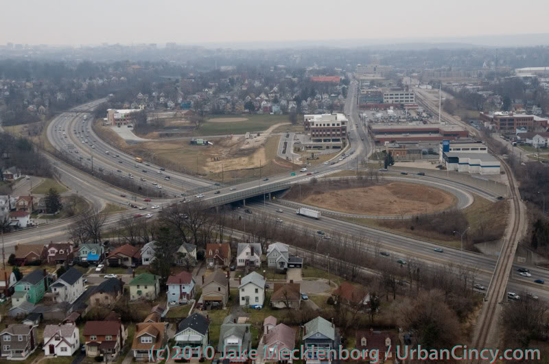
The $1.2 million project will get started next summer and be built along the Isben Avenue, just east of Marburg Avenue. The location is in the middle of an area that has been completely transformed over the past two decades, including such projects as Center of Cincinnati and Oakley Station.

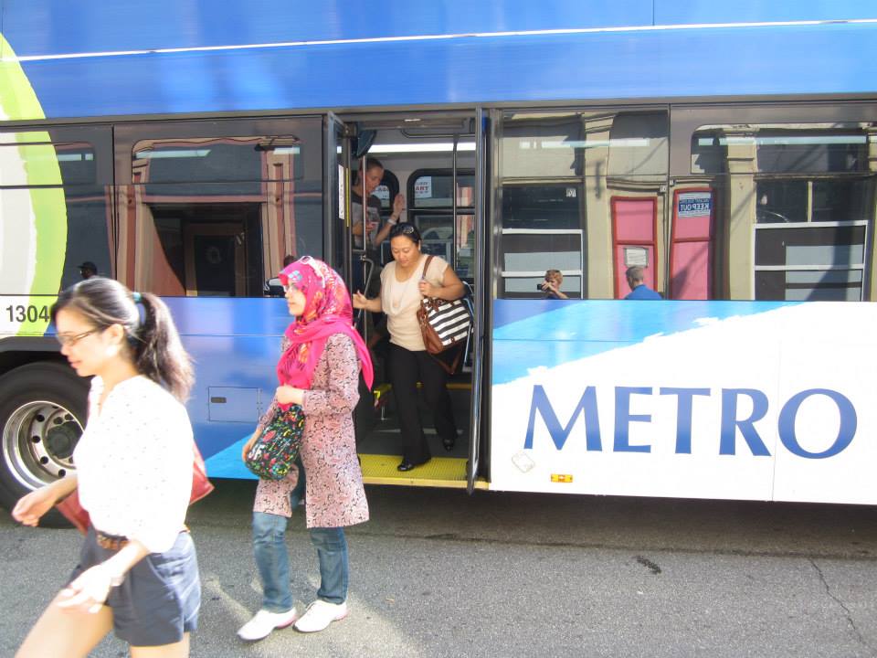
The project is part of a larger effort by Metro to overhaul its regional bus system from a traditional hub-and-spoke model, which focused on moving people in and out of the center city, to one that has more flexibility and connects more people, more directly, with job centers throughout the region.

“We are always looking ahead and planning for the future needs of this community,” SORTA Board Chair Jason Dunn said in a prepared statement. “Our goal is to continue to operate efficiently while constantly working to improve service.”

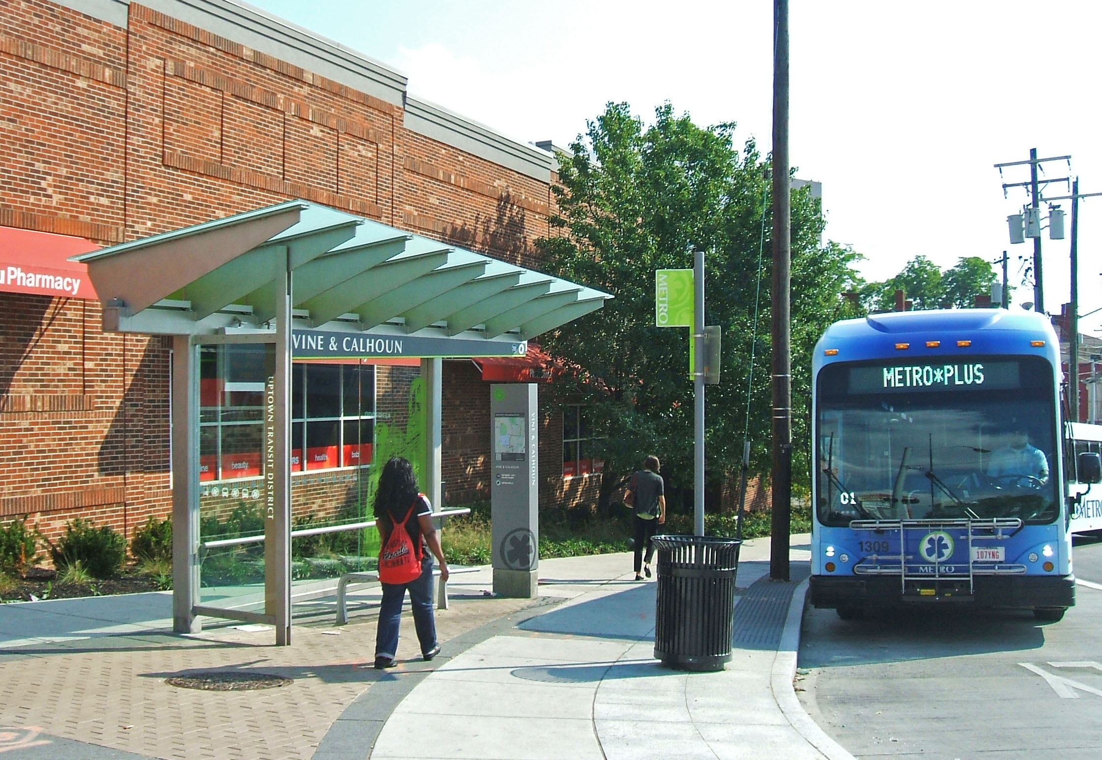
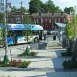
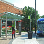
This particular project directly addresses the new vision for Metro by significantly enhancing transit service to an estimated 7,100 jobs in the nearby area, major shopping destinations and the Crossroads megachurch. It also builds on other recent transit hub projects like the Glenway Crossing Transit Center and Uptown Transit District, and the planned Northside Transit Center and Walnut Hills Transit District.

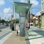
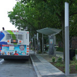
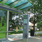
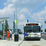
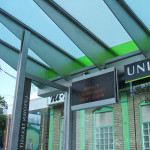
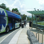
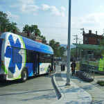
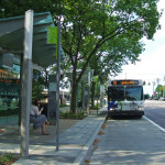
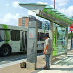
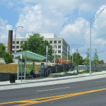
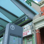
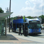
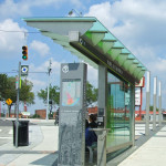
Metro officials say that the Oakley Transit Center will consist of four boarding bays, park-and-ride spaces for commuters, enhanced transit shelters and wayfinding, real-time arrival screens, and a ticketing kiosk like those at Government Square and the Uptown Transit District.

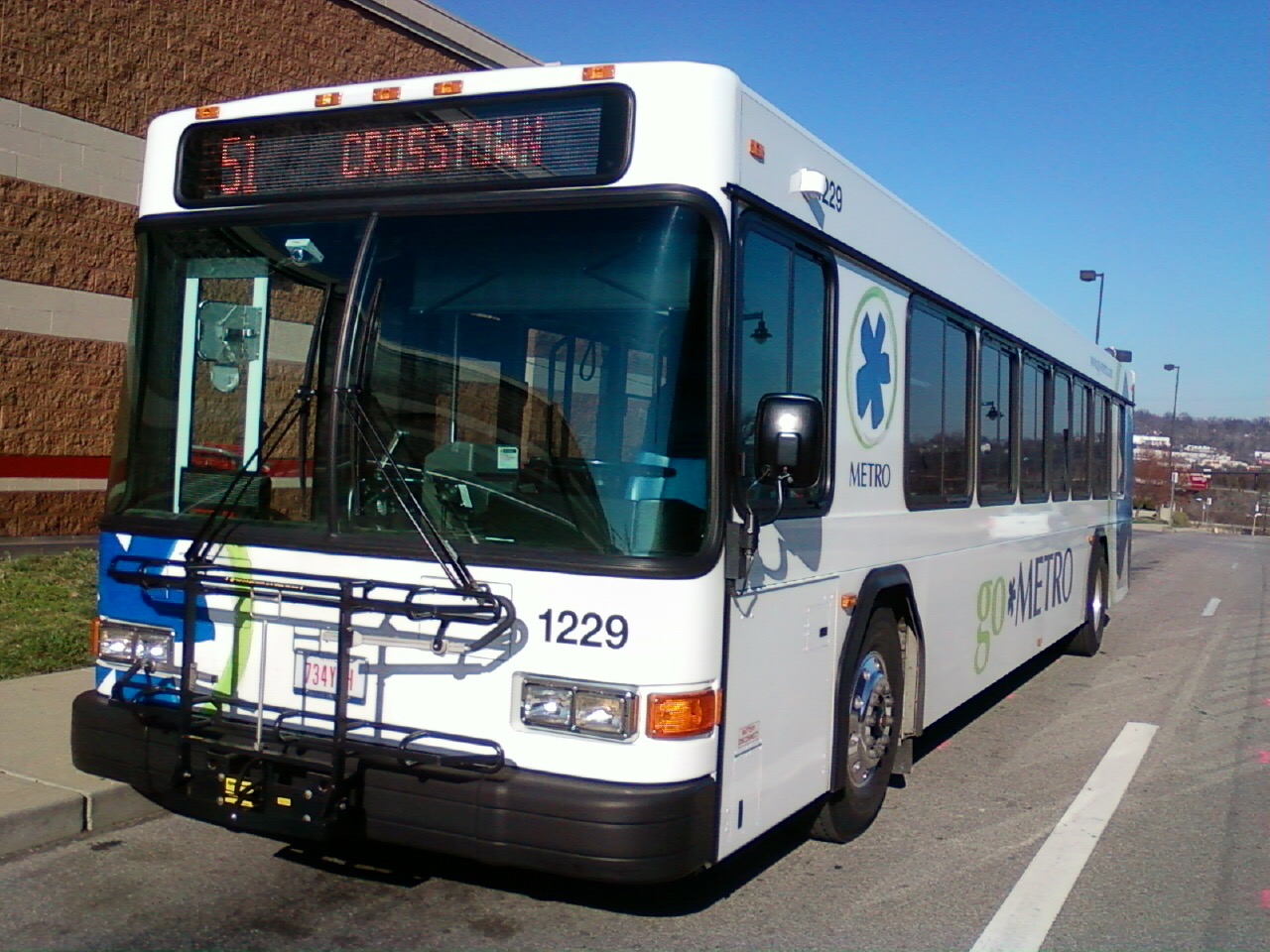
As of now, the improvements made as part of the Oakley Transit Center will immediately improve service for routes 4, 11, 12X, 41 and 51.

While Metro has stated that they are currently short on capital funding for upgrading their fleet, the funds for this project were provided by the Federal Surface Transportation Program, along with some local funds.

Categories
News Transportation

New Transit Hubs on the Way for Northside, Walnut Hills

Walnut Hills and Northside have long been two of the region’s busiest transit hubs, and now it appears that they will finally get their due as part of an ongoing effort by the Southwest Ohio Regional Transit Authority (SORTA) to broaden its services beyond its traditional hub-and-spoke model.

To-date those efforts have included the construction of the Glenway Crossing Transit Center, Uptown Transit District and Montgomery Road Metro*Plus Route – all of which have been found to be helping boost ridership.

Two action items before today’s meeting of SORTA’s Planning & Operations Committee call for the award of funds to two companies to design transit hubs in both neighborhoods.

The first item is a $126,000 award to Woolpert. This contract would fund the final design and construction contract services for what is being called the Walnut Hills Transit District, which would include new passenger shelters, lighting, route information, sidewalk improvements and other amenities at seven bus stops throughout the Peeble’s Corner District.

While not yet approved, the investment was hinted at when Metro announced that monthly passes and regional stored-value cards would be available for purchase at the Walnut Hills Kroger.

The second item on the agenda would provide $319,000 to Michael Schuster Associates Architects (MSA), who also designed Government Square and the Uptown Transit District, to provide the preliminary and final design and construction contract administration services for an off-street transit center in the heart of Northside’s business district at the intersection of Spring Grove, Hamilton and Blue Rock.

According to official documents, the new transit center will include new passenger shelters, pedestrian-scale lighting, next bus information, sidewalk and waiting area improvements, and other amenities. Further adding to the firm’s strength, MSA had completed a conceptual layout for the Northside Transit Center in 2012.

According to SORTA officials, the funds for both of these allocations will come from the agency’s annual capital budget funding.

For Northside it comes at a particularly good time, as the first Cincy Red Bike station outside of Uptown or Downtown is currently being installed.

Categories
News Transportation

Metro Rolling Out Series of Transit Enhancements for Peeble’s Corner District

As part of Metro’s system-wide upgrades, transit officials have announced a new project to upgrade stations and services in Walnut Hills.

The first part of these enhancements includes the availability of Metro’s monthly passes and regional stored-value cards, which were available as of last week, at the customer service counter at the Walnut Hills Kroger on E. McMillan Avenue.

“At Kroger, we are always seeking ways to offer conveniences to our customers,” explained Sarah Raney, Walnut Hills Kroger Store Manager. “The Walnut Hills Kroger is happy to partner with Metro to sell bus passes to our customers who regularly use them.”

In addition to many of the store’s customers, management also says that many of the store’s employees use Metro bus service to get to and from work on a daily basis.

According to Brandy Jones, Public Relations Manager at Metro, this is the first such partnership for the region’s largest transit operator, but could be the first of more to come. Jones says that this is a test to see how it works, and that additional partnerships with Kroger and other retailers may be explored.

The move is part of a larger goal to increase ridership system-wide. Other recent improvements have included the construction of the Uptown Transit District and Glenway Crossing Transit Center, and the establishment of the Montgomery Road Metro*Plus route and several new crosstown routes.

Metro officials tout the Walnut Hills Transit Enhancement Project as enhancing service for one of their busiest neighborhoods. According to ridership data, approximately 208,000 rides were provided to the historic neighborhood in 2014. Once complete in 2016, the enhancement project will introduce new sheltered boarding areas, improved lighting, sidewalk and landscape improvements, electronic real-time arrival screens and some other more modest improvements at a total of seven stations in the Peeble’s Corner area.

“Metro is invested in the Walnut Hills community,” Dwight Ferrell, Metro CEO & General Manager, stated in a prepared release. “We’re excited that the Walnut Hills Kroger has become the first major retailer in the region to sell Metro bus passes. This new partnership will help us better serve our mutual customers.”

The commitment from Metro is just the latest in a string of positive announcements from the surrounding neighborhoods, but community leaders are hoping to provide even more transportation choices, such as Cincy Red Bike, in the future as well. But as for now, neighborhood leaders are particularly bullish on the impacts the Walnut Hills Transit Enhancement Project will have on the E. McMillan Corridor.

“We think this is going to be a game changer,” Kevin Wright, Executive Director of Walnut Hills Redevelopment Foundation, explained to UrbanCincy. “Peeble’s Corner has always been one of the largest transfer points in the city and we think ridership will only grow as we add more density to the corridor.”

EDITORIAL NOTE: An earlier version of this story incorrectly stated that Metro provides approximately 2.8 million rides to the Walnut Hills area, while the number of rides is actually 208,000.

Categories
News Transportation

PHOTOS: Take a Look at Metro’s New Uptown Transit District Stations

City officials and the Southwest Ohio Regional Transit Authority (SORTA) unveiled the new $7 million Uptown Transit District earlier this year. The hope is that the enhanced stations and improved design will improve the experience for existing and future bus riders.

But if the Glenway Crossing Transit Center is to serve as any evidence, then this might in fact pay off for Metro in the form of higher ridership.

The Uptown Transit District, however, is a bit different from the west side park and ride station, and the long-time Government Square hub. Instead, it is four distinct areas – Children’s Hospital, Vine & Calhoun, University, Clifton Heights – within the sprawling Uptown area that are seen as major nodes for riders. Transportation planners at Metro say this approach was taken due to the layout of Uptown and the lack of a single location that could serve as a major hub like Government Square is for Downtown.

In addition to serving a dozen or so existing bus lines, different stations in the Uptown Transit District also serve the University of Cincinnati’s Bearcat Transportation System (BTS) and the regional bus authority’s new Metro*Plus route.

All of the stations include covered seating areas similar to those being constructed for the Cincinnati Streetcar system. They also include real-time arrival screens, area wayfinding, ADA accessibility and include information about nearby landmarks.

The stations were designed by Cincinnati-based MSA Architects.

EDITORIAL NOTE: All 22 photos were taken by Eric Anspach for UrbanCincy on August 22, 2014.

Categories
News Opinion Politics Transportation

EDITORIAL: Cincinnati Leaders Should Rethink Planned Rail, Trail Systems

Ten days ago UrbanCincy sounded the alarm on the proposed Wasson Way Trail, and we feel that due to the large amount of feedback that further explanation is needed.

Tomorrow at 12pm, City Council’s Strategic Growth Committee will discuss the proposal that would turn the Wasson Corridor from a railroad right-of-way into a recreational trail. What UrbanCincy is urging City Council to require is a minimum of 28 feet worth of right-of-way preserved for future light rail use.

Standard designs for bi-directional light rail traffic require a minimum of 28 feet of right-of-way. Along some portions of the Wasson Corridor it may very well be possible to accommodate 28 feet for light rail, plus additional right-of-way for the proposed recreational trail, and in those segments it may make sense to get started.


Looking east as the Wasson Line crosses over Interstate 71. Photograph by Jake Mecklenborg for UrbanCincy.

While there is no funding currently in place to build light rail along the Wasson Corridor, it would be short-sighted to remove one of the best rail transit corridors in the city. This was previously done on Cincinnati’s west side when an abandoned railway used by freight and passenger rail traffic was abandoned and then allowed to be built over and occupied by the Glenway Crossings retail center.

Allowing this to take place offered city and county leaders to reap the rewards of a short-term boost, but it has also created a situation that makes building light rail to Cincinnati’s western suburbs almost impossible. This same thing could happen to Cincinnati’s eastern suburbs should the Wasson Corridor be used by a recreational trail.

Proponents of the Wasson Way Trail project made it clear that many of the supporters also want to see light rail eventually happen, but that we should not wait until that day comes to improve the visual appearance of the corridor. Case studies from all over the United States show, however, that once a former rail line is converted into another use, it is almost always an impossible political task to take that land back for rail purposes.


2002 regional light rail plan for Cincinnati.

In the larger scheme of things, UrbanCincy believes that regional leaders need to take a step back and ask themselves why we are still discussing commuter rail along the Ohio River, and a recreational trail through densely populated city neighborhoods. The priorities should be reversed, and the Oasis Line along the Ohio River should be converted into a recreational trail while the Wasson Line is preserved for future light rail use.

It is estimated that the Wasson Light Rail Line would attract three times the number of riders than the Oasis Commuter Rail Line, while also being significantly less expensive to build and operate. Futhermore, when discussions were held about the Oasis Line, residents and property owners along the line voiced their opposition to such activity and have conversely expressed interest in seeing the railway converted into a recreational trail.

City and regional leaders should maintain the natural beauty of the Ohio River and turn the Oasis Line into an attractive recreational trail that can connect into existing trail networks to the east, and the Wasson Line should be preserved for light rail use in the future. It may seem frustrating to leave the Wasson Line in its current state of appearance, but it will be much more frustrating to jeopardize one of the best potential light rail corridors envisioned for the region.