Categories
News Transportation

Cincinnati Moves Forward With Land Use Study of Wasson Railroad Corridor

On November 14, Cincinnati’s Department of City Planning & Buildings held a public hearing on its upcoming land use study for the disused Wasson Road Railroad and adjacent properties.

Norfolk-Southern Railroad ended service on the line in 2009, and in 2010 the City of Cincinnati’s Department of Transportation & Engineering (DOTE) identified the right-of-way as a future off-road bicycle path in its planned 400-plus-mile network of bike lanes and trails.

Local bicycle advocates have since built public support for construction of a paved rails-to-trails bicycle path between Xavier University and Fairfax as part of a project called the Wasson Way Trail.


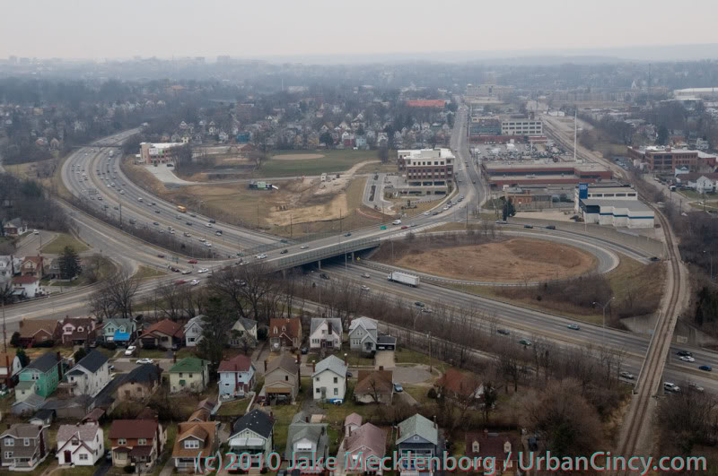
The proposed Wasson Way Trail would use the Norfolk Southern Railroad right-of-way to create a bike trail from the Little Miami Trail to Xavier University. Image provided.

On Wednesday, however, city officials were quick to mention that the upcoming land use study is just that – a determination of how the Norfolk Southern property and its surroundings might be rezoned in order to protect the right-of-way up until and after the right-of-way is purchased by Cincinnati – not a determination of what should be built in its place.

Already, Norfolk Southern has leased some of its railroad property for other uses. In 2011, a shopping center at Wasson Road and Edwards Road created a gravel parking lot on the disused tracks and another business near Paxton Road is looking to do the same.

Although Federal regulations prohibit railroads from subdividing their disused properties until they complete an “abandonment” process, Wasson Way Trail advocates are concerned that revenue from additional leases might discourage Norfolk Southern from selling the right-of-way to the City of Cincinnati at a future date.

Michael Moore, Director of the City of Cincinnati’s DOTE, stated that appraisals of the Norfolk Southern property fall close to $2.5 million. He cautioned, though, that this appraisal should not be thought of as a sale price, as the terms of the City’s purchase of the property cannot be known at this time.

Multi-Modal Use of the Corridor
At the November 14 meeting, city officials also made a point of stating that the title of the upcoming land use study has not been determined but that it will make no explicit mention of bicycle paths, light rail transit, or multi-modal use of the corridor.


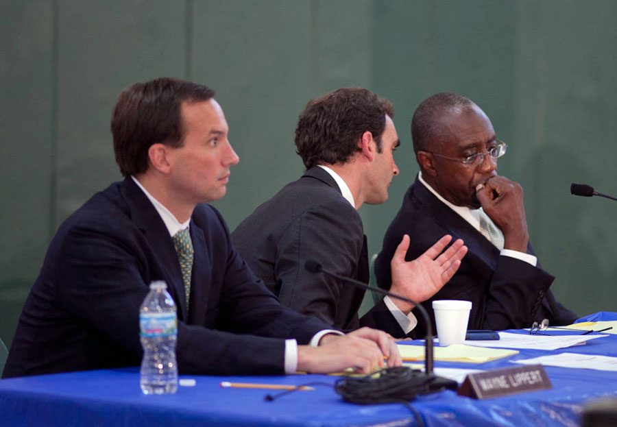
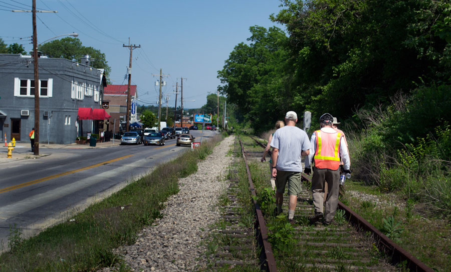
Members of Queen City Bike joined Cincinnati City Councilmember Laure Quinlivan (D) and former MetroMoves chairman John Schneider for a walk along the Wasson Railroad Corridor in May 2012. Photograph by Jake Mecklenborg for UrbanCincy.

Construction of a double track light rail transit line in the right-of-way was first identified by the OKI Regional Council of Governments in the late 1970s. Then in 2002, the Southwest Ohio Regional Transit Authority (SORTA) planned to build a light rail line in place of the Wasson Road freight railroad as part of its MetroMoves plan and failed sales tax referendum. If the ballot issue had passed, construction of a light rail line would have almost certainly commenced soon after Norfolk Southern ceased freight service in 2009.

The width of the Norfolk Southern right-of-way varies wildly as it travels between Xavier University and Hyde Park. It is typically at least 30 feet wide, but in a few places widens close to 100 feet.

In May 2012 members of Queen City Bike walked the right-of-way with John Schneider, who had previously chaired the MetroMoves campaign. At that time, the groups agreed that conflicts between the proposed bike path and light rail line can be avoided if the two are planned as a unified project.

Further complicating the issue is that small sections of the Norfolk Southern property fall under the jurisdiction of the City of Norwood. These sections are all north of the line’s main tracks, for example the railroad’s former yard tracks near Montgomery Road. As Norwood is not involved in Cincinnati’s upcoming land use study, and Cincinnati of course has no influence in its affairs, whatever zoning changes Cincinnati applies will not affect bordering Norwood properties.

The Department of Planning & Buildings will complete its land use study in summer 2013, but with no immediate plans to enter into negotiations with Norfolk Southern, there is no timeline for construction of the Wasson Way Trail.

Categories
News Opinion Politics

Steve Chabot Attempts to Overturn the Will of Cincinnati Voters

There they go again. After two failed initiatives (Issue 9 and Issue 48) to defeat fixed rail public transportation at the ballot boxes, enemies of the Cincinnati Streetcar project are once again moving to bar the city from completing what has been billed as crucial to the economic development of Over-the-Rhine and downtown. This time they found an ally at the congressional level.

Last week, Representative Steve Chabot (R), Ohio’s District One representative, and native of the west side of Cincinnati coyly inserted an amendment into the Transportation Housing and Urban Development (THUD) bill that would bar the use of federal dollars in funding any project in Cincinnati that is on a “fixed guideway” system. The bill is currently in the Senate where it will be voted on and forwarded to the President for his signature should it pass.

The amendment, which reads, “None of the funds made available by this Act may be used to design, construct, or operate a fixed guideway project located in Cincinnati, Ohio,” is designed as an attempt to stop the Cincinnati Streetcar project. The amendment’s language mirrors that of both Issue’s 9 & 48 but has even broader and more far reaching consequences than either of the two failed ballot initiatives.

According to the Federal government, a fixed guideway is defined as:

Any transit service that uses exclusive or controlled rights-of-way or rails, entirely or in part. The term includes heavy rail, commuter rail, light rail, monorail, trolleybus, aerial tramway, inclined plane, cable car, automated guideway transit, ferryboats, that portion of motor bus service operated on exclusive or controlled rights-of-way, and high-occupancy-vehicle (HOV) lanes.

This broad definition means that not only would the amendment preclude that no federal funding go towards the streetcar project but that federal funds would also be barred from being used towards any improvement of the following city projects:

  • Upgrading the city’s overcrowded freight rail system: The city has previously asked for state and federal funding to add a “fourth main” freight rail line expanding the regions freight rail capacity and reducing the impact of an existing freight rail bottleneck along the three main freight lines adjacent to the Mill Creek. The City can’t even ask for this solution if the amendment goes forward.
  • Development of the city’s Bus Rapid Transit system: SORTA and the City have been conducting studies on implementing BRT on several streets in Cincinnati including Reading Road and Montgomery Road. This amendment will make it impossible for the project to utilize much needed federal funds to buy buses and construct stops and street improvements.
  • Development of the Eastern Corridor and Wasson Line for light or commuter rail: Both of these rail lines would connect downtown to the east side of the city. Without federal funds neither project can even be studied. This includes any study on the possibility of a “Rails and trails” combined bicycle path on the Wasson Line.

This amendment is a poison pill meant to punish the progress of Cincinnati and its revitalizing urban core and overrules and ignores the will of the city electorate. It serves only the shortsighted will of vocal minority and threatens to leave our entire metropolitan region at a competitive disadvantage against other regions as we move towards a 21st century economy.

We strongly urge supporters of transportation infrastructure to write Ohio Senators Sherrod Brown (D) and Rob Portman (R) to remove this overly restrictive language from the THUD bill. Additionally, we encourage supporters of transportation infrastructure in Ohio’s First Congressional District to give Representative Chabot an earful over this callous disregard towards voters in his home district.

Happy Independence Day!

Categories
News Opinion Politics Transportation

EDITORIAL: Cincinnati Leaders Should Rethink Planned Rail, Trail Systems

Ten days ago UrbanCincy sounded the alarm on the proposed Wasson Way Trail, and we feel that due to the large amount of feedback that further explanation is needed.

Tomorrow at 12pm, City Council’s Strategic Growth Committee will discuss the proposal that would turn the Wasson Corridor from a railroad right-of-way into a recreational trail. What UrbanCincy is urging City Council to require is a minimum of 28 feet worth of right-of-way preserved for future light rail use.

Standard designs for bi-directional light rail traffic require a minimum of 28 feet of right-of-way. Along some portions of the Wasson Corridor it may very well be possible to accommodate 28 feet for light rail, plus additional right-of-way for the proposed recreational trail, and in those segments it may make sense to get started.


Looking east as the Wasson Line crosses over Interstate 71. Photograph by Jake Mecklenborg for UrbanCincy.

While there is no funding currently in place to build light rail along the Wasson Corridor, it would be short-sighted to remove one of the best rail transit corridors in the city. This was previously done on Cincinnati’s west side when an abandoned railway used by freight and passenger rail traffic was abandoned and then allowed to be built over and occupied by the Glenway Crossings retail center.

Allowing this to take place offered city and county leaders to reap the rewards of a short-term boost, but it has also created a situation that makes building light rail to Cincinnati’s western suburbs almost impossible. This same thing could happen to Cincinnati’s eastern suburbs should the Wasson Corridor be used by a recreational trail.

Proponents of the Wasson Way Trail project made it clear that many of the supporters also want to see light rail eventually happen, but that we should not wait until that day comes to improve the visual appearance of the corridor. Case studies from all over the United States show, however, that once a former rail line is converted into another use, it is almost always an impossible political task to take that land back for rail purposes.


2002 regional light rail plan for Cincinnati.

In the larger scheme of things, UrbanCincy believes that regional leaders need to take a step back and ask themselves why we are still discussing commuter rail along the Ohio River, and a recreational trail through densely populated city neighborhoods. The priorities should be reversed, and the Oasis Line along the Ohio River should be converted into a recreational trail while the Wasson Line is preserved for future light rail use.

It is estimated that the Wasson Light Rail Line would attract three times the number of riders than the Oasis Commuter Rail Line, while also being significantly less expensive to build and operate. Futhermore, when discussions were held about the Oasis Line, residents and property owners along the line voiced their opposition to such activity and have conversely expressed interest in seeing the railway converted into a recreational trail.

City and regional leaders should maintain the natural beauty of the Ohio River and turn the Oasis Line into an attractive recreational trail that can connect into existing trail networks to the east, and the Wasson Line should be preserved for light rail use in the future. It may seem frustrating to leave the Wasson Line in its current state of appearance, but it will be much more frustrating to jeopardize one of the best potential light rail corridors envisioned for the region.

Categories
Business Development News Opinion Transportation

Cincinnati’s Wasson Railroad Corridor Should Not Be Converted Into Recreational Trail

In the post-industrial United States cities all across America have been left with an abundance of rail right-of-way that once served industrial properties. Cities have since struggled to find a use for these rail corridors.

In many cases the rail right-of-way either gets built over, or makes room for some other use – most typically a park or trail of some sort. The most famous, and perhaps most unique, example of this is New York City’s Highline which converted an abandoned freight rail corridor into an elevated park. In most cities, however, much simpler trails are developed in order to cater to bicyclists and pedestrians.

These are great projects, but in the cases where rail right-of-way is needed in order to introduce rail transit, they should not be done. The acquisition of right-of-way can be one of the most difficult hurdles to clear when developing rail transit, so if you have a prime corridor intact, you should do everything in your power to preserve it for future rail transit.


Map of the proposed Wasson Way Project.

The reason this is particularly important in Cincinnati right now is because on March 6, advocates of what is being called Wasson Way Project will present their ideas for converting the Wasson Corridor into a bike/ped trail to City Council’s Strategic Growth Committee.

The idea is not a bad one on face value, but should it proceed it would eliminate one of the most valuable rail corridors in the city. A corridor that could connect neighborhoods like Hyde Park, Oakley, Evanston, Norwood, Mt. Lookout, Fairfax and Mariemont with light rail and eventually connect those neighborhoods to the region’s two largest employment centers – uptown and downtown – without much additional track or right-of-way acquisition.

“I know of no example in the United States where a former railway that has been converted to a bike/hike trail has ever been returned to passenger rail service,” explained Cincinnati transit advocate John Schneider (aka “Mr. Transit”). “Once it’s gone, it’s gone.”

Rail corridors that run through areas of limited potential transit ridership like the Oasis Line should be redeveloped into trails. It just makes sense. There is less automobile traffic and the riverfront trail provides a scenic ride for bicyclists and connects its users to a string of riverfront parks.

The Wasson Line, however, is ripe for light rail service with its densely populated neighborhood, vibrant business districts and key attractions along the line. The Oasis Line should become a bike/ped trail, but the Wasson Line should not.

Unfortunately the exact opposite is progressing for both of these lines in Cincinnati. Hamilton County officials continue to explore funding options to turn the Oasis Line into a commuter rail corridor, and a citizen-led group is strongly advocating for the conversion of the Wasson Line into a bike/ped trail.

While UrbanCincy supports conversion of some rail right-of-ways into other uses, we believe it needs to be done in a thoughtful manner that considers the future transit needs of the region. The Wasson Line is too valuable to convert into a bike/ped trail and should be preserved for an urban light rail line.

The upcoming committee meeting is scheduled to take place at 12pm on Tuesday, March 6 at City Hall (map). We would like to urge you to come out and support the future of regional light rail in the Cincinnati region, and request that the Wasson Corridor not be converted into a recreational trail.

Categories
News Politics Transportation

Residents Take Stand Against Proposed Highway Through Cincinnati’s Eastern Neighborhoods

In December 2010, the Ohio Department of Transportation (ODOT) published its 2011-2015 Major New Construction Project List. The list included funding to resume study of the highway component of the controversial Eastern Corridor Project. Dormant since 2006, the sudden reappearance of the highway project alarmed area residents, more than 100 of whom gathered at the Madisonville Recreation Center on August 3 for a meeting of Cincinnati City Council’s Livable Communities Committee.

On display were ODOT’s two circa 2006 Tier 1 alternatives, one of which called for the complete replacement of Red Bank Road with a fully grade separated interstate-style highway. This drawing, seen for the first time by most in attendance, emboldened suspicions that the Eastern Corridor Project is in fact a veiled attempt to extend Interstate 74 across Hamilton County.

I

“We urge ODOT to unbundle the Eastern Corridor projects and concentrate on providing transportation alternatives in this community, not another highway,” exclaimed one resident at the recent City Council committee meeting. “Reallocating resources to utilize the Wasson Line will produce more cost-effective transportation alternatives for thousands including Madisonville citizens.”

Citizen feedback generally welcomed improvements to Red Bank Road, especially a boulevard or parkway that might compare favorably to the more attractive roads in the area. Many also suggested development of better public transportation, especially implementation of light rail transit on the abandoned Wasson Road railroad.

Read UrbanCincy‘s exclusive in-depth analysis of the Wasson Line and Oasis Line.

Opposition to construction of an expressway in place of Red Bank Road was unanimous at the meeting, and citizen comments were followed by stern questioning of ODOT officials by City Council members Roxanne Qualls, Laure Quinlivan and Chris Bortz.

ODOT assured the committee that the Tier 1 alternatives on display would be reworked and that it will work closely with Madisonville Community Council and other neighborhood groups to ensure a favorable outcome. ODOT officials also remarked that the City of Cincinnati and other jurisdictions through which the Eastern Corridor Project will pass will have to approve ordinances to allow its eventual construction.