Categories
Up To Speed

Mixed record for new Transportation Secretary Anthony Foxx

Mixed record for new Transportation Secretary Anthony Foxx

Last month President Obama choose outgoing Transpiration Secretary Ray LaHood’s (R) successor, Charlotte Mayor Anthony Foxx (D). While Foxx has overseen the expansion of the city’s light rail line and championed its streetcar project he has also supported extensions for the regions highways. What does his eventual appointment mean for American cities looking to mitigate sprawl and increase transportation alternatives?  More from NextCity:

When the news broke in January that LaHood would not serve a second term, a number of transit advocates fantasized that his position would go to a superstar like Los Angeles Mayor Antonio Villaraigosa or New York City Transportation Commissioner Janette Sadik-Khan. Instead, as our friends at Streetsblog have already pointed out, LaHood’s successor comes from a background indicating that he’ll support “giving people more transportation options without making much of an effort to rein in sprawl infrastructure.”

Categories
Business Development News Opinion Transportation

Portland Aims to Replicate Streetcar Success on East Side of Willamette River

Six months ago Portland celebrated the opening of a 3.3-mile extension of their modern streetcar system across the Willamette River.

The $148.3 million Portland Streetcar project represents a significant expansion of the existing six-mile system, and city leaders hope it will find similar success in the Lloyd District, Buckman and Hosford-Abernethy neighborhoods as it has in the Pearl District and Northwest District.

At the time when Portland built its first streetcar leg, the Pearl District was a rundown industrial district in search of new life, and the Northwest District was looking to build on its existing stability.

Pearl District Buckman Neighborhood
Portland’s Pearl District [LEFT] has seen a massive transformation over the past decade, and many hope the streetcar’s recent extension will do the same for the city’s Buckman neighborhood [RIGHT]. Photographs by Randy Simes for UrbanCincy.

The story is not all that different on the east side of the river where the Buckman and Hosford-Abernethy neighborhoods are looking for the streetcar to breathe new life into its underutilized land and lingering industrial users, and the Lloyd District is trying to build on its successes and possibly reinvent itself with a lesser focus on the automobile.

While the streetcar extension is operating daily, the investments are not quite finished. Transportation officials are waiting on an additional six streetcar vehicles to roll off the production line so that service frequencies can be improved for the system’s four million annual riders.

TriMet officials are also overseeing progress on the construction of the new Portland-Milwaukie Bridge which will provide a river crossing for bicycles, pedestrians, streetcars, and light rail from Hosf0rd-Abernethy to the South Waterfront District as part of a the 7.3-mile Portland-Milwaukie Light Rail Project.

The $134 million bridge project is expected to open in September 2015 and buoy both new and existing ridership on the city’s light rail and streetcar systems.

Portland-Milwaukie Light Rail Bridge South Waterfront District
Construction progresses on the Portland-Milwaukie Light Rail Bridge in November 2012 [LEFT], which will connect the Hosford-Abernethy neighborhood with the South Waterfront District [RIGHT]. Photographs by Randy Simes for UrbanCincy.

The verdict is still out on whether or not the new east side streetcar extension will have as big of an impact as it did on the west side of the river next to downtown, but the possibilities are there.

The streetcar’s alignment through Buckman and Hosford-Abernethy heads south along Martin Luther King Boulevard and north a block over on Grand Avenue. To the west of MLK Boulevard is the river with a large collection of warehouses in between. To the east of Grand Avenue is an in-tact neighborhood that has become increasingly popular with young creative types over the past several years.

In between the two streets one will find a collection of aging car dealerships and associated service businesses that date back to the mid-twentieth century.

These large parcels, combined with the large warehouse properties immediately to the west, offer a unique opportunity for large scale redevelopment. Such massive real estate investment might not be plausible without another real estate bubble.

The prospects are there, however, and if Portland can pull off even a fraction of the investment in Buckman as they saw in the Pearl District, then the city will add billions of dollars to its real estate value and create a secondary downtown in the city center for the 2.2 million person region.

Categories
Development News Politics Transportation

OKI Survey Results Show Preference for Compact, Walkable Communities

The OKI Regional Council of Governments has released the findings from its 2012 How Do We Grow From Here survey, and is reporting a record response.

According to OKI officials, the survey received 2,474 responses and more than 1,200 comments. In the past, the organization had received around 100 responses for similar surveys, but was hoping for higher numbers this time around due to a larger outreach effort.

The survey is intended to take the pulse of the Cincinnati region with regards to regional vitality, sustainability, and competitiveness with a special focus on land use and transportation policy. The results of the survey are then intended to be used when updating the metropolitan planning organization’s Strategic Regional Policy Plan (SRPP), which was last updated in 2005.

OKI 2012 Survey Results

“While much has been accomplished since the plan’s adoption in 2005, much remains to be done to reach its goals,” state OKI officials. “The SRPP needs to be updated to reflect the impacts of subsequent events such as the Great Recession and significant changes in our demographics, particularly as the baby-boom generation ages.”

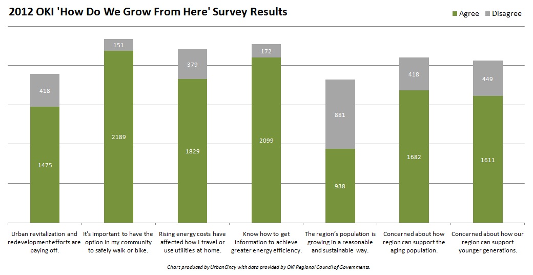
Of the survey’s 21 total questions, seven offered particularly revealing insights into the psyche of those from around the region concerning transportation options, economic development strategies, and land use policy.

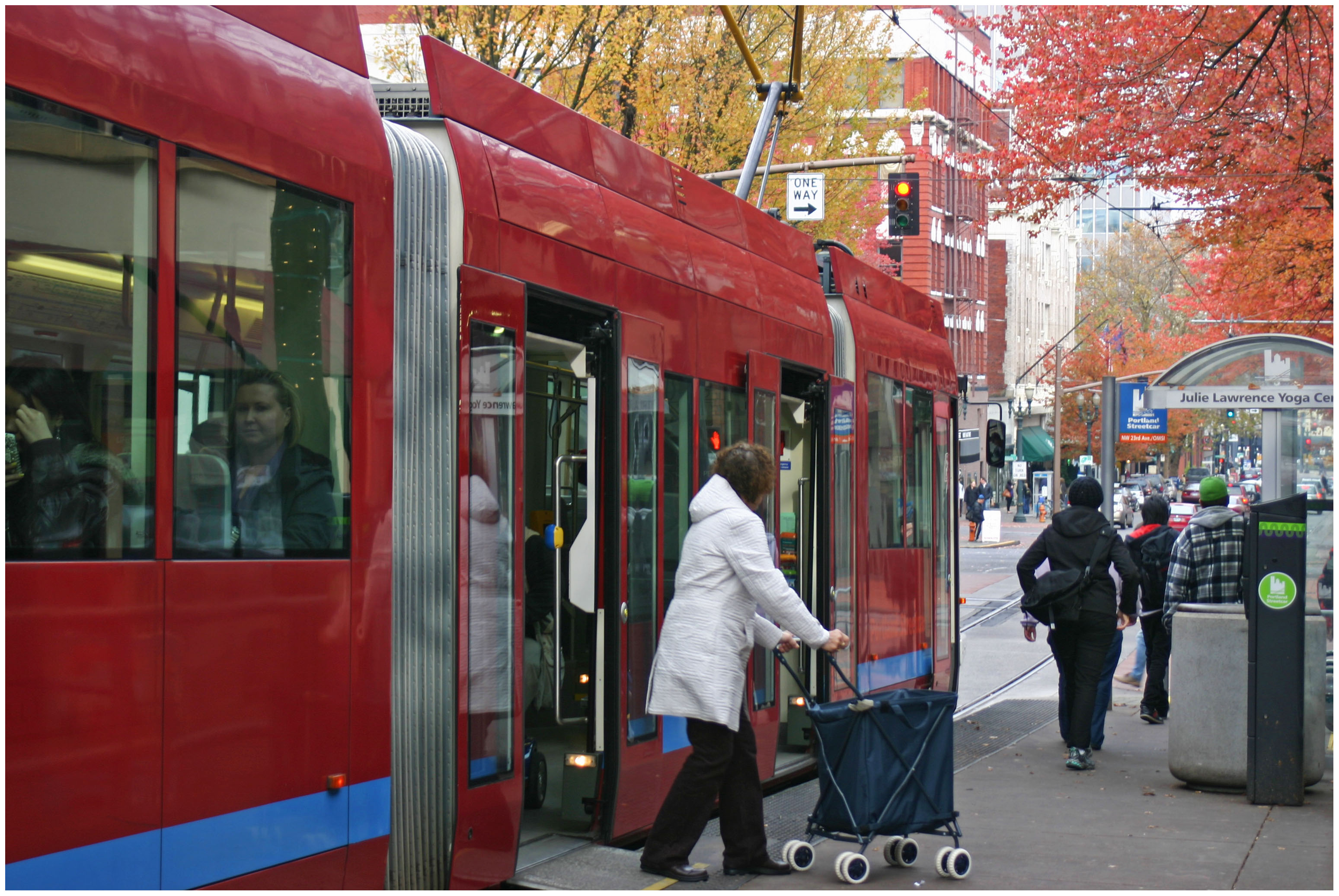
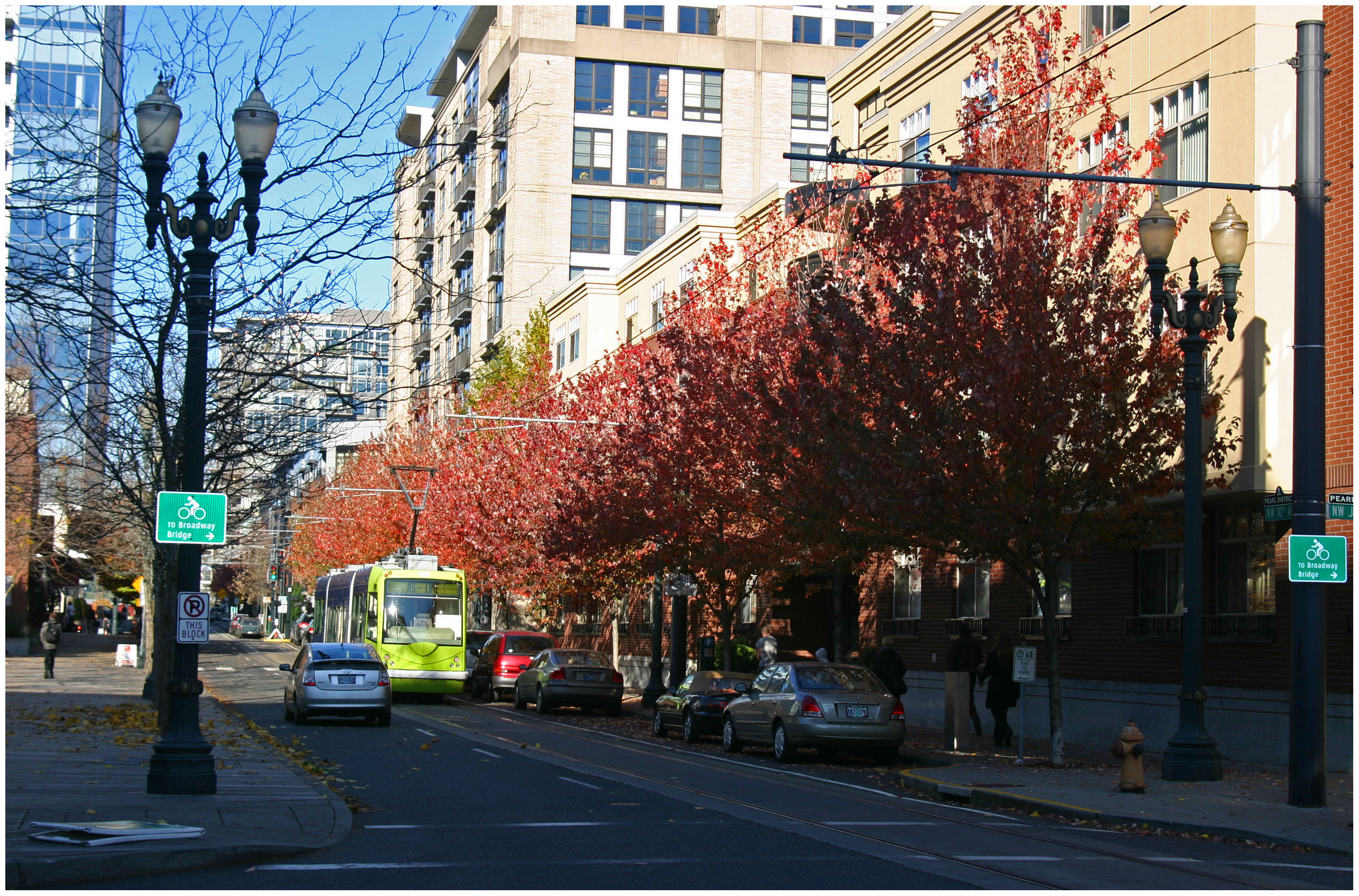
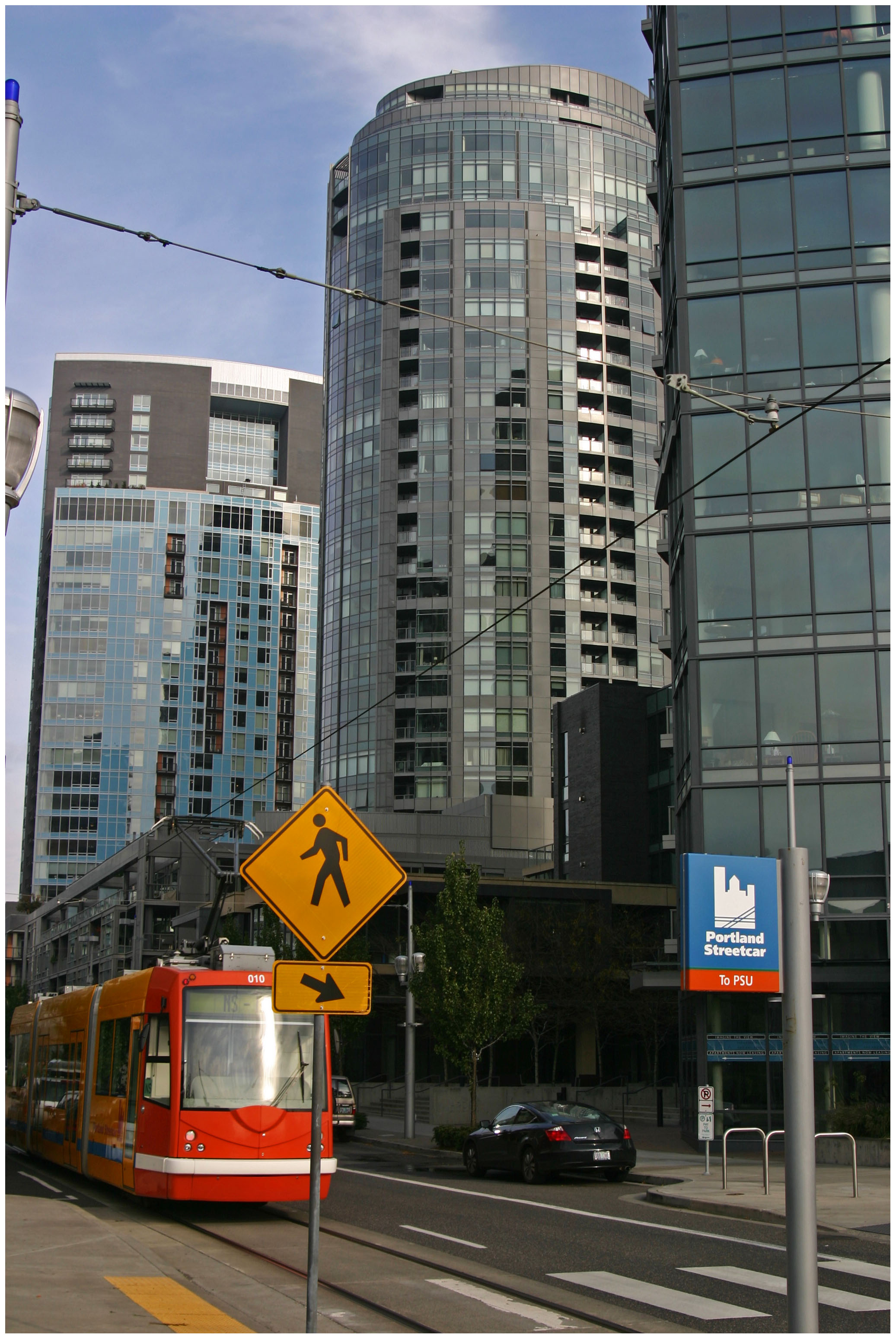
The survey results indicate a clear preference for sustainable and urban communities. Approximately 60% of respondents said that they felt urban revitalization and neighborhood redevelopment efforts are paying off, and a whopping 88.5% said that it is important to have safe pedestrian and bicycling options in their community.

While the 2,474 respondents stated that they wanted to see existing infrastructure maintained and their communities built in a way to support walking and bicycling, it does not appear that they feel the region is heading in that direction.

“Bicycle infrastructure can play a big role in enhancing public health, providing additional options for transportation, and reducing pollution,” commented one responder. “I also would support a comprehensive transportation plan that includes the extended streetcar line and light rail. This could reduce traffic congestion and pollution and enhance economic growth for our neighborhoods.”

More than a third of those responding said that they feel the region is growing in an unsustainable manner, and more than two-thirds expressed concern about how the region’s housing, transportation, healthcare, and recreation options will support aging individuals and younger generations that desire walkable urban communities.

A 2011 report from Transportation For America found that more than 64% of Cincinnati’s population between the ages of 65 and 79 will have poor transit access by 2015 – ranking the region as the 17th worst out of 48 regions with 1-3 million people.

When asked about energy and the climate, approximately 74% said that rising energy costs have impacted their lifestyle choices surrounding transportation and utilities. With nearly 85% of those same respondents feeling confident about knowing where to go to get more information or help to achieve greater energy efficiency, it appears that organizations like the Greater Cincinnati Energy Alliance are making a positive impact.

“OKI needs to develop renewable energy sources for our area and eliminate all fossil fuel usage in the next 10 years,” responded one individual on the survey. “OKI needs to actively promote the Greater Cincinnati Energy Alliance that has enough funding to upgrade close to 70,000 homes and business in the Hamilton County and northern Kentucky.”

OKI officials state that while they currently have no authority, and seek no authority, over local land use decisions, they hope that the results of their updated SRPP will bring about more consistency between local land use planning and regional transportation planning.

On episode two of The UrbanCincy Podcast we discussed the issue of transportation poverty facing Cincinnati’s aging population, and how unsustainable development patterns are hurting the region’s environment and economy. You can stream our bi-weekly podcasts online for free, or download the podcasts on iTunes.

Categories
Up To Speed

More than $64.3B to be invested in North American rail transit in 2013

More than $64.3B to be invested in North American rail transit in 2013.

As the migration of people from the suburbs back to cities continues, so does the investment in urban forms of transport. A modern streetcar route is currently under construction in Cincinnati, and bus rapid transit, light rail and commuter rail is all being studied for the area. Nationally, more than $64.3 billion is being invested to expand rail transit. More from The Transport Politic (including map):

What is evident is that certain cities are investing far more than others. Among American cities, Denver, Honolulu, Houston, Los Angeles, New York, San Francisco, Seattle, and Washington stand out as regions that are currently investing particularly dramatically. Toronto has the biggest investments under way in Canada. These metropolitan areas have invested billions of local dollars in interconnected transit projects that will aid in the creation of more livable, multi-modal environments. Dynamic, growing cities require continuous investment in their transit systems.

Categories
News Transportation

Cincinnati Moves Forward With Land Use Study of Wasson Railroad Corridor

On November 14, Cincinnati’s Department of City Planning & Buildings held a public hearing on its upcoming land use study for the disused Wasson Road Railroad and adjacent properties.

Norfolk-Southern Railroad ended service on the line in 2009, and in 2010 the City of Cincinnati’s Department of Transportation & Engineering (DOTE) identified the right-of-way as a future off-road bicycle path in its planned 400-plus-mile network of bike lanes and trails.

Local bicycle advocates have since built public support for construction of a paved rails-to-trails bicycle path between Xavier University and Fairfax as part of a project called the Wasson Way Trail.


The proposed Wasson Way Trail would use the Norfolk Southern Railroad right-of-way to create a bike trail from the Little Miami Trail to Xavier University. Image provided.

On Wednesday, however, city officials were quick to mention that the upcoming land use study is just that – a determination of how the Norfolk Southern property and its surroundings might be rezoned in order to protect the right-of-way up until and after the right-of-way is purchased by Cincinnati – not a determination of what should be built in its place.

Already, Norfolk Southern has leased some of its railroad property for other uses. In 2011, a shopping center at Wasson Road and Edwards Road created a gravel parking lot on the disused tracks and another business near Paxton Road is looking to do the same.

Although Federal regulations prohibit railroads from subdividing their disused properties until they complete an “abandonment” process, Wasson Way Trail advocates are concerned that revenue from additional leases might discourage Norfolk Southern from selling the right-of-way to the City of Cincinnati at a future date.

Michael Moore, Director of the City of Cincinnati’s DOTE, stated that appraisals of the Norfolk Southern property fall close to $2.5 million. He cautioned, though, that this appraisal should not be thought of as a sale price, as the terms of the City’s purchase of the property cannot be known at this time.

Multi-Modal Use of the Corridor
At the November 14 meeting, city officials also made a point of stating that the title of the upcoming land use study has not been determined but that it will make no explicit mention of bicycle paths, light rail transit, or multi-modal use of the corridor.


Members of Queen City Bike joined Cincinnati City Councilmember Laure Quinlivan (D) and former MetroMoves chairman John Schneider for a walk along the Wasson Railroad Corridor in May 2012. Photograph by Jake Mecklenborg for UrbanCincy.

Construction of a double track light rail transit line in the right-of-way was first identified by the OKI Regional Council of Governments in the late 1970s. Then in 2002, the Southwest Ohio Regional Transit Authority (SORTA) planned to build a light rail line in place of the Wasson Road freight railroad as part of its MetroMoves plan and failed sales tax referendum. If the ballot issue had passed, construction of a light rail line would have almost certainly commenced soon after Norfolk Southern ceased freight service in 2009.

The width of the Norfolk Southern right-of-way varies wildly as it travels between Xavier University and Hyde Park. It is typically at least 30 feet wide, but in a few places widens close to 100 feet.

In May 2012 members of Queen City Bike walked the right-of-way with John Schneider, who had previously chaired the MetroMoves campaign. At that time, the groups agreed that conflicts between the proposed bike path and light rail line can be avoided if the two are planned as a unified project.

Further complicating the issue is that small sections of the Norfolk Southern property fall under the jurisdiction of the City of Norwood. These sections are all north of the line’s main tracks, for example the railroad’s former yard tracks near Montgomery Road. As Norwood is not involved in Cincinnati’s upcoming land use study, and Cincinnati of course has no influence in its affairs, whatever zoning changes Cincinnati applies will not affect bordering Norwood properties.

The Department of Planning & Buildings will complete its land use study in summer 2013, but with no immediate plans to enter into negotiations with Norfolk Southern, there is no timeline for construction of the Wasson Way Trail.