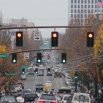
Every weekday tens of thousands of commuters in downtown Cincinnati struggle in traffic to get onto the highway and back to their homes in other neighborhoods or the suburbs. However, City Hall is stalling on taking advantage of a unique opportunity to capitalize on funds to study and re-time the traffic signals to benefit all road users downtown.
The last time the traffic patterns of the city’s downtown Central Business District were studied was in the mid 1990’s. Back then the city had about 80,000 workers (a New York Times article puts the number at 82,000 in 1991) which is about 17,000 more than the most recent Downtown Cincinnati Inc. count of 65,000.
There are plenty of other things that have happened in downtown Cincinnati since the last traffic signal study, such as the reconfiguration and realignment of Fort Washington Way, the building of the Banks development, an increase of over 10,000 residents and of course the Cincinnati Bell Connector streetcar.
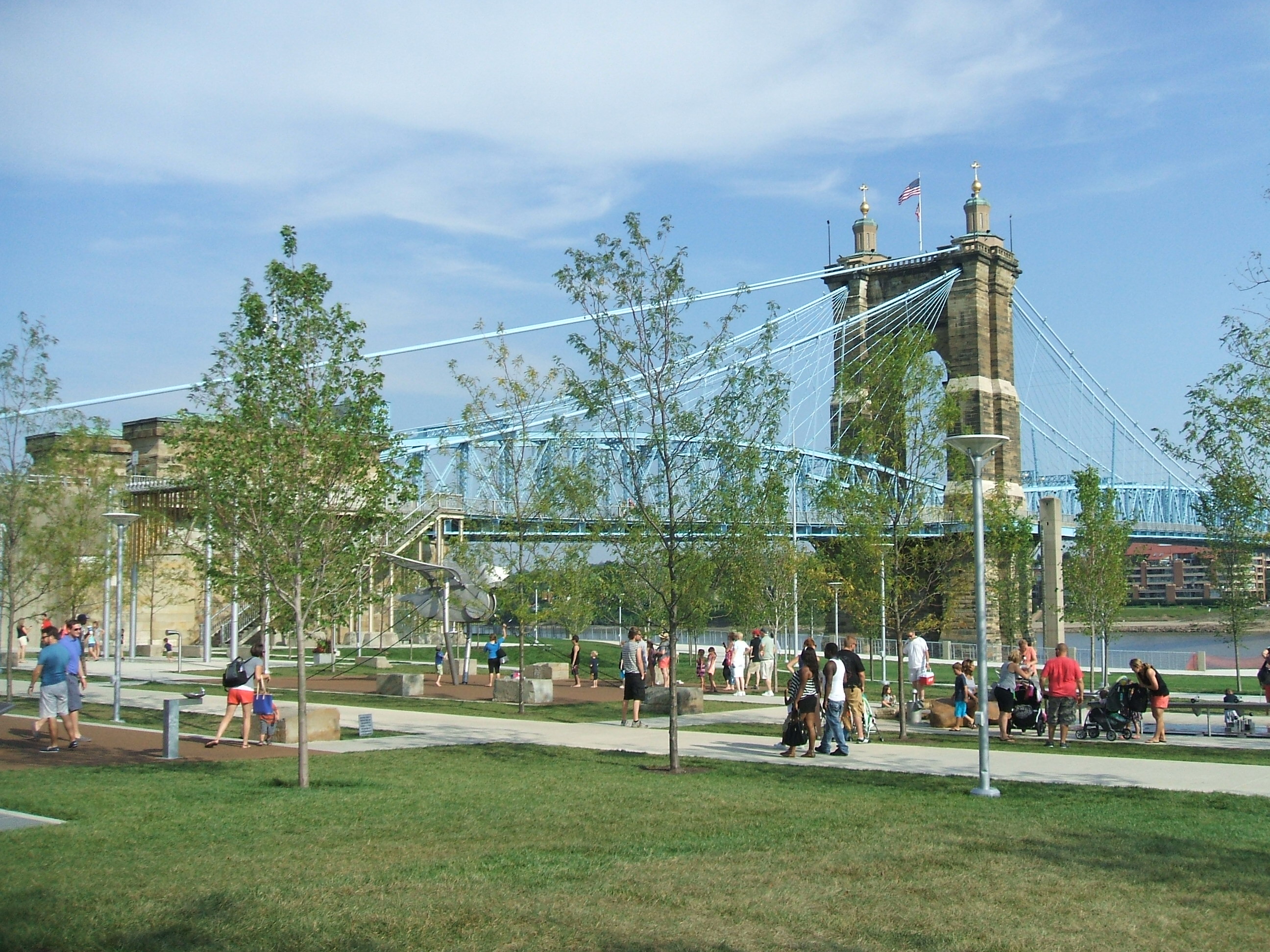
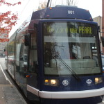
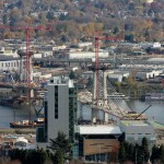
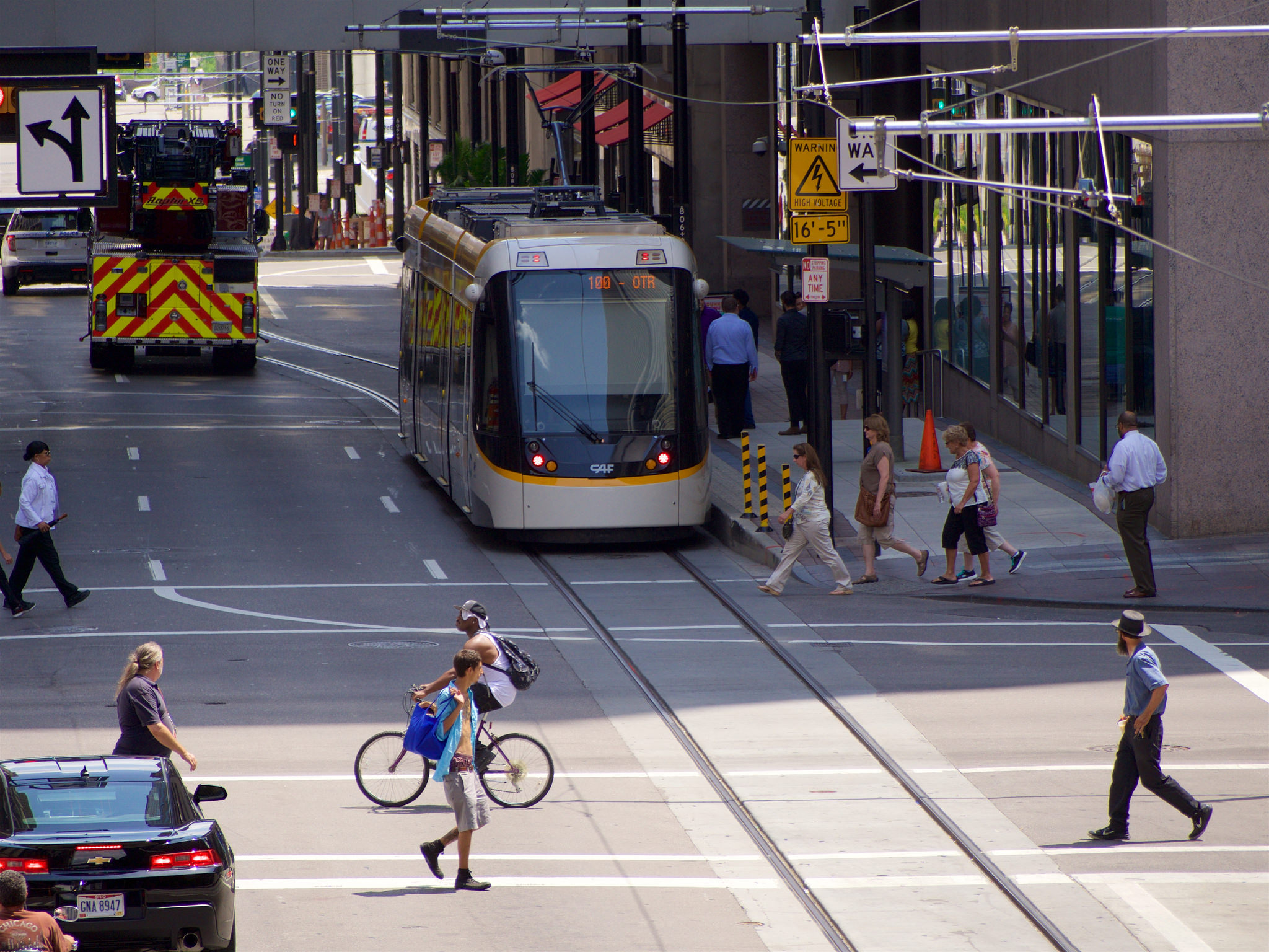
A traffic study and signal improvements would benefit all modes of transportation downtown
The funds for the study would come from the Cincinnati Streetcar Contingency Fund, basically funds left over from the construction and startup of the system. The study would not only allow the city’s Department of Transportation and Engineering (DOTE) to conduct the study but also would fund much needed upgrades to signals across downtown.
This would allow for the city to implement a more robust and flexible traffic timing scheme beyond the archaic three phase programming of the current signal system which is only programmed for rush hour, non-rush hour and weekend traffic patterns.
In October, City Council voted to approve a motion to start the traffic study. Since then, however, progress has been stalled for unknown reasons. The study was discussed again in council chambers this week as Council members probed Metro and City Administration on streetcar operations.
Streetcar supporters are quick to blame the city leadership on stalling to create a narrative that the streetcar is a failure. And the response to that, to blame Transdev, the company that operates the streetcar, should not go unheeded. However; the city is stalling on a golden opportunity to modernize and coordinate downtown traffic for the 21st Century.
This is a project that would fit perfectly into the data driven decision-making vision this administration values. And maybe we will all benefit from time saved being stuck in traffic whether we are drivers, pedestrians, cyclists, bus commuters or even streetcar riders.
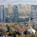
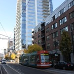
Autumn heralds apple cider, crisp cool air and the colorful reveal of fall foliage. The best way to experience this in Cincinnati is by visiting one of the city’s many parks. This city is blessed with having some of its best parks within or overlooking its urban core. The Smale Riverfront Park, Washington Park and others dot the landscape and are all easily connected by the brand new Cincinnati Bell Connector. Yet the leaves won’t stay on the trees forever, which is why this weekend is the best time to snap a few photos!
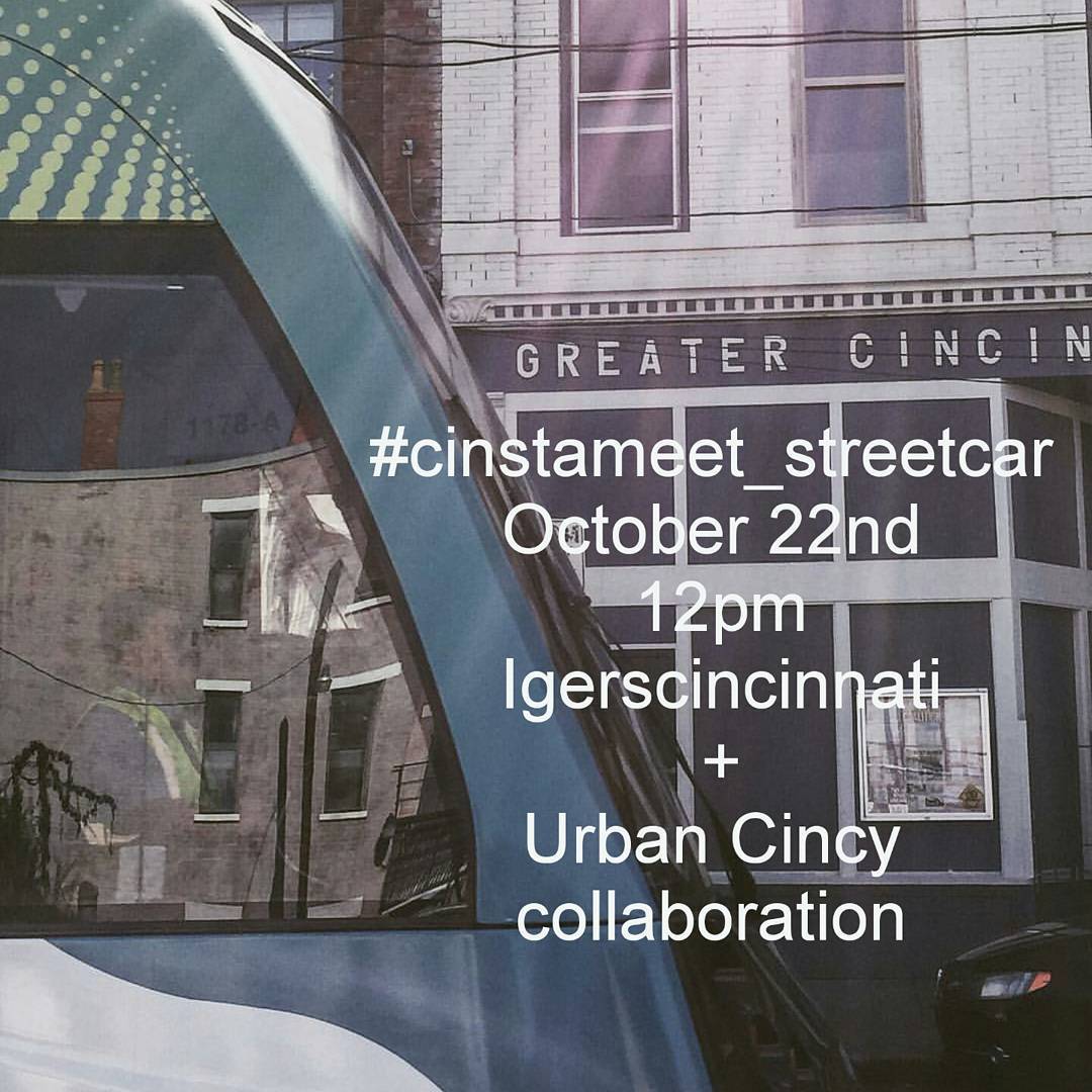
UrbanCincy has partnered with IGers Cincinnati, a group dedicated to highlighting the best Cincinnati area Instagramers to do a photo walk this Saturday, October 22 at noon. The photo walk, called “Park + Ride,” will highlight the new Cincinnati Bell Connector and the city’s great urban parks along the streetcar route.
Participation is free and open to anyone. This is a great opportunity to meet new people, fellow Instagram photographers and more. We will be meeting at the “Sing the Queen City” sign at Smale Riverfront Park at noon. From there the group will tour the Riverfront Park before boarding the streetcar to travel to our next destinations. Stops include Smale Riverfront Park, Piatt Park, Washington Park and the Rhinegeist rooftop deck. There will also be an optional climb to Bellevue Hill Park.
Some photos taken at the event and tagged with #cinstameet_streetcar will be highlighted by UrbanCincy.
The event starts at noon on Saturday October 22 in front of the “Sing the Queen City” sign located at the foot of the Roebling Suspension Bridge. It is easily accessible from the Banks Streetcar stop and is located within a block of three Cincy RedBike stations. Bring your smartphone or camera. We hope to see you there!
A few weeks ago I journeyed seven-plus hours by car from Cincinnati to Atlanta for the American Planning Association’s (APA) national conference. The five-day conference was held in the Georgia World Congress Center in the core of Atlanta between downtown and Vine City.
This was my first trip to Atlanta since passing through the city in the early 1990’s.
For an urbanist, the city of Atlanta at first glance is a conundrum. Subway stations that seem to feed park and rides, buildings that barely front the street and streets with no crosswalks where pedestrians play a dangerous game of Frogger just to cross to the other side are all typical occurrences in the city.
However the city is all of these things and more. Atlanta boasts beautiful and funky neighborhoods such as Poncey Highlands, Little Five Points and Castleberry Hill. Beautiful parks such as Inman Park and the Frederick Law Olmsted-designed Piedmont Park.
The BeltLine, a multi-modal transportation corridor we reported on last week, has sparked development along its route and spurred pedestrian and bicycle connectivity between many of Atlanta’s intown neighborhoods.
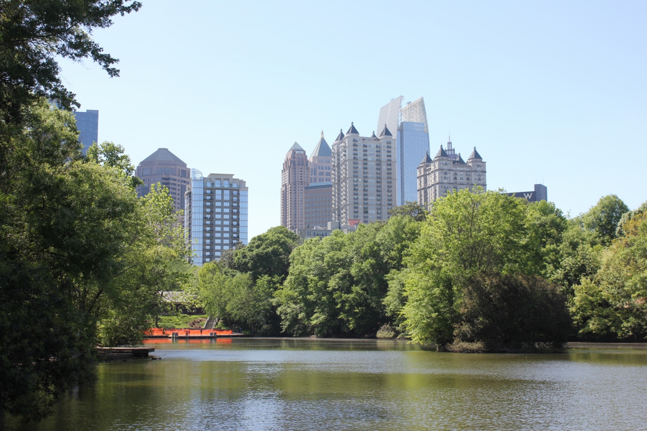
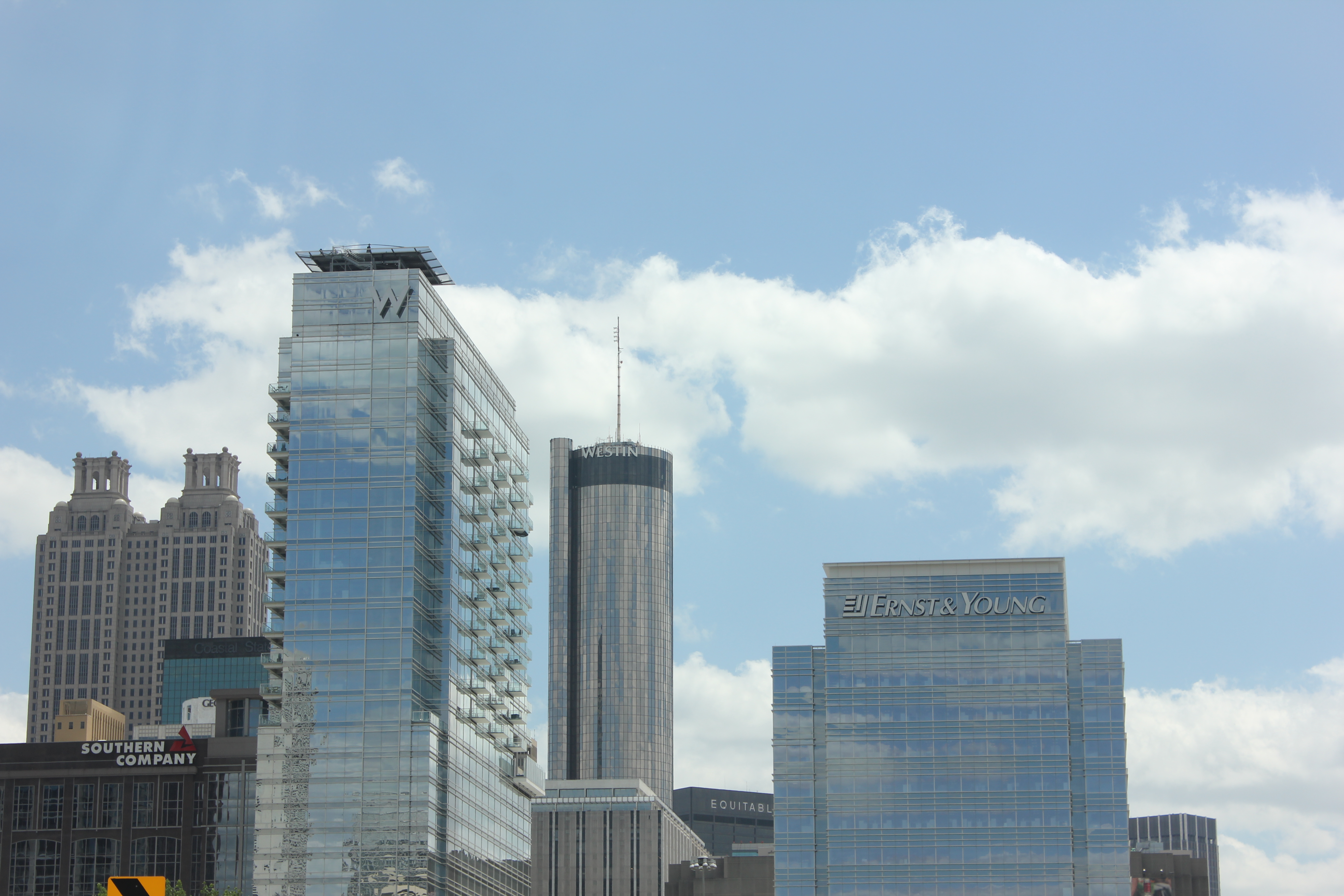
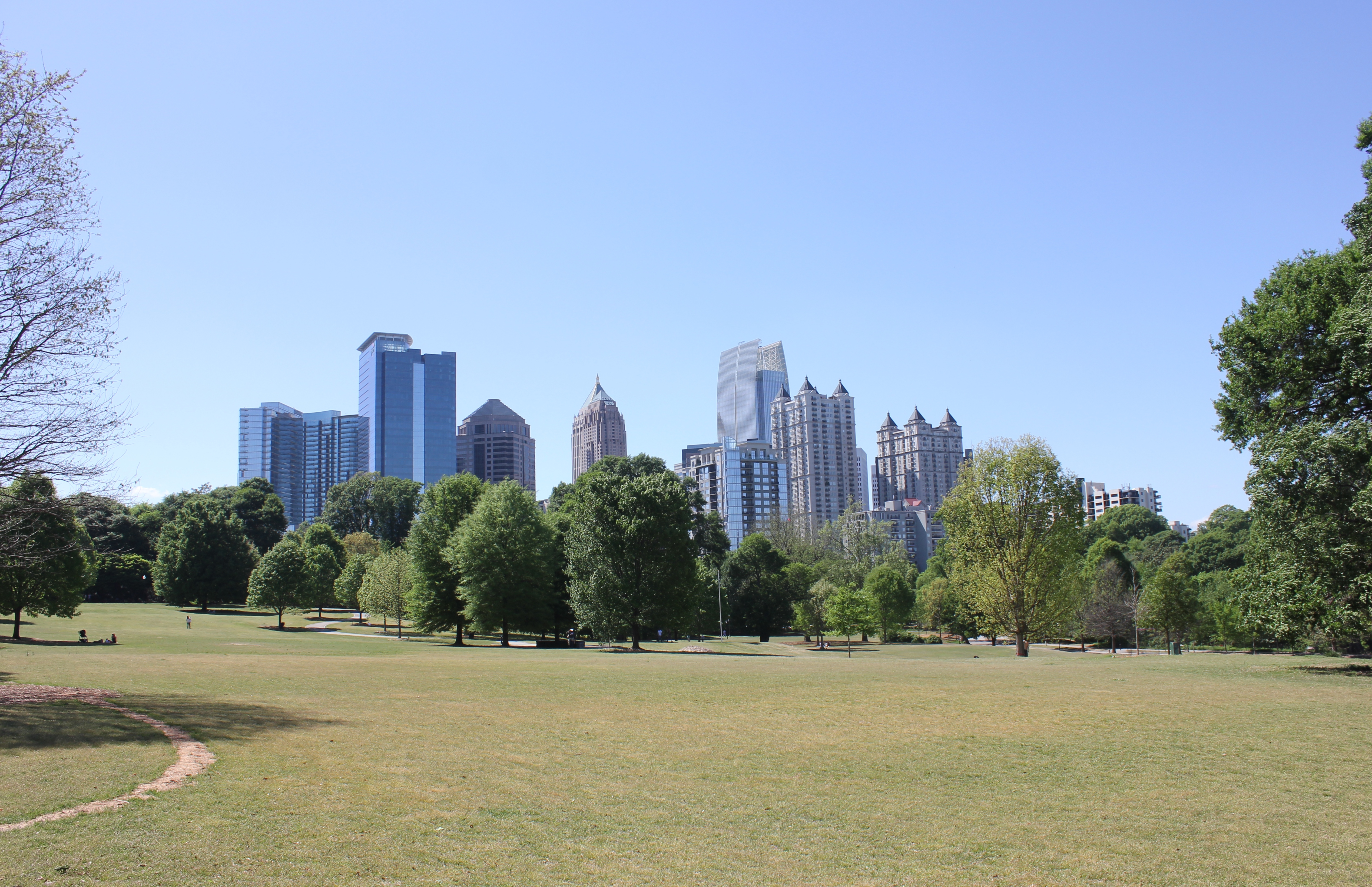
The Midtown Skyline
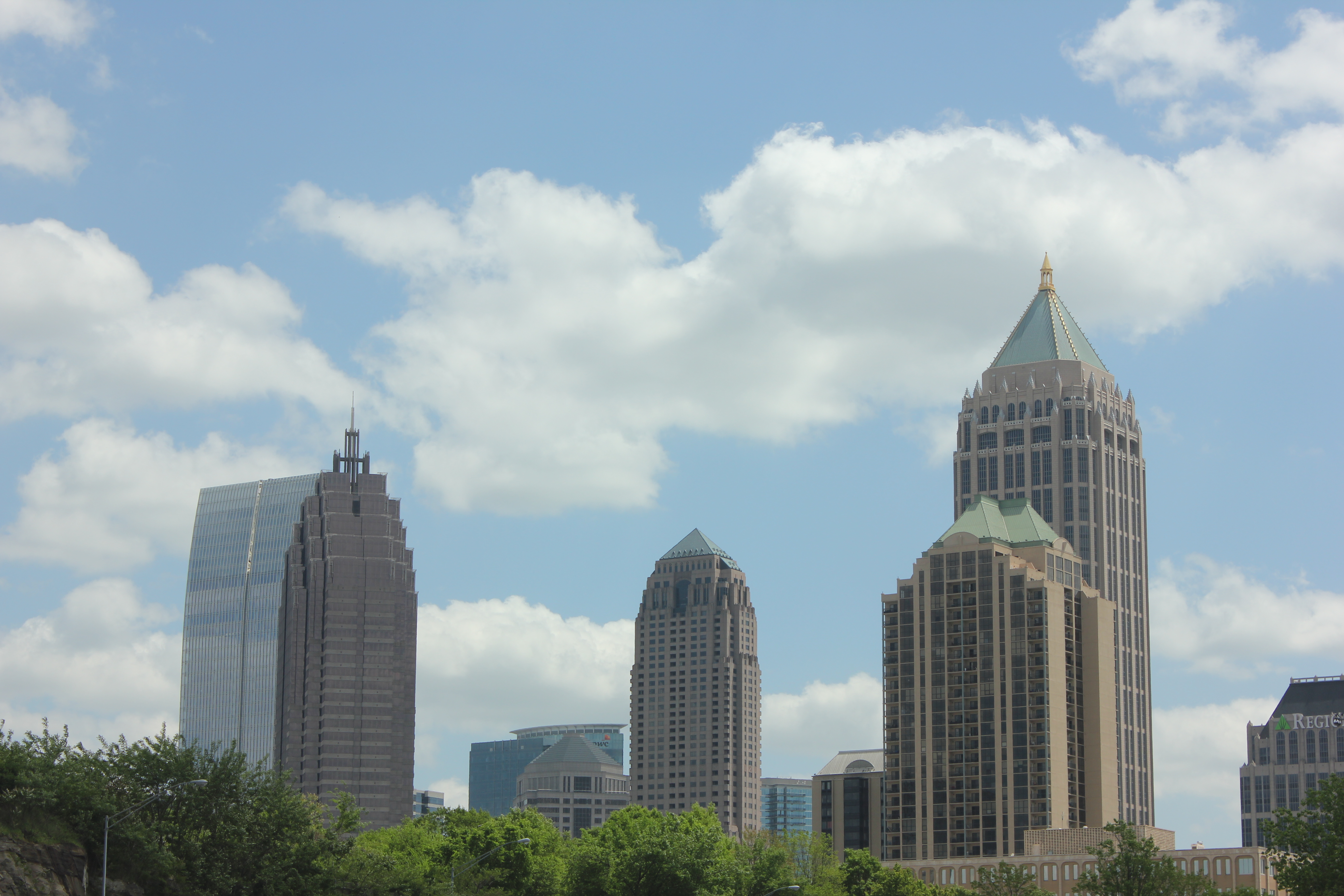
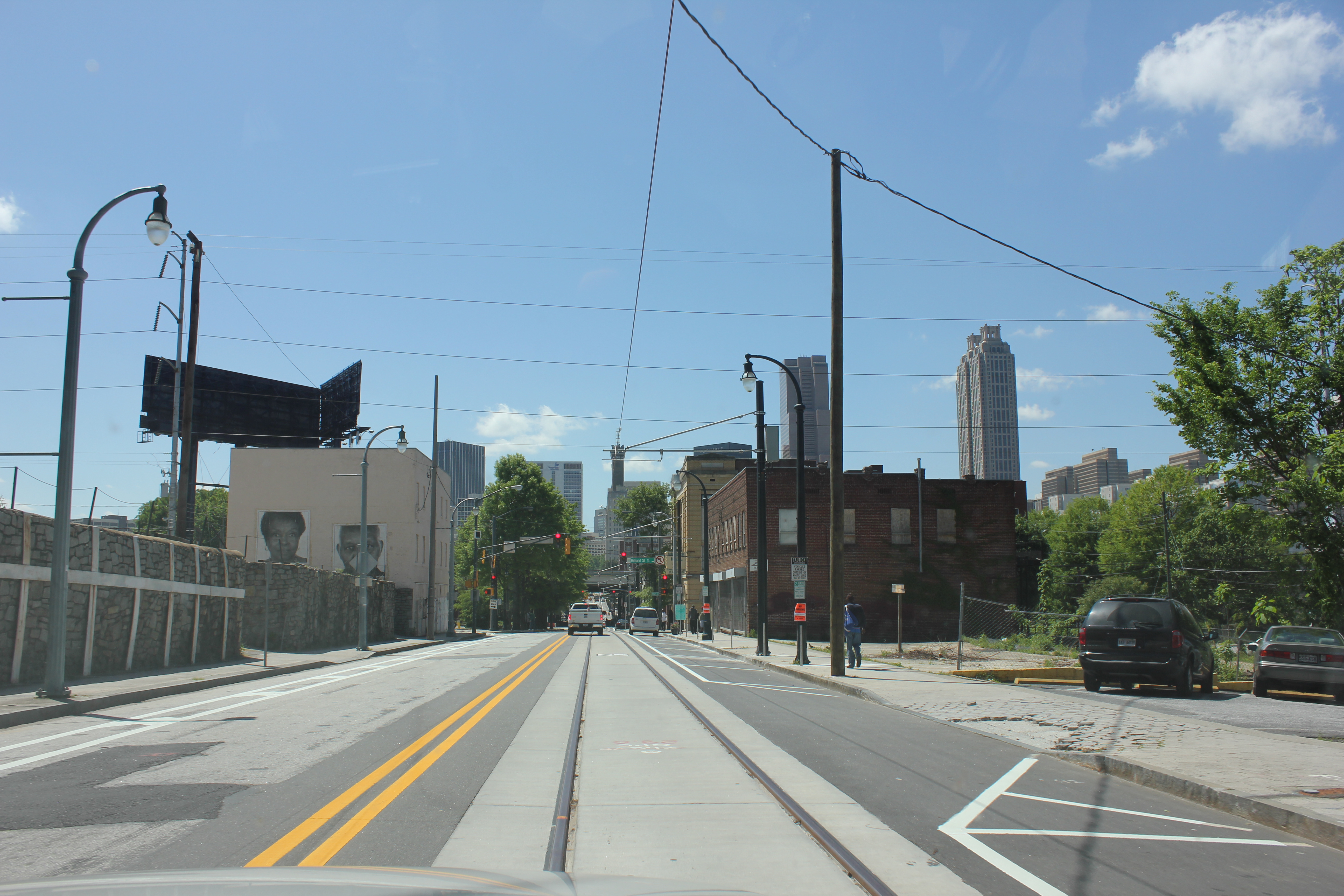
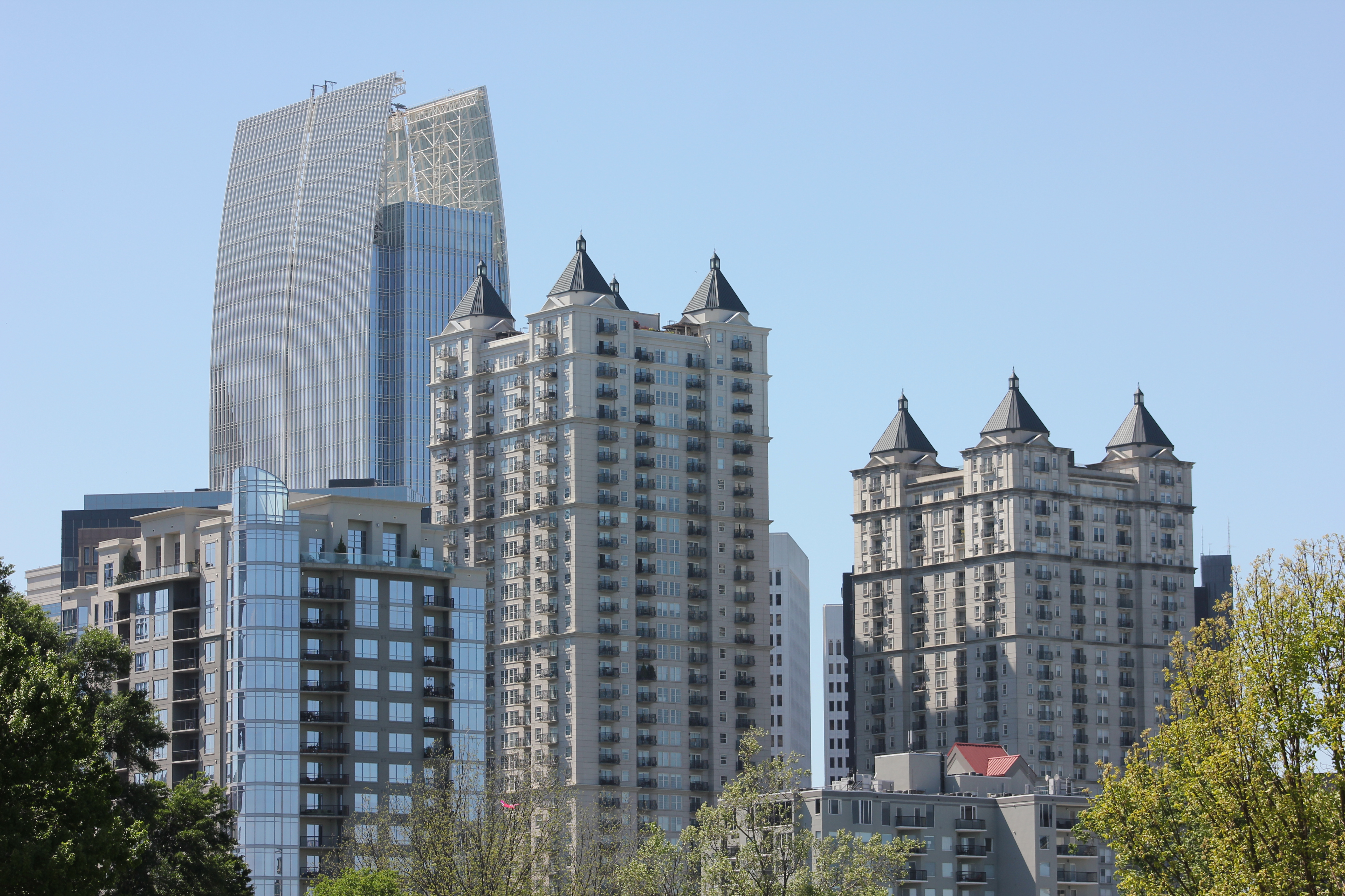
Downtown Atlanta
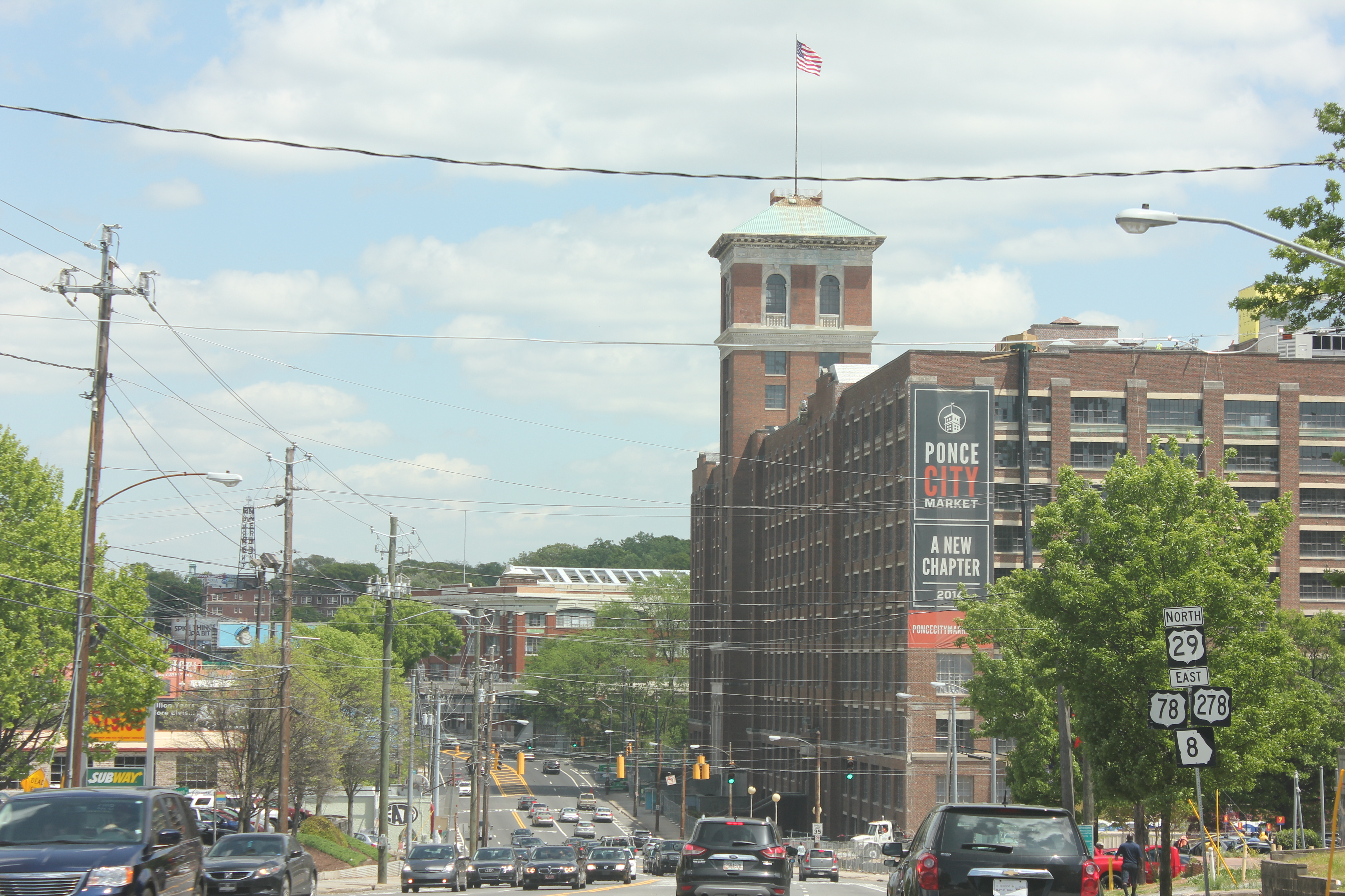
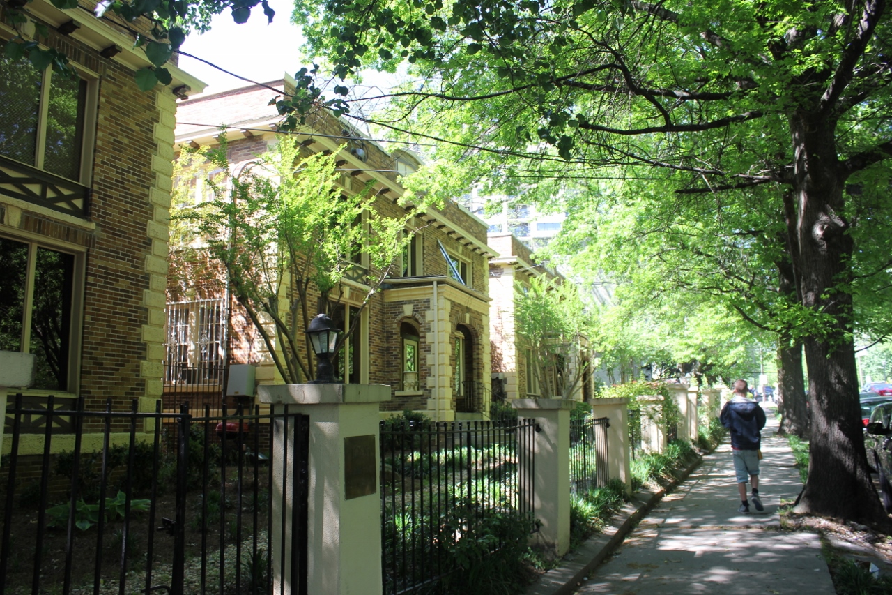
Redevelopment in Poncey Highlands
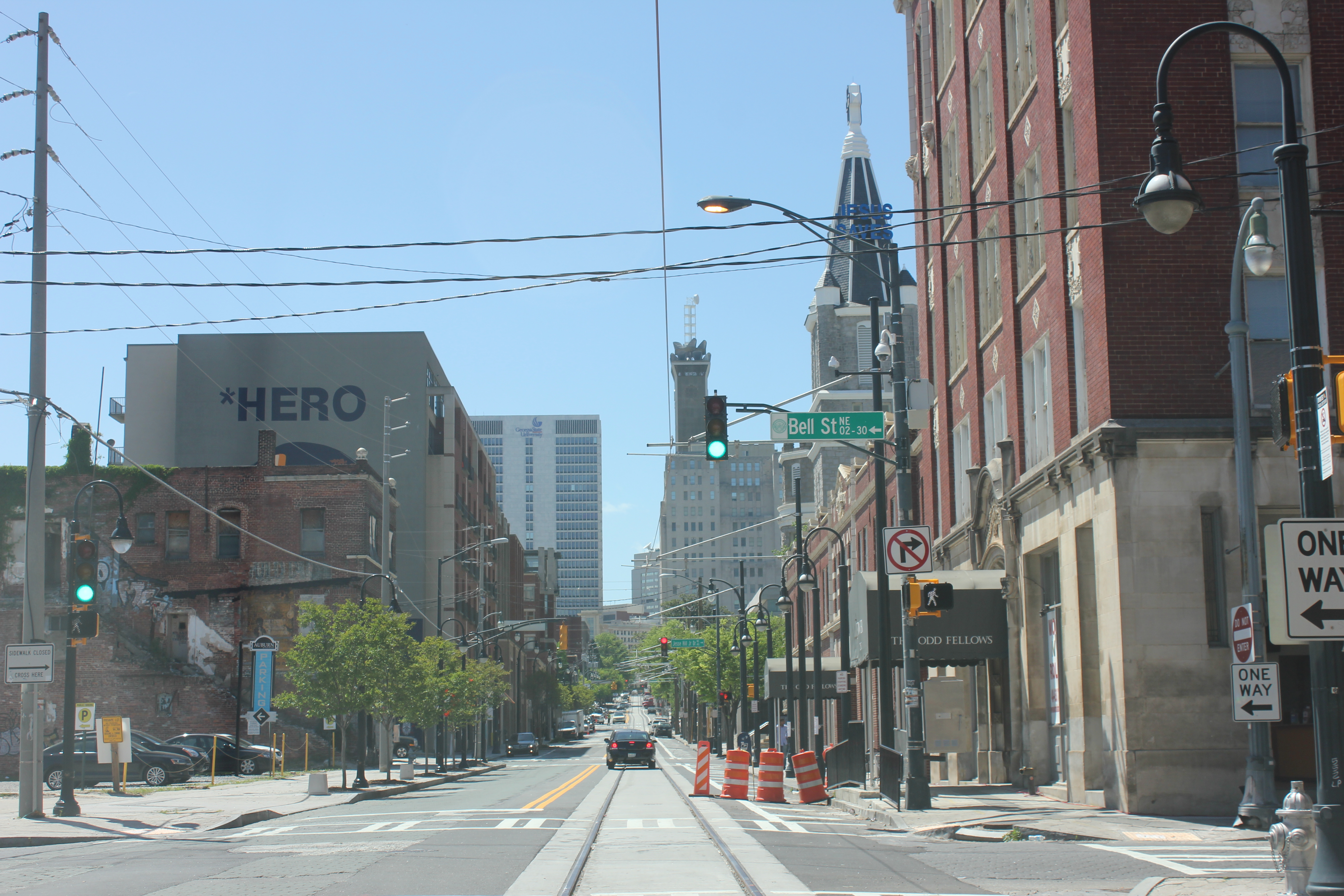
Atlanta Streetcar track and wire
Streetcar power substation
Atlanta Streetcars by Siemens
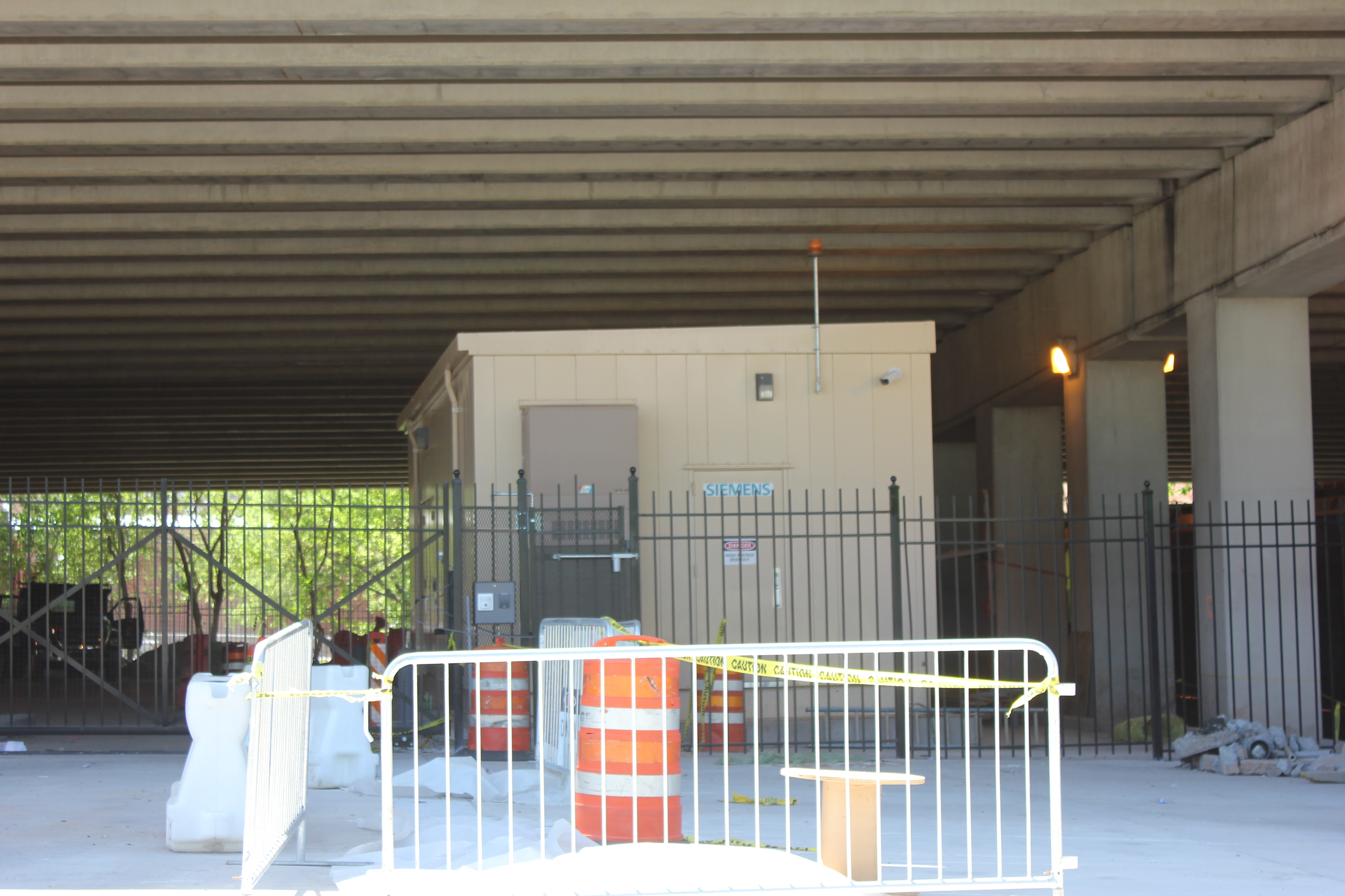
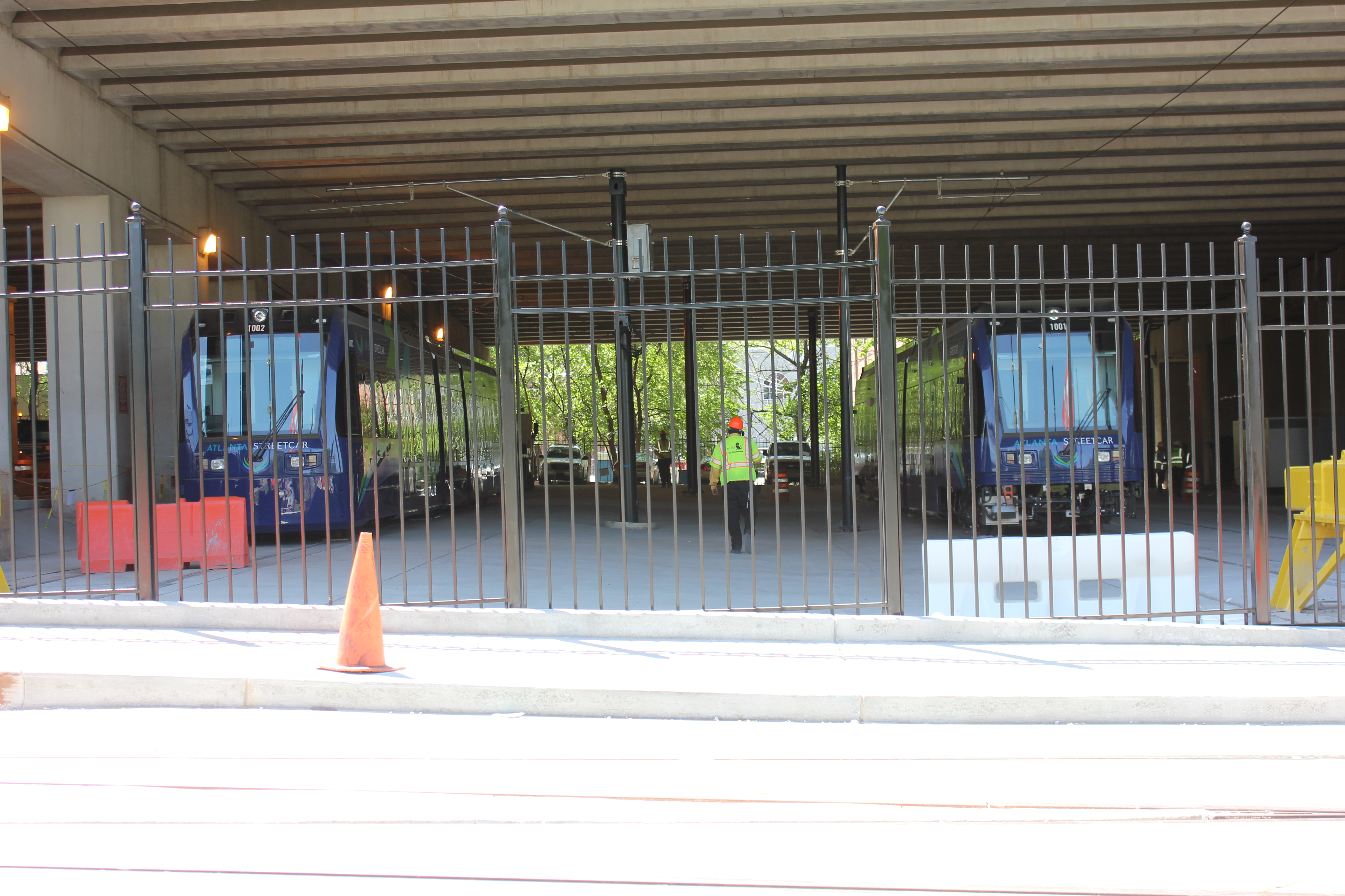
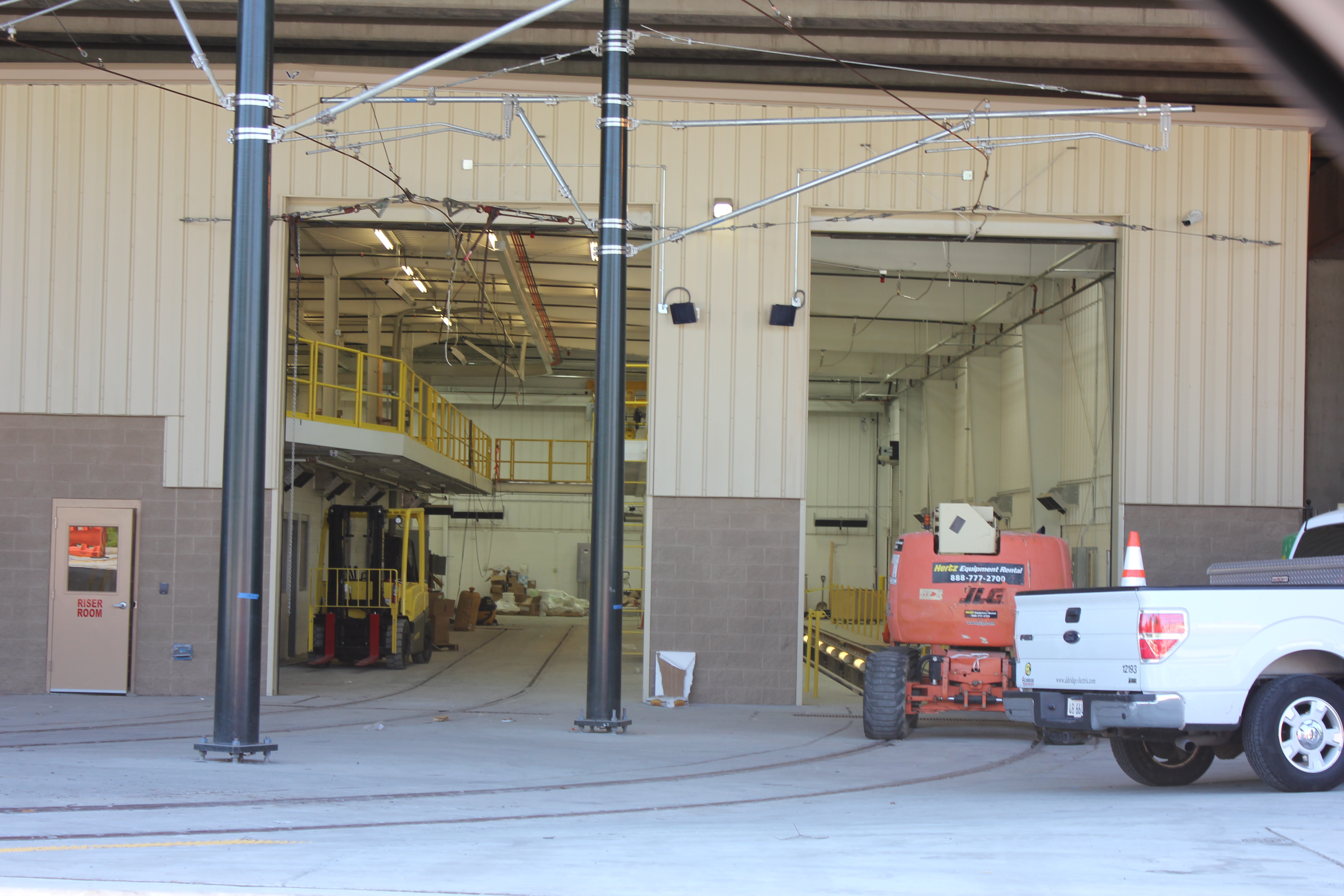
Streetcar Maintenance Facility
Finished Streetcar track
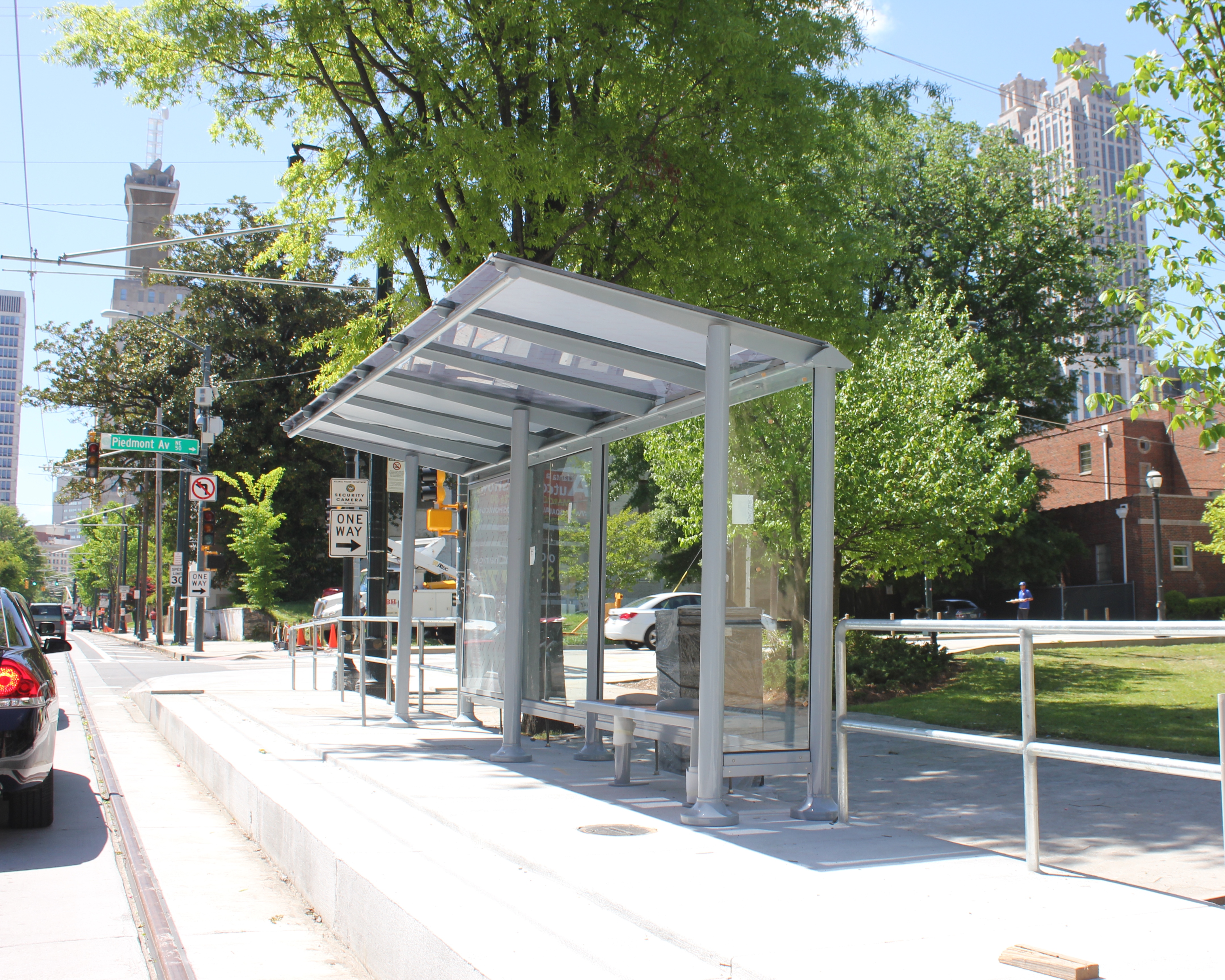
Completed Streetcar Station
Midtown from Piedmont Park
Residential high rises in Midtown
Beautiful historic homes near Piedmont Park
The skyline from Piedmont Park pond
During the conference I also had a chance to view the Atlanta Streetcar, which could begin operating later this year. Planners in Atlanta have tucked the streetcar’s maintenance facility under a highway viaduct. This is where the streetcars that have already arrived are now being stored.
As you might expect, social divisions by income were evident. I had a chance to explore some of Vine City, which is located just west of where the conference was held and was also home to Martin Luther King Jr. This neighborhood has given way to abandonment and decay. Empty lots, run down houses and discarded vehicles littered the streets.
At the conference, one particular session focused on the redevelopment of Vine City and the adjacent English Avenue. During that session, neighborhood leaders and proponents of the redevelopment plan were questioned vigorously by a representative from a community group that is active in those neighborhoods. The challenges reminded me of the not-so-distant past for Over-the-Rhine and other Cincinnati neighborhoods, such as the West End or Avondale, that are still struggling to rebuild what they have lost over the years.
On the last day of the conference, the APA announced that they had completed a survey which found that both Millennials and Baby Boomers prefer to live in urban settings where there are plenty of transportation options and walkable neighborhoods.
“If there is a single message from this poll, it’s that place matters,” stated APA’s executive director, Paul Farmer, in a prepared release. “Community characteristics like affordability, transportation choices, safe streets, high-speed internet and housing that can accommodate others or enable you to live there as you grow older matter as much as job opportunities.”
It seemed odd that the APA would choose to release this information while hosting a conference in an infamously automobile reliant city; but, while Atlanta is a city that is still overrun by the automobile it is showing signs that communities, residents and activists are coming together to push for neighborhood connectivity and pedestrian improvements.
Even though my initial impression was that the city serves as a dystopian future for urbanism where pedestrians are marginalized in urbanized places, after learning more about the city at the conference, it is encouraging to see that old mentality is changing.
Portland is often cited as the “go to” city for rail transit and good planning initiatives. As someone who had ridden a fair share of streetcar, light rail and subway systems, I traveled to Portland with a dose of skepticism. TV shows like “Portlandia” showcase the quirky and often times absurd hipster culture that has blossomed in the city despite chronic problems with homelessness.
For a Cincinnatian, downtown Portland is a showcase of what could have been for downtown Cincinnati. A brief detour into Pioneer Place mall shows the potential of the failed Tower Place mall in downtown Cincinnati. A block away there is a downtown Nordstroms, something downtown Cincinnati failed to land in the 1990’s. A few blocks away, there is a downtown Target and TJ Maxx. The city’s retail scene is vibrant and its eclectic arrangement of food trucks and bicycle infrastructure add to that vibrancy.
It seems strange that these similarly sized metropolitan regions have realized two very different fortunes. One is of success through investing in transit infrastructure, the other struggling to make gains so far without it. This is why the construction and success of the Cincinnati Streetcar project is so vital.
Twenty-five guests of the Alliance for Regional Transit, spearheaded by John Schneider, toured Portland last month to ride the various modes of transit in the city and tour the different areas along the city’s expanding streetcar system. This is the 30th group Schneider has led out to Portland and also the largest.
Schneider has not always been a fan of rail transit. Citing the availability of bus transit, he was often critical of the need for rail in cities like Cincinnati. After the formation of Downtown Cincinnati Inc. (DCI), however, a survey was conducted where rail transit was found to be the top priority for downtown residents and visitors. He was assigned as the head of the Transportation Committee and tasked with bringing rail to the region, something he scoffed at at the time.
When recounting this story, he told the group in Portland that he had ridden several systems until one day he was riding a train in St. Louis and it finally clicked. The self-identified Republican has been a supporter ever since.
The $1.6 billion development started in 2004 and is home to thousands of residents. An aerial tram serves as a direct connection between the South Waterfront and the hospital. The tram also offers dramatic views of the city and the surrounding Cascades mountain range.
The east side of Portland, opposite the Willamette River, is primarily dominated by auto-oriented developments, however there is evidence that the recently opened Central Loop (CL) Streetcar line is having a positive impact on development in the area. A $250 million upscale apartment development has already begun construction at the junction between the streetcar and light rail lines at NE 7th Avenue and NE Holladay Street in the sleepy Lloyd District.
The next phase of the Portland’s streetcar system will connect the end of the CL Line in the east end to the end of the NS Line near the South Waterfront. To accomplish this the city is building a $134.6 million cable-stayed rail, bike and pedestrian only transit bridge that will open in 2015.
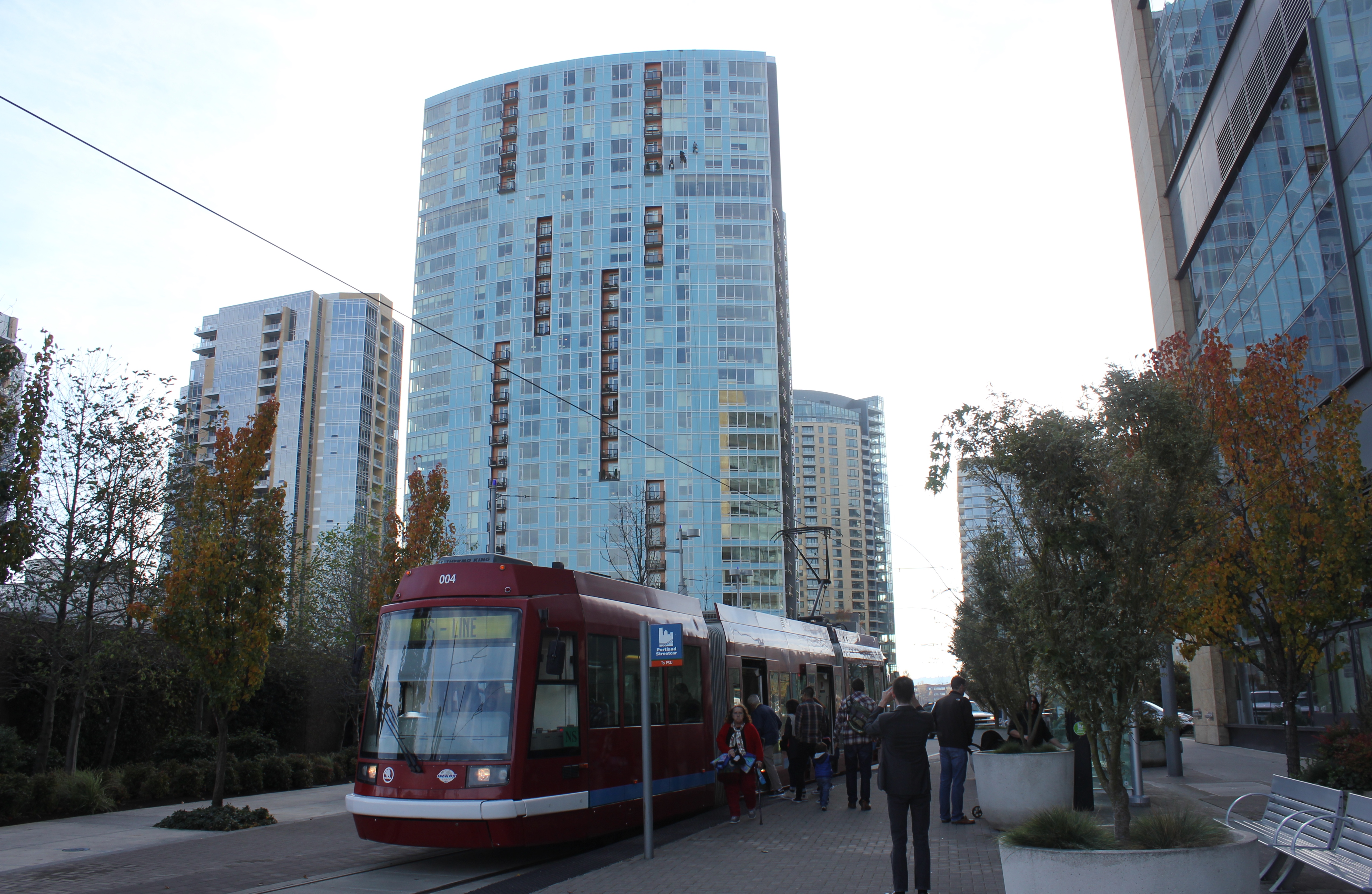
Portland Streetcar
CL Line Streetcar arrives
CL Line Streetcar runs down four lane one way streets
Phase V of Streetcar project includes this rail only transit bridge
Transit Bridge is under construction
South Waterfront from Aerial Tram
Streetcar runs by in Pearl District
New construction in Pearl District
Portland small business embraces streetcar
South Waterfront at south end of NS Streetcar line
Streetcar stop at South Waterfront
The tour also took the group through the Pearl District, which is the oft-touted renovated warehouse distinct in Portland.
While there are many comparisons to Cincinnati’s Over-the-Rhine neighborhood, it would be an unjust assumption because Over-the-Rhine features a greater amount of remaining abandoned and underutilized mixed-use multi-family buildings than the Pearl District. The Pearl District has seen over $2 billion in development, but it has largely been new construction built on sites that once were once occupied by rail yards and warehouses.
During the tour the group was introduced to different leaders who shared their perspective of Portland’s progress on its streetcar system. People like Paddy Tillett, Principle at ZGF Architects, who is with the firm that helped spearhead the effort to establish the transit mall in downtown Portland.
“People were calling it a toy train and saying that we already had light rail,” Tillett told the group. “Even TriMet didn’t want to operate it.”
However Portlanders soon came to embrace their streetcar system, which is now in its fifth phase of construction. Tillett continued, “The streetcar helps extend peoples walking distance, it is not supposed to serve as point-to-point transit. Today it has a dedicated ridership and is helping demonstrate how streetcars can play an important role in public transit around the country.”
The tour was capped off with a meeting with Portland Mayor Charlie Hales (D). Hales told the group, “We no longer have to provide subsidies for downtown development.”
Mayor Hales also stated that it took fifteen years for developers to begin reducing the size need of parking structures for development.
Portland is a beautiful city with vibrancy and life. However, this vibrancy was hard fought over the last three decades. The construction of the transit mall, TriMet light rail and the streetcar were huge gambles that ultimately paid off, and took Portland from a sleepy waterfront lumber town to a place where people move to even if they don’t have jobs lined up. Portland’s problems are ones born from success, not failure and even those problems are good to have.
At today’s council meeting, Cincinnati’s new political leadership will be making decisions regarding the continuation of construction of the Cincinnati’s streetcar system. The new mayor and city council will have to decide whether to continue the same hit or miss approach to development in the urban core, or decide to embrace a system that has a proven track record of success in many cities throughout the country and the world.
Cities like Portland are where the future is headed, Cincinnati’s new leaders should take heed.
Streetcar supporters. Vine Street Taco- Noshers. Urbanistas. Roxanne and Quinlivan dead-enders. I feel your pain. We just had our butts kicked in city elections where only 29% of the electorate bothered to show up.
If you own property or a business in OTR you may be calling a realtor. Maybe you’re checking to see if it’s too late to cancel the granite countertops for that flashy new Main Street kitchen. Or just banging your head against the wall while trolling through Kayak.com for a one-way ticket to Portland.
Before you bail out, listen to a grizzled, cynical political warrior who has been on the losing side of plenty of elections, and won a few too, over 40 years on these mildly mean streets.
First, the election is over. Your team lost. Did you vote last year for 4 year terms? Oops. Get over it. Licking wounds for more than 48 hours is unsanitary.
Give some grudging credit to John Cranley and his handlers. He put together an unlikely coalition: Tea Partiers who just hate the messy melting pots of cities; (some) African American voters led to resent the idea of white urban professionals insisting on rides cushier than smelly Metro buses; and more than a few west siders convinced that “gentrification” in your neighborhood means more “undesirables” in theirs. (See Pete Witte’s twitter feed if you think I’m making that up.)
Mr. Cranley is hardly the first candidate to win an election by whipping up resentment in the “neighborhoods” about spending on development “downtown”. He won’t be the last. Many politicians have built entire political careers in this town on being against stuff.
The mayor-elect could care less if you call him “Can’t Do Cranley”. At 39, he sees this as a launching pad to greener pastures, even if he leaves shoe prints on your backs to prove he keeps his promises.
Advocates of the streetcar – and I’ve been one of them – have allowed their pet project to be painted by COAST and Chris Smitherman as a wasteful contraption designed for Chablis sipping metrosexuals, who think they are too good for the bus or the family mini-van. Can’t these precious young professionals read their iPads on the number 24, or get stuck behind a truck on the viaduct like the rest of us? Don’t take it personally. It’s just politics.
We have not sold the incredible progress downtown and in OTR, despite the great recession, as a model for other neighborhoods with their own aspirations for cool restaurants, modern transportation and rising property values. So in Price Hill and Mt. Washington, your rising neighborhood is seen as a threat to theirs, not as a sign of good things to come to our city.
Those of you with skills and no kids to tie you down can’t be blamed for bailing out now. With Cranley in the Mayor’s office and a hostile Council majority, the streetcar is on life support, and the air soon may start coming out of the downtown/OTR balloon. No doubt there are bright folks at 3CDC, dunnhumby and all those hip new branding firms with OTR addresses already tuning up their resumes.
We are now in an age when public investment will comes in the form of hiring the 200 more cops Mr. Cranley has promised, to protect us from ourselves.
But if you choose to stick around and fight another day, think a little more strategically:
Get to know the neighborhoods and convince them that what is good for the central city is not a threat to Westwood or Oakley. There is life on the other side of I-75 and Mt. Adams. Explore. Collaborate. Cross-Pollinate a little. Try the burgers at Zips and Camp Washington Chili.
Create a vision for a modern transportation system that does not begin and end in downtown and OTR; then sell it. Gas prices aren’t going down. Work with the Uptown institutions to develop a funding model that does not rely on council to come up with more cash. Develop a long-term vision that includes connections to Price Hill, Northside, Avondale and Walnut Hills.
Dig in for a long, hard but constructive fight with the new mayor and right-leaning majority on City Council. Give some credit to COAST and Smitherman for their relentless opposition to the outgoing regime. Now they hold sway with a mayor and council that owe them big time.
Progressives may need their own version of COAST to litigate, referendize and challenge the mayor and council. Look for wiffs of scandal and corruption to expose. And remind the city of their promises: restore 200 cops, fix the pension system, neighborhood development and no new taxes. No problem.
Recruit and bolster the next generation of city leadership. Low turnout says more about the candidates than the voters. Don’t expect voters to show up when the candidates don’t persuade them they have something at stake.
The absence of an African American candidate in the mayor’s election explains a lot about turnout in 2013. For eight years you were fortunate to have an African American mayor who “got” your aspirations. Find the next one: Yvette Simpson? Eric Kearney? Rob Richardson? Work with them or others and prepare them for 2017. You can’t beat somebody with nobody.
Remember that politics is cyclical. The faction that will take over at City Hall come December are political heirs to the crew that ran the city from 1997-2005; and before that in the 1980’s. They had their ups and their downs. But no cycle lasts forever. Be ready and rested when the next wind of change blows.
Don Mooney is a local attorney and longtime Cincinnati political activist. He served for more than 20 years on the Cincinnati Planning Commission and is a former Treasurer of Cincinnatians for Progress. If you would like to submit a guest editorial to UrbanCincy you can do so by contacting our editorial team at editors@urbancincy.com.
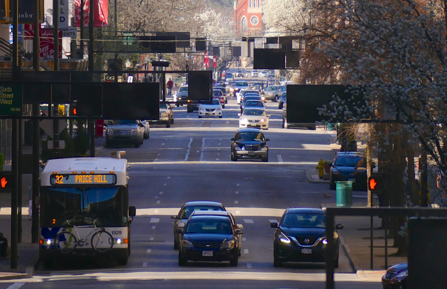
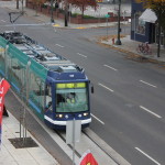
 A traffic study and signal improvements would benefit all modes of transportation downtown