Recently, David Brooks wrote an article for the New York Times about Vice President Joe Biden. The article referenced Biden’s ‘Formation Story.’ Regardless of the politics of the article, we were drawn to this term. In order to be effective in civic work we must have a deep understanding of who we are and what drives us to get out of bed every day and fight.
Most people don’t realize that the Walnut Hills Redevelopment Foundation has been around for almost 40 years. We were created by the community council in 1977 to develop quality affordable housing in a time when places like Walnut Hills were being abandoned and, in many cases, forgotten.
New Focus and Vision for the Walnut Hills Redevelopment Foundation
After decades of assorted success, the organization was at a crossroads five years ago. We could close our doors … or innovate into an organization that reimagines our role as much more. Having chosen the latter, we maintained that we didn’t just want to be a developer. We wanted to be a catalyst for sustainable and positive change. Partnerships with the Walnut Hills Area Council and Walnut Hills Business Group ignited that course, yet, we have still struggled to establish an identity.
Throughout this time we’ve asked big picture questions like ‘What is our purpose?’ ‘What do we value?’ and ‘What will we fight for?’ Recognizing the importance of community input, we posed these tough questions in the form of neighborhood listening sessions, survey collection, and through non-traditional engagement streams. As a result, our new brand was born.
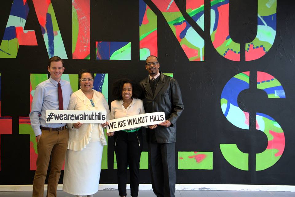
Our new brand identity is a mash up of what we’ve heard in the community over the last four years. It reflects our relentless desire for equitable change and growth. It reflects community development that values the community organizing and boots on the ground strategy of the past and matches it with the modern day approaches to big, bold and innovative ideas that are driving urban expansion across the country. It is an inclusive brand that respects and celebrates the history and identity of Walnut Hills, while inviting new stakeholders to the table to contribute to our community’s growth.
Will inclusive and equitable change be easy? Will we always be as successful as we want to be? No. It will be hard. Damn hard. But we believe that we must do what’s hard. We believe that we must lead by example. And guess what? We can’t do it alone. This type of change is going to require your participation, through both successes and challenges. It’s going to require all of us to listen to each other, to inspire each other, to be agile, smart and strategic together.
We believe that the future of community development belongs to change agents and risk takers. Those who believe the impossible is possible. Are you one of those people? Are you ready?
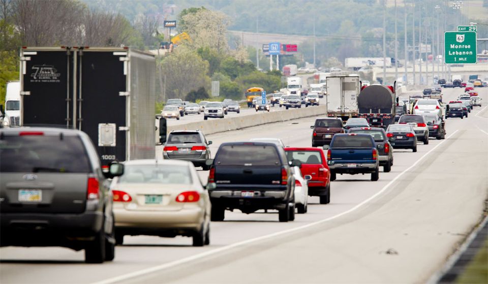
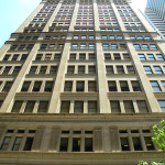
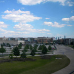
As if the Ohio River valley was already enough of a factor in the stagnation of air pollution in this region, now Cincinnati leaders have charted course on an effort that would advance the city’s ranking on the list of most polluted cities in America.
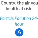
The list, released last month, shows that out of the top 100 metropolitan areas Cincinnati’s air quality is the eighth worst, with Cleveland coming in right behind us at number 10.
Courtesy of the American Lung Association
“We’re in a good position to close the gap to being in the top five over the next few years,” a layperson told UrbanCincy. “As long as our region keeps on driving everywhere those numbers are bound to increase.”
In fact, as construction continues on the new MLK Interchange along I-71, and the widening of I-75, the induced traffic demand from those two projects alone will allow for even more cars to become stuck on the region’s already gridlocked highways during rush hour.
“Widening highways to relieve traffic congestion is like an overweight person loosening their belt to lose weight,” someone smart once told us.
The $2.6 billion Brent Spence Bridge project, if it ever gets off the ground, would also do much to help push the region up the charts toward the most polluted city in America. In particular, many motorists look forward to the more pronounced smog and foggy orange haze expected to hang over the city and region for years to come.
Air quality is very important to Suburban Person, a financial analyst that works downtown. He tells UrbanCincy that he moved thirty miles out of the city just to escape the smog. Since he still works downtown he informed us he is sitting stuck in traffic on I-75 as of the writing of this article.
Time will tell if those evil progressive urbanists will get in the way of the grand plan by succeeding in actually passing some sort of regional mass transit plan, or even a streetcar extension, but until then the best way to the top is to keep on driving. Happy motoring everyone!
EDITORIAL NOTE: If it was not abundantly clear already, this is a satire post. No one should be proud of the fact that Cincinnati has the 8th worst air pollution in America.
When discussing regional transportation issues, the topic seems to always be about congestion. In reality, outside of a few limited periods, the Cincinnati region has relatively good traffic flow with little actual congestion. So instead of trying to solve a problem that does not exist, we should be instead focusing our resources on maintaining our current system and improving mobility within the overall region.
As is the case in any city, the natural environment often serves as a chokepoint and barrier to regional mobility. This is true for Cincinnati with its hills and rivers.
With the region’s population largely centered along the Ohio River, it is natural that this is where the most choke points exist. Outside of the center city, however, there are very few river crossings. In fact, there are only two Ohio River crossings outside of the center city, and both of those are for I-275.
One such area that makes sense for a new local road bridge is around Cincinnati’s Columbia Tusculum neighborhood and Dayton, KY near where the $400 million Manhattan Harbour project is planned.
An increasing amount of development continues to occur on the northern bank of the river in Columbia Tusculum and East End. Further up the hill sits prosperous neighborhoods like Mt. Lookout, Hyde Park, and Oakley; and just around the bend lies Lunken Airfield.
Conversely, on the south side of the river in Kentucky, large-scale development projects have long been envisioned, but are often derailed due to poor access via existing roadway networks. This remains true for Manhattan Harbour where concerns exist about the traffic burden that would be placed on the narrow KY 8 running through historic Bellevue’s quaint business district.
A local road bridge that is one lane in each direction with space for pedestrian and bicycle paths would be an ideal fit for this area of the region. It would improve mobility and access to two difficult-to-access areas. It would also offer a highway alternative for those looking to cross between the two states.
A second location where a local bridge of this nature would make sense is near where the Anderson Ferry currently operates today on the city’s west side.
The Cincinnati-Northern Kentucky International Airport sits on the southern side of the river where this bridge would land. This area continues to be bolstered by warehouses, distribution facilities and other airport-related services, and could be further bolstered with better access. What’s more, Cincinnati’s western neighborhoods that have long had to deal with excessive airplane noise, yet long treks to the airport, could at least resolve one of those injustices with a new local access bridge.
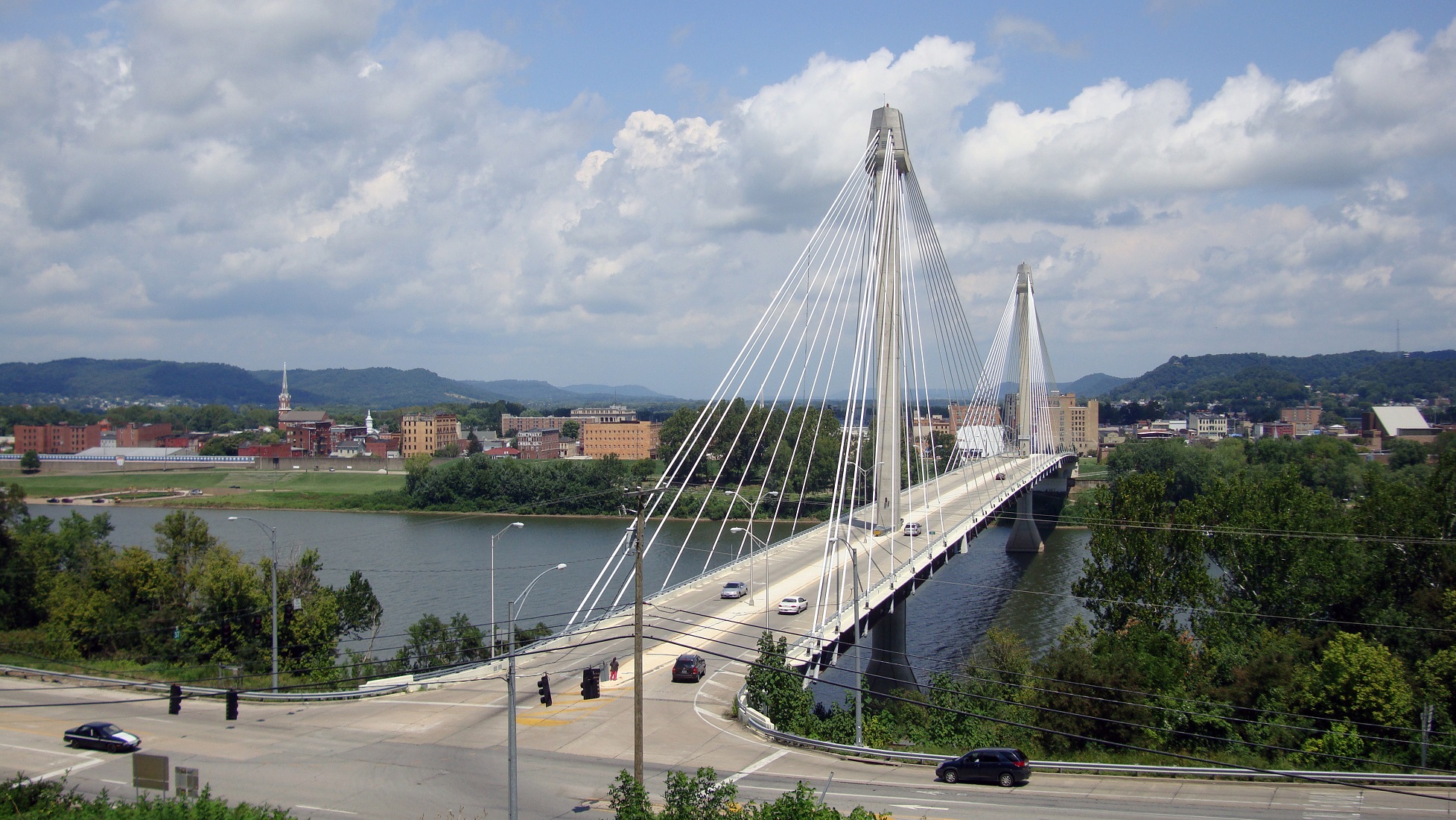
U.S. Grant Bridge [Terry Johnson]
The Taylor-Southgate Bridge is the most recent span that has been constructed over the Ohio River. It was completed in 1995 and cost $56 million at that time – approximately $85 million when adjusted for inflation. Both of these new bridges would need to span an approximate 1,700-foot-wide width, which is about 300 feet more than the Taylor-Southgate Bridge river width.
One of the main differences, however, is that the Taylor-Southgate Bridge includes two lanes of traffic in each direction, plus sidewalks. The need for only one lane of traffic on these bridges would allow them to have a deck width of around just 30 to 35 feet.
Another good nearby comparison is the U.S. Grant Bridge in Portsmouth, OH. That cable-stayed bridge was completed by the Ohio Department of Transportation in 2006 for approximately $30 million – or about $35 million in today’s dollars.
In addition to access and mobility improvements for motorists, a new bridge in both of these locations would also be a boon for cyclists. Those riding along the Little Miami Scenic Trail and the Ohio River Trail would now also be able to continue on to Northern Kentucky’s Riverfront Commons Trail, which will eventually stretch 11.5 miles from Ludlow to Ft. Thomas.
The Cincinnati region does not need multi-billion dollar solutions for a traffic congestion issues that largely do not exist. Reasonable and affordable projects that aim to increase mobility and access, along with maintaining our existing assets, should be the priority.
New local bridges connecting the region’s east and west side neighborhoods would open up land for new development, improve access between both states, enhance mobility for pedestrians and cyclists, and would do so at a price tag we can afford.
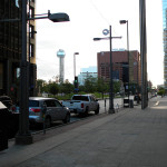
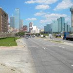
I saw my first cowboy hat within my first five steps off of my Frontier Airlines flight into Dallas/Fort Worth International Airport.
The truth is, I didn’t really know what to expect from Dallas – hell, I’d never even been to Texas. What I found during last week’s visit was a clean, cosmopolitan city filled with music, art, and a personable populace that exceeded my expectations.
Things didn’t get off to the best start. I had to spend a couple of hours at the airport waiting for my girlfriend’s flight to arrive. Leaving Terminal E for the train at Terminal A, the Terminal Link bus felt, indeed, terminal, as it would its way through an unintelligible maze of ramps and roadways.
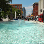
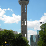
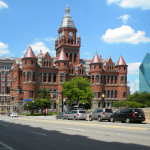
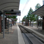
We then faced another hour on Dallas Area Rapid Transit‘s (DART) Orange Line to our accommodations, the historic Hotel Lawrence in the West End of Dallas. I would not recommend this hotel unless you’re looking for something cheap and you’re not planning on being there much, because it’s currently under a heavy renovation to rebrand it as a LaQuinta Inn & Suites and won’t be completed until early next year. But it is served by several bus lines, is across the street from Dallas Union Station, and is a short walk from Dealey Plaza and the Sixth Floor Museum, which is located in the building from which President Kennedy was shot. Oh, and the 561-foot Reunion Tower (1978), where for $16 you can access the GeO-Deck. (I declined.)
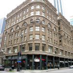
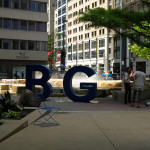
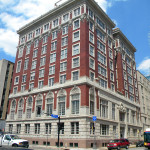
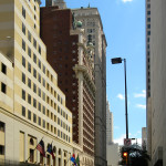
I was in town for CNU23, which was being held downtown at the beautiful Hotel Adolphus (1912) on Commerce Street. The first two days were spent getting to know writers from other Streetsblog affiliate sites and brainstorming ways to build better stories, better sites, and a better national network. We also traveled to the adjacent Deep Ellum neighborhood, which, with its restaurants and bars, would be considered the city’s hipster enclave. While there, we heard a presentation on tactical urbanism and took part in a project to build seating out of reclaimed wood pallets for a street festival.
The rest of the conference – which was extremely well-run, by the way – was focused heavily on transportation and designing around transit. Called “Meeting the Demand For Walkable Places”, the conference featured speakers presenting on topics ranging from in-depth to broad, tours of place making initiatives that are working, and meet-ups.
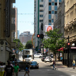
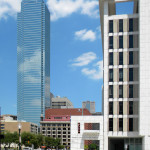
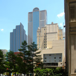
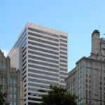
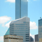
I will say that the architecture in Dallas left me a bit wanting. Many of the downtown buildings are constructed in the modern/brutalist and postmodern styles, indicative of the postwar boom that saw the city grow from a population of under 300,000 in 1940 to an estimated 1.3 million today. But there are pockets of “old” Dallas here and there, and numerous public plazas from which to enjoy them.
On the way back to the airport on Friday, I was able to get a good look at some transit-oriented development near the Orange Line’s Victory station (near the American Airlines Center) and the massive planned community of Las Colinas in neighboring Irving.
The airport was no better the next day.
I would definitely recommend Dallas. The people were fantastic, the food was great, and the positive vibe was palpable. It may have just been the great minds that were in town for the conference, but, if it’s even half as nice on a daily basis, I’d still enjoy it. And the “CVB” weather made it all the more enjoyable.
CNU24 will take place June 8-11, 2016 in Detroit. I’ve been to Detroit several times, but not for a few years. Perhaps it will be time to visit again.
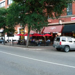
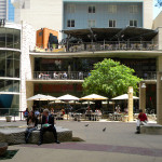
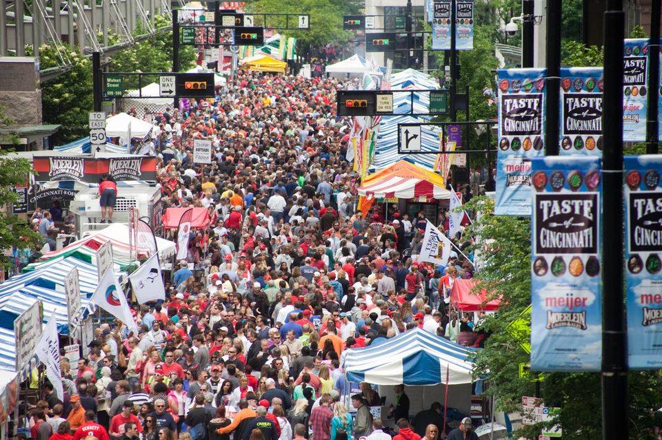
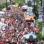
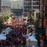
Taste of Cincinnati on Fifth Street in 2014 [Taste of Cincinnati]
There has been much rancor over the past week about how or if to operate the streetcar during major events such as Oktoberfest or Taste of Cincinnati. The perceived problem is that the streetcar’s tracks cross the existing location of those major festivals, and would thus pose a conflict.
It is worth taking a look at these festivals and their locations along Fifth Street, along with what other options might exist.
Historical Context
Both festivals got their start in the 1970s, with Oktoberfest tapping its first keg in 1976 and the Taste of Cincinnati kicking off in 1979. While Oktoberfest originally began on Fifth Street, Taste of Cincinnati did not. In fact, it was not until very recently that the Taste of Cincinnati moved to Fifth Street and joined its mega-festival partner.
When Taste of Cincinnati modestly kicked off 36 years ago, it was actually held in Piatt Park. It stayed there for three short years and then moved to Central Parkway, where it remained until 2007 when the renovation of Fountain Square was completed. At that time, it made sense to host both festivals to Fifth Street around the reborn Fountain Square.
When the city’s first modern streetcar line opens next year, it will have been nine years since both festivals were regularly being held on Fifth Street. Following this year’s scheduled events, it will also be time for both festivals to consider moving to even better environs along the central riverfront. Of course, since the streetcar isn’t planned to open for operations until September, that means Taste of Cincinnati could stay where it is without any problems for 2016 as well.
Accessibility
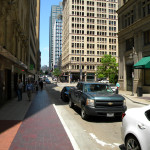
One of the biggest positives and negatives about Fifth Street is its central location and connectivity to Fountain Square – the traditional public gathering point for Cincinnatians. Everyone knows where it is. The problem with it is that it is also all of that for everyday residents, visitors and workers in the bustling central business district; and these events shut down that corridor for days at a time.
Taste of Cincinnati on Fifth Street in 2014 [Taste of Cincinnati]
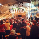
Oktoberfest on Fifth Street in 2014 [Oktoberfest Zinzinnati]
With the events typically extending from Race/Vine Street to Sycamore/Broadway Street – a four- to five-block span – they also require a number of cross streets and major transportation hubs like Government Square to shut down. When the streetcar begins its operations, it too will have to alter its operations and only run approximately half of its initial route during the events.
By moving both festivals to the central riverfront they would be able to take advantage of the huge Central Riverfront Garage underneath The Banks, and also be able to take direct advantage of the Riverfront Transit Center, which was custom built for serving massive crowds such as those that attend Oktoberfest and Taste of Cincinnati.
At the same time, Metro bus service and streetcar operations would be able to continue uninterrupted.
Furthermore, unlike Fifth Street, the streets at The Banks do not serve as major access points for the regional highway system, so closing those streets off would not severely disrupt the flow of goods and people in the central business district. Without that restriction, Oktoberfest and Taste of Cincinnati could explore the idea of taking place over additional days, instead of being limited to three-day weekends.
Accommodations
Like Fifth Street, the central riverfront is within close walking distance of the many hotels located in the central business district, but it doesn’t serve as a barrier to them with its tents, debris and staging.
In addition to the hotels, businesses at The Banks would be much better-suited to handle mega events such as these. Buildings and storefronts along and around Fifth Street have been designed in a traditional sense, while those at The Banks have been custom built to accommodate large street crowds and festivals with walk-up windows, fold open walls and the forthcoming open-container law.
In fact, the huge popularity of Oktoberfest has already begun to spread beyond Fifth Street. UberDrome is now set-up in Smale Riverfront Park by the Moerlein Lager House and Paulaner; and the growing number of breweries in Over-the-Rhine are also now hosting special events during the period during and around Oktoberfest. A perfect connection between all of the festivities, as has been suggested by Christian Moerlein’s owner Greg Hardman, is the first leg of the streetcar.
Oktoberfest UberDrome [Moerlein Lager House]
Organization and Set-Up
Fifth Street, unlike the central riverfront, has very little in terms of open areas for special activities. With the $125 million dunnhumby Centre now complete at Fifth and Race, Fifth Street has also lost a large surface parking lot that had served as a staging area for these festivals. Along the central riverfront there are several event lawns that not only offer more flexibility for programming, but also are more comfortable for event-goers than the hardscapes offered along Fifth Street.
Furthermore, while Cincinnatians have grown accustomed to the linear organization of these types of festivals, which may not be the best set-up for them. With the ability to shut down multiple streets at a time without causing problems for traffic flow, The Banks allows for a more district-oriented festival. This would allow people to more easily get from one spot to another, without needing to go back against the grain an entire four blocks to meet friends just arriving.
In addition to all of this, The Banks development and Smale Riverfront Park are only getting bigger. So as they expand over the coming years, so will the possibilities for both of these great festivals that help to define the spirit of Cincinnati and its people.
While the Cincinnati Streetcar may be sparking this conversation, the decision to move Oktoberfest and Taste of Cincinnati to the central riverfront is clear on its own merits and should be seriously considered. Both continue to grow in popularity and set record crowds each year. At some point soon we are going to have to make a decision about how to accommodate these growing crowds.
Let’s allow our companies in the central business district to flourish without interruption, our transit systems to serve huge crowds at full capacity, and two of our greatest cultural festivals the ability to grow and prosper for generations to come. Move Oktoberfest and Taste of Cincinnati off of Fifth Street and to the central riverfront.