Categories
News Transportation

Cincinnati Seeking Feedback on Two Bike Infrastructure Projects

The City of Cincinnati is studying two new streets for potential bicycle enhancements, and officials with the Department of Transportation & Engineering (DOTE) are looking for the public’s feedback.

The first project is on Delta Avenue where they are considering adding a five-foot bike lane on both sides of the street, and the second is a larger project along Central Parkway that is considering adding either striped bike lanes or physically separated cycle tracks along a 2.2-mile stretch of the roadway.

Delta Avenue Bike Lanes
The Delta Avenue project will take place between Columbia Parkway and Erie Avenue, but will not impact Mt. Lookout Square. DOTE officials say that the schedule calls for repaving to begin in early 2014.

Right now planners and engineers are looking at two options for Delta Avenue. One option would maintain the existing roadway conditions that include two 10-foot travel lanes and two 18-foot travel/parking lanes.

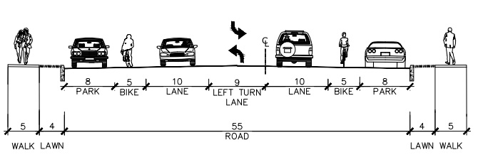
Delta Avenue Proposed Section

The second option would modify this layout to include two 5-foot bike lanes, two 10-foot travel lanes, one 9-foot left turn lane, and two 8-foot parking lanes.

The proposed reconfiguration, DOTE officials say, would provide safety benefits for bicyclists, pedestrians and automobile drivers, and is similar to what was recently installed on Madison Road between Woodburn Avenue and O’Bryonville.

In addition to improving bicycle accessibility along Delta Avenue, the new bike lanes would connect into the recently installed bike lanes on Riverside Drive, which will be extended into the downtown area later this year.

“Delta Avenue is a primary cycling route from Riverside and downtown to the city’s eastern neighborhoods, and these plans will help to calm traffic and make the street safer for cyclists, pedestrians and motorists,” Queen City Bike president Frank Henson stated.

Those interested in sharing their feedback regarding the Delta Avenue project can do so by visiting the City of Cincinnati’s webpage for the project and answering a few brief questions.

Central Parkway Cycle Tracks
The larger Central Parkway project is planned to be built in two phases, with the first phase of work stretching from Elm Street in Over-the-Rhine to Marshall Avenue in Fairview.

Neighborhoods along the first phase of the project have already been approached about the project, and the City of Cincinnati received a $480,000 Transportation Alternative grant from the federal government, administered through the OKI Regional Council of Governments, in June 2013.

This portion of the work is being studied in three separate segments due to existing roadway configuration.
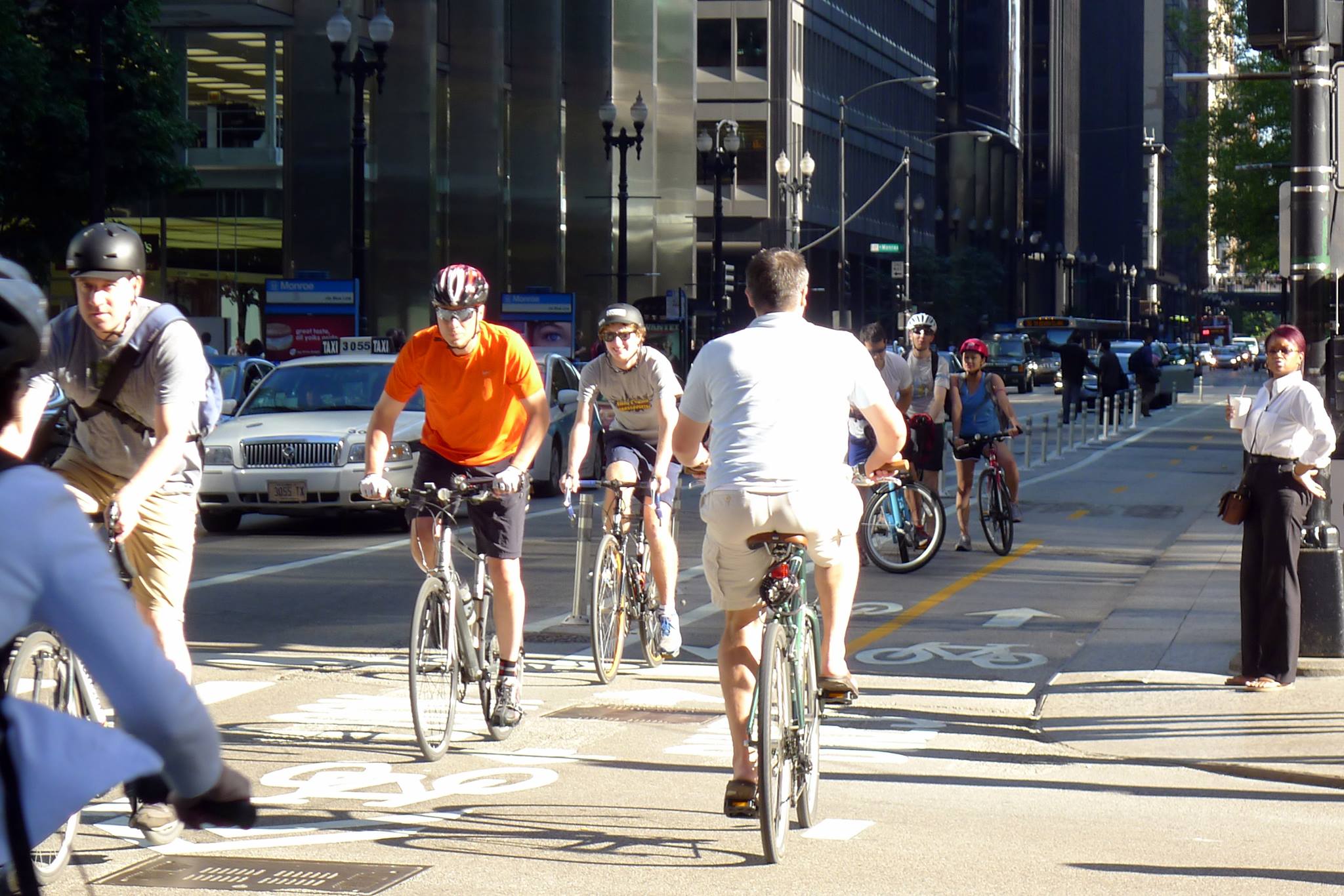
Dearborn Street Two-Way Cycle Track
City officials are looking into the possibility of installing a two-way cycle track along Central Parkway – similar to Chicago’s two-way cycle track on Dearborn Street. Image provided by Active Transportation Alliance.

The first segment is from Elm Street to Liberty Street, and due to the median that divides Central Parkway there, it is considered unfeasible to have a two-way cycle track. As a result, the DOTE is considering only two options – the existing road with no enhancements or one-way cycle tracks on both sides of the street.

The second segment being studied in phase one is from Liberty Street to Brighton Avenue, and is studying three options in addition to the existing conditions. The first would be a 14-foot, two-way cycle track on the west side of the street, the second would be 7-foot-wide one-way cycle tracks on both sides of the street, and the third would be 5-foot bike lanes on both side of the street.

The final segment within the first phase of the Central Parkway project is from Brighton Avenue to Marshall Avenue. Here, the same three options are being considered as for the second segment. The only difference being the two-way cycle track on the west side of the street would be 12 feet wide instead of 14 feet.

“Adding a cycle track to Central Parkway will create a safer, family-friendly space for people on bicycles and will exponentially increase the number of people using bicycles in this corridor,” explained Mel McVay, senior city planner with Cincinnati DOTE. “This project is a game changer for Cincinnati – it has the ability to completely change the way people feel about riding bicycles in our city.”

Those looking to share their thoughts on which design option would be best can do so by completing a very short survey on the Central Parkway project’s webpage.

The second phase of work along Central Parkway would then progress northward from Marshall Avenue to Ludlow Avenue, where the city’s first green bike lanes were installed in November 2012. The details have not yet been worked out for this phase of work, but will progress as soon as funds become available.

“Both of these projects would be extremely beneficial if completed,” noted Queen City Bike executive director Nern Ostendorf. “What bike lanes and especially cycle tracks do is they expand the accessibility of biking on city streets to more users who consider biking on roads without special bike facilities too dangerous, or at least too stressful.”

This story was originally published in the July 19, 2013 print edition of the Cincinnati Business Courier. UrbanCincy readers are able to take advantage of an exclusive digital membership and access all of the Business Courier‘s premium content by subscribing through UrbanCincy‘s discounted rate.

Categories
News Transportation

Cincinnati wins national CDBG award for Ohio River Trail project

City leaders will gather today in downtown Cincinnati to accept a national award for its Ohio River Trail project. The John A. Sasso National Community Development Week Award will be presented at the National Community Development Association (NCDA) convention currently being held in Cincinnati.

NCDA officials say that the Ohio River Trail project is helping to improve neighborhoods and better the lives of low- and middle-income residents through the use of the association’s Community Development Block Grants (CDGB). In 2011, eight departments within the City of Cincinnati made more than $13 million in total CDBG requests. Over the past five years, the City has requested approximately $13 million annually in CDBG funds.

The association specifically looked at a 1.1-mile stretch of the Ohio River Trail through Columbia Tusculum which was recently completed thanks to a CDBG Economic Development Initiative grant of $745,125. In May, UrbanCincy partnered with the City of Cincinnati to give future bicycle commuters a tour of the Ohio River Trail.

Once entirely complete, the Ohio River Trail will connect with the Little Miami Scenic Trail to the east and downtown Cincinnati at its western terminus. Future segments could go further west along the Ohio River.

The Ohio River Trail project was chosen for this year’s award out of 550 local governments who work with NCDA on community development projects. Those projects include a wide variety of efforts that are targeted to improve economic development, housing and human services.

Officials will be presented the award by Cardell Cooper, executive director of NCDA, at 12:30pm today at the Pavilion Room inside the Hilton Netherland Plaza Hotel.

Categories
Development News

Green home show enters second weekend in historic Columbia Tusculum

Following the success of recent CitiRama home showcases, the City of Cincinnati has decided to present another urban home show but this time with a decidedly more green focus. The new Greenarama Home Show first opened to the public this past weekend, and still has one more weekend for public viewing.

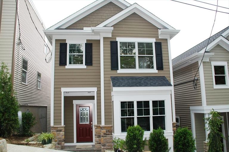
Organizers say that Greenarama is the first home show of its kind which focuses on green homes built pursuing LEED for Homes certification. In total there are nine homes constructed, by five builders, along Strafer Street in Cincinnati’s historic Columbia Tusculum neighborhood.


2011 Greenarama home at 463 Strafer Street.

One of the three-story townhomes has already sold, but the remaining eight feature outdoor space, state-of-the-art green technology and modern finishes meant to accentuate the urban location.

Organizers say that beyond Columbia Tusculum’s urban location, it also boasts inherently green lifestyle features that have made the neighborhood a destination for new homebuyers. Within a short walk of the Greenarama homes is the new Columbia Square development, dozens of neighborhood businesses, Alms Park and Riverside Academy Elementary School.

Those interested in seeing the new green homes first-hand can still do so this weekend. Tickets cost $10 per person (children under 12 years of age are free) with all proceeds going to benefit the Cincinnati Scholarship Foundation.

The 2011 Greenaram Home Show will be open on Friday from 2pm to 9pm, Saturday from 12pm to 9pm and Sunday from 12pm to 6pm. Tickets can be purchased online or at the event.

Categories
News Transportation

Ohio River Trail Tour to explain bike commuter center basics this Sunday

To wrap up the end of Bike Week (and Bike Month), UrbanCincy and the City of Cincinnati have teamed up to lead the Ohio River Trail bike ride on Sunday, May 22 at 10 am. The ride travels along the completed portion of the Ohio River Trail, and will also share information about the new Bike & Mobility Center at the Central Riverfront Park. This event will share information with those in attendance about future phases of the bike trail, as well as learn how to commute to Cincinnati’s urban core by bike.

Once both the Ohio River Trail and Bike & Mobility Center are completed, bicycle commuters will be able to easily commute from Cincinnati’s eastern suburbs to the region’s urban core. The Bike & Mobility Center will include bicycle parking, lockers, showers and a repair facility.

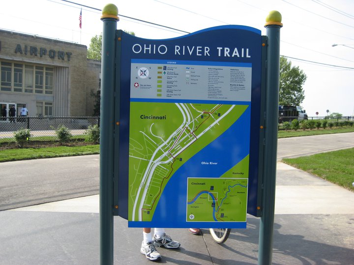
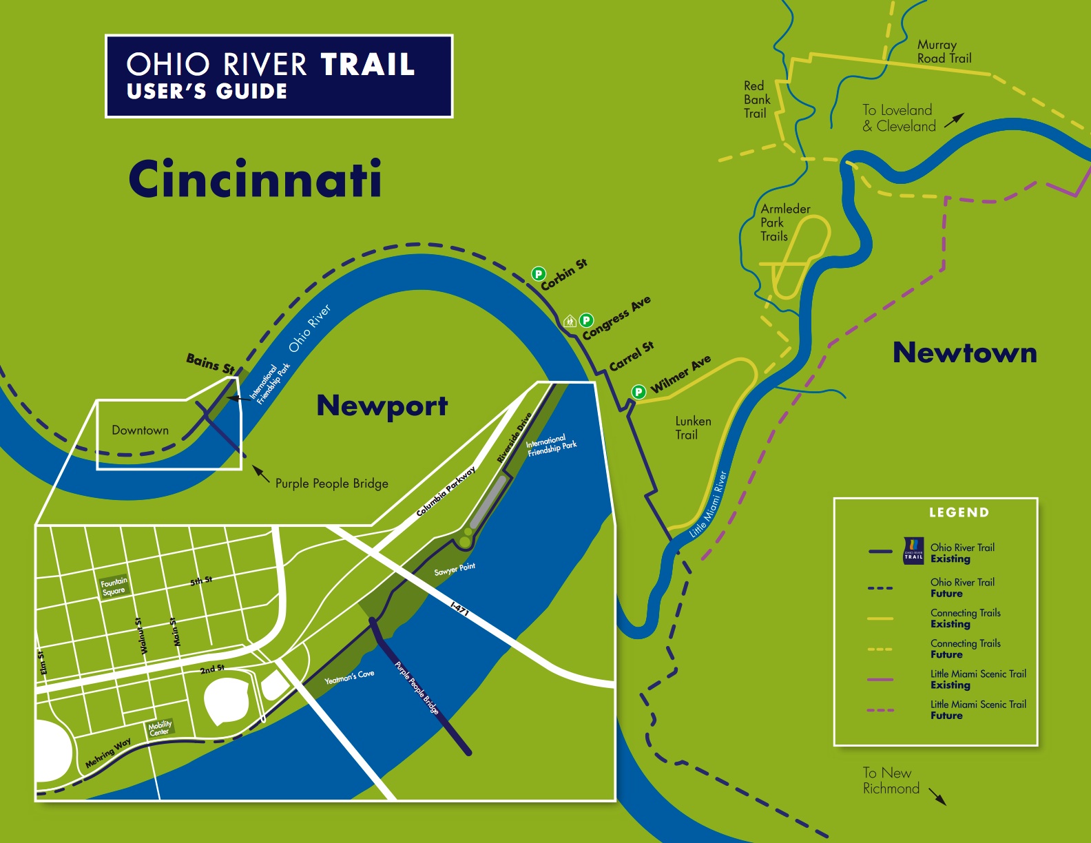
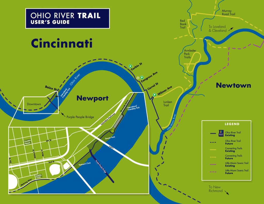
The event is free and open to the public, and is part of the City of Cincinnati’s official 2011 Bike Month activities. The ride is approximately six miles (one way). The map (below) details the route.

“I want this to be something that folks can use to come back to the trail by themselves, that will show them where they can park their cars, and where they need to get on and off the street because the trail is ending or beginning,” said Melissa McVay, with the City’s transportation office.

Steve Schuckman with the Parks department, will be along for the ride and will give a short talk at the termination of the trail to discuss the new mobility center and how residents and cyclists can take advantage of the showers, rental facilities and other amenities to make biking to work part of their routine.

The ride will begin at the parking lot across from the Lunken Airport at 2622 Wilmer Avenue at 10am on Sunday morning. The ride is approximately 6 miles (one way) and covers relatively flat terrain with little elevation change. Check the Facebook event page for more details.

Categories
Development News Transportation

First Eastern Corridor open house raises additional questions about plan

First proposed in the late 1990’s, the multi-modal Eastern Corridor plan concluded its Tier 1 planning in 2006. After four years of inaction, planning for commuter rail on the Oasis line resumed in May 2010. Tier 2 National Environmental Policy Act (NEPA) analysis and preliminary engineering is currently underway and preferred alternatives will be determined in 2012.

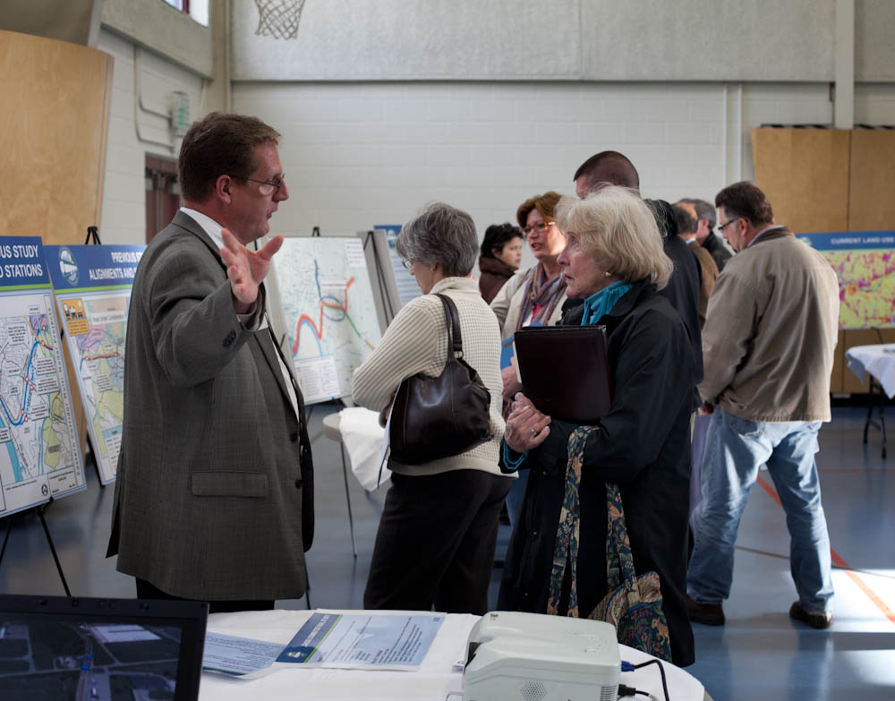
As the plan moves forward, project leaders are holding three community open houses this week to provide an opportunity for the public to learn more about the project and offer feedback at the midpoint of this planning phase. But because there will not be any official decisions concerning track alignment, vehicle type, etc., until 2012, those who attended the April 5 open house at the Leblond Recreation Center on Riverside Drive were frustrated by the inability of planners to answer specific questions.

The primary concern of open house attendees was the proposed use of diesel locomotives. Area residents are familiar with the sound of the line’s periodic freight trains and the Cincinnati Dinner Train, and fear that frequent high-speed diesel commuter train service will significantly impact their neighborhoods. Most expressed that they would be more welcoming to the proposed commuter service if it took the form of electric light rail or modern streetcar technology similar to that of the proposed Cincinnati Streetcar.

Several concerned citizens, including Arn Bortz, Managing Partner of Towne Properties, observed that the Oasis Commuter Rail is designed to serve far eastern Hamilton County and Clermont County to the detriment of those who live in Cincinnati. Thayne Maynard, President of the Cincinnati Zoo, said that he moved to Newtown to be close to the Loveland Bike Trail, and is worried that the Oasis commuter rail might scuttle plans for the Ohio River Trail between Downtown and Lunken Airport.

Planners assured those in attendance that “No Build” is a possible outcome of the Tier 2 work, in which case all of these concerns can be forgotten. But the completion of Tier 2 work will not determine how capital funds are acquired or which local entity will operate the line. The Southwest Ohio Regional Transit Authority (SORTA) is the most likely operator. With the vast majority of SORTA’s funding coming from a .3% Cincinnati earnings tax, it appears that a special source of revenue will be needed for the Oasis Line as it is expected to terminate near I-275 in Clermont County.

Further complicating the issue, UrbanCincy investigated the Eastern Corridor plan in August 2010 and discovered several significant flaws that have yet to be addressed by project planners.

Two more open houses are scheduled to be held. The first will take place on Wednesday, April 6 at the R.G. Cribbet Recreation Center (map), and the second on Thursday, April 7 inside the Milford High School cafeteria (map). Both open houses will take place from 5pm to 8pm, and will include an open comment/Q&A session beginning at 7pm.

Eastern Corridor Open House photograph by Jake Mecklenborg for UrbanCincy.