Categories
Business News Opinion

EDITORIAL: Don’t Cancel Homearama, Relocate It

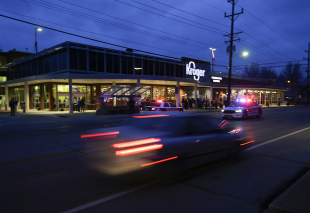
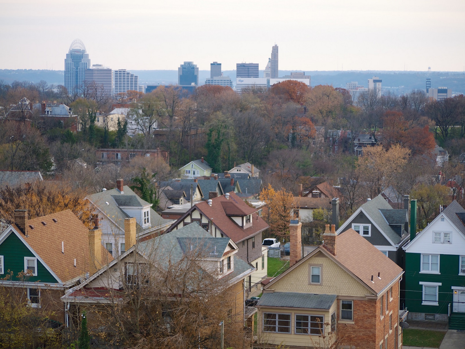
The past ten days have been interesting. A week ago I spoke with Keith Schneider from the New York Times about the booming residential property values in Cincinnati’s center city. Then, just one day later, the Home Builders Association of Greater Cincinnati announced that they would be cancelling this year’s Homearama event in Clermont County.

The annual suburban home show has been going since 1962, and was cancelled this year due to, “increased activity in other segments of the housing market.” One of the builders that has traditionally participated in those over-the-top suburban home shows is Great Traditions, which recently expressed a growing interest in developing urban properties.

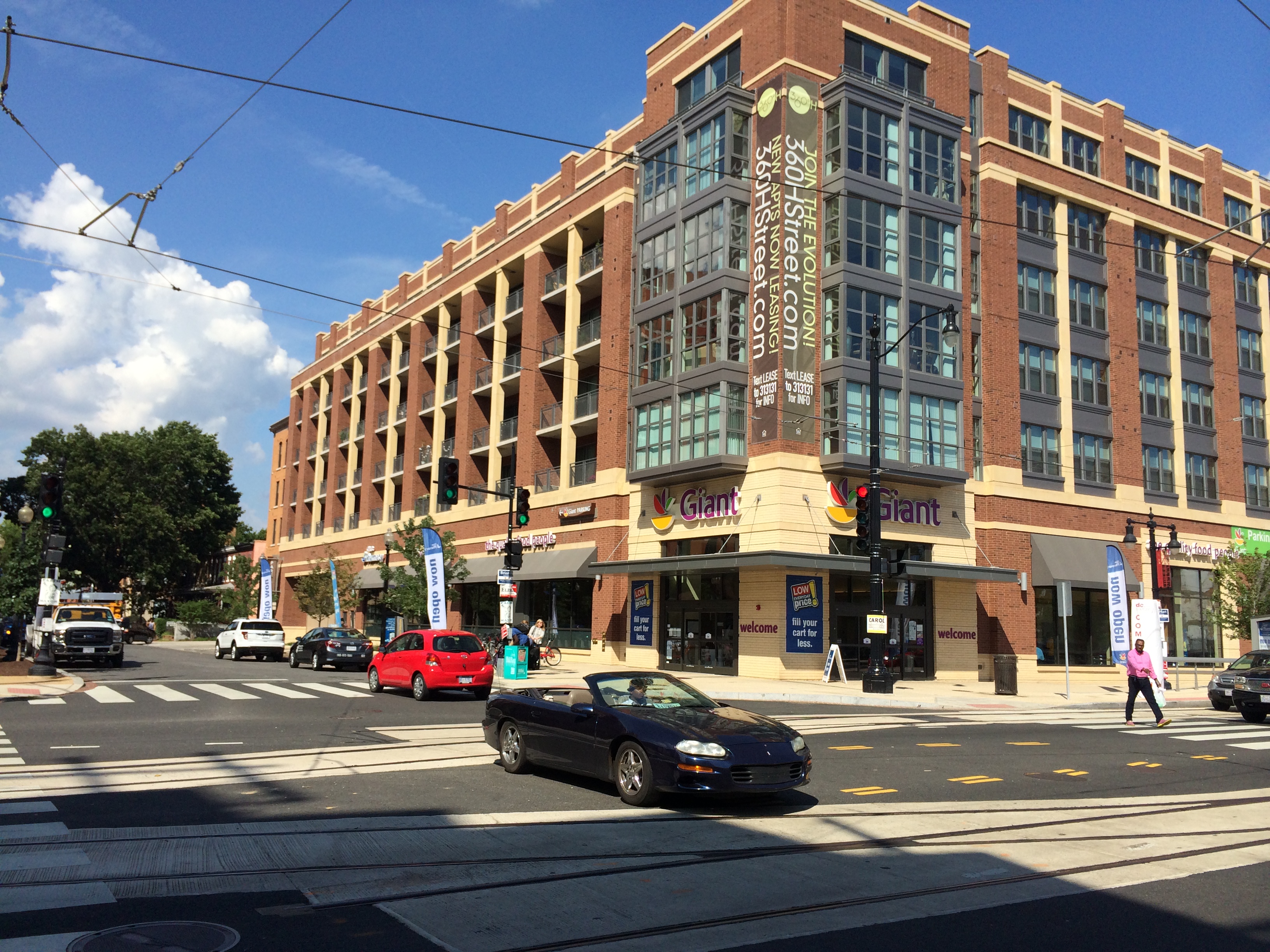
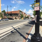
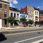
Great Traditions is not the only one. Greiwe Development has also said that they would like to start building homes along the Cincinnati Streetcar starter line, John Hueber Homes made the same transition to Over-the-Rhine, and Ashley Builders appears to just be getting started on their work in the center city.

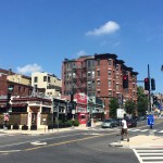
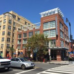
So while homebuilders are struggling in the region’s outlying suburbs, they seem to be thriving in a manner that is pulsating outward from Downtown and Over-the-Rhine.

It seems more than likely that Homearama will return in the not-so-distant future, but should it? With all the demographic and economic trends pointing in the opposite direction, perhaps the energy and money put into the 53-year-old suburban home show should be shifted elsewhere. I could think of some very nice places to do urban home shows in Pleasant Ridge, Walnut Hills, Avondale, West End, Price Hill, East End, and College Hill. And that is not even considering the possibilities in Northern Kentucky’s river cities.

Yes, there is CiTiRAMA, but that annual home show is often limited in its scale and tends to leave much to be desired.

The writing appears to be on the wall, which makes the outlandish Fischer Homes Expressway proposal look all the more desperate. Why keep up the fight? There are plenty of opportunities in our region’s first-ring suburbs, and the city governments overseeing those sites will assuredly be more than happy to cooperate.

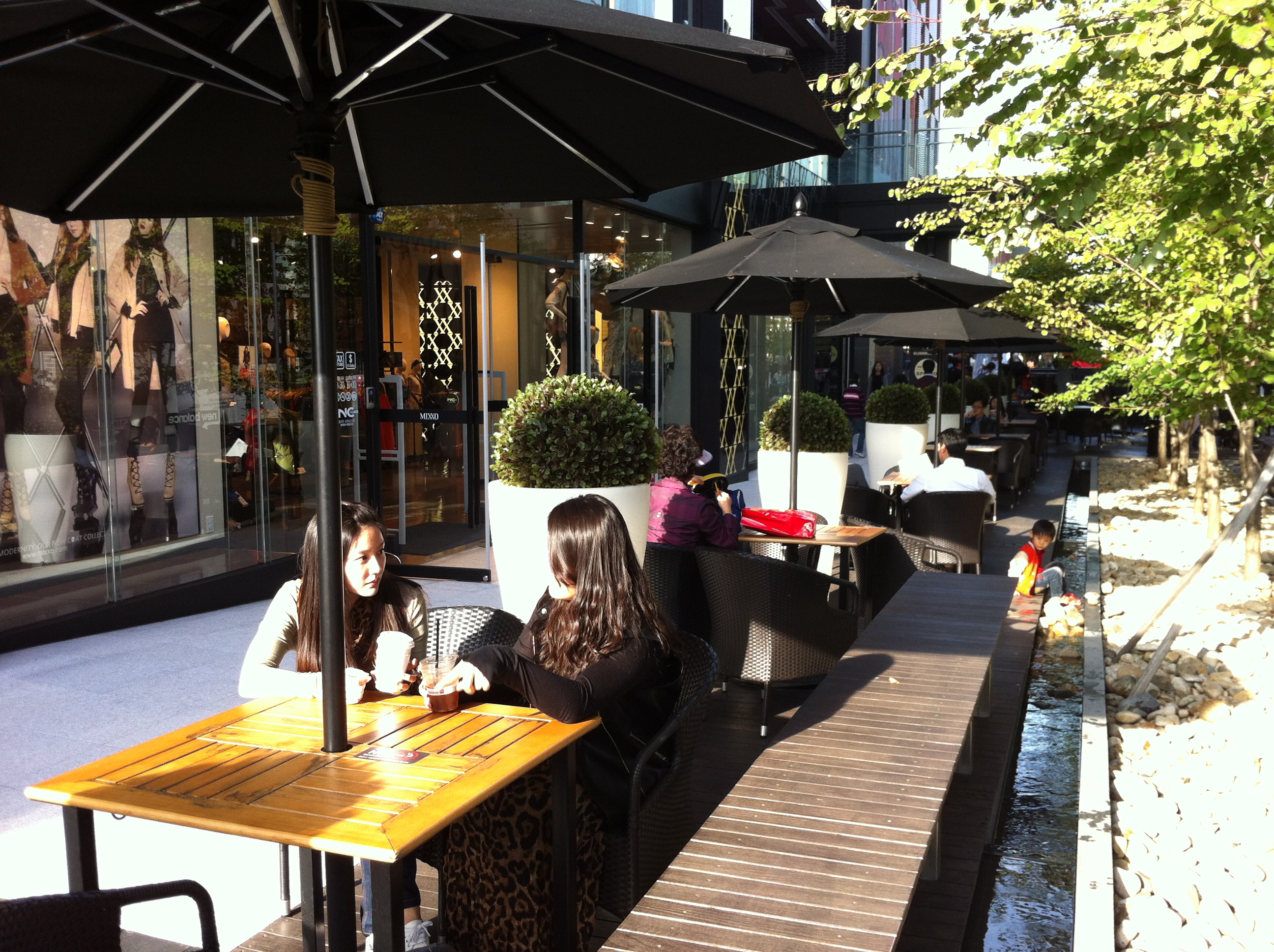
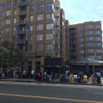
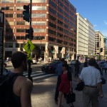
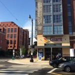
Don’t believe me? Just ask those developers that had been defined by their suburban subdivisions for decades how they are liking life in neighborhoods like East Walnut Hills, O’Bryonville, Northside, Clifton and Over-the-Rhine where condos are virtually sold-out.

I hope the Home Builders Association of Greater Cincinnati decides to not cancel this year’s Homearama after all. I just hope they relocate it to the inner-city where the residential housing market is hot.

Categories
Development News Opinion

Why Does Kroger Continue to Avoid Urban Store Model in Cincinnati?

Kroger is one of the Queen City’s prized Fortune 500 gems. The company was founded here in 1883 and has grown into the nation’s largest grocer, and one of the nation’s largest retailers overall. While the company has done much good for the city, the question is now being asked if they are now content with their hometown market.

While public officials work to rid the city of its food deserts, Kroger has been largely absent from the conversation. Furthermore, the grocer’s remaining stores throughout the city are seemingly in a constant state of fear of closure. Cincinnati still has Kroger stores in about a half-dozen neighborhoods, but many have either fallen into disrepair or are showcases of urban design failures.

In 2008, Kroger rebuilt its East Price Hill store to the pleasure of city and neighborhood leaders. The possibility of losing the neighborhood’s only full-service grocery store was a real concern. While shiny and new, the rebuilt store now sits more than 100 feet off of Warsaw Avenue, with a sea of parking and a Kroger Fueling Station in front.

Mt. Washington had their neighborhood Kroger built in 1999. In this case, the parking for the store is off to the side of the building, and it sits right along Beechmont Avenue. However, the building includes virtually no windows, and instead of serving as an anchor for the business district is more of an eyesore. While its site plan differs from Kroger’s East Price Hill store, both are still oriented to cars, not the pedestrians or cyclists that make the respective neighborhood business districts attractive.

As UrbanCincy reported yesterday, Kroger is now working with transit officials to improve bus facilities in and around their Walnut Hills store in Peeble’s Corner. But aside from that, the store is essentially defined by the same story as its Mt. Washington counterpart.

In Corryville a different story is unfolding. First developed in the 1960s as part of what is now seen as an awful urban renewal project, Kroger’s uptown store is one of its worst. Fortunately the store will soon be torn down, but after years of discussions with neighborhood leaders and developers, it sounds as if the new store will be not much different from the existing one in terms of its form or function.

Kroger stores in Winton Place and Westwood, and the one currently under construction in Oakley, are nothing more than urban design atrocities ignorant of their surroundings.

Of course, all of this goes without discussing the poor state of Kroger’s Over-the-Rhine store, which practically sits in the shadow of the company’s global headquarters, or the fact that Kroger has yet to actively pursue a store for the city’s exploding residential population downtown.

Meanwhile, approximately 80 miles south along I-75, Kroger has worked with community leaders in Lexington on a new store near the University of Kentucky. The newly opened 86,000-square-foot store is two stories tall with parking situated on the building’s rooftop. The structure is built to the street, includes facades with windows, café seating both inside and out, local food offerings, and has been designed with the surrounding community in mind.

In short, Lexington’s brand new Kroger shines as an example for what the Cincinnati-based company could and should build in its hometown.

Cincinnati is fortunate to have Kroger headquartered here; and the half-dozen or so neighborhoods that have a store are surely thankful to not be left stranded, but at some point Cincinnati should demand better from its hometown company. It is not too late for Kroger to get it right in Corryville, Walnut Hills, Over-the-Rhine, Downtown, or any of the city’s existing neighborhoods without any access to a full-service grocer.

Categories
News Opinion Transportation

Transit Users Will Need 7 Hours to Commute to ODOT Public Transit Meeting

An event making the rounds on social media hosted by the Ohio Department of Transportation (ODOT) provides an opportunity for citizens to tell Governor John Kasich’s (R) administration about public transportation improvements they’d like to see in their city. The public meeting to discuss statewide transit needs is hosted on Friday, October 31 from 10am to 12pm at the Warren County OhioMeansJobs Center in Lebanon.

While the gathering has good intention, it fails to meet the basic criteria of planning a public involvement meeting:

  1. Never host a public meeting on a holiday.
  2. Never host a public meeting on a Friday or weekend.
  3. The location of a public meeting should be accessible to all members of the community and able to attract a diverse group of citizens.

By car, Lebanon is roughly a one hour drive north of Cincinnati, and a 30-minute drive south from Dayton. It’s also the city where the regional ODOT office is located; understandably why the administration would opt to hold a public involvement meeting here. What went unconsidered are the needs of people that the public meeting is focused on: citizens reliant on public transportation.

The closest Metro bus stop to Lebanon is 8.3 miles away, near Kings Island in Mason. Let’s say we’re feeling ambitious and attempt to take the bus, then bicycle the remaining journey to Lebanon. It would take 48 minutes to cycle to the meeting in addition to the 1 hour, 11 minute ride on the bus. Cincinnati Metro, the region’s bus system, only offers select service to the northern suburbs. In order to arrive on time for the 10am meeting, a person dependent on transit would have to catch the 71x at 7:45am, arrive in Mason at 8:52am, then continue to the meeting on bicycle.

Getting back home is another story. The public involvement meeting adjourns at 12pm, but the bus route that services Mason is a job connection bus, meaning it only runs traditional hours when people are going to and from work. After another 48 minutes of cycling back to the bus stop, the inbound 71x picks up shortly after 3pm and returns to Cincinnati at 4:40pm.

In summary, if a citizen dependent on bus transportation wishes to give ODOT their input, they would spend 7 hours commuting to the two hour meeting, and need to able-bodied to ride a bicycle for eight miles. What about senior citizens and people with disabilities? Who can afford to take an entire day off work to attend a meeting? As a transit rider who has a car, driving an hour each way to attend the meeting –in the middle of the work day– for me, is inconvenient and unfeasible.

The poor choice of trying to combine Cincinnati and Dayton into one meeting was an unfortunate oversight in event planning. Instead, meetings should be hosted in the downtown of each city, just like they have been in Columbus and Cleveland which are also participating in the ODOT series.

Since 2011, Governor Kasich has cut $4 million from the state’s public transit budget, leaving Ohio with one of the lowest funded transit systems in the country. If there’s a genuine interest in hearing how those cuts affect the people that rely on public transportation the most, the administration needs to schedule a second meeting in Cincinnati near Government Square where those people can actually get to.

Of course, this isn’t the first time area transit users have been ignored when it comes to public meeting locations. Earlier this year, Ohio Secretary of State Jon Husted (R) upheld a decision to relocate Hamilton County’s Board of Elections office to a location that would take up to four hours to access by transit.

Categories
Development News Opinion

Redesigned Streetscapes Could Turn Fourth and Race Streets Into Vibrant Public Spaces

Fourth Street offers one of the more impressive urban street canyons in all of America. Its pre-war high-rises dominate the streetscape and offer a glimpse into the proud history of Cincinnati.

Once the very center of business activity, Fourth Street was historically known as the region’s financial district – a place where all the power players lingered and conducted business. Since its heyday in the early 20th century, that center of financial clout has shifted. Some say it has shifted to Third Street, while others say it has moved east along Fourth or even north to Fifth Street.

In any case, many of those power players are now in other nearby districts, while the impressive structures they built are left behind.

City leaders had believed, with good reason, that Fourth Street would become the region’s premier shopping destination. However, with the demise of downtown malls and department stores, that vision never fully came to be.

All has not been lost though. Virtually all of the impressive, historic urban fabric remains and has since been largely converted into residential space. There is also a movement afoot from some business and civic leaders to breathe new life into not only Fourth Street’s retail scene, but Race Street’s as well.

Part of the ongoing transformation includes Mabley Place, which converted the former Tower Place Mall into a parking garage with street-level retail, the proposed 30-story residential tower that would replace the aging Pogue’s Garage, and the nearby and soon-to-open dunnhumbyUSA headquarters tower.

There is even the possibility of Fourth Street being converted back to two-way traffic following the activation of the now unused ramp to I-75 from Third Street.

As all of these projects start to become reality, they offer a unique opportunity to redo the public space in the area. One particular area that has long needed a redo, and has been the subject of many studio projects at DAAP, is Fourth Street’s dated streetscaping. Not only does the design of the sidewalks, benches and street trees leave much to be desired, they also do not follow standard good design practices.

The renovation of Fountain Square realized this and implemented good urban design practices in its final product. Things like softscaping and movable furniture are powerful elements to a good public space. The same could be done along Fourth Street’s, and for that matter much of Race Street’s, wide sidewalk widths.

Being in the midst of the digital age, it would also make sense to make the area more welcoming to tech users by implementing Internet hot spots and including solar-powered charging stations at benches and tables set up along the street.

Specifically, the areas best suited for such a transformation would be the north side of Fourth Street between Vine and Elm, and the east side of Race Street between Fifth and Seventh.

With more and more hotels opening up downtown in general, and specifically on or very near Fourth Street, this public space could also serve as a convenient and desirable ‘third place’ for travelers that are looking to spend some time out in the city, without feeling obligated to purchase endless cups of coffee or beer, but not also be trapped inside their hotel room.

Such a design could also activate the largely lifeless corridor with people from all backgrounds, and provide more passing customers for existing and potential businesses looking to setup shop there.

With all the construction taking place and about to get started, it would make most sense to leverage these private investments to improve this public space at the same time. Heck, it might even be the perfect opportunity to connect the new Central Parkway Cycle Track with the Ohio River Trail.

Categories
Development News Opinion Transportation

PHOTOS: Washington D.C.’s Model Transportation Investments Paying Dividends

Washington D.C. has, perhaps, the nation’s most prosperous and booming urban economy. It is a city that has also become defined by its highly educated, young workforce.

Over the past decade or so, the nation’s capital has also been transforming its transport network in a way to make it more multi-modal and improve mobility.

One of the most striking things upon arriving in Washington D.C. is the sheer number of bike lanes. And not just bike lanes, but protected bike lanes. As many cities have begun noticing in recent years, striped bike lanes next to moving traffic are not enough, and that protected bike lanes that separate cyclists from moving traffic with bollards or on-street parking are far superior.

As a result, you see many of the newer bike lanes in Washington D.C. receiving this treatment, and many of the older lanes being transitioned over, as possible, to protected facilities. To this end, it should come as no surprise that the city has one of the nation’s highest percentages of people commuting by bike.

In addition to that, Washington D.C. launched North America’s first bikeshare system in 2008 when SmartBike DC opened with 120 bikes at 10 stations. After some initial struggles, a new system called Capital Bikeshare was launched in September 2010 and currently boasts more than 2,500 bikes at more than 300 stations.

This new system extends beyond the District of Columbia into three additional nearby jurisdictions and stands as one of three biggest bikeshare systems in the United States along with New York City’s CitiBike and Chicago’s Divvy.

I used Capital Bikeshare to make an approximate two-mile trip from near the U Street Metro Station to Washington Union Station. The journey was a breeze and preferable, to me at least, to using a taxi or the city’s well-functioning transit system.

Upon arriving at Union Station I met a friend to check out one of Washington D.C.’s other marque transportation projects at this time. The H Street/Benning Road modern streetcar line terminates here and extends approximately 2.4 miles to the east, and is part of a larger 37-mile streetcar network that will include five lines in total.

The $137 million starter line is in the final stages of construction, with train vehicles and their drivers currently being tested and trained along its route. Project officials expect it to open to riders in early 2015.

Walking the route was not all that pleasant thanks to the hot temperatures and only brief areas of shade along the busy street, which serves a bevy of transit operations including Megabus, Greyhound and Bolt intercity buses, articulated city buses and now the streetcar. Fortunately a mid-afternoon stop at a local Mexican eatery, with plenty of guacamole to go around, made the overheated outing more tolerable.

While H Street is a largely a hit-or-miss commercial corridor, its immediately surrounding residential streets are expectedly charming and offer a good foundation from which to build. Some development has already begun to spring up along the line, including a slew of residential projects and a 41,000-square-foot grocery store. There are also signs of renewed interest in many existing buildings that have new restaurants and shops opening up within them.

Of course not everything that is happening in Washington D.C. is related to infrastructure or transportation enhancements. There is, overall, just an extraordinary amount of new construction taking place and a far-reaching sense of vitality. One cannot help but think that there is at least some connection between these policy decisions and investments, and vibrancy on the ground.

EDITORIAL NOTE: All 39 photos were taken by Randy Simes for UrbanCincy between Wednesday, September 3 and Friday, September 5.