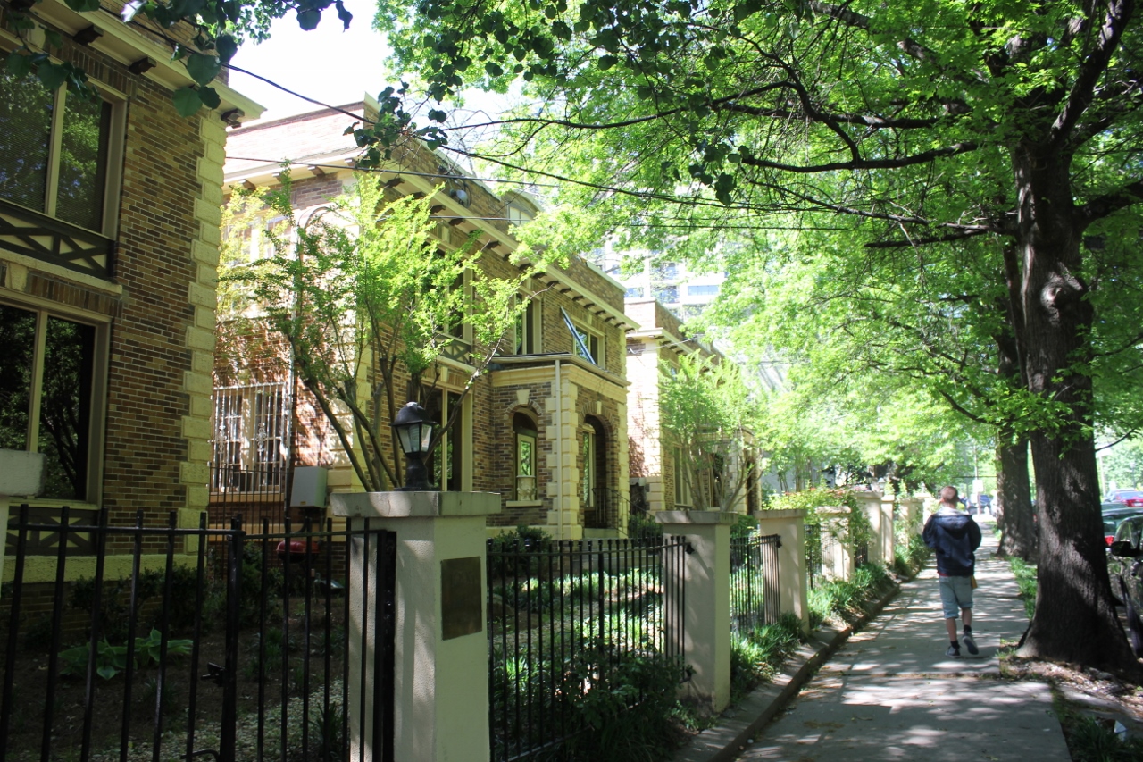
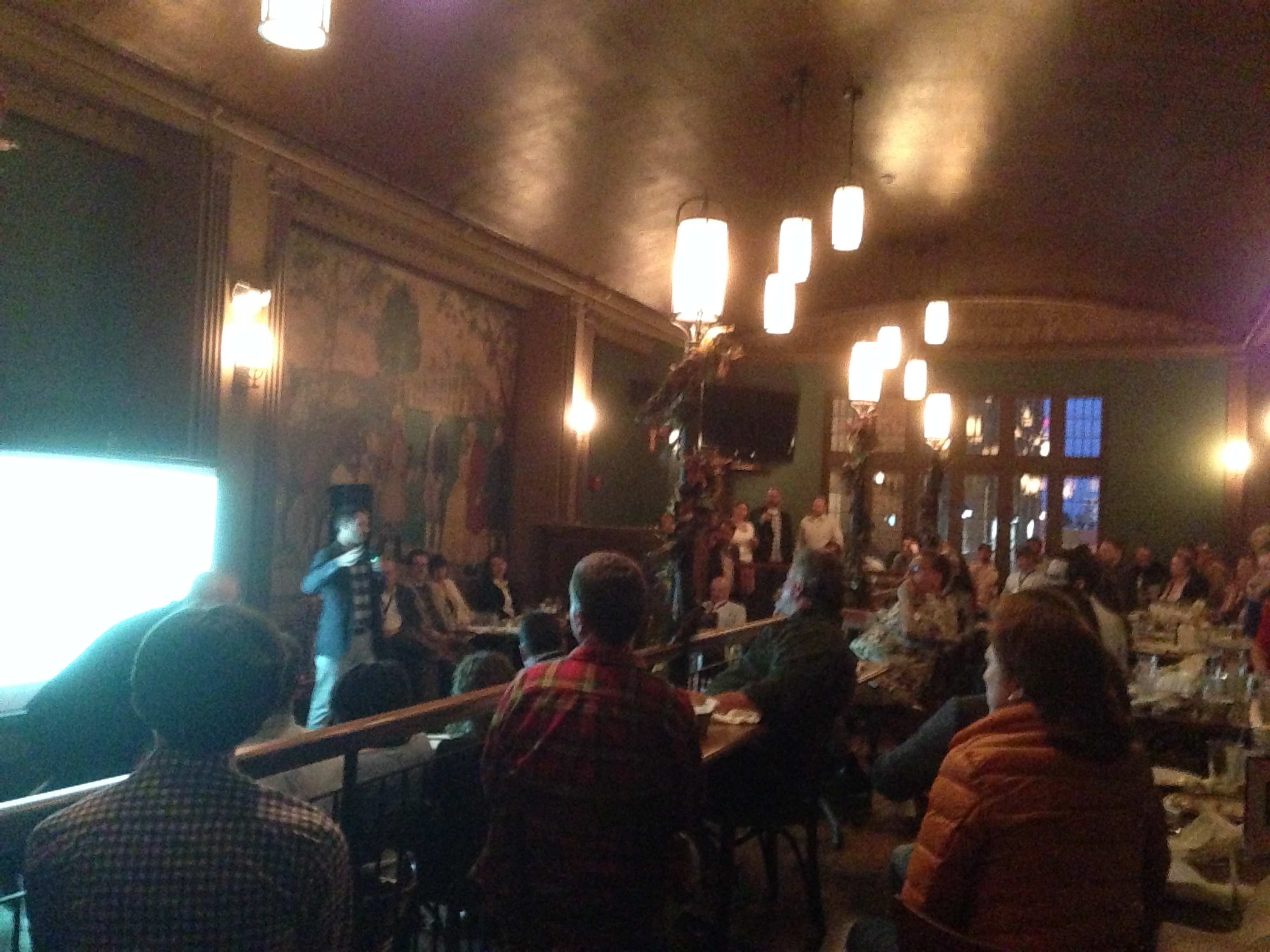
The weather is warming up which makes it a great time to enjoy fine Belgian beers outside at this Thurday’s URBANexchange event (weather permitting)! We are returning to Taste of Begium’s Short Vine location.
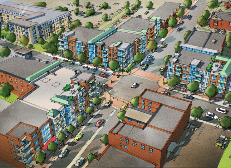
Come down for some waffles and chicken or some Belgian beers this Thursday from 5:30pm to 8:00pm. This is a great opportunity to check out the progress of the new streetscape being installed on Short Vine in Uptown and to check out the new apartments going up along Correy Street.
As always, the event will be a casual setting where you can meet others interested in what is happening in the city. We will gather in a space near the bar so that each person can choose how much or little they buy in terms of food or drink. Although we do encourage our attendees to generously support our kind hosts at Taste of Belgium.
As always URBANexchange is free and open to the public. This Thursday kicks off World Cup Soccer so Taste of Belgium will have special happy hour prices.
Additionally, Jocelyn and I have recently returned from attending the 22nd annual Congress for the New Urbanism in Buffalo where Cincinnati won a major award and have some great ideas and experiences to share.
We will be situated near the kitchen bar on the north end of the restaurant but you can also ask the host where the UrbanCincy group is located and they will be happy to assist.
Taste of Belgium is located on Vine Street in Correville between the University of Cincinnati’s east and west campuses and is located just two blocks from a future uptown streetcar stop. If you choose to bike there is free and ample bike parking is available outside the building. The venue is also served by Metro’s Metro+ bus , as well as routes #19, #78 and #46 buses.
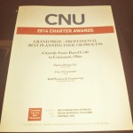
The City of Cincinnati’s Department of Planning & Buildings has been on a roll lately. This past weekend in Buffalo, at the Congress for the New Urbanism (CNU) national conference, the city won its third national award of the year for its new form-based code.
CNU’s grand prize for the Best Planning Tool or Process was actually a tie and thus jointly awarded to Cincinnati for its form-based code (FBC) and Station Center, a transit-oriented development in Union City, California.
As first reported by UrbanCincy, the Department of Planning & Buildings was honored with the Daniel Burnham Award for a Comprehensive Plan at the American Planning Association’s (APA) national conference in Atlanta. Additionally, in late 2013, the Department won the Ohio APA’s award for Comprehensive Planning for a Large Jurisdiction.
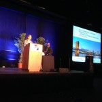
Elizabeth Plater-Zyberk introduces the award.
In 2012, city leaders were also awarded with the Frank F. Ferris II Community Planning Award from the Hamilton County Regional Planning Commission.
“It is an honor for us to have our code recognized by an organization that is on the cutting edge of best practices with regard to planning tools and good urbanism,” said Alex Peppers, senior city planner for Cincinnati. “We put a lot of work into developing a code that would fit our context and assets.”
What makes Cincinnati’s FBC unique is that it is a voluntary tool for neighborhoods who seek to preserve the character of their centers of activity and historic business districts. Thus far, it has been adopted in College Hill, Madisonville, Walnut Hills and Westwood.
Jurors noted that they were particularly impressed by the code’s extensive photo documentation and mapping analysis that calibrated the code’s application, and reinforced the unique characteristics of Cincinnati’s urban neighborhoods.
“The Cincinnati code is an excellent example of that advancement in the deployment of SmartCode, with particular attention paid to public process, neighborhood structure and graphic presentation,” explained Elizabeth Plater-Zyberk, one of CNU’s award jurors. “It reinforces Cincinnati’s historic urban patterns with guidance for appropriate infill and predictable redevelopment building.”
The final draft of Cincinnati’s form-based code is available online and can be accessed here.
Three of UrbanCincy‘s top stories in May revolved around a few dramatic transformations taking place in the urban core. We took you on a Street View tour of some of the biggest transformations in the city, showed you photos of the Cincinnati Streetcar’s construction, and shared news about changes to the city’s oldest historic district. In case you missed them, enjoy UrbanCincy‘s most popular stories from May 2014:
PHOTOS: Cincinnati’s Dramatic, Decade-Long Transformation Visualized While many of us can feel that a transformation has taken place in Cincinnati over the past decade, it can be difficult to visualize it. Thanks to new Google Street View capabilities we have done just that.
The Littlefield to Bring Craft Bourbon Bar to Northside This June A craft bourbon bar called The Littlefield will open in Northside next month. The approximately 400SF establishment, which will also include a large outdoor terrace, has been years in the making.
Western & Southern Aiming to Alter Lytle Park Historic District Boundaries Western & Southern has long been rumored to be eyeing a location for a new high-rise office tower to consolidate their headquarters; and proposed changes to the Lytle Park Historic District may be setting up for exactly that.
A few weeks ago I journeyed seven-plus hours by car from Cincinnati to Atlanta for the American Planning Association’s (APA) national conference. The five-day conference was held in the Georgia World Congress Center in the core of Atlanta between downtown and Vine City.
This was my first trip to Atlanta since passing through the city in the early 1990’s.
For an urbanist, the city of Atlanta at first glance is a conundrum. Subway stations that seem to feed park and rides, buildings that barely front the street and streets with no crosswalks where pedestrians play a dangerous game of Frogger just to cross to the other side are all typical occurrences in the city.
However the city is all of these things and more. Atlanta boasts beautiful and funky neighborhoods such as Poncey Highlands, Little Five Points and Castleberry Hill. Beautiful parks such as Inman Park and the Frederick Law Olmsted-designed Piedmont Park.
The BeltLine, a multi-modal transportation corridor we reported on last week, has sparked development along its route and spurred pedestrian and bicycle connectivity between many of Atlanta’s intown neighborhoods.
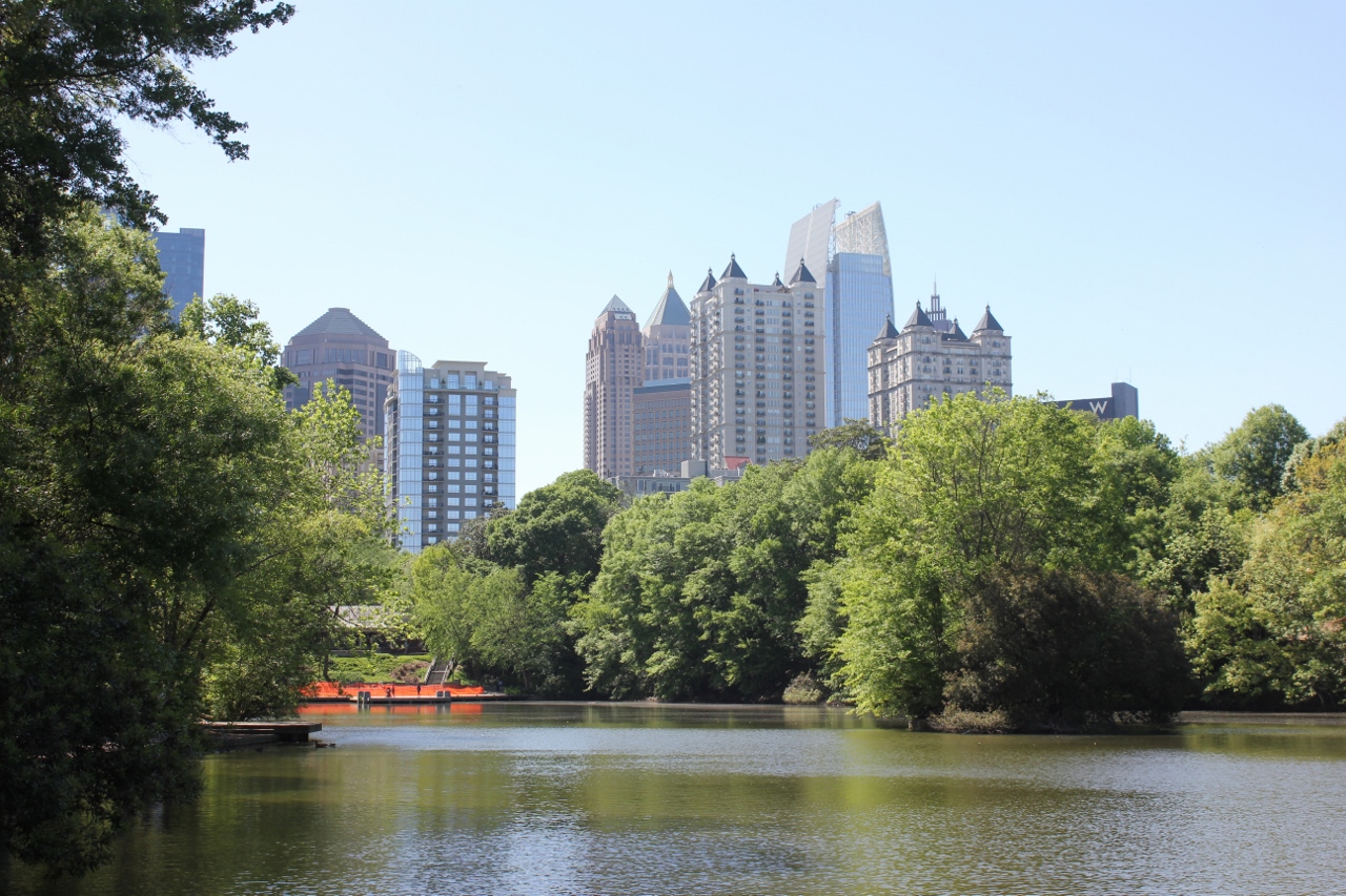
The Midtown Skyline
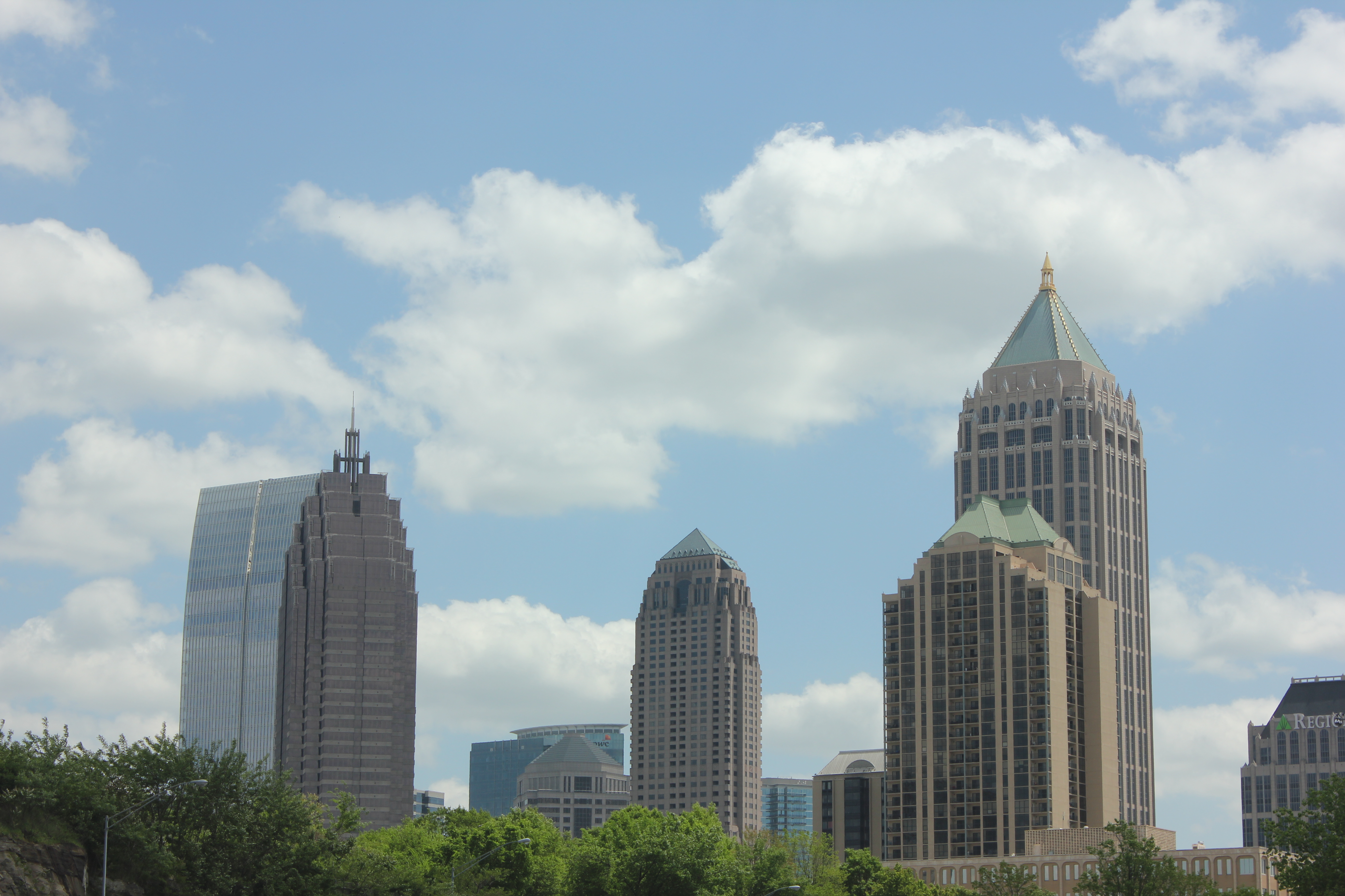
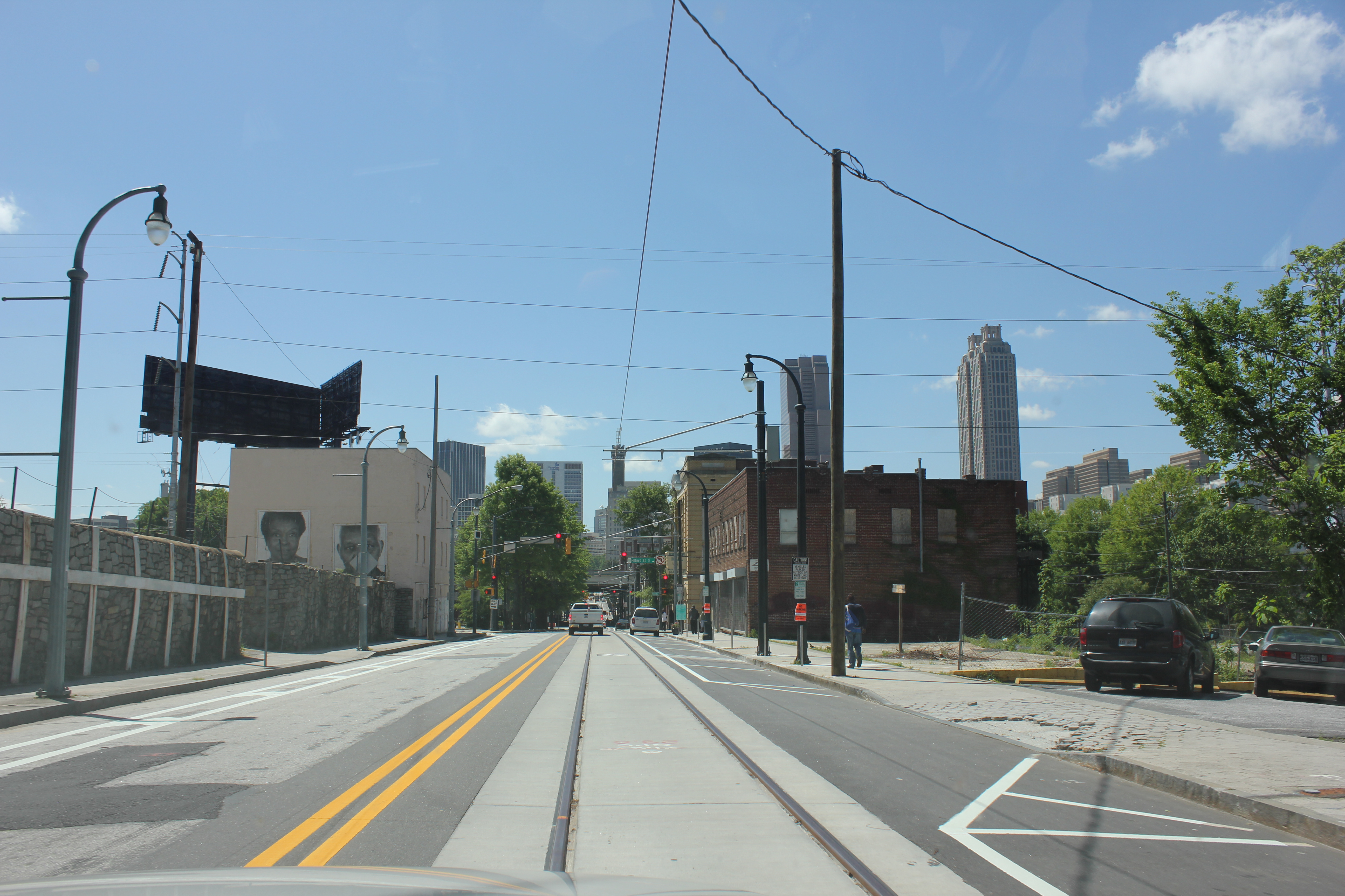
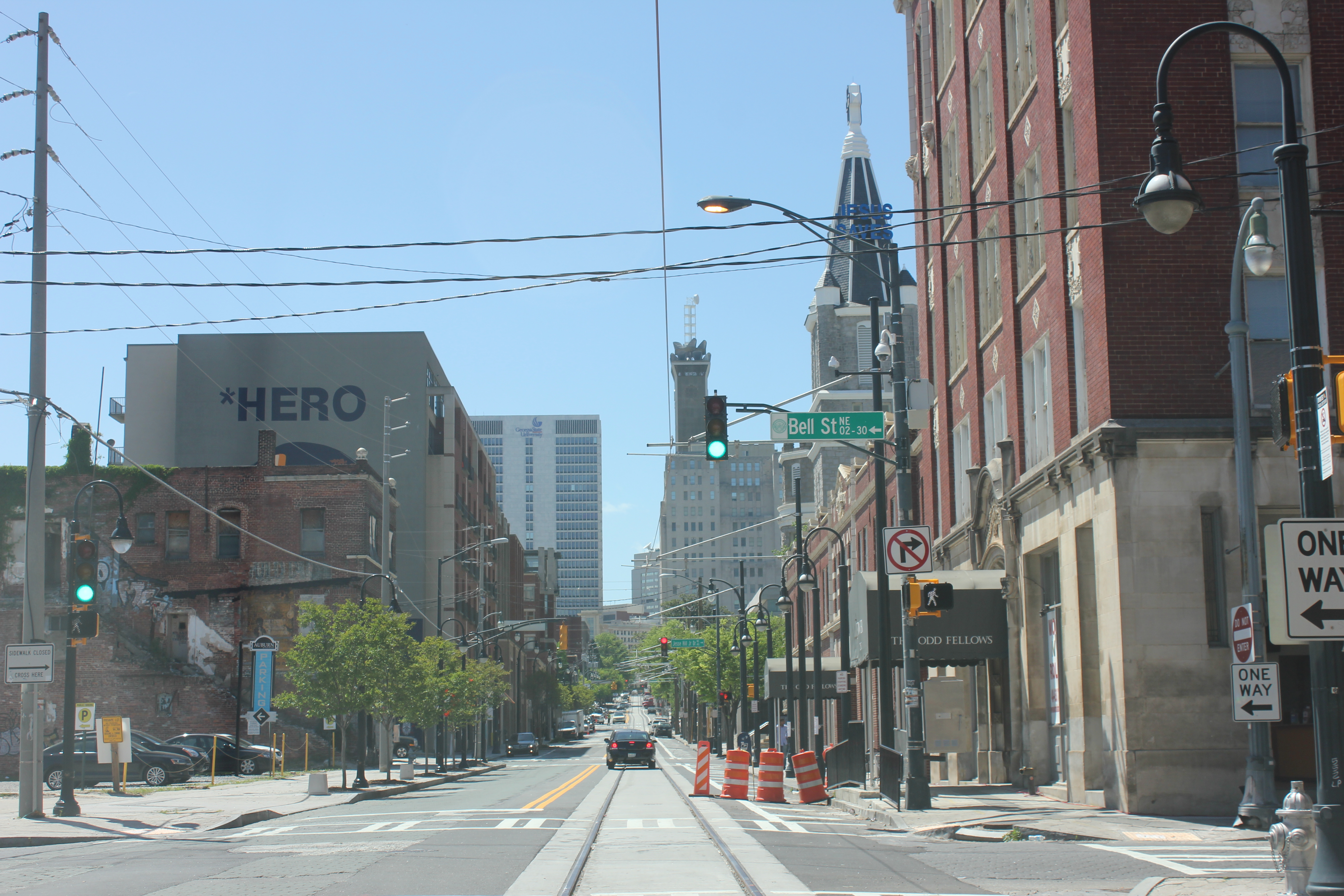
Downtown Atlanta
Redevelopment in Poncey Highlands
Atlanta Streetcar track and wire
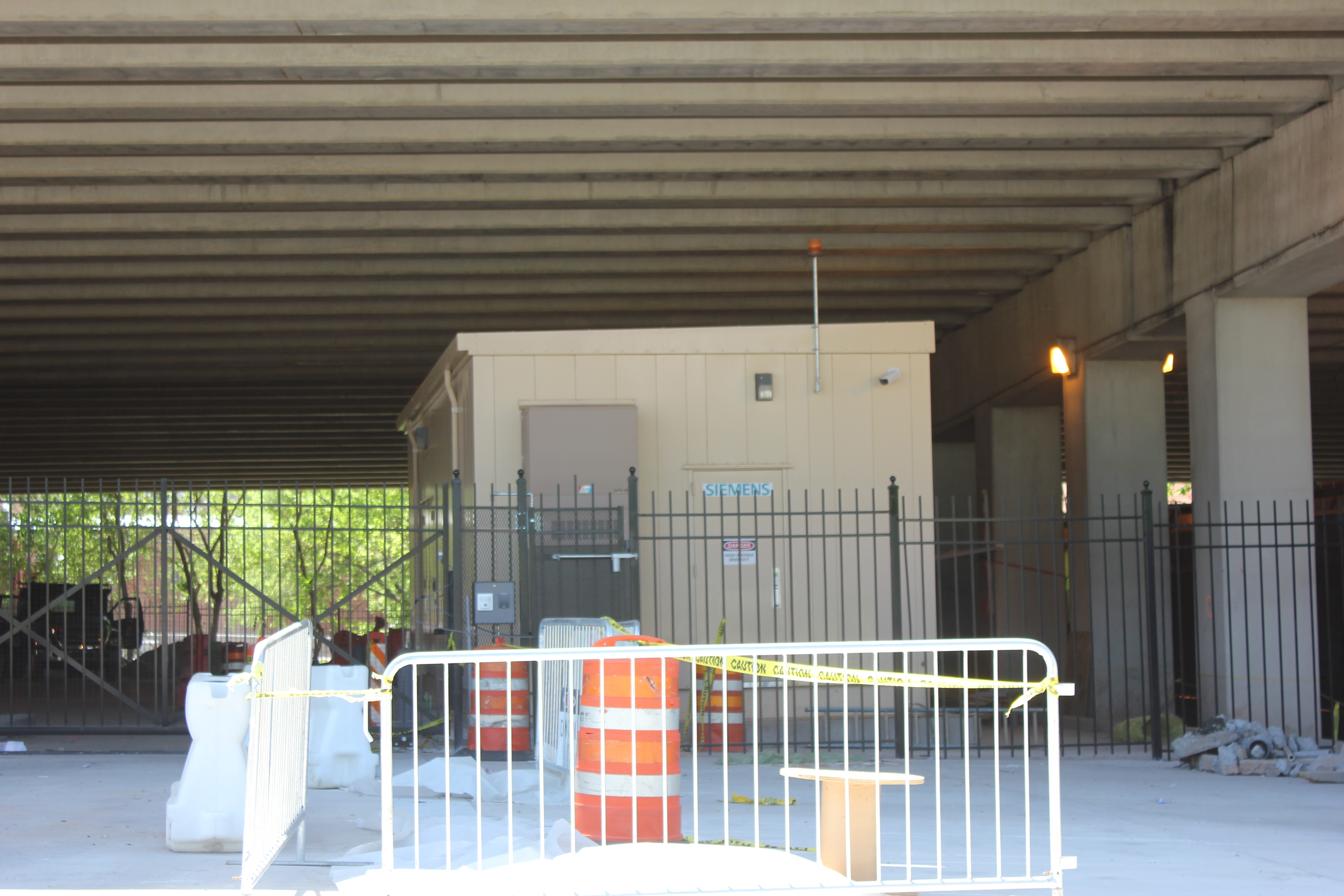
Streetcar power substation
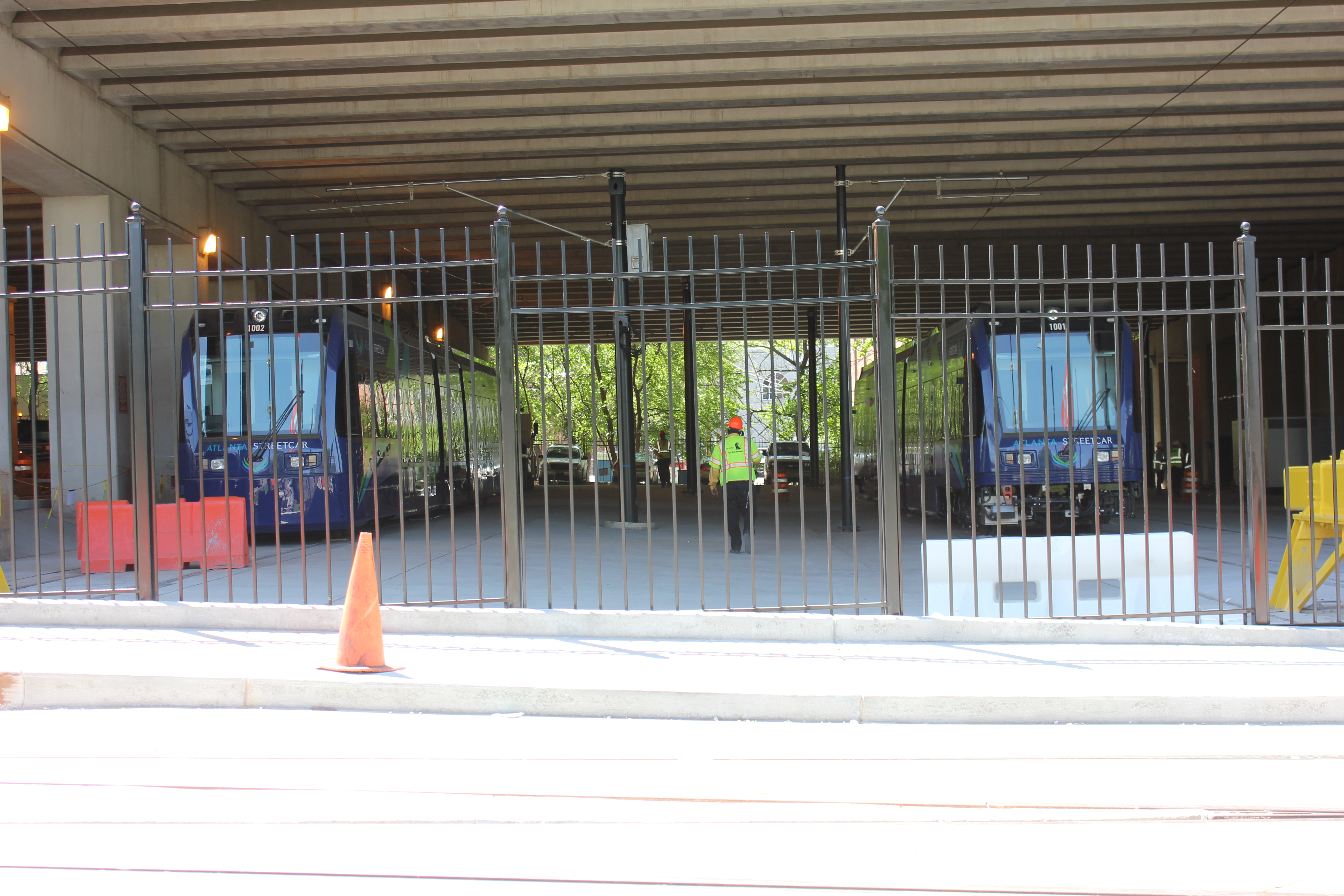
Atlanta Streetcars by Siemens
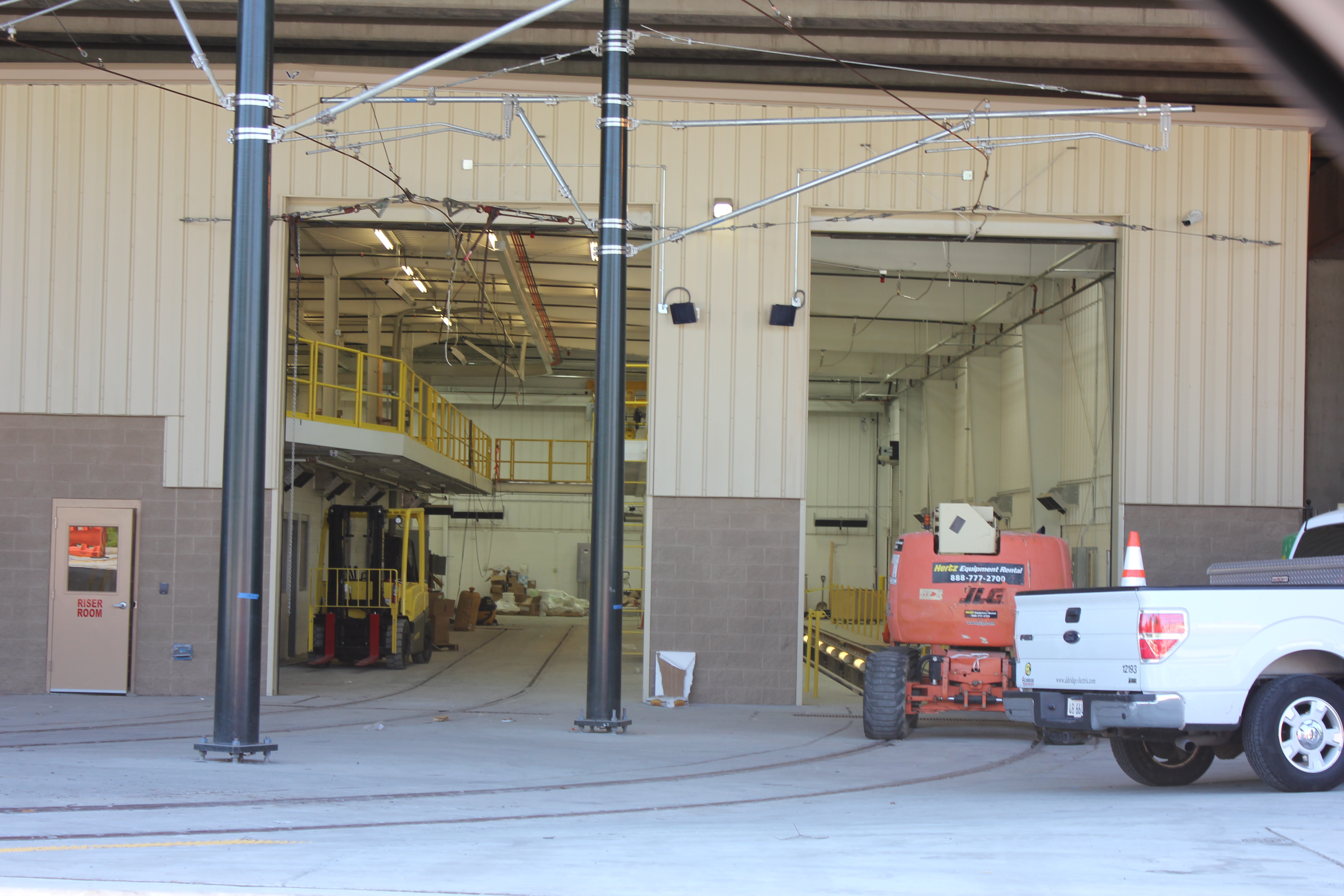
Streetcar Maintenance Facility
Finished Streetcar track
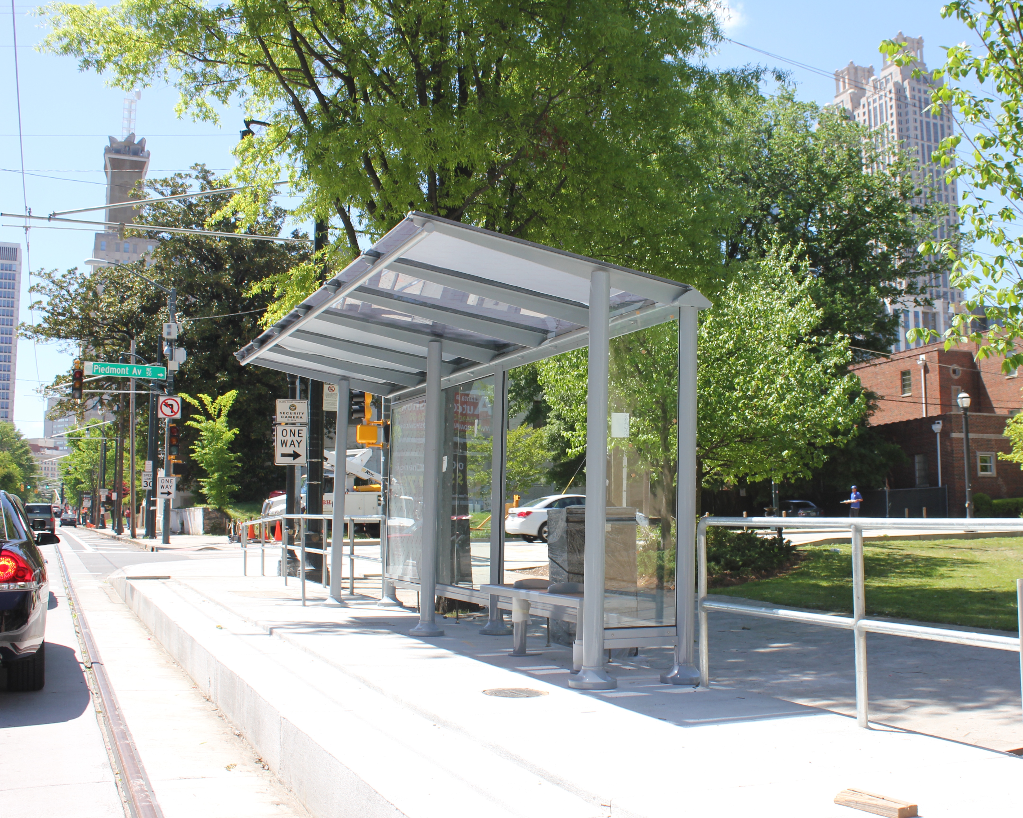
Completed Streetcar Station
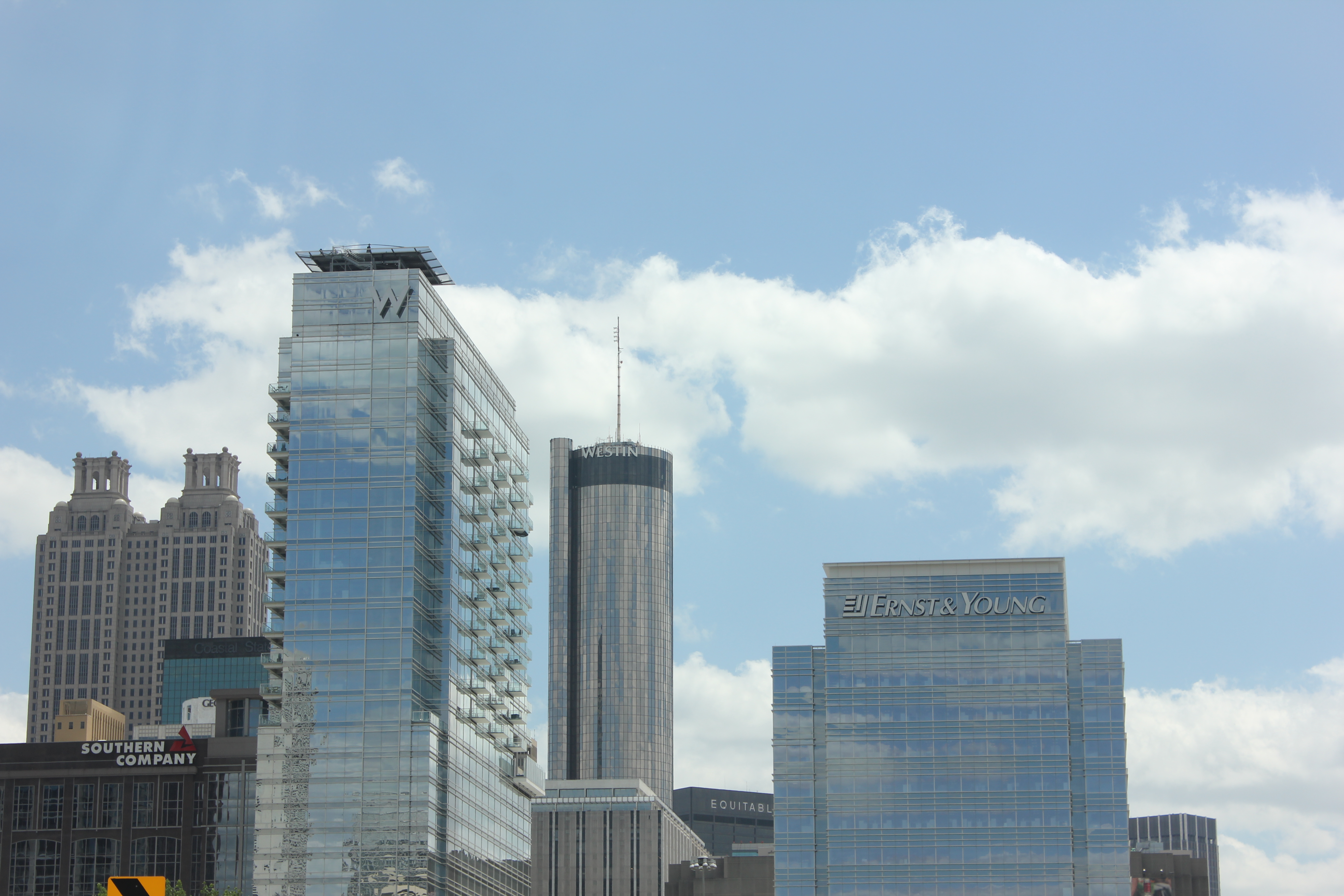
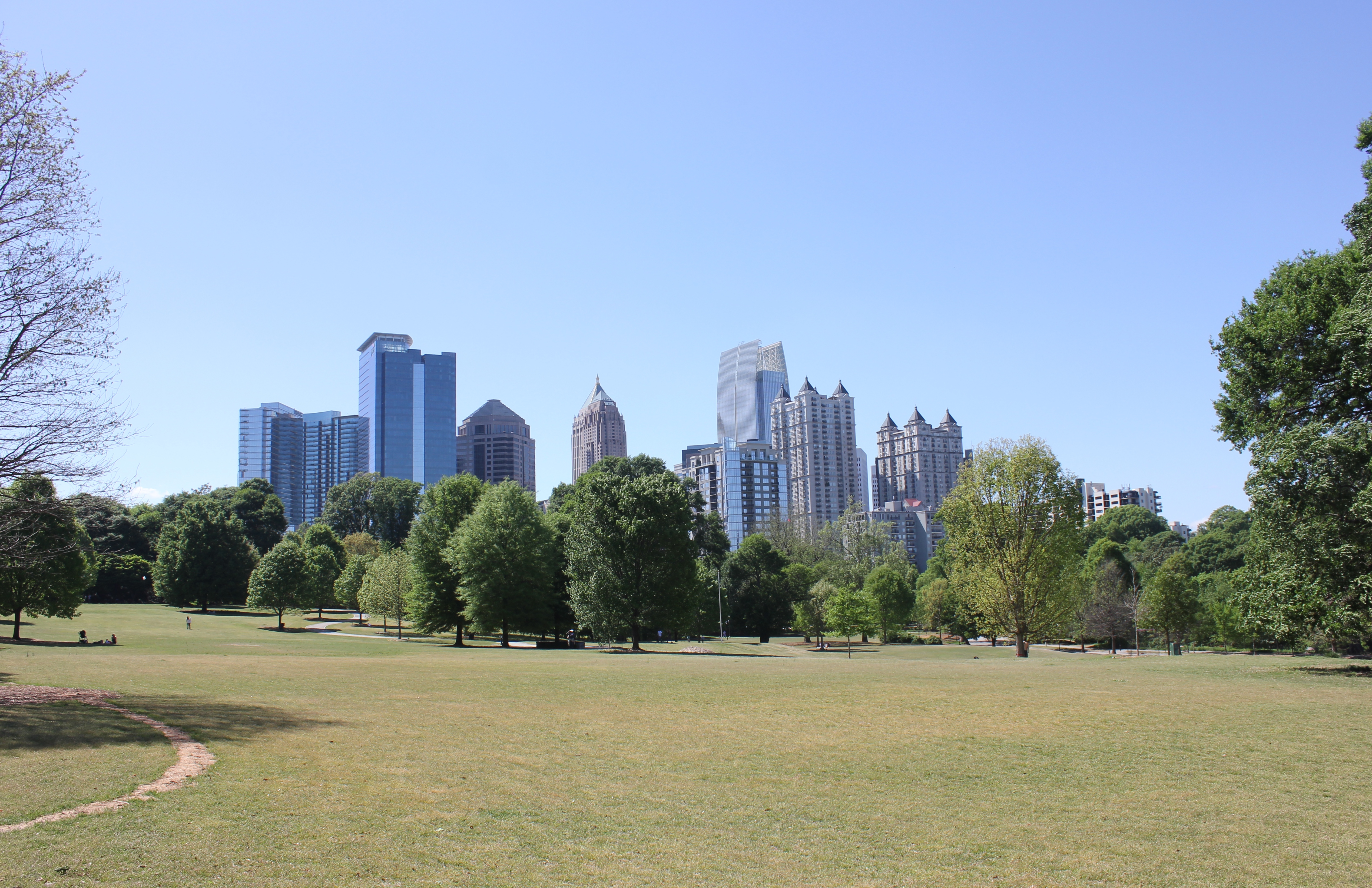
Midtown from Piedmont Park
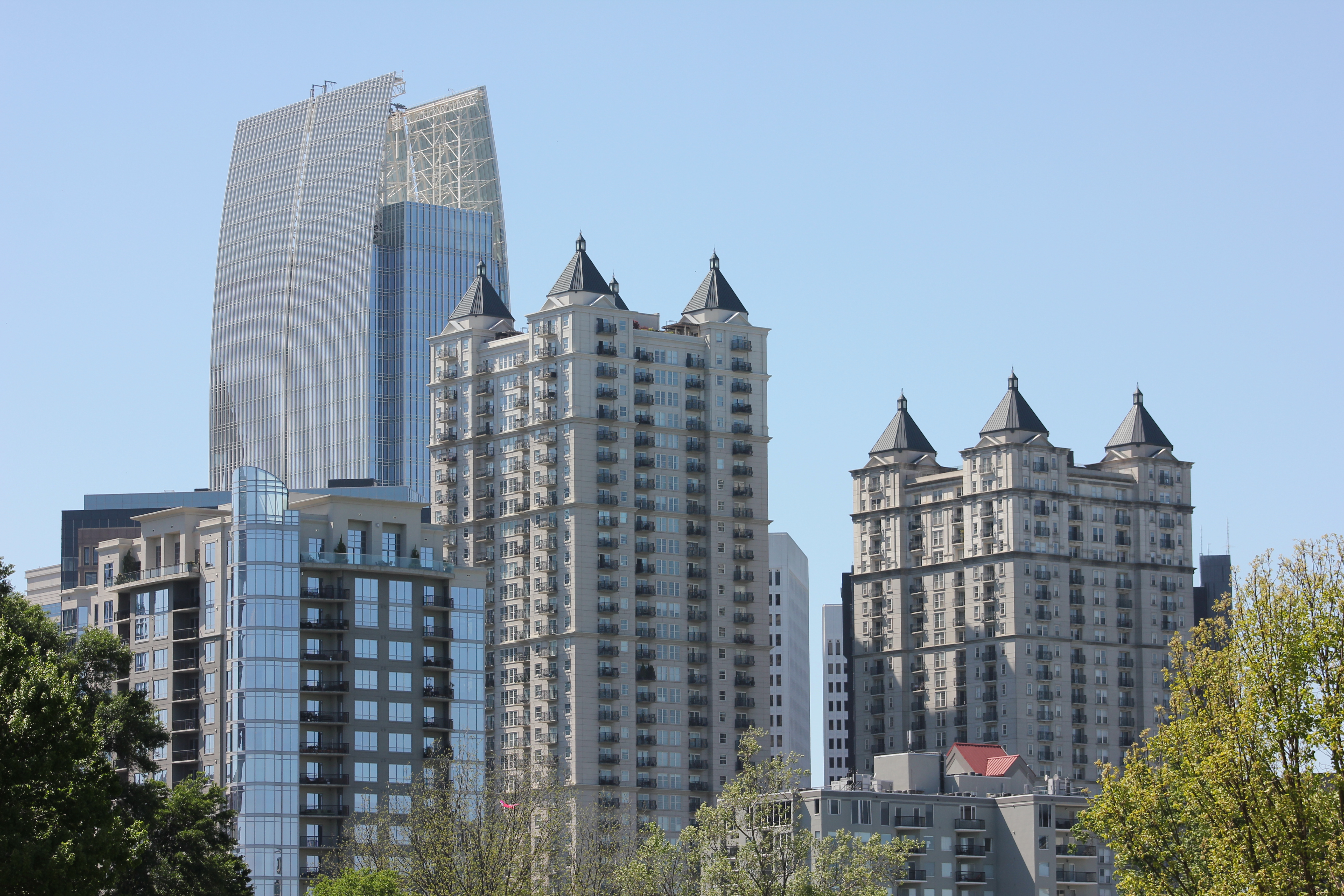
Residential high rises in Midtown
Beautiful historic homes near Piedmont Park
The skyline from Piedmont Park pond
During the conference I also had a chance to view the Atlanta Streetcar, which could begin operating later this year. Planners in Atlanta have tucked the streetcar’s maintenance facility under a highway viaduct. This is where the streetcars that have already arrived are now being stored.
As you might expect, social divisions by income were evident. I had a chance to explore some of Vine City, which is located just west of where the conference was held and was also home to Martin Luther King Jr. This neighborhood has given way to abandonment and decay. Empty lots, run down houses and discarded vehicles littered the streets.
At the conference, one particular session focused on the redevelopment of Vine City and the adjacent English Avenue. During that session, neighborhood leaders and proponents of the redevelopment plan were questioned vigorously by a representative from a community group that is active in those neighborhoods. The challenges reminded me of the not-so-distant past for Over-the-Rhine and other Cincinnati neighborhoods, such as the West End or Avondale, that are still struggling to rebuild what they have lost over the years.
On the last day of the conference, the APA announced that they had completed a survey which found that both Millennials and Baby Boomers prefer to live in urban settings where there are plenty of transportation options and walkable neighborhoods.
“If there is a single message from this poll, it’s that place matters,” stated APA’s executive director, Paul Farmer, in a prepared release. “Community characteristics like affordability, transportation choices, safe streets, high-speed internet and housing that can accommodate others or enable you to live there as you grow older matter as much as job opportunities.”
It seemed odd that the APA would choose to release this information while hosting a conference in an infamously automobile reliant city; but, while Atlanta is a city that is still overrun by the automobile it is showing signs that communities, residents and activists are coming together to push for neighborhood connectivity and pedestrian improvements.
Even though my initial impression was that the city serves as a dystopian future for urbanism where pedestrians are marginalized in urbanized places, after learning more about the city at the conference, it is encouraging to see that old mentality is changing.
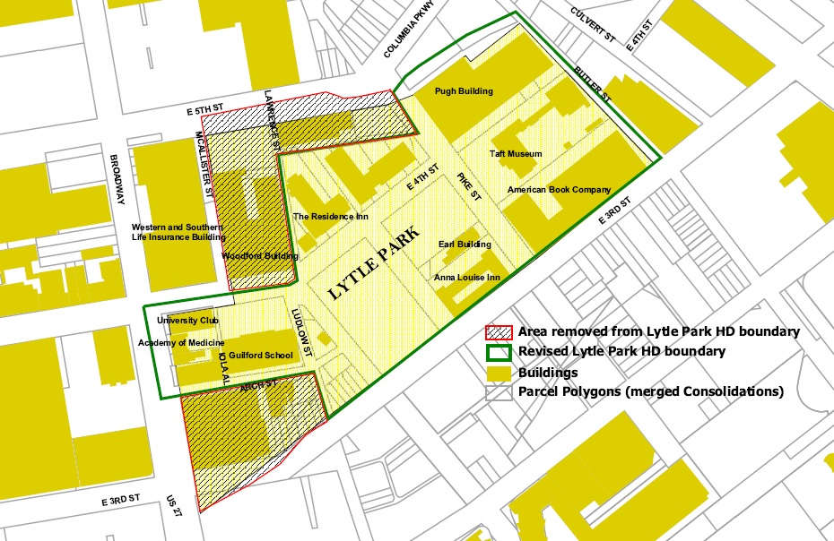
Proposed Lytle Park Historic District Boundary (City of Cincinnati)
The construction of Interstate 71 spelled the permanent division of several east side neighborhoods in Cincinnati including Evanston and Walnut Hills. But in the early 1960’s, an effort arose from downtown land owners around historic Lytle Park to preserve one of the oldest areas in the city.
Enacted in 1964, the Lytle Park Historic District has protected this area of the city which I-71 now passes under. Now, per city regulations, the city’s oldest historic district is up for renewal. A city staff report to the Cincinnati Planning Commission, however, reveals that several changes may be afoot.
The district has historically been split into two types of regulated areas. Area A properties were those that had to meet the strictest requirements of the historic district’s guidelines; while Area B properties were granted special allowances to accommodate some changes.
Proposed Lytle Park Historic District Boundary (City of Cincinnati)
The proposed district changes would remove some properties from the historic district altogether, and would also eliminate the distinction between properties. Specifically the Woodford Building along Fourth Street, a building along Fifth Street, a parking garage, and several historic buildings along Third and Arch Streets would be removed under the proposal.
In the letter to Planning Commission legal counsel Western & Southern attorney Fran Barrett stated:
“Our client’s desires to be able to provide for keeping its home office headquarters in the area which will ensure the ever-increasing high number of wage earners who add significantly to the city’s tax base, support a number of businesses and commercial activities in the downtown area, and continue to promote a major financial services company in the Central Business District.
There is a concern that an added layer of government reviews could deter positive economic growth at this location. Western & Southern’s track record demonstrates that all concerned should have nothing but the greatest of confidence in any future development undertaken by Western & Southern.”
The removal of these areas from the historic district would essentially clear the way for the financial services giant to demolish and redevelop the properties in a way that would not have to conform to the district’s guidance on new infill development.
Such information only fuels intense speculation that Western & Southern is actively eyeing a location to build a new high-rise office tower to consolidate its headquarters, and possibly even a second high-rise tower accommodating either a hotel or residences.
While the staff report offers no comment on the removal of the buildings from the district, the three buildings along Arch Street are some of the oldest buildings in the city.
The proposed changes will go before Cincinnati Planning Commission on Friday, May 2. The meeting is scheduled to take place at 9am on the seventh floor inside the J. Martin Griesel Conference Room at Centennial Plaza Two (map).
 The weather is warming up which makes it a great time to enjoy fine Belgian beers outside at this Thurday’s URBANexchange event (weather permitting)! We are returning to Taste of Begium’s Short Vine location.