Categories
News Opinion Politics

Mayoral Election Will Impact Cincinnati’s Planning Future

Cincinnati is in the midst of revitalization. There have been several significant accomplishments achieved since 2007 when the city’s Planning Department was reconstituted. Initiatives such as Plan Cincinnati and the development of Form-based code have united regional leaders and communities to help build a shared vision of the city’s future.

These efforts could be affected drastically with the election of a new mayor on November 5th.

Qualls: Focus on vision and and consensus building:
In her time as Mayor in the 1990’s and when she returned to City Council in 2007 Roxanne Qualls (C) has been the leader in implementing a bold vision for Cincinnati through planning policies. In the 1990’s, Qualls lead the effort to narrow Fort Washington Way which allowed for the expansion of downtown and the conversion of the riverfront into a showcase for the city.

The award winning Banks Master Plan owes its existence and implementation to Qualls’s dedicated leadership in establishing the Riverfront Steering Committee which developed the plan. By the time Qualls returned to council the plan had advanced through Mayor Mark Mallory (D) who formed The Banks Working Group and began implementing the plan in 2008.

Qualls has also been active in developing Plan Cincinnati, the city’s recently adopted comprehensive plan. But since her return on council she has been more closely associated with bringing form-based codes to Cincinnati.

Since 2007 she has led several groups on tours to Nashville, TN and Columbus, OH to learn more about form-based codes and how they benefit cities. Last month, that vision became reality when Madisonville became the first city neighborhood to adopt the form-based code regulating plan.

The Cincinnati form-based code is a comprehensive land use regulation that was developed by the city through years of community participation. It is a code that emphasizes that new development be constructed in a form that integrates into the traditional character of the neighborhood.

Cranley: Focus on removing barriers for developers:
Running against Qualls is former council-member John Cranley (D) who served on council from 2001 to 2009. He resigned from council in 2009 to pursue building a private development in East Price Hill.

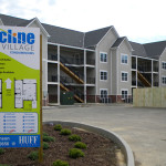
The Incline Square project, located next to the Queens Tower apartment building, was envisioned to have a 22,500 square-foot office building be constructed along with a 58-unit four-story apartment building and restaurant space. Only the residential and restaurant portions of that development were built.

A review of Cranley’s track record on council had shown that early in his council career, he had been an advocate for making the city more “developer friendly.” In 2002, he was instrumental as chairman on the Budget & Finance Committee in dissolving the city’s long standing Planning Department, the oldest continuously running planning division in the country at the time.

The dissolution came over disagreements between the Planning Department and a developer in Oakley for the Center City of Cincinnati development. The unprecedented move generated a good amount of public outcry.

In 2002 Cranley told the Cincinnati Enquirer, “”The Planning Department was almost given the mission of causing problems, because it was completely divorced from economic incentives and any kind of market reality.”

However; Cranley did not oppose Mallory’s effort in 2007 to reestablish the department. He also signed a motion with Qualls on advancing form-based codes in 2008, but at a recent mayoral debate sponsored by the Urban Land Institute, Cranley strongly opposed them. He has also stated his opposition to planning and zoning, stating that the solution to neighborhood problems is money.

The outcome of this election will determine the future vision and progress of Cincinnati. That vision of progress is either one forged on grand visions and community outreach or one that favors minimizing regulations and oversight to increase development in the city.

Categories
Business Development News

VIDEO: Next Phases of 45-Acre Smale Riverfront Park Taking Shape

Hopefully you are ready to learn all about support structures and geothermal, because the latest video update for the $120 million Smale Riverfront Park goes into great detail about both topics. It also reveals some new information about upcoming features at the park.

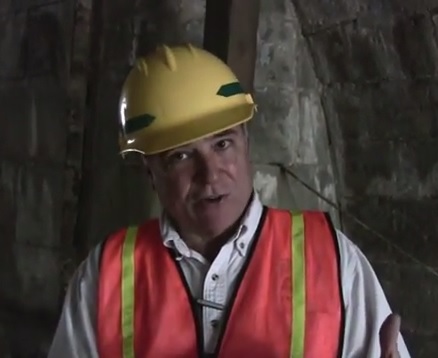
The first half of the 13:30 video focuses on the intricate details involved with some of the most mundane work taking place at the site. Project manager Dave Prather does a good job, however, at illustrating just how important that work is.

The more intriguing pieces of information are saved for the second half of the video. During that portion, Prather reveals details about the fog feature at the Heekin/PNC Grow Up Great Adventure Playground, which is scheduled to open to the public in spring 2014.

Prather also discusses that the Cincinnati Park Board has control of the anchorage under the John A. Roebling Suspension Bridge. Dating back to the Civil War, the inner structure, he says, will be opened to the public in some way. Details have not yet been finalized for how they will utilize the area, which is in the flood plane, but Prather expects to be able to make an announcement in time for the next video update.

City and park officials aim to complete the 45-acre central riverfront park by mid-2017, assuming all remaining financing falls into place.

Categories
Business News Politics Transportation

Ludlow Avenue: The Case for a Pedestrian Streets Ordinance

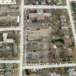
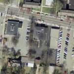
The stretch of Ludlow Avenue from Whitfield Avenue to the west to Ormond Avenue to the east has a decidedly suburban form different from the rest of the gaslight district between Ormond Avenue and Clifton Avenue. This western stretch is part of a two-block commercial main street that is arguably the “most complete neighborhood commercial district in the city,” according to Aaron Renn.

Just being a commercial main street, however, has not been enough to preserve the pedestrian-oriented nature of the street for the entire western half of the district on the south side of Ludlow, and a key gap on the north side of Ludlow at Ormond.

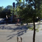
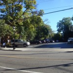
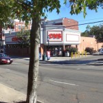
The southern stretch could be described as the Clifton financial district. Between Whitfield and the CVS are three banks – US Bank, PNC and Columbia Savings Bank – all with their own independent access and parking lots surrounding the buildings.

The oddity is not that banks have their own access and parking, but that you have auto-oriented suburban development on a historic commercial main street. This is not a unique problem, but a pedestrian streets ordinance, perhaps modeled after Chicago’s, could help correct faulty land use decisions like this one.

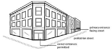
The theory behind such an ordinance is that you have an A and B street hierarchy, with A streets having a high standard of spatial definition and pedestrian interest in a continuous network, and B streets having lower standards for parking lots, drive-thru’s, muffler shops, etc.

This is a neoliberal approach typical of New Urbanism, It compromises for many areas and gives businesses a design choice based on location: a pedestrian main street (A), or an auto-oriented B street.

Chicago’s pedestrian streets ordinance seeks “to preserve and enhance the character of streets and intersections that are widely recognized as Chicago’s best examples of pedestrian-oriented shopping districts. The regulations are intended to promote transit, economic vitality and pedestrian safety and comfort.”

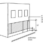
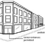
The ordinance then sets the criteria for the pedestrian street designation, lists all street segments within the city that have been deemed pedestrian streets subject to the ordinance, and sets standards for build-to lines, transparency and pedestrian access.

Of particular importance is what it says about parking and driveways:

Parking Location. All off-street parking spaces must be enclosed or located to the rear of the principal building and not be visible from the right-of-way of a pedestrian street.

Driveways and Vehicle Access. Vehicle access to lots located along pedestrian streets must come from an alley. No curb cuts or driveways are allowed from a pedestrian street.

If this the stretch of Ludlow Avenue had a pedestrian streets ordinance, at such time these banks wish to make improvements or redevelopment, these standards would then kick in and require the banks to reconsider their vehicular access, possibly to the point of eliminating driveways and consolidating parking and access off Whitfield.

More realistically, however, the ordinance would help guard other commercial main streets from the auto-oriented nature of drug stores, banks and restaurants without the need for a short-term Interim Development Controls (IDC) district or historic district protections.

Categories
Business Development News

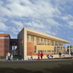
Cincinnati Breaks Ground on $16M Net Zero Energy, LEED Platinum Police HQ

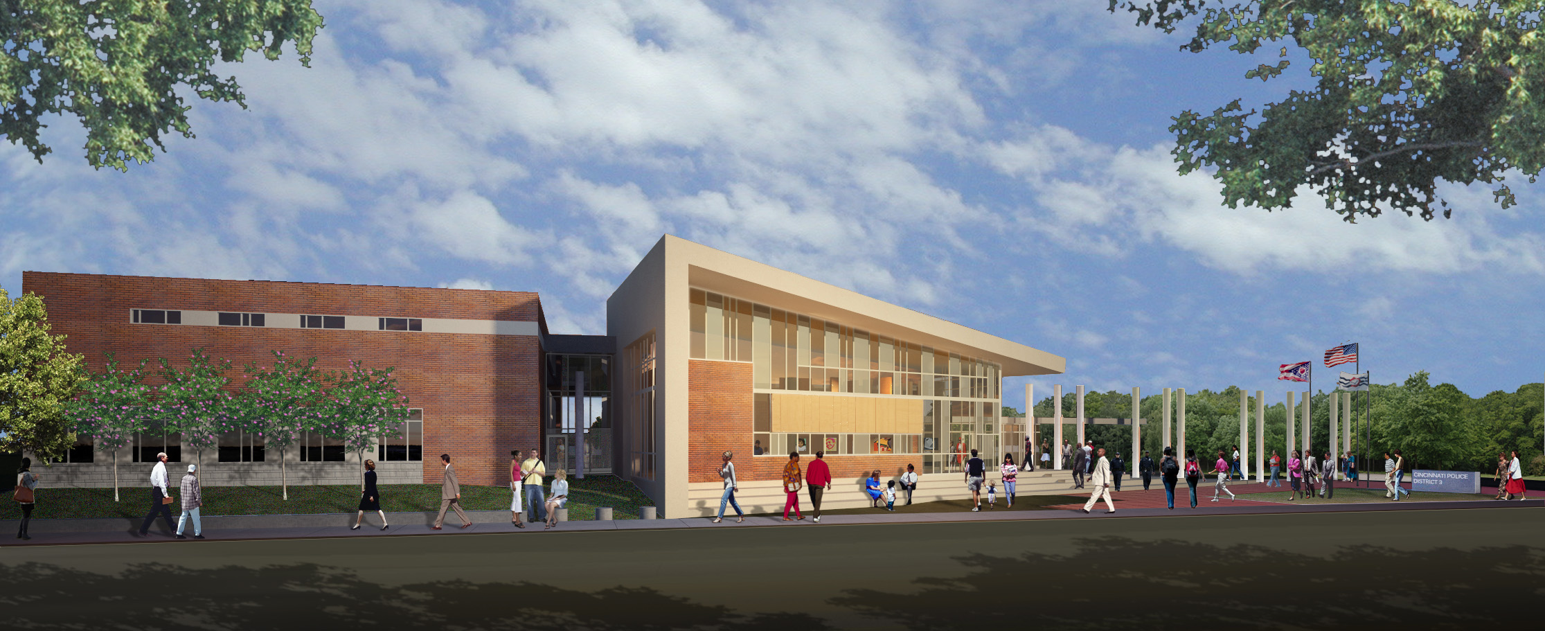
City officials and neighborhood leaders celebrated the ground breaking for Cincinnati’s new $16 million Police District 3 Headquarters on Monday.

Located in Westwood, the 39,000 square-foot facility will replace what city and police officials consider an antiquated 105-year-old facility in East Price Hill.

While the City of Cincinnati has built or begun construction on several new fire stations, including one nearby in Westwood, this is the first new police station built in the city since in more than four decades.

“It used to be that when cities built civic buildings like this, they were places the community could come together,” Mayor Mark Mallory (D) said. “With District 3, we’re doing that again. We want people to come here and feel comfortable coming here with their neighbors.”

According to city officials, the new police headquarters will serve 14 neighborhoods from a central location on the west side. A site that was specifically chosen due to the input provided during Plan Cincinnati.

To help further strengthen the concept of the police headquarters also serving as a community gathering place, city officials have ensured that the new facility will include community gathering space and public art. It is an approach to community building similar to what was done, with rave reviews, by Cincinnati Public Schools (CPS) when rebuilding its entire building portfolio.

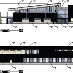
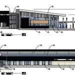
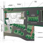
The location is just a block away from Dater High School and Western Hills High School and sits in what was a vacant outlot of a suburban-style strip mall. Site plans show that the new facility will be built at the street and oriented toward the sidewalk.

While Cincinnati has been seen as a leader in green building when it comes to the rebuilding of CPS, its tax abatements for Leadership in Energy and Environmental Design (LEED) rehabilitation and new construction, and public building in general, this will be one of the Queen City’s greenest buildings.

The development team of Messer Construction, Triversity Construction and Emersion Design are aiming to achieve a LEED Platinum certification – the highest possible rating under the LEED system.

The development team also says that it has designed the structure to achieve Net Zero Energy Consumption through its geothermal mechanical systems, high performance building envelope and solar panels. The new Police District 3 Headquarters will also reduce potable water consumption by 30% thanks to on-site bio-retention cells and strategic use of site design materials.

City leadership also expects the project will reach 36.2% Small Business Enterprise (SBE) inclusion. If such a number is achieved, it would make it the highest percentage of SBE participation on any city project to-date.

According to project officials, construction is expected to take about a year-and-a-half and could start welcoming members of the community as early as July 2015.

Categories
News Opinion

GUEST EDITORIAL: Cincinnati Could Learn from LA’s Regional, High Growth Mentality

There is perhaps no more controversial word to utter in Cincinnati than streetcar. The roughly three-mile rail project connects the riverfront to Over-the-Rhine’s Findlay Market, passing several points of interest and centers of employment along the way. The total cost for the streetcar is roughly $100 million, and it is fully funded without taxpayer assistance.

To anyone familiar with transportation projects, this price tag is on the low end of the spectrum, and actually appears to be quite affordable when compared to highway construction and more comprehensive light and heavy rail systems, which both often have project costs well exceeding a billion dollars.

In spite of this, the Cincinnati Streetcar project has been met with a very vocal public opposition from day one. The project has faced and defeated two ballot initiatives aimed at stopping the project completely, has adapted to a smaller route after having more than $50 million in state funding revoked, and has generally persevered through every challenge the opposition has created.

The question I want to answer is not whether the streetcar is a good idea; nor do I want to speculate on the future success or failure of the project. What is far more compelling of an idea to explore is the root causes of the unrelenting opposition to what is actually a modest and simple transportation and economic development project.

Perhaps no better city serves as a juxtaposition to the Cincinnati experience than Los Angeles. Having lived, worked, and studied urban planning in LA for the past 4.5 years; I was able to witness firsthand the differences from Cincinnati in the attitudes towards transit, and more generally, the city itself.
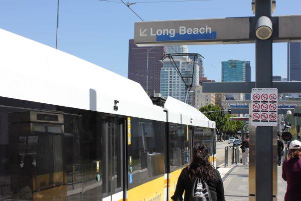
532472_608157281591_764452968_nPassengers board the Blue Line LRT in Los Angeles. Photo provided by John Yung for UrbanCincy.

In 2008, over 67% of Los Angeles County residents approved Measure R, a 30-year half-cent sales tax increase to support transportation projects. As a result of the passage of Measure R, LA is now in the process of building:

  • The so called “subway to the sea” connecting Downtown LA to Santa Monica;
  • An extension of the Green Line light rail line to connect to Los Angeles International Airport;
  • An extension of the Gold Line light rail line to serve the far eastern suburbs; and
  • Phase two of the Expo light rail line connecting Culver City with Santa Monica (phase one connected Downtown LA with Culver City, and opened in 2012).

Additionally, a downtown streetcar project (sound familiar?) was proposed a few years ago, and in late 2012, nearly 73% of downtown residents voted to create a special, localized tax district to partially fund the project.

In 2013, Los Angeles has transformed from a city known for its sprawl and obsession with freeways and cars, to a city with multiple rail lines under construction simultaneously and a regional population that has twice voted in a super-majority to increase their tax burden to fund transit. Instead of simply chalking up the different experiences in Cincinnati and LA as being the result of differing demographics, I think that there are two main underlying differences between the cities that help explain the reactions to transit.

High Growth vs. Low Growth
While the City of Cincinnati has been hemorrhaging population since the 1970s, the metropolitan area has seen slow and steady population growth. Although slow growth is better than regional decline, a la Cleveland and Pittsburgh, the growth rate of the Cincinnati region pales in comparison to growth experienced in the Southern and Western parts of the country that constitute the Sunbelt.

Conversely, the Los Angeles story has been one of explosive growth at both the city and regional level since the 1940s. The slow growth of Cincinnati creates a situation where municipalities in the region compete with each other not just for jobs, but also residents, potential customers for businesses, and resources. The insecurities of slow growth repeatedly surface in the opposition to the streetcar. “Why not spend $100 million in my neighborhood?”

The streetcar represents an investment in part of the city that will almost assuredly give it an advantage over other parts of the metro area. As such, it is seen as a threat to the population and employment bases to many communities in the region. In Los Angeles, however, while there is still competition among municipalities, the situation is not a zero sum game, and therefore does not elicit the same threatened response that we see in Cincinnati.

Regionalism
The second of the two underlying factors that help explain the difference in attitudes toward transit in Cincinnati and Los Angeles is regionalism. Los Angeles is often described as the prototypical polycentric city. Rather than one core, Southern California is dotted with hubs of commerce, retail, and population. The city of Los Angeles itself has multiple clusters, and there are several other cities in the region such as Pasadena, Glendale, Santa Monica, Long Beach, and Anaheim that serve as nodes on the regional map.

A result of this polycentricity is interdependence among different parts of the region. Someone who lives in Burbank might work in Downtown Los Angeles, shop in Pasadena, go to the beach in Santa Monica, and take their kids to Disneyland in Anaheim. When you think regionally, it is easier to view the improvements of one community as indirectly benefitting yourself.

As most regions in 2013, Cincinnati is also increasingly polycentric. However, there is a strong monocentric legacy in Cincinnati; where downtown was the undeniable heart and hub of the region. Neighborhoods take pride in their unique identities, and often times regionalism is viewed skeptically, as embracing it necessitates a departure away from the hyper-localism that Cincinnati prides itself on. With this type of perspective, it is harder for individuals to see how a transit improvement elsewhere in the region would benefit them.

The monocentric legacy of Cincinnati also has led many people to feel attached to downtown in a way that does not exist in Los Angeles. Much of the streetcar opposition is from people who live outside of the City of Cincinnati, from people who feel that, despite living far away from the project, they still have a right to comment on it because downtown is perceived as being almost a public good for the region to consume.

In Los Angeles, opposition to transit projects seems to come from groups that have a specific issue that they object to. For example, the Expo Line came under attack by environmental groups when Metro announced that a sizeable number of trees had to be removed for construction of the line. An environmental group having a problem with trees being cut down is a logical complaint that is able to be placated relatively easily. In Cincinnati, stopping the city from progressing seems to be an interest group in itself, with broad support from a variety of different populations. This type of opposition is what stymies Cincinnati, and keeps the region in relative stagnation.

There are deep, underlying issues that contribute to these attitudes- far more than I could cover in this post, but I believe that low growth and lack of regional thinking are the two underlying issues at the root of much of the opposition to the Cincinnati Streetcar. Los Angeles, for much of its existence, was the poster child for sprawl, automobile dependence, air pollution, and many other associations that are incongruent with a pro-transit city. Somewhere in the past 20 or so years, LA made a switch.

Perhaps it was a re-exposure to rail transit following the construction of the Red Line subway in 1993, LA’s first rail line since the removal of the extensive streetcar network that covered the city. Or maybe Angelenos finally got fed up with the infamous traffic that has snarled Southern California for decades. Whatever the tipping point was, Los Angeles has positioned itself as a leader of transit in the 21st century. The high growth Los Angeles region is transforming before our eyes. It’s time for Cincinnati to take a look.
This guest editorial was authored by Patrick Whalen – a Cincinnati native who currently lives in the city’s Mt. Adams neighborhood. Patrick is a member of the Urban Land Institute’s Mission Advancement Committee, and graduated from the University of Southern California’s Price School of Public Policy. He now works for Urban Fast Forward – an urban real estate and planning firm based in Cincinnati. If you would like to have your thoughts published on UrbanCincy you can do so by submitting your guest editorial to urbancincy@gmail.com.