Categories
Business Development News Politics Transportation

MetroMoves: A Decade Later

The election held earlier this month marked the 10-year anniversary of MetroMoves, the Hamilton County ballot issue that would have more than doubled public support for the Southwest Ohio Regional Transit Authority (SORTA). Specifically, a half-cent sales tax would have raised approximately $60 million annually, permitting a dramatic expansion of Metro’s bus service throughout Hamilton County and construction and operation of a 60-mile, $2.7 billion streetcar and light rail network.

MetroMoves was SORTA’s third attempt to fund countywide transit service – sales tax ballot issues also failed in 1979 and 1980.


The 2002 MetroMoves plan called for five light rail lines, modern streetcars, and an overhauled regional bus system. Image provided.

Bus System Expansion
According to John Schneider, who chaired the MetroMoves campaign, SORTA planned to expand bus service immediately after collection of the tax began. In 2003 Metro’s schedule would have been reworked with more frequent service on every existing bus line, including more late night and weekend service. By 2004, with the arrival of newly purchased buses, Metro planned to link a dozen new suburban transit hubs with new cross-town bus routes.

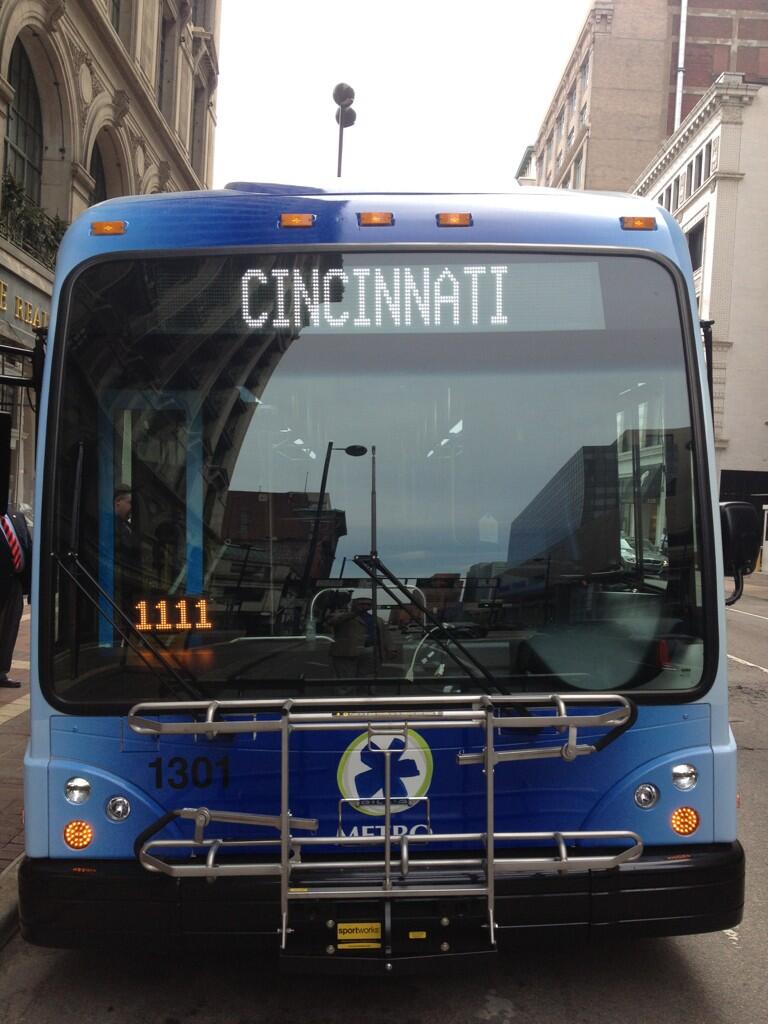
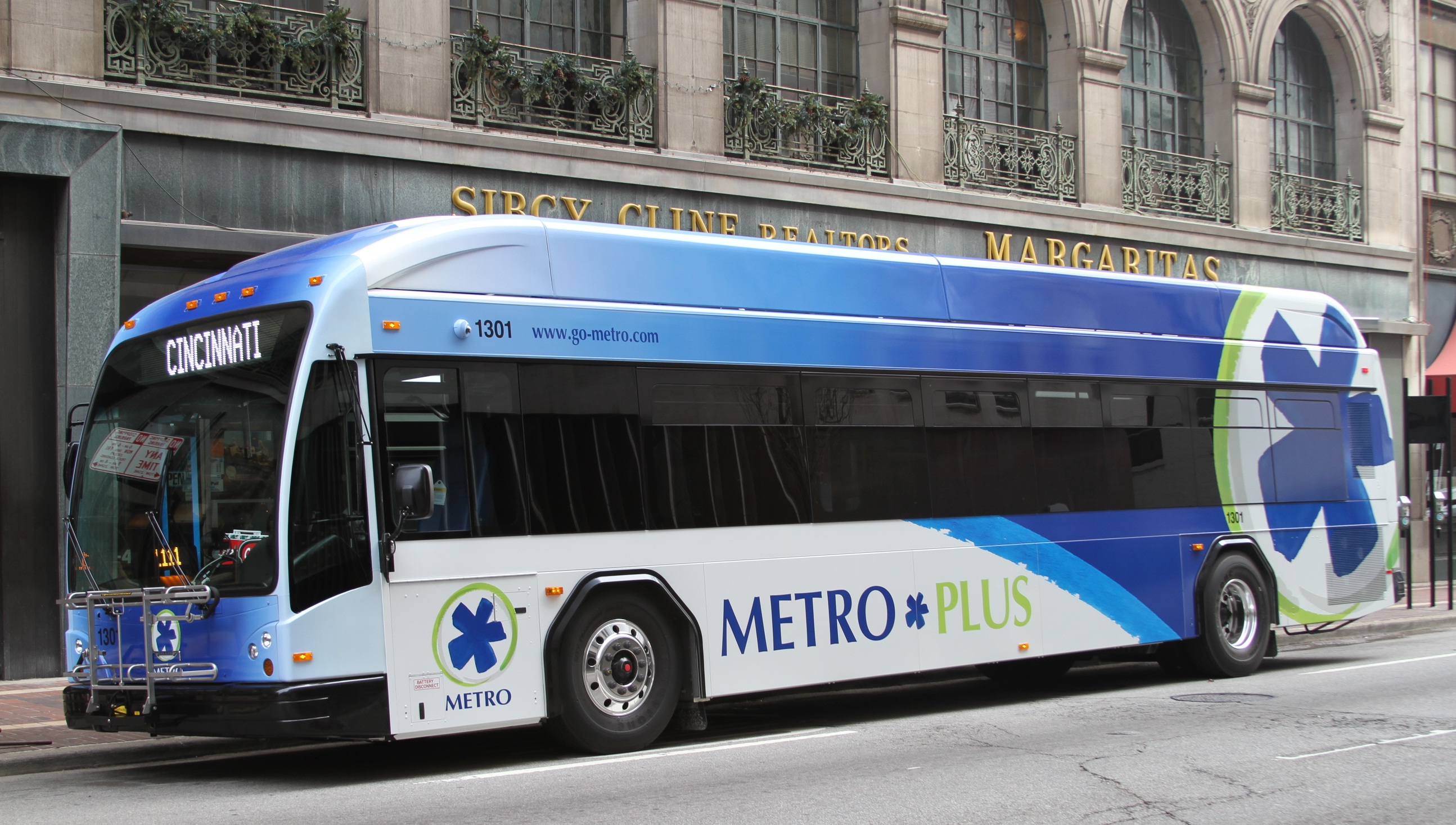
The Glenway Crossing Transit Center, which opened in early 2012, is an example of the sort of suburban bus hubs planned as part of MetroMoves. The 38X bus, which began service when the transit center opened, is an example of the sort of new routes that MetroMoves would have funded.

Modern Streetcars & Light Rail Lines
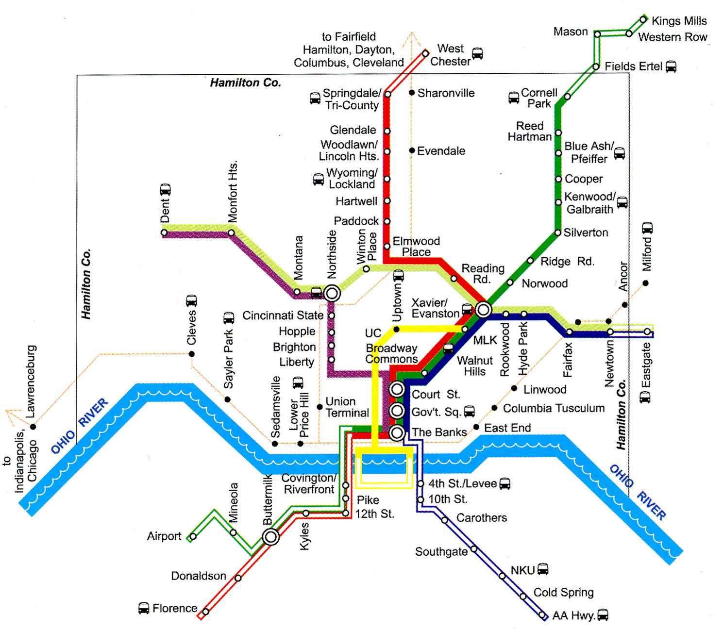
In 2003 design work would have begun on a modern streetcar line and the first of five light rail lines. The streetcar line was planned to follow a route nearly identical to the line currently under construction in Downtown and Over-the-Rhine. The modern streetcar line was planned to have traveled up the Vine Street hill to the University of Cincinnati, then turn east on Martin Luther King Drive, cross I-71, and meet a light rail line on Gilbert Avenue.

Construction would have begun in 2004 and operation would have begun by 2006 or 2007.

The start date for light rail construction was less certain because the MetroMoves tax revenue was to be used as the local contribution for a large Federal Transit Administration (FTA) match. This process became standard practice in cities throughout the country since federal matching began in the early 1970s.


Modern streetcars, similar to those used in Portland, OR, could have been in service as early as 2005 had Hamilton County voters approved MetroMoves in 2002. Photograph provided by John Scheinder.

The first light rail line to be built was the system’s “trunk”, a line connecting Downtown and Xavier University on Gilbert Avenue and Montgomery Road. At Xavier, three suburban light rail lines were planned to converge on a trio of abandoned or lightly used freight railroad right-of-ways.

The first to be built would have been the northeast line through Norwood to Pleasant Ridge and Blue Ash. It was expected that the second line would be one incorporated into a rebuilt I-75; however that highway project has now been pushed back past 2020, meaning the Wasson Road line to Hyde Park likely would have been built soon after the line’s abandonment in 2009.

Renovating the Central Parkway Subway
Lost in the rhetoric employed to defeat MetroMoves was perhaps its most intriguing feature: a plan to renovate and at last put into use the two-mile subway beneath Central Parkway. This tunnel was built between 1920 and 1922 as part of the Rapid Transit Loop, a 16-mile transit line that would have connected Downtown with Brighton, Northside, St. Bernard, Norwood, Oakley, and O’Bryonville. Construction of the Rapid Transit Loop ceased soon after the Charterite ouster of the Boss Cox Machine and never resumed.

Three subway stations at Race Street, Liberty Street, and Brighton were to have been renovated and put into use as part of the 2002 MetroMoves plan. North of the subway’s portals, the line would have traveled on the surface to Northside, then entered I-74’s median near Mt. Airy Forest. Park & Ride stations were planned in the I-74 median at North Bend Road and Harrison Avenue/Rybolt Road in Green Township.

A fifth light rail line, requiring construction of four miles of new track, was planned to connect Northside and the Xavier University junction. Trains on this fifth line would travel from the far West Side to Hyde Park on the I-74 and Wasson Road corridors.

MetroMoves failure at the polls
MetroMoves was placed on the November 2002 ballot by SORTA in anticipation of a new federal transportation bill in 2003. What became known as SAFETEA-LU, a $286.4 billion measure, was not passed until 2005. Although SORTA’s board had the authority to place a transit tax on Hamilton County’s ballot in the years before the federal transportation bill was passed, MetroMove’s 2002 defeat was so lopsided (161,000 to 96,000 votes) that the regional transit authority choose not do so.

When speaking with those affiliated with the 2002 MetroMoves campaign, the failure of the ballot issue is usually attributed to four key factors:

  1. Anti-tax mood caused by the 1996 stadium sales tax and ensuing cost overruns
  2. 2001 Race Riot
  3. The MetroMoves campaign was thrown together quickly during summer 2002. SORTA’s board did not vote to place the issue on the ballot until August 20.
  4. A dirty opposition campaign comprised of Hamilton County Auditor Dusty Rhodes (D), Commissioner John Dowlin (R), Commissioner Phil Heimlich (R), and Congressman Steve Chabot (R).

The opposition campaign was led by Stephan Louis, who in late 2002 was reprimanded for false statements made during the campaign by the Ohio Elections Commission. Nevertheless, as a reward for his work in opposing MetroMoves, he was soon after appointed to SORTA’s board along with fellow public transit opponent Tom Luken in 2003.


Opponents to the 2002 MetroMoves campaign were accused and found guilty of using unethical campaign tactics. Newspaper image taken from a 2002 issue of CityBeat.

In 2006, Louis came under fire for having written racist and anti-public transportation emails and was forced off the board soon after. He reappeared to campaign in support of COAST’s anti-streetcar Issue 9 in 2009 and Issue 48 in 2011.

Another MetroMoves?
In 1972 when Cincinnati voters approved the .3% earnings tax that enabled creation of a public bus company, it was expected that city funding would be temporary and Hamilton County would eventually fund the region’s public transportation. Instead, nearly 40 years later, Cincinnati’s bus company is still funded only by the city and therefore provides only limited service outside city limits.

Ten years after the defeat of MetroMoves, despite a tripling of gasoline prices and the viability of transit systems proven by an increasing number of mid-sized American cities, it seems unlikely that a similar effort stands a chance of passage in Hamilton County in the immediate future. Many of the same public figures who opposed MetroMoves ten years ago have acted repeatedly in the past five to obstruct Cincinnati’s current streetcar project.

Furthermore, since the election of President Barack Obama (D) in 2008, the Tea Party has fomented an irrational suspicion of local government, and local anti-tax groups have authored intentionally misleading ballot issues. Meanwhile our local media, especially talk radio, continues to harass public transportation at every opportunity.

The way forward for the Cincinnati area has, since 2007, been the City of Cincinnati by itself. Despite the efforts of politicians, anti-tax groups, and utility companies to stop Cincinnati’s streetcar project, it broke ground in early 2012 and track installation will begin next year. Along with ongoing demographic shifts within Hamilton County, the success of Cincinnati’s initial streetcar might persuade the county’s electorate to approve county funding of public transportation for the first time.

Categories
News Transportation

Cincinnati Moves Forward With Land Use Study of Wasson Railroad Corridor

On November 14, Cincinnati’s Department of City Planning & Buildings held a public hearing on its upcoming land use study for the disused Wasson Road Railroad and adjacent properties.

Norfolk-Southern Railroad ended service on the line in 2009, and in 2010 the City of Cincinnati’s Department of Transportation & Engineering (DOTE) identified the right-of-way as a future off-road bicycle path in its planned 400-plus-mile network of bike lanes and trails.

Local bicycle advocates have since built public support for construction of a paved rails-to-trails bicycle path between Xavier University and Fairfax as part of a project called the Wasson Way Trail.


The proposed Wasson Way Trail would use the Norfolk Southern Railroad right-of-way to create a bike trail from the Little Miami Trail to Xavier University. Image provided.

On Wednesday, however, city officials were quick to mention that the upcoming land use study is just that – a determination of how the Norfolk Southern property and its surroundings might be rezoned in order to protect the right-of-way up until and after the right-of-way is purchased by Cincinnati – not a determination of what should be built in its place.

Already, Norfolk Southern has leased some of its railroad property for other uses. In 2011, a shopping center at Wasson Road and Edwards Road created a gravel parking lot on the disused tracks and another business near Paxton Road is looking to do the same.

Although Federal regulations prohibit railroads from subdividing their disused properties until they complete an “abandonment” process, Wasson Way Trail advocates are concerned that revenue from additional leases might discourage Norfolk Southern from selling the right-of-way to the City of Cincinnati at a future date.

Michael Moore, Director of the City of Cincinnati’s DOTE, stated that appraisals of the Norfolk Southern property fall close to $2.5 million. He cautioned, though, that this appraisal should not be thought of as a sale price, as the terms of the City’s purchase of the property cannot be known at this time.

Multi-Modal Use of the Corridor
At the November 14 meeting, city officials also made a point of stating that the title of the upcoming land use study has not been determined but that it will make no explicit mention of bicycle paths, light rail transit, or multi-modal use of the corridor.


Members of Queen City Bike joined Cincinnati City Councilmember Laure Quinlivan (D) and former MetroMoves chairman John Schneider for a walk along the Wasson Railroad Corridor in May 2012. Photograph by Jake Mecklenborg for UrbanCincy.

Construction of a double track light rail transit line in the right-of-way was first identified by the OKI Regional Council of Governments in the late 1970s. Then in 2002, the Southwest Ohio Regional Transit Authority (SORTA) planned to build a light rail line in place of the Wasson Road freight railroad as part of its MetroMoves plan and failed sales tax referendum. If the ballot issue had passed, construction of a light rail line would have almost certainly commenced soon after Norfolk Southern ceased freight service in 2009.

The width of the Norfolk Southern right-of-way varies wildly as it travels between Xavier University and Hyde Park. It is typically at least 30 feet wide, but in a few places widens close to 100 feet.

In May 2012 members of Queen City Bike walked the right-of-way with John Schneider, who had previously chaired the MetroMoves campaign. At that time, the groups agreed that conflicts between the proposed bike path and light rail line can be avoided if the two are planned as a unified project.

Further complicating the issue is that small sections of the Norfolk Southern property fall under the jurisdiction of the City of Norwood. These sections are all north of the line’s main tracks, for example the railroad’s former yard tracks near Montgomery Road. As Norwood is not involved in Cincinnati’s upcoming land use study, and Cincinnati of course has no influence in its affairs, whatever zoning changes Cincinnati applies will not affect bordering Norwood properties.

The Department of Planning & Buildings will complete its land use study in summer 2013, but with no immediate plans to enter into negotiations with Norfolk Southern, there is no timeline for construction of the Wasson Way Trail.

Categories
News Opinion Politics Transportation

EDITORIAL: Cincinnati Leaders Should Rethink Planned Rail, Trail Systems

Ten days ago UrbanCincy sounded the alarm on the proposed Wasson Way Trail, and we feel that due to the large amount of feedback that further explanation is needed.

Tomorrow at 12pm, City Council’s Strategic Growth Committee will discuss the proposal that would turn the Wasson Corridor from a railroad right-of-way into a recreational trail. What UrbanCincy is urging City Council to require is a minimum of 28 feet worth of right-of-way preserved for future light rail use.

Standard designs for bi-directional light rail traffic require a minimum of 28 feet of right-of-way. Along some portions of the Wasson Corridor it may very well be possible to accommodate 28 feet for light rail, plus additional right-of-way for the proposed recreational trail, and in those segments it may make sense to get started.


Looking east as the Wasson Line crosses over Interstate 71. Photograph by Jake Mecklenborg for UrbanCincy.

While there is no funding currently in place to build light rail along the Wasson Corridor, it would be short-sighted to remove one of the best rail transit corridors in the city. This was previously done on Cincinnati’s west side when an abandoned railway used by freight and passenger rail traffic was abandoned and then allowed to be built over and occupied by the Glenway Crossings retail center.

Allowing this to take place offered city and county leaders to reap the rewards of a short-term boost, but it has also created a situation that makes building light rail to Cincinnati’s western suburbs almost impossible. This same thing could happen to Cincinnati’s eastern suburbs should the Wasson Corridor be used by a recreational trail.

Proponents of the Wasson Way Trail project made it clear that many of the supporters also want to see light rail eventually happen, but that we should not wait until that day comes to improve the visual appearance of the corridor. Case studies from all over the United States show, however, that once a former rail line is converted into another use, it is almost always an impossible political task to take that land back for rail purposes.


2002 regional light rail plan for Cincinnati.

In the larger scheme of things, UrbanCincy believes that regional leaders need to take a step back and ask themselves why we are still discussing commuter rail along the Ohio River, and a recreational trail through densely populated city neighborhoods. The priorities should be reversed, and the Oasis Line along the Ohio River should be converted into a recreational trail while the Wasson Line is preserved for future light rail use.

It is estimated that the Wasson Light Rail Line would attract three times the number of riders than the Oasis Commuter Rail Line, while also being significantly less expensive to build and operate. Futhermore, when discussions were held about the Oasis Line, residents and property owners along the line voiced their opposition to such activity and have conversely expressed interest in seeing the railway converted into a recreational trail.

City and regional leaders should maintain the natural beauty of the Ohio River and turn the Oasis Line into an attractive recreational trail that can connect into existing trail networks to the east, and the Wasson Line should be preserved for light rail use in the future. It may seem frustrating to leave the Wasson Line in its current state of appearance, but it will be much more frustrating to jeopardize one of the best potential light rail corridors envisioned for the region.

Categories
Business Development News Opinion Transportation

Cincinnati’s Wasson Railroad Corridor Should Not Be Converted Into Recreational Trail

In the post-industrial United States cities all across America have been left with an abundance of rail right-of-way that once served industrial properties. Cities have since struggled to find a use for these rail corridors.

In many cases the rail right-of-way either gets built over, or makes room for some other use – most typically a park or trail of some sort. The most famous, and perhaps most unique, example of this is New York City’s Highline which converted an abandoned freight rail corridor into an elevated park. In most cities, however, much simpler trails are developed in order to cater to bicyclists and pedestrians.

These are great projects, but in the cases where rail right-of-way is needed in order to introduce rail transit, they should not be done. The acquisition of right-of-way can be one of the most difficult hurdles to clear when developing rail transit, so if you have a prime corridor intact, you should do everything in your power to preserve it for future rail transit.


Map of the proposed Wasson Way Project.

The reason this is particularly important in Cincinnati right now is because on March 6, advocates of what is being called Wasson Way Project will present their ideas for converting the Wasson Corridor into a bike/ped trail to City Council’s Strategic Growth Committee.

The idea is not a bad one on face value, but should it proceed it would eliminate one of the most valuable rail corridors in the city. A corridor that could connect neighborhoods like Hyde Park, Oakley, Evanston, Norwood, Mt. Lookout, Fairfax and Mariemont with light rail and eventually connect those neighborhoods to the region’s two largest employment centers – uptown and downtown – without much additional track or right-of-way acquisition.

“I know of no example in the United States where a former railway that has been converted to a bike/hike trail has ever been returned to passenger rail service,” explained Cincinnati transit advocate John Schneider (aka “Mr. Transit”). “Once it’s gone, it’s gone.”

Rail corridors that run through areas of limited potential transit ridership like the Oasis Line should be redeveloped into trails. It just makes sense. There is less automobile traffic and the riverfront trail provides a scenic ride for bicyclists and connects its users to a string of riverfront parks.

The Wasson Line, however, is ripe for light rail service with its densely populated neighborhood, vibrant business districts and key attractions along the line. The Oasis Line should become a bike/ped trail, but the Wasson Line should not.

Unfortunately the exact opposite is progressing for both of these lines in Cincinnati. Hamilton County officials continue to explore funding options to turn the Oasis Line into a commuter rail corridor, and a citizen-led group is strongly advocating for the conversion of the Wasson Line into a bike/ped trail.

While UrbanCincy supports conversion of some rail right-of-ways into other uses, we believe it needs to be done in a thoughtful manner that considers the future transit needs of the region. The Wasson Line is too valuable to convert into a bike/ped trail and should be preserved for an urban light rail line.

The upcoming committee meeting is scheduled to take place at 12pm on Tuesday, March 6 at City Hall (map). We would like to urge you to come out and support the future of regional light rail in the Cincinnati region, and request that the Wasson Corridor not be converted into a recreational trail.

Categories
Business Development News

CPA honors Cincinnati’s best preservation projects in 2011

Cincinnati Preservation Association (CPA) held their 47th annual awards ceremony this past weekend at Hughes High School. More than 70 people attended the ceremony that honored the best preservation projects throughout the Cincinnati region.

Eight awards were given out, in total, in the categories of rehabilitation and sustainability. According to CPA, two of the awards focused specifically on the restoration of public buildings and spaces.

“Cincinnati’s historic public schools represent civic architecture at its best,” said Paul Muller, Executive Director, Cincinnati Preservation Association. “We are proud to honor Cincinnati Public Schools’ brilliant renovation of Hughes High School and the City’s ongoing stewardship of City Hall, as expressed by the restoration of the beautiful Council Chambers ceiling.”


Ten historic structures along Vine Street were renovated as part of the Parvis Lofts development in Over-the-Rhine.

Projects receiving the remaining awards were distributed across the city. A 1926 home in Hyde Park and an 1896 home in North Avondale won awards for their stately renovations. Meanwhile the renovation of an 1870s structure in Northside won CPA’s sustainability award for achieving LEED Gold certification.

The United Way of Greater Cincinnati also won an award for the renovation of its 77,000-square-foot headquarters in Walnut Hills. CPA officials say that United Way’s structure dates back to 1933 and serves as a monument for the neighborhood.

In Cincinnati’s largest historic district, Over-the-Rhine, two projects won awards for their preservation of 13 total structures. Saengerhalle renovated three deteriorating structures built in the late 1800s into 32,000 square feet of office and commercial space.

A block east of Saengerhalle, the Parvis Lofts project renovated ten vacant buildings into 32 apartments which are fully leased. The $10.7 million development also received awards from the Ohio Historical Society and the Associated Builders & Contractors.

“We were fortunate to have a great team that developed Parvis Lofts,” Rick Kimbler, NorthPointe Group partner, told UrbanCincy. “Collectively, we took ten buildings and melded them into one great complex that the community immediately embraced.”