Categories
Development News

The City Series Aims To Create Scalable Development Model In Established Walkable Neighborhoods

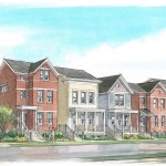
The City Series is an interesting and somewhat new approach for urban housing development in Cincinnati. Instead of pursuing big developments with a large amount of land, or the redevelopment of existing structures, it instead is focused on challenging infill sites.

Leadership at Great Traditions and D-HAS, which is overseeing The City Series, say they chose the sites due to their walkable environments. They believe that the city’s neighborhoods represent the most important aspect of real estate today – walkability.

In addition, the development team says that they were attracted to each particular site cluster, of which they currently have three, because of its distinctive character. As of now their sites are located in Northside, O’Bryonville and East Walnut Hills.

So far, it seems as though the team’s assessment is correct. Two of the five currently available homes located on Gold Street in O’Bryonville and Cleinview Avenue in East Walnut Hills have already sold. With six more homes coming soon, the team expects that number to quickly rise.

What is also unique is that in each case the homes are being built in line with traditional design characteristics of their neighborhood surroundings. But starting at $595,000, the homes in East Walnut Hills and O’Bryonville are also being priced higher than most nearby properties. In Northside, the townhomes will range from $250,000 to $350,000.

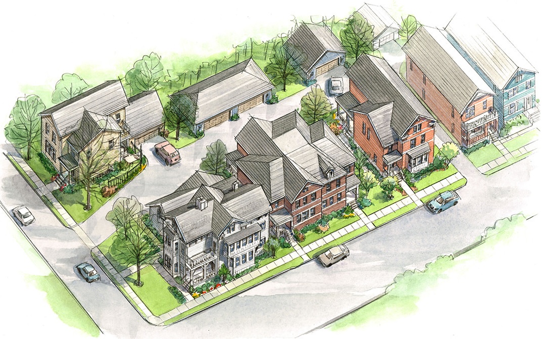
The four homes on Cleinview Avenue are being built around an 1860s servant’s house from the original Klein Estate – the developer of the neighborhood in the late 19th century. In this case D-HAS came up with a design solution that uses three variations on an open floor plan, with car access coming through a rear yard with detached garages. This, the design firm says, allows the new homes to contribute to the streetscape at a pedestrian scale – no curb cuts to accommodate cars – and match the historic nature of the neighborhood.

About a mile east on Madison Road is the three-home Gold Street development, which actually sits on a road named Paul Street. Sitting at the end of a narrow side street, the site is within easy walking distance of both the Hyde Park and O’Bryonville business districts. For this development, D-HAS says that they looked to maximize the use private outdoor space in spite of the site’s difficult location and terrain.

Across town sits the team’s newest announced project on Fergus Street. Like the other projects, the five homes in this development are located in the heart of a historic neighborhood and feature a design reflective of its roots. Due to the differences of Northside compared to the other two neighborhoods, these homes are slightly smaller, but have the added benefit of being next to a neighborhood playground.

“We worked with the community groups – Cincinnati Northside Community Urban Redevelopment Corporation (CNCURC) and the Northside Community Council to design a series of homes that would be a catalyst for the surrounding neighborhood”, explained Doug Hinger, owner of D-HAS and President of Great Traditions. “There are a lot of very cool and committed people in Northside that have been active for decades and I really enjoy our partnership.”

Driven by his passion for urban design, Hinger said he established D-HAS to provide a vehicle for his architectural pursuits. And from a business standpoint, he said they saw an opportunity to start these three smaller projects as a way to bridge the gap to bigger sites and see how designs in walkable neighborhoods like this will be accepted.

“We have found value in several facets,” Hinger told UrbanCincy. “Probably the biggest value is that we’re growing the business and developing a body of work that we can take into other Cincinnati neighborhoods.”

Great Traditions and D-HAS believe they are off to a good start, and hope to use these developments as a foundation for more projects like on a somewhat larger scale.

“We’re always looking for the next project and there are several neighborhoods where we think The City Series can work,” Hinter stated. Having a viable commercial aspect in place will certainly help bolster the prospects for scalable projects of this nature, especially since they are intending to push the boundaries of the current marketplace focus.

For many urbanists, the idea of scaling up the size of such an approach is an appealing one, and one that many thought would be the defining feature of Cincinnati’s annual CiTiRAMA home show. CiTiRAMA, however, has not yet been able to consistently produce successful urban infill in the way that Great Traditions and D-HAS are attempting to do.

Hinger’s hope is to make The City Series a citywide endeavor. If successful, Cincinnati’s urbanists may finally get the annual urban home show they have long desired.

Categories
News Transportation

New Center City On-Street Parking Rates, Hours of Enforcement Now In Effect

New parking rates and hours of operation went into effect for the Central Business District and Over-the-Rhine on Friday. The changes come after Cincinnati City Council approved the matter in November 2014.

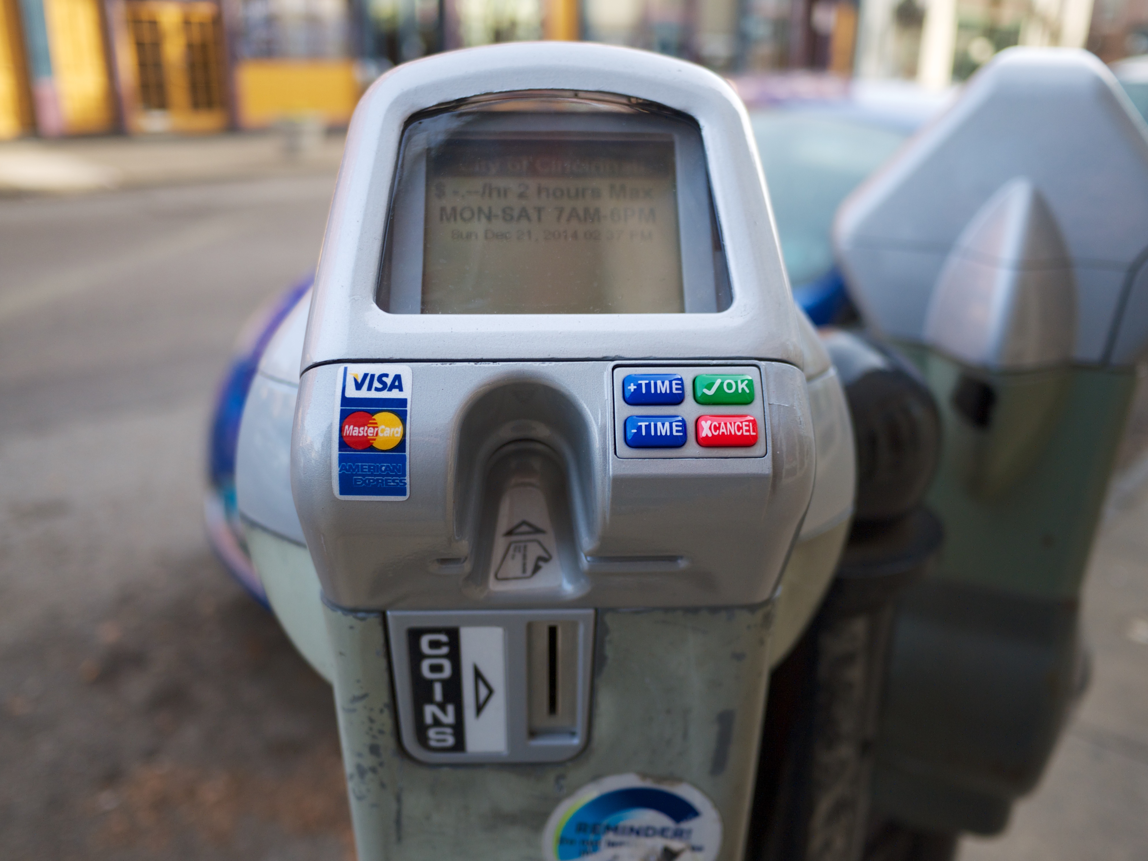
Under the arrangement, 500 new electronic parking meters have been installed throughout Over-the-Rhine to complement the existing set already in place in the Central Business District. Over the coming weeks, the City of Cincinnati will also be installing 1,000 additional electronic meters throughout the Clifton, Hyde Park, Mt. Lookout, Northside, O’Bryonville, Oakley, and Pleasant Ridge neighborhood business districts, as well as key locations throughout Uptown.

The electronic meters, officials say, are meant to replace the old ones with newer models that accept credit card payments and are compatible with future plans for pay-by-phone technology and dynamic pricing structures. Pay-by-phone capabilities are expected to be operational by the middle of 2015.

While nearly a dozen neighborhoods will benefit from the new technology, only Over-the-Rhine will see its on-street parking policies change across the board. As part of the new policy, parking rates in Over-the-Rhine will double to $1/hour; while rates will remain set at $.50/hour and $2/hour in the other neighborhoods and in the Central Business District, respectively.

As of today, parking meters in the Central Business District and Over-the-Rhine will now also be in effect from 9am to 9pm Monday through Saturday, and 2pm to 9pm on Sundays. Parking hours of enforcement in the remaining 50 neighborhoods, meanwhile, will remain unchanged.

The sweeping changes are meant to help improve the performance of the City’s broken parking system. While many small business owners in Over-the-Rhine have expressed their support for the changes, especially in light of ongoing vandalism of meters in Over-the-Rhine, some believe they have been singled out following the cancellation of a previous agreement that would have raised rates and increased enforcement city-wide.

“I’m not opposed to longer meter hours and higher rates, but what upsets me, as an OTR resident and business owner, is the fact that our neighborhood has been singled out,” Jean-Francois Flechet, owner of Taste of Belgium, wrote in a Facebook post. “The same hours and rates should apply to other neighborhoods.”

The original Parking Lease & Modernization Plan approved in early 2013 was, of course, cancelled by Mayor John Cranley (D) almost immediately upon his arrival at City Hall at the end of 2013. While the mayor and many members of City Council bemoaned the previous plan, a similar plan appears to be taking shape, but in a piece-by-piece approach.

As like the original plan, new electronic meters are being installed that accept credit card payments and utilize dynamic pricing models, meters are being upgraded city-wide, and a contract has been signed with Xerox.

The Cranley Administration has not yet commented on plans for new hours or rates in the city’s remaining neighborhood business districts, where on-street parking meters exist, but they do say that they intend to systematically create multi-space parking that will “produce more aesthetically clean public right-of-way areas in Over-the-Rhine.”

This means that the newly retrofitted parking meters in the historic neighborhood will eventually be removed to make way for multi-space equipment, similar to what has been used in the Central Business District in the past. The upgraded parking meters from Over-the-Rhine will then be shifted to other neighborhoods throughout the city. This process, officials say, could begin as soon as this spring.

In addition to the specific focus on center city neighborhoods, the new parking policy differs from the previously approved plan by creating Sunday hours of enforcement. While the new Sunday hours of enforcement are only in effect for the Central Business District and Over-the-Rhine, it crosses what was considered a red line in the previous public debate over proposed parking changes.

All of the changes are expected to bring confusion to those parking in the affected areas, including a large group of people who drove to Christ Church Cathedral for the Boar’s Head & Yule Log Festival on Sunday. According to Michelle Dillingham, Director of Education at the Greater Cincinnati Coalition for the Homeless, parking enforcement officers ticketed many cars parked on the street during the event.

“I walked out of the Boar’s Head event that was barely an hour long and almost every car had a parking ticket on their windshield…on a Sunday and in front of a church celebrating 75 years of a Cincinnati tradition,” Dillingham wrote. “I don’t know, but it just rubbed me wrong.”

The former Cincinnati City Council candidate went on to say that she had two separate conversations with people, who lived outside of the center city, that were very upset by the situation and would reconsider visiting downtown again due to the aggressive parking enforcement.

City officials acknowledge that there will be a bit of a learning curve, and say they are working to improve awareness of the new rates and hours of enforcement by distributing flyers and working with groups like Downtown Cincinnati Inc. and the Over-the-Rhine Chamber of Commerce to inform drivers of the changes.

Categories
Business News

Eighth Annual BuyCincy Holiday Event to Take Place This Weekend

The Greater Cincinnati Independent Business Alliance (CiNBA) is hosting their second annual BuyCincy event this weekend between November 21 and November 23.

While in only its second year with CiNBA, the BuyCincy event has actually been running in some form for eight years now, following its initial launch through the now defunct BuyCincy blog.

CiNBA, which was established in in 2012, is the first independent business alliance, of 90 nationwide, to have successfully partnered with a university. In this case that institution is Xavier University’s William’s College of Business .

“CiNBA’s mission is to create a thriving community of local independent businesses and non-profits by supporting and representing the value of those in the Greater Cincinnati area and works to accomplish this mission through networking, marketing and events such as the BuyCincy Holiday Event,” said Madison Wallace, a Xavier University student in charge of the social media marketing for CiNBA and BuyCincy.

Initially launched as a blog in 2007, BuyCincy has since morphed into a brand used to promote local spending, and help area residents discover new local businesses. This year, organizers say, the event is expecting more than 150 businesses to participate from more than 15 different neighborhoods, including Bellevue, Over-the-Rhine, Hyde Park and College Hill.

Last year the event had 146 participating businesses from 20 different neighborhoods. Organizers estimate that the approximated spending during the four-day event totaled $25,000. Similar events to this one nationwide tend to boost sales in the participating neighborhood business districts. On average, independent business organizations estimate that those participating areas see 5.3% more business activity than other non-participating areas.

“We know small businesses get lost in frantic “big box” promotions during the holidays, so we created BuyCincy’s Holiday Event to bring our city’s local businesses together with a ‘buy local’ shopping message,” CiNBA explains.

The three-day BuyCincy Holiday Event will take place the weekend before Thanksgiving. The complete list of participating businesses can be found on the group’s website, and includes shops, restaurants, bars and other local establishments to round out your holiday shopping experience.

Categories
Month in Review

Month in Review – October 2014

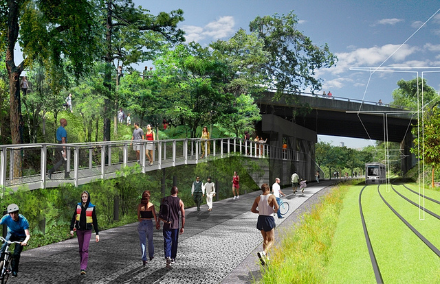
Wasson Corridor WalkUrbanCincy readers must be excited about the idea of turning Wasson Way into a multi-modal corridor; that was our most popular story of October by a factor of 2×. Our other top stories included news on bike infrastructure, transit, and a new business opening. Check them out:

  1. City Planners Recommend Transportation Overlay District for Wasson Railroad Corridor
    City planners have completed their land use study of the Wasson Railroad Corridor and have recommended the creation of a Transportation Overlay District to preserve the corridor for both future rail transit and a biking and walking trail.
  2. PHOTOS: Ohio’s First Protected Bike Lane Attracting New Riders to Central Parkway
    Ohio’s first protected bike lane is now complete and is attracting new riders to what was once of the city’s more intimidating and unsafe streets for cyclists.
  3. Can Metro, Megabus Come to Terms on Moving the Intercity Bus Operator Into the Riverfront Transit Center?
    Following yet another move by Megabus, there has been a renewed call by many to permanently move the intercity bus operator into the Riverfront Transit Center underneath Second Street at The Banks.
  4. Collective Espresso to Open Second Location in Northside Later This Fall
    The owners of Over-the-Rhine’s popular Collective Espresso will open up a second location in Cincinnati’s eclectic Northside neighborhood later this fall.
  5. Transit Users Will Need 7 Hours to Commute to ODOT Public Transit Meeting
    The Ohio Department of Transportation is hosting a forum on transit funding and policy, but they’re hosting it in a location not served by transit – making it virtually impossible for transit users to attend.


Categories
News Transportation

City Planners Recommend Transportation Overlay District for Wasson Railroad Corridor

Following the guidance of City Council, Cincinnati’s Department of City Planning & Buildings has completed its land use study for the Wasson Railroad Corridor. The study’s findings and recommendations offer the clearest guidance to-date as to how to proceed with redeveloping the abandoned freight rail corridor, following the issuance of preliminary designs in July 2014.

City planners took a comprehensive look at the history of the corridor, its current conditions and the best path forward that respects the desires of the city and the impacted neighborhoods.

In that analysis City staff revealed seven studies and plans that recommend the corridor either be used for rail transit, or a combined multi-modal network that accommodates rail transit, bicycles and pedestrians. Some of the most notable of these include the 2002 MetroMoves regional transit plan, 2010 Bicycle Transportation Plan, 2012 comprehensive Plan Cincinnati, and the 2013 Railroad Safety Improvement Plan – all of which either specifically call for the corridor to be used for rail transit, or a multi-modal corridor.

The history is important as it influenced the study’s recommendation as to how to proceed with acquiring and preserving the corridor. As of now, the 5.7-mile Wasson Railroad Corridor is still owned by Norfolk Southern, but the City of Cincinnati has stated that they are in the process of acquiring the property from them.

“With this corridor being so crucial to the future development of multi-modal transportation in the City, the threat of potential development within the railroad right-of-way would significantly slow down, if not completely hinder, those possible public transportation opportunities from occurring,” city planners wrote in the 32-page land use study released earlier this month.

Of course, this fact has been known by policy makers at City Hall for years. As a result, City Council has, on several occasions, approved interim development controls to protect the corridor from being built upon. These controls, however, are just temporary and city officials must now decide how they would like to move forward.

In the study city planners examined the pros and cons of three potential options for accomplishing this.

The first option examined the idea of rezoning the property to a Parks and Recreation classification. This would offer the corridor significant protections, but it would also severely restrict the City from being able to implement rail transit in the future due to federal regulations that prohibit the use of public parks or wildlife refuges for transit corridors.

A second option studied looked at simply dedicating the land as City right-of-way. This too would offer significant protections, but is not possible until the City acquires the land from Norfolk Southern.

The third option, and the one recommended by city staff, is enacting a Transportation Overlay District over the corridor. While planners admit that crafting the language for such legislation may be complicated, they also stated that it would be most aligned with the preferences of neighborhood residents and publicly adopted planning documents.

In order to address the complexity of the legislation required for such an overlay district, city planners recommended looking at the Atlanta BeltLine Overlay District that was implemented to protect a 22-mile abandoned freight rail corridor. In Atlanta civic leaders are currently in the process of converting the corridor into a similarly envisioned multi-modal network with rail transit, bikeways, parks and pedestrian paths.

“While all options present advantages and disadvantages, the Transportation Overlay District is seen as the best solution for preservation of the Wasson Railroad Corridor,” city planners wrote. “This tool, while it may take a bit longer to craft the ordinance language, will provide more flexibility and also protect the contiguous nature of the corridor.”

City officials say that this solution will allow for the development of the Wasson Way Trail to move forward in the near term, while affirming the City’s intentions to develop the corridor as a multi-modal transportation facility that includes rail transit in the future.

The solution crafted by the Department of City Planning & Buildings appears to be a perfect compromise between the two constituencies looking to use the corridor. Bicycle advocacy groups can see the right-of-way acquired and preserved so that they can move forward with their plans for a bike and pedestrian trail, while transit advocates can rest assure that those immediate efforts are not being done in conflict with ongoing planning and design work for a future light rail line.

With the Wasson Railroad Corridor Land Use Study now complete, it will go before the city’s Planning Commission. Should it be approved by Planning Commission, it will then go back to city staffers so that draft overlay district language can be crafted and recommended to City Council. From there, it would go before City Council for approval.

It is a standard process and one that advocates hope can be completed in the coming months.