Categories
Business Development News Opinion

EDITORIAL: It’s Time for Cincinnati to Build a New First-Class Arena

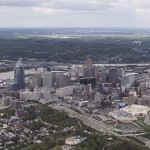
The Cincinnati region has an arena problem that is two-fold. The first part of the problem is that there is no stand-out venue that offers both the capacity and modern amenities to attract large-scale events. The second is that the region has far too many venues competing with one another.

Within a one-hour drive from Fountain Square there are eight arenas with a capacity of more than 9,000 people for their primary tenants. Of these, only three have been built or undergone major renovations since the year 2000. The lone major project currently on the books is the $310 million renovation and rebuild of Rupp Arena in Lexington, which also happens to be the furthest away of the eight venues mentioned.

  1. Rupp Arena (23,500): Built in 1975 with minor renovations in 2001. Primary tenant is University of Kentucky athletics. Major renovation and rebuild planned for completion in 2017.
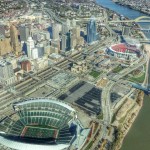
  2. U.S. Bank Arena (17,566): Built in 1975 with a major renovation in 1997 and subsequent minor renovations. Primary tenant is the minor league hockey Cincinnati Cyclones team.
  3. UD Arena (13,409): Built in 1969 with major renovations in 2002 and minor renovations again in 2010. Primary tenant is University of Dayton athletics.
  4. Fifth Third Arena (13,176): Built in 1989 with several minor renovations since. Primary tenant is University of Cincinnati athletics.
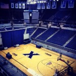
  5. Cintas Center (10,250): Built in 2000. Primary tenant is Xavier University athletics.
  6. Cincinnati Gardens (10,208): Built in 1949 with no major renovations since its opening. Primary tenant is the amateur women’s roller derby Cincinnati Rollergirls team.
  7. Bank of Kentucky Center (9,400): Built in 2008. Primary tenant is Northern Kentucky University athletics.
  8. Millett Hall (9,200): Built in 1968 with no major renovations since its opening. Primary tenant is Miami University athletics (sans hockey).

Recent talks closer to the core of our region have revolved around either embarking on a major renovation of Fifth Third Arena, or building a new one altogether; and performing major renovations on U.S. Bank Arena. The problem with these two approaches, however, fails to address the two core problems with the region’s plethora of arenas.

Any discussion on this topic should be focused on creating a stand-out venue that is both large enough and offers the modern amenities needed to attract major events, while also decluttering the regional arena landscape.

To that end, UrbanCincy recommends building a brand new arena adjacent to the Horseshoe Casino at Broadway Commons that would become the new home for the Cincinnati Cyclones, Cincinnati Rollergirls and University of Cincinnati Men’s Basketball. This venue would also accommodate the existing events held at U.S. Bank Arena and should be built in a way that is conducive for casino operators to program additional events, such as boxing, at the venue.

As part of this plan, U.S. Bank Arena and the Cincinnati Gardens should be torn down, and Fifth Third Arena used as the multipurpose facility it was originally intended to be.

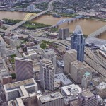
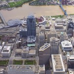
This location makes perfect sense with immediate access to the center city’s hotels and convention facilities, casino, streetcar system, highways and abundant parking. Such a plan would also allow for the current U.S. Bank Arena site to be redeveloped with additional housing and shops akin to what is being developed at The Banks.

The land left over at the Cincinnati Gardens site in Bond Hill could then be repackaged, with surrounding land, to be developed as part of community-driven master plan.

As is often the case, funding is one of the primary hurdles preventing any of this from getting done. In this particular plan, each of the partners (University of Cincinnati, City of Cincinnati, Hamilton County, Horseshoe Casino) could contribute to the capital costs. Furthermore, value capture tools could be used for the U.S. Bank Arena and Cincinnati Gardens properties to help offset costs even more.

The last thing our region needs is another tax to pay for a sports or entertainment complex. Those scarce public resources should be reserved for more pressing things like improving our region’s transit network.

Our region’s political and business leaders need to think holistically when it comes to this challenge. Moving forward in a panicked and rushed fashion will get us an end result that does not solve the problems before us, and ultimately squanders public dollars.

Let’s build ourselves a modern arena venue that can attract top-level events, but do so without placing the burden on the taxpayers. Let’s also do so in a way that rids the region of some of its excess number of existing arenas, and frees up land to be redeveloped in a more productive manner for our neighborhoods.

There is a wealth of talent and C-Level executives in this region. Let’s get creative and start thinking beyond the sales tax. Let’s get this done.

Categories
News Opinion Transportation

Chicago Serves as a Model for Midwestern Cities Looking to Bolster Bicycling

For the past few years anyone with an interest in bicycling has seen their Facebook and Twitter feeds stuffed daily with bike lane and bike share project updates from cities around the United States. Much of that news has come from our northern neighbor Chicago, where its first of 100 planned miles of protected bike lanes opened in 2012.

In 2013 Chicago also launched the nation’s third-largest bike share program, a 300-station network sprawling across large sections of the city. Then, in early 2014, construction began on the $60 million Navy Pier Flyover, an elevated structure that will speed Lakefront Trail bicycle traffic over the Chicago River and the congested Navy Pier tourist area.

In May I spent part of a vacation day biking 35 miles around Chicago to see its various recent bicycling improvements for myself. This ride included The Loop, parts of the Lakefront Trail, and various residential areas where bike lanes have been recently created.

Dearborn Street Two-Way Protected Bike Lane
This two-way protected bike lane opened on the otherwise one-way Dearborn Street in November 2012, and is among the most talked-about new bike lanes in the country. It occupies a 10-foot wide strip on the west side of this major north-south street, with bikes separated from vehicular traffic by bollards and on-street parking.

To manage conflicts between two-way bike and one-way automobile movements, bicycle traffic is controlled by dedicated signals at about a dozen intersections in The Loop.

I biked the length of this protected lane in both directions beginning at about 4:50pm on a weekday. It was immediately obvious that travel in the lane during rush hour was not particularly fast or orderly — pedestrians often stepped into the bike lane to hail cabs or to cross Dearborn Street mid-block. At cross-streets, bicycle traffic was sometimes unable to proceed when signaled due to surges of pedestrians or gridlocked traffic.

Bicyclist behavior within the protected lane was more chaotic than I expected.

Commuters riding their own bikes often passed slower Divvy bikes and northbound bikers sometimes drifted between the protected bike lane and Dearborn’s vehicular lanes. I observed a handful of northbound bicyclists ignoring the protected bike lane altogether, instead biking in mixed vehicular traffic up Dearborn Street as they had for the past 100 years.

Divvy Bikeshare
Chicago’s “Divvy” bike share system began operation on June 28, 2013 and by year’s end the system logged over 700,000 trips. This year the system is planned to expand from 300 to 400 stations and add 1,000 bicycles to its existing fleet of 3,000.

To say that the Divvy bikes are popular would be a gross understatement – the extent to which the blue bicycles have become a ubiquitous feature of Chicago’s cityscape in their first year has no doubt silenced all critics.

To that end, the utility of shared bicycles in Chicago is aided by the city’s flat layout. Recently a writer from Seattle expressed some skepticism of a planned bike share program’s popularity in the hilly Emerald City.

Similar questions have been raised locally and intensely debated on Internet forums. The questions bear enough validity to cause many proponents of Cincy Bike Share to concede that Uptown and Downtown operations may function and serve different customers from one another.

Navy Pier Flyover
Chicago’s Lakefront Trail stretches 18 miles along the city’s lakefront, and is home to a crush of bicycle traffic unlike anything to be seen in Cincinnati or elsewhere in the Midwest. In fact, the Active Transportation Alliance claims that Lakefront Trail is the busiest in the United States with peak daily usage reaching 30,000 people at key points.

Every type of bicycle and every type of rider uses the trail, along with joggers, walkers, and inline skaters – motivating the Chicago Tribune to remark earlier this year that the Lakefront Trail is “claustrophobic and dangerous—the antithesis of the shoreline as a refuge from urban crowding.”

The Navy Pier Flyover will link the north and south halves of the trail with 16-foot wide elevated approaches to the Outer Drive Bridge. The trail will cross the Chicago River on a new structure cantilevered off the west side of the famed 77-year-old bascule bridge.

General Observations
As someone who grew up biking the monster hills and hostile commercial avenues of Cincinnati’s west side in the 1980s, riding in Chicago – even the many areas without new bike lanes — is by comparison a piece of cake. So easy in fact that it’s boring.

Virtually all of Chicago’s streets are perfectly flat, perfectly straight, and traffic moves at pretty much the same speed and in the same fashion on all of them. There is little to no sense of exploration and discovery during a bike ride around Chicago – no wonder the Lakefront Trail is so popular when a ride between any two neighborhoods has the same character as any other combination.

No Chicago bicyclist knows anything like our varied street characteristics, our innumerable odd intersections, and of course the two-mile downhill runs that can be strung together between various Cincinnati neighborhoods.

Experimenting with side streets and alternate routes between points A and B is something that keeps the avid Cincinnati bicyclist exploring the city, year after year, and familiarity with all of the hills is a point of pride.

When Cincinnati’s bike share begins later this year, and if we eventually build more protected bike lanes beyond the current Central Parkway project, no doubt bicycling will become more popular in the center city, basin neighborhoods, and across the river in Covington and Newport.

Any city, however, can paint bike lanes and buy a few thousand bike share bikes, but the endless range of leisurely or challenging rides available to the Cincinnati bicyclist is something Chicago and most other American cities will never have.

Categories
Business Development News

Construction Pace Picking Up on $120M Smale Riverfront Park Project

As is often the case in construction, warmer weather brings greater progress on the site. This holds true for the $120 million, 45-acre Smale Riverfront Park.

According to project manager Dave Prather, work has picked up in recent months and significant elements of the ongoing phase of work are now becoming visible.

One of the elements that is very quickly nearing completion is the Heekin/PNC Grow Up Great Adventure Playground that sits immediately beside the Roebling Suspension Bridge, and is on schedule to open in spring 2015. Significant progress is also now noticeable on the Vine Street Fountains & Steps, which are almost identical to their existing Walnut Street counterpart, and the Anderson Pavilion.

In the latest video update from Cincinnati Parks, Prather walks viewers through all the progress and mentions that a great deal of additional work will be completed in the near future.

“It’s really starting to come into focus,” Prather said in the 15-minute video update. “The next time we film, which will be in late summer, you’ll see the slides and pick-up sticks in place, all the stone climbing walls will be there, and you’re really be able to get a feel on what we’ll have to offer in this next extension.”

One of the things significantly different about the portion of Smale Riverfront Park west of the Roebling Suspension Bridge is the Anderson Pavilion and Carol Ann’s Carousel. These two features will create the most significant building structure at the central riverfront park to-date, and serve as potential sources of revenue to maintain the sprawling park going forward.

The implementation of the full vision for the park will not come for several years, and is still seeking additional capital funding. Some capital funding help, however, has been found this year in the form of a $4.5 million grant from the U.S. Army Corps of Engineers.

The ongoing work is also being aided by $4 million from the City of Cincinnati that was approved last year following a one-time allocation of resources from a property tax supported bond increase in 2013. The recent budget quickly passed 6-3 by City Council, however, included no additional capital support for Smale Riverfront Park.

Project officials estimate that an additional $30 million will be needed to complete the park.

In April, the American Planning Association presented its National Planning Excellence Award for Implementation to Cincinnati for its execution of the Cincinnati Central Riverfront Plan, which included the reconfiguration of Fort Washington Way, and the development of The Banks and Smale Riverfront Park.

Categories
Month in Review

Month in Review – May 2014

Three of UrbanCincy‘s top stories in May revolved around a few dramatic transformations taking place in the urban core. We took you on a Street View tour of some of the biggest transformations in the city, showed you photos of the Cincinnati Streetcar’s construction, and shared news about changes to the city’s oldest historic district. In case you missed them, enjoy UrbanCincy‘s most popular stories from May 2014:

    1. PHOTOS: Cincinnati’s Dramatic, Decade-Long Transformation Visualized
      While many of us can feel that a transformation has taken place in Cincinnati over the past decade, it can be difficult to visualize it. Thanks to new Google Street View capabilities we have done just that.
    2. EDITORIAL: What Cranley’s Clever Budget Means for Urbanists
      The rookie Mayor John Cranley has proposed his first budget. At first glance, it doesn’t look so bad. But after further review what most feared is in fact the sad reality.
    3. The Littlefield to Bring Craft Bourbon Bar to Northside This June
      A craft bourbon bar called The Littlefield will open in Northside next month. The approximately 400SF establishment, which will also include a large outdoor terrace, has been years in the making.
    4. Western & Southern Aiming to Alter Lytle Park Historic District Boundaries
      Western & Southern has long been rumored to be eyeing a location for a new high-rise office tower to consolidate their headquarters; and proposed changes to the Lytle Park Historic District may be setting up for exactly that.
    5. PHOTOS: Construction Activities for $133M Streetcar Project Move Southward
      Significant visual progress continues to be made on the $133M first phase of the Cincinnati Streetcar. Take a look at the progress and learn about a string of good news that may push forward the opening date.


Categories
Development News

PHOTOS: Cincinnati’s Dramatic, Decade-Long Transformation Visualized

The changes that have been taking place in Cincinnati over the past decade have been felt and noticed by many. There is a palpable buzz surrounding the Queen City these days.

The city’s central riverfront has almost entirely been transformed following billions of dollars worth of public and private investment, Over-the-Rhine’s renaissance continues to be touted nation-wide as one to be admired, and thousands of more residential units are being developed in the center city as we speak.

For those who live outside the city and may not have been back recently, or for those out-of-towners who have not yet been able to make a visit, it could be difficult to even recognize some places now.

Thanks to a new feature from Google Street View, we can now go back in time and compare Google’s most current Street View images with those they have taken since 2007 when they started the service.

Here’s a look at some of Cincinnati’s more visually impressive transformations, but it is certainly not all encompassing. Simply drag the arrow bar back-and-forth to compare the old and new images.

Clifton Heights at W. McMillan Avenue and Ohio Avenue:

Clifton Heights in September 2007
Clifton Heights in September 2012


Evanston at Dana Avenue and St. Francis Way (formerly Woodburn Avenue):

Xavier University September 2007
Xavier University August 2012


Over-the-Rhine looking south on Vine Street near Fifteenth Street:

Vine Street September 2007
Vine Street June 2012


Over-the-Rhine looking north on Vine Street near Fourteenth Street:

Vine St September 2007
Vine St June 2012


The Banks at Freedom Way and Walnut Street:

The Banks July 2007
The Banks September 2012


Smale Riverfront Park along Mehring Way at Main Street:

Smale Riverfront Park July 2007
Smale Riverfront Park August 2012


Avondale on Burnet Avenue near Northern Avenue:

Mt. Auburn September 2007
Mt. Auburn June 2012


Columbia Tusculum at Delta Avenue and Columbia Parkway:

Columbia Tusculum August 2007
Columbia Tusculum June 2012


College Hill on Hamilton Avenue near Elkton Place:

College Hill August 2007
College Hill September 2013

If you are having difficultly viewing both the before and after images, try to just drag the arrow bar back-and-forth instead of clicking on the images in an attempt to reveal the after.

And for what it’s worth, we totally stole the idea for this post from The Washington Post. What other areas did we miss? Let us know in the comment section.