Categories
News Transportation

Final Designs Revealed for Long-Envisioned Northside Transit Center

One of Cincinnati’s most popular neighborhoods will soon get its very own transit hub.

With more than 13,000 people boarding or exiting buses every day, Northside has long been one of the region’s busiest transit hubs. This is partially due to the neighborhood’s high population and business density, but also because of the numerous transfers from the eight bus routes there (15x, 16, 17, 19, 20, 23x, 27, 51).

This high transit ridership also creates an odd conversion of buses from all over the city. In an effort to clean up the operation of these bus routes, the Southwest Ohio Regional Transit Authority has long been trying to streamline and enhance operations at Knowlton’s Corner.

After years of work, that vision is finally becoming reality with the $320,000 Northside Transit Center.

“Northside has been working to improve bus traffic through the neighborhood for most of two decades, and the pieces are finally falling into place,” said Ollie Kroner, President of the Northside Community Council.

“Metro presented preliminary plans to the community in July. I would say we are a hard group to impress, but their drawings really exceeded expectations,” Kroner continued. “This should be good for commuters, and also good for our business district.”

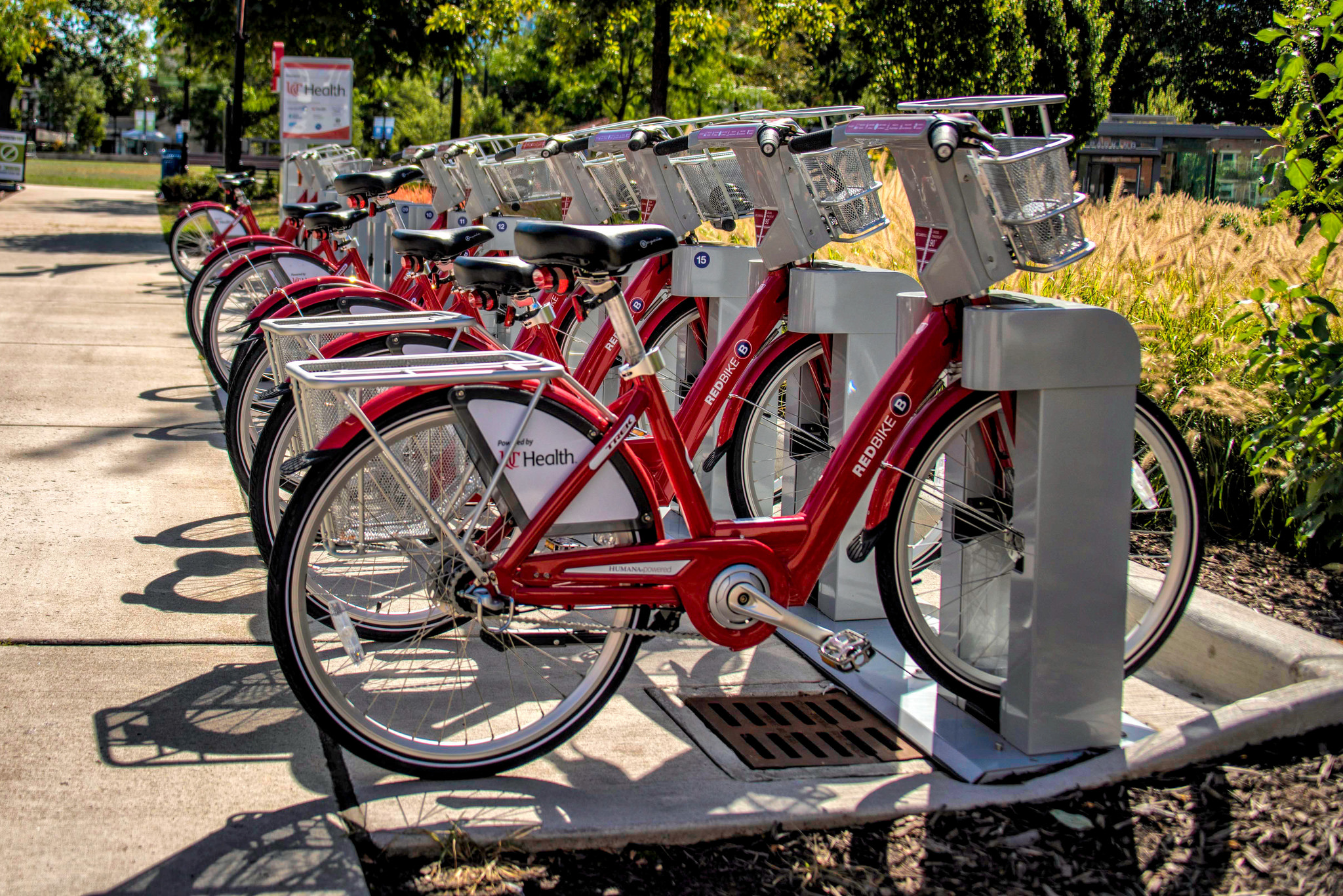
Its location is further complimented by the nearly location of a large Cincy Red Bike Station at Hoffner Park.

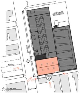
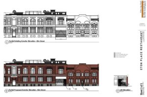
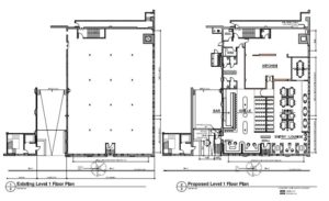
Cincinnati-based MSA Architects has completed its designs for the new transit hub in the heart of the Northside business district immediately south of the recently completed $15 million Gantry Apartments development. The new facility will boast dedicated bus lanes, boarding platforms, passenger shelters, bike racks and lockers, and real-time arrival technology.

The plan also calls for a significant upgrade and expansion of an adjacent parking lot, which SORTA officials envision as also serving as a miniature park-and-ride facility with 18 allocated spaces.

Project officials say that the Northside Transit Center project is expected to be completed by late 2017.

Larger Implications
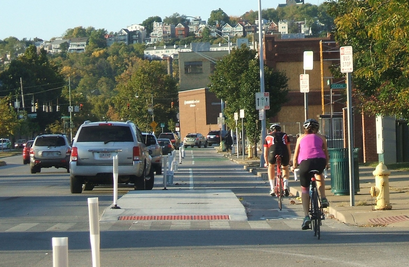
Northside has become the center point for the city as hit-and-runs with people walking and biking have increased. In September, this even led to the community organizing public demonstrations urging City Hall to reduce the speed limit through the business district, while also committing to other safety improvements city-wide.

The implementation of the Northside Transit Center will significantly help consolidate bus traffic through the popular business district, while also create a safe and hospitable place for people to wait for their transit connections.

“We have the second busiest transit hub in the city after Government Square, in a neighborhood that was built before we had cars,” Kroner told UrbanCincy. “The transit hub should make riding the bus easier, more comfortable, and safer in Northside.”

While the City of Cincinnati has not committed to a Vision Zero campaign, or an official Complete Streets policy, residents continue to call for such measures.

Meanwhile, the move also comes as Metro attempts to reinvent its region-wide bus system in order to better connect people with jobs. Historically, many bus systems relied on what is called a spoke-and-hub system that ran all routes to a central downtown transit center. This train of thought has changed as cities have become increasingly more mixed-use and diverse.

Metro officials plan to unveil a new regional transit plan in early 2017, and may possibly put a transit tax increase before votes next November to help implement the recommendations laid out in that plan.

Categories
News Opinion Politics Transportation

Downtown Signal Study Stuck in Political Traffic

Every weekday tens of thousands of commuters in downtown Cincinnati struggle in traffic to get onto the highway and back to their homes in other neighborhoods or the suburbs. However, City Hall is stalling on taking advantage of a unique opportunity to capitalize on funds to study and re-time the traffic signals to benefit all road users downtown.

The last time the traffic patterns of the city’s downtown Central Business District were studied was in the mid 1990’s. Back then the city had about 80,000 workers (a New York Times article puts the number at 82,000 in 1991) which is about 17,000 more than the most recent Downtown Cincinnati Inc. count of 65,000.

There are plenty of other things that have happened in downtown Cincinnati since the last traffic signal study, such as the reconfiguration and realignment of Fort Washington Way, the building of the Banks development, an increase of over 10,000 residents and of course the Cincinnati Bell Connector streetcar.

A traffic study and signal improvements would benefit all modes of transportation downtown

The funds for the study would come from the Cincinnati Streetcar Contingency Fund, basically funds left over from the construction and startup of the system. The study would not only allow the city’s Department of Transportation and Engineering (DOTE) to conduct the study but also would fund much needed upgrades to signals across downtown.

This would allow for the city to implement a more robust and flexible traffic timing scheme beyond the archaic three phase programming of the current signal system which is only programmed for rush hour, non-rush hour and weekend traffic patterns.

In October, City Council voted to approve a motion to start the traffic study.  Since then, however, progress has been stalled for unknown reasons.  The study was discussed again in council chambers this week as Council members probed Metro and City Administration on streetcar operations.

Streetcar supporters are quick to blame the city leadership on stalling to create a narrative that the streetcar is a failure. And the response to that, to blame Transdev, the company that operates the streetcar, should not go unheeded. However; the city is stalling on a golden opportunity to modernize and coordinate downtown traffic for the 21st Century.

This is a project that would fit perfectly into the data driven decision-making vision this administration values. And maybe we will all benefit from time saved being stuck in traffic whether we are drivers, pedestrians, cyclists, bus commuters or even streetcar riders.

Categories
Arts & Entertainment Development News

Popular Brewery Rhinegeist Prepares Restaurant Space

Rhinegeist, the popular brewery in Over-the-Rhine, recently received approval from the city’s Historic Conservation Board to make alterations to the space at the southwest corner of their building, at the intersection of Elm and Eton Place.  Specifically, they requested to make the following modifications:

– Install a new lift/elevator and stairwell entrance

– Install new two-over-two windows

– Repair and improve stairs at entrance

– Install new entrance door

Within their application, they include proposed drawings for the space.  The renderings are of a restaurant that includes a kitchen, bar, dining area, and a private event/dining space.  Rhinegeist declined to comment or provide any further details on the space, saying they are not yet ready to make a detailed announcement.

This development follows a flurry of investments that Rhinegeist has made since opening in June of 2013.  Rhinegeist then invested $10 million to expand operations.  This included the purchase of their building from Orton Development for $4.2 million in November of 2014, new brewing equipment in early 2015, and the 4,500 square foot deck that opened in 2016.  The new production equipment enabled them to triple production from 11,000 barrels in 2014, the first full year of operation, to 31,000 barrels in 2015.  Rhinegeist also built an almost 8,000 square foot private event space in 2015 that began holding weddings and other events in September of 2015.

Besides changes made inside the building, several assets have been added outside of Rhinegeist since their opening in 2013.  In 2014, Rhinegeist was the first business to pledge funding for streetcar operations at $5,000 per year.  The Brewery District stop for the Cincinnati Bell Connector, which began operations in September earlier this year, is located just outside of Rhinegeist’s entrance.  In addition to the streetcar stop, Cincy Red Bike also opened a station outside of Rhinegeist’s entrance in July of this year.  Additionally, ArtWorks completed a mural outside the brewery last month.

Categories
News Transportation

Cincinnati Ranks as Top Bike City

The 2016 biennial list from Bicycling.com shows Cincinnati ranked 36th out of 50 bike-friendly US cities. The ranking is determined by variables such as the number of bicycle facilities, bicycle-friendly businesses, bike-share programs, and the length and safety of infrastructure, amongst others. This year and since 2014, Cincinnati has seen a dramatic increase in bikeability, due to Red Bike and the Central Parkway bike lane, being hailed the 3rd fastest growing biking community in the US. Even with our successes, Cincinnati has fallen from last year’s rank of #35. So, why the fall from #35?

Bicycling.com claims the lack of progress on the City’s Bicycle Transportation Plan, adopted in 2010, coupled with the increasing urban population, with little access to bicycle infrastructure, for the decrease. This year, the first 4.1 miles of the potentially 7.6 mile Wasson Way was purchased just prior to the release of the biennial list. The first phase implementation of the trail, which is scheduled for next year could positively affect the city’s standings in future rankings. However; future on-street connections to the new trail would further boost the city’s access to bicycle infrastructure.

The Central Parkway Protected Bike Lane

This could mean that our rank will increase in coming years. With 100,000 people living within one mile of Wasson Way, the potential for new cyclists and trail-servicing businesses are high and will undoubtedly affect the bike friendliness of the city.

Plans are also underway to secure $21 million in funding to create 42 miles of bike paths, in order to connect Wasson Way, Oasis Trail, Mill Creek Greenway and the Ohio River Trail West. This project is known as Cincinnati Connects and if it passes, will further the city’s bikeability. Additionally, Cincy Red Bike has been an ongoing success; their annual installation of new stations, since its inception in 2014, has added to the momentum of Cincinnati’s bike friendliness.

Although change is afoot, Cincinnati still lacks the complete designation of being ‘bike friendly’ by its residents and outsiders, like those at the top of Bicycling.com’s list. When locals are asked about their view towards biking in Cincinnati, it’s still met by most with negativity: seen as an annoyance, while others are very concerned for their safety while cycling in the city. Cars still dominate the roadways, with some even parking in the bike lane along Central Parkway.

With the new year around the corner, Cincinnati appears to be on a continued path to being a top bike-friendly city however; the following issues are key: residents being made aware of the benefits and safety of cycling; continued implementation of the 2010 Bicycle Master Plan; and policy changes that mirror those cities at the top of the biennial list.

Categories
Development News

New Western Hills Viaduct Could Arrive in Late 2020’s

City officials recently unveiled plans for a new Western Hills Viaduct to replace the 84-year-old structure.

Built in 1931, the viaduct serves as the West Side’s main connection to the city’s urban core. “It affects everybody,” said Cincinnati City Engineer Richard Szekeresh, the project manager. Over 71,000 vehicles cross the bridge every day. However, a city study back in 2012 highlighted the bridge’s deteriorating structural conditions and the poor pedestrian and bicycle accessibility.

The current viaduct is a car haven. Vehicles zoom by a single, narrow sidewalk along the southern edge and cyclists are rare. According to Department of Transportation and Engineering officials, the new structure will be pedestrian- and bicycle-friendly and built to light rail specifications.

Wester Hills Viaduct NewNew cable-stayed design presented by DOTE

Design

Heading west, the current bridge passes over Interstate 75, the CSX Queensgate rail yard, and then deposits cars onto Queen City Avenue in South Fairmont. Queensgate posed a significant problem for the engineers because they couldn’t shut down a privately-owned and high-trafficked rail yard for several years. “We had to find a way to build only from above,” said Szekeresh.

Two design features overcome this constraint. First, the cable-stayed bridge (shown in the renderings) has large distances between its support towers that (mostly) avoid the yard. Second, the physical structure consists of several interlocking parts, meaning the builders can simply insert the relevant pieces into place without much delay. Some rail lines will still be affected, but never for more than a few hours.

Traffic concerns ensure the old bridge will remain in use until its replacement is erected just to the south. The Ohio Department of Transportation (ODOT) must acquire several land parcels. All of them have been appraised, but ODOT must complete its environmental review before it can purchase the properties.

Funding

Total project cost hovers around $310 million, a substantial hike from the city’s previous estimate of $240 million. Federal funds will cover 80 percent, with the city, county, and state covering the remaining funds. Szekeresh indicated that the project could receive a $20 million Transportation Review Advisory Council grant from the Ohio Department of Transportation.

When federal funding will arrive, however, is unclear. Extensions to the projected 2028 end date may be necessary, especially if President-elect Trump reneges on his promise to improve infrastructure.

After the presentation ended, Szekeresh conducted an informal poll to gauge support for the design. Most community members raised their hands in affirmation.