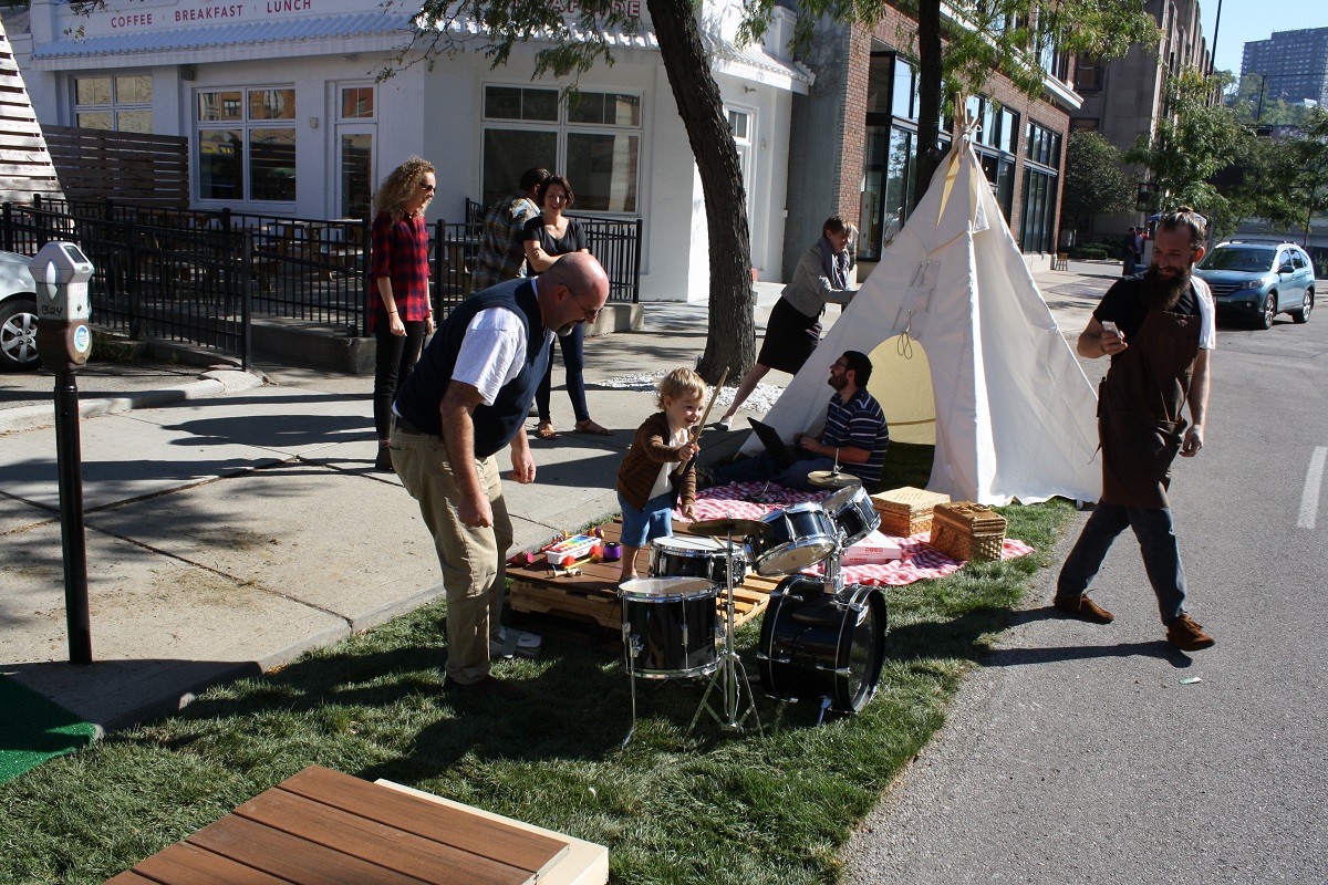
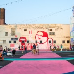
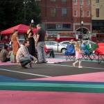
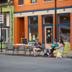
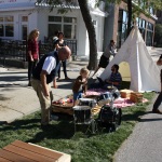
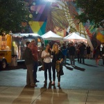
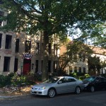
The 2014 edition of the international protest related to the wasteful use of public land for automobile parking took place this past Friday. PARK(ing) Day, as it is known, took place in hundreds of cities across the globe, including Cincinnati.
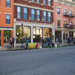
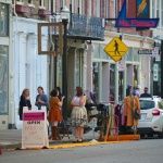
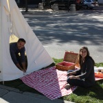
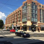
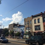
As with past years, the majority of Cincinnati’s parking spaces turned temporary parks or hangouts were concentrated in the center city. Perhaps the most prominent installations were in Over-the-Rhine and across the river in Covington.
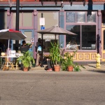
Park(ing) Day Vendor [Travis Estell]
Park(ing) Day [Travis Estell]
Covington’s Madlot [Bradley Cooper]
Park(ing) Day [Travis Estell]
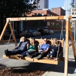
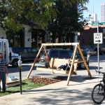
Giant Swing on 8th Street [Bradley Cooper]
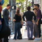
Inquisitive Police [Bradley Cooper]
Park(ing) Day [Travis Estell]
Covington’s Madlot [Bradley Cooper]
Park(ing) Day [Travis Estell]
Camping in OTR [Travis Estell]
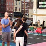
Downtown on Park(ing) Day [Bradley Cooper]
Covington’s Madlot [Bradley Cooper]
Park(ing) Day [Travis Estell]
Cheapside Cafe [Bradley Cooper]
Covington’s Madlot [Bradley Cooper]
Learning to Drum [Bradley Cooper]
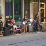
Park(ing) Day Musicians [Travis Estell]
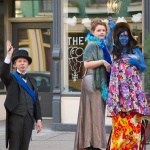
OTR Performer [Travis Estell]
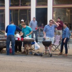
OTR Grill Out [Travis Estell]
Park(ing) Day [Travis Estell]
Covington’s Madlot [Bradley Cooper]
Park(ing) Day Cafe [Travis Estell]
EDITORIAL NOTE: All 22 photos were taken by Travis Estell and Bradley Cooper for UrbanCincy on Friday, September 19.
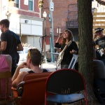
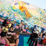
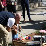
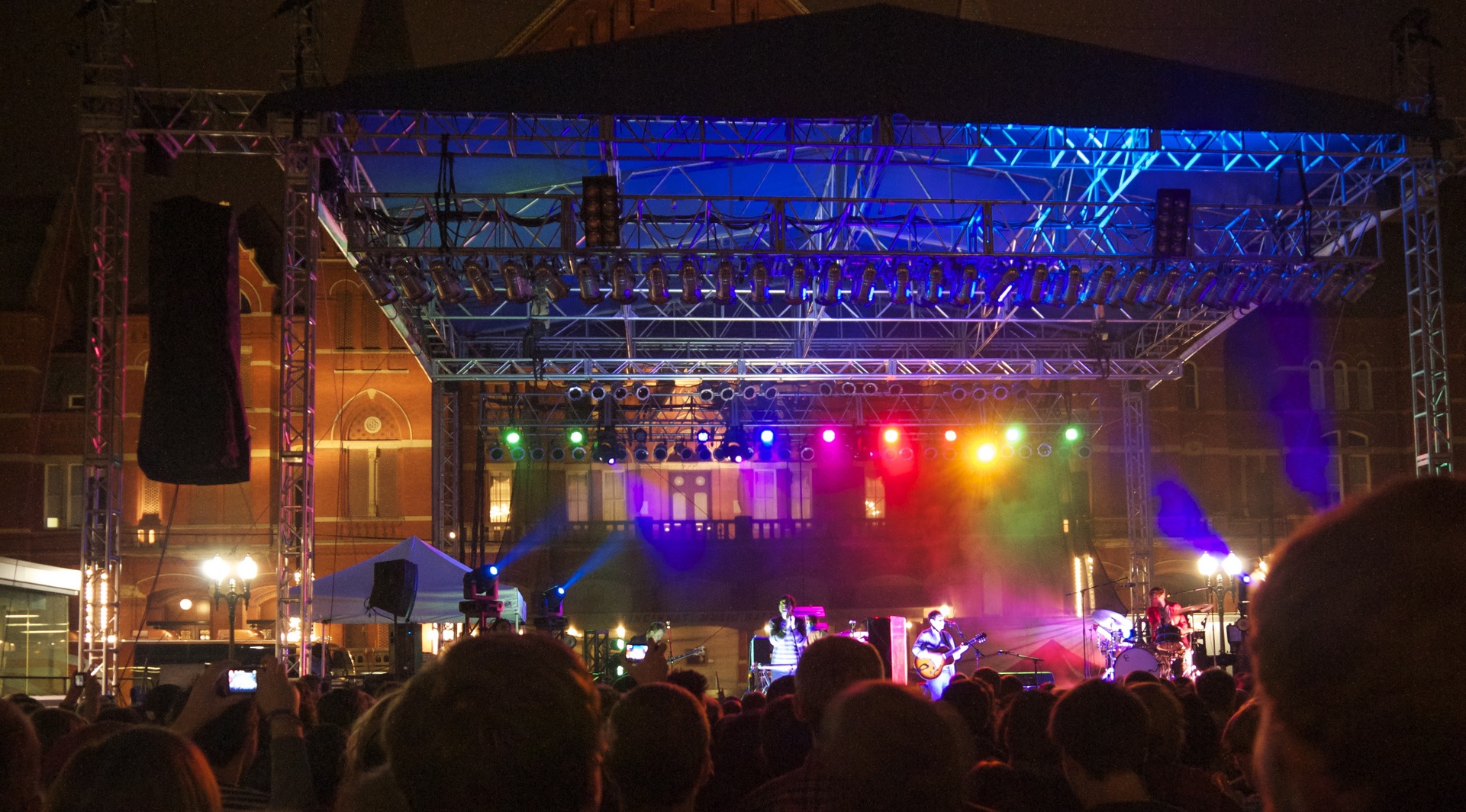
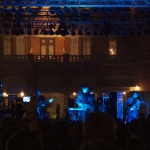
MidPoint Music Festival, known to music fans as MPMF, returns to Cincinnati’s city center this week. Starting on Thursday, September 25, the three-day festival will take over local venues and bars with 150 acts from seven countries and 57 cities, including a great lineup of Cincinnati bands.
Unlike music festivals that take place in empty fields, like Bonnaroo and Lollapalooza, MPMF lives and breathes within Cincinnati’s urban core. This year, the festival will host 14 stages among 12 venues in bars, restaurants, concert halls, and nightclubs throughout Over-the-Rhine and Downtown.
The 2014 festival footprint will look slightly different than in years’ past, featuring the addition of numerous new venues and the elimination of several familiar stages. Since the festival relies on small businesses to host its live performances, the increasing popularity of Over-the-Rhine has, ironically, proven bittersweet for MidPoint’s festival organizers.
Dan Bockrath, CityBeat publisher and de facto executive producer of MidPoint Music Festival, explained that as Over-the-Rhine evolves, the festival has to change with it.
“When [CityBeat] first took over MidPoint [in 2008], there were a lot of empty storefronts that we could put to work, and there were a lot of rooms that served other functions typically that we could repurpose for MidPoint weekend. Now it’s getting a little more challenging to do that because Over-the-Rhine’s filled out,” Bockrath told UrbanCincy.
Bockrath reflects back to a few years ago. “We took a venue like Grammer’s and people thought we were crazy having our main stage, pre-dating Washington Park, at the corner of Liberty and Walnut.”
Now with Grammer’s under construction, MPMF had to find a new outdoor venue to host their bigger acts. This year the festival inched north of Liberty Street to Moerlein Brewing Company where they’ll have two stages: a larger outdoor stage that can hold roughly 1,500 people, and a secondary indoor stage for more intimate shows.
Other long-time MPMF venues have opted out of the festival as to not alienate the loyal customer bases they’ve built over the years. This will be the first year, for example, that Below Zero Lounge is not participating as a venue since 2007. “Businesses don’t want to abandon their successful business models now that they’ve built a loyal following,” Bockrath explained.
MPMF 2014 Venues [Provided]
But as some opportunities go away, others seem to be coming online almost equally. One example organizers give is the Cincinnati Streetcar, which will allow for all kinds of new possibilities once it opens in advance of Midpoint’s 2016 festival.
“There are a lot of possibilities for the future. As the streetcar comes online I can see ourselves going further up into Over-the-Rhine.”
While the streetcar has not significantly impacted the layout of this year’s festival, the same can’t be said for 2015. For instance, the MidPoint Midway on 12th Street between Vine and Walnut sits right on the streetcar line. The free programming area which, since 2011, has hosted the ArtWorks Box Truck Carnival, the Powerhouse Poster Expo, and this year’s ArtWorks programming around the theme “Ink Your Love,” may need to find a new home next year or, perhaps, this may be its last year. Either way, Bockrath remains optimistic.
The festival is open to reinventing itself, he said. “It’s not a Bonnaroo plopped in some big field somewhere. Those kinds of festivals can happen in any city. We really think what we have is uniquely Cincinnati.”
Tickets for MPMF are available online at mpmf.com/tickets, and a comprehensive review of each artist can be found on CityBeat’s website.
DID YOU KNOW THAT MPMF…
Was almost called Mid by Midwest? Founders Sean Rhiney and Bill Donabedian eventually landed on MidPoint Music Festival.
Launched with only 12 venues, but across three cities? In 2002, the inaugural festival hosted 12 venues in Newport, Covington and Cincinnati, including Newport’s Southgate House (not to be confused with Southgate House Revival) and York Street Cafe, Madison Theater in Covington, and now defunct OTR spots Kaldi’s, BarrelHouse, Crush, The Cavern (now Below Zero Lounge) and Jefferson Hall (on Main Street, before it moved across the river and back across again).
Used to coincide with a music industry conference? Much like South by Southwest, the industry conference featured panel discussions, artist and industry keynotes and a trade show. Past keynote speakers included Big Star drummer Jody Stephens (2003), Everclear frontman Art Alexakis (2004), Afghan Whigs and Twilight Singers frontman Greg Dulli (2005), CD Baby founder Derek Sivers (2006), Superdrag vocalist and songwriter, John Davis (2007) and Minor Threat guitarist, Lyle Preslar (2007).
Used to be four days long? The festival spanned across four days of live music and panels, but was condensed into three days when CityBeat acquired the festival in 2008.
Once hosted 25 stages, the most venues MPMF has ever had in one year? In 2010 MPMF expanded to empty storefronts and spaces like the Hanke Building and non-music venues like the Tax Place, ArtWorks, the Segway Room, and the Inner Peace Center.
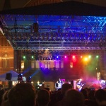
Grizzly Bear at MPMF [Travis Estell]
MidPoint Music Festival [Travis Estell]
Grizzly Bear at MPMF [Travis Estell]
HOW TO GET AROUND AT MPMF
Bike: BYOB (Bring Your Own Bike) – the festival has partnered with the City of Cincinnati to provide temporary bike racks adjacent to nearly every venue. You could also get around by using Cincy Red Bike for just $8/day for unlimited trips of 60 minutes or less. There are 19 Cincy Red Bike stations between OTR and Downtown, including at Washington Park, near the Midway at 12th & Vine, and by the Taft Theater at Broadway. Car: Uber is offering first-time Uber users a discount during MPMF. Just use the promo code MPMF14 to receive a discount of up to $20 off. Foot: The distance from MPMF’s northernmost venue (Moerlein Brewing Co.) to its southermost venue (Mainstay Rock Bar) is a little over a mile, so it’s totally doable to hoof it, though it’s bit of a trek if you’ve got a tight schedule. Transit: Most of the venues for this year’s festival are located on Metro bus routes, but many are within a short walk of a number of bus lines. You can check out which routes and stops are most convenient for you by using Google Map’s transit feature or Metro’s Trip Planner.
On top of all the official MPMF activities, there are a number of complimentary events that will be taking place. On September 24, Christian Moerlein Brewing Co. will be hosting a preview party with a free show by THE PASS and Machines Are People Too. The event will run from 8pm to 11pm and also include a ceremonial keg tapping of Moerlein’s seasonal Helltown Rye.
On Friday and Saturday, FRCH Design Worldwide will host Framed at MidPoint at the Frameshop (1317 Main Street). The pop-up event will include a photo booth, postcard gallery, sculptures made of instruments and a missed-connections space titled You’ve Been Framed. Donations benefit Music Resource Center, a nonprofit that helps provide youth with musical resources. Open Thursday through Saturday from 7pm to 12am.
In addition to all of that, MPMF.FM will feature free daytime performances by MPMF bands at Findlay Market all weekend.
Taking transit is not always a gratifying experience. Sure you are reducing your stress by not sitting in traffic, and you’re reducing the impact on both your wallet and the environment. But that does not change the fact that there are many times where you are waiting for your bus or train in unpleasant circumstances.
Of course, unpleasant waiting and riding conditions are not the only things keeping some people away from taking transit, or upsetting those that already do.
The Southwest Ohio Regional Transit Authority (SORTA) has been trying to fix some of these issues with recent service enhancements and new transit facilities. But those efforts have only gone so far with a limited budget.
Here’s where you come in.
If you have an idea that you think would improve the transit experience for existing and potential future riders, Ioby – a neighborhood crowdfunding program – wants to hear about it. In partnership with Transit Center, they will select the best applicants and award them up to $4,000 in matching funds to implement their idea through what they are calling the Trick Out My Trip campaign.
In order to qualify, organizers say that projects should be non-digital tools that improve the public transportation experience, focus on a single node within a transit system (train station, bus station, bus shelter, subway or metro stop, bikeshare docking station), encourage the use of clean transportation, or be something that is in the spirit of improving shared public transportation experiences.
Ioby also asks that project budgets not exceed $10,000, and that each project involves a group of three or more people working together.
Since Ioby is a crowdfunding platform, project budgeting will require each application to create their own crowdfunding page where the amount of money they raise will be matched dollar-for-dollar, up to $4,000, by Ioby.
Those interested are asked to submit an initial form of interest by Monday, October 6. From there projects will be selected, with fundraising activities taking place in late October. Organizers say that projects will need to be implemented by November 25, 2014, with reports on their effectiveness delivered by December 16.
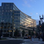
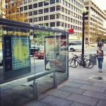
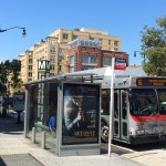
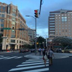
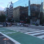
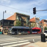
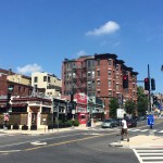
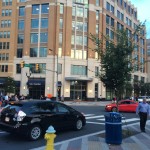
Washington D.C. has, perhaps, the nation’s most prosperous and booming urban economy. It is a city that has also become defined by its highly educated, young workforce.
Over the past decade or so, the nation’s capital has also been transforming its transport network in a way to make it more multi-modal and improve mobility.
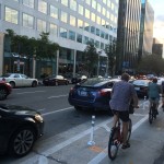
One of the most striking things upon arriving in Washington D.C. is the sheer number of bike lanes. And not just bike lanes, but protected bike lanes. As many cities have begun noticing in recent years, striped bike lanes next to moving traffic are not enough, and that protected bike lanes that separate cyclists from moving traffic with bollards or on-street parking are far superior.
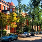
DuPont Circle
Washington D.C.
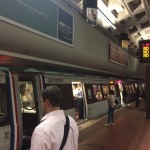
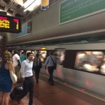
DC Metro
DC Metro
DC Residential
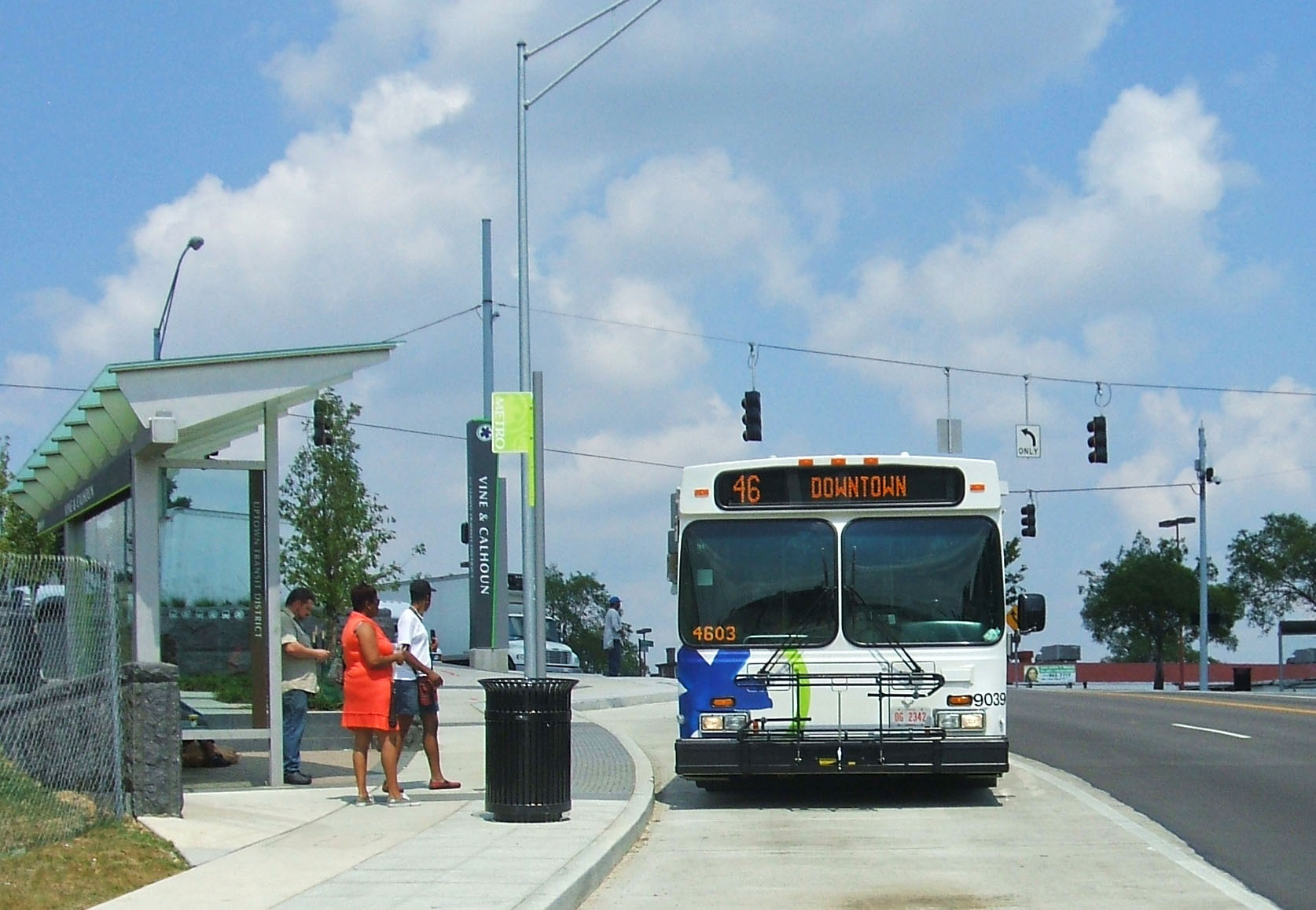
DC Bus Stop
U Street Metro Bus Stop
Columbia Heights
Clarendon Metro Station
DC Bike Lane
DC Bike Lane
DC Bike Box
DC Bike Box
Articulated Bus on H Street
U Street
DuPont Circle
Washington D.C.
Vespa Parking
U Street Infill
T Street
DC Protected Bike Lane
DC Protected Bike Lane
Farragut North Metro Station
Farragut North Metro Station
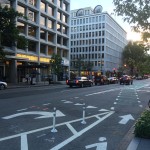
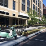
As a result, you see many of the newer bike lanes in Washington D.C. receiving this treatment, and many of the older lanes being transitioned over, as possible, to protected facilities. To this end, it should come as no surprise that the city has one of the nation’s highest percentages of people commuting by bike.
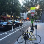
In addition to that, Washington D.C. launched North America’s first bikeshare system in 2008 when SmartBike DC opened with 120 bikes at 10 stations. After some initial struggles, a new system called Capital Bikeshare was launched in September 2010 and currently boasts more than 2,500 bikes at more than 300 stations.
This new system extends beyond the District of Columbia into three additional nearby jurisdictions and stands as one of three biggest bikeshare systems in the United States along with New York City’s CitiBike and Chicago’s Divvy.
I used Capital Bikeshare to make an approximate two-mile trip from near the U Street Metro Station to Washington Union Station. The journey was a breeze and preferable, to me at least, to using a taxi or the city’s well-functioning transit system.
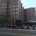
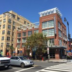
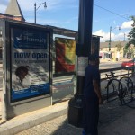
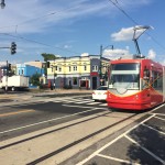
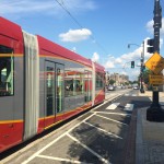
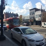
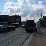
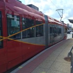
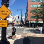
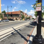
Upon arriving at Union Station I met a friend to check out one of Washington D.C.’s other marque transportation projects at this time. The H Street/Benning Road modern streetcar line terminates here and extends approximately 2.4 miles to the east, and is part of a larger 37-mile streetcar network that will include five lines in total.
DC Streetcar Stop
H Street/Benning Road Streetcar Route
H Street/Benning Road Streetcar Route
H Street/Benning Road Streetcar Route
H Street/Benning Road Streetcar Route
H Street/Benning Road Streetcar Route
H Street/Benning Road Streetcar Route
H Street/Benning Road Streetcar Route
H Street/Benning Road Streetcar Route
H Street/Benning Road Streetcar Route
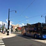
Megabus on H Street
H Street
H Street Infill
H Street
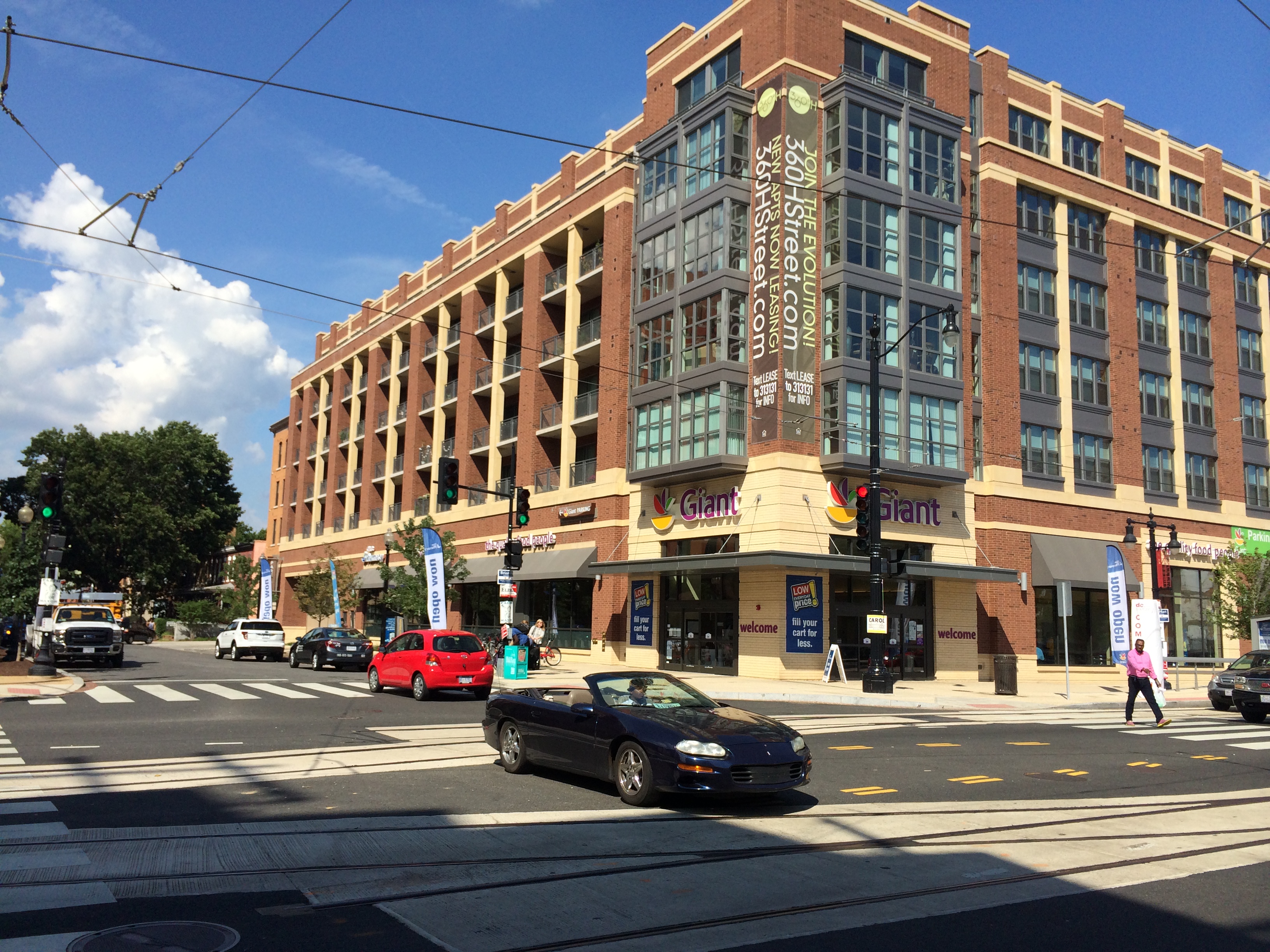
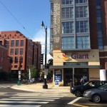
Giant Grocery on DC Streetcar Line
The $137 million starter line is in the final stages of construction, with train vehicles and their drivers currently being tested and trained along its route. Project officials expect it to open to riders in early 2015.
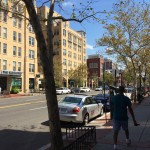
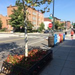
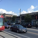
Walking the route was not all that pleasant thanks to the hot temperatures and only brief areas of shade along the busy street, which serves a bevy of transit operations including Megabus, Greyhound and Bolt intercity buses, articulated city buses and now the streetcar. Fortunately a mid-afternoon stop at a local Mexican eatery, with plenty of guacamole to go around, made the overheated outing more tolerable.
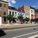
While H Street is a largely a hit-or-miss commercial corridor, its immediately surrounding residential streets are expectedly charming and offer a good foundation from which to build. Some development has already begun to spring up along the line, including a slew of residential projects and a 41,000-square-foot grocery store. There are also signs of renewed interest in many existing buildings that have new restaurants and shops opening up within them.
Of course not everything that is happening in Washington D.C. is related to infrastructure or transportation enhancements. There is, overall, just an extraordinary amount of new construction taking place and a far-reaching sense of vitality. One cannot help but think that there is at least some connection between these policy decisions and investments, and vibrancy on the ground.
EDITORIAL NOTE: All 39 photos were taken by Randy Simes for UrbanCincy between Wednesday, September 3 and Friday, September 5.
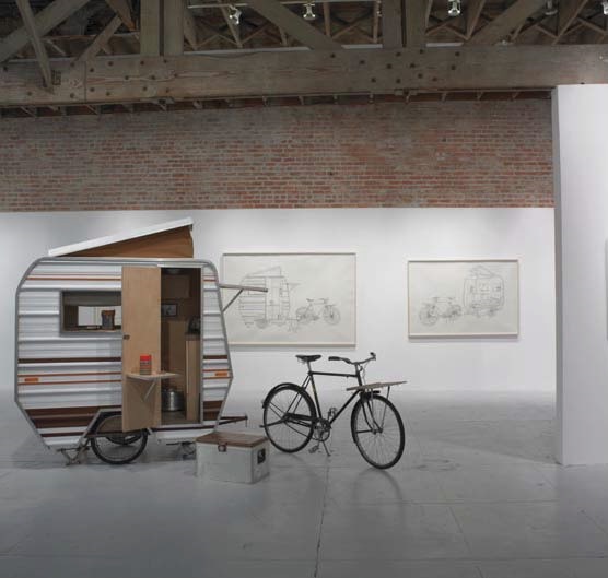
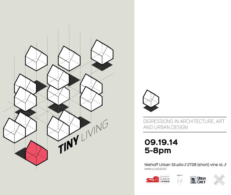
To most people, tiny homes often are viewed as a novelty. The idea of building a small house or living in an apartment with less than 500 square feet sounds like living in a closet.
However; with the rising cost of housing and the growing desire for people to do more outside their homes, the idea of tiny living is stirring a new conversation. Tiny homes, for example, could be used to address urban revitalization, homelessness or retrofitting existing structures, such as this garage project in Atlanta.
Writing about the event, organizer Ana Gisele Ozaki postulated that tiny homes are “an antithesis of suburbanization and the ‘American Dream’ as we know it, tiny spaces/living fundamentally question consumption of our current system by proposing repurpose of materials, as a clear response to the 2009 housing crisis and many other flaws of our current economic/financial system.”
This event is part of the continuing partnership between the Niehoff Urban Studio and UrbanCincy to examine complex urban issues. Earlier this year UrbanCincy moderated the panel discussion for the Metropolis & Mobility workshop focused on Cincinnati’s Wasson Way Corridor.
The Tiny Living event is free and open to the public, and will run from 5pm to 8pm. The evening will begin with interactive pieces produced by the DPMT7 and ParProjects, and will be followed by a series of short presentations at 6pm to get the discussion started. The panel discussion will begin around 7:30pm.
The Niehoff Urban Studio can be reached via Metro*Plus and the #24, #78 Metro bus lines. The collaborative, public studio is also within one block of a Cincy Red Bike station.
EDITORIAL NOTE: UrbanCincy‘s local area manager, John Yung, will be one of the panelists at this event. John is also a graduate of the University of Cincinnati’s Master of Community Planning program.