Categories
Development News

Cincinnati Recognized for Recent Planning Successes, Historical Achievements at APA

Last month the American Planning Association (APA) held its annual conference for planning professionals. The 2013 conference was held in Chicago and organizers made efforts to showcase planning efforts of The Second City.

The educational sessions at the conference are made up of presentations by planning officials across the country. A few of the sessions were hosted by Cincinnati Planning officials who highlighted some of Cincinnati’s recent planning successes.

Of the three sessions that featured Cincinnati city planners, one actually focused on the recently adopted PLAN Cincinnati comprehensive plan.

The Banks
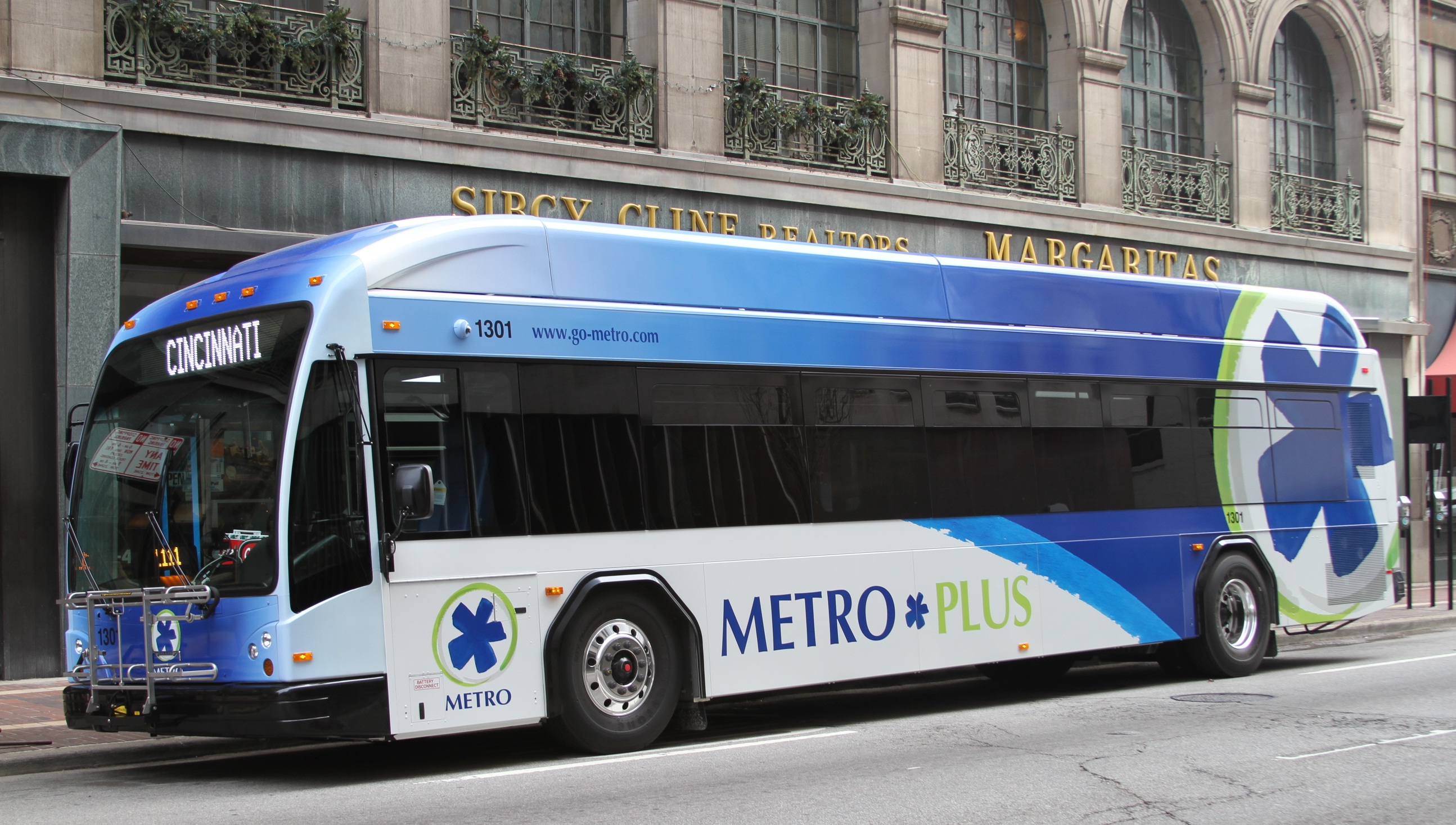
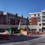
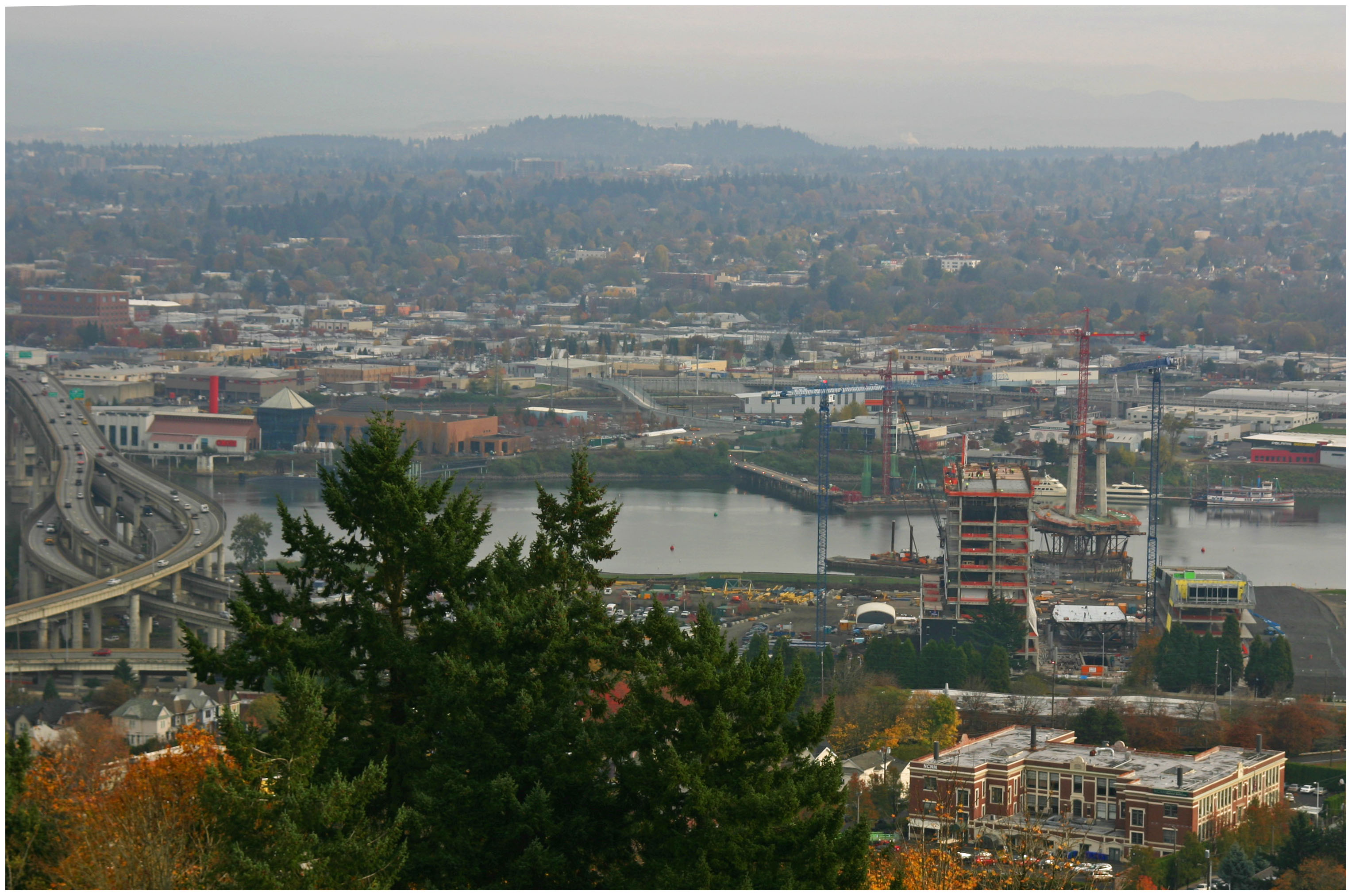
Cincinnati and Hamilton County received a national award from the APA for the implementation of the Central Riverfront Master Plan and The Banks. Photograph by Randy Simes for UrbanCincy.

The plan was approved by the city in October 2012 and is the first long-term comprehensive planning vision of the city since 1980. The seminar also highlighted Cincinnati’s rich planning heritage as the city carries the noteworthy distinction of drafting the first ever city-wide comprehensive plan in the 1925 Master Plan. That plan, along with the 1907 Kessler Parks Plan, envisioned a walkable cityscape with an extensive parks system.

However, after World War II, the city drafted the 1948 Comprehensive Plan which proposed several highways and urban renewal projects. The 1948 plan was successfully implemented but instead of the promised revitalization of the city, the highway system and slum clearance policies supported by the plan drove the city’s population to the suburbs.

“The highway was unfortunately a successful implementation,” explained Gregory Dale from McBride Dale Clarion Associates, “Sixty years later we’re still trying to repair the damage.”

Presenters also highlighted how the Cincinnati’s Planning Department overcame the problems of being dissolved in 2002 and reconstituted in 2007.

“In some ways I think maybe if we had not been eliminated as a departments, maybe there would not be that strength today, maybe it wouldn’t have woken people up to see the importance of planning,” recalled Cincinnati Senior Planner Katherine Keough-Jurs.

She went on to say that she noticed the involvement and passion of participants in the new comprehensive plan was a positive sign that citizens were concerned about the future direction of the city. The citizen participation in the new plan highlighted residents desire for creating and reinvigorating walkable neighborhoods and commercial centers.

“The plan is unapologetically urban,”  Keough-Jurs told session attendees,”In many ways our new comprehensive plan returns to the vision of the 1925 plan.”

At the conference the City of Cincinnati and Hamilton County received an Excellence in Planning award from the APA for the implementation of the Central Riverfront Master Plan. That plan, which was first developed in the late 1990’s when the stadiums and Fort Washington Way were proposed for reconstruction envisioned a new mixed-use riverfront neighborhood called The Banks.

In 2011 the first phase of the mixed-use neighborhood opened to the public and the second phase is slated to begin construction this year.

The planning department’s most recent project, the adoption of the final draft of the form-based code is on City Council’s Livable Communities Committee Agenda today for their 1pm meeting.

The code was approved by the city’s Planning Commission on March 7. Once the code wins approval from the committee it will go on to the full council for a vote. The city’s planning department is looking to meet with the four demonstration neighborhoods – Walnut Hills, Westwood, Madisonville, College Hill – in the coming months to move forward with changes in the zoning map to implement the form-based code.

Categories
Development News Transportation

Metro Seeking Public Feedback on Proposed City-Wide Bus Enhancements

Following a year of ridership growth, the Southwest Ohio Regional Transit Authority (SORTA) will roll out a series of improvements to its Metro bus service this year. Agency officials say that the improvements will be rolled out in two phases.

The first round will go into effect this August and will include significant service enhancements at the new Glenway Crossing Transit Center on the west side.

A new Route 32 will provide all-day service between Price Hill and Downtown, a modified Route 64 will connect Westwood with retail on Ferguson Road and the transit center, and new connections will be offered to Route 38X to Uptown and Route 77X to Delhi. Additional service will also be added to Route 19 along Colerain Avenue and Route 33 along Glenway Avenue.

Metro Plus Bus
New Metro*Plus buses were revealed to the public this week, and will be in operation by August. Image provided.

New direct crosstown services, from the Glenway Crossing Transit Center, will take riders to Oakley via the new Mercy Health West Hospital on Route 41, and to the new Uptown Transit District and onto Hyde Park via Route 51.

The transit agency will also begin operating the new pre-bus rapid transit (BRT) service, called Metro*Plus, between Kenwood and the Uptown Transit District this August.

Officials envision Metro*Plus as offering faster service through fewer stops and enhanced visibility through uniquely designed buses and more robust bus stops. The service will initially connect Uptown with the Kenwood area via Montgomery Road, but will be judged for consideration along another six corridors throughout the region.

Attend our free event this Friday from 5pm to 7:30pm at the Niehoff Studio in Corryville on bus rapid transit and bikeway planning that will include an expert panel discussion and open house.

The improvements are a result of SORTA’s 2012 planning efforts, and will be reviewed to determine whether or not the changes should stay in effect.

“Last year, we listened to the community’s suggestions and, as a result, are proposing a number of service changes to better meet our customers’ needs and attract new riders,” Terry Garcia Crews, Metro CEO, stated in a prepared release. “We’re ready to go forward with improvements that will make Metro more efficient, more convenient, and easier to ride.”

Potential Cincinnati BRT Corridors

Officials say that the second round of enhancements will be rolled out this December and will include added service to Route 20 along Winton Road, Route 78 along Vine Street, Route 31 crosstown service, Route 43 along Reading Road, and faster service on Route 1 between the Museum Center and Eden Park.

It is also expected that the four transit boarding areas, that form the $6.9 million Uptown Transit District, will also be complete by the end of the year, and taking on the additional service to the region’s second largest employment center, and one of the city’s fastest growing population centers.

SORTA officials emphasize that the changes are all short-term in nature, and that they would like public feedback on the adjustments. Officials also state that the improvements are being made within Metro’s 2013 operating budget, and will not require fare increases.

Metro will host a public meeting on Wednesday, May 1 from 8am to 5:30pm at the Duke Energy Convention Center (South Meeting Room 232). Officials say that visitors can come anytime during those hours, and that presentations will be offered every hour on the hour.

Comments can also be submitted online, by email at routecomments@go-metro.com, fax at (513) 632-9202, or mail to 602 Main Street, Suite 1100, Cincinnati, OH 45202. The deadline for public comments is May 1, 2013.

Categories
Business Development News

PHOTOS: $80M Mixed-Use Development Nears Completion in Clifton Heights

Since 2000, the University of Cincinnati’s surroundings have changed dramatically – many homes and a few landmark buildings were demolished for construction of Stetson Square, McMillan Manor, University Park Apartments, and 65 West. U Square at the Loop, a 161-unit, $80 million midrise situated between McMillan and Calhoun Streets, has been under construction for more than a year and is scheduled for occupancy on August 1.

The development includes over a dozen street-level commercial spaces, an office building that has been rented by the University of Cincinnati, and a site fronting McMillan Street where a hotel is planned. Apartment prices range between $695 for studios to $2,350 for penthouses with balconies.

U Square at The Loop

Reserved parking spaces in the development’s two garages will cost $95/month. Unlike other new apartment complexes in the area, units at U Square at the Loop can be rented by non-students.

In the early 2000s the site where U Square at the Loop is being built was partially cleared for a very different development – a 360-unit condo midrise dubbed McMillan Park that had been in planning since 1999. The two phases of the development were planned above two underground parking garages totaling 900 spaces, and planned units ranged from $160,000 for a one bedroom to $800,000 for a penthouse.

That project was to be financed by the University of Cincinnati, the site assembled by the City of Cincinnati through eminent domain, and the project managed by the Clifton Heights Community Urban Redevelopment Corporation (CHCURC). Demolition of properties began in 2003, but litigation involving the owners of Acropolis Chili, Inn the Wood, and two fast food restaurants was not resolved until 2007, a year after the university withdrew its funding.

In 2008 Towne Properties became the project’s developer, and the long-vacant Hardee’s and Arby’s that had been the subject of eminent domain litigation were demolished that summer.

Renderings depicting a development similar to what is nearing completion in 2013 were published that fall, and the project was dubbed Uptown Commons in 2009. The project’s name changed again to U Square at the Loop in 2010 and construction began in 2012.

Categories
Business Development News Transportation

Cincinnati Proposes Eliminating Parking Requirements in Downtown and Over-the-Rhine

The City of Cincinnati will hold a public conference this evening about proposed amendment to the zoning code that would deregulate parking requirements throughout the center city.

According to city officials, the amendment would create new ‘Urban Parking Districts’ and remove the current regulations that mandate how many parking spaces must be provided for any new development or for any project that is modifying the use of an existing structure.

The efforts to get rid of the parking requirements throughout the center city have been ongoing for years.

In June 2010, city officials moved forward with new legislation that allowed for a 50% parking reduction for residences located within 600 feet of a streetcar stop. Then in March 2012, Vice Mayor Roxanne Qualls (C) introduced a motion, which was co-sponsored by six other council members, to eliminate all parking requirements throughout the Central Business District and Over-the-Rhine.

Over-the-Rhine
Over-the-Rhine’s existing historic fabric is at risk of further demolitions, due to current parking requirements, as investment continues to pour into the neighborhood. Photograph by Randy Simes for UrbanCincy.

Last March, UrbanCincy examined just how these off-street parking mandates are stifling growth and investment in the center city, which was largely built before the advent of the automobile. The requirements have led to not only increased costs for small businesses, but they have also led to an excess of parking in these neighborhoods.

The parking regulations also make it particularly difficult to redevelop smaller historic buildings like the ones found throughout Over-the-Rhine.

“Requiring parking for historic structures that have never had parking is incentivizing their demolition. This puts the property owner in a really difficult position; he must either find parking for the building, demolish it or let it languish in perpetuity.” Nashville city planner, Joni Priest, told UrbanCincy last March. “If a property owner wants to rehab an historic building – a building that marks the character of a neighborhood and contributes to the fabric of the city – all incentives, including the elimination of parking requirements, should be considered.”

Parking requirements have also contributed to the increased costs of redevelopment in these historic neighborhoods.

Last April, Chad Munitz, Executive Vice President of Development and Operations of the Cincinnati Center City Development Corporation (3CDC), estimated that existing parking mandates cost developers, on average, $5,000 for one surface parking space and $25,000 for a structured parking space. The increased cost associated with that parking, Munitz says, is then passed on to the consumer and raises the price of a residential unit by as much as $25,000.

The City of Cincinnati’s Planning & Buildings Department will host the public conference this evening at 5:30pm at Two Centennial Plaza, which is located at 805 Central Avenue downtown, and is well-served by a number of Metro bus routes (plan your trip). City officials say that the meeting will take place on the 7th floor, Suite 720 in the Martin Griesel Room A.

Categories
Business Development News Opinion Transportation

Portland Aims to Replicate Streetcar Success on East Side of Willamette River

Six months ago Portland celebrated the opening of a 3.3-mile extension of their modern streetcar system across the Willamette River.

The $148.3 million Portland Streetcar project represents a significant expansion of the existing six-mile system, and city leaders hope it will find similar success in the Lloyd District, Buckman and Hosford-Abernethy neighborhoods as it has in the Pearl District and Northwest District.

At the time when Portland built its first streetcar leg, the Pearl District was a rundown industrial district in search of new life, and the Northwest District was looking to build on its existing stability.

Pearl District Buckman Neighborhood
Portland’s Pearl District [LEFT] has seen a massive transformation over the past decade, and many hope the streetcar’s recent extension will do the same for the city’s Buckman neighborhood [RIGHT]. Photographs by Randy Simes for UrbanCincy.

The story is not all that different on the east side of the river where the Buckman and Hosford-Abernethy neighborhoods are looking for the streetcar to breathe new life into its underutilized land and lingering industrial users, and the Lloyd District is trying to build on its successes and possibly reinvent itself with a lesser focus on the automobile.

While the streetcar extension is operating daily, the investments are not quite finished. Transportation officials are waiting on an additional six streetcar vehicles to roll off the production line so that service frequencies can be improved for the system’s four million annual riders.

TriMet officials are also overseeing progress on the construction of the new Portland-Milwaukie Bridge which will provide a river crossing for bicycles, pedestrians, streetcars, and light rail from Hosf0rd-Abernethy to the South Waterfront District as part of a the 7.3-mile Portland-Milwaukie Light Rail Project.

The $134 million bridge project is expected to open in September 2015 and buoy both new and existing ridership on the city’s light rail and streetcar systems.

Portland-Milwaukie Light Rail Bridge South Waterfront District
Construction progresses on the Portland-Milwaukie Light Rail Bridge in November 2012 [LEFT], which will connect the Hosford-Abernethy neighborhood with the South Waterfront District [RIGHT]. Photographs by Randy Simes for UrbanCincy.

The verdict is still out on whether or not the new east side streetcar extension will have as big of an impact as it did on the west side of the river next to downtown, but the possibilities are there.

The streetcar’s alignment through Buckman and Hosford-Abernethy heads south along Martin Luther King Boulevard and north a block over on Grand Avenue. To the west of MLK Boulevard is the river with a large collection of warehouses in between. To the east of Grand Avenue is an in-tact neighborhood that has become increasingly popular with young creative types over the past several years.

In between the two streets one will find a collection of aging car dealerships and associated service businesses that date back to the mid-twentieth century.

These large parcels, combined with the large warehouse properties immediately to the west, offer a unique opportunity for large scale redevelopment. Such massive real estate investment might not be plausible without another real estate bubble.

The prospects are there, however, and if Portland can pull off even a fraction of the investment in Buckman as they saw in the Pearl District, then the city will add billions of dollars to its real estate value and create a secondary downtown in the city center for the 2.2 million person region.