John joined UrbanCincy in 2011 and immediately established himself as a key member of the UrbanCincy team. A native of Chicago, transplanted to Lebanon, Ohio in his teenage years, John currently resides in Cincinnati’s historic Mt Auburn neighborhood. John earned a Masters of Community Planning degree from the University of Cincinnati in 2013.
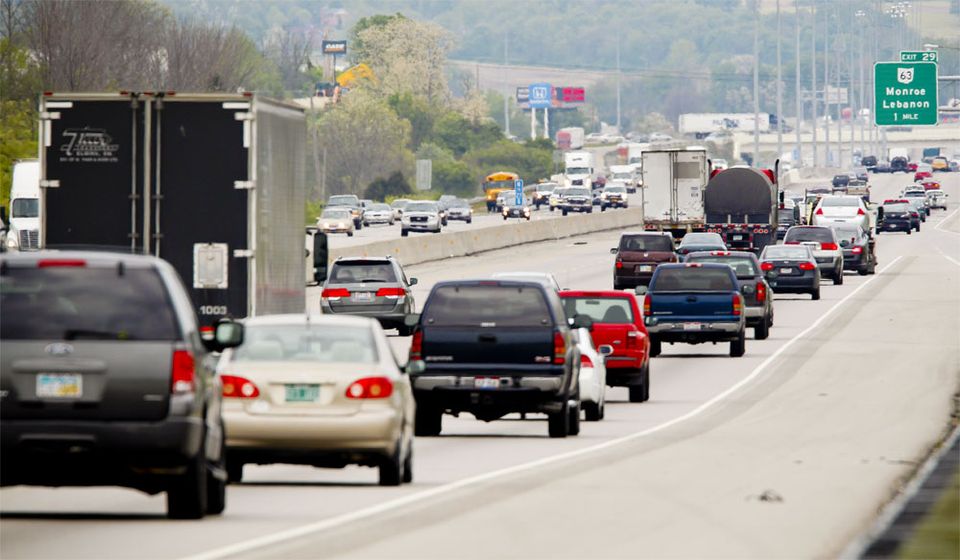
As if the Ohio River valley was already enough of a factor in the stagnation of air pollution in this region, now Cincinnati leaders have charted course on an effort that would advance the city’s ranking on the list of most polluted cities in America.
The list, released last month, shows that out of the top 100 metropolitan areas Cincinnati’s air quality is the eighth worst, with Cleveland coming in right behind us at number 10.
Courtesy of the American Lung Association
“We’re in a good position to close the gap to being in the top five over the next few years,” a layperson told UrbanCincy. “As long as our region keeps on driving everywhere those numbers are bound to increase.”
In fact, as construction continues on the new MLK Interchange along I-71, and the widening of I-75, the induced traffic demand from those two projects alone will allow for even more cars to become stuck on the region’s already gridlocked highways during rush hour.
“Widening highways to relieve traffic congestion is like an overweight person loosening their belt to lose weight,” someone smart once told us.
The $2.6 billion Brent Spence Bridge project, if it ever gets off the ground, would also do much to help push the region up the charts toward the most polluted city in America. In particular, many motorists look forward to the more pronounced smog and foggy orange haze expected to hang over the city and region for years to come.
Air quality is very important to Suburban Person, a financial analyst that works downtown. He tells UrbanCincy that he moved thirty miles out of the city just to escape the smog. Since he still works downtown he informed us he is sitting stuck in traffic on I-75 as of the writing of this article.
Time will tell if those evil progressive urbanists will get in the way of the grand plan by succeeding in actually passing some sort of regional mass transit plan, or even a streetcar extension, but until then the best way to the top is to keep on driving. Happy motoring everyone!
EDITORIAL NOTE: If it was not abundantly clear already, this is a satire post. No one should be proud of the fact that Cincinnati has the 8th worst air pollution in America.
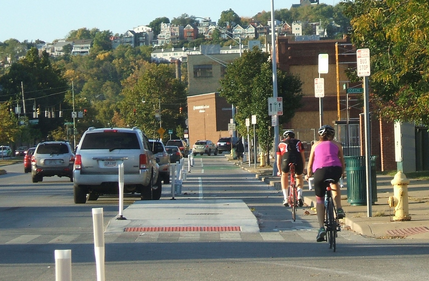
Anyone who rides a bicycle to work, either their own or on a Cincy Red Bike, knows all to well the commute mostly involves sharing the road with automobiles. With the current city administration focusing more on creating recreational trails for bicycle hobbyists, cyclists who bike as a form of transportation can only daydream about better on-street bicycle infrastructure.
That daydream could come closer to reality with the release of a new animation from planner and author Jeff Speck.
An accomplished author of books such as Walkable City and Suburban Nation, Speck describes four simple street reconfiguration options that would better accommodate all modes of transportation without adding to the roadway’s width. In order to accomplish that, the techniques include narrowing lanes, adding striped or buffered bike lanes.
Planners and engineers have found that such changes have a minimal impact on the flow of vehicular traffic, by adding only seconds onto commute times.
The street in the video is 38 to 40 feet in width, which is just about the average width of many streets throughout Cincinnati. In fact, UrbanCincy proposed a similar reconfiguration of Elm Street through the Central Business District in 2013. Such transformations have been noted to positively impact safety.
“Such a change on Prospect Park West in Brooklyn reduced speeding by 77% and reduced injury crashes by 63%, while having no impact on car volume or travel times,” Speck noted in the video.
When Randy Simes first wrote about the Elm Street reconfiguration, he explained that it would also serve as a critical connection point between the protected bike lane on Central Parkway and the Ohio River Trail. While Elm Street is a particularly obvious choice, other streets throughout the city could and should get some of the same treatment.
One another prominent example is Liberty Street, which Cincinnati’s Department of Transportation & Engineering has been looking at for years as a potential road diet candidate. Originally designed for much higher traffic volumes that were never realized, Liberty Street’s 70-foot width now functions more as a safety issue for people walking or biking, and as a barrier between the northern and southern portions of Over-the-Rhine.
Those plans for Liberty Street were originally envisioned by the Over-the-Rhine Brewery District, which then convinced City Hall to perform some planning work. At this time, however, the project does not appear to be moving forward.
Speck’s video makes it easy to see that for the cost of paint it would be relatively easy to install a more comprehensive bike network on streets throughout the city. Such changes would improve safety, increase the number of people riding bikes, which probably means more Red Bike usage, all while slowing down traffic just a tiny bit. Besides, even automobile drivers may appreciate not needing to directly interact with so many bicycles on the street.
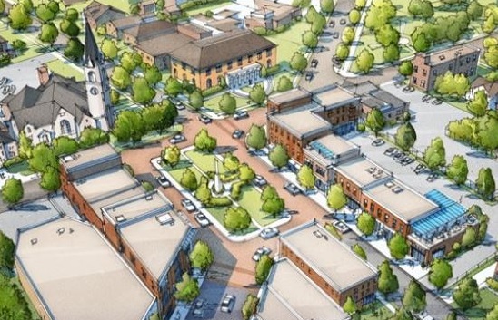
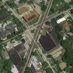
Imagine a picturesque park that is easily known as the center of a neighborhood district. A square with lush landscaping, a stage for plays and space for a farmers market. It’s a square that is easily the envy of Hyde Park or Mt. Lookout or Oakley. That was the vision of Westwood Square.
Westwood Square was born out of the month-long city-wide charrette that helped formulate the city’s four form-based code districts. The vision was further refined in the fall of 2012 by community groups Westwood Works, Westwood Civic Association, Westwood Historical Society, Westwood Community Urban Redevelopment Corporation.
As part of the process, citizens, planners and engineers looked at the problems Harrison Avenue had been causing the neighborhood. Serving mostly as a four-lane connector to Cheviot, ideas were floated to design some traffic calming measures for the corridor.
Westwood Square [Provided]
Existing Conditions [Google Earth]
The idea was that Westwood should not be a place for cars to fly through on their way to downtown, but instead a place to be visited and enjoyed.
Through this process, which was championed by then Vice Mayor Roxanne Qualls (D), the team came up with the idea for a central square. By taking a section of Harrison Avenue at the intersections of Epworth and Urweiler Avenues, the square would be constructed to deliberately force vehicles to slow down and turn to navigate around the public gathering space.
City planners found that they could create an opportunity to form a community green space, slow traffic and make the area safer for people walking and biking by implementing such a change.
After MadCap Puppet Theater moved into the old Cincinnati Bell switching station, they cited the plan as one of their main draws to the area. Theater director John Lewandowski spoke about that plan, and the hopes for the neighborhood last year on The UrbanCincy Podcast.
During the 2013 mayoral campaign, Qualls lost to Mayor John Cranley (D), who spoke against the idea of form-based codes during the campaign, and has continued to challenge them ever since.
The recent parks levy announcement from Mayor Cranley and other city leaders included a notable change to the long-held and developed plans for Westwood Square. The adjustments to Harrison Avenue, and creation of the square, are now gone.
Instead, City Hall is now calling for $2 million to renovate the existing green space adjacent to Westwood Town Hall. The new vision will do nothing to slow the traffic at the intersection and appears to make feint aspirations at building the kind of place originally envisioned by the community in 2012.
While specific details for the new plan have yet to be provided, the end result is now expected to be a major departure from the form-based approach that was first laid out.
Zoning. The word evokes a sense of bafflement from many people – often serving as a Rorschach test for those outside the urban planning profession. Even to experts, there are different ways to tackle the term; however, the term simply refers to the method of how municipalities regulate the usage of land and dimensional placement of buildings.
Almost every community has them, with the notable exception of Houston, and most two zoning codes are never the same.
In Cincinnati, the last time the city passed a zoning code was in the 1960’s. At that time shopping malls, office parks and subdivisions were all the rage, and the zoning code reflects it. Many zones called for large yards, two cars per dwelling unit, and large parking lots for commercial strip malls. The code was updated over time, with the last significant overhaul occurring more than a decade ago in 2004.
Since that last update, the city has undergone a renaissance that has focused on urban development in previously long-neglected neighborhoods. The current zoning code does not adequately address that change, nor does it address many emerging trends as they relate to sustainable development, bicycle infrastructure or even tiny homes.
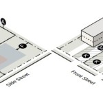
RM-L District Example [Provided]
RM-L District Diagram [Provided]
In 2012, the City of Cincinnati undertook an effort to redesign the zoning code around the changing development patterns of the city. The code, which is referred to as the Land Development Code, is still in the early stages of drafting and review. The second draft was released in October 2014 and the Planning Department has been making changes and soliciting input in preparation for releasing the third revision.
“Incorporating public input into any draft revising the zoning code is a top priority, and we are making every effort to receive and incorporate public input prior to any draft being presented to the City Planning Commission or mayor and council,” explained Charles Graves III, Cincinnati’s Planning Director. “They will gather additional public feedback and ultimately have the final say on any changes to the Code.”
After looking through the draft code posted on the City’s website, the biggest difference is the visuals. There are plenty of diagrams and drawings that assist with interpreting the code. Aside from that, here is a breakdown of a few major issues the new Land Development Code could potentially address:
Lot Sizes
Lot sizes generally will remain the same for all residential zones; however, there are some proposed changes to mixed commercial zones and other zones. The Planning Department is considering the concept of tiny houses, something UrbanCincy hosted a forum on in 2014, and is a media partner on with to Bradley Cooper’s effort to construct Tiny Houses in Over-the-Rhine.
“There is the opportunity to write some language in the draft Code that would permit the newer concept of tiny house; however, we are seeking input from the public and developers,” Graves said.
Parking
Parking regulations have been revised after consultants made recommendations to the department, but planning staff decided to delve deeper into the issue as parking regulations can be a complex balance between the needs of developers, the surrounding community and other variables. The department has assembled a parking and zoning working group to study best practices from around the country and analyze what works best for the City to use in the update.
Bicycle Parking
Bicycle parking is already required in new private and city-owned parking garages, but it is not generally required for other development. The current draft code calls for a minimum number of bicycle parking spaces for multi-family residential development, commercial, industrial and public development, but Graves told UrbanCincy that his staff is reviewing and having discussions regarding bicycle parking as part of the working group.
Administrative Changes
One of the Planning Department’s main goals in this effort is to allow for an easier and more streamlined permitting process. A part of this is creating something called minor variances that can be approved by a newly created Zoning Administrator position. Minor variances would not need to go through the entire hearings examiner process, which would reduce the wait time for minor and non-controversial variances by weeks. Other initiatives have been proposed by the City Manager Harry Black, which could occur outside the code which could streamline the processes related to permitting and plan review.
Other things such as incorporating green development and sustainability practices into the code are being evaluated in the “light impact development” chapter; however, these items are still being discussed by the staff and their consultants. Planning staff has indicated that they do not have a set date for the release of the third review draft because it is still a work in progress.
“In order to ensure adequate and thorough input there will be plenty of time given for a third public review period once that point is reached,” Graves said.
Public comment is still welcome for review of the second draft code which is available on the City Planning Department website.
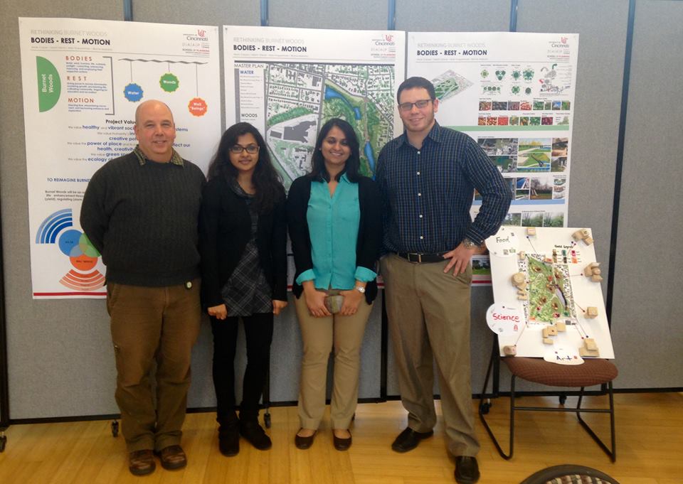
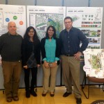
Mark Carper, Binita Mahato, Maitri Desai, and Alex B. Koppelman present "The Plan: Bodies, Rest, Motion, a plan for Burnet Woods"
Over one hundred and fifty people gathered at the Niehoff Urban Design Studios in Corryville to see and hear what University of Cincinnati design students had come up with on a reimagining of Burnet Woods. The Woods, which once included the land that is now the University’s west campus, is still one of the largest parks in the Cincinnati Park system and also the central focal point of three Cincinnati neighborhoods.
Both Masters and Bachlors degree students from the School of Planning at DAAP focused on the park as part of a year long planning effort coordinated by the City of Cincinnati and the university to envision a revitalized Burnet Woods. A recent study conducted by the university polled 2,000 students. One of the biggest findings from the study is that 87% of the students polled do not think the Woods are safe. Another 7% did not know it existed at all.
UrbanCincy’s John Yung moderated a panel discussion on the future of Burnet Woods.
Mark Carper, Binita Mahato, Maitri Desai, and Alex B. Koppelman present “The Plan: Bodies, Rest, Motion, a plan for Burnet Woods”
As part of the event, UrbanCincy moderated a discussion panel with some of the regions’ top experts on park planning and programming. Chris Manning from Human Nature joined Ken Stapleton from Ken Stapleton & Associates and Christy Samad from Center City Development Corportation (3CDC). Panelists discussed ways to make the park appear safer including better lighting, more programming and activities and better gateway connections into the park.
The hour long panel focused on a range of topics regarding Burnet Woods including a student proposal for a green land bridge between the park and the school. The bridge proposal was praised by the panelist for its outside the box approach at incorporating an aspect of the park in a way that overcomes the physical separation caused by the wide and traffic heavy Martin Luther King Jr. Boulevard.
Audience members were also encouraged to participate and some voiced concerns about the park being underutilized. One participant asked about residential housing on the periphery as part of the park redevelopment noting that connecting residential to the park would be an opportunity for change.
UrbanCincy media specialist Travis Estell was on hand to take photographs and record the conversation which will appear later this week on The UrbanCincy Podcast.
The open house was a joint event between the Niehoff Urban Design Studio, the Urbanists and UrbanCincy. Stay tuned for our next joint event in the fall!