Categories
Business Development News

Project Officials To Move Forward With Phase III of The Banks Ahead of Schedule

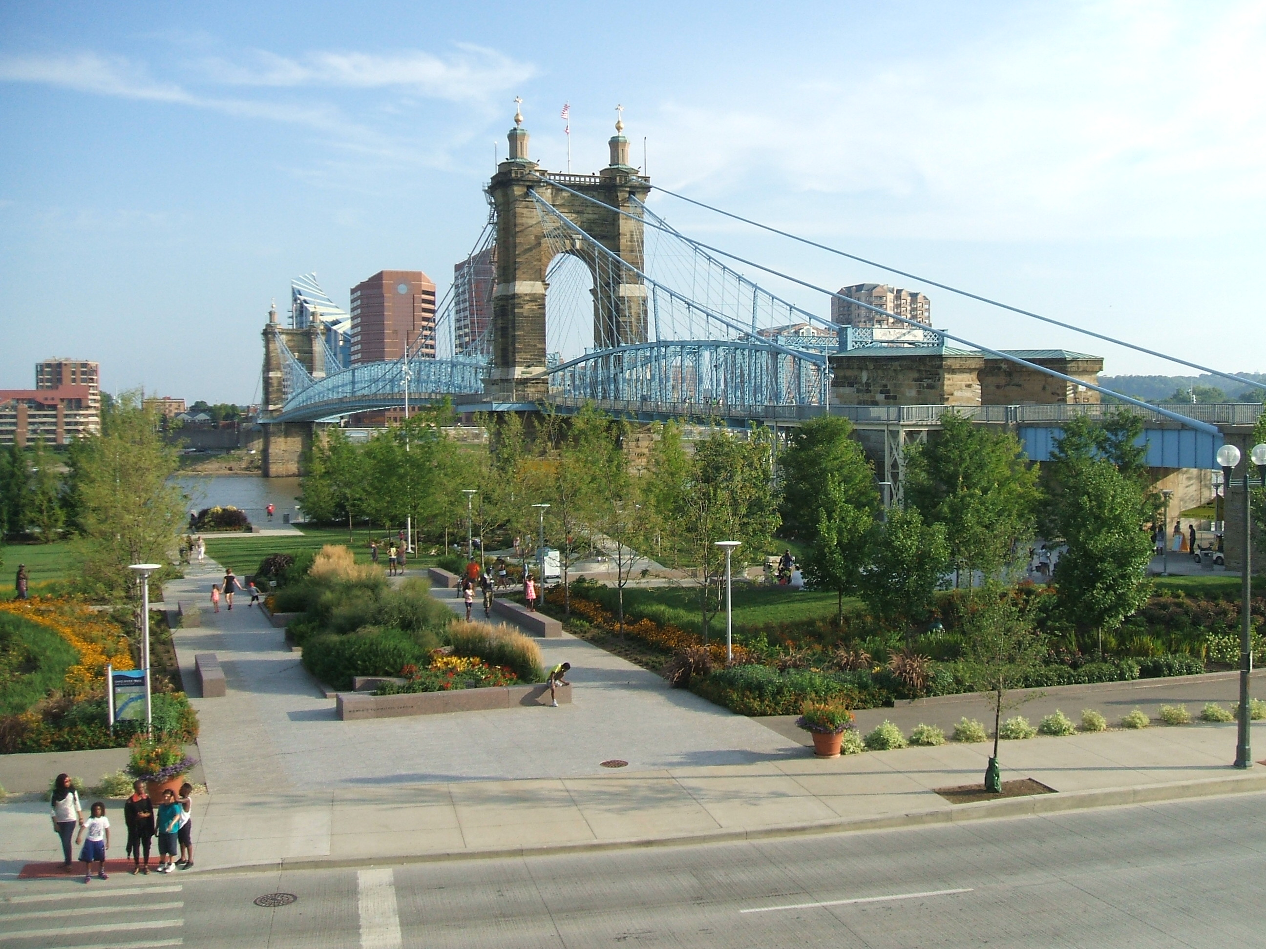
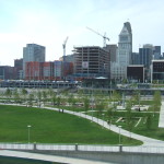
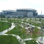
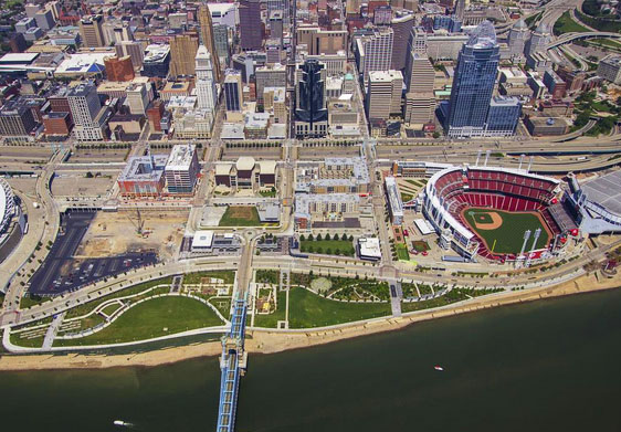
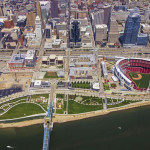
Business leaders and public officials from the City of Cincinnati and Hamilton County will gather tomorrow morning to celebrate the groundbreaking of the next phase of work at The Banks.

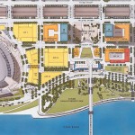
As has been done in the past at the massive central riverfront development, the first work to be done will be the construction of a public parking garage that will lift the project out of the Ohio River’s flood plain. From there, the existing public streets surrounding the project site will be extended to frame the block.

While the event is being touted as a groundbreaking ceremony, workers from Prus Construction and Beaty Construction began mobilizing on the site to perform preparation work. The news is a bit of a departure from previous announcements that said construction work would hold off until the close of the Bengals season in order to preserve parking for tailgaters at Paul Brown Stadium.

In this particular phase of work, project officials say that 690 parking spaces will be built on two levels that will be connected with the rest of the underground parking deck at The Banks, which has been casually described as one of the largest underground parking structures in North America.

This $29.3 million effort is being jointly funded by the City of Cincinnati, Hamilton County, and the State of Ohio’s Jobs Ohio program. Representatives from the various public agencies funding the project say that it will create an estimated 200 jobs, with at least 30% of the contract totals spent with Small Business Enterprises.

Such a claim for small business inclusion is on-target for what the project has been delivering thus far. As of June 2015, the latest reporting date, The Banks has had an average of 36% small business participation and approximately 17.5% minority and female workforce participation.

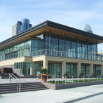
Nearby work continues on the private sector vertical construction of Radius, a 291-unit apartment midrise with 19,000 square feet of street-level retail, and the 340,000-square-foot General Electric Global Operations Center.

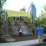
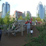
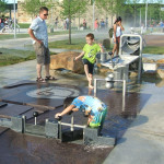
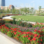
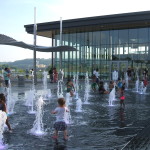
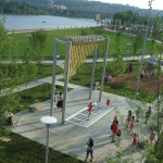
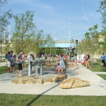
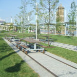
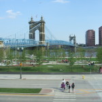
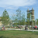
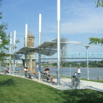
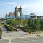
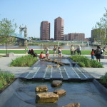
Once these two phases of work are complete, it will allow for the next phase of Smale Riverfront Park to move forward, and will set the stage for private real estate development south of Freedom Way and in between Race and Vine Streets.

So far, Carter USA and the Dawson Company have yet to reveal what will ultimately be built on top of this latest garage extension, but most suspect it will be some combination of apartments and condominiums.

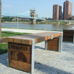
While The Banks has received much positive praise as of late, it has not come without its struggles. The retail in the first phase of the project continues to find its footing, and the area continues to struggle with a brand identity and architectural designs that people feel are worthy for the prominent piece real estate that this development occupies.

Categories
Business News Transportation

Beyond Downtown, Cleveland’s RTA Rebuild Spurring New Development

Amidst further positive national news for upgraded Midwestern rail service, All Aboard Ohio met in Cleveland for their summer meet-up. At the weekend-long gathering, the group toured the Greater Cleveland Regional Transit Authority’s numerous heavy rail, light rail, and bus rapid transit lines.

Often unknown to outsiders, the Cleveland area boasts some 39 miles of rail transit, with daily ridership of over 53,000. As a result, Cleveland’s transit ridership dwarfs that of both Cincinnati and Columbus. Even though Cleveland is approximately the same size as Cincinnati and Columbus, its transit ridership is bigger than both of them combined.

In addition, All Aboard Ohio executive director Ken Prendergast led the tour and showcased the substantial amount of transit-oriented development that is taking place throughout Cleveland.

With the opening of Cincinnati’s first few miles of rail transit just over a year away, it made the tour particularly relevant. As a result, I was joined by a small Cincinnati contingent including City Councilman Chris Seelbach (D), SW Ohio Director of All Aboard Ohio Derek Bauman, and Price Hill community leader Pete Witte.

The group’s tour began at Terminal City Tower in downtown Cleveland, where inter-city trains once stopped and all rapid transit lines currently meet. From there we took the Green Line to the lakefront, passing large-scale transit-oriented development along the Cuyahoga River, the Port of Cleveland, Cleveland Brown Stadium, Rock & Roll Hall of Fame, and the city’s Amtrak station.

Negotiations are currently underway for the construction of a large intermodal hub where Amtrak is currently located, combining Amtrak, Greyhound, Megabus, and many local buses from Akron and other cities into one complex.

The Green Line’s E. 55th Street Station was showcased after having been rehabbed in 2011. It is part of GCRTA’s program to rebuild every station in its system. Nearby this still young station, an old hospital is undergoing a $75 million redevelopment that will refit it with apartments.

Changing to the Blue Line, the train ran through semi-suburban areas that reminded the Cincinnati contingent of the Wasson Corridor. Among these areas is the Van Aken District at the Warrensville Station at the end of the line. There, Joyce Braverman, the planning director for Shaker Heights, gave us a walking tour of the area and detailed the numerous transit-oriented developments currently under construction, including a $91 million residential development and a rebuild of a pedestrian-unfriendly intersection.

A newly renovated station – just four days old – greeted us at Little Italy along with the Feast of the Assumption Festival. In addition to the throngs of neighborhood residents filing in and out of the trains, redevelopment can be found nearby in University Circle. During an opportunity to speak with the president of University Circle Inc., he boasted about the area’s transformation from a run-down district with multiple surface parking lots into one of the city’s most desirable neighborhoods.

The numbers back up the claims. In just a decade, more than $6 billion in private investment has flowed to the neighborhood, generating some 10,000 new jobs and 11,000 new residents.

While serviced by RTA’s Red Line, this particular area is also anchored by Cleveland’s now famous Health Line BRT, which runs along Euclid Avenue to the center city and is the highest-rated BRT line in North America.

Through this station rebuilding program, Cleveland has used it as an opportunity to leverage an impressive amount of private investment in the surrounding areas. While success of downtown Cleveland has been well-publicized amidst the continued struggles elsewhere in the region, there are bright spots popping up along the city’s transit corridors. With more than 100 rail and BRT stations in the region, many more opportunities seem to be on the horizon.

Categories
Business News

Dirt’s Opening at Findlay Market Bolsters South Side of Market, Evening Activity

After a soft opening in July, Dirt: A Modern Market finally opened its doors on August 4.

“We are a full-time retail store at Findlay Market selling locally produced goods,” said Karen Kahle, who served as project manager until April. She also wrote the grants that ultimately funded the effort from the Interact for Health Foundation.

Based on the Local Roots store concept in Wooster, OH, Kahle says that she, along with Rebecca Heine and Mike Hass, were inspired to move forward with the idea after visiting the shop during a trip to Cleveland for the International Public Market Conference in September 2012.

“We loved the idea of the ‘consignment shop’ for local food,” Kahle explained.

The market is hoping to make locally grown and produced foods available to Findlay Market shoppers every day the market is open. The trio says that they want to create another way for local growers and producers to sell their product and increase revenue in order to help them become more sustainable and profitable.

A broader goal in the long run, Kahle says, is to help educate the public on the health and environmental benefits of eating fresh local foods, while also promoting community involvement and sustainable living.

The market is currently selling fruits, vegetables, meats, cheeses, dairy products and cottage goods. Customers will notice that the shop functions a bit like a consignment store where growers and producers rent space by the week or the month, set up their own individual displays, and set their own prices. They are then reimbursed 70 to 80% of their gross sales.

Located in between Maverick Chocolate and Eli’s BBQ, the opening of Dirt is yet another shot in the arm for the once struggling south side of the Findlay Market.

Dirt’s operating hours also show a commitment to the efforts to increase evening business activity in the area. They are currently open from 10am to 7pm Tuesday through Friday, 8am to 6pm on Saturdays, and 10am to 4pm on Sundays. The shop is not open on Mondays.

“Dirt: A Modern Market will market food products that celebrate what is unique and best about a community – its local crops, ethnic traditions, and creative populace – while keeping a greater percentage of food dollars circulating in the local economy,” said Kahle.

Categories
Business News

The Location of Every Job in Cincinnati Mapped

Ohio Employment Dot Map

Two years ago, University of Virginia researcher Dustin Cable put together a detailed dot map based on the racial distribution of people in the United States. This work inspired another researcher to put together something similar, but for America’s job distribution.

Robert Manduca studies sociology and social policy at Harvard University. He says that while jobs and the economy are continuously discussed, we seem to know very little about where jobs are actually located. So what he did was examine the Census Bureau’s Longitudinal Employer-Household Dynamics data and then plot that information out on an interactive map.

The LEHD data is based on state unemployment insurance records, and tabulates the count of jobs by census block,” Manduca explained on his website. “Here, jobs are colored by type, allowing us to see how different industries and sectors exhibit different spatial patterns–some clustering in downtowns, others spreading across city and suburbs alike.”

The way the visualization works is that red represents Manufacturing & Trade; blue for Professional Services; green for Healthcare, Education and Government; and yellow for Retail, Hospitality and Other Services.

Upon examination of the map, you can see that some cities and regions have a much stronger concentration of jobs than others. When looking at Ohio from a distance, it looks like this pattern holds true for the state’s three big cities. That picture changes as a more detailed look is taken at Manduca’s research.

In Cincinnati, for example, the two largest job centers, downtown and uptown, are joined by the Mill Creek Valley and Blue Ash as areas with heavy concentrations of jobs. As expected, there is a large cluster of education and health jobs uptown, while downtown boasts the region’s heaviest concentration of professional service jobs.

Blue Ash then comes in as, perhaps, the most impressive job center for professional service jobs in the region outside of the center city.

The Mill Creek Valley, which generally runs north along I-75 from the Ohio River, serves as the region’s primary manufacturing and trade corridor. This industrial corridor is well-rooted in Cincinnati’s history, and is even reflected in the City of Cincinnati’s robust tax collections from these zip codes.

The research reveals how much of a barrier the natural landscape serves as when considering job distribution. Throughout the Cincinnati region, for example, you can see how the hills cut across the landscape.

The data also shows that while Cincinnati is often defined by an east/west divide, the distribution of jobs is far more north/south oriented than it is east/west. Of course, the same is true for the region’s population.

Categories
Arts & Entertainment Development News

PHOTOS: The Impressive Impact of Smale Riverfront Park

There are dozens of development projects underway at any given time, but few have the opportunity to make a truly transformative impact. Smale Riverfront Park is one of those rare exceptions.

As UrbanCincy has chronicled in the past, the changes that have taken place along Cincinnati’s central riverfront over the past two decades have been truly remarkable. The consolidation and burial of Fort Washington Way. The construction of two behemoth stadiums, a world class museum and an entire new neighborhood. And now the opening up of the Ohio River through the redesigned riverbank and park.

What was once an asphalt riverfront separated from the rest of the city by an inhospitable highway now the region’s central gathering place for tourists and a destination for everyone in the region looking to the river that gave the city its birth. The changes are breathtakingly wonderful.

Of course, there is nothing better than images to help visual such changes. Instead of posting photos of what the area was once like, as we have in the past, this collection of photos are from that past few weeks at Smale Riverfront Park’s latest addition, and its immediate surroundings.

Projects like this and Washington Park, which is currently hosting thousands of thrilled Cincinnatians as part of this year’s Lumenocity event, are the types of investments and projects that change a city. What’s even better is that they’re accessible to everyone.

EDITORIAL NOTE: All 20 photographs were taken by Eric Anspach in July 2015.