The following is a guest post by Indianapolis based planner Jeffrey Tomkins with a forward from Micah Paldino, Clifton Heights resident, and founder of creative storytelling agency, Fallon Thatcher. It has been edited lightly.
“With the area in and around Findlay Market expanding with new restaurants, bars, and lifestyle concepts, the neighborhood is primed and ready for a conversation around how we provide a safer and more beautiful experience.
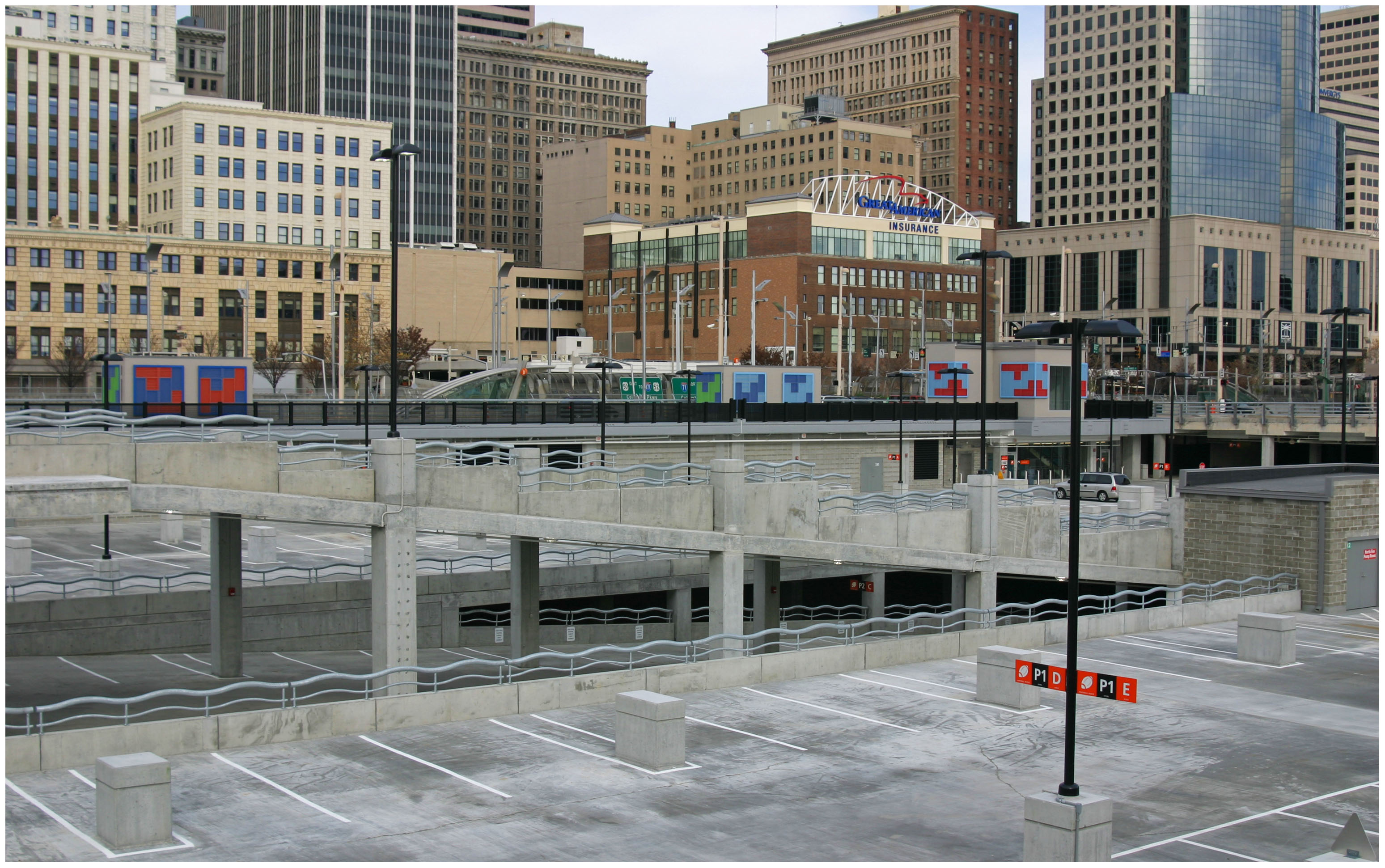
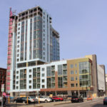
This is timed nicely with ongoing construction of FC’s stadium set to open in March 2021 that will bring even more focus on how pedestrians utilize this space. Visibility for pedestrians at this important, but rather troubling and cumbersome, intersection has always been a pain point when crossing the street and competing with cars.
In this reconfiguration designed by Jeffery Tompkins it lessens the risk for pedestrians by reducing the allowances of turns and creates a calmer environment. This is something we need more than ever as Over-the-Rhine and Clifton Heights become a more singular unit.”
Micah Paldino
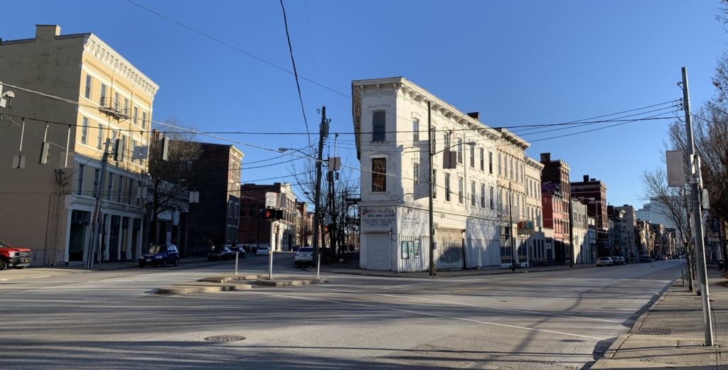
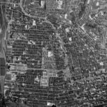
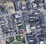
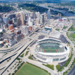
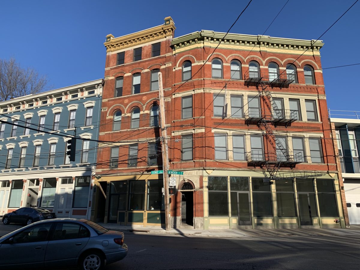
The intersection of Vine St. and McMicken St. is one of Cincinnati’s more complicated – and potentially more deadly. While it has been the subject of art, the first search engine result for the five-way intersection lists pedestrian deaths as its biggest story. And this is no surprise: complicated turn radii, low vehicle visibility from a wild angle of incidence, and an antiquated slip lane have created a logistical nightmare for cyclists and pedestrians hoping to cross the intersection.
Any design intervention hoping to calm traffic and improve mobility at this nexus should account for the district-wide significance of this crossing and, thus, must think in terms of the relevant traffic flow through Vine and McMicken corridors. As it stands, current traffic flow is overly complicated and caters almost entirely to automobiles rather than encouraging pedestrian interaction.
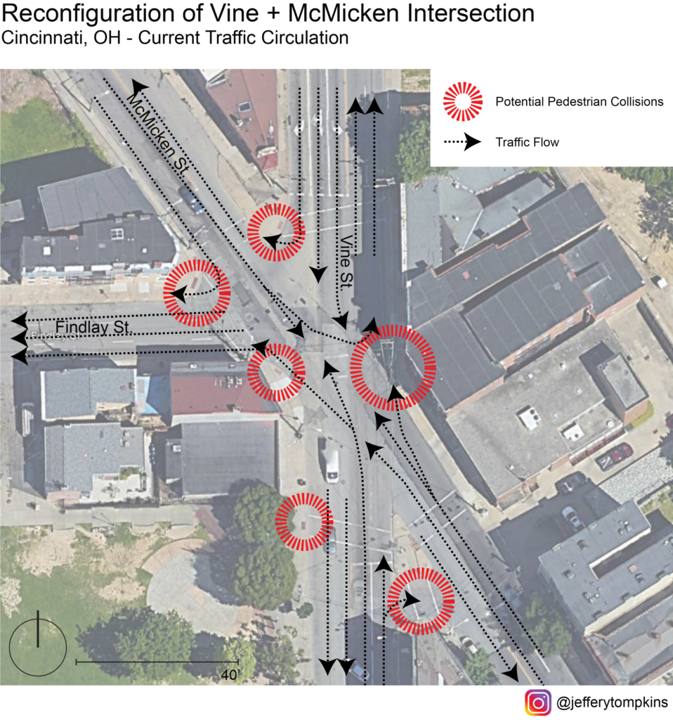
Seen from this map, the wide turn radii and allowance of multitudinous turning options fosters inhospitable conditions for peds, with several critical points ripe for accidents. On top of decreasing pedestrian safety, this wide array of turns also can negatively impact traffic flow and connectivity between adjacent neighborhoods. To fully reconfigure the intersection to allow for smoother traffic flow and safety, traffic flow of the corridor should be reanalyzed and possibly rerouted.
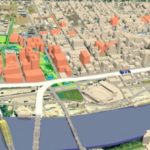
To allow for a complete-streets redesign of Vine/McMicken, my proposal eliminates left turns from McMicken onto Vine and removes right turns from Vine onto McMicken. North-bound traffic on Vine intending to turn right on McMicken would be rerouted to a new two-way Elder St. allowing for southbound travel. South-bound traffic on Vine intending to turn right on McMicken would instead be rerouted south to a two-way Elder and directed north-ward on a reconfigured two-way Race St. north of the Cincinnati streetcar connector, leaving the slip lane redundant. North-bound traffic from McMicken onto Vine would be routed south from Pace to Elder and then north on Vine. South-bound traffic from McMicken to Vine would instead utilize Elder as a conduit between the two streets. While this reconfiguration could create inconveniences for residents in the near-term, it is with a long-term eye toward saving pedestrian lives that makes it worth it. Atop this, the redesign hopes for slower traffic, improvements in overall traffic flow with elimination of one-ways, and a reduction in accidents.
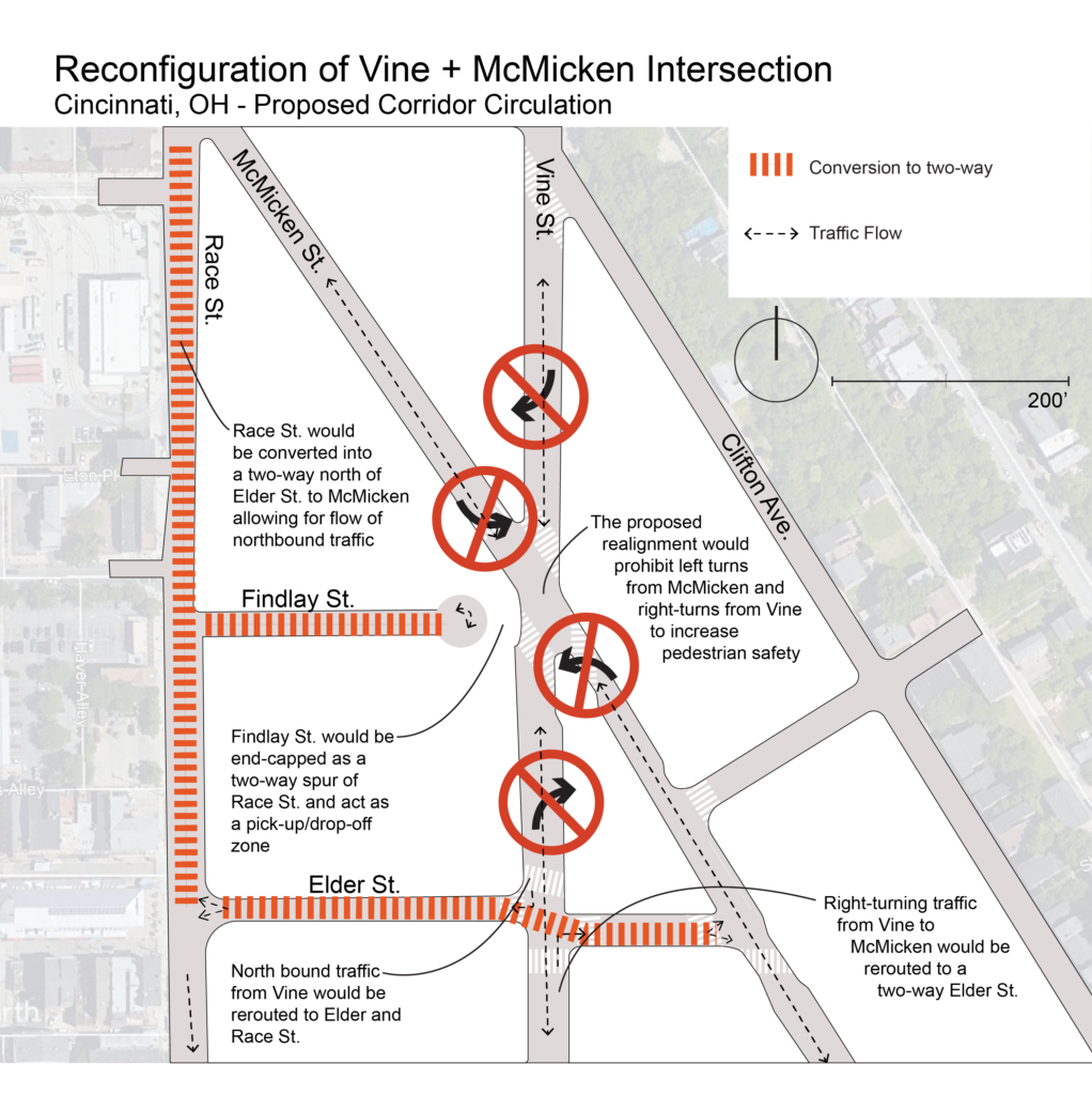
Aside from turn-regulation at the intersection, my proposal forVine/McMicken involves the capping of Findlay St. to eliminate the five-way and diminish incidence points. With this reclaimed space from the new configuration and removal of slip lanes, public space would be created, and pedestrian sightlines would be vastly improved at the new four-way intersection.
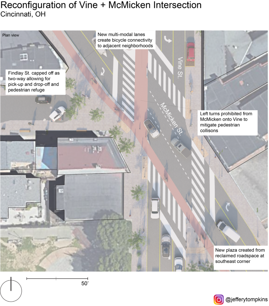
The new configuration calls for a reduction in vehicular space and the inclusion of multi-modal lanes catering to mid-speed travel (bicycle, scooter, powerchair, etc.) along Vine and McMicken. The reclaimed slip lane at the southeast corner would be reallocated as a public plaza and pedestrian sanctuary protected by bollards and activated by food carts or public art. A 6’ multi-modal lane along McMicken would improve connectivity for bicyclists along the corridor and offer a commuting solution for Over-the-Rhine residents. The 10’ multi-modal lane along Vine would take the place of the current right-turn lane and give a north-bound option for bicycle connectivity. One side of street parking would still be retained north and south of the intersection on both streets. The capped-off Findlay St. would become a possible pick-up and drop-off zone for rideshare and Uber/Lyft.

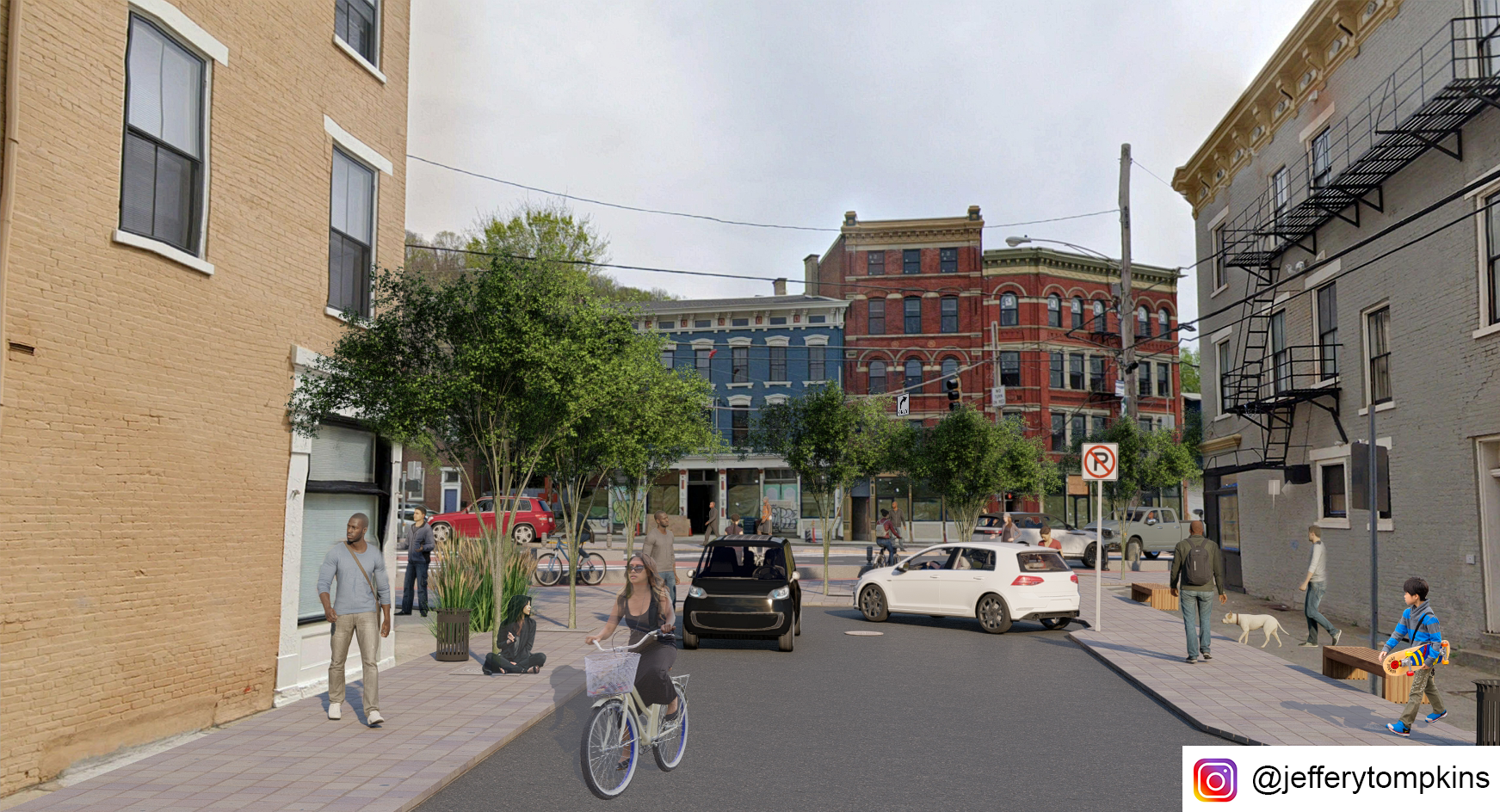
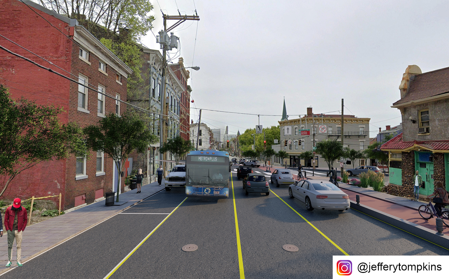
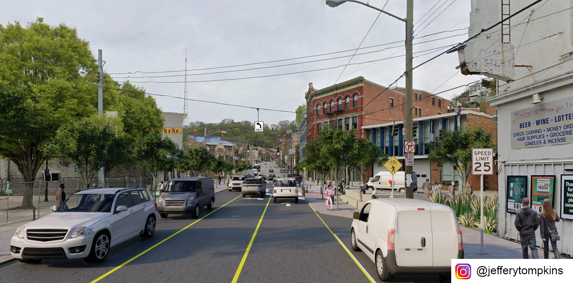
Looking southeast on McMicken Ave 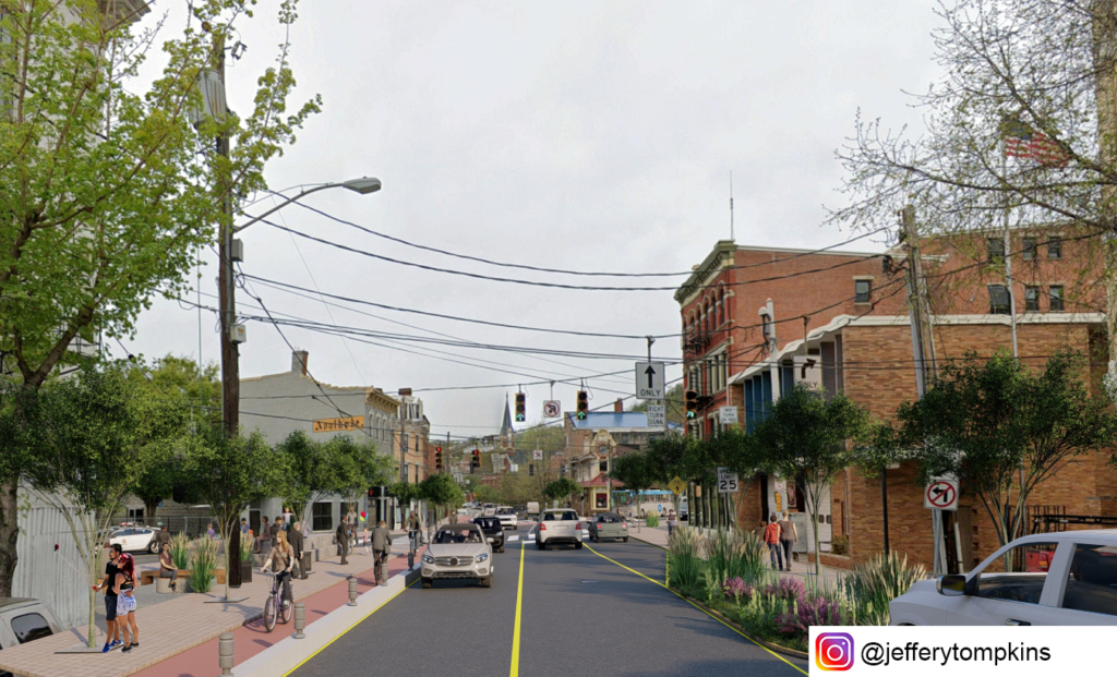
Looking northwest on McMicken Ave 
Looking east from Findlay Street 
Looking south on Vine Street 
Looking north on Vine Street
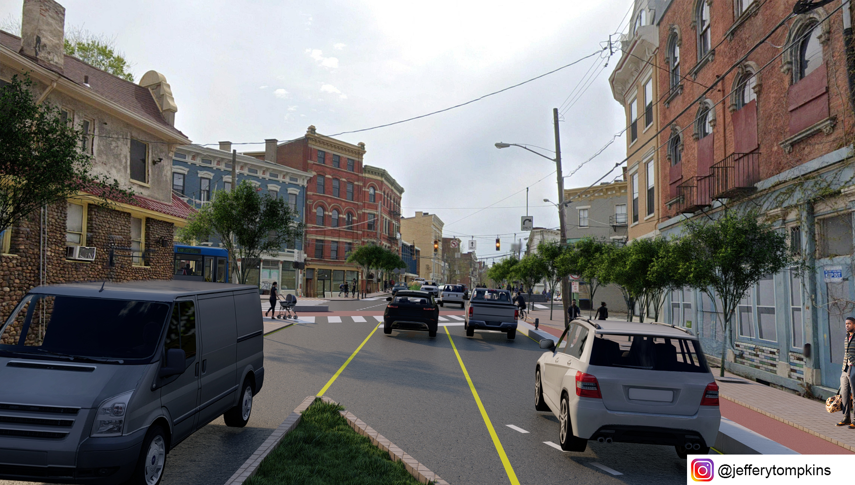

Aside from fostering pedestrian safety and increasing bicycling viability, the redesigned intersection vastly improves overall traffic flow with its reduction in turns. This may offset future rates of accidents. While the reconfiguration would affect bus routes 46 and 78 currently turning from south-bound Vine onto Findlay to get to Race St. SB, the new configuration would allow for bus travel on the newly designated two-way Elder St, with traffic stop bars pushed back to allow for bus travel.
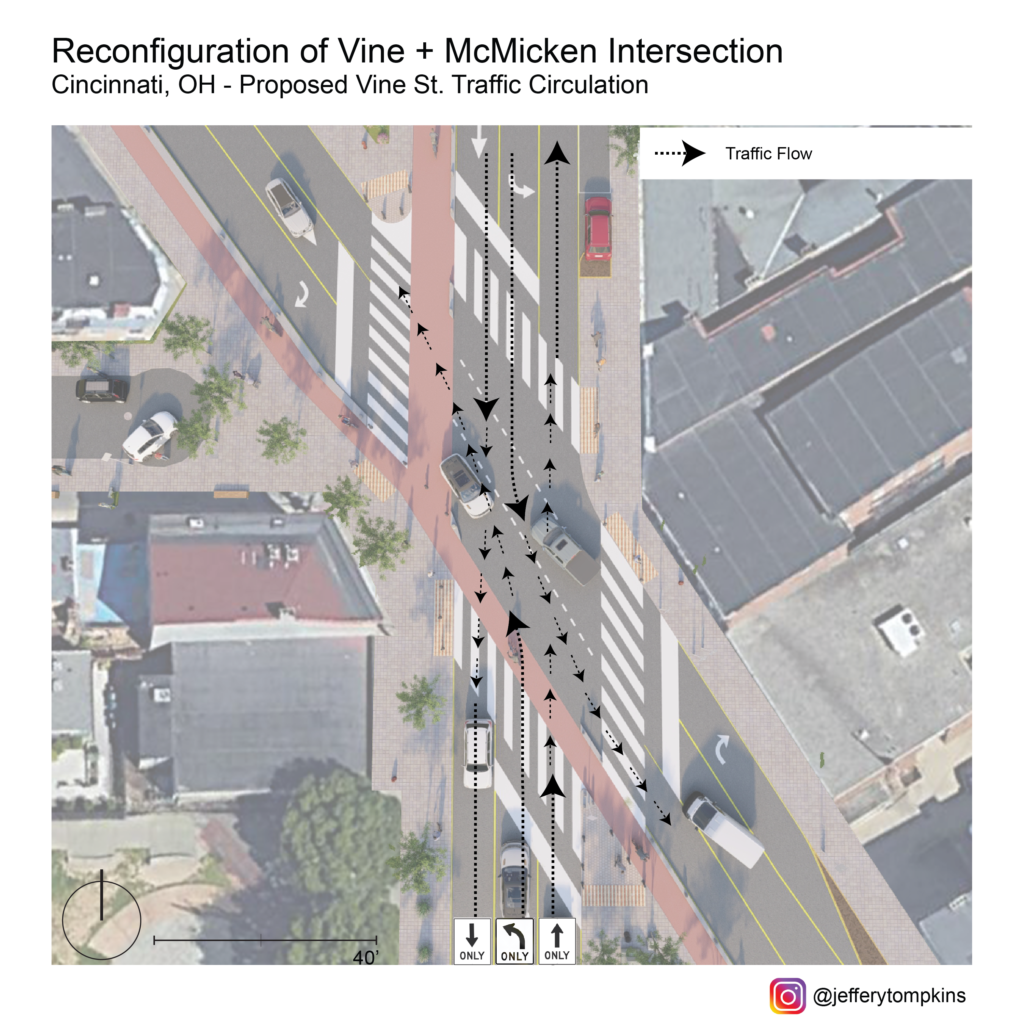
Vine Street Circulation 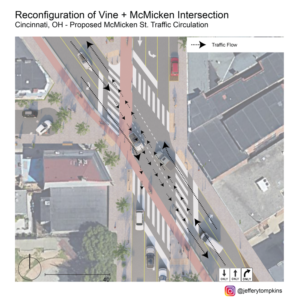
McMicken Ave Circulation 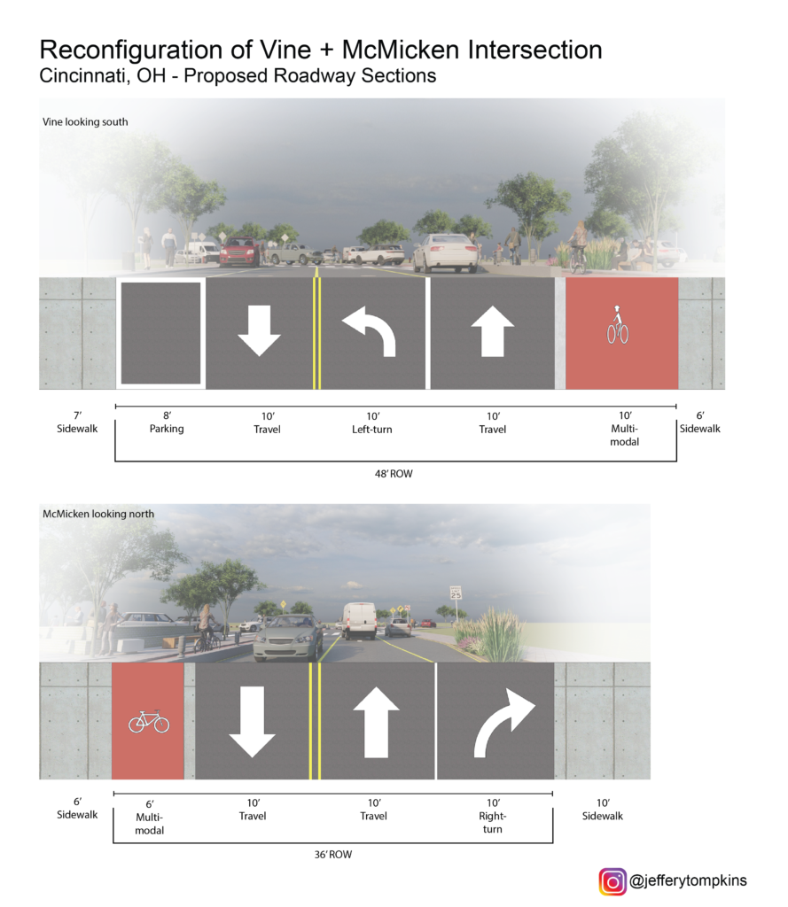
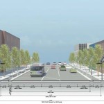
Street Cross Section
If you would like to have your thoughts and opinions published on UrbanCincy, simply contact us at editors@urbancincy.com.