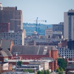
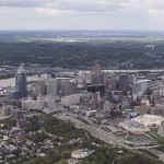
Six months ago, we reported on 11 residential developments moving forward in the Central Business District, Over-the-Rhine, and Pendleton. At the time, these were expected to add about 1,500 new units of housing to the urban core. Although one of these projects has been downsized and another postponed, one new residential project was announced as well.
Most notably, the proposed tower at Fourth and Race was downsized from 300 to 200 units, and the grocery store that would have been located on the ground floor of the building has been dropped from the plan.
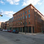
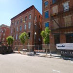
The Cincinnati Center City Development Corporation (3CDC) is also shelving its plans for a new mixed-use project at 15th and Race, which would have added 57 residential units. However, 3CDC is also shelving its plan to build 53,000 square feet of office space as part of the third phase of Mercer Commons, and is considering building more residential at that location. The first two phases of Mercer Commons contain 126 apartments and 28 condos in addition to retail space.
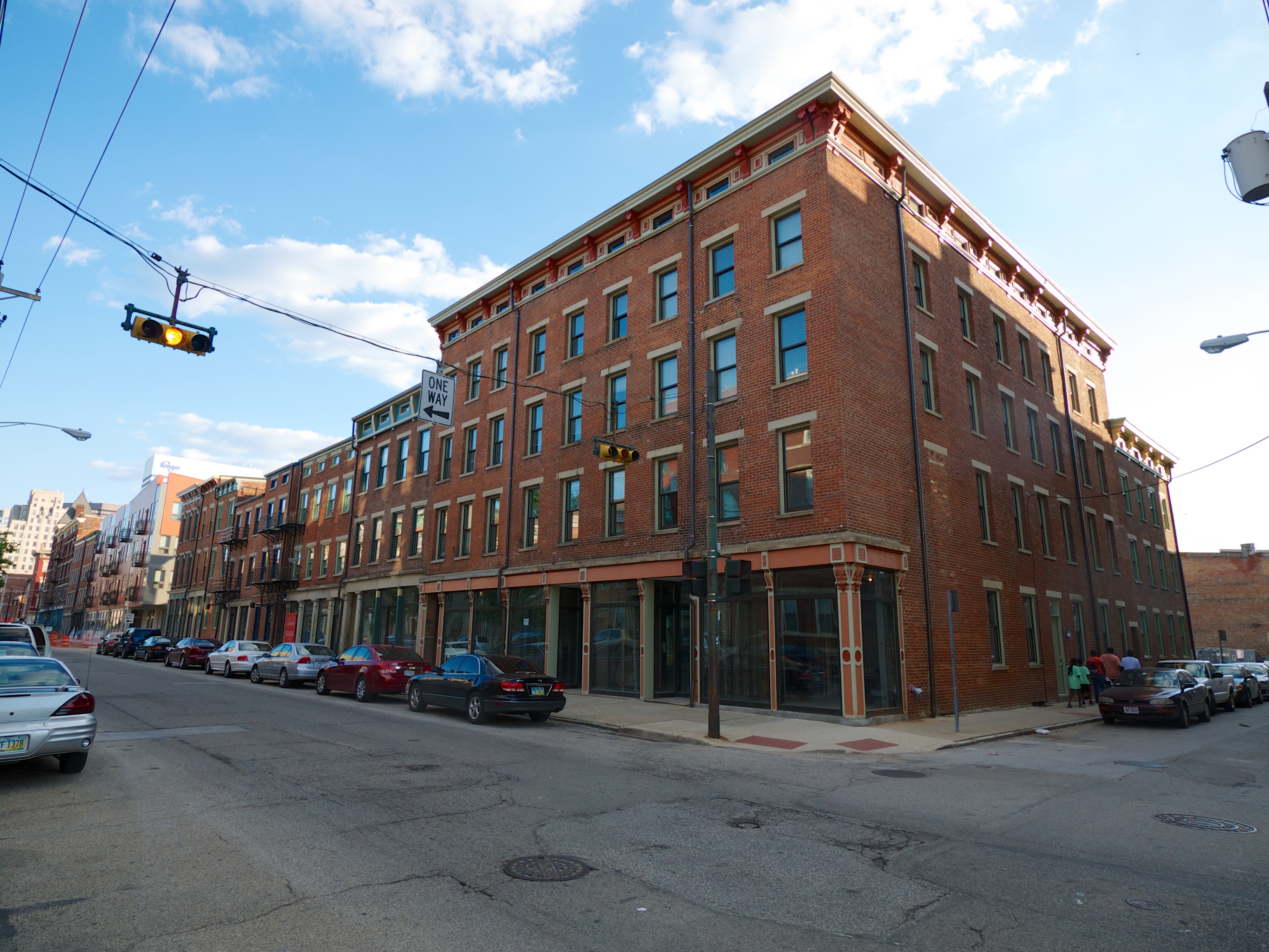
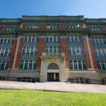
Finally, the proposal to bring an AC Hotel to the former School for the Creative & Performing Arts (SCPA) in Pendleton has been scrapped. Developers are now moving forward with an alternate plan, which will convert the building into 155 market-rate apartments.
Mercer Commons Phase Two
Mercer Commons Phase Two
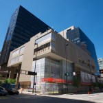
Schwartz Building
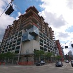
AT580
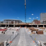
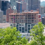
The Banks Phase Two
School for the Creative and Performing Arts
Broadway Square
Broadway Square
7th Street
Seven at Broadway
Seven at Broadway
The Banks and Dunnhumby Centre tower cranes
The other projects still moving forward include:
Phase two of The Banksbroke ground in April 2014. It will contain 305 new apartments and 21,000 square feet of retail space, in addition to a new office tower for General Electric.
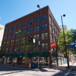
AT580, formerly known as the 580 Building, is being converted from office space into 179 apartments. The existing retail spaces on the first and second floors will remain.
The Seven at Broadway project will feature 110 high-end apartments, built above an existing parking garage. The target demographic for these units will be empty-nesters and older professionals looking for downtown living, according to Rick Kimbler, partner at the NorthPointe Group.
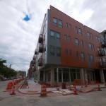
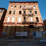
Broadway Square, a $26 million development, is now under construction in Pendleton. Its first phase will feature 39 apartments and 40,000 square feet of retail space, and developer Model Group will add at least another 39 apartments in the second phase of the project.
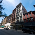
The Schwartz Building, formerly vacant office space, is being converted into 20 apartments. Developer Levine Properties cited the building’s location along the Cincinnati Streetcar route as a driving factor for the renovation.
The Ingalls Building will be redeveloped into 40 to 50 condos and ground-floor retail space by the Claremont Group.
Peak Property Group plans to purchase and renovate three buildings on Seventh Street into 75 apartments and 15,000 square feet of retail space.
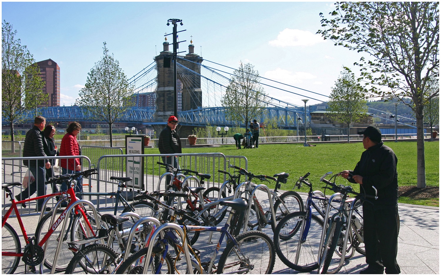
Bicycle Commuter at Moerlein Lager House [Randy Simes]
Research continues to show that Americans are driving less, but are biking, walking and using transit more. This is true in Cincinnati to the extent that transit ridership has increased in recent years.
While originally attributed to the economic downturn at the beginning of the century, these trends have continued while the economy has rebounded – leading many to believe it is an indication of new market forces being driven by aging Baby Boomers and emerging Millennials. Perhaps predictably so, governments have been slow to change with the changing economic forces.
Despite a growing number of trips for biking, walking and transit, funding has not increased correspondingly. In fact, many communities have seen funding for these non-automotive forms of transportation decrease as governments have worked to cut spending at all levels. This, new research finds, is only exacerbating the problem of having underfunded these modes of transportation for many years.
“Conventional statistics tend to under report active travel because most travel surveys under-count shorter trips (those within a traffic analysis zone), off-peak trips, non-work trips, travel by children, and recreational travel,” stated Todd Litman, Executive Director of the Victoria Transport Policy Institute, in a summary of his report entitled Whose Roads? Evaluating Bicyclists’ and Pedestrians’ Right to Use of Public Roadways.
Transportation Mode Share in Cincinnati Region [OKI]
“More comprehensive surveys indicate that active travel is two to four times more common than conventional surveys indicate, so if statistics indicate that only 5% of trips are by active modes, the actual amount is probably 10-20%.”
Litman indicates that funding levels tend to be much lower than even the low 5% trip share estimates, and recommends changing those levels to reflect not only the current trip share levels, but those that could be achieved should investments be made.
Unequal Funding Allocations at Regional Level
At the local level, the same situation of unequal funding allocation exists. In the 2040 Regional Transportation Plan, developed by the OKI Regional Council of Governments, approximately 88% of the nearly $21.5 billion in funding is recommended to go toward roadway projects, just 11% to transit and a mere 0.1% to bicycle and pedestrian improvements.
While the level of investment in transit appears closely aligned with current ridership levels for commute-related trips, it is far below ideal levels for bicycle and pedestrian investments.
“Relatively aggressive pedestrian and cycling improvement programs only cost about 1-4% of the total per capita roadway expenditures, or just 4-10% of general taxes spent on local roadways,” Litman contests. “Since walking and cycling represent about 12% of total trips, and a much larger share of short urban trips, and since most North American communities have under-invested in walking and cycling facilities for the last half-century, much larger investments in walking and cycling facilities can be justified to meet user demands and for fairness sake.”
OKI leadership contends that the organization’s regional planning document does not accurately reflect the level of investment being made in bicycle and pedestrian infrastructure, noting that many of the “roadway projects” in their plan actually include bike and pedestrian elements.
To that end, some recent improvements have been made with regard to bicycle infrastructure. The City of Cincinnati has installed around 40 miles of new on-street bike lanes or paths over the past several years, and has plans to install a total of 290 miles by 2025. The City’s Bicycle Transportation Plan, however, has been plagued by a lack of funding and has been relegated to only moving forward when roadway resurfacing projects emerge.
Not everyone is convinced, however, that enough is being done in terms of the overall investment needed for bike and pedestrian improvements.
Implications for Regional Transit
Of the money being recommended for transit investments, not including operations, approximately 96% is targeted for the contentious Oasis Line – a commuter rail line connecting Cincinnati’s far eastern suburbs with downtown.
Furthermore, the vast majority of OKI’s recommended transit funding is aimed to pay for ongoing operations – not pay for system expansions or improvements.
This grim financial picture for transit gets even worse when considering contributions from state and local governments.
In Kentucky, meanwhile, communities struggle with state law that prohibits any dedicated source of transit funding – thus forcing the Transit Authority of Northern Kentucky (TANK) to go before the state legislature every year seeking money, similar to how Amtrak must annually go before Congress.
Impact on Environmental Justice Populations
These dire funding and political situations have led to Greater Cincinnati taking the title of being the most populated region in North America without any rail transit; while even far less populated regions advance their own regional transit plans.
What makes the figures more troubling is that those most affected by the imbalanced funding appropriations are minority, low-income and disabled populations. While only 6% of the region takes transit, bikes or walks to work each day, that number escalates to 17% for African Americans, 11% for Hispanics and 10% for people with disabilities; while low-income commuters see that number spike to 21%. Quite simply, the lack of funding for non-automotive forms of transportation is most damaging to those who can least afford it.
Bicycle Commuter at Moerlein Lager House [Randy Simes]
The results of this inequality sparked a recent lawsuit by the ACLU of Wisconsin Foundation and Midwest Environmental Advocates filed a complaint against the Wisconsin Department of Transportation over a $2 billion highway interchange project. In MICAH & Black Health Coalition of Wisconsin v. Gottleib, the ACLU states:
“WisDOT explicitly refused to consider transit expansion (or transit in any way) as part of this proposal. This will further widen the already large gap between transit-dependent communities of color and disproportionately white suburban commuters. The ACLU of Wisconsin Foundation was one of the organizations that have complained about the government’s decision-making and reporting process, as well as how the project would exacerbate segregation and disparities in transportation access for low-income people to jobs.”
And while some of these mode shares may seem low, it has been noted by the U.S. National Household Travel Survey that commute trips are the lowest for walking and biking, while personal trips and trips less than one mile are significantly higher for both modes.
“In much of the region where we have large concentrations of EJ populations the sidewalk network is already quite developed, the roadway network is quite developed and available to bicyclists and the transit service is good,” countered Bob Koehler, Deputy Executive Director at OKI. “We do, as a community, need to do a better job at sharing the road and being aware of pedestrians to make these facilities better for all modes.”
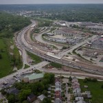
Highway Building Frenzy
Even though young people are increasingly either delaying or choosing not to get a driver’s license at all, user fees collected from the gas tax continue to decline, total vehicle miles traveled (VMT) has been decreasing since 2007 and annualized VMT has been decreasing for nearly a decade, the nation and Cincinnati region continue to build new capacity.
Of the roughly $8.3 billion being recommended for roadway projects in OKI’s planning documents, approximately 73% of that is targeted for additional lanes, new facilities or new interchanges, while reconstruction and improvements to existing roadways account for the rest.
I-75 Construction Work at Mitchell Avenue [Jake Mecklenborg]
“Although VMT may be slightly declining in recent years in some parts of the country this may not be a long-term trend. Clearly the region has many needs,” explained Brian Cunningham, Director of Communications at OKI. “This plan addresses the significant existing safety and congestion needs. The plan is updated every four years and will provide an opportunity to revisit the assumptions.”
Litman argues that shifting some of the investment from roadways to bicycle and pedestrian projects due to their proven ability to reduce congestion and improve safety not only for bicyclists and pedestrians, but motorists as well. He also believes that such policy directives empower people by giving them the ability to choose between multiple transportation options for each of their trips.
“It is important to recognize the unique and important roles that active modes [biking and walking] play in an efficient and equitable transportation system, and the various benefits that can result when walking and cycling are improved, including indirect benefits to people who do not currently use those modes,” Litman concluded.
“Just as it would be inefficient to force travelers to walk or bike for trips most efficiently made by motorized modes, it is inefficient and unfair to force travelers to drive for trips most efficiently made by active modes, for example, if children must be chauffeured to local destinations because their communities lack sidewalks, or if people must drive to recreational trails due to inadequate sidewalks and paths near their homes.”
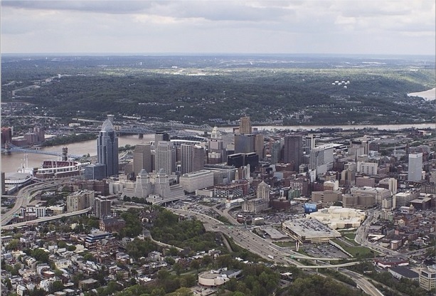
Existing and Potential Arena Sites [Brian Spitzig]
The Cincinnati region has an arena problem that is two-fold. The first part of the problem is that there is no stand-out venue that offers both the capacity and modern amenities to attract large-scale events. The second is that the region has far too many venues competing with one another.
Within a one-hour drive from Fountain Square there are eight arenas with a capacity of more than 9,000 people for their primary tenants. Of these, only three have been built or undergone major renovations since the year 2000. The lone major project currently on the books is the $310 million renovation and rebuild of Rupp Arena in Lexington, which also happens to be the furthest away of the eight venues mentioned.
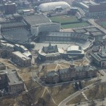
Fifth Third Arena on UC’s Crowded Campus [Brian Spitzig]
Fifth Third Arena [Randy Simes]
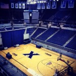
Cintas Center [Randy Simes]
Rupp Arena (23,500): Built in 1975 with minor renovations in 2001. Primary tenant is University of Kentucky athletics. Major renovation and rebuild planned for completion in 2017.
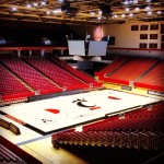
U.S. Bank Arena (17,566): Built in 1975 with a major renovation in 1997 and subsequent minor renovations. Primary tenant is the minor league hockey Cincinnati Cyclones team.
UD Arena (13,409): Built in 1969 with major renovations in 2002 and minor renovations again in 2010. Primary tenant is University of Dayton athletics.
Fifth Third Arena (13,176): Built in 1989 with several minor renovations since. Primary tenant is University of Cincinnati athletics.
Cintas Center (10,250): Built in 2000. Primary tenant is Xavier University athletics.
Cincinnati Gardens (10,208): Built in 1949 with no major renovations since its opening. Primary tenant is the amateur women’s roller derby Cincinnati Rollergirls team.
Bank of Kentucky Center (9,400): Built in 2008. Primary tenant is Northern Kentucky University athletics.
Millett Hall (9,200): Built in 1968 with no major renovations since its opening. Primary tenant is Miami University athletics (sans hockey).
Recent talks closer to the core of our region have revolved around either embarking on a major renovation of Fifth Third Arena, or building a new one altogether; and performing major renovations on U.S. Bank Arena. The problem with these two approaches, however, fails to address the two core problems with the region’s plethora of arenas.
Any discussion on this topic should be focused on creating a stand-out venue that is both large enough and offers the modern amenities needed to attract major events, while also decluttering the regional arena landscape.
Existing and Potential Arena Sites [Brian Spitzig]
To that end, UrbanCincy recommends building a brand new arena adjacent to the Horseshoe Casino at Broadway Commons that would become the new home for the Cincinnati Cyclones, Cincinnati Rollergirls and University of Cincinnati Men’s Basketball. This venue would also accommodate the existing events held at U.S. Bank Arena and should be built in a way that is conducive for casino operators to program additional events, such as boxing, at the venue.
As part of this plan, U.S. Bank Arena and the Cincinnati Gardens should be torn down, and Fifth Third Arena used as the multipurpose facility it was originally intended to be.
This location makes perfect sense with immediate access to the center city’s hotels and convention facilities, casino, streetcar system, highways and abundant parking. Such a plan would also allow for the current U.S. Bank Arena site to be redeveloped with additional housing and shops akin to what is being developed at The Banks.
The land left over at the Cincinnati Gardens site in Bond Hill could then be repackaged, with surrounding land, to be developed as part of community-driven master plan.
Aerial View of U.S. Bank Arena [Brian Spitzig]
Central Riverfront [Brian Spitzig]
Southeastern Downtown Cincinnati [Brian Spitzig]
As is often the case, funding is one of the primary hurdles preventing any of this from getting done. In this particular plan, each of the partners (University of Cincinnati, City of Cincinnati, Hamilton County, Horseshoe Casino) could contribute to the capital costs. Furthermore, value capture tools could be used for the U.S. Bank Arena and Cincinnati Gardens properties to help offset costs even more.
The last thing our region needs is another tax to pay for a sports or entertainment complex. Those scarce public resources should be reserved for more pressing things like improving our region’s transit network.
Our region’s political and business leaders need to think holistically when it comes to this challenge. Moving forward in a panicked and rushed fashion will get us an end result that does not solve the problems before us, and ultimately squanders public dollars.
Let’s build ourselves a modern arena venue that can attract top-level events, but do so without placing the burden on the taxpayers. Let’s also do so in a way that rids the region of some of its excess number of existing arenas, and frees up land to be redeveloped in a more productive manner for our neighborhoods.
There is a wealth of talent and C-Level executives in this region. Let’s get creative and start thinking beyond the sales tax. Let’s get this done.
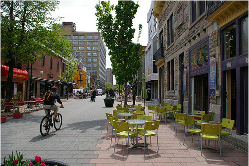
CNU22 featured speakers from all over the world, from Bogotá to Toronto to Brighton. One plenary speaker from Bristol moved the audience with an idea called Shared Space that was beautifully simple and innovative, yet entirely new to most of the crowd.
Ben Hamilton-Baillie is a British urban designer, “recovering” architect and self-taught in the area of transportation planning. His presentation focused on explaining Shared Space as an urban design technique that can alleviate the frequently problematic interface between pedestrians, cyclists, automobiles and the public realm.
As the name would suggest, Shared Space advances the idea that streets themselves can be a seamless part of public space that is shared by all users. The method came from the Netherlands, where Hamilton-Baillie studied under transportation engineer Hans Monderman and Joost Váhl, who developed the Dutch woonerfs where pedestrians and cyclists have priority on roadways.
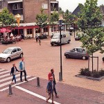
Woonerf in Madison, WI
The concept also integrates a thoughtful assessment of human psychology as it relates to driving. “It’s essential to understand the changing view of the nature of risk,” Hamilton-Baillie explained. “Hazards keep us aware of our environment and allow us to adapt our behavior.”
This seems counter-intuitive, but it was effectively explained through an example of two cities in the Tel Aviv region of Israel.
Bnei-Brak, located east of Tel Aviv, is composed of largely low-income, ultra-conservative Jews. Ramat-Gan, also located east of Tel Aviv, is home to a more moderate, middle-income Jewish population. Hamilton-Baillie explained that the people of Bnei-Brak are known throughout the region as being unruly pedestrians. Adults and children cross streets with disregard for traffic. Locals know that they must be vigilant when driving there.
Conversely, the residents of Ramat-Gan respect pedestrian rules, crosswalks, and jaywalk less frequently. Drivers are more at ease in Ramat-Gan.
Perhaps counter-intuitively, there is a higher instance of pedestrian fatality in Ramat-Gan. Drivers in Bnei-Brak tend to cautiously drive at lower speeds, aware that there is a greater risk of a pedestrian appearing in the road. One can see in this example that increased risk makes for more attentive drivers.
Shared Space utilizes risk in the form of mixing cyclists, pedestrians and motorists on streets, and relies on the idea that removing lines and signaling allows for social protocols to take over more strongly than signs. This, Hamilton-Baillie said, is called “friction”, or natural cues that guide a driver’s speed. There is already an increasing awareness in North America that things like narrow streets, street trees and buildings built to the right-of-way naturally induce drivers to reduce speed without a speed-limit.
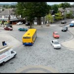
Woonerf in Drachten, Netherlands
One might think that this friction would create delays, but evidence from project implementation has found the opposite, as did Hans Monderman’s projects in the Netherlands. And post-project evaluations, like in Poynton, UK, have confirmed the efficacy of Shared Space designs.
Poynton is a city southeast of Manchester. It is a throughway for traffic between the two larger cities of Macclesfield and Stockport. In this instance, vehicles were found to be passing on the main thoroughfare at a rate of 26,000 per day, many of which were trucks. The initial approach to relieve congestion was the construction of additional lanes of traffic.
Shared Space, however, was applied as part of a regeneration scheme in Poynton. The first task for Hamilton-Baillie’s consultancy was to “remove every trace of traffic engineering.”
Three lanes of cars were reduced to one, signaling was removed, additional on-street parking was introduced, and sidewalks were widened. There was increased edge friction through vertical elements within the driver’s line of vision.
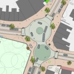
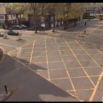
Main Intersection at Poynton, UK
Poynton Intersection Before
Poynton Intersection After
Even after the removal of two lanes and signals, traffic flow stayed the same and pedestrian traffic increased five-fold. Before the project, 16 of 32 shops in town were boarded up; but within one to two years after project completion, all shop spaces in the business district were occupied.
Streets were able to concurrently be part of Poynton public space and serve through traffic – the change in aesthetics was remarkable.
It is certain that freight and car movement is critical to the healthy functioning of any economy. This fact is not contested. But since civilizations started building cities, they have been venues for people to roam – sometimes at odds with our economic necessity to move people and goods through them quickly.
Fast big things and slow small things do not mix well.
Shared Space demonstrates that these seemingly incompatible users actually function better when mixed within the city fabric – cars move more fluidly when drivers are forced to react to their surroundings instead of their actions being dictated to them. People are safer, too.
The outcome is that streets become a different kind of public space, where mobility means interacting with one’s surroundings.
When asked if he thought famously impatient North American drivers could adapt to the concept, he paused for a moment and said, “Everywhere Shared Space has been applied, I was told that the drivers in the locale couldn’t adapt. In every case they did.”
As is the case with all SSOM events, this one will once again feature dozens of local arts and crafts vendors, local food and beer, live music, food trucks, street performers and more.
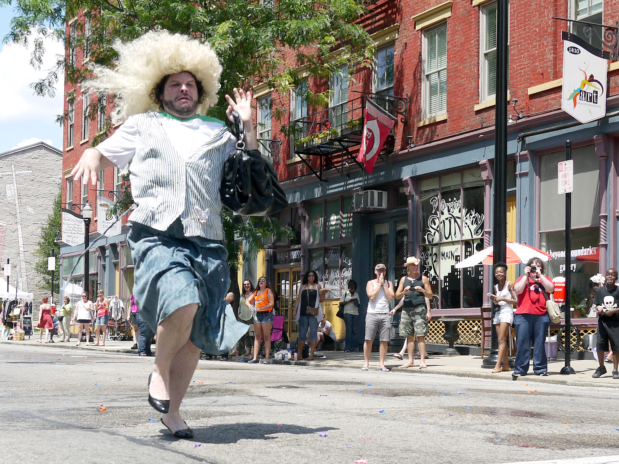
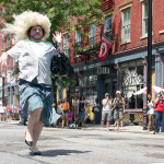
Second Sunday on Main Drag Race [Provided]
The event is free and open to the public, so even if you don’t have a bunch of cash to drop, you can swing through for a leisurely stroll and people watch in what is Cincinnati’s oldest and most prominent Open Streets events.
Each month event organizers change up the theme for SSOM; and this month’s event is called Pride on Main. To complement the theme there will be the Missed OTR Drag Queen Contest and the famous Drag and Tryke Races, both of which will have their proceeds go to benefit Pride 2015.
This is the ninth year the OTR Chamber of Commerce has put on Second Sunday on Main. For those who haven’t attended in the past, the event stretches from Thirteenth Street to Liberty Street along, you guessed it, Main Street. There are also small segments of side streets that are closed off and include some additional activities.
There will also be a cooking demo by Chef Jose Salazar and speciality cocktail demo by bartenders Andrew Rettig and Steven Clement at 2pm inside Mr. Pitiful’s. Throughout the day, Art on the Streets will also be working on a crosswalk painting project at Main and Liberty Streets.
A full schedule and list of music performers and other details can be found on SSOM’s website.
EDITORIAL NOTE: UrbanCincy is an official media partner of Second Sunday on Main; and is proud to support the city’s oldest open streets festival.