Categories
Development News Opinion

Redesigned Streetscapes Could Turn Fourth and Race Streets Into Vibrant Public Spaces

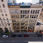
Fourth Street offers one of the more impressive urban street canyons in all of America. Its pre-war high-rises dominate the streetscape and offer a glimpse into the proud history of Cincinnati.

Once the very center of business activity, Fourth Street was historically known as the region’s financial district – a place where all the power players lingered and conducted business. Since its heyday in the early 20th century, that center of financial clout has shifted. Some say it has shifted to Third Street, while others say it has moved east along Fourth or even north to Fifth Street.

In any case, many of those power players are now in other nearby districts, while the impressive structures they built are left behind.

City leaders had believed, with good reason, that Fourth Street would become the region’s premier shopping destination. However, with the demise of downtown malls and department stores, that vision never fully came to be.

All has not been lost though. Virtually all of the impressive, historic urban fabric remains and has since been largely converted into residential space. There is also a movement afoot from some business and civic leaders to breathe new life into not only Fourth Street’s retail scene, but Race Street’s as well.

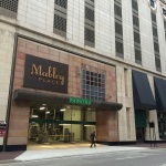
Part of the ongoing transformation includes Mabley Place, which converted the former Tower Place Mall into a parking garage with street-level retail, the proposed 30-story residential tower that would replace the aging Pogue’s Garage, and the nearby and soon-to-open dunnhumbyUSA headquarters tower.

There is even the possibility of Fourth Street being converted back to two-way traffic following the activation of the now unused ramp to I-75 from Third Street.

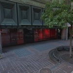
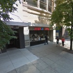
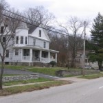
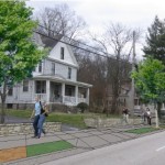
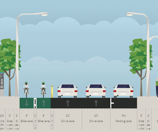
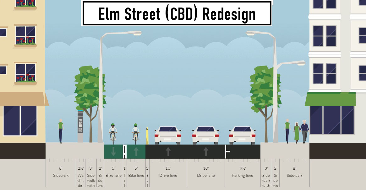
As all of these projects start to become reality, they offer a unique opportunity to redo the public space in the area. One particular area that has long needed a redo, and has been the subject of many studio projects at DAAP, is Fourth Street’s dated streetscaping. Not only does the design of the sidewalks, benches and street trees leave much to be desired, they also do not follow standard good design practices.

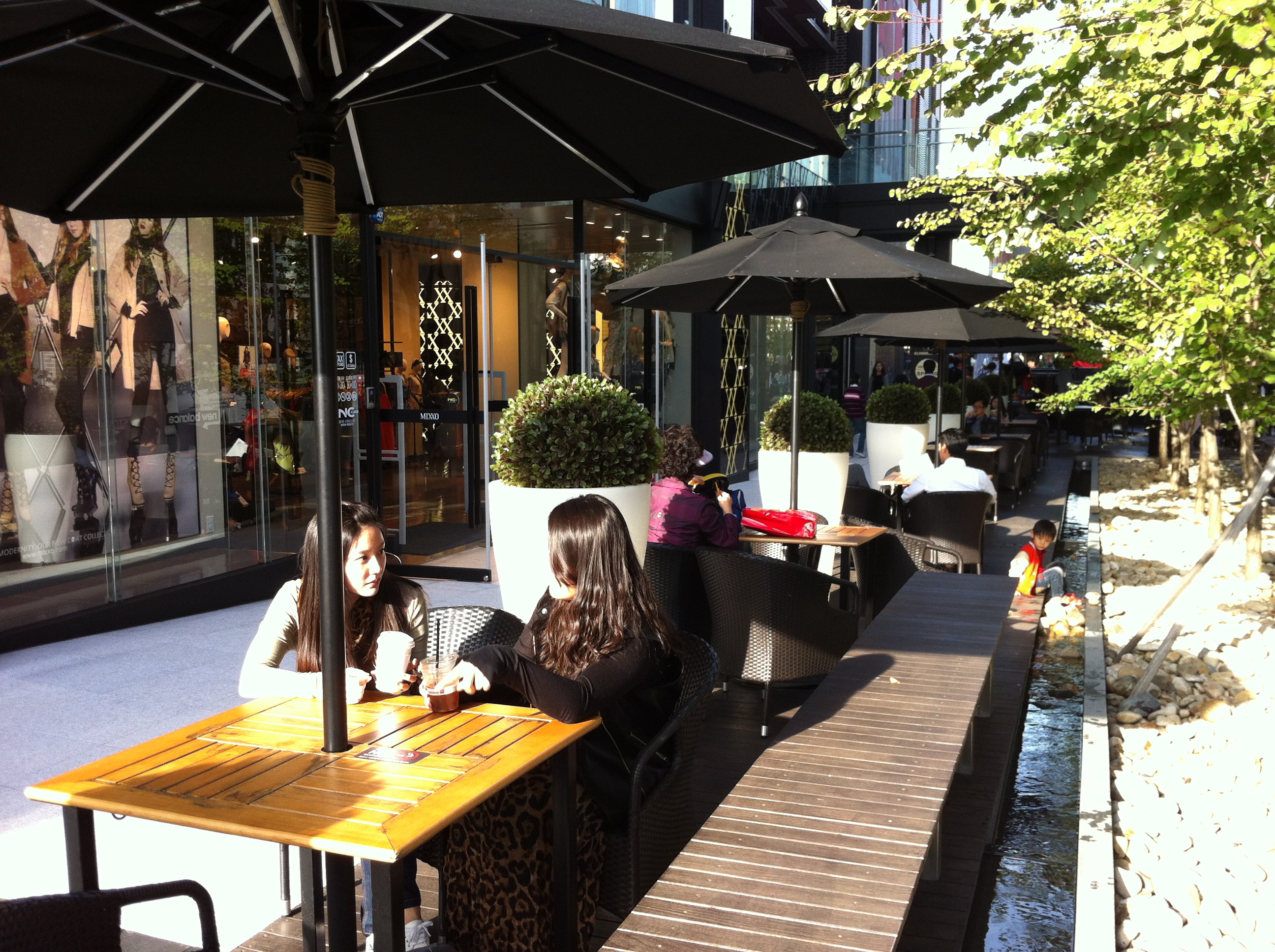
The renovation of Fountain Square realized this and implemented good urban design practices in its final product. Things like softscaping and movable furniture are powerful elements to a good public space. The same could be done along Fourth Street’s, and for that matter much of Race Street’s, wide sidewalk widths.

Being in the midst of the digital age, it would also make sense to make the area more welcoming to tech users by implementing Internet hot spots and including solar-powered charging stations at benches and tables set up along the street.

Specifically, the areas best suited for such a transformation would be the north side of Fourth Street between Vine and Elm, and the east side of Race Street between Fifth and Seventh.

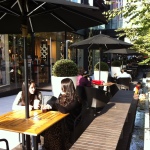
With more and more hotels opening up downtown in general, and specifically on or very near Fourth Street, this public space could also serve as a convenient and desirable ‘third place’ for travelers that are looking to spend some time out in the city, without feeling obligated to purchase endless cups of coffee or beer, but not also be trapped inside their hotel room.

Such a design could also activate the largely lifeless corridor with people from all backgrounds, and provide more passing customers for existing and potential businesses looking to setup shop there.

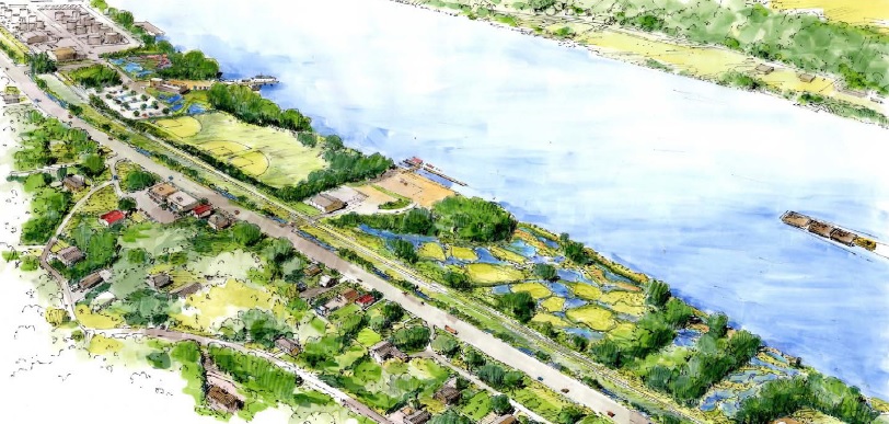
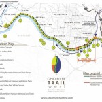
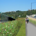
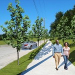
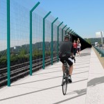
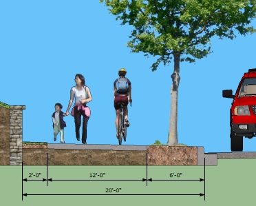
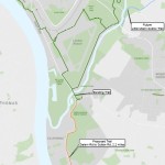
With all the construction taking place and about to get started, it would make most sense to leverage these private investments to improve this public space at the same time. Heck, it might even be the perfect opportunity to connect the new Central Parkway Cycle Track with the Ohio River Trail.

Categories
Month in Review

Month in Review – September 2014

Afghan Whigs-5
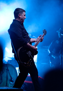
This month has been full of news about the new Cincy Red Bike system, the Ohio River Trail, and a proposed residential parking plan for Over-the-Rhine. UrbanCincy also looked into the history of the MidPoint Music Festival and how it evolved along with the city itself. If you missed any of them, check out UrbanCincy’s top five stories from September 2014:

  1. EDITORIAL: Cincinnati Should Embrace John Cranley’s Residential Parking Permit Idea
    UrbanCincy recommends identifying what the market rate for parking is throughout the city and establish districts where on-street residential parking permits can be purchased.
  2. With Membership Rates Set, Cincy Red Bike to Begin Operations Monday
    All of the 260 bikes and 30 stations throughout Downtown and Uptown are now up and running.
  3. Ohio River Trail Project Moving Westward from Center City
    While oft-viewed as an industrial stretch, it is a little known fact that Cincinnati’s western riverfront is actually one of the region’s largest green corridors with riverfront parks and wooded hillsides.
  4. Cincinnati Gentrified at One of Nation’s Fastest Rates Immediately Following Housing Boom
    “Another interesting case is Cincinnati, which barely changed in income ranking from 2000 to 2007 but has increased at a pace similar to Denver or Washington during the 2007 to 2010 period.”
  5. As Over-the-Rhine Evolves, So Does MidPoint Music Festival
    Unlike music festivals that take place in empty fields, like Bonnaroo and Lollapalooza, MPMF lives and breathes within Cincinnati’s urban core.


Categories
Development News Transportation

Ohio River Trail Project Moving Westward from Center City

For those coming from the west side along the Ohio River, Cincinnati’s western riverfront serves as a bit of a welcome mat. However, after losing residents and jobs since mid-20th century, many in the area believe now is the time to rethink this historic area.

While oft-viewed as an industrial stretch, it is a little known fact that Cincinnati’s western riverfront is actually one of the region’s largest green corridors with riverfront parks and wooded hillsides. And just a few feet down from the busy streets and railways, there is a different Cincinnati – one community leaders believe has the potential to serve as a national example of environmental stewardship and urban recreation.

Perhaps the biggest asset this area boasts is the Ohio River with its views and access to unique amenities. The existing amenities offered by the river and surrounding hillsides, combined with potential amenities from a string of riverfront parks, have the ability to create a powerful attraction for new residents and jobs. It is because of this potential that community leaders see so much value in Ohio River Trail West, which is part of the city’s larger Western Riverfront Plan.

The proposed three-segment first phase of Ohio River Trail West. formerly known as the Western Riverwalk, ties together the reconstruction of the Waldvogel Viaduct, ongoing redevelopment in Lower Price Hill, and repurposing of the former Hilltop Concrete property into a park.

URS estimates that the first two segments within the first phase of work will cost approximately $1.3 million and build upon the much larger Ohio River Trail. This particular phase of trail would extend roughly 3.7 miles downriver to the Gilday Recreation Center.

The biggest of these three pieces of the puzzle is the $55 million reconstruction of the Waldvogel Viaduct. As part of the planning and engineering of the new viaduct, there will be improved views and access to the river from Lower Price Hill. Once the viaduct’s construction is complete, more than 16 acres of riverfront property will become accessible at the former Hilltop Concrete site, which had once been planned for a new rail-to-barge shipping facility, and will now become Price’s Landing.

The combination of all these ongoing efforts creates the possibility for a dramatically different future for the long-troubled Lower Price Hill neighborhood.

Olyer School – an architectural treasure and a foundation of the Lower Price Hill community– recently underwent a $21 million dollar renovation; and the reconstruction of the Waldvogel Viaduct will reconnect the neighborhood to the river for the first time in over 60 years.

Meanwhile, the western end of the first phase of Ohio River Trail West is the Gilday Recreation Center, which will support the trail through its current configuration and planned upgrades.

It is estimated that the stretch of properties between the former Hilltop Concrete site and Southside Avenue are controlled by no more than five entities, and project planners have already secured roughly 70% of the right-of-way needed for this first phase of work.

So while ownership and access are typically major hurdles for projects of this variety, proponents are particularly excited that all of the needed right-of-way required for the first phase of work is either controlled already, or is vacant and potentially available for the new trail. Furthermore, each endpoint is owned by the City and will be able to provide both access and parking for future users.

The efforts to make this plan a reality were given a boost by former Cincinnati Mayor Mark Mallory (D) when he delivered his final State of the City Address and made the western riverfront a key component of that speech.

“If you think about the proposed investment here…this could serve as a landmark development for the west side of Cincinnati,” Mallory stated.

The efforts were then given another jolt in April 2014 when current Cincinnati Mayor John Cranley (D) allocated $250,000 to the project for ongoing engineering work, and pledged to support the project going forward.

There is currently no timetable for phase one construction activities, but project proponents hope to finalize engineering work and secure construction funding for phase one over the next year or so.

Categories
Development News Transportation

Cincinnati Aims to Break Ground on Next Phase of Ohio River Trail in June 2017

City officials are advancing the designs for the next phase of the Ohio River Trail. The 2.2-mile segment will run from Salem Road to Sutton Road in Cincinnati’s California neighborhood on its eastern riverfront.

Project and community leaders are excited about the work because it will fill in a gap in the Ohio River Trail that will eventually stretch 23 miles from Coney Island on the east to Sayler Park on the west. The project will also represent an approximate 50% increase in the number of completed miles of the Ohio River Trail.

While designs are still being finalized, city officials presented a conceptual design and the preferred alignment with the public at an open house held on March 25.

The designs call for a shared use, asphalt path for bicyclists and pedestrians that is 12 feet wide. There would be a six-foot setback from the road, and the path would essentially function as an extra wide sidewalk in order to avoid taking any right-of-way away from automobiles.

The preferred alignment for the shared trail would run along the eastern side of Kellogg Avenue and go through the California Woods Nature Preserve. The pathway would pass underneath I-275 at the foot of the Combs-Hehl Bridge.

Project officials say that they will take feedback given during the recent open house into consideration when developing final designs, and formulate construction cost estimates. The next public meeting will take place in October.

If all goes according to plan, detailed design work will be complete by October 2016 and construction will begin in June 2017.

Categories
Development News Transportation

Elm Street Cycle Track Would Provide Critical Link for Region’s Bike Infrastructure

The city will start construction on physically separated bike lanes along Central Parkway, from Downtown to Clifton, this coming spring. Following a community engagement process, a final design was selected in recent weeks, and the large addition to Cincinnati’s bike network is expected to make a significant impact.

Not only will it be one of the most impressive bike facilities installed in the region to-date, but it will also link neighborhoods together that have large percentages of bicyclists. Furthermore, it will link other bike facilities with one another, and come close to linking even more.

Some of the existing facilities include numerous bike lanes and the Mill Creek Greenway, but the Central Parkway bike lanes will come about 12 blocks shy of connecting with the Ohio River Trail, which then links to the Little Miami Scenic Trail.

A two-way cycle track should be built in order to connect the new Central Parkway bike lanes with the Ohio River Trail and beyond.

Elm Street Cycle Track

There are two streets that connect from Central Parkway to the Ohio River Trail along Mehring Way without interruption: Main Street and Elm Street. Both of the streets have one-way traffic heading northbound, but Main Street is considerably more congested with cars and buses heading to Government Square.

Elm Street, however, has some of the least congestion of any north/south street in the Central Business District and could easily connect the Central Parkway cycle track with the Ohio River Trail. A reorganization of the street would need to occur however.

Presently Elm Street, from Central Parkway to Mehring Way, lacks consistency in its design with on-street parking located haphazardly along both sides of the street. A reconfiguration of the street could consolidate all on-street parking to the east side of the street, thus eliminating only a nominal number of on-street parking spaces, and maintain 2 to 3 moving traffic lanes (the parking lane could be restricted during rush hours to allow for a third travel lane).

The Elm Street cycle track, meanwhile, would be located along the west side of the street and be buffered from moving traffic by a row of bollards. Such a redesign of Elm Street would be a bit of a road diet, but one that seems reasonable for this stretch of overbuilt roadway.

Planners with the City’s Department of Transportation & Engineering (DOTE) said that the idea of an Elm Street cycle track had not come up before, and has not been presented to any formal committees or community councils to-date. Such coordination, they say, would need to take place prior to the idea moving forward.

With future phases of The Banks and the yet-to-be-named residential tower on Fourth Street set to begin construction soon, there seems to be an opportunity to rebuild this roadway along with those projects. This would help offset some of the costs and make for a more seamless transition.

Projects like this are low-hanging fruit for the new mayor and council, should they wish to pursue investments that improve the city’s bike infrastructure. They should work with the bike community and come up with a strategy that provides a clear path forward to make this happen.

An Elm Street cycle track like this would provide a critical link in the region’s bike network, make the street safer, more accommodating to more users and more attractive to those who currently find themselves along the now bleak and desolate stretch of roadway. Let’s get to work.