Hopefully you are ready to learn all about support structures and geothermal, because the latest video update for the $120 million Smale Riverfront Park goes into great detail about both topics. It also reveals some new information about upcoming features at the park.
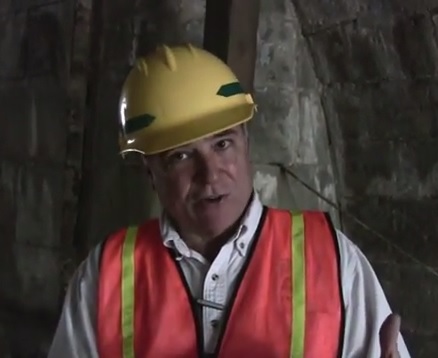
The first half of the 13:30 video focuses on the intricate details involved with some of the most mundane work taking place at the site. Project manager Dave Prather does a good job, however, at illustrating just how important that work is.
The more intriguing pieces of information are saved for the second half of the video. During that portion, Prather reveals details about the fog feature at the Heekin/PNC Grow Up Great Adventure Playground, which is scheduled to open to the public in spring 2014.
Prather also discusses that the Cincinnati Park Board has control of the anchorage under the John A. Roebling Suspension Bridge. Dating back to the Civil War, the inner structure, he says, will be opened to the public in some way. Details have not yet been finalized for how they will utilize the area, which is in the flood plane, but Prather expects to be able to make an announcement in time for the next video update.
City and park officials aim to complete the 45-acre central riverfront park by mid-2017, assuming all remaining financing falls into place.
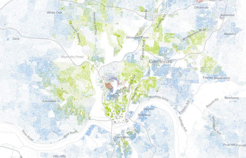
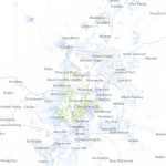
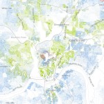
On their map each dot was assigned one of five colors based on the racial and ethnic affiliation. Whites are blue; African-Americans, green; Asians, red; Hispanics, orange; and all other racial categories are coded as brown. Cable used publicly available 2010 data from the U.S. Census Bureau.
When viewed in its entirety from afar, the map makes cities look like integrated places with a merging of all the colors to create a purple shade. This, however, is not the most accurate portrait of the racial segregation found throughout American cities.
When viewing Cincinnati at a more detailed level, for example, one can see the clear separation of White, Black, Hispanic and Asian populations.
The dots are evenly distributed throughout their assigned Census Block, so some dots (or people) appear to be living in areas where they cannot (i.e. parks, water, streets).
The specific areas of interest inside Cincinnati city limits are several Uptown neighborhoods where a dense cluster of Asian individuals live, and the Lower Price Hill and East Price Hill area where a small concentration of Hispanic individuals call home.
When looking elsewhere around the region it is also interesting to observe the Hispanic population cluster in Butler County near in and around the City of Hamilton.
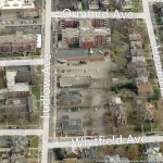
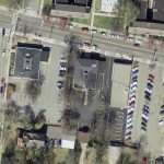
The stretch of Ludlow Avenue from Whitfield Avenue to the west to Ormond Avenue to the east has a decidedly suburban form different from the rest of the gaslight district between Ormond Avenue and Clifton Avenue. This western stretch is part of a two-block commercial main street that is arguably the “most complete neighborhood commercial district in the city,” according to Aaron Renn.
Just being a commercial main street, however, has not been enough to preserve the pedestrian-oriented nature of the street for the entire western half of the district on the south side of Ludlow, and a key gap on the north side of Ludlow at Ormond.
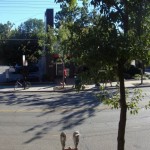
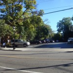
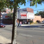
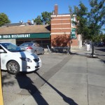
The southern stretch could be described as the Clifton financial district. Between Whitfield and the CVS are three banks – US Bank, PNC and Columbia Savings Bank – all with their own independent access and parking lots surrounding the buildings.
Looking East
Bank and CVS parking and access, notice the loss of onstreet spaces compared to north side of street
Columbia Savings Bank
PNC (left) and US Bank
North side of Ludlow at Ormond
The oddity is not that banks have their own access and parking, but that you have auto-oriented suburban development on a historic commercial main street. This is not a unique problem, but a pedestrian streets ordinance, perhaps modeled after Chicago’s, could help correct faulty land use decisions like this one.
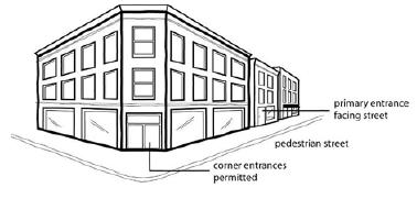
The theory behind such an ordinance is that you have an A and B street hierarchy, with A streets having a high standard of spatial definition and pedestrian interest in a continuous network, and B streets having lower standards for parking lots, drive-thru’s, muffler shops, etc.
This is a neoliberal approach typical of New Urbanism, It compromises for many areas and gives businesses a design choice based on location: a pedestrian main street (A), or an auto-oriented B street.
Chicago’s pedestrian streets ordinance seeks “to preserve and enhance the character of streets and intersections that are widely recognized as Chicago’s best examples of pedestrian-oriented shopping districts. The regulations are intended to promote transit, economic vitality and pedestrian safety and comfort.”
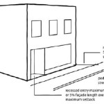
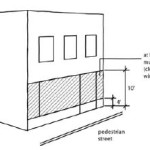
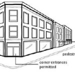
The ordinance then sets the criteria for the pedestrian street designation, lists all street segments within the city that have been deemed pedestrian streets subject to the ordinance, and sets standards for build-to lines, transparency and pedestrian access.
Of particular importance is what it says about parking and driveways:
Parking Location. All off-street parking spaces must be enclosed or located to the rear of the principal building and not be visible from the right-of-way of a pedestrian street.
Driveways and Vehicle Access. Vehicle access to lots located along pedestrian streets must come from an alley. No curb cuts or driveways are allowed from a pedestrian street.
If this the stretch of Ludlow Avenue had a pedestrian streets ordinance, at such time these banks wish to make improvements or redevelopment, these standards would then kick in and require the banks to reconsider their vehicular access, possibly to the point of eliminating driveways and consolidating parking and access off Whitfield.
More realistically, however, the ordinance would help guard other commercial main streets from the auto-oriented nature of drug stores, banks and restaurants without the need for a short-term Interim Development Controls (IDC) district or historic district protections.
It turns out that while China has been gaining ground, it still has a long way to go to catch up with America’s economic prowess. In fact, recent numbers show that the 30 largest metropolitan areas in the United States, alone, have a higher GDP than China. When looking at Ohio, Cincinnati, Columbus Cleveland ($320 billion) tally a combined GDP just higher than Denmark ($314 billion) and just lower than the United Arab Emirates ($359 billion). More from Business Journals:
A recent Pew Research Center survey of 38,000 people in 39 nations found widespread expectations that China will soon surpass the United States. Respondents in just six of those 39 countries are still placing their bets on the U.S. The current numbers, however, suggest something different.
China’s total output of goods and services, better known as its gross domestic product (GDP), climbed to an impressive $8.23 trillion last year, according to the latest estimates from the International Monetary Fund. But the United States is still far in the lead with GDP of $15.68 trillion, roughly 90 percent higher than China’s total.
The City of Cincinnati unveiled the official design of the streetcar to supporters in a gathering in Over-the-Rhine. With standing room only, crowds filled the Christian Moerlein Brewery with anticipation of the mystery to be revealed by Mayor Mark Mallory (D). The UrbanCincy teamwas there to film the event:
Daffodil Yellow, which actually looks closer to light orange, was selected as the primary exterior color based on a recommendation from a panel of 20 community members, which was then presented to the mayor for the final say.
Fade resistance and easy maintenance were deciding factors, city officials say, in addition to the overall design aesthetic. Inside the vehicle, Capri Blue seats provide a burst of modern color to the soft grey and stainless steel accents. Interior side panels highlight the walls with a matching shade of light orange.
Each of the streetcar vehicles will be capable of carrying 154 passengers at a time and will include a total of 32 seats, six of which fold up to make room for wheelchairs, strollers and bicycles.
New Color Scheme Rendering
Interior of Cincinnati Streetcar
One of the most noteworthy elements of Cincinnati’s rolling stock is that they will be the first light rail vehicles in North America to have 100% curb-level boarding at every stop. The manufactures say that curb-level boarding allows for easy, independent access for seniors and people with disabilities.
In contrast to a bus, which has a maximum capacity of 38-50 people, a person with mobility issues can enter and ride the streetcar without needing assistance from the driver to lower a platform and secure their wheelchair with straps. This feature is also beneficial for people with walkers, strollers, luggage and small children.
Attending the presentation were representatives from CAF USA, who was the winning bidder to manufacture five vehicles for Cincinnati’s streetcar system, and now five more vehicles for Kansas City as it piggybacks on Cincinnati’s order.
“We are so proud to be building your streetcar, which for us, is going to be a showcase,” said Virginia Verdeja, Vice President of Sales, CAF USA. “So many cities are looking at what’s happening here in Cincinnati. Our business is grateful to be part of a city that is the leading model for new streetcar systems around the nation.”
Meanwhile streetcar construction along the route continues to progress. Utility relocation is moving forward at various locations along the route and demolition is complete at Race and Henry which will allow crews to begin construction of the Maintenance and Operations Facility. Finally, city officials have disclosed that streetcar track is expected to begin tomorrow with the first section being installed along Elm Street in front of Music Hall.