Categories
News Transportation

Streetcar project expands with new funding

UPDATE: The Fiscal Year TIGER III grants have been released, and it is official: The Cincinnati Streetcar has received funding to complete Phase 1 with the Riverfront Loop. Along with a transit building upgrade in Cleveland, the Cincinnati Streetcar project was the only other Ohio project to be awarded money. Out of 848 applicants, the project was one of 46 to move forward with funding.

Undisclosed Congressional sources notified UrbanCincy Monday that the shovel-ready Cincinnati Streetcar project will receive 10.9 million dollars in funding from the federal TIGER III grant. As reported earlier in November, the city applied for $58 million in funding through the program, to restore the project to its original aim of connecting the Uptown and Downtown employment centers. The $10.9 million will potentially be able to expand the adjusted route down to the Banks.

“This TIGER III grant was awarded on a competitive basis and shows that the Cincinnati Streetcar is one of the best transportation projects in the country for generating economic development and putting Cincinnatians back to work,” said CincyStreetcar blog founder and local transit expert Brad Thomas.

Over $50 million of the project’s original funding was cut by Governor Kasich’s office in April for other much lower ranked projects, including a bus line in Canton, Ohio.

According to Transportation Issues Daily, no other cities in Ohio have received funds from the grant. However, TRAC director and former asphalt lobbyist Jerry Wray wrote a letter of recommendation for a TIGER III grant to widen 3.75 miles of roadway in Pickaway County, Ohio. Despite major pushback at the state level, local support has never been stronger with the new election of 7 pro-streetcar council-members.

Council-member, OTR resident and ardent supporter Chris Seelbach told UrbanCincy, “IF the news is correct, as the Business Courier is reporting, then it’s great news! The goal was always to connect Cincinnati’s two biggest job centers, downtown and uptown. Only when Governor Kasich cut the State’s funding was the route shortened. I’m hopeful this new funding source will again allow us to have fixed rail from the stadiums to the University of Cincinnati and hospitals, and everywhere in between.”

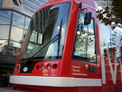
Cincinnati Streetcar picture by 5chw4r7z.

Categories
News Transportation

SORTA holding public forum to discuss service changes Friday

SORTA, the Southwest Ohio Regional Transit Authority (also known as Metro), has proposed three service changes as part of a “rebalancing” effort that will see existing resources shifted to different routes that promise higher ridership. This week the organization is holding a public forum for citizens to comment on the changes.

A new express service from Western Hills to Uptown will be funded by cutting non-rush hour service on the #1 Museum Center – Mt. Adams – Zoo. Although the Zoo can also be reached by the #78, the #1 bus provides Metro’s only access to Union Terminal and Mt. Adams. [see route]

SORTA has also proposed the elimination of the #62 Job Connection and #62X, which link Government Square with industrial parks in Butler County. These routes will be replaced by an extension of the #23X Tri-County Express north to Fairfield. [see route]

The route reorganization was recommended by the Butler County Regional Transit Authority, which funds the lightly patronized routes. BCRTA funding will be shifted to the proposed extension of the #23X Tri-County Express, which currently operates entirely within Hamilton County.

This situation highlights why Cincinnati Metro is unable to expand suburban express service: those routes which serve exurban Butler, Warren and Clermont Counties must be funded by their respective transit agencies.

Cincinnati Metro is itself funded primarily by a .3% income tax paid by those who work within Cincinnati city limits. This tax was approved by Cincinnati voters in 1973, and was intended to temporarily fund the bus system until funding for a countywide system was secured. Hamilton County property or sales taxes that would have funded a countywide bus system and rail transit networks failed at the polls in 1971, 1979, 1980, and 2002.

These three proposals have not been finalized, and Metro has invited the public to discuss service changes with officials between 11am and 4pm on Friday, June 10 at Metro’s offices on the 12th floor of the Gwynne Building, 602 Main St. All comments received by 4 p.m. on June 10, 2011 will become part of the official public meeting record and will be considered by SORTA. Comments may be submitted in the following ways:

* Online comment form
* E-mail to routecomments@go-metro.com
* Comment forms on buses, at the Government Square information booth, and at the sales office in the Mercantile Building arcade
* Mail to SORTA, Public Meeting Comments, 602 Main Street, Suite 1100, Cincinnati, OH 45202. You can print and send this comment form (PDF).
* Fax to 513-632-9202

The proposed changes will be reflected in Metro’s Google Transit program which is now an up and running feature, connecting riders with an easy way to access trip information.

Union Terminal bus picture by Jake Mecklenborg for UrbanCincy.

Categories
News Transportation

Ohio River Trail Tour to explain bike commuter center basics this Sunday

To wrap up the end of Bike Week (and Bike Month), UrbanCincy and the City of Cincinnati have teamed up to lead the Ohio River Trail bike ride on Sunday, May 22 at 10 am. The ride travels along the completed portion of the Ohio River Trail, and will also share information about the new Bike & Mobility Center at the Central Riverfront Park. This event will share information with those in attendance about future phases of the bike trail, as well as learn how to commute to Cincinnati’s urban core by bike.

Once both the Ohio River Trail and Bike & Mobility Center are completed, bicycle commuters will be able to easily commute from Cincinnati’s eastern suburbs to the region’s urban core. The Bike & Mobility Center will include bicycle parking, lockers, showers and a repair facility.

The event is free and open to the public, and is part of the City of Cincinnati’s official 2011 Bike Month activities. The ride is approximately six miles (one way). The map (below) details the route.

“I want this to be something that folks can use to come back to the trail by themselves, that will show them where they can park their cars, and where they need to get on and off the street because the trail is ending or beginning,” said Melissa McVay, with the City’s transportation office.

Steve Schuckman with the Parks department, will be along for the ride and will give a short talk at the termination of the trail to discuss the new mobility center and how residents and cyclists can take advantage of the showers, rental facilities and other amenities to make biking to work part of their routine.

The ride will begin at the parking lot across from the Lunken Airport at 2622 Wilmer Avenue at 10am on Sunday morning. The ride is approximately 6 miles (one way) and covers relatively flat terrain with little elevation change. Check the Facebook event page for more details.

Categories
News Transportation

Local transit map exceeds expectations

In less than six months, Nate Wessel has helped bring change to Cincinnati’s transit system. After debuting his bus-riding basics map on UrbanCincy earlier this year, Wessel launched the project on crowdfunding site Kickstarter in April. People from Cincinnati and around the world responded to the design, and in 30 days the initiative had raised twice its initial goal of $1,000.

In five days, the Transit Guide raised over $1,200. By the deadline, over one hundred donors had given $2,105 to help print and distribute the pocket guide to bus riders all over Cincinnati.

Wessel also had an opportunity to interface with donors and solicit feedback on the map’s design during the fundraising period, and the updated version is better than ever. Described as a diagrammatic illustration of the Greater Cincinnati area’s transit system, the guide shows conceptually where, when, and how one can travel by bus.

It’s nearer to New York City’s Subway Map or that of London’s Tube in design than to the more literal and more difficult to read maps of most Midwestern cities like Akron or Cincinnati.

Like the New York map, his new map for Cincinnati highlights the important frequent and convenient transit lines over services that are infrequent, specialized or too complex to readily apprehend. Lines are spaced for easier reading, and line thickness indicates how long one can expect to wait for the next bus. The most frequent lines have buses that come every ten minutes in each direction for most of the day. The thinnest lines have service every 1 hour or slightly better.

The map does not include routes that only run during rush hours to serve commuters, since these have a relatively limited application. The back of the map will answer some common questions for people who have never been on the bus before, point out peculiarities of specific lines and highlight major routes and bus stops in Downtown.

The funds from the project will be used to print and distribute more than 30,000 pocket-sized copies of the map and several hundred posters to organizations and businesses in the area.

“I particularly hope to get maps in the hands of students, young professionals and recent immigrants and visitors to Cincinnati,” said Wessel. “As it is, people who are new to the city, or just unfamiliar with the transit system face an enormous hurdle in trying transit for the first time.”

He believes many in the city would utilize the bus service if they understood it better – where and when the buses go. The local transit authorities have tried, but not completely succeeded in making their maps user-friendly.

Wessel admits the current transit system is not perfect, but it is pretty good. “My goal is to allow people to see what good service exists, and where it can take them,” he explained. “This way users can better understand the system that serves them and to begin to see public transit as a realistic transportation option.”

Nate will be giving a talk at the Contemporary Arts Center on May 23rd to further explain the project.

Updated Cincinnati Transit Guide map provided for UrbanCincy by Nate Wessel.

Categories
News Transportation

Transit guide explains Cincinnati bus riding basics

A good map makes it easy to see what’s important. Highways don’t look the same as local roads on a good street map; similarly, major transit corridors shouldn’t look the same on a map as a bus that only runs twice a day.  Cincinnati activist Nathan Wessel created a map that highlights the most valuable and convenient Metro bus corridors – the transit equivalent of major arterial streets – and separates them from inconvenient and specialized routes.

“These frequent routes are the backbone of Cincinnati’s transit infrastructure, and understanding them is vital to riding the bus without stress,” Wessel explained. “A good transit map not only needs to represent spatial relationships, but show where and WHEN transit exists.”

Click to enlarge (PDF)

One of the biggest challenges of using transit in Cincinnati is understanding it. The new rider is presented with a complicated fare structure as well as a mess of schedules and maps so overwhelming and disjointed that many would-be riders give up. Metro is making strides towards streamlining the system, but in the interim, Wessel’s map makes understanding how the buses work a lot easier.

This map reduces the jumble to a legible system with an easily visible structure of primary, secondary, and tertiary routes that change clearly in both space and time. “The map is laid out so that people who are new to riding the bus can quickly and easily see which route they need to take, and how to do it,” Wessel said.

Long term, the goal is to have the map printed, distributed, and available potential transit riders. For example, the easy to understand transit map could be included in a welcome binder presented to incoming freshmen at UC, or handed to new out-of-town P&G employees looking for a place to live on a bus line. When printed, the map folds into an approximately 3-inch by 3-inch square with downtown routing information and some other important specifics on the back side.

Wessels is still looking to raise funds to make his idea a reality, as well as official acknowledgment from the the Southwest Ohio Regional Transit Authority, which operates Metro, and the Transit Authority of Northern Kentucky.