Categories
Development Opinion

IMAGE: Cincinnati To Grow Taller in the Coming Years

In just a few years time the Cincinnati’s center city could reach new heights with thousands of new residential units, several new hotel and office towers.

Last year, UrbanCincy analyzed the rate of tower construction in Cincinnati by decade and found that the 1960s through the 1980s saw the most tower construction of any decades in the history of the city. At that time, UrbanCincy counted six proposed towers into the tally for this decade, but our new list includes six more that we had not considered at that time.

Center City Cincinnati in 2015

In an effort to track the visual transformation of downtown Cincinnati,  we at UrbanCincy have used GoogleEarth to help track the dramatic new additions to the city’s downtown. Below is a compiled listing and description of these redevelopment projects:

  • dunnhumby Centre: A nine story office building located at Fifth Street and Race Street that will serve as the North American headquarters for dunnhumbyUSA.
  • Fountain Place Apartments: Late last year the Business Courier reported that Towne Properties was looking to construct an apartment tower over the building currently housing Macy’s department store. The tower could contain up to 225 apartment units.
  • Fourth and Race: Indianapolis developer Flaherty & Collins recently won approval from the city to move forward in constructing a 30-story residential tower with a grocery retailer on the first floor. The existing garage and attached skywalks will be demolished.
  • The Banks Phases 1B and 1C: Developers of The Banks are actively looking for an anchor office tenant to begin construction of a 13-story office tower at the corner of Second Street and Walnut Street. They are also looking for a hotel chain to construct a mid-rise along Joe Nuxhall Way and Freedom Way.
  • The Banks Phase 2: Development should begin by the end of the year on a 10-story apartment building housing 300 apartment units. This development will also include a future office building on the Vine Street side. The Carter-Dawson development team revealed their phase two designs to UrbanCincy last October.
  • Apartments at Seventh Street and Broadway Street: Announced in March, this apartment development will be constructed above an existing parking garage that was recently expanded by the city a couple of years ago. The development will have 110 apartment units.
  • Holiday Inn and Sycamore Street Garage: Part of the city’s Parking Modernization & Lease agreement includes the demolition of an aging city parking deck that will clear part of the site for construction of a 11-story Holiday Inn hotel. A 7-story garage with street-level retail will replace part of the old garage and the former American Red Cross building.
  • One River Place: The former condo project at the foot of the Purple People Bridge has extended its development approval with the city late last year and expressed an interest in developing as an apartment project. No number of units has been identified at this time.
  • Western & Southern Tower: With the resolution of litigation regarding the Ann Louise Inn, Western & Southern Financial Group will be able to move forward with plans to build a long planned tower at the site of the parking garage with the spinning clock. There are no renderings available as of this date so the model in the picture is a placeholder designed by the UrbanCincy team.

Of the nine towers on this list, six are recent additions to the tower listing compiled last year. Cincinnati is now poised to add 15 towers to its collection this decade, putting it dead even with how many the city added in the 1970s. Since many of these will be completed within the first half of this decade, it may be safe to assume that the city will add even more by decade’s end and approach the 1980s rate of tower construction.

While these new buildings may soon be added to downtown Cincinnati’s cityscape, other buildings are undergoing transformations including these following projects:

  • AT580: The renovation of an existing office building on Sixth Street, between Walnut and Main Street, into 176 apartment units, office and ground level retail. A steakhouse has already committed to the crucial corner spot of Sixth Street and Walnut Street.
  • Bartlett Building: This historic building, constructed and designed by Daniel Burnham has sat vacant as the bank foreclosed on the property owner during the recent financial crisis. The building’s new owners have recently received historic tax credits and city assistance in converting the building into a Renaissance Hotel.
  • Old Enquirer Building: Once slated to become condo’s prior to the recession, developers have recently begun construction of a dual brand hotel concept.
  • Terrace Plaza Hotel: The historic modernist building, which closed its doors in 2010, was recently sold. No word yet on whether their are plans for redevelopment of the building.

Half of the projects listed here are slated to start construction this year, adding an infusion of new residents and visitors to the Central Business District. The addition of these towers will not only accelerate the projected rate of tower construction in Cincinnati this decade, but it will also add fuel to the fire of the city’s ongoing renaissance.

And of course, none of this includes any of the any of the investment that is adding thousands of more residences, office and retail space, and hotel rooms throughout the city’s other neighborhoods. They just happen to not be taller than 100 feet in height.

Categories
Arts & Entertainment Business News Opinion

PHOTOS: A Look Back at Spring in the Queen City

We have had an eventful spring at UrbanCincy. We’ve had our monthly URBANexchange events at Moerlein Lager House, we hosted the 2013 edition of Bikes+Brews, produced original videography and photography, and dozens of original stories.

Our annual Bikes+Brews ride on May 4 attracted our largest crowd yet and we traveled from Findlay Market through Over-the-Rhine, to Nicholson’s Pub in the Central Business District, across the Ohio River to Keystone Bar & Grill in Covington and The Elusive Cow Cafe in Bellevue, and then back across the river to Via Vite at Fountain Square.

Our URBANexchange events, meanwhile, continue to attract people who are new to Cincinnati and those that are interested in getting more involved with the growing urbanist movement in the Queen City. These events are smaller than the Bikes+Brews ride, but they tend to attract one to two dozen people to the biergarten at Moerlein Lager House. Hopefully we’ll see you at the next one on Wednesday, July 10 from 5:30pm to 8:30pm (come and go as you please).

With summer officially beginning this Friday, June 21, I thought it would be a good time to share 28 of my favorite photos from this spring. Enjoy!

Categories
News Opinion Transportation

REVIEW: ‘Walkable City’ Offers Clear Guidance on How to Improve Cities

Walkable Cities
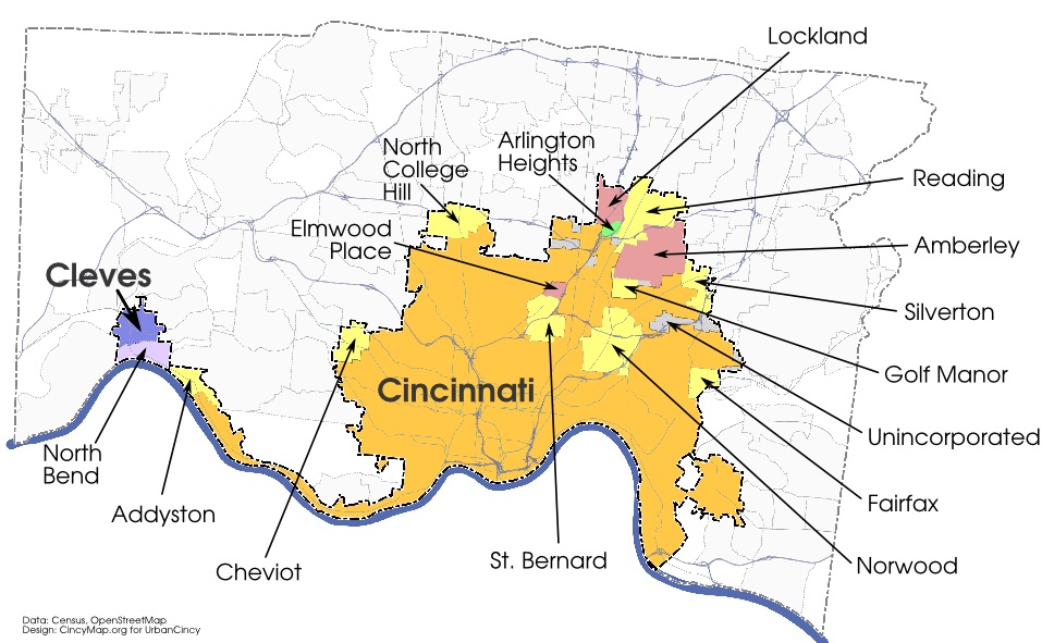
In his 2012 book, Walkable City, Jeff Speck, coauthor of Suburban Nation and The Smart Growth Manual, branches out on his own to nail down a comprehensive guide to walkability.

He contends that a great deal of money and muscle have gone into streetscape improvements, but how important are these in convincing people to walk? The book is rooted in Speck’s ‘General Theory of Walkability’, that for walking to be favored, it must be useful, safe, comfortable and interesting.

  1. Useful: Most aspects of daily life close at hand and well-organized
  2. Safe: Streets that are designed to be safe and also feel safe to pedestrians
  3. Comfortable: Urban streets as outdoor living rooms
  4. Interesting: Sidewalks lined by unique buildings with friendly faces

Speck then prefaces his ten steps to walkability with some notable cases studies proving the economic advantage of walkable places, real estate premiums of walkable urbanism versus drivable suburbansism, the personal and health benefits those in walkable places gain, the environmental impacts of driving, and one’s risk of dying in a traffic crash versus murder by a stranger.

“It is the places shaped around automobiles that seem most effective at smashing them into each other.”

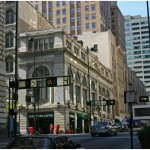
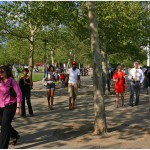
The book is a useful read for those looking to better understand urban design and transportation policy practices, and how they influence our behaviors in cities. Here is a summary of Speck’s analysis and thoughts on working towards a more walkable community using his ‘Ten Steps of Walkability.’

Step 1: Put cars in their place
Speck acknowledges that the auto will remain a fixture of our communities given the Federal Government’s historic and current interest, with some nudging from the “Road Gang” lobby, in road building and the inverse relationship between highway investment and property values.

He argues that traffic studies are “bullshit” by nature and that all transportation decisions should be made in light of induced demand, the phenomenon rooted in the economic theory of supply and demand where demand from drivers tends to quickly overwhelm new supply.

He goes on to attack state DOTs and their involvement, or lack thereof, in the new American Main Street – the state road running right through town. He is against pedestrian zones, for congestion pricing, and notes how the automobile has not moved us any faster, just further.

Step 2: Mix the uses
Speck notes the historical impetus for Euclidean Zoning and that it now undermines the success of cities.

Humans can no longer work, shop, eat, drink, learn, recreate, convene, worship, heal, visit, celebrate, and sleep all within downtown, and the primary inadequacy of housing prevents all other activities from thriving. However, the housing inadequacy should not be made up with more affordable housing, as cities have too much of it, but affordable housing should come through inclusionary zoning and accessory dwelling units.

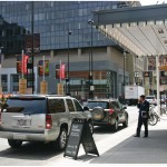
Step 3: Get the parking right
The author also points out something we’re all affected by on a daily basis but rarely think about, the amount of off-street parking that exists and how its cost in all forms is “diffused everywhere in the economy.”

Speck notes that employer-subsidized parking and minimum parking requirements undermine urbanism and instead advocates for in-lieu fees to fund shared municipal parking and parking cash out programs for employees of large companies.

Speck also carefully addresses the more exact science of on-street parking using parking guru Donald Shoup, author of The High Cost of Free Parking. Speck summarizes this discussion with a comparison between the Chicago parking meter lease where profit for Morgan Stanley (now CPM) bears no relation to parking occupancy, and San Francisco’s managed congestion-pricing regime that seeks goal occupancy of 80%, meaning rates ranging from $0.25/hour to $6.00/hour throughout eight neighborhoods.

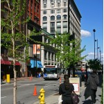
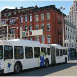
Step 4: Let transit work
“With rare exceptions, every transit trip begins and ends with a walk. As a result, while walkability benefits from good transit, good transit relies absolutely on walkability.”

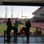
Speck is an advocate of well-planned modern streetcars. He points to the failures of the Dallas Area Rapid Transit system “where parking is as ubiquitous as it is cheap, the only significant constraint to driving is the very congestion that DART hopes to relieve.”

Metro Buses
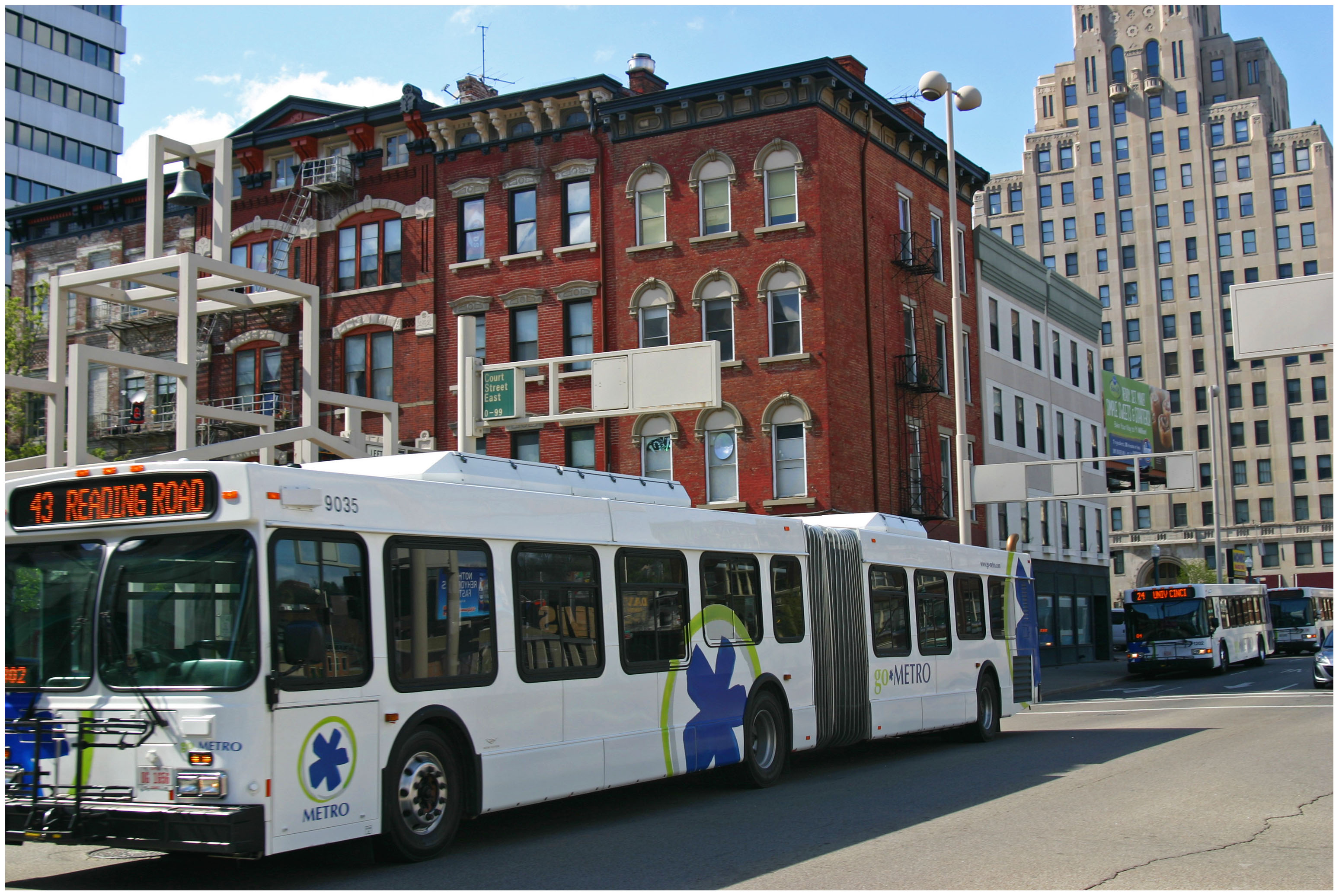
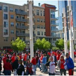
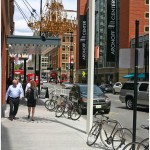
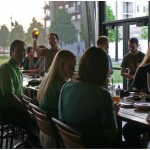
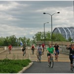
Speck strongly supports the expansion of bus service to provide greater accessibility and mode choices. Photograph by Randy Simes for UrbanCincy.

He contends streetcars should not be means of reducing traffic, but should act as pedestrian accelerators that make the most sense when a large area of vacant or underutilized land sits just beyond walking distance from a walkable downtown, and that private parties should want to help pay for it. For the rare routes where other transit can offer a superior experience to driving, there must be urbanity, route clarity, frequency and pleasure; and traditional buses have a hard time being efficient and pleasurable.

Step 5: Protect the pedestrian
“Will potential walkers feel adequately protected against being run over, enough so that they make the choice to walk?”

Speck first advocates small block lengths with many blocks per square mile providing route options and shorter distances between destinations. Next, he addresses design speed and how four lanes roads can encourage weaving and how effective road diets can be when they include left turn lanes. He advocates for the historic lane width of 10 feet, rather than 12 feet which is the standard for cars going 70mph and how pedestrians are much more likely to survive being hit at 20mph than 45mph.

He then addresses the psychology of intersections and risk homeostasis, naked streets and shared spaces saying, “nobody drove dangerously through this intersection, precisely because the intersection felt dangerous.”

Speck does not believe one-way streets are appropriate for downtowns, especially retail areas where traffic is distributed unevenly and cross-street visibility is reduced and also addresses bike lanes, trolleys and curb cuts impact on pedestrians.

“What makes a sidewalk safe is not its width, but whether it is protected by a line of parked cars that form a barrier of steel between the pedestrian and the roadway.”

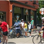
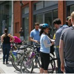
Step 6: Welcome bikes
“A street with bikes, once the drivers get used to them, is a place where cars proceed more cautiously.”

Streets with bicycle infrastructure have proven safer for pedestrians and drivers, with the biggest factors in establishing a biking city being urbanism and infrastructure. Portland increased the population of people biking to work from 1% to 8% in 15 years with only $50 million or 1% of their transportation funding.

He goes on to point out the obvious dangers of cycling, especially vehicular cycling, and how bike lanes can be used as part of road diets but should not replace curbside parking or be and impediment in retail areas.

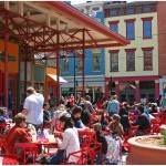
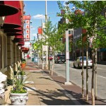
Step 7: Shape the spaces
“If a team of planners was asked to radically reduce the life between buildings, they could not find a more effective method than using modernist planning principles”- Jan Gehl.

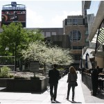
Speck hits on one of the more well-known urban design tenets – that pedestrians enjoy a sense of enclosure and need it to feel comfortable. The trouble is, however, that the typical American urban experience is a profound lack of spatial enclosure, “a checkerboard city devoid of two-sided streets,” and that figural space (the public realm) is in a battle with the figural object of modernist architects.

Main Street
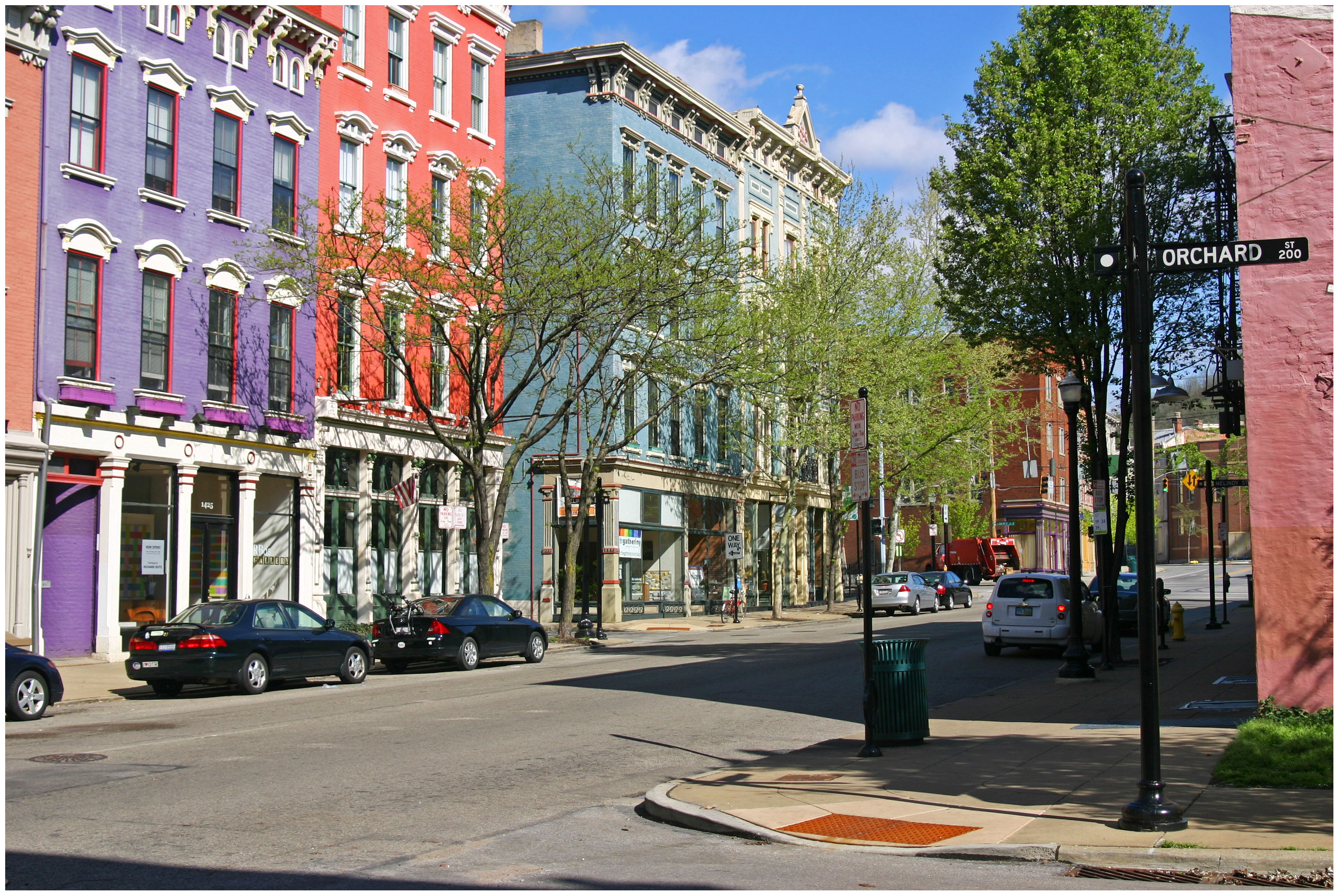
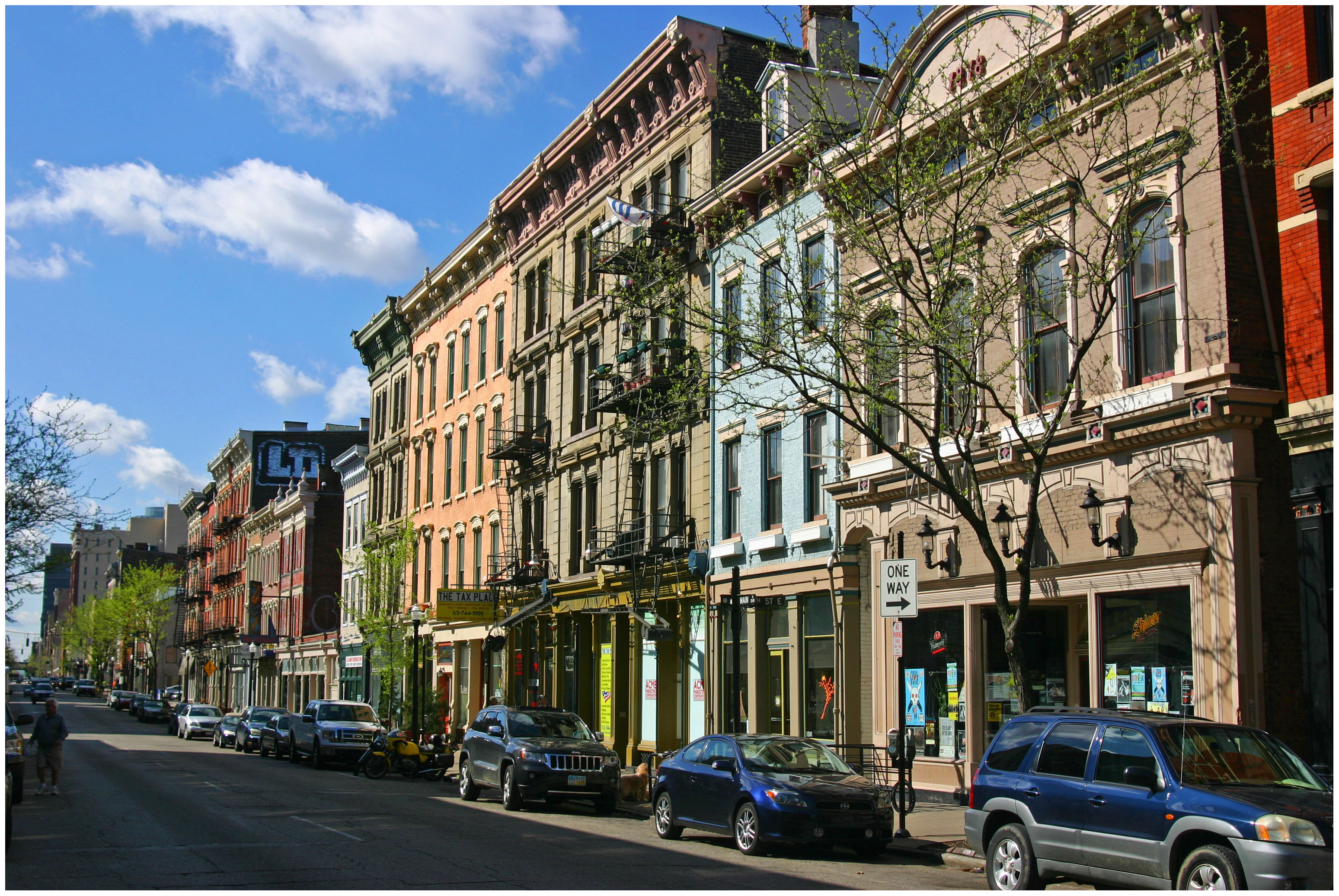
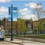
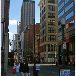
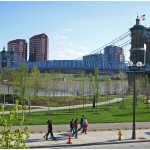
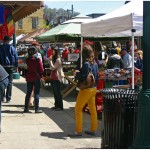
Planting street trees and creating a buffer between pedestrians, like along Main Street in Over-the-Rhine, Speck says is critical for success. Photograph by Randy Simes for UrbanCincy.

He goes on to state that tall buildings are not necessarily needed to create this enclosure, or density, and can actually be a detriment to downtown development.

Step 8: Plant trees
Trees can also create a cathedral-like enclosure over streets and have other environmental, health, safety and economic benefits. Street trees provide an obvious buffer between sidewalks and automobiles, though DOT’s and county engineers have seemingly chosen the safety of drivers over that of pedestrians by categorizing street trees as “fixed hazardous objects.”

Trees close to the roadway also capture CO2 and rain more effectively and should be part of the solution to combined sewer overflows. The author goes on to mock how little it takes to achieve the Tree City USA designation, the return on investment trees can provide, and varying species block-by-block to guard against disease.

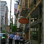
Step 9: Make friendly and unique faces
Pedestrians demand almost constant stimulation, and parking lots, windowless storefronts, and landscapes fail to do this. Where there is parking, surface lots can be hidden from view by mere one-story buildings, and parking structures should be hidden from view by liner buildings or at least have upper floors that appear to be inhabited.

Cities need active, open and lively building edges with transparent building facades and features that add depth such as awnings, deep window sills and columns. Facade geometries should also be oriented vertically and limited in width to provide the appearance of a shorter walk and building variety.

He is critical of modernist architect’s disinterest in pedestrian activity and singles out Frank Gehry, but goes on to bail modernism, but not brutalism, out by stating “what matters is not whether the details were crafted by a stone carver or a cold extruder, but whether they exist at all.”

Lastly, he reiterates that the greening of the city in an untraditional manner should be avoided as open spaces can encourage people to take walks, but do not cause people to embrace walking as a practical form of transportation.

Step 10: Pick your winners
Finally, Speck acknowledges there is a finite supply of financial resources to create walkability and therefore it should be spent where the most difference can be made- where there’s already an accommodating private realm with comfort and interest to support an improved public realm.

Speck then uses this logic to create his urban triage plan for walkability that steers financial resources to the identified network. He states that though it may not be viewed as equitable, that this plan should happen first in downtowns as they are shared places and are important to the city image and attracting investment.

Categories
News Opinion Politics

EDITORIAL: Long Trail of Referendums Limit City’s Budget Options

Congratulations, Cincinnati, on earning the honorable distinction of being one of the worst budgeted cities in the country. However the city did not earn this coveted distinction by lack of competent leadership, instead it was earned through the gradual tying of hands of government officials through a series of voter referendums.

To start, Cincinnati’s budget woes did not come from one single project or expenditure; it came instead through a series of political promises, bad decisions, and some funding conditions that are beyond the city’s control.

Most recently, the State of Ohio cut over $20 million in funding to Cincinnati when it reduced its Local Government Fund. Additionally, the elimination of the estate tax fund subtracted another estimated $15 million from the city’s projected revenues. If these funds were in place, the budget would be balanced and the recent parking modernization and lease plan would not need to be on the table.

Realizing as early as 2006 that the City’s budget position was headed in a fiscally unsustainable direction, City Manager Milton Dohoney proposed to spin-off Greater Cincinnati Water Works into its own entity. The deal would have created a regional water district, similar to the Northern Kentucky Water District, and would have generated $6-12 million in annual revenue for the city with increases over time.

Cincinnati Skyline

In 2009 COAST and the Cincinnati chapter of the NAACP successfully led a campaign to put the issue on the November ballot. It may be difficult to recall but that’s because another issue dominated that year’s election, Issue 9. So as Cincinnatians for Progress and other Cincinnati voters rallied together to fight for rail transit in defeating Issue 9, Issue 8, which prevented the sale of Greater Cincinnati Water Works, passed with very little debate.

Again City leaders were forced to find another way to plug the budget gap. To address the budget shortfalls of 2010 and 2011, City Manager Milton Dohoney asked City Council to levy a trash collection fee to help address the budget shortfall. City Council rejected the idea, echoing the concerns of their constituents, which is reflective of representative democracy in action.

But that wasn’t enough for some, so in 2011 as progressives were once again fighting against another anti-rail ballot initiative, Issue 48, Issue 47, the referendum banning the city’s ability to levy a trash collection fee, passed with little debate. Again, both referendums came from the same two groups.

So in a classic stroke of misdirection, every strategy that the city has attempted to use to climb out of a budget deficit has been met with a referendum, making it more difficult or impossible to fix the problem.

The latest, the parking modernization and lease deal, may likely be met with yet another referendum. And signing the petition being circulated will put the issue up for a vote, but not before the City of Cincinnati is forced to lay off 344 employees, close pools and cut other services.

The reason this is happening immediately is due to the change in the City’s fiscal year, which now starts on July 1, and with the temporary restraining order placed on the City by Republican Party-endorsed Judge Robert C. Winkler with regards to using emergency ordinance procedures, City officials will now need to have a budget in place by June 30 to allow for the 30-day waiting period required. If new revenues are not found, then services will have to be cut.

The narrative that the City of Cincinnati is continually unable to balance its own checkbook does Cincinnati and the region no good, and is flat out untrue. The suburbs, the townships and the three states that Cincinnati is connected to need the city and the heart of the region to be vibrant, successful and attractive. Not for our own sake but because this city is still climbing out of the riots, still in fly-over country and still associated with the Rust Belt (undeservedly so).

City leaders have worked hard to retain and attract talent to the region, creating a new neighborhood in The Banks, building a new skyscraper, and rehabilitating Over-the-Rhine. Out-of-towners don’t think of West Chester when they hear Cincinnati any more than people think of Southfield when they hear Detroit. The condition, reputation and quality of the actual city itself is the magnet that draws economic growth to the city, to Sharonville, West Chester and even to Anderson Township.

The City has a right to govern itself by choosing the people that lead them not in the single-mindedness of an endless referendum cycle. That is the nature of representative democracy, one that our nation’s founding fathers recognized 225 years ago and one that we should preserve today.

Categories
Business Development News Opinion Transportation

Portland Aims to Replicate Streetcar Success on East Side of Willamette River

Six months ago Portland celebrated the opening of a 3.3-mile extension of their modern streetcar system across the Willamette River.

The $148.3 million Portland Streetcar project represents a significant expansion of the existing six-mile system, and city leaders hope it will find similar success in the Lloyd District, Buckman and Hosford-Abernethy neighborhoods as it has in the Pearl District and Northwest District.

At the time when Portland built its first streetcar leg, the Pearl District was a rundown industrial district in search of new life, and the Northwest District was looking to build on its existing stability.

Pearl District Buckman Neighborhood
Portland’s Pearl District [LEFT] has seen a massive transformation over the past decade, and many hope the streetcar’s recent extension will do the same for the city’s Buckman neighborhood [RIGHT]. Photographs by Randy Simes for UrbanCincy.

The story is not all that different on the east side of the river where the Buckman and Hosford-Abernethy neighborhoods are looking for the streetcar to breathe new life into its underutilized land and lingering industrial users, and the Lloyd District is trying to build on its successes and possibly reinvent itself with a lesser focus on the automobile.

While the streetcar extension is operating daily, the investments are not quite finished. Transportation officials are waiting on an additional six streetcar vehicles to roll off the production line so that service frequencies can be improved for the system’s four million annual riders.

TriMet officials are also overseeing progress on the construction of the new Portland-Milwaukie Bridge which will provide a river crossing for bicycles, pedestrians, streetcars, and light rail from Hosf0rd-Abernethy to the South Waterfront District as part of a the 7.3-mile Portland-Milwaukie Light Rail Project.

The $134 million bridge project is expected to open in September 2015 and buoy both new and existing ridership on the city’s light rail and streetcar systems.

Portland-Milwaukie Light Rail Bridge South Waterfront District
Construction progresses on the Portland-Milwaukie Light Rail Bridge in November 2012 [LEFT], which will connect the Hosford-Abernethy neighborhood with the South Waterfront District [RIGHT]. Photographs by Randy Simes for UrbanCincy.

The verdict is still out on whether or not the new east side streetcar extension will have as big of an impact as it did on the west side of the river next to downtown, but the possibilities are there.

The streetcar’s alignment through Buckman and Hosford-Abernethy heads south along Martin Luther King Boulevard and north a block over on Grand Avenue. To the west of MLK Boulevard is the river with a large collection of warehouses in between. To the east of Grand Avenue is an in-tact neighborhood that has become increasingly popular with young creative types over the past several years.

In between the two streets one will find a collection of aging car dealerships and associated service businesses that date back to the mid-twentieth century.

These large parcels, combined with the large warehouse properties immediately to the west, offer a unique opportunity for large scale redevelopment. Such massive real estate investment might not be plausible without another real estate bubble.

The prospects are there, however, and if Portland can pull off even a fraction of the investment in Buckman as they saw in the Pearl District, then the city will add billions of dollars to its real estate value and create a secondary downtown in the city center for the 2.2 million person region.