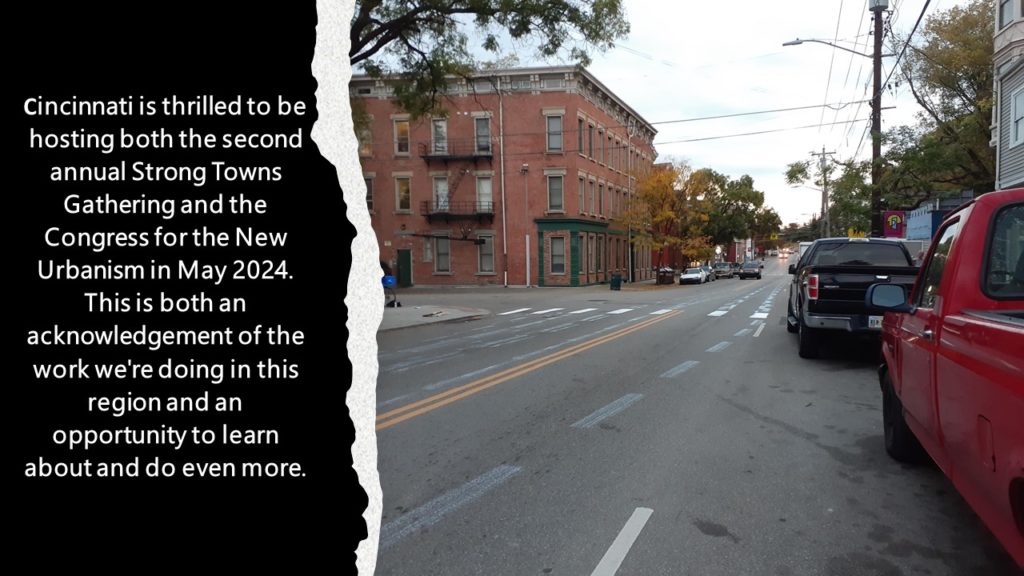
Julie Carpenter of Soapbox Cincinnati has a great article outlining all the ways increased density helps cities build and maintain themselves sustainably.
You can read this as a both a complement to the city’s proposed Connected Communities plan — and a way to help address some of the issues identified by the Futures Commission.
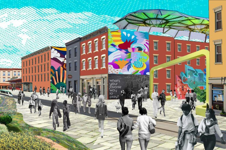
A student project that reimagines the Findlay Market district as a cultural hub (Students: Caroline VanBuskirk and Lanie Tarowsky. Advisor: Hyesung Jeong
It’s the same nightmare every city neighborhood fears: a young child ends up in intensive care after being hit by a car. The media shows up to cover the community’s anguish, advocacy groups and city officials hold meetings, and – sometimes – announce long-term fixes.
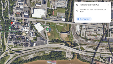
That’s what happened in Lower Price Hill, a Cincinnati neighborhood sandwiched between three urban highways. Click on this link and you’ll see that State Street is a major connector between three urban highways that surround the community.
The child was hit by a car turning off busy State Street onto the street housing the community’s only public school, Oyler Community Center. Oyler not only serves the community’s K-12 students; it also offers wraparound community services and outreach to the surrounding community.
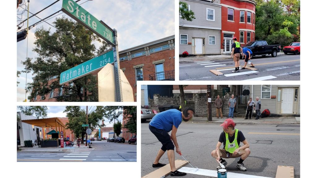
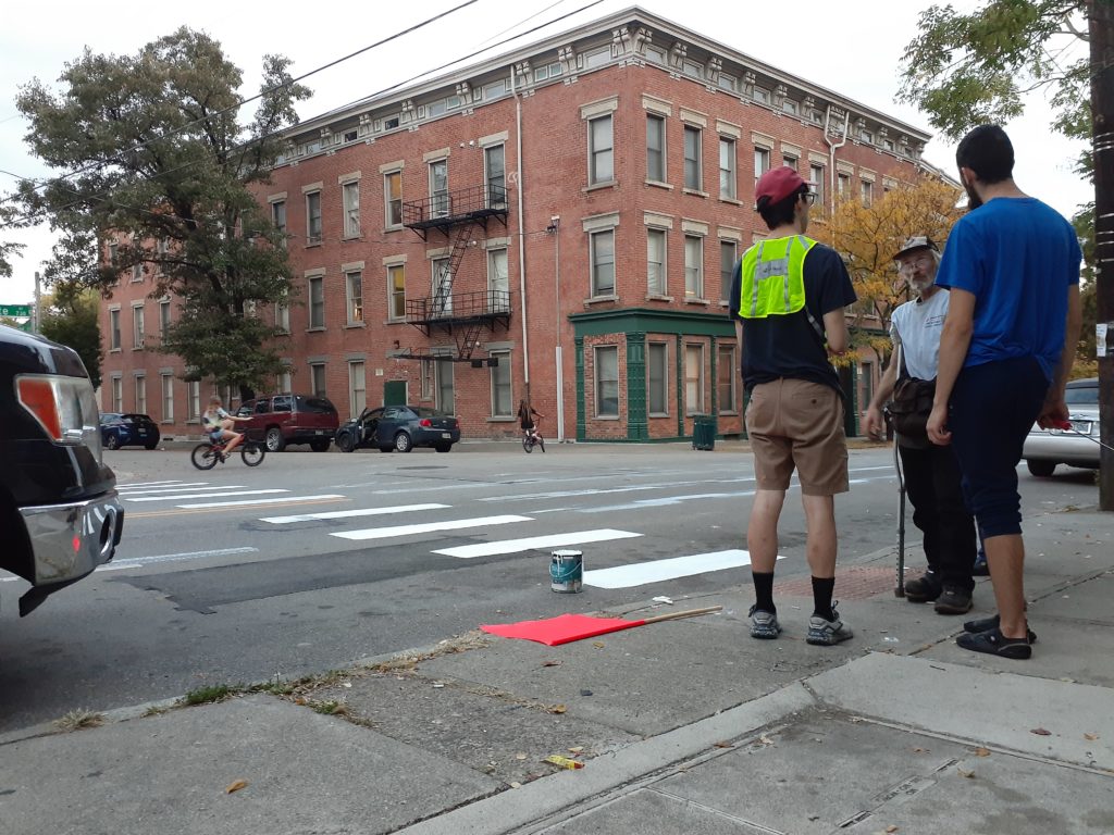
Our Local Strong Towns group, Civic Cincinnati, chose the intersection of State Street and Hatmaker for our first tactical urbanism intervention to draw attention to the dangerous conditions for people living, walking and biking in this community, most especially its children.
On a warm evening in late October 2023, a group of us showed up with a bucket of paint, a couple of rollers and makeshift stencils. This is one of countless areas around Cincinnati where curb cuts and ADA ramps were installed for crosswalks that never got built. So — technically a crosswalk.
Given Cincy drivers’ penchant for not stopping even at marked crosswalks, the goal was to give this unmarked crosswalk more visibility. Residents who gathered around to watch us seemed to appreciate the effort. Passersby in cars, on foot and on bikes stopped to ask what we were doing and chat about the problems speeding cars pose to the community.
Traffic was heavy and fast in this very vibrant neighborhood during the 6 PM hour. In addition to a Red Bike kiosk and Outerspace, a community gathering space for neighbors of all ages, the corner includes a popular market. We saw several kids, both on bikes and on foot, during our time there.
This is not a safe place for them right now. They deserve better.
In the past two years Cincinnati’s city council and administration have taken a more active role in making the city’s streets safer for everyone, especially for more vulnerable pedestrians and cyclists and in the city’s traditionally underserved communities. Efforts include enacting a Complete Streets ordinance, providing funding to create more protected bike lanes and expanding the city’s growing network of dedicated walking/biking trails.
These efforts include a plan for Lower Price Hill’s 8th Street corridor and State Street. The earliest construction will begin is 2026 due to work priorities for the city’s DOTE. Civic Cincinnati will continue looking for opportunities to fill in the gaps until there’s funding for more permanent fixes.
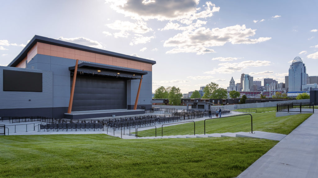
Ovation, the 25-acre mixed-use development planned by Corporex to transform the northwestern corner of Newport, has completed its first phase of construction with the addition of PromoWest Pavilion at Ovation—a music venue that promises big things for the river’s edge. The $40 million concert venue aims to attract hundreds of thousands of fans every year with over 180 acts, both big and small.
PromoWest Productions, which operates six music venues as well as the Bunbury Music Festival, considers the Newport venue to be their third crown jewel, alongside Express Live! in Columbus and Stage AE in Pittsburgh. All three feature a reversible stage allowing for smaller indoor or larger outdoor configurations, but as the newest, Newport’s venue features additional amenities designed to provide the best possible experience for fans, artists, and the production crew.
The multi-level indoor pavilion can accommodate 1500 to 2700 general admission fans plus an additional 428 seated. Outside, the amphitheater can accommodate 7000 general admission plus 1040 seated. The whole venue sits atop a parking garage that boasts upwards of 500 spaces.
Both indoor and outdoor areas feature giant sunken pits in front of the stage with raised levels surrounding them, providing excellent vantage points from every viewing angle. And no matter where you are in the venue, whether it be at the bar getting another round or on your way to the bathroom to get rid of the previous one, TV screens scattered strategically throughout the pavilion will keep you tethered to what’s happening on stage.
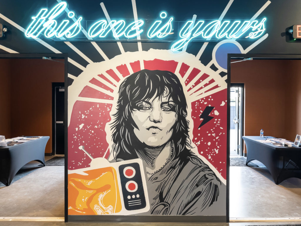
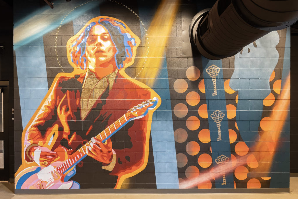
Murals of well-known musicians enliven the walls of the facility. Inside the VIP lounge on the second level, a mural featuring a TV is animated BLINK-style with a ceiling-mounted projector, adding yet another dimension to an already stunning work of art.
Backstage, six dressing rooms, each equipped with TVs and bathrooms with showers, are poised to make the performing artists’ lives as comfortable as possible. A full kitchen will serve as the base for on-site caterers, and multiple production rooms, each with its own private bathroom, are equipped to house show technicians comfortably.
The Green Room on the second level lives up to its namesake by committing to the color in every way possible and can be rearranged to accommodate artists’ varying needs. Adjacent to the Green Room is the King Records Room—a versatile, private space embellished with a colorful mural that pays homage to Cincinnati’s legendary artists and the historic recording studio in Evanston.
Click the photo below to launch our full photo gallery:
The venue’s first wave of acts was announced earlier this morning:
Lady A
Russ
Jelly Roll
Dirty Heads & Sublime with Rome
The Struts
Kip Moore
The Distillers
Jordan Davis
Another wave of artists will be announced on June 15th.
PromoWest Pavilion at Ovation is located at 101 W. 4th Street in Newport, KY, right behind the Campbell County Courthouse. Visit OvationPavilion.com for additional information.
The following is a guest post by Indianapolis based planner Jeffrey Tomkins with a forward from Micah Paldino, Clifton Heights resident, and founder of creative storytelling agency, Fallon Thatcher. It has been edited lightly.
“With the area in and around Findlay Market expanding with new restaurants, bars, and lifestyle concepts, the neighborhood is primed and ready for a conversation around how we provide a safer and more beautiful experience.
This is timed nicely with ongoing construction of FC’s stadium set to open in March 2021 that will bring even more focus on how pedestrians utilize this space. Visibility for pedestrians at this important, but rather troubling and cumbersome, intersection has always been a pain point when crossing the street and competing with cars.
In this reconfiguration designed by Jeffery Tompkins it lessens the risk for pedestrians by reducing the allowances of turns and creates a calmer environment. This is something we need more than ever as Over-the-Rhine and Clifton Heights become a more singular unit.”
Micah Paldino
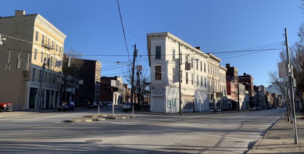
Vine Street and McMicken Avenue today. Photo by John Yung.
The intersection of Vine St. and McMicken St. is one of Cincinnati’s more complicated – and potentially more deadly. While it has been the subject of art, the first search engine result for the five-way intersection lists pedestrian deaths as its biggest story. And this is no surprise: complicated turn radii, low vehicle visibility from a wild angle of incidence, and an antiquated slip lane have created a logistical nightmare for cyclists and pedestrians hoping to cross the intersection.
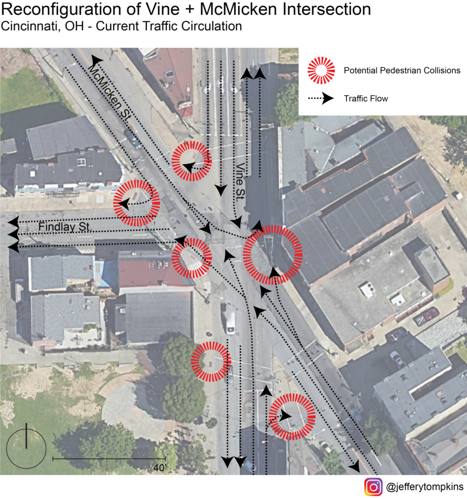
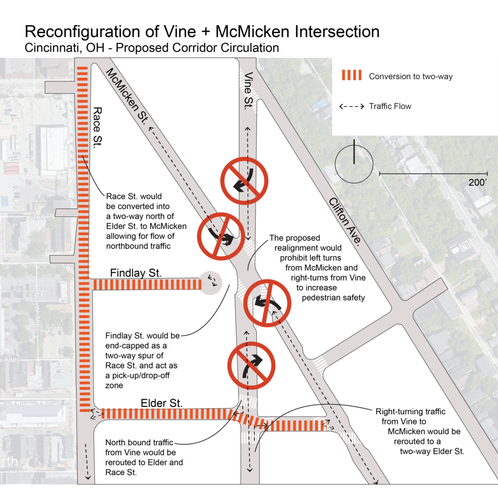
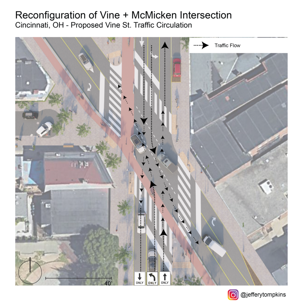
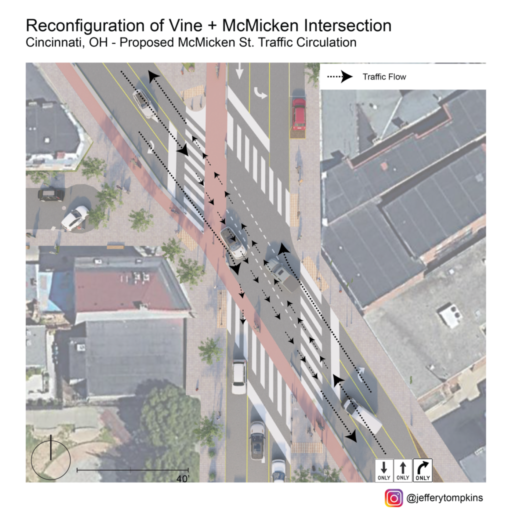
Current Traffic Circulation
Any design intervention hoping to calm traffic and improve mobility at this nexus should account for the district-wide significance of this crossing and, thus, must think in terms of the relevant traffic flow through Vine and McMicken corridors. As it stands, current traffic flow is overly complicated and caters almost entirely to automobiles rather than encouraging pedestrian interaction.
Seen from this map, the wide turn radii and allowance of multitudinous turning options fosters inhospitable conditions for peds, with several critical points ripe for accidents. On top of decreasing pedestrian safety, this wide array of turns also can negatively impact traffic flow and connectivity between adjacent neighborhoods. To fully reconfigure the intersection to allow for smoother traffic flow and safety, traffic flow of the corridor should be reanalyzed and possibly rerouted.
To allow for a complete-streets redesign of Vine/McMicken, my proposal eliminates left turns from McMicken onto Vine and removes right turns from Vine onto McMicken. North-bound traffic on Vine intending to turn right on McMicken would be rerouted to a new two-way Elder St. allowing for southbound travel. South-bound traffic on Vine intending to turn right on McMicken would instead be rerouted south to a two-way Elder and directed north-ward on a reconfigured two-way Race St. north of the Cincinnati streetcar connector, leaving the slip lane redundant. North-bound traffic from McMicken onto Vine would be routed south from Pace to Elder and then north on Vine. South-bound traffic from McMicken to Vine would instead utilize Elder as a conduit between the two streets. While this reconfiguration could create inconveniences for residents in the near-term, it is with a long-term eye toward saving pedestrian lives that makes it worth it. Atop this, the redesign hopes for slower traffic, improvements in overall traffic flow with elimination of one-ways, and a reduction in accidents.
Corridor Flow Map
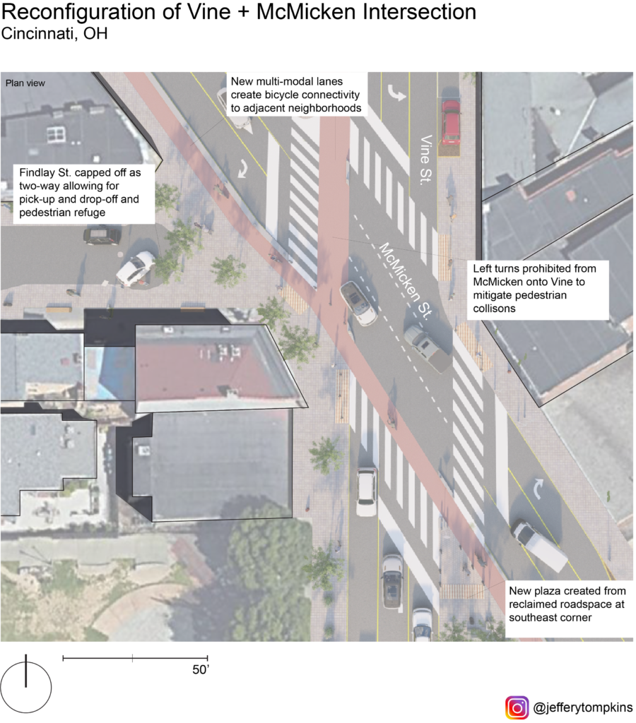
Aside from turn-regulation at the intersection, my proposal forVine/McMicken involves the capping of Findlay St. to eliminate the five-way and diminish incidence points. With this reclaimed space from the new configuration and removal of slip lanes, public space would be created, and pedestrian sightlines would be vastly improved at the new four-way intersection.
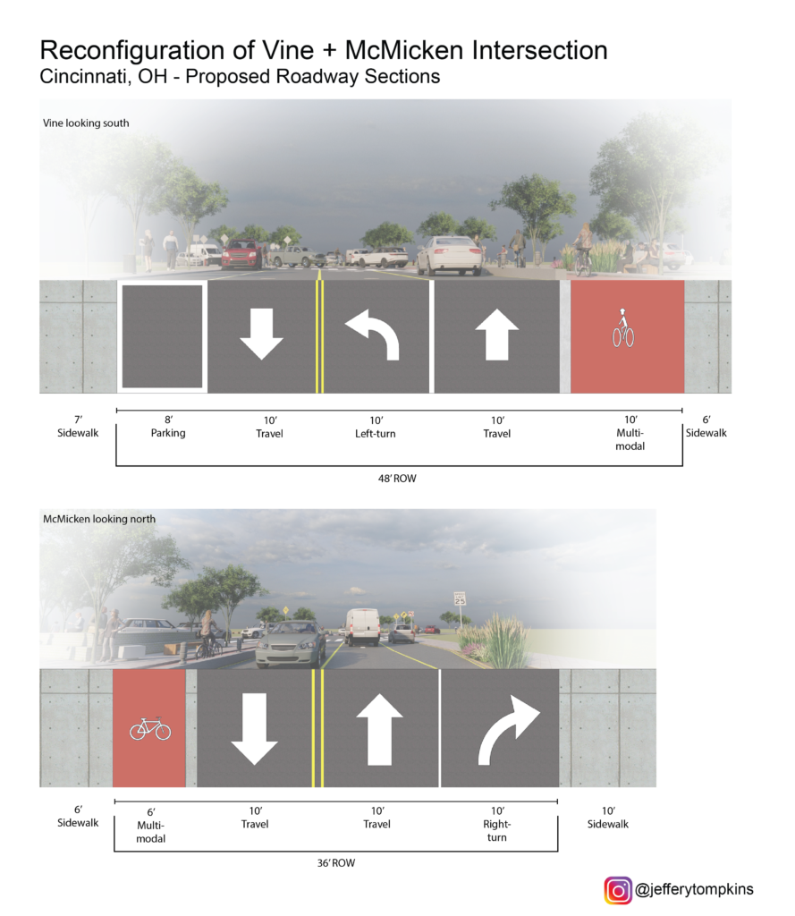
Plan View
The new configuration calls for a reduction in vehicular space and the inclusion of multi-modal lanes catering to mid-speed travel (bicycle, scooter, powerchair, etc.) along Vine and McMicken. The reclaimed slip lane at the southeast corner would be reallocated as a public plaza and pedestrian sanctuary protected by bollards and activated by food carts or public art. A 6’ multi-modal lane along McMicken would improve connectivity for bicyclists along the corridor and offer a commuting solution for Over-the-Rhine residents. The 10’ multi-modal lane along Vine would take the place of the current right-turn lane and give a north-bound option for bicycle connectivity. One side of street parking would still be retained north and south of the intersection on both streets. The capped-off Findlay St. would become a possible pick-up and drop-off zone for rideshare and Uber/Lyft.
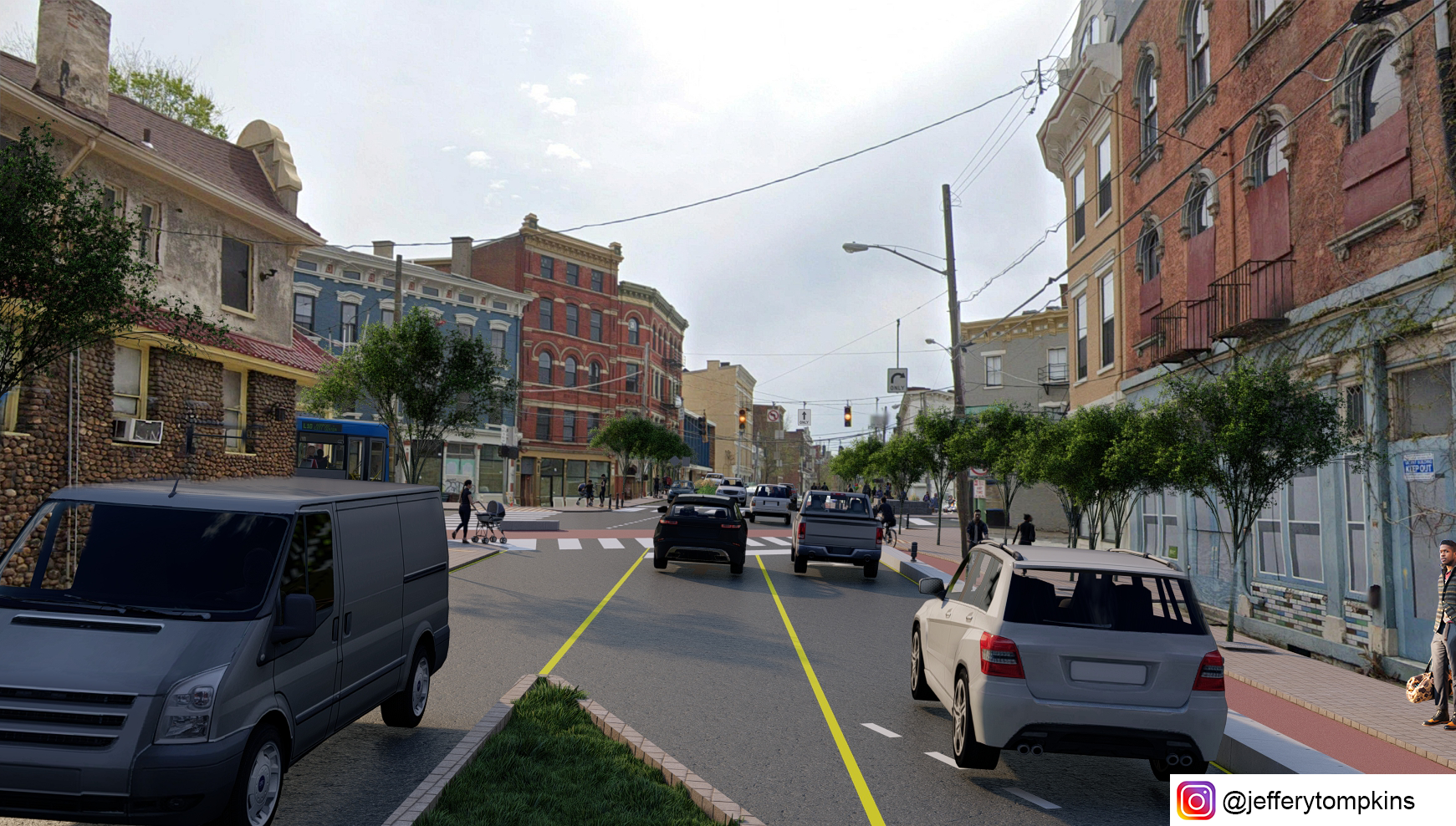
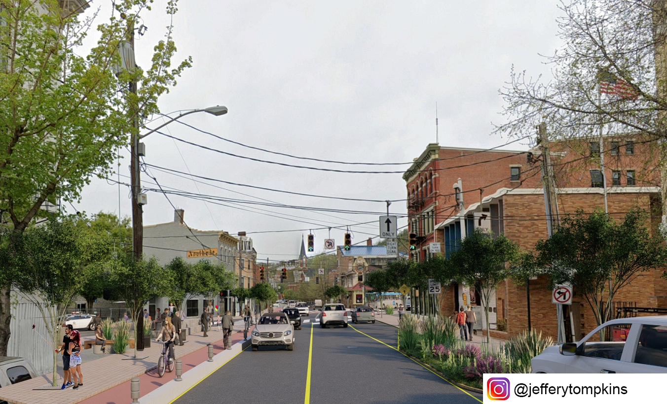
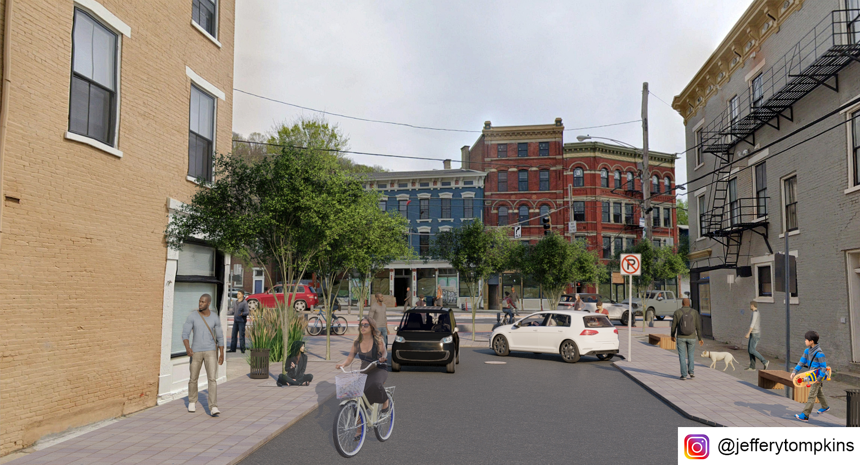
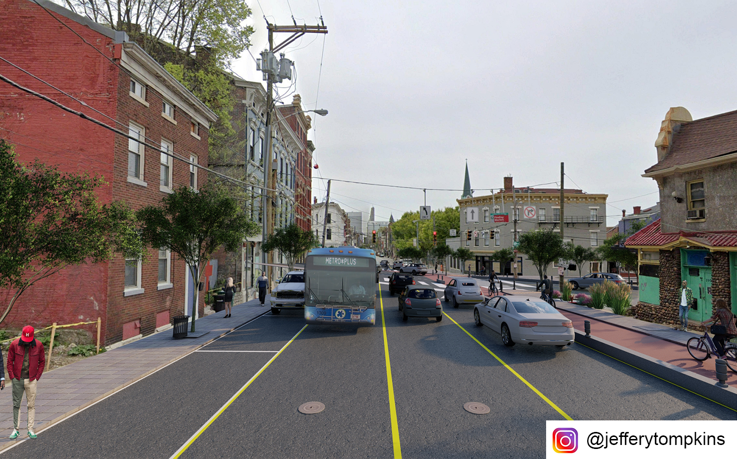
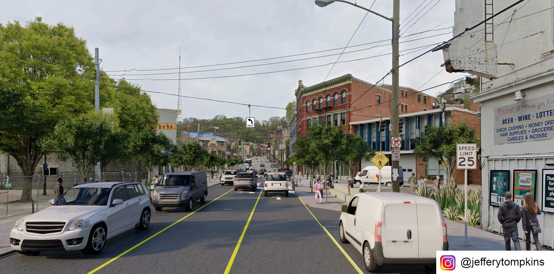
Looking southeast on McMicken Ave
Looking northwest on McMicken Ave
Looking east from Findlay Street
Looking south on Vine Street
Looking north on Vine Street
Render views of proposed intersection change. All illustrations by author.
Aside from fostering pedestrian safety and increasing bicycling viability, the redesigned intersection vastly improves overall traffic flow with its reduction in turns. This may offset future rates of accidents. While the reconfiguration would affect bus routes 46 and 78 currently turning from south-bound Vine onto Findlay to get to Race St. SB, the new configuration would allow for bus travel on the newly designated two-way Elder St, with traffic stop bars pushed back to allow for bus travel.
Vine Street Circulation
McMicken Ave Circulation
Street Cross Section
Overview and cross sections. All images by author.
If you would like to have your thoughts and opinions published on UrbanCincy, simply contact us at editors@urbancincy.com.
Well hello there! It’s been a year, what did we miss?
All kidding aside much has happened over the past year. While our team was alive and well, doing what we do, the site crashed. We can discuss how much effort we had to put into restoring the site from the archive but the long and short of it is that the back end server and hosting needed to be rebuilt almost entirely.
Thank you, Travis, for all your hard work!
In lieu of a broader update, we have decided to focus on catching up on some of the major developments in Cincinnati over the past year. Here’s a brief review of news from 2019 and early 2020:
Of course, we would be remiss to not mention the current COVID-19 crisis. We will continue to track its impacts on urbanism in Cincinnati and beyond. This Friday, the city will close 15 street sections in downtown and Over-the-Rhine to allow for expanded outdoor dining. Other areas may follow.
With the site back, we hope to become a public platform for urban thought in Cincinnati. With most of us now working full-time, we have less time to devote to the site. With that in mind, if you, our reader have an article you would like to submit or an opinion piece, please feel free to contact us at editors@urbancincy.com.