Categories
Business News Transportation

Beyond Downtown, Cleveland’s RTA Rebuild Spurring New Development

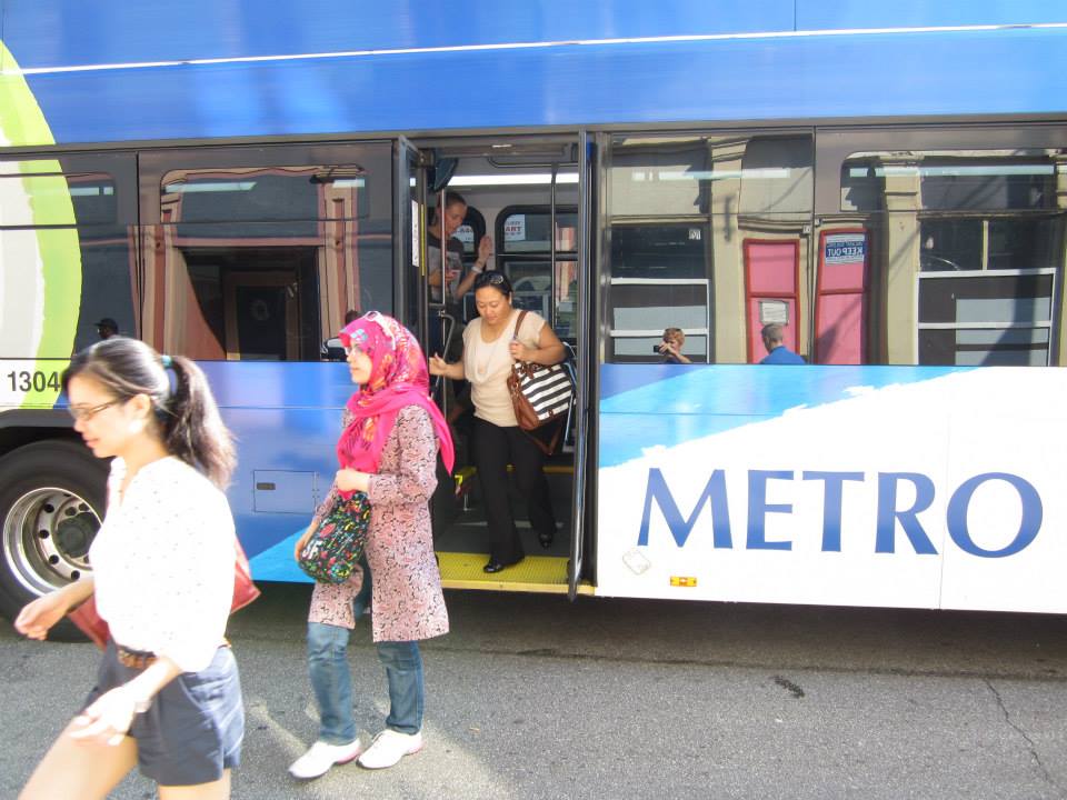
Amidst further positive national news for upgraded Midwestern rail service, All Aboard Ohio met in Cleveland for their summer meet-up. At the weekend-long gathering, the group toured the Greater Cleveland Regional Transit Authority’s numerous heavy rail, light rail, and bus rapid transit lines.

Often unknown to outsiders, the Cleveland area boasts some 39 miles of rail transit, with daily ridership of over 53,000. As a result, Cleveland’s transit ridership dwarfs that of both Cincinnati and Columbus. Even though Cleveland is approximately the same size as Cincinnati and Columbus, its transit ridership is bigger than both of them combined.

In addition, All Aboard Ohio executive director Ken Prendergast led the tour and showcased the substantial amount of transit-oriented development that is taking place throughout Cleveland.

With the opening of Cincinnati’s first few miles of rail transit just over a year away, it made the tour particularly relevant. As a result, I was joined by a small Cincinnati contingent including City Councilman Chris Seelbach (D), SW Ohio Director of All Aboard Ohio Derek Bauman, and Price Hill community leader Pete Witte.

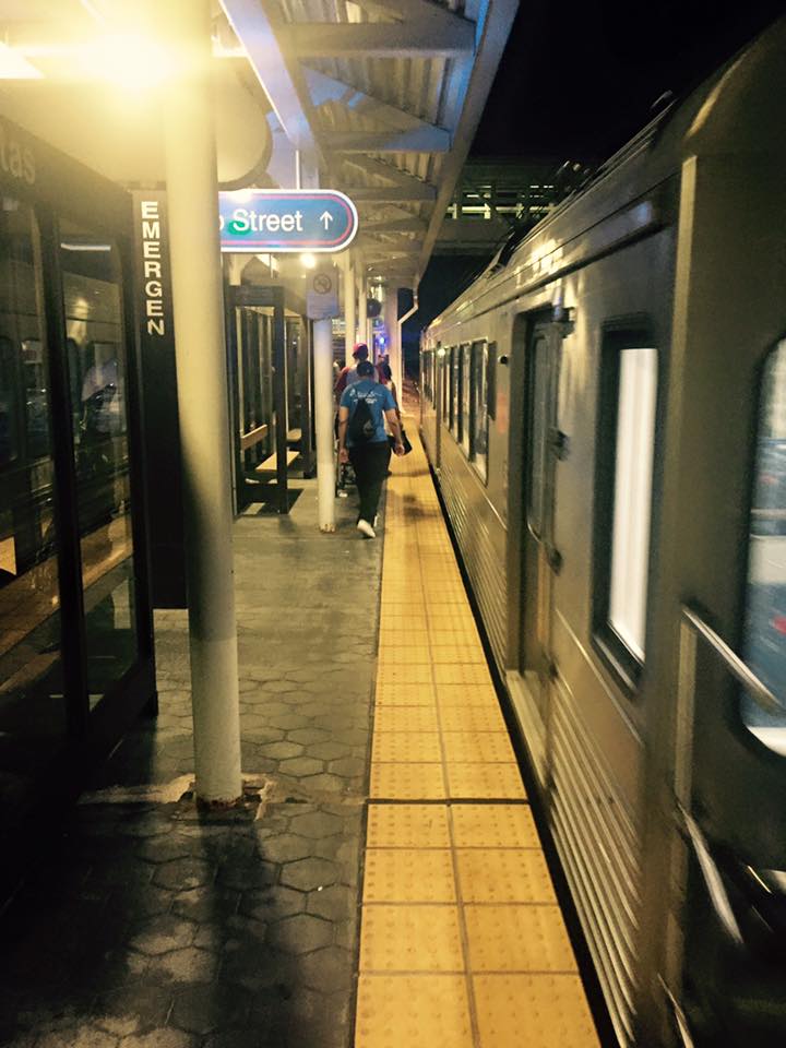
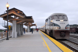
The group’s tour began at Terminal City Tower in downtown Cleveland, where inter-city trains once stopped and all rapid transit lines currently meet. From there we took the Green Line to the lakefront, passing large-scale transit-oriented development along the Cuyahoga River, the Port of Cleveland, Cleveland Brown Stadium, Rock & Roll Hall of Fame, and the city’s Amtrak station.

Negotiations are currently underway for the construction of a large intermodal hub where Amtrak is currently located, combining Amtrak, Greyhound, Megabus, and many local buses from Akron and other cities into one complex.

The Green Line’s E. 55th Street Station was showcased after having been rehabbed in 2011. It is part of GCRTA’s program to rebuild every station in its system. Nearby this still young station, an old hospital is undergoing a $75 million redevelopment that will refit it with apartments.

Changing to the Blue Line, the train ran through semi-suburban areas that reminded the Cincinnati contingent of the Wasson Corridor. Among these areas is the Van Aken District at the Warrensville Station at the end of the line. There, Joyce Braverman, the planning director for Shaker Heights, gave us a walking tour of the area and detailed the numerous transit-oriented developments currently under construction, including a $91 million residential development and a rebuild of a pedestrian-unfriendly intersection.

A newly renovated station – just four days old – greeted us at Little Italy along with the Feast of the Assumption Festival. In addition to the throngs of neighborhood residents filing in and out of the trains, redevelopment can be found nearby in University Circle. During an opportunity to speak with the president of University Circle Inc., he boasted about the area’s transformation from a run-down district with multiple surface parking lots into one of the city’s most desirable neighborhoods.

The numbers back up the claims. In just a decade, more than $6 billion in private investment has flowed to the neighborhood, generating some 10,000 new jobs and 11,000 new residents.

While serviced by RTA’s Red Line, this particular area is also anchored by Cleveland’s now famous Health Line BRT, which runs along Euclid Avenue to the center city and is the highest-rated BRT line in North America.

Through this station rebuilding program, Cleveland has used it as an opportunity to leverage an impressive amount of private investment in the surrounding areas. While success of downtown Cleveland has been well-publicized amidst the continued struggles elsewhere in the region, there are bright spots popping up along the city’s transit corridors. With more than 100 rail and BRT stations in the region, many more opportunities seem to be on the horizon.

Categories
Business News

Dirt’s Opening at Findlay Market Bolsters South Side of Market, Evening Activity

After a soft opening in July, Dirt: A Modern Market finally opened its doors on August 4.

“We are a full-time retail store at Findlay Market selling locally produced goods,” said Karen Kahle, who served as project manager until April. She also wrote the grants that ultimately funded the effort from the Interact for Health Foundation.

Based on the Local Roots store concept in Wooster, OH, Kahle says that she, along with Rebecca Heine and Mike Hass, were inspired to move forward with the idea after visiting the shop during a trip to Cleveland for the International Public Market Conference in September 2012.

“We loved the idea of the ‘consignment shop’ for local food,” Kahle explained.

The market is hoping to make locally grown and produced foods available to Findlay Market shoppers every day the market is open. The trio says that they want to create another way for local growers and producers to sell their product and increase revenue in order to help them become more sustainable and profitable.

A broader goal in the long run, Kahle says, is to help educate the public on the health and environmental benefits of eating fresh local foods, while also promoting community involvement and sustainable living.

The market is currently selling fruits, vegetables, meats, cheeses, dairy products and cottage goods. Customers will notice that the shop functions a bit like a consignment store where growers and producers rent space by the week or the month, set up their own individual displays, and set their own prices. They are then reimbursed 70 to 80% of their gross sales.

Located in between Maverick Chocolate and Eli’s BBQ, the opening of Dirt is yet another shot in the arm for the once struggling south side of the Findlay Market.

Dirt’s operating hours also show a commitment to the efforts to increase evening business activity in the area. They are currently open from 10am to 7pm Tuesday through Friday, 8am to 6pm on Saturdays, and 10am to 4pm on Sundays. The shop is not open on Mondays.

“Dirt: A Modern Market will market food products that celebrate what is unique and best about a community – its local crops, ethnic traditions, and creative populace – while keeping a greater percentage of food dollars circulating in the local economy,” said Kahle.

Categories
Business News

The Location of Every Job in Cincinnati Mapped

Ohio Employment Dot Map

Two years ago, University of Virginia researcher Dustin Cable put together a detailed dot map based on the racial distribution of people in the United States. This work inspired another researcher to put together something similar, but for America’s job distribution.

Robert Manduca studies sociology and social policy at Harvard University. He says that while jobs and the economy are continuously discussed, we seem to know very little about where jobs are actually located. So what he did was examine the Census Bureau’s Longitudinal Employer-Household Dynamics data and then plot that information out on an interactive map.

The LEHD data is based on state unemployment insurance records, and tabulates the count of jobs by census block,” Manduca explained on his website. “Here, jobs are colored by type, allowing us to see how different industries and sectors exhibit different spatial patterns–some clustering in downtowns, others spreading across city and suburbs alike.”

The way the visualization works is that red represents Manufacturing & Trade; blue for Professional Services; green for Healthcare, Education and Government; and yellow for Retail, Hospitality and Other Services.

Upon examination of the map, you can see that some cities and regions have a much stronger concentration of jobs than others. When looking at Ohio from a distance, it looks like this pattern holds true for the state’s three big cities. That picture changes as a more detailed look is taken at Manduca’s research.

In Cincinnati, for example, the two largest job centers, downtown and uptown, are joined by the Mill Creek Valley and Blue Ash as areas with heavy concentrations of jobs. As expected, there is a large cluster of education and health jobs uptown, while downtown boasts the region’s heaviest concentration of professional service jobs.

Blue Ash then comes in as, perhaps, the most impressive job center for professional service jobs in the region outside of the center city.

The Mill Creek Valley, which generally runs north along I-75 from the Ohio River, serves as the region’s primary manufacturing and trade corridor. This industrial corridor is well-rooted in Cincinnati’s history, and is even reflected in the City of Cincinnati’s robust tax collections from these zip codes.

The research reveals how much of a barrier the natural landscape serves as when considering job distribution. Throughout the Cincinnati region, for example, you can see how the hills cut across the landscape.

The data also shows that while Cincinnati is often defined by an east/west divide, the distribution of jobs is far more north/south oriented than it is east/west. Of course, the same is true for the region’s population.

Categories
News Politics Transportation

Stars Aligning for Cincinnati to Chicago High-Speed Rail

4123288130_f7b778d9d5_b
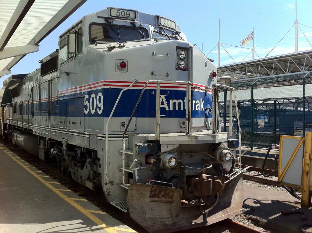
Local and national developments show positive signs for America’s oft-criticized national passenger railroad company, Amtrak. A railroad reform bill introduced in the Senate contains many positive changes for Amtrak and local support continues to grow for increased service on Cincinnati’s tri-weekly train to Indianapolis and Chicago.

The Railroad Reform, Enhancement, and Efficiency Act of 2015 (RREEA, S.1626) was introduced by Senators Cory Booker (D-NJ) and Roger Wicker (R-MS) to improve Amtrak service across the nation. The bill addresses several different issues for the railroad, including expansion, funding, and leadership. It also provides an increase in funding levels for the railroad through 2019.

In terms of leadership, the legislation would reorganize the board of directors for the railroad, with two representatives for the heavily traveled Northeast Corridor, two for long-distance routes (the Cardinal), and two for state-supported lines. There would also be one “floating” member.

The RREEA also includes several sections that fuel possible future expansion of the national rail network by establishing a committee to facilitate communication and cooperation between states and Amtrak on state-supported routes. In addition, it would require Amtrak to work with an independent agency to evaluate all routes and review possible elimination of routes, expansion or extension of current routes, or the establishment of new ones.

While calling this clause problematic, the National Association of Railroad Passengers acknowledges that this text includes a “comprehensive framework for analyzing a route that recognize the unique benefits rail service provides.”

Section 301 of the act explicitly requires that the Department of Transportation set up a program to assist the operating costs of launching or restoring passenger rail transportation. The section seems to be a nod towards the amount of routes cut from the system over Amtrak’s 40-plus years of operation.

Additional clauses provide mechanisms for cooperation between states and the federal government, when it comes to addressing the backlog of capital projects within the system, Amtrak’s money-losing food service, and the restoration of service along the Gulf Coast, a line that has been out of commission since Hurricane Katrina in 2005.

After the deadly derailment in Philadelphia in May, safety across the network is a major component of this legislation.

Both sponsoring senators touted the bipartisan nature of the bill and Senator Wicker’s office released a statement identifying the national passenger rail system as an “integral part of our overall transportation structure and our economy,” and thanking Senator Booker for his support and help in creating the bill.

The Senate Committee on Commerce, Science, & Transportation voted on July 13 to include the RREEA Act into the broader transportation bill, the Comprehensive Transportation and Consumer Protection Act of 2015 (S.1732).

In the Cincinnati metropolitan area, support continues to grow for the expansion of rail service in the area, especially to Chicago.

The City of Hamilton recently applied to Amtrak for a stop and has passed a resolution of support for increased service. Nearby in Oxford, home of Miami University, initial approvals have been set to create a station for Amtrak, and efforts are currently underway to identify the exact location for that facility.

The effort has also gained support from the University of Cincinnati Student Senate, when they passed a resolution 31-1 in support of increased rail service to Chicago, citing Chicago as “an important transportation hub for students’ co-op travels, as well as an economic destination for students, staff, and faculty alike.”

According to All Aboard Ohio’s Southwest regional director, Derek Bauman, the UC student government president is also coordinating with other local university student governments to obtain resolutions of support; and in addition to Hamilton, both Norwood, where Amtrak employs local workers, and Wyoming, where the Cardinal line runs through, have also passed resolutions of support for increased passenger rail service.

Hamilton County commissioners also unanimously approved a resolution pursuing a feasibility study.

Going forward, Bauman says that there will be a need for increased cooperation and support from local Metropolitan Planning Organizations along the route. In Columbus, the Mid-Ohio Regional Planning Commission (MORPC) has actively supported the implementation of a Columbus-Ft. Wayne-Chicago rail line; and in Northeast Ohio, a consortium of local MPOs have banded together and formed a sub-group to support increased rail service to the region.

From here, leadership at All Aboard Ohio says that they hope the OKI Regional Council of Governments will take a similar approach on behalf of the Cincinnati region.

Categories
News Transportation

Second Real-Time Transit App Launches Just Four Months After SORTA Opened Data

Area transit riders can now download a new app called Bus Detective that offers real-time arrival information for Metro bus service.

Developed by locally based Gaslight, the app is free and available for download on Android and iOS devices. The data has also been packaged so that it can be accessed on the web at www.busdetective.com.

For years the Southwest Ohio Regional Transit Authority had been reluctant, like many other transit operators throughout the nation, to open up their data to the public. But just four months after opening the data, the region’s largest transit agency is now the beneficiary of a free real-time bus tracking app.

“It’s all about convenience. Our customers want to know when their bus is coming, real-time,” says Metro CEO Dwight Ferrell. “Smartphones are everywhere, and transit apps like Bus Detective make transit even easier to use.”
The city’s burgeoning tech community had been calling for local leaders to open more data. So far 2015 has proven to be a watershed moment for such actions, particularly so with the launch of Open Data Cincy.

“We’re huge fans of open data and turning that information into something valuable for the public,” says Chris Moore, CEO of Gaslight. “We also love public transportation and hope the app encourages more people to ride the bus.”

A query of the App Store reveals that Cincinnati may be the first transit agency in Ohio with its own custom real-time tracking application; however, both Cincinnati and Cleveland also have had Transit Tracker – an app that has been tailored to more than 30 cities nationwide – since 2014.

Both applications are free to use, but Transit Tracker can be used on the Apple Watch if users purchase an in-app upgrade. It also offers limited interoperability with TANK and Cincy Red Bike.

While Bus Detective has been available for more than two weeks, it officially launched today.

The timing could not be better, as reports show that Metro continues to struggle with stagnant ridership with what industry analysts call choice riders. Apps like these allow for people, who could otherwise opt for a personal automobile or ridesharing services, to more comfortably plan their transit schedules; and thus more likely to ride the bus.

“The Bus Detective app is a great example of the talent and creativity within our community and is helping make catching the bus even easier for the thousands of customers who rely on our service every day,” said Ferrell.

The app is relatively simple to use. Users just need to download the app and then search for their stop by a specific street address or the closest stop to their current location. From there users are presented with the arrival information for the next several buses, and can save specific stops as favorites for quicker reference in the future.

While the app offers clear bus tracking information, it does not allow users to map their trips. This much more complicated function is best carried out by using GoogleMaps, which Metro was added to in 2011 after the agency opened their data to the tech giant.

The Bus Detective launch event will continue on Fountain Square today until 1pm. Those who attend will be able to learn more about the app, while also having the opportunity to win prizes and take selfies with a full-size, sleuthy Metro buses.