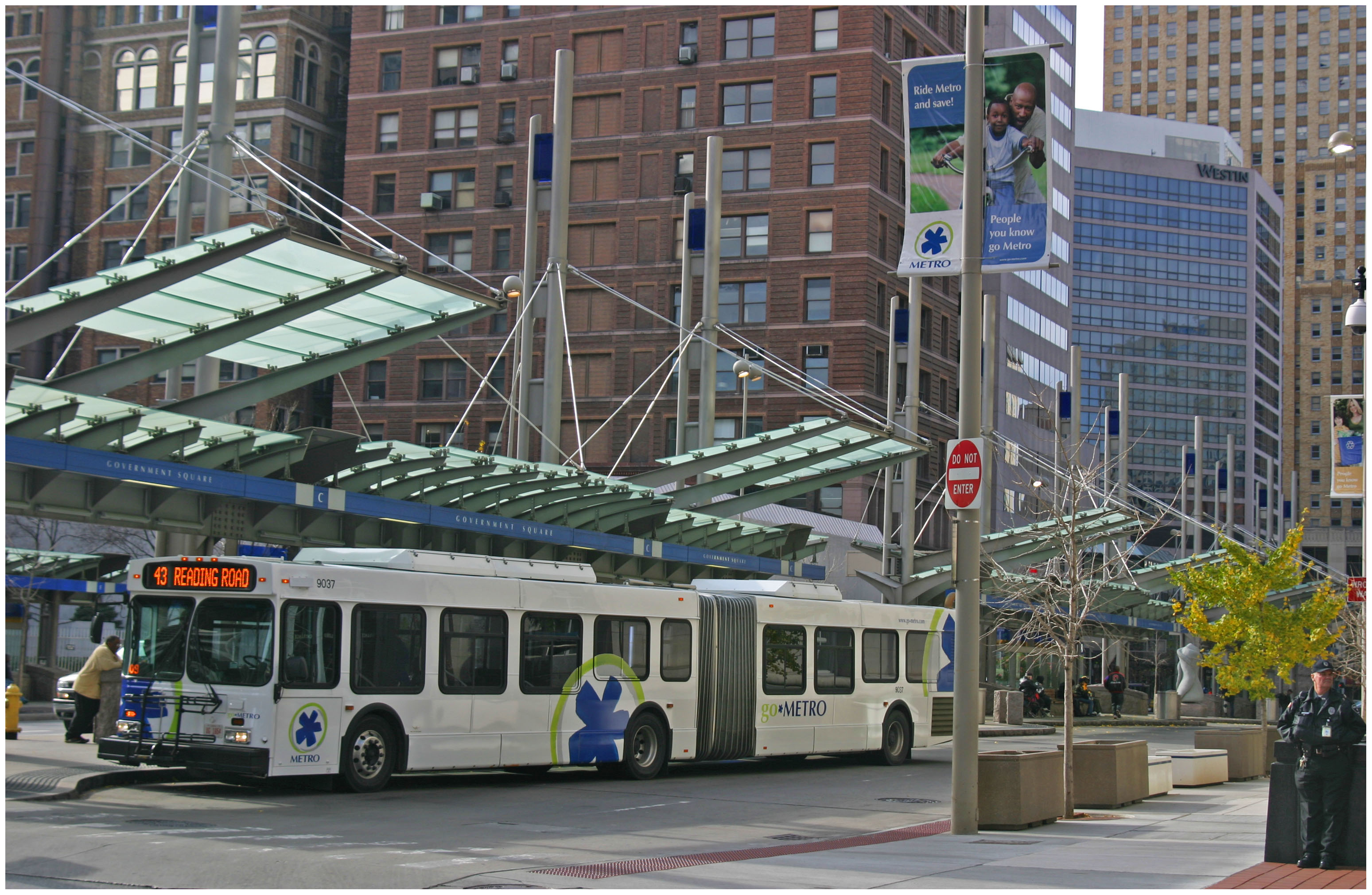
While transit ridership nationwide inched upward and reached its highest level in more than a half century, it remained flat in Ohio’s two largest metropolitan regions.
According to new data released by the American Public Transportation Association (APTA), transit ridership in both Cincinnati and Cleveland remained essentially unchanged from 2013 to 2014. With a 3% ridership gain over the previous year, Columbus bucked the trend and posted the fifth highest bus ridership gain nationally.
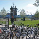
Uptown Transit District University Station [Eric Anspach]
Uptown Transit District Vine & Calhoun Station [Eric Anspach]
Uptown Transit District Vine & Calhoun Station [Eric Anspach]
“In 2014, people took a record 10.8 billion trips on public transportation — the highest annual ridership number in 58 years,” said Phillip Washington, APTA Chair and CEO & General Manager of the Regional Transportation District in Denver. “Some public transit systems experienced all-time record high ridership last year.”
In a nod to Columbus, Washington said that the increases were not just relegated to large cites, but were found in smaller and medium size communities as well. But according to Streetsblog USA, an UrbanCincy content partner, the national increases can be largely attributed to the large gains in New York City, which accounts for roughly 25% of American transit ridership.
The opening of the first leg of the Cincinnati Streetcar is also expected to boost ridership in 2016. Until then, Cleveland will remain as the only city in Ohio to have both bus and rail offerings. Not surprisingly, Cleveland’s transit usage dwarfs that of both Cincinnati and Columbus.
Ohio Transit Ridership [UrbanCincy]
While year-over-year ridership only increased nationally by 1%, that gain is seen as encouraging since it occurred at the same time as prices for gasoline plummeted. Transportation officials see continued transit ridership growth, in addition to VMT growth for the first time in nearly a decade, as a clear indication of a much stronger economy where more people are employed.
“Since nearly 60 % of the trips taken on public transportation are for work commutes, public transportation ridership increases are seen in areas where the local economy is growing,” said APTA President and CEO Michael Melaniphy.
In spite of Cincinnati’s growing economy, transit ridership actually posted a slight loss. That loss, however, is in line with national bus ridership trends. While Cincinnati saw an annual decrease of 1.8%, bus ridership across the country also experienced a 1.1% decline. All modes of rail transit, meanwhile, posted gains, which now accounts for 46% of all trips made by transit.
Light rail systems posted the biggest annual gain of 3.6%, while heavy rail and commuter rail added riders by 3.3% and 2.9%, respectively.
“People are changing their travel behavior and want more travel options,” Melaniphy concluded. “In the past people had a binary choice. You either took public transit, most likely a bus, or you drove a car. Now there are multiple options with subways, light rail, streetcars, commuter trains, buses, ferries, cars and shared use vehicles.”
EDITORIAL NOTE: APTA’s annual report does not include ridership data for the Transit Authority of Northern Kentucky (TANK), which provides approximately 3.8 million trips annually. For the purposes of this analysis, UrbanCincy has used a constant 3.8 million annual trips from TANK in the Cincinnati totals presented in the above chart.
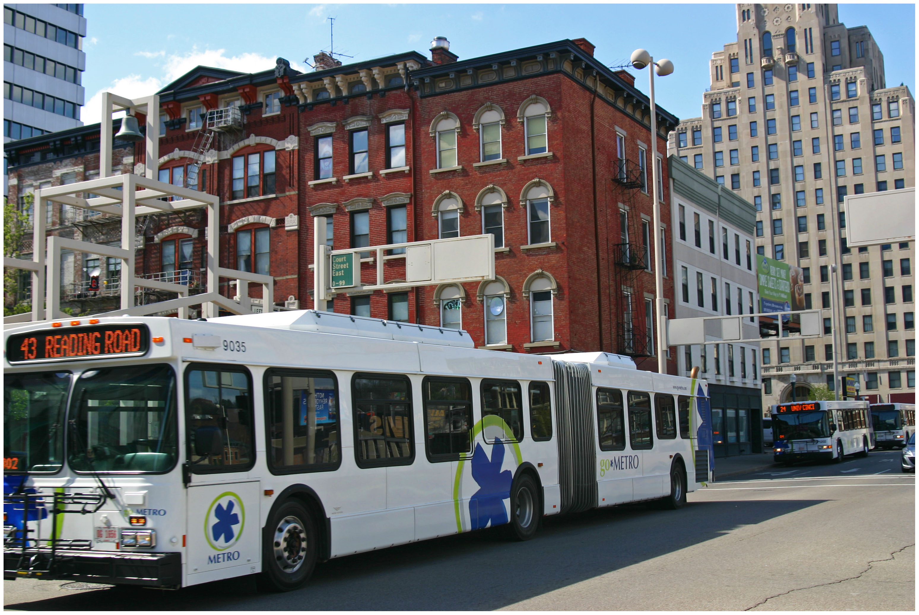
Regular commuters who cross the Ohio River, either into Cincinnati or Northern Kentucky, are well aware of bringing the required amount of change to transfer between Metro and TANK buses. Other non-seasoned riders, however, were stuck with navigating a complex combination of transfer fees and payment options.
The region’s two largest transit agencies announced that technology afforded to them in 2011 will support the introduction of a long-anticipated regional fare payment card. Metro unveiled the shared stored-value card earlier this month at The Westin’s Presidential Ballroom during the annual State of Metro address.
Transit officials say that the card works with both TANK and Metro buses, thus eliminating the need for carrying change on either system. The card deducts the correct fare amount for each agency so if a rider boards a Metro bus it will deduct $1.75 for Zone 1 or $1.50 for a TANK bus fare.
“We are trying to make this a more seamless and integrated approach to transit.” Metro spokesperson Sallie Hilvers told UrbanCincy.
While there already is a monthly pass that can be used for both systems, the pass is limited to rides on TANK and Metro buses within Cincinnati city limits. As a result, officials from Metro and TANK believe the new shared stored-value card provides better accessibility and flexibility to people who use both systems on both sides of the river.
Behind the scenes, Metro handles the accounting for the stored-value cards so if the card is used on a TANK bus, the agency reports that usage to Metro, which then reimburses TANK for the fare.
“We’ve seen more people buying day passes and stored value passes since we introduced them.” Hilvers said.
This kind of collaboration is not what has traditionally defined the relationship between Metro and TANK, but Hilvers said that this has been years in the making and hopes that it will lead to even more collaboration in the future.
According to Hilvers, the next goal is to work with local universities to develop a standard student and faculty card that would cover access to area institutions served by both transit agencies. Currently Metro has separate agreements with the University of Cincinnati and Cincinnati State, while TANK has an agreement with Northern Kentucky University.
Such changes would seem to bode well for both Metro and TANK. In 2013, Metro reported surging ridership due to the implementation of new collaborative programs and improved fare payment technology.
Leadership at the Southwest Ohio Regional Transit Authority (SORTA), which oversees Metro bus and streetcar operations, says that they are working on ways for riders to get real-time arrival information system-wide.
The challenge, they say, is to make sure it is a benefit available to all users. Therefore, transit officials are working to implement real-time arrival information that utilizes smartphone, adaptive website and phone service technologies. Metro representatives are tentatively saying that they are hopeful such services could be in place by spring 2015.
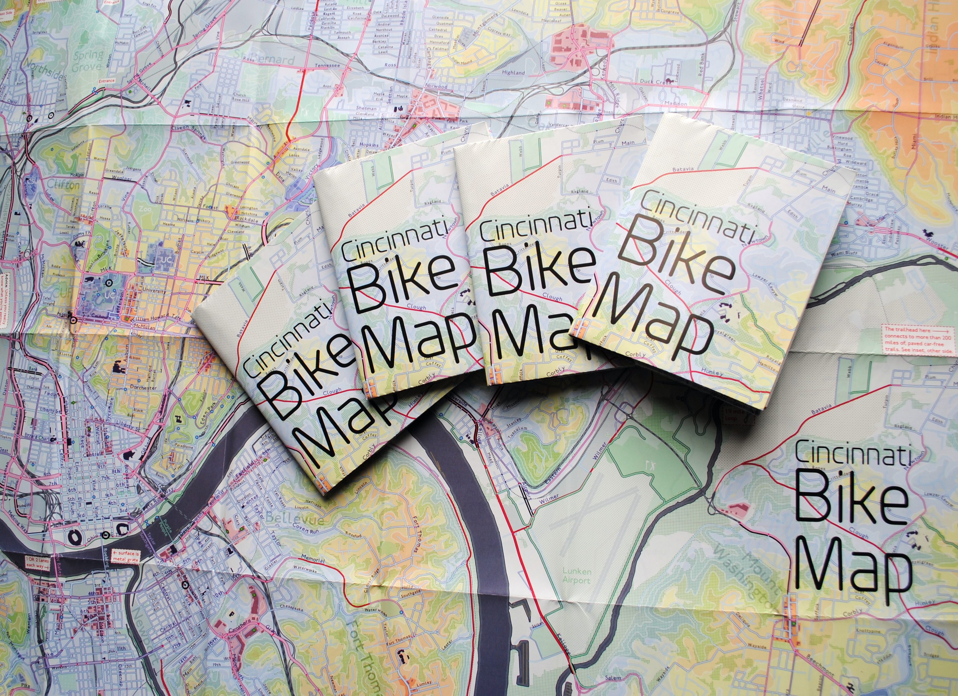
In 2011 Nate Wessel sought out to change the way Cincinnati mapped its transit. In a region with multiple transit operators that all use traditional bus mapping visuals, it was quite the daunting task. But after successfully raising more than $2,000 on Kickstarter, Wessel was able to fund his effort to print tens of thousands of his newly designed maps that ultimately received national praise.
Since that time he has continued his quest to improve the visual nature of map-making in Cincinnati, including serving as UrbanCincy’s official contributing cartographer, but he also embarked on another major endeavor. Instead of a transit map with bus frequencies, Wessel this time focused his energies on creating a new regional bike network map.
“Imagine someone kept taking, and reproducing and sharing, very unflattering photos of you or someone you loved. If you’re like me, you’d probably let the first one slide,” Wessel stated. “Maybe it was an accident, but by the fifth or sixth one, you’d start noticing a pattern and you’d start getting kind of miffed about it.”
Cincinnati Bike Maps [Provided]
This is the feeling the twenty-something urban planner, cartographer and fashion designer felt about the region’s existing bike maps, and he wanted to take control of the situation and improve it.
“This is a subtle visual game and words won’t do,” Wessel explained. “You need to make your own photo that shows the beauty you see in what you love; and then get other people to see what you see.”
One of the ways to accomplish that, he says, is to get the maps into people’s hands – digital maps are not enough. While the physical presence of a printed map gives it a sense of permanency and seriousness, producing a hard copy map also comes with its challenges.
After finishing the design for the Cincinnati Bike Map, Wessel said that he received feedback from the binder recommending a redesign to better accommodate the way the paper would fold, but that it was too late in the process. As a result, he wishes the maps folded a bit better, but that he is otherwise quite pleased with the final product. Perhaps leading to that feeling of satisfaction, however, is the fact that no compromise was needed since the project was entirely self-funded.
“Both times I’ve raised money for these projects it was in advance of having a real demonstrable product,” said Wessel. “In neither project have I ever had to check anything with a sponsor, supervisor or co-designer. The maps were totally my own in both cases, held to my own standards alone and uncompromised. That is very unusual for print maps.”
While quite unusual, it was a situation he preferred. In fact, Wessel says that a local organization very generously offered to fully fund the printing of Cincinnati Bike Map should he work with their graphic designer. A generous offer indeed, but one that came with risks that the final product not turn out as originally envisioned.
The release of the new regional bike map last month comes at a time when Cincinnati is in the national spotlight for its dramatic gains in bike ridership and development of new bike infrastructure.
Now that the project is complete, the goal now shifts to distributing the stack of Cincinnati Bike Maps that now exist. In addition to distributing the maps to local bike shops and organizations, Wessel is also mailing out copies of the map. His hope is that new or unfamiliar riders feel empowered by the maps, and that experienced riders use them to explore new routes throughout the region.
“Regular cyclists have found their favorite routes and will probably stick with what they know,” said Wessel. “Though, I totally discovered Fort Thomas through this map. Every map I’d seen made it look like a pretty crappy, suburban place to ride and I always avoided it; but the streets are beautifully wooded and very slow with 25mph speed limits.
Of course, all of this would not have been possible without access to the treasure trove of data on-hand at Cincinnati City Hall, and with the OKI Regional Council of Governments.
Those who would like to get a free copy of the Cincinnati Bike Map can do so by emailing Nate Wessel at bike756@gmail.com and informing him of your name, how many copies you want, and the address to which he can ship them.
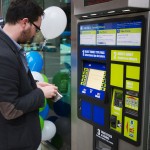
The new one-day, unlimited ride passes are part of Metro’s ongoing fare payment overhaul that began back in 2011 with the introduction of new electronic fare boxes.
The new day passes will be able to be purchased directly on any Metro bus as you board. Jill Dunne, Public Affairs Manager at Metro, says that all the purchaser will need to do is notify the driver before paying their fares. The pass is then activated upon its first use and will be valid for unlimited rides until 3am the next day.
Government Square Ticketing Kiosk [Travis Estell]
The passes cost $4.50 for Zone 1, which is anything within city limits, and $6.30 for Zone 2. A pass purchased for either zone accounts for all necessary transfer fees.
Since these day passes will be ideal for visitors, you can also purchase them in advance at the sales office on Government Square. The passes can then be distributed to friends or family members and used at their convenience, only being activated upon their first use.
“Riders have been asking for day passes for several years,” Dunne explained to UrbanCincy. “They are great for visitors, occasional riders and anyone who plans to ride Metro frequently throughout the day without worrying about exact change or transfers.”
In many cities around the world, however, the idea of buying day or month passes is a thing of the past thanks to the advent of smart card payment technology. If Metro were to switch over to a system like this, which their new electronic fare boxes are capable of handling, it would allow for riders to use enabled bank cards or loadable fare cards.
“We are looking at all options for fares to make it convenient for our riders,” Dunne emphasized. “We have been working on ‘smart cards’ for a while and I hope we’d be able to roll them out in the future.”
Another new feature riders can soon expect, and has been rumored for some time, is a regional stored-value card that works on transit services offered by Metro and the Transit Authority of Northern Kentucky (TANK). Metro officials say they are optimistic that will be available within the next few months.
Those interested in getting their hands on the new day passes can do so by attending a ceremony Metro will hold at Government Square on Monday, November 3 at 10am. To celebrate the moment, Metro employees and SORTA board members will be giving out 500 free day passes on a first-come, first-serve basis.
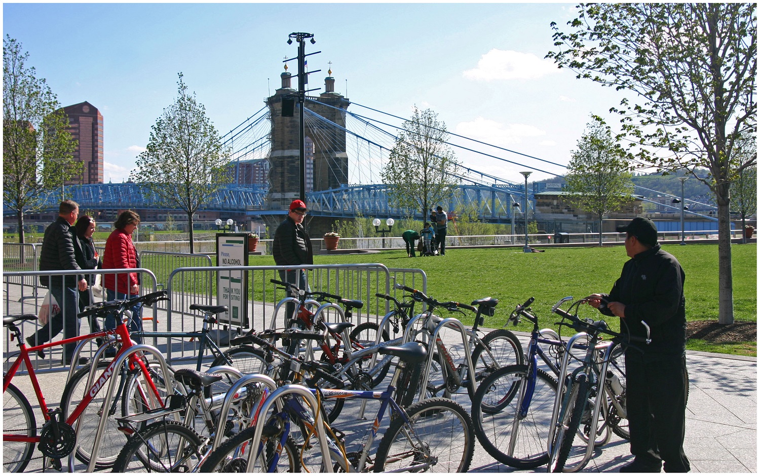
Bicycle Commuter at Moerlein Lager House [Randy Simes]
Research continues to show that Americans are driving less, but are biking, walking and using transit more. This is true in Cincinnati to the extent that transit ridership has increased in recent years.
While originally attributed to the economic downturn at the beginning of the century, these trends have continued while the economy has rebounded – leading many to believe it is an indication of new market forces being driven by aging Baby Boomers and emerging Millennials. Perhaps predictably so, governments have been slow to change with the changing economic forces.
Despite a growing number of trips for biking, walking and transit, funding has not increased correspondingly. In fact, many communities have seen funding for these non-automotive forms of transportation decrease as governments have worked to cut spending at all levels. This, new research finds, is only exacerbating the problem of having underfunded these modes of transportation for many years.
“Conventional statistics tend to under report active travel because most travel surveys under-count shorter trips (those within a traffic analysis zone), off-peak trips, non-work trips, travel by children, and recreational travel,” stated Todd Litman, Executive Director of the Victoria Transport Policy Institute, in a summary of his report entitled Whose Roads? Evaluating Bicyclists’ and Pedestrians’ Right to Use of Public Roadways.
Transportation Mode Share in Cincinnati Region [OKI]
“More comprehensive surveys indicate that active travel is two to four times more common than conventional surveys indicate, so if statistics indicate that only 5% of trips are by active modes, the actual amount is probably 10-20%.”
Litman indicates that funding levels tend to be much lower than even the low 5% trip share estimates, and recommends changing those levels to reflect not only the current trip share levels, but those that could be achieved should investments be made.
Unequal Funding Allocations at Regional Level
At the local level, the same situation of unequal funding allocation exists. In the 2040 Regional Transportation Plan, developed by the OKI Regional Council of Governments, approximately 88% of the nearly $21.5 billion in funding is recommended to go toward roadway projects, just 11% to transit and a mere 0.1% to bicycle and pedestrian improvements.
While the level of investment in transit appears closely aligned with current ridership levels for commute-related trips, it is far below ideal levels for bicycle and pedestrian investments.
“Relatively aggressive pedestrian and cycling improvement programs only cost about 1-4% of the total per capita roadway expenditures, or just 4-10% of general taxes spent on local roadways,” Litman contests. “Since walking and cycling represent about 12% of total trips, and a much larger share of short urban trips, and since most North American communities have under-invested in walking and cycling facilities for the last half-century, much larger investments in walking and cycling facilities can be justified to meet user demands and for fairness sake.”
OKI leadership contends that the organization’s regional planning document does not accurately reflect the level of investment being made in bicycle and pedestrian infrastructure, noting that many of the “roadway projects” in their plan actually include bike and pedestrian elements.
To that end, some recent improvements have been made with regard to bicycle infrastructure. The City of Cincinnati has installed around 40 miles of new on-street bike lanes or paths over the past several years, and has plans to install a total of 290 miles by 2025. The City’s Bicycle Transportation Plan, however, has been plagued by a lack of funding and has been relegated to only moving forward when roadway resurfacing projects emerge.
Not everyone is convinced, however, that enough is being done in terms of the overall investment needed for bike and pedestrian improvements.
Implications for Regional Transit
Of the money being recommended for transit investments, not including operations, approximately 96% is targeted for the contentious Oasis Line – a commuter rail line connecting Cincinnati’s far eastern suburbs with downtown.
Furthermore, the vast majority of OKI’s recommended transit funding is aimed to pay for ongoing operations – not pay for system expansions or improvements.
This grim financial picture for transit gets even worse when considering contributions from state and local governments.
In Kentucky, meanwhile, communities struggle with state law that prohibits any dedicated source of transit funding – thus forcing the Transit Authority of Northern Kentucky (TANK) to go before the state legislature every year seeking money, similar to how Amtrak must annually go before Congress.
Impact on Environmental Justice Populations
These dire funding and political situations have led to Greater Cincinnati taking the title of being the most populated region in North America without any rail transit; while even far less populated regions advance their own regional transit plans.
What makes the figures more troubling is that those most affected by the imbalanced funding appropriations are minority, low-income and disabled populations. While only 6% of the region takes transit, bikes or walks to work each day, that number escalates to 17% for African Americans, 11% for Hispanics and 10% for people with disabilities; while low-income commuters see that number spike to 21%. Quite simply, the lack of funding for non-automotive forms of transportation is most damaging to those who can least afford it.
Bicycle Commuter at Moerlein Lager House [Randy Simes]
The results of this inequality sparked a recent lawsuit by the ACLU of Wisconsin Foundation and Midwest Environmental Advocates filed a complaint against the Wisconsin Department of Transportation over a $2 billion highway interchange project. In MICAH & Black Health Coalition of Wisconsin v. Gottleib, the ACLU states:
“WisDOT explicitly refused to consider transit expansion (or transit in any way) as part of this proposal. This will further widen the already large gap between transit-dependent communities of color and disproportionately white suburban commuters. The ACLU of Wisconsin Foundation was one of the organizations that have complained about the government’s decision-making and reporting process, as well as how the project would exacerbate segregation and disparities in transportation access for low-income people to jobs.”
And while some of these mode shares may seem low, it has been noted by the U.S. National Household Travel Survey that commute trips are the lowest for walking and biking, while personal trips and trips less than one mile are significantly higher for both modes.
“In much of the region where we have large concentrations of EJ populations the sidewalk network is already quite developed, the roadway network is quite developed and available to bicyclists and the transit service is good,” countered Bob Koehler, Deputy Executive Director at OKI. “We do, as a community, need to do a better job at sharing the road and being aware of pedestrians to make these facilities better for all modes.”
Highway Building Frenzy
Even though young people are increasingly either delaying or choosing not to get a driver’s license at all, user fees collected from the gas tax continue to decline, total vehicle miles traveled (VMT) has been decreasing since 2007 and annualized VMT has been decreasing for nearly a decade, the nation and Cincinnati region continue to build new capacity.
Of the roughly $8.3 billion being recommended for roadway projects in OKI’s planning documents, approximately 73% of that is targeted for additional lanes, new facilities or new interchanges, while reconstruction and improvements to existing roadways account for the rest.
I-75 Construction Work at Mitchell Avenue [Jake Mecklenborg]
“Although VMT may be slightly declining in recent years in some parts of the country this may not be a long-term trend. Clearly the region has many needs,” explained Brian Cunningham, Director of Communications at OKI. “This plan addresses the significant existing safety and congestion needs. The plan is updated every four years and will provide an opportunity to revisit the assumptions.”
Litman argues that shifting some of the investment from roadways to bicycle and pedestrian projects due to their proven ability to reduce congestion and improve safety not only for bicyclists and pedestrians, but motorists as well. He also believes that such policy directives empower people by giving them the ability to choose between multiple transportation options for each of their trips.
“It is important to recognize the unique and important roles that active modes [biking and walking] play in an efficient and equitable transportation system, and the various benefits that can result when walking and cycling are improved, including indirect benefits to people who do not currently use those modes,” Litman concluded.
“Just as it would be inefficient to force travelers to walk or bike for trips most efficiently made by motorized modes, it is inefficient and unfair to force travelers to drive for trips most efficiently made by active modes, for example, if children must be chauffeured to local destinations because their communities lack sidewalks, or if people must drive to recreational trails due to inadequate sidewalks and paths near their homes.”