Categories
Up To Speed

Boston has shed thousands of parking spaces in recent years, and most aren’t coming back

Boston has shed thousands of parking spaces in recent years, and most aren’t coming back.

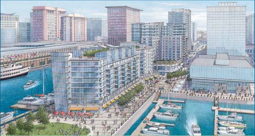
Boston has experienced a center city revival that is right up there with the best of ’em in North America. In particular, the South Boston neighborhood has seen a dramatic change in fortunes. Where thousands surface parking lot spaces once sat are now mixed-use buildings housing new residents and jobs. So what happened to all of that parking? No one is really sure, and only a few seem to care. More from the Boston Globe:

One large landowner in the Seaport, the Massachusetts Port Authority, offers a startling estimate of the changes afoot: Roughly three years ago, there were 6,000 spaces in surface parking lots in the South Boston neighborhood. Three years from now, there will be just 750.

For some, it may be hard to understand how we got here. How did a city of technology wizards, big-data gurus, and parking apps for smartphones lose track so utterly of its parking plan? How did the city of “pahk the cah” become one bereft of places to put the cars? Blame a booming economy, low interest rates fueling development, and a demographic shift to younger urban dwellers willing to live without wheels.

Categories
Up To Speed

Complete Streets are more equitable, safer and improve economic outcomes

Complete Streets are more equitable, safer and improve economic outcomes.

Over the past several years the idea of taking a new approach toward designing our public streets has been gaining traction. For many decades roads were built almost exclusively for people driving cars. But historically speaking, streets have always been much more egalitarian – accommodating all modes of transportation of the time.

While the idea of designing streets for all users has gained attention, it has not always gained supporters. This includes Cincinnati where a Complete Streets policy has yet to be realized. More from Streetsblog USA:

Redesigning streets to make room for people is a no brainer. “Complete streets” projects that calm traffic and provide safe space for walking and biking save money, reduce crashes and injuries, and improve economic outcomes. Need further convincing? Smart Growth America has done some number crunching, looking at the impact of 37 complete streets projects from communities across the country. 

Categories
Up To Speed

Should a portion of gas tax revenues go towards transit?

Should a portion of gas tax revenues go towards transit?

According to a recent state-funded study, Ohio needs to double its investment in transit to keep up with the growing demand across the state. Even after an increase in funding for 2016, Ohio will only spend $8.3 million per year on transit–that’s less than 72 cents per resident, putting Ohio near the bottom of list compared to other states. One way to provide more funding would be to allocate a portion of the state’s gas tax revenue for transit projects.

In the state of Oregon, a proposal is being considered that would allow a portion of the state’s gas tax revenue to go towards bus, rail, bicycle, and pedestrian infrastructure that “reduces the traffic burden of, or pollution from, motor vehicles on public highways, roads and streets.” Currently, the state’s gas tax revenue can only be spent on highways and rest areas. The proposed resolution (SJR 16) would put the issue on the ballot for Oregon voters to decide in November 2016. More from Portland Transport:

SJR 16 would allow future legislation to assign a portion of motor vehicle taxes and fees for purposes such as rural bus service, safety and congestion relief projects that include transit, separated bicycle facilities such as the Sullivan’s Gulch trail, and local match for federal funds for non-highway transportation projects. Oregon received far less federal stimulus money to improve Amtrak service than did neighboring Washington because we did not have enough local match. Bridge and road tolls could be spent on transit, pedestrian, and bicycle facilities that provide alternatives to highway travel.

Non-highway alternatives may be cheaper, less polluting, or less damaging to the human or natural environment. These alternatives may also be desirable components of a new highway facility, allowing for a smaller, less-damaging structure that is more likely to win approval of nearby residents.

Categories
Up To Speed

Cincy Red Bike users can use Dayton’s new Link Bike Share when it launches in May

Cincy Red Bike users can use Dayton’s new Link Bike Share when it launches in May.

While Cincy Red Bike is expanding and celebrating higher than expected ridership in its first six months, Dayton is preparing to launch a 24-station bike share system of its own. Link Bike Share is expected to begin operations in May and will also be part of the national B-Cycle network – meaning that Cincy Red Bike members can also use their memberships when in Dayton. More from WDTN:

Mayor Nan Whaley was the first to buy a Link membership. The first 100 members will get $10 off of the $65 dollar membership. Otherwise, renting a bike for 24 hours will cost $5, but will need to be ‘checked-in’ every 30 minutes at any kiosk. Link will be the 31st bike share program system in the country when it launches in May.

Categories
Up To Speed

Should SORTA redraw its entire system? And if so, how?

Should SORTA redraw its entire system? And if so, how?.

On the latest episode of The UrbanCincy Podcast we discussed some ideas that Cincinnati would be smart to copy from other cities. One of the items discussed was a complete overhaul of the region’s bus network. Metropolitan Seoul did it in the early aughts, and Houston is in the process of doing it now. While there are numerous ways in which to go about doing this, one approach could be to crowd-source ideas from people using this bus routing tool. More from CityLab:

Not only does the tool give agencies a visually appealing way to present potential routes, but it enables them to respond to ideas—or, let’s face it, complaints—in real-time. If someone wants to move a bus route one street over, for instance, planners can just drag a line a few blocks and show that for an extra $250,000 the bus will now pick up just 10 more people a day.

“Transit for a lot of riders seems like just lines on the map,” he says. “This tool can really communicate to folks—much, much quicker than we’ve ever been able to— what changes to the system mean.”