Categories
Development News Politics

Planning Commission Flexes Muscle With Use of Interim Development Control Districts

While two of the more lengthy discussion items were controversial planned commercial developments in Hyde Park and Roselawn, Cincinnati Planning Commission had a slew of other items on their Friday afternoon agenda.

In three related moves, the City Planning Commission recommended using Interim Development Control Overlay Districts. Two were extensions of existing IDCs, but one was newly recommended. Traditionally the City uses IDCs to put a temporary control on development while planning or feasibility studies are conducted. During such time, the establishment of uses, construction of new buildings, and the demolition or alteration of existing structures are all subject to review by the City Planning Commission.

The two recommended for extension include IDC Districts 73 and 74, Wasson Line District and Pleasant Ridge NBD, for an additional six months to allow for the completion of land use and zoning studies.

The newly recommended IDC is for the hot real estate market surrounding the University of Cincinnati. In particular, the neighborhoods to the south and southwest of the university where midrise developments continue to be proposed and built, much to the dismay of many long-time residents.

IDC District 77 was recommended to be put in place for a period of three months while a University Impact Area Study will look at growth and housing conditions, parking and traffic, quality of life concerns, and new development vs. existing character in the areas within a quarter-mile walk from the university’s main campus and the Clifton Heights business district.

Here is a quick rundown of the rest of the cases and the recommendations made by the seven-member board:

  • Approved the sale of 1623 Pleasant Street in Over-the-Rhine to Avila Magna Group, LLC for $20,000. The developer plans to renovate the 3,296-square-foot building into three one-bedroom for-sale units and one two-bedroom for-sale unit.
  • Approved the sale of approximately three acres of land left over from the Kennedy Connector road project to Vandercar Holdings and Al Neyer Inc. for $530,000. The developers plan to consolidate the land with adjacent parcels to construct two office buildings of up to 45,000 total square feet.
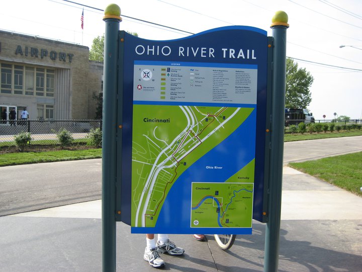
  • Approved a dedication plat of 3.48 acres along the south side of River Road in Sedamsville to allow for a western extension of the Ohio River Trail.
  • Approved a final development plan for Phase 1G of Oakley Station, which will consist of a 12,000-square-foot multi-tenant retail building at the northwest corner of Vandercar Way and Oakley Mill Lane.

The commission also approved the sale of a one-acre parcel at Eighth and Sycamore streets to the Cincinnati Center City Development Corporation for $1. This move will ultimately pave the way for a new $45 million development that will continue the transformation of the northeast quadrant of the central business district where numerous other midrises are advancing.

Through the agreement, the non-profit development corporation will create a garage air lot, a commercial air lot, and an apartment air lot. Once construction is imminent, 3CDC will sell the garage air lot to the City for $1 to allow for a 500-space parking garage to be built. They will then sell the apartment air lot to North American Properties for $1 for the construction of a 130-unit tower, and will retain ownership of the commercial air lot for the construction of 10,000 square feet of commercial space.
Categories
Development News

Report Quantifies Growing Influence of UC’s Niehoff Urban Studio and Community Design Center

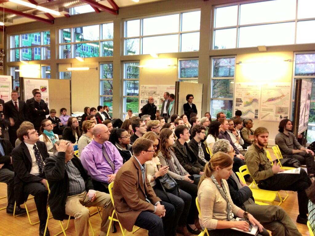
Urban ideation and practical implementation of projects are the dual subjects of the 2014 Annual Report from the Niehoff Urban Studio and Community Design Center.

The symbiotically connected interdisciplinary programs are administered by the University of Cincinnati’s College of Design, Architecture, Art, and Planning at off-campus studio in Corryville.

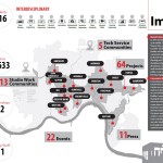
The recently issued report details that since the program began in 2002, more than 1,200 students in urban planning, engineering, architecture, design, anthropology, business, nursing, political science and urban geography have worked with nearly 150 organizations on projects to address urban issues throughout the Cincinnati region and make it more sustainable.

Specifically highlighted within the report is the studio’s work on the Wasson Way Light Rail and Bike Trail Corridor, which continues the studio’s initiatives on Movement in the City and Building Healthy & Resilient Places.

Over the past year, a major effort focused on Burnet Woods, and how it could become the epicenter of a larger ecodistrict in Uptown. That work included a civil engineering team that explored stormwater management and planners that studied how to convert the park into a landscape with edible forests, a fish hatchery and more, while also improving public health through amenities. A freshman innovation seminar further researched student perceptions of the park and how to inspire greater use.

“Some of the ideas are really out of the box thinking,” stated Willie Carden, Director of Cincinnati Parks. “These ideas could well blossom and inspire actual changes in the park someday.”

Support from the Niehoff Studio and UC is important, Carden says, in order to help think about how to enhance the experience and enjoyment of the city’s top-rated park system.

Another highlight of the report was student participation in a competition by the Urban Land Institute (ULI) for a commercial real estate project with green infrastructure in East Walnut Hills.

Dave Neyer, ULI’s chair and executive vice president at Al Neyer Inc. said, “The experience was exciting because, in some ways, the students were the ones doing the teaching by introducing mentors — industry experts with 20 and 30 years of experience — to new ideas and creative solutions. The competition was a great example of collaboration.”

Neyer says that another competition is planned for 2015, and that everyone involved is eager to see what the next class of Niehoff students will accomplish.

Complimenting the interdisciplinary studio is the Community Design Center, which is also directed by Frank Russell with assistance from co-op students and graduate assistants. The goal of the CDC, Russell says, is to help community groups represent underserved areas and underfunded projects.

During 2014, for example, staff and students worked with Cincinnati Public Schools on the Rothenberg Academy’s rooftop teaching garden; Cincinnati AIA Urban Design Committee on the Mill Creek Restoration Project’s West Fork Creek trail plan; and Center for Closing the Health Gap to help promote healthy corner stores in some of Cincinnati’s “food desert” neighborhoods such as Avondale and the West End.

As if that wasn’t enough, they also facilitated a two-day workshop for planning officials featuring Australian designer and theorist Tony Fry called Metrofitting Cincinnati for a Resilient Future.

In total, the 40-page report summarizes two dozen events from 2014, ranging from open houses and lectures to workshops and panel discussions, including a highlight on Modern Makers, a partner arts collaborative.

EDITORIAL NOTE: UrbanCincy is a partner of the Niehoff Urban Studio and Community Design Center, and collaborates to produce events throughout the year that engage the public with the work and research being done at the studio.

Categories
News Transportation

East Side Commuter Rail Project in Doubt Following Vote to Develop Oasis Line as Trail

The fate of a long-planned commuter rail line along the eastern riverfront took an abrupt turn over the past month. With the Southwest Ohio Regional Transit Authority (SORTA) Board voting 12-1 in favor of a plan to use it for the Ohio River Trail, it puts a severe damper on one day using it as commuter rail to the city’s eastern suburbs.

The commuter rail, commonly referred to as the Oasis Line, had been pursued by Hamilton County Commissioner Todd Portune (D) for many years. Over time the Oasis Line had become a component of the much larger Eastern Corridor project, which is also now facing a very unclear future of its own.

SORTA purchased the right-of-way in 1994 for $4 million, after which it sold the more southern of the parallel-running tracks and easement to Genesee & Wyoming – the parent company of the Indiana & Ohio Railway Company – which also has the rights to utilize the northern tracks that would be paved over as part of this plan.

As a result, SORTA officials still need to work out details with G&W in order to allow the bike trail to move forward.

“After a comprehensive three-month review of all aspects of the issue, the SORTA Board has overwhelmingly endorsed the concept of a temporary bike trail on the Oasis Line,” said Jason Dunn, Chair of the SORTA Board. “We will do all in our power to work collaboratively with our partners to support the development of the trail.”

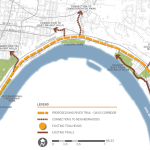
The 4.75-mile section of trail will complete the Ohio River Trail on the city’s east side. This segment is estimated to cost $4 million, of which $1 million has already been raised by Ohio River Way. Other portions of the Ohio River Trail, which connects to the Little Miami Scenic Trail, have been completed in a piecemeal fashion over the years.

Project supporters say that if everything goes smoothly, the multipurpose trail could open as early as 2017.

“The trail is an asset that the community clearly wants and it will be an enhancement to multimodal transportation in the region,” Dunn stated in a prepared media release.

SORTA officials say the next steps call for working out regulatory issues with federal agencies, and coming up with a design for the trail that is both safe and amenable to G&W.

While this move may hamper future efforts of developing commuter rail along this corridor, SORTA officials structured the agreement to allow for future flexibility. This includes the design of what the transit agency is calling a “temporary trail” that does not preclude from future passenger rail service along the Oasis Line.

To some passenger rail advocates, however, the prospect of the Oasis Line going away is a good one.

“The riverfront is a perfect place for a recreational trail, while light rail transit would be better-suited serving our neighborhoods,” Derek Bauman, Chair of Cincinnatians for Progress and SW Ohio Director for All Aboard Ohio, told UrbanCincy. “We should move forward with this plan to complete the Ohio River Trail, and then shift our attention to developing a recreational trail and light rail line along the Wasson Corridor.”

EDITORIAL NOTE: In August 2010, UrbanCincy provided an in-depth look at the plans for the Oasis Line. Then in February 2012, UrbanCincy published a controversial editorial that called for a new vision with the Oasis Line being utilized as a trail, and the Wasson Line as a combined trail and light rail corridor.

Categories
Business Development News Transportation

A Look Back at the Top Stories on UrbanCincy in 2014

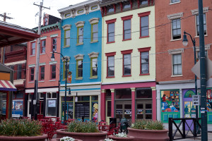
Findlay Market StorefrontsNow that 2014 has come to a close, we at UrbanCincy would like to take a moment to look back on what’s happened in the past year. The following are UrbanCincy‘s top five most popular news stories from 2014:
  1. Eli’s Barbeque, Maverick Chocolate First of Several New Tenants to Open at Findlay Market
    This year marked a turning point for the area known as the Northern Liberties in Over-the-Rhine, with several new developments being announced. The first of these announcements was in April, when craft chocolatier Maverick Chocolate and popular East End restaurant Eli’s Barbeque announced they would open at Findlay Market. Later in the year, Model Group announced a $14 million office development along Race Street and Urban Sites announced their plan to renovate the historic Film Center building.
  2. Uber and Lyft to Soon Enter Cincinnati Market
    In 2014, Cincinnatians gained a brand new transportation option as ridesharing services Uber and Lyft came to town. Our own Jake Mecklenborg began driving for Uber shortly after their launch and told us about his experiences on The UrbanCincy Podcast Episode #41. In November, Cincinnati City Council passed new regulations for carsharing providers, and we discussed this at the beginning of Episode #44.
  3. City Planners Recommend Transportation Overlay District for Wasson Railroad Corridor
    For years, UrbanCincy has been following the Wasson Way project and writing about the corridor’s potential usage as both a bike trail and a rail transportation corridor. The project took a step forward this year, as the Department of City Planning & Buildings announced a plan that would allow for both uses. We’ll be keeping our eye on this project in 2015.
  4. Popular St. Louis-Based Pi Pizzeria to Open Cincinnati Location in AT580 Building
    In collaboration with our partners at nextSTL, UrbanCincy reported on Pi Pizzeria’s entry into the Cincinnati market. The restaurant opened in the AT580 Building, which is currently undergoing a transformation from office space into residential. Pi co-owner Chris Sommers mentioned that the company was “amazed at the resurgence of Downtown and OTR” and chose the location based on its proximity to the Cincinnati Streetcar route.
  5. Findlay Market Ready to Work With Developers Poised to Transform Area Around It
    UrbanCincy talked to Joe Hansbauer, President and CEO of Findlay Market, about how Findlay Market can serve as the hub for new retail, office, and residential development in the Northern Liberties.

Ohio RiverOccasionally, we like to share a photo gallery or video taken by an UrbanCincy team member or a guest contributor. In 2014, our top five most popular visual features were:
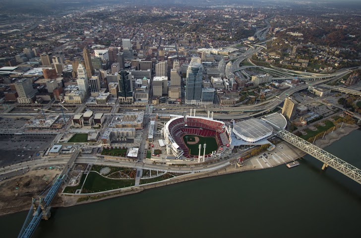
  1. Take a Look at These 20 Breathtaking Photos of Cincinnati’s Center City
    Brian Spitzig shares some of his aerial photography from the Central Business District and Over-the-Rhine.
  2. Take a Look at CVG’s Abandoned Concourse C Through Ronny Salerno’s Lens
    Photographer Ronny Salerno documents the abandoned Concourse C at the Cincinnati-Northern Kentucky International Airport, which serves as a symbol of how far the airport has fallen.
  3. Check Out These 14 Amazing Images of Cincinnati’s Inner City Neighborhoods
    Enjoy more of Brian Spitzig’s aerial photography, this time from the West End, Queensgate, Corryville, Mt. Auburn, Mt. Adams, Clifton Heights, Walnut Hills, and University Heights.
  4. Thousands of New Residential Units to Transform Downtown
    Anyone visiting Downtown Cincinnati in 2014 was certainly aware of the huge amount of construction happening in the urban core. Looking back at this photo set shows how much progress has been made on Seven at Broadway, Mercer Commons, AT580, Broadway Square, and other projects in just a year.
  5. 49 Shots from the 2014 Northside Fourth of July Parade
    Jake Mecklenborg captures some interesting sights from Cincinnati’s most eclectic parade.


Categories
Month in Review

Month in Review – October 2014

Wasson Corridor WalkUrbanCincy readers must be excited about the idea of turning Wasson Way into a multi-modal corridor; that was our most popular story of October by a factor of 2×. Our other top stories included news on bike infrastructure, transit, and a new business opening. Check them out:

  1. City Planners Recommend Transportation Overlay District for Wasson Railroad Corridor
    City planners have completed their land use study of the Wasson Railroad Corridor and have recommended the creation of a Transportation Overlay District to preserve the corridor for both future rail transit and a biking and walking trail.
  2. PHOTOS: Ohio’s First Protected Bike Lane Attracting New Riders to Central Parkway
    Ohio’s first protected bike lane is now complete and is attracting new riders to what was once of the city’s more intimidating and unsafe streets for cyclists.
  3. Can Metro, Megabus Come to Terms on Moving the Intercity Bus Operator Into the Riverfront Transit Center?
    Following yet another move by Megabus, there has been a renewed call by many to permanently move the intercity bus operator into the Riverfront Transit Center underneath Second Street at The Banks.
  4. Collective Espresso to Open Second Location in Northside Later This Fall
    The owners of Over-the-Rhine’s popular Collective Espresso will open up a second location in Cincinnati’s eclectic Northside neighborhood later this fall.
  5. Transit Users Will Need 7 Hours to Commute to ODOT Public Transit Meeting
    The Ohio Department of Transportation is hosting a forum on transit funding and policy, but they’re hosting it in a location not served by transit – making it virtually impossible for transit users to attend.